Items Similar to Collection of Five Antique Maps Depicting Ancient Greek and Anatolian Regions
Want more images or videos?
Request additional images or videos from the seller
1 of 8
French SchoolCollection of Five Antique Maps Depicting Ancient Greek and Anatolian Regions
$165.30
$206.6320% Off
£120
£15020% Off
€141.39
€176.7420% Off
CA$228.32
CA$285.4020% Off
A$244.53
A$305.6720% Off
CHF 131.46
CHF 164.3220% Off
MX$2,970
MX$3,712.5020% Off
NOK 1,661.05
NOK 2,076.3120% Off
SEK 1,520.82
SEK 1,901.0220% Off
DKK 1,056.45
DKK 1,320.5620% Off
About the Item
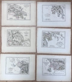
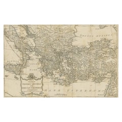
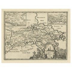
Collection of Five Antique Maps
each drawing : 9 x 12 inches
provenance: private collection
condition: very good and sound condition
Description: This set of five finely detailed antique maps offers a captivating glimpse into the geography of ancient Greek and Anatolian regions. Each map showcases precise engravings, illustrating key historical locations such as the Cyclades, Pont-Euxin (Black Sea), and the Coasts of Asia Minor, as well as Thrace and other significant territories. These maps reflect the meticulous craftsmanship of 19th-century cartographers and their dedication to preserving the knowledge of classical antiquity.
- Creator:French School (1924, American)
- Dimensions:Height: 9 in (22.86 cm)Width: 12 in (30.48 cm)
- Medium:
- Movement Style:
- Period:
- Condition:
- Gallery Location:Cirencester, GB
- Reference Number:1stDibs: LU509313360122
Born in 1924 in Maryland USA. This artist was self - taught, but after intensive study of the great master techniques and methods, has interpreted them into a very personal and unique style. Bensons subtle blend of colors, lightening and attention to detail, adds to the mood and character of the subject.
About the Seller
5.0
Platinum Seller
Premium sellers with a 4.7+ rating and 24-hour response times
Established in 1989
1stDibs seller since 2016
5,062 sales on 1stDibs
Typical response time: 1 hour
- ShippingRetrieving quote...Shipping from: Cirencester, United Kingdom
- Return Policy
More From This Seller
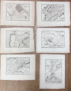
View AllCollection of Six Antique Engravings of Ancient Greek Regions and Territories
Located in Cirencester, Gloucestershire
Collection of Six Antique Engravings
each drawing : 9 x 12 inches
provenance: private collection
condition: very good and sound condition
Description: This remarkable set of six ant...
Category
19th Century French School Landscape Drawings and Watercolors
Materials
Pencil
Set of Six Antique Engravings Historical Plans Maps of Ancient Greek Cities
Located in Cirencester, Gloucestershire
Set of Six Antique Engravings
each drawing : 9 x 12 inches
provenance: private collection
condition: very good and sound condition
Description: This collection of six antique engrav...
Category
19th Century French School Landscape Drawings and Watercolors
Materials
Pencil
$187 Sale Price
20% Off
Set 5 Antique French Engravings Ancient Roman Artefacts
Figures
By Antique French
Located in Cirencester, Gloucestershire
Set of 5 black and white engravings
French School, 19th century
each paper (unframed) : 9 x 12 inches
provenance: private collection
condition: good and sound condition, old foxing s...
Category
19th Century Rococo Figurative Prints
Materials
Engraving
$495 Sale Price
20% Off
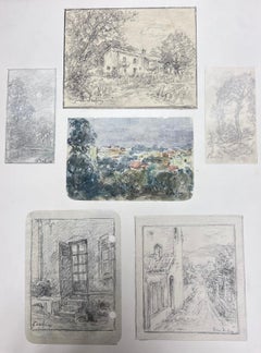
Fine Antique French Impressionist Painting Landscape Combination of Six Drawings
Located in Cirencester, Gloucestershire
The artist:
Henri Aime Duhem (1860-1941) French *see notes below, signed
Title:
Medium:
signed gouache on paper, loosely laid over card, unfram...
Category
19th Century Impressionist Landscape Paintings
Materials
Gouache
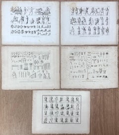
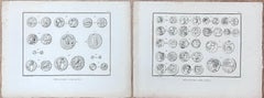
Pair of Antique Engravings Depicting Ancient Greek Medallions and Coins
Located in Cirencester, Gloucestershire
Pair of Antique Coins
each drawing : 9 x 12 inches
provenance: private collection
condition: very good and sound condition
Description: This exquisite pair of antique engravings showcases an array of meticulously detailed ancient Greek medallions...
Category
19th Century French School Landscape Drawings and Watercolors
Materials
Pencil
Set of 7 Original Paintings - The Seven Wonders of the Ancient World Classical
Located in Cirencester, Gloucestershire
The Seven Wonders of the Classical World
English School, early 20th century
set of seven (7)
7 x oil paintings on paper mounted on board, framed
Glass covering
framed: 22 x 14 inch...
Category
Early 20th Century English School Figurative Paintings
Materials
Oil
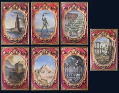
$2,204 Sale Price
20% Off
You May Also Like
Pair Antique Italian Maps of the North American Eastern Seaboard
Located in New York, NY
Pair antique Italian maps of the North American Eastern Seaboard. Late 18th early 19th century original Italian documentation of the East Coast of the United States from Passamaquadd...
Category
Antique Late 18th Century Italian Maps
Materials
Wood, Paper

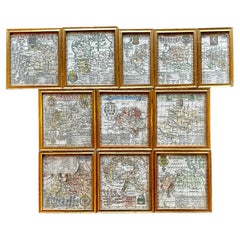
A Variety of Eleven Wonderful Old Maps, Framed
Located in San Francisco, CA
A Variety of Eleven Wonderful Old Maps, Framed
Category
20th Century Decorative Art
Materials
Paper
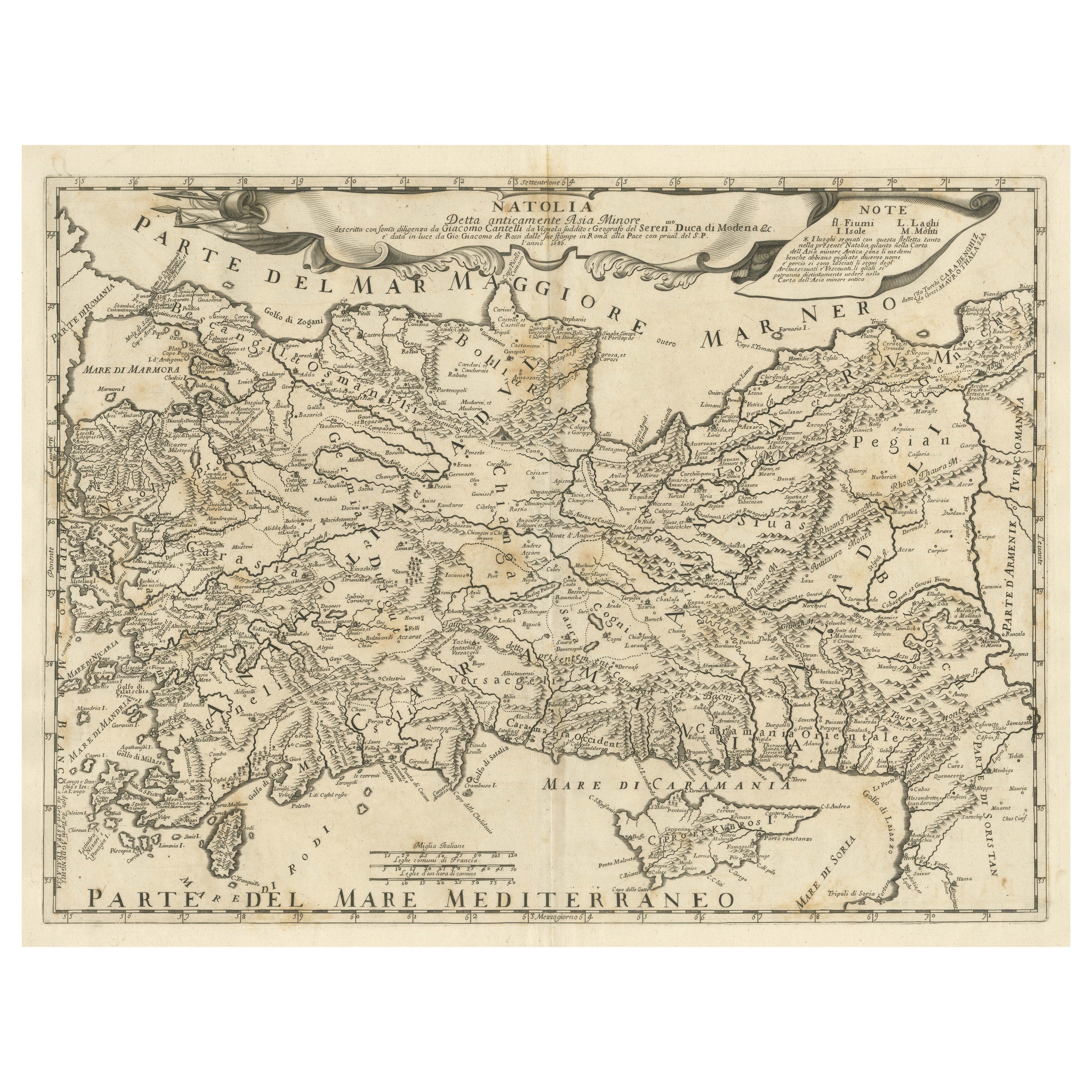
Original Italian Antique Map of Asia Minor and Cyprus and Neighboring Regions
Located in Langweer, NL
Antique map titled 'Natolia detta anticamente Asia Minor (..)'. Rare map of Asia Minor (Turkey) and Cyprus and neighboring regions. The map provides one of the most detailed and up t...
Category
Antique Late 17th Century Maps
Materials
Paper
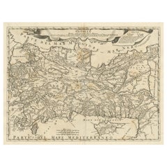
$620 Sale Price
20% Off
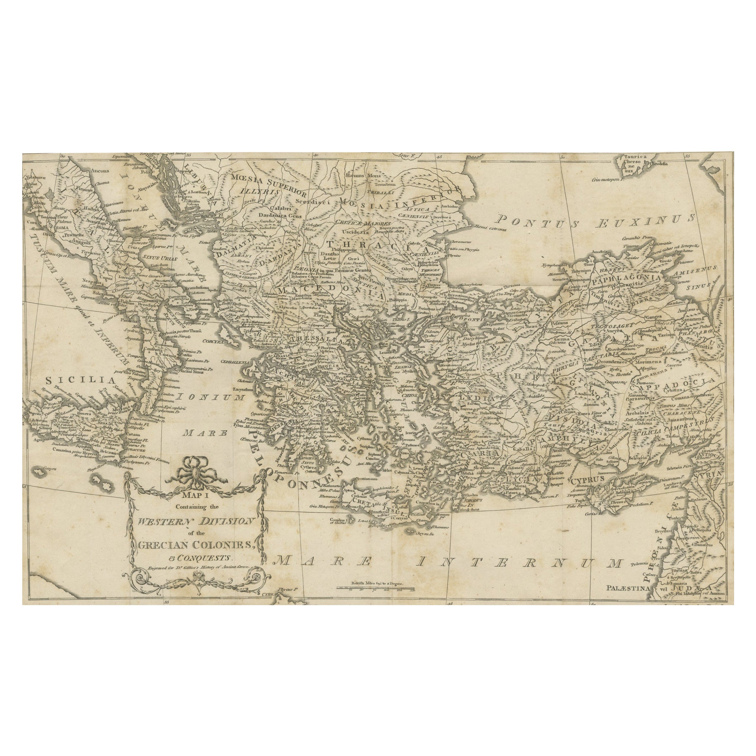
Antique Map of the Ancient Greek Colonization
Located in Langweer, NL
Antique map titled 'Map I containing the Western Division of the Grecian Colonies & Conquests'. Original antique map of the ancient Greek colonization. Frontispiece map of 'The Histo...
Category
Antique Late 18th Century Maps
Materials
Paper
$171 Sale Price
20% Off
Original Antique Map of the Coast of Part of Greece, with Athens and Thebes
Located in Langweer, NL
Original antique map titled 'Achaia quae et Hellas hodie Livadia'. Detailed map of the coast of part of Greece. With inset maps of Athens and Thebes. This map originates from 'Philippi Cluveri Introductionis in universam geographiam (..)' by P. Clüver. Published 1729.
Philipp Clüver was an Early Modern German geographer and historian. Cluver's Geography was one of the most enduring works of the 17th & 18th Centuries, issued by several different publishers with many different sets of maps...
Category
Antique Early 18th Century Maps
Materials
Paper
$419 Sale Price
20% Off
Original Antique Map of Ancient Greece, Achaia, Corinth, 1786
Located in St Annes, Lancashire
Great map of Ancient Greece. Showing the region of Thessaly, including Mount Olympus
Drawn by J.D. Barbie Du Bocage
Copper plate engraving by P.F Tardieu
Original hand color...
Category
Antique 1780s French Other Maps
Materials
Paper

More Ways To Browse
Ancient Greece
19th Century French School
Asia Minor
Ancient Greek Art
Greek Landscape Art
Antique Greek Painting
Map Greece
Antique Maps Of Greece
Landscape Painting Greece
19th Century Greece Painting
Map Of Ancient Greece
Paul Emile Pissarro Pastel
Pencil Drawings Canadian
Susan Van Campen
Thomas Knight
Thomas Schaller
Andrew King
Ann Mccoy