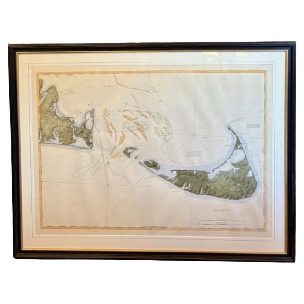
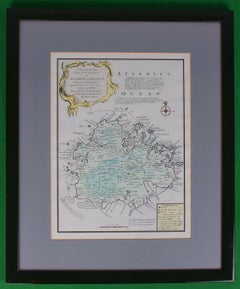
Items Similar to Maps of Nantucket Sound and Harbor Provenance: The Susie Hilfiger Collection

Want more images or videos?
Request additional images or videos from the seller
1 of 14
UnknownMaps of Nantucket Sound and Harbor Provenance: The Susie Hilfiger Collection
$2,400
£1,831.27
€2,083.20
CA$3,370.38
A$3,688.47
CHF 1,949.03
MX$44,024.36
NOK 24,872.10
SEK 22,747.56
DKK 15,560.43
About the Item
Map Sz: 22 1/2"H x 17"W
Frame Sz: 26 1/2"H x 20 3/4"W
*w/ age toning/ slight creasing/ waving to mounted maps*
Provenance: The Susie Hilfiger Collection
From "Point of View", the historic $27M/ 10 bd/ 10 ba/ 6,797 sq ft Nantucket home of Tommy and Susie Hilfiger located at 9 Lincoln Ave, Nantucket, MA
- Dimensions:Height: 20.75 in (52.71 cm)Width: 26.5 in (67.31 cm)
- Medium:
- Period:
- Condition:
- Gallery Location:Bristol, CT
- Reference Number:Seller: 446481stDibs: LU1260116939052
About the Seller
4.8
Vetted Professional Seller
Every seller passes strict standards for authenticity and reliability
Established in 2000
1stDibs seller since 2019
138 sales on 1stDibs
Typical response time: 2 hours
- ShippingRetrieving quote...Shipping from: Bristol, CT
- Return Policy
More From This Seller
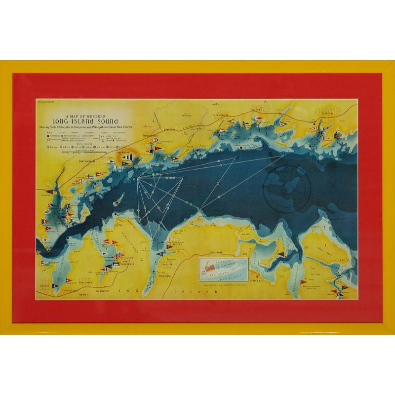
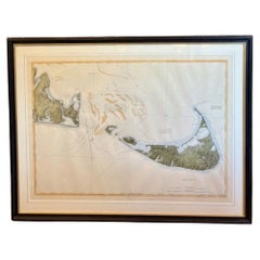
View AllA Map Of Western Long Island Sound Showing Yacht Clubs, Aids To Navigation...
Located in Bristol, CT
Classic color map/ nautical chart (by Nolf Klep '39) of the North Shore of Long Island Sound
for members of the Larchmont Yacht Club (see verso)
Map Sz: 13 ...
Category
1930s More Prints
Materials
Paper

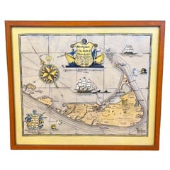
"Rhode Island Map, 1933"
Located in Bristol, CT
Classic c1933 colour (12 fold) red framed map of Rhode Island designed by H.W. Hetherington from Narragansett Bay to Buzzard's Bay
Map Sz: 17 3/8"...
Category
1930s Prints and Multiples
Materials
Lithograph
American Revolution Map Drawn For John Marshall
s "Life Of Washington" First Acc
Located in Bristol, CT
A Map Of The Country Which Was The Scene Of Operations Of The Northern Army: Including The Wilderness Through Which Gerneral Arnold Marched To Attack Plate VI
Map Sz: 11"H x 9 1/4"W...
Category
Early 1800s Prints and Multiples
Materials
Paper, Engraving
Plan Of The Northern Part Of New Jersey Showing The Positions Of The American &
By Richard Phillips
Located in Bristol, CT
After Crossing The North River in 1776
Map Sz: 9 7/8"H x 7 1/4"W
Frame Sz: 18 5/8"H x 15 3/4"W
Engraved by J Yeagen
Uncolored map of Northern New Jersey, Staten Island and the lo...
Category
Early 1800s Prints and Multiples
Materials
Lithograph
Map Of The Island Of Antigua
Located in Bristol, CT
Classic colour plate depicting a 'Map of the Island of Antigua' by Eman Bowen
Print Sz: 13 1/2"H x 10"W
Frame Sz: 20"H x 16 1/2"W
w/ grey mat & green lacquer frame
Emanuel Bowen ...
Category
19th Century Prints and Multiples
Materials
Lithograph
Coastal Harbor Scene 1958 Watercolor
Located in Bristol, CT
Art Sz: 10 5/8"H x 7 7/8"W
Frame Sz: 16 3/8"H x 13 3/8"W
w/ yellow matte & gilt bamboo frame
Charming watercolor rendering depicting a coastal f...
Category
1950s Drawings and Watercolor Paintings
Materials
Watercolor

You May Also Like
DesBarres (1776) Chart of Nantucket Island, 1966 Restrike
Located in Nantucket, MA
DesBarres (1776) Chart of Nantucket Island and the Eastern Half of Martha's Vineyard Restrike, published by the Massachusetts Historical Society in association with Haley
Steel...
Category
Vintage 1960s American Other Maps
Materials
Paper
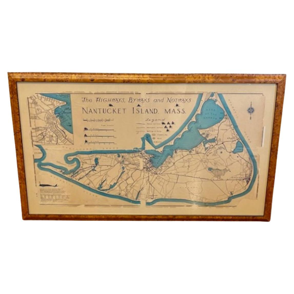
Nantucket High-Ways, By-Ways and Not-Ways Decorative Map by Tony Sarg, ca 1930
By Tony Sarg
Located in Nantucket, MA
Vintage Nantucket High-Ways, By-Ways and Not-Ways Decorative Map by Tony Sarg, (Nantucket: 1880 - 1942) circa 1930, a decorative tourist map of Nantucket Island with details of roadw...
Category
Vintage 1930s American Other Maps
Materials
Paper

Hand Colored Map of Nantucket by Austin Strong (1881 - 1952), circa 1921
Located in Nantucket, MA
Map of Nantucket by Austin Strong (1881 - 1952), circa 1921, an original print on paper whimsical map of Nantucket Island by Robert Louis Stevenson's step- grandson, noted stage set ...
Category
Vintage 1920s American Folk Art Maps
Materials
Paper
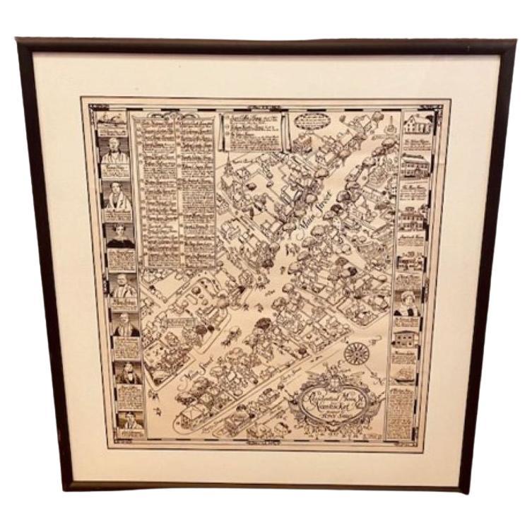
Tony Sarg Map of Nantucket Town, 1937
By Tony Sarg
Located in Nantucket, MA
Tony Sarg Map of Residential Main Street, Nantucket, 1937, a black and white printed map of our historic downtown area, with images of each building, street names and whimsical figur...
Category
Vintage 1930s American Other Maps
Materials
Paper

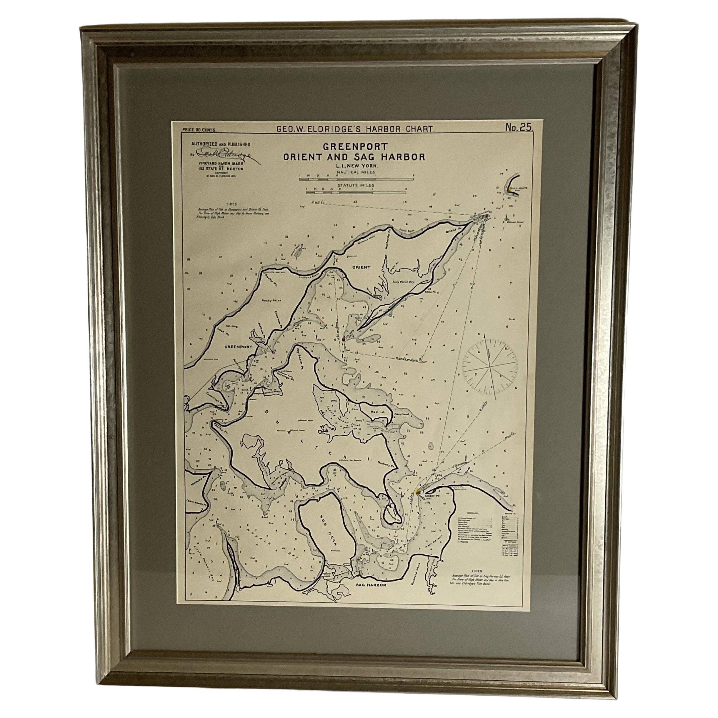
Sag Harbor Nautical Chart
Located in Norwell, MA
Marine chart of Greenport, Orient, and Sag Harbor New York published by George Eldridge in 1901. Details include the areas of Greenport, Orient, Shelter ...
Category
Antique Early 1900s Prints
Materials
Paper
1873 Martha
s Vineyard and Nantucket Chart
Located in Norwell, MA
Original chart of Nantucket and Martha's Vineyard by George Eldridge, Cartographer, 125 State Street, Boston. Dated 1873. Mounted to canvas. Also showing the coast of Cape Cod includ...
Category
Antique 1870s North American Maps
Materials
Paper
