Items Similar to Hand-Colored Map of Africa, circa 1744


Want more images or videos?
Request additional images or videos from the seller
1 of 5
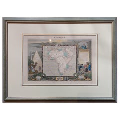
Matthew SeutterHand-Colored Map of Africa, circa 17441744
1744
$450
£341.51
€393.49
CA$635.78
A$681.23
CHF 365.43
MX$8,069.22
NOK 4,609.70
SEK 4,217.16
DKK 2,939.41
About the Item
Seutter, Matthew.
Africa.
From Atlas minor praecipua Terrarum Imperia...
Augsburg, circa 1744.
Original engraving with old hand-coloring.
Image size: 7 5/8 x 10 1/8 inches.
- Creator:
- Creation Year:1744
- Dimensions:Height: 13.75 in (34.93 cm)Width: 16.5 in (41.91 cm)Depth: 0.75 in (1.91 cm)
- Medium:
- Condition:
- Gallery Location:New York, NY
- Reference Number:Seller: 1579161stDibs: LU43831144903

About the Seller
4.9
Recognized Seller
These prestigious sellers are industry leaders and represent the highest echelon for item quality and design.
Gold Seller
Premium sellers maintaining a 4.3+ rating and 24-hour response times
Established in 1972
1stDibs seller since 2016
193 sales on 1stDibs
Typical response time: <1 hour
Associations
International Fine Print Dealers Association
- ShippingRetrieving quote...Shipping from: New York, NY
- Return Policy
More From This Seller
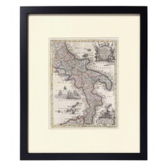
View AllHand-Colored Map of Southern Italy, circa 1744
By Matthew Seutter
Located in New York, NY
Seutter, Matthew.
Neapolis Regnum...
From Atlas minor praecipua Terrarum Imperia...
Augsburg, circa 1744.
Original engraving with old hand-coloring.
Image size: 10 3/16 x 7 11...
Materials
Paper
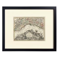
Hand-Colored Map of Genoa, circa 1744
By Matthew Seutter
Located in New York, NY
Seutter, Matthew.
Genova [Genoa].
From Atlas minor praecipua Terrarum Imperia...
Augsburg, circa 1744.
Original engraving with old hand-coloring.
Image size: 7 5/8 x 10 inches.
Materials
Paper
Two-Part Large Hand-Colored Map of Europe from 1798
By Thomas Kitchin
Located in New York, NY
Map of Europe printed on two separate sheets from A New Universal Atlas by Thomas Kitchin. Published in London by Laurie & Whittle, 1798. Original engravings hand-colored at publicat...
Category
1790s More Art
Materials
Paper

$1,700 Sale Price
33% Off
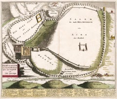
Map of Biblical Jerusalem
Located in New York, NY
Original copper engraving hand-colored at the time of publication. Nuremberg, 1720.
Category
1720s Prints and Multiples
Materials
Paper
The Dole Map of the Hawaiian Islands.
Located in New York, NY
Original color lithograph. Honolulu. Hawaiian Pineapple Company, 1950.
Category
1950s Prints and Multiples
Materials
Paper
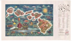
Plate 20 from "Formes et Couleurs"
Located in New York, NY
Plate 20 from "Formes et couleurs; vingt planches en couleurs contenant soixante-sept motifs décoratifs" by Auguste H. Thomas. Paris: A. Levy, Librarie Centrale des Beaux-Arts, circa...
Category
1930s Animal Prints
Materials
Paper
You May Also Like
Original Hand-Colored Antique Map of Africa by Elwe
1792
Located in Langweer, NL
Antique map titled 'l'Afrique Divisée en ses Empires, Royaumes, et Etats'. Decorative large map of Africa. The cartography is typical for the 17th century with the Nile originating i...
Category
Antique Late 18th Century Maps
Materials
Paper

$951 Sale Price
20% Off
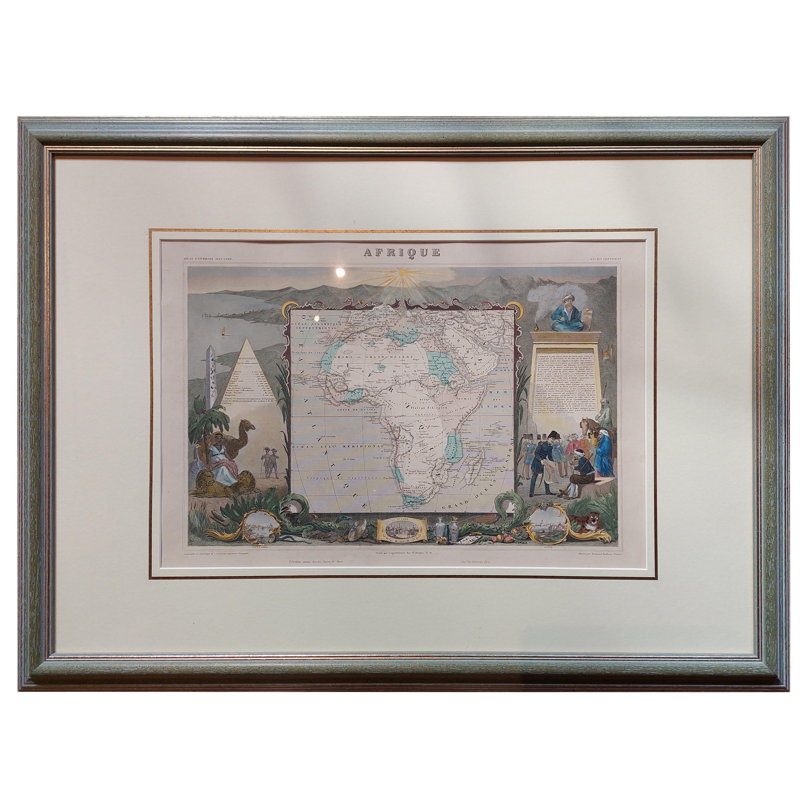
Antique Map of Africa by Levasseur
c.1840
Located in Langweer, NL
Antique map titled 'Afrique'. Original antique map of Africa. Decorative map of the continent surrounded by allegorical vignettes. Engraved by Raimond Bonheur, father of the famous F...
Category
Antique Mid-19th Century Maps
Materials
Paper
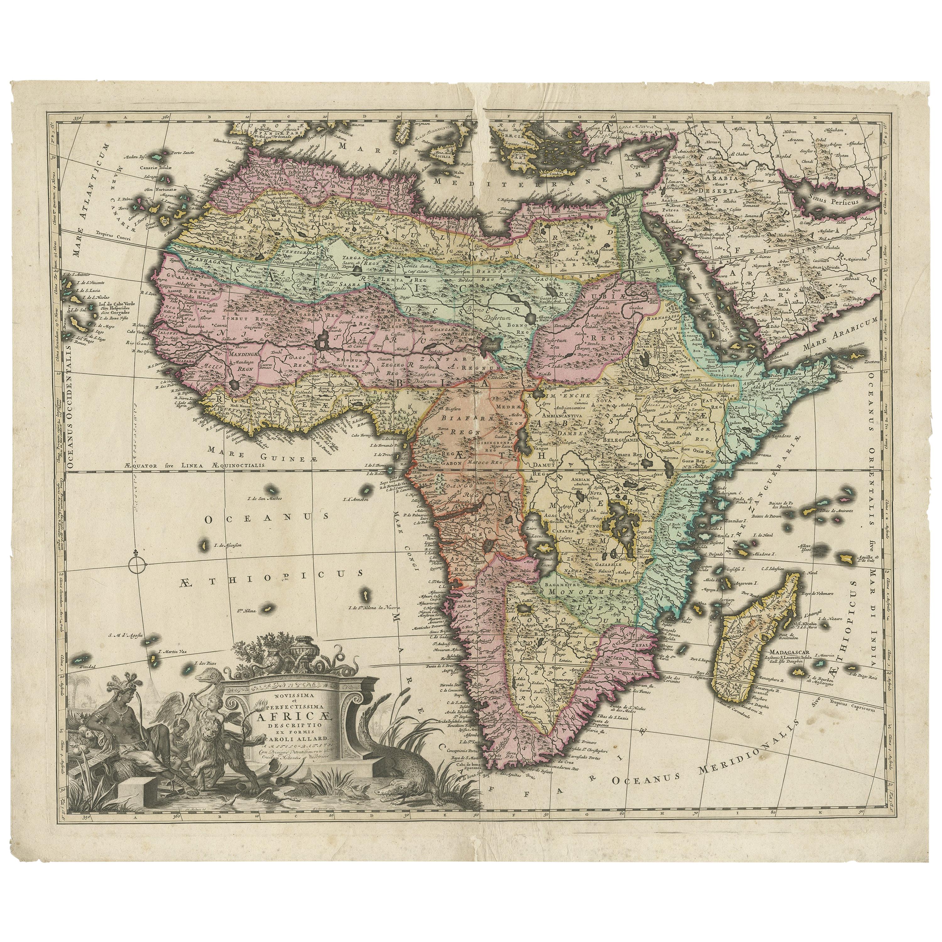
Original Antique Hand- Map of Africa by Allard
1697
Located in Langweer, NL
Antique map titled 'Novissima et Perfectissima Africae (..)'. Beautiful large map of Africa. This is the 3rd state of the map, with climate notation add...
Category
Antique Late 17th Century Maps
Materials
Paper

$1,160 Sale Price
35% Off
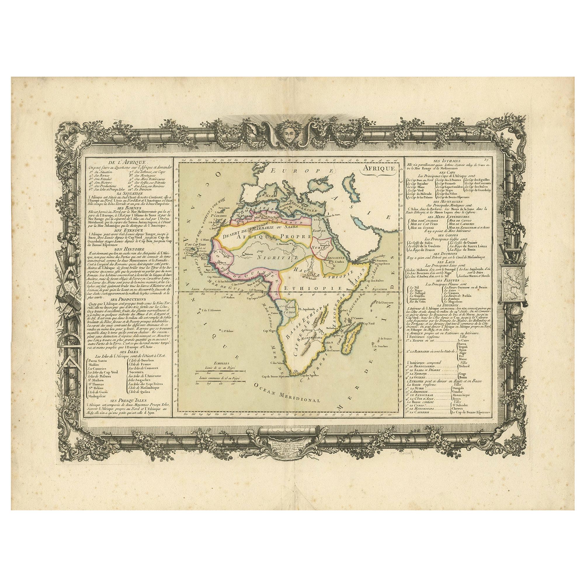
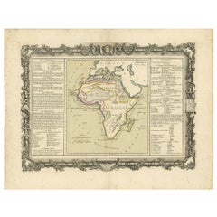
Antique Map of Africa by Claude Buy de Mornas
1761
Located in Langweer, NL
Antique map titled 'Afrique'. Original antique map of Africa flanked with descriptions containing geographical information about the area. This map originates from 'Atlas Methodique ...
Category
Antique Mid-18th Century Maps
Materials
Paper
$475 Sale Price
20% Off
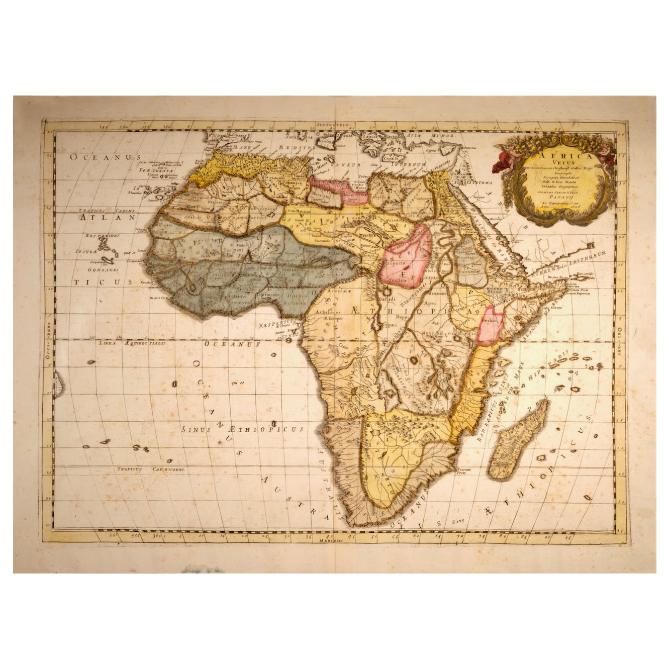
"Africa Vetus": a 17th Century Hand-Colored Map by Sanson
By Nicolas Sanson
Located in Alamo, CA
This original hand-colored copperplate engraved map of Africa entitled "Africa Vetus, Nicolai Sanson Christianiss Galliar Regis Geographi" was originally created by Nicholas Sanson d...
Category
Antique Late 17th Century French Maps
Materials
Paper

Antique Map of Africa by Homann Heirs,
1804
Located in Langweer, NL
Antique map titled 'Charte von Africa'. Large, original antique map of Africa by Franz Ludwig Güssefeld. Published by Homann Heirs, 1804.
Category
Antique Early 19th Century Maps
Materials
Paper

$1,427 Sale Price
20% Off