Items Similar to Plan of a Part of Newport, R. I. Showing Changes... O. H. P, Belmont, Esq.


Want more images or videos?
Request additional images or videos from the seller
1 of 11
UnknownPlan of a Part of Newport, R. I. Showing Changes... O. H. P, Belmont, Esq.1907
1907
$5,000
£3,794.52
€4,372.09
CA$7,064.20
A$7,569.18
CHF 4,060.33
MX$89,658
NOK 51,218.86
SEK 46,857.33
DKK 32,660.07
About the Item
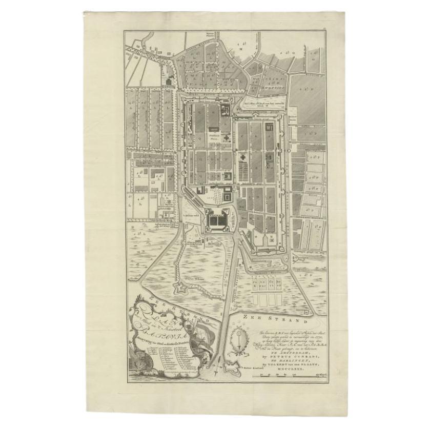
PLAN OF A PART OF NEWPORT, R.I. SHOWING CHANGES IN HIGHWAYS ASKED FOR BY O.H.P. BELMONT, ESQ.
The original ink and watercolor plan on paper from 1907. The plan is extremely large; if fully assembled it would measure no less than 11.5 feet in height and 6.5 feet in breadth. Segmented and backed on modern linen in four sections – each section is 70 x 39 inches. This grand oversized folding map can be folded down to four sections each 17.5 x 11 inches and stored in a modern made leather and marble paper case 18 x 11.75 x 3 inches.
Text continues, "Prepared for Charles Warren Lippitt at the office of J. P. Cotton, C.E. Newport, R.I. Oct. 28, 1907." A fine manuscript plan of the Bellevue neighborhood of Newport, depicting the street layout and the detailed footprints of the area’s many mansions.
The plan was produced at the behest of Charles Warren Lippett (1846-1924), who served as governor of Rhode Island from 1895-1897. The Lippett “Breakwater” mansion is also shown on this plan, situated at the southernmost tip of the peninsula. Though the circumstances are unclear, Lippitt seems to have requested the plan be drawn out of some concern for road construction proposed by Oliver Hazard Perry Belmont (1858-1908). Belmont, the extremely wealthy heir of Rothschilds agent August Belmont, had recently built his own home “Belcourt Castle” in the area bounded by Ledge Road and Bellevue and Lakeview Aves. The “Castle” seems to be shown on the plan as the extremely large, unlabeled residence at the intersection of Lakeview and Ledge. Though the nature of the proposed construction is unclear, it seems to be indicated in some way by the letters “A” through “K” shown in red in the top half of the map. These are presumably keyed to some other planning document, which alas is not present here. This piece is in good to fair condition, some staining, and paper loss, primarily along edges.
- Creation Year:1907
- Dimensions:Height: 18 in (45.72 cm)Width: 11.75 in (29.85 cm)Depth: 3 in (7.62 cm)
- Medium:
- Movement Style:
- Period:
- Condition:This piece is in good to fair condition, some staining, and paper loss, primarily along edges.
- Gallery Location:New York, NY
- Reference Number:Seller: #535611stDibs: LU33126475312
About the Seller
4.7
Recognized Seller
These prestigious sellers are industry leaders and represent the highest echelon for item quality and design.
Established in 1898
1stDibs seller since 2015
60 sales on 1stDibs
Associations
International Fine Print Dealers Association
- ShippingRetrieving quote...Shipping from: New York, NY
- Return Policy
More From This Seller
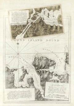
View AllHell Gate / Oyster Bay and Huntington / Huntington Bay
Located in New York, NY
HELL GATE / OYSTER BAY AND HUNTINGTON / HUNTINGTON BAY. This aquatint and line engraved map was published according to Act of Parliament Novr. 19th, 1778.
T...
Category
18th Century Naturalistic More Prints
Materials
Engraving, Aquatint
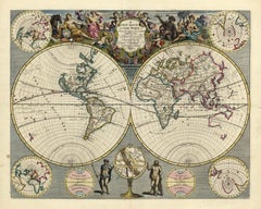
A NEW MAP OF THE WORLD from the Latest Observations.
By John Senex
Located in New York, NY
The title continues “…. Most Humbly Inscribd [sic] to his Royal Highness George Prince of Wales.”
A fine British produced double hemisphere world map. On this map, California is shown as an island on the main double hemisphere map...
Category
18th Century Other Art Style More Prints
Materials
Watercolor, Engraving
Indiarum Occidentalium Tractus Littorales cum Insulis Caribicis / Pascaert van W
By Louis Renard
Located in New York, NY
This early 18th-century engraved map was published by Louis Renard in Amsterdam. The image size is 19 x 22 " (48.3 x 55.9 cm) plus margins.
A beautifully engraved Dutch sea chart. Shown is the entire Caribbean basin including the eastern seaboard up to Cape Cod and includes Bermuda. Florida is shown with the classic flattened southeastern coast that was derived by Hessel Gerritz. Noted are the routes taken by the Spanish treasure...
Category
18th Century Other Art Style More Prints
Materials
Engraving

Planiglobii Terrestris Mappa Universalis / Mappe Monde
By Homann Heirs
Located in New York, NY
This map was printed from a copperplate engraving in 1746. The printed image size is 18.25 x 21.75 inches (46.3 x 55.2 cm) plus margins.
An attractive double hemisphere map...
Category
18th Century Other Art Style More Prints
Materials
Engraving

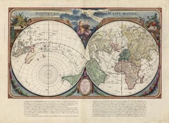
Nouvelle Mappe Monde, dediee au progres de nos connoissances.
Located in New York, NY
A handsome and well-engraved world map constructed with the prime meridian through Paris. The hemispheres are rotated through 45 degrees. This is an unusual projection for a world map and was based on the work of the French Academie Royale des Sciences. This particular impression is by Remondini who re-issued Santini's "Atlas Univ." in 1784. "Nouvelle Mappe Monde" is a copper plate engraving published by Giuseppe Remondini, Venice. The printed image size is just over 15 x 25 inches. Overall the map is in good condition with three small tears at the paper edge - all repaired. Modern (not 18th...
Category
18th Century Other Art Style More Prints
Materials
Watercolor, Engraving
Alhambra XII
By Antonio Frasconi
Located in New York, NY
Antonio Frasconi created the color woodcut entitled “Alhambra XII” in 1963. This piece is signed titled, and dated in pencil. The edition is 12, and paper size is 18 x 24 inches. “...
Category
1960s American Modern Landscape Prints
Materials
Woodcut
You May Also Like
Rare 18th C. Newport Map
Located in Sandwich, MA
Rare 18th C, Map titled "A plan of the town of Newport in the province of Rhode Island". Earliest printed plan of Newport, published for the use of the British just prior to their o...
Category
Antique 1770s American Maps
Materials
Paper

$19,500 / item
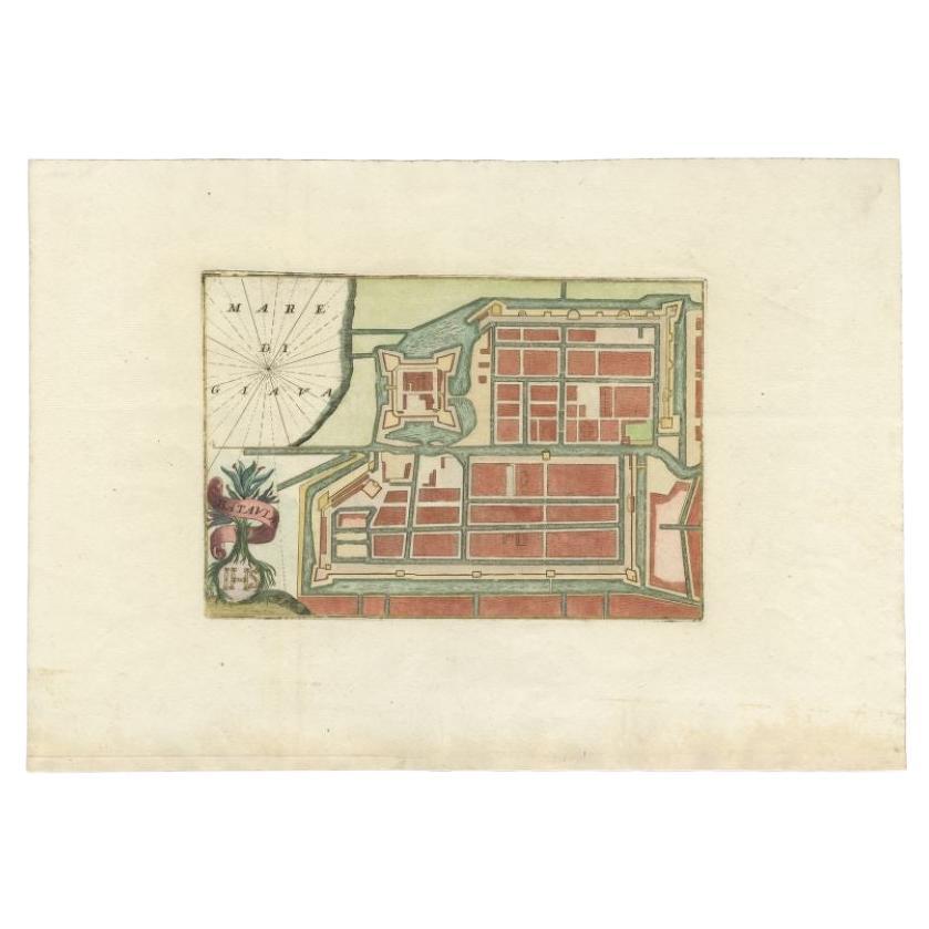
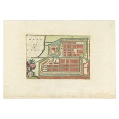
Antique Plan of Batavia, Nowadays Jakarta, Indonesia, 1780
Located in Langweer, NL
Antique map titled 'Plan der Stad en 't Kasteel Batavia'. A very rare late 18th century detailed plan of Batavia with an alpha-numeric key showing the main areas and buildings (only ...
Category
Antique 18th Century Maps
Materials
Paper

$1,759 Sale Price
20% Off
Large Original Antique City Plan of Montreal, Canada, circa 1900
By Rand McNally
Co.
Located in St Annes, Lancashire
Fabulous colorful map of Montreal
Original color
By Rand, McNally & Co.
Published, circa 1900
Unframed
Minor edge tears
Free shipping.
Category
Antique Early 1900s American Maps
Materials
Paper

Antique Plan of Batavia in the Dutch East Indies or Nowadays Jakarta, Indonesia
Located in Langweer, NL
Rare plan of Batavia titled 'Batavia'. With 'IHS' monogram, symbolizing Jesus Christ. Source unknown, to be determined.
Artists and Enrgavers: Anonymous.
Condition: Very good,...
Category
Antique 18th Century Maps
Materials
Paper
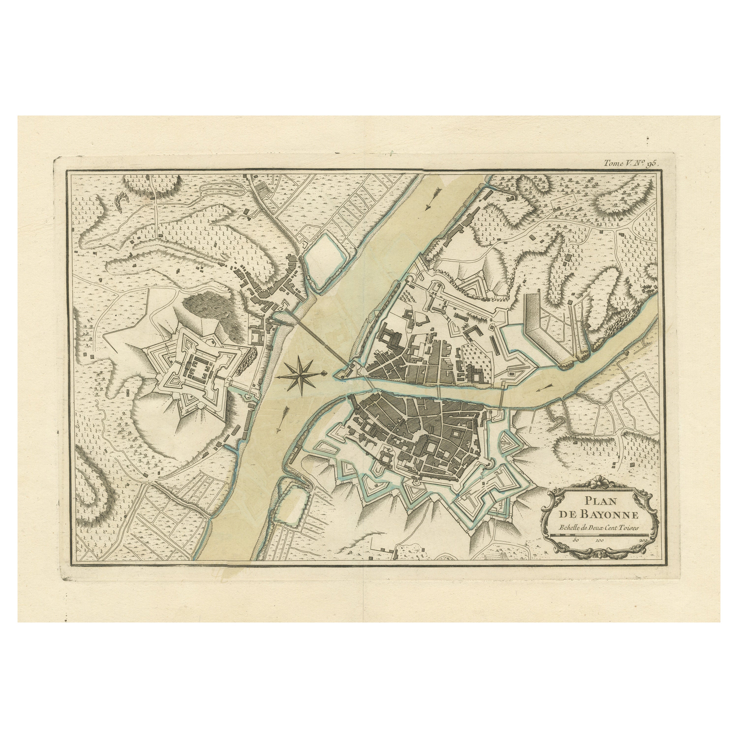
Antique Plan of the City of Bayonne, France
Located in Langweer, NL
Antique map titled 'Plan de Bayonne'. Original old plan of the city of Bayonne, France. This map originates from 'Le Petit Atlas Maritime (..)' by J.N. Bellin. Published 1764.
Be...
Category
Antique Mid-18th Century Maps
Materials
Paper
$323 Sale Price
20% Off
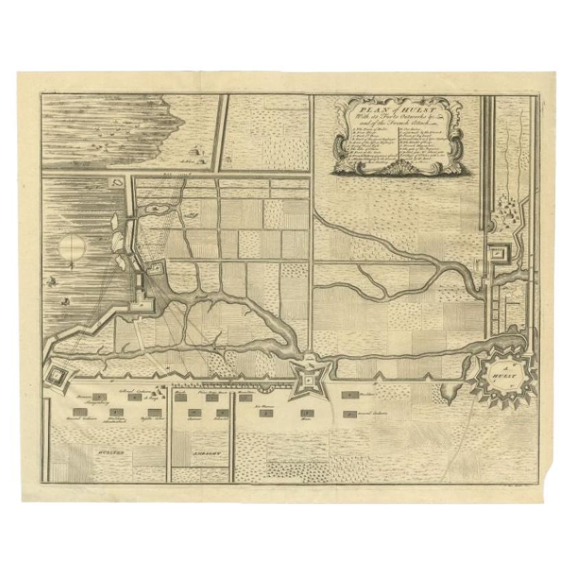
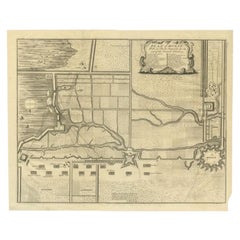
Plan of Hulst with its Forts and Outworks, Holland, War of Spanish Succession
Located in Langweer, NL
Antique map titled 'Plan of Hulst with its Forts and Outworks (..)' Plan of Hulst with its Forts and Outworks, Holland, War of Spanish Succession, 1729 - With details of the area including forts and outworks. The map features a very large and decorative legend naming specific forts and the direction of cannon fire...
Category
Antique 18th Century Maps
Materials
Paper
More Ways To Browse
Marbleized Paper
Takahashi Bird
Takashi Murakami Pillow
Tatyana Vafina
Ted Smith
Tiffany And Co X Spalding Basketball
Tiffany Basketball
Tiffany Studio New York Belt Buckles
Tintin Rocket
Tyrannosaurus Rex Tooth
Used Aermotor Windmill
Vintage Cowboy Guitars
Vintage Playboy Watch
Virgin And Child Russian
Wakao Toshisada
Warren Mackenzie Teapot
Wifredo Lam Ceramic
Willa Vennema Art