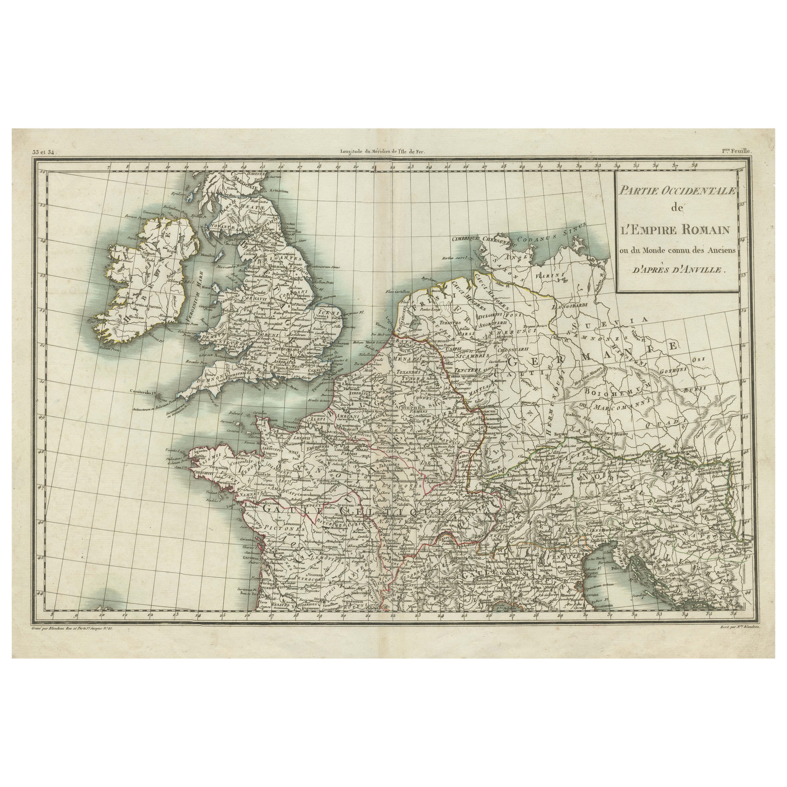
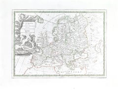
Items Similar to Parte Occidentale dell
Imprero Romano (Western Part of the Roman Empire)

Want more images or videos?
Request additional images or videos from the seller
1 of 5
Jean-Baptiste Bourguignon d
AnvilleParte Occidentale dell
Imprero Romano (Western Part of the Roman Empire)1820
1820
$299.62
£221.99
€250
CA$413.18
A$437.45
CHF 236.74
MX$5,228.34
NOK 2,950.88
SEK 2,698.48
DKK 1,904.52
About the Item
Etching hand colored realized after Jean-Baptiste Bourguignon D'Anville in 1820.
Table from "Nuovo Atlante di Geografia Universale" by Batelli
Fanfani.
Very good condition.
- Creator:Jean-Baptiste Bourguignon d Anville (French)
- Creation Year:1820
- Dimensions:Height: 18.12 in (46 cm)Width: 22.84 in (58 cm)Depth: 0.04 in (1 mm)
- Medium:
- Movement Style:
- Period:
- Framing:Framing Options Available
- Condition:
- Gallery Location:Roma, IT
- Reference Number:Seller: T-1572081stDibs: LU650317072162
About the Seller
4.9
Platinum Seller
Premium sellers with a 4.7+ rating and 24-hour response times
1stDibs seller since 2017
7,919 sales on 1stDibs
Typical response time: 1 hour
- ShippingRetrieving quote...Shipping from: Grasse, France
- Return Policy
More From This Seller
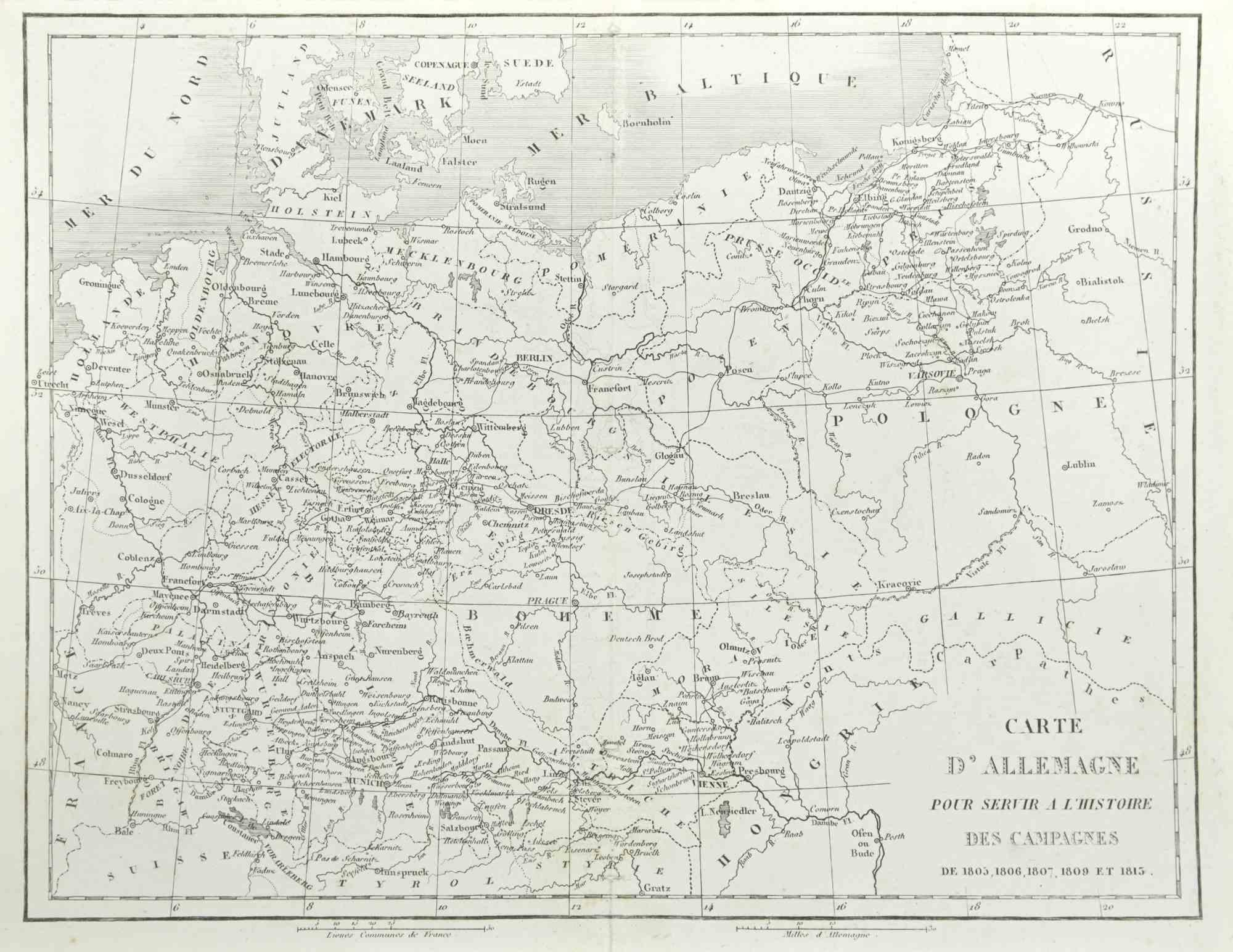
View AllGerman Campaign - Etching by Pierre François Tardieu - 1837
Located in Roma, IT
German campaign is an Etching realized by Pierre François Tardieu in 1837.
Good conditions.
The artwork is realized in a well-balanced composition. the artwork and belongs to the s...
Category
1830s Modern Figurative Prints
Materials
Lithograph
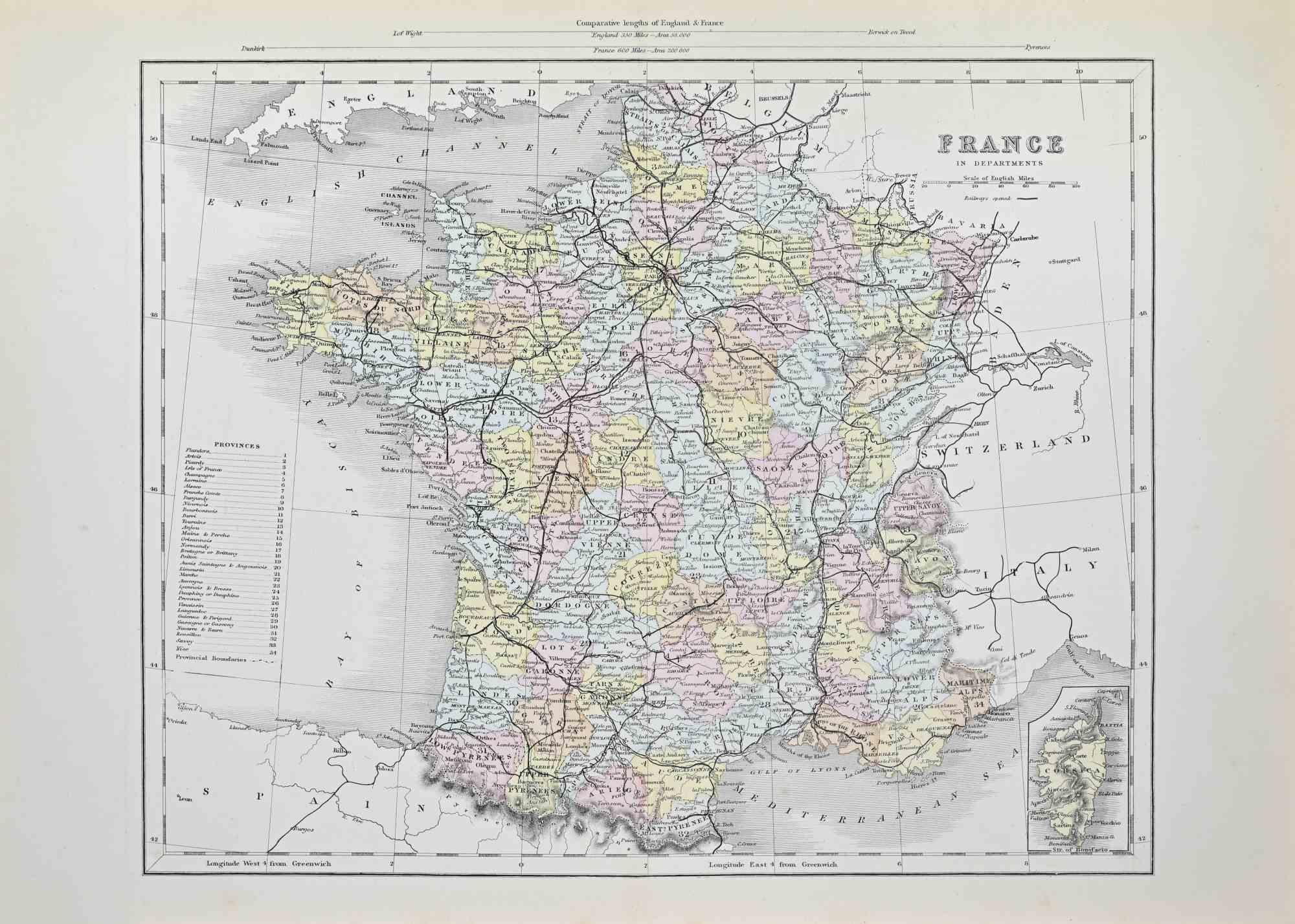
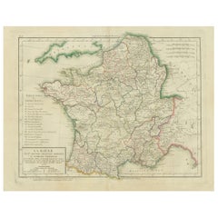
France in Departments - Lithograph - 1872
Located in Roma, IT
France in Departments is a map realized by an artist of the 19th century.
Lithograph, printed in 1872 by Milliam Mackenzie, London.
Category
1870s Modern Figurative Prints
Materials
Lithograph
France in Departments - Lithograph - 1872
Located in Roma, IT
France in Departments is an artwork realized by an artist of the 19th century.
Lithograph, printed in 1872 by Milliam Mackenzie, London.
Good condition.
Category
1870s Modern Figurative Prints
Materials
Lithograph

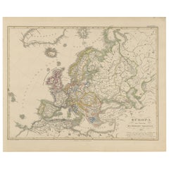
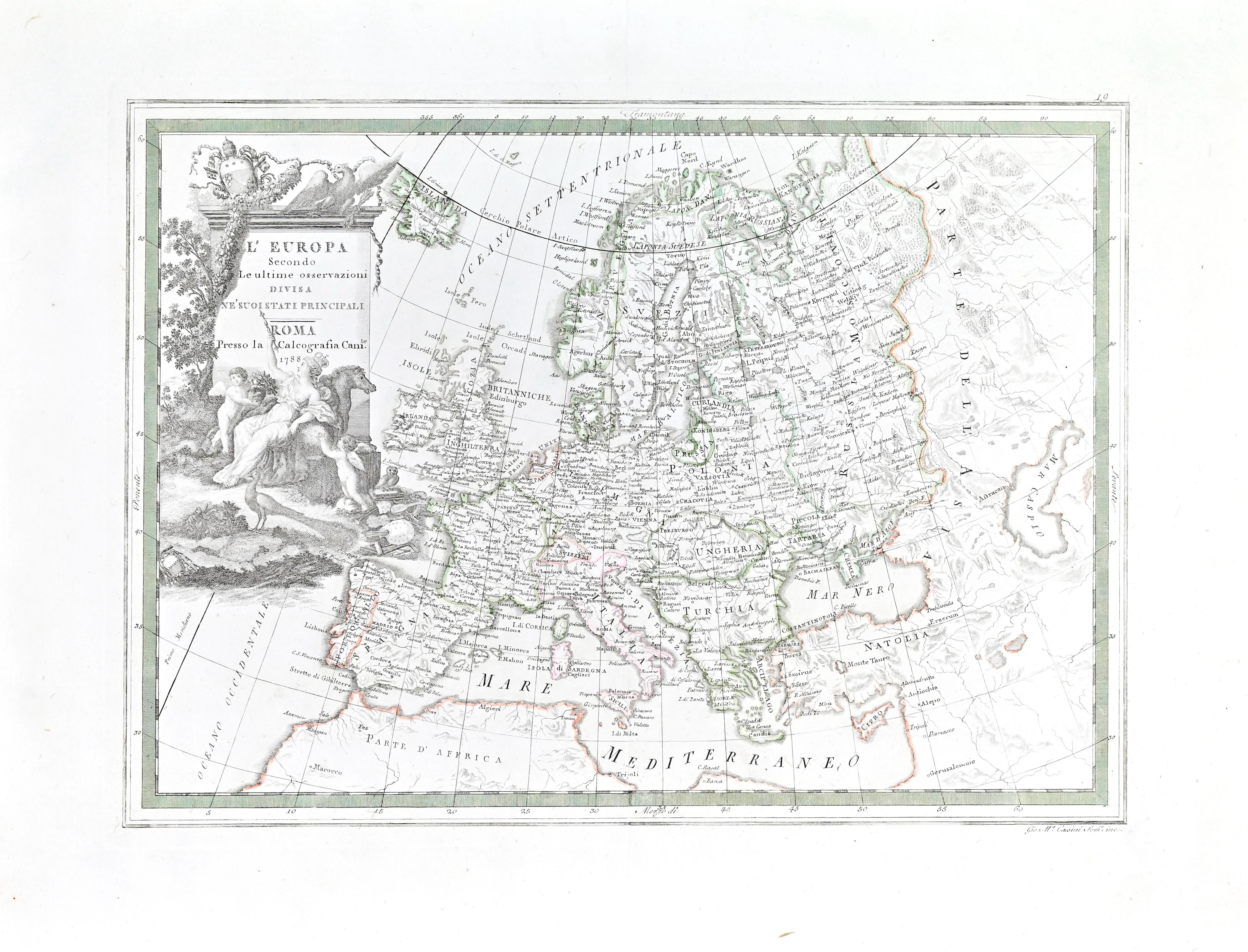
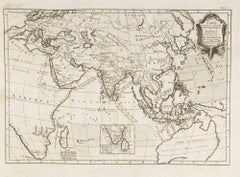
Map of Europe
Located in Roma, IT
Etching hand colored realized by Giovanni Maria Cassini in 1788.
Table from "Nuovo Atlante Geografico Universale", published in Rome in 1788 at Calcografia Camerale.
Very good cond...
Category
1780s Modern Figurative Prints
Materials
Etching
Carte Pour Servir a l
Histoire Philosophique.. - Etching by Rigobert Bonne- 1780
Located in Roma, IT
Etching on paper.
From Guillaume-Thomas Raynal, Histoire philosophique et politique des établissemens et du commerce des Européens dans les deux Indes, Geneva 1780.
This interestin...
Category
1780s Modern Figurative Prints
Materials
Etching
Map of Campaign of 1814 - Etching by Pierre François Tardieu - 1837
Located in Roma, IT
Map of Campaign of 1814 is an Etching realized by Pierre François Tardieu in 1837.
Good conditions.
The artwork is realized in a well-balanced composition. the artwork and belongs ...
Category
1830s Modern Figurative Prints
Materials
Lithograph

You May Also Like
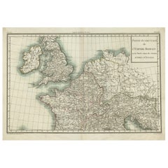
Western Roman Empire Map: British Isles
Gaul - 1802 Tardieu Atlas
Located in Langweer, NL
Antique Map Description and title: "Partie Occidentale de l'Empire Romain ou du Monde connu des Anciens d'Après d'Anville"
Publication Details:
- **Atlas Title:** Nouvel Atlas Univ...
Category
Antique Early 1800s Maps
Materials
Paper
$421 Sale Price
20% Off
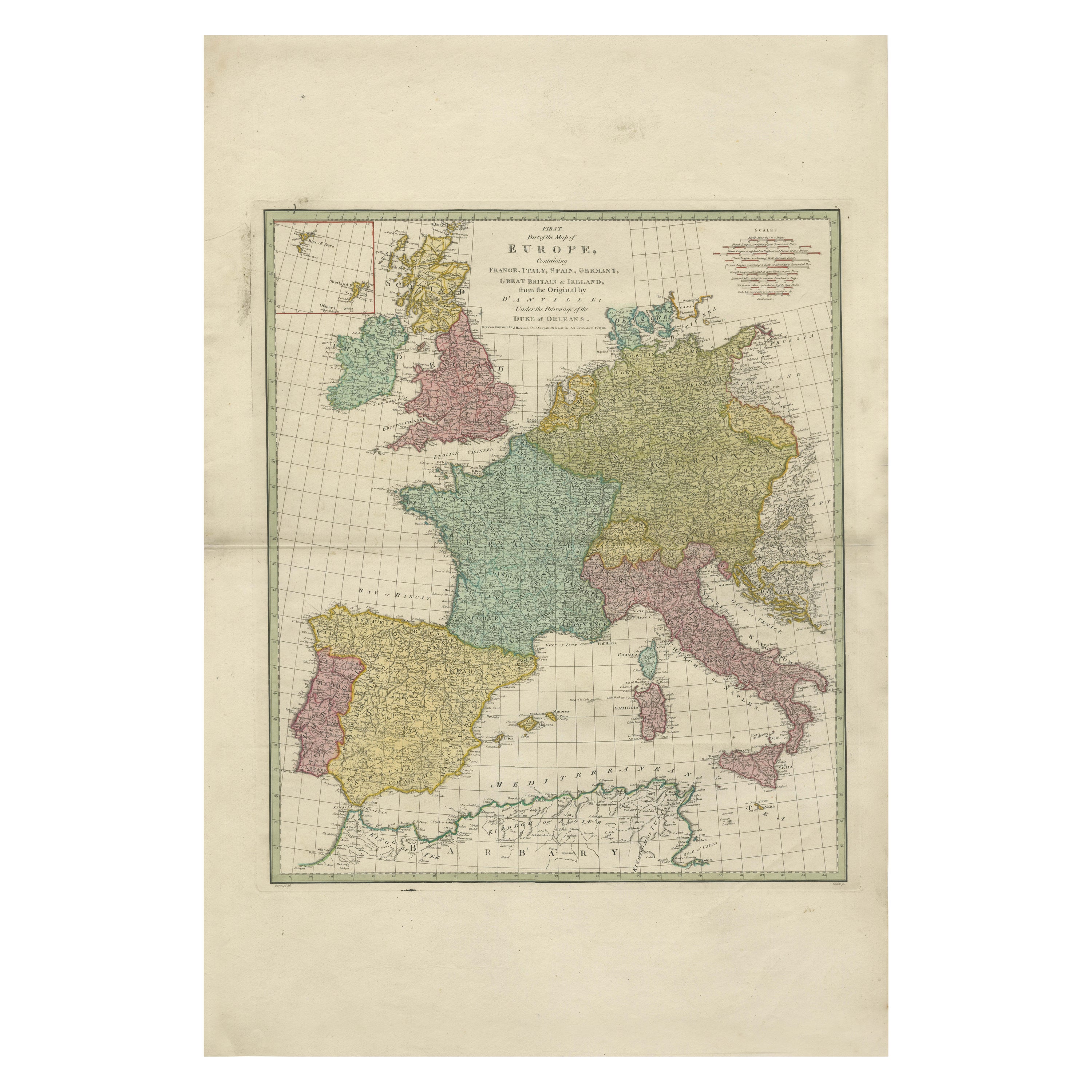
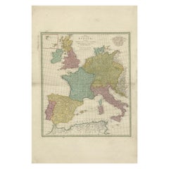
1788 Map of Europe - France, Italy, Spain, Germany, Great Britain
Ireland
Located in Langweer, NL
Title: "1788 Map of Europe - France, Italy, Spain, Germany, Great Britain & Ireland by D'Anville"
Description:
This detailed map of Europe, titled "First Part of the Map of Europe...
Category
Antique 1780s Maps
Materials
Paper
$1,073 Sale Price
20% Off
Antique Map of France in Ancient Roman Times by d
Anville, c.1795
Located in Langweer, NL
Antique map titled 'Gallia Antiqua ex Aevi Romani Monumentis (..)'. Original, large, map of France in ancient Roman times. Bottom left, a large inset shows Gallia's southern most Rom...
Category
Antique Late 18th Century French Maps
Materials
Paper

$671 Sale Price
30% Off
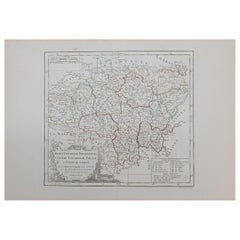
1762 Berri, Nivernois Bourbonois, Lyonois, Bourgogine, Bresse, et, Franche - Com
Located in Norton, MA
1762 Vaugondy map, entitled
"Berrl Nivernois Bourbonois Lyonois, Bourgone, Bresse, Et Franche-Comte,"
Ric.b003
About this Item
A fine Copperplate Engraving with original han...
Category
Antique 18th Century Unknown Maps
Materials
Paper
Map of Ancient Gaul
Roman Provinces: Early 19th Century - 1802 Tardieu Atlas
Located in Langweer, NL
### Antique Map Description
**Title:** La Gaule et Ses Grandes Dignités Romaines au Temps des Empereurs
**Publication Details:**
- **Atlas Title:** Nouvel Atlas Universel de Géogra...
Category
Antique Early 1800s Maps
Materials
Paper
Europe Map – Political Divisions and Borders, Published in 1858
Located in Langweer, NL
Europe Map – Political Divisions and Borders 1858
This fine antique print shows Europe with its political divisions titled “Europa zur Übersicht der politischen Verhältnisse” meanin...
Category
Antique Mid-19th Century German Maps
Materials
Paper