Items Similar to Carte D
Europe


Want more images or videos?
Request additional images or videos from the seller
1 of 13
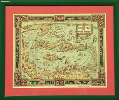
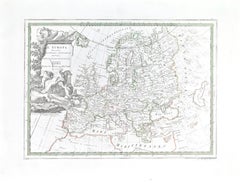
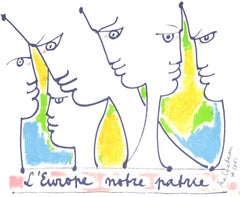
Pierre HeraultCarte D
Europe1946
1946
$750
£560.64
€646.72
CA$1,050
A$1,109.50
CHF 596.69
MX$13,282.77
NOK 7,475.89
SEK 6,846.83
DKK 4,830.21
About the Item
Classic colour French post-war c1946 map of Western Europe by Pierre Herault (LR)
Editions Jacque-Petit
Print Sz: 21"H x 28 1/2"W
Frame Sz: 25 1/4"H x 32 1/4"W
- Creator:Pierre Herault
- Creation Year:1946
- Dimensions:Height: 25.25 in (64.14 cm)Width: 32.25 in (81.92 cm)
- Medium:
- Period:
- Condition:
- Gallery Location:Bristol, CT
- Reference Number:Seller: 154661stDibs: LU126018205662
About the Seller
4.8
Vetted Professional Seller
Every seller passes strict standards for authenticity and reliability
Established in 2000
1stDibs seller since 2019
141 sales on 1stDibs
Typical response time: 2 hours
- ShippingRetrieving quote...Shipping from: Bristol, CT
- Return Policy
More From This Seller
View AllLe Coste Nord Ovest Dell
America E Nord Est Dell
Asia Delineate Sulle Ultime O
Located in Bristol, CT
Map Sz: 14 1/2"H x 19 7/8"W
Frame Sz: 21"H x 26 3/8"W
A fine example of Cassini's 1798 map of Alaska, the Bering Strait, and Siberia. Cassini issued this map in his 1798 atlas to illustrate the discoveries made by James Cook. Cook was the first to accurately chart the Alaskan coastline and provide a detailed mapping of the Aleutian Islands. Cook's zigzagging route is shown as he skirts the Aleutian Islands, passes through the Bering Strait into the Arctic Ocean, and then turns back to sail south along the Siberian Coast. Here the Aleutians are collectively identified as Isole Alessiane, though many of the original islands...
Category
1790s Prints and Multiples
Materials
Paper
"The Story Map Of The West Indies" 1936
Located in Bristol, CT
Framed colour map of the West Indies published 1936 w/ border design motif adapted from native West Indian handicraft and indigenous tropical fruits
Colorte...
Category
1930s More Prints
Materials
Paper
"Le Carre Hermes" 2009 Deluxe Ltd Edition Copy #208
Located in Bristol, CT
[303] pp.
Editions du Regard
2009
First Edition
10" x 10" x 1 1/2"D
w/ silk scarf wrap-around boards
w/ morie silk endpapers
New in Hermes box w/ ribbon
This book has been pr...
Category
Early 2000s More Art
Materials
Paper

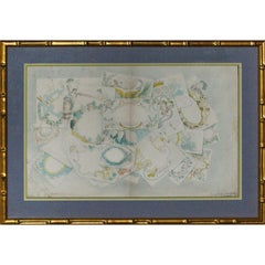
Hand-Embellished Bespoke Stationery
Located in Bristol, CT
Delightful & delicate watercolour on papier featuring approx. 20 hand-embellished stationary sheets replete with cartouches & scrolling throughout signed & titled (LR)
Art Sz: 12"H ...
Category
1830s Drawings and Watercolor Paintings
Materials
Watercolor
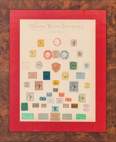
"United States Continued Private Offices Postage Stamps"
Located in Bristol, CT
Rare 19th century early United States 'Private Offices' postage stamps 43 hand-affixed on elaborate calligraphy sheet acquired by George Cary of Buffalo, N.Y. who was a cousin of US ...
Category
19th Century More Art
Materials
Paper
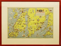
"Rhode Island Map, 1933"
Located in Bristol, CT
Classic c1933 colour (12 fold) red framed map of Rhode Island designed by H.W. Hetherington from Narragansett Bay to Buzzard's Bay
Map Sz: 17 3/8"...
Category
1930s Prints and Multiples
Materials
Lithograph
You May Also Like
Map of Europe
Located in Roma, IT
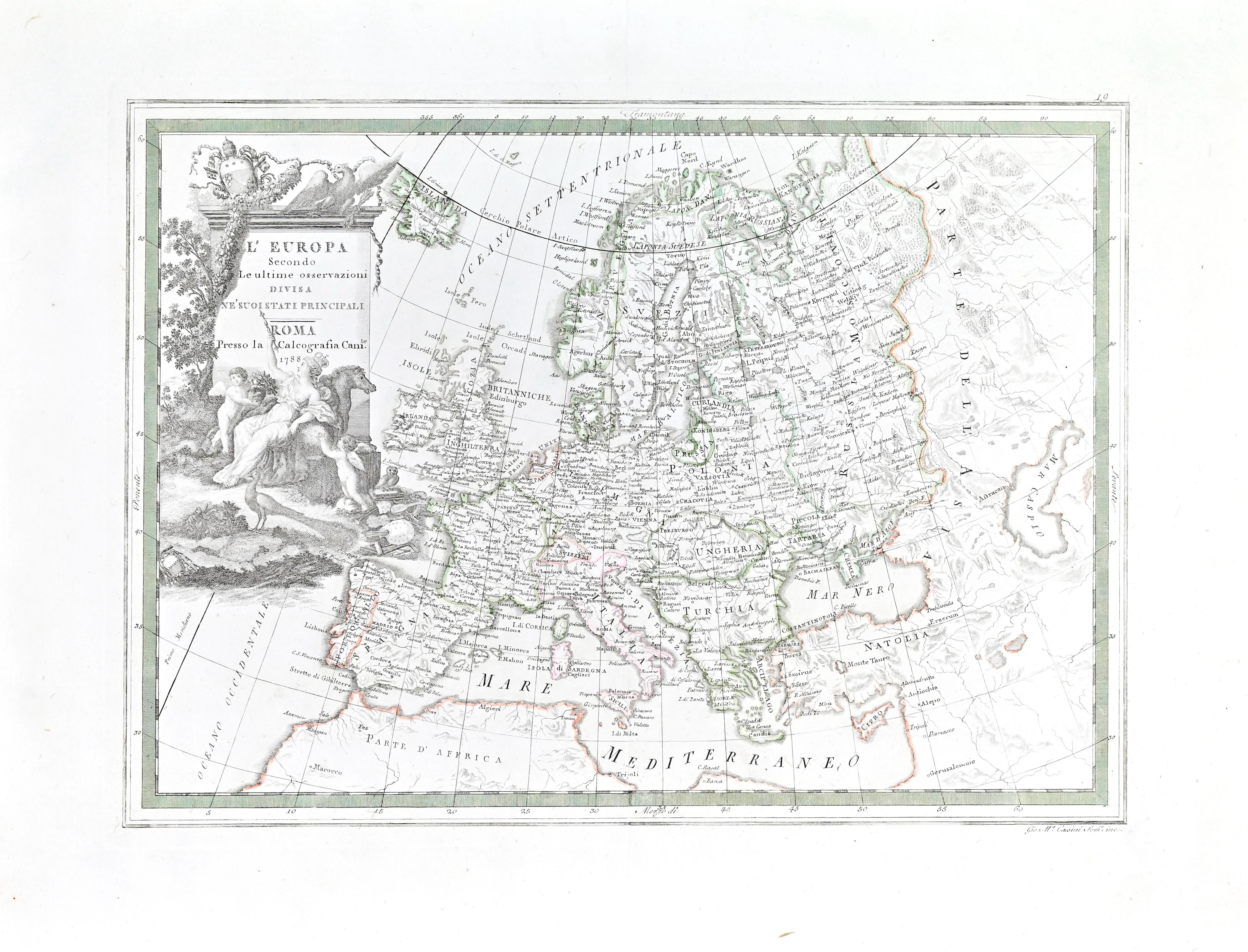
Etching hand colored realized by Giovanni Maria Cassini in 1788.
Table from "Nuovo Atlante Geografico Universale", published in Rome in 1788 at Calcografia Camerale.
Very good cond...
Category
1780s Modern Figurative Prints
Materials
Etching
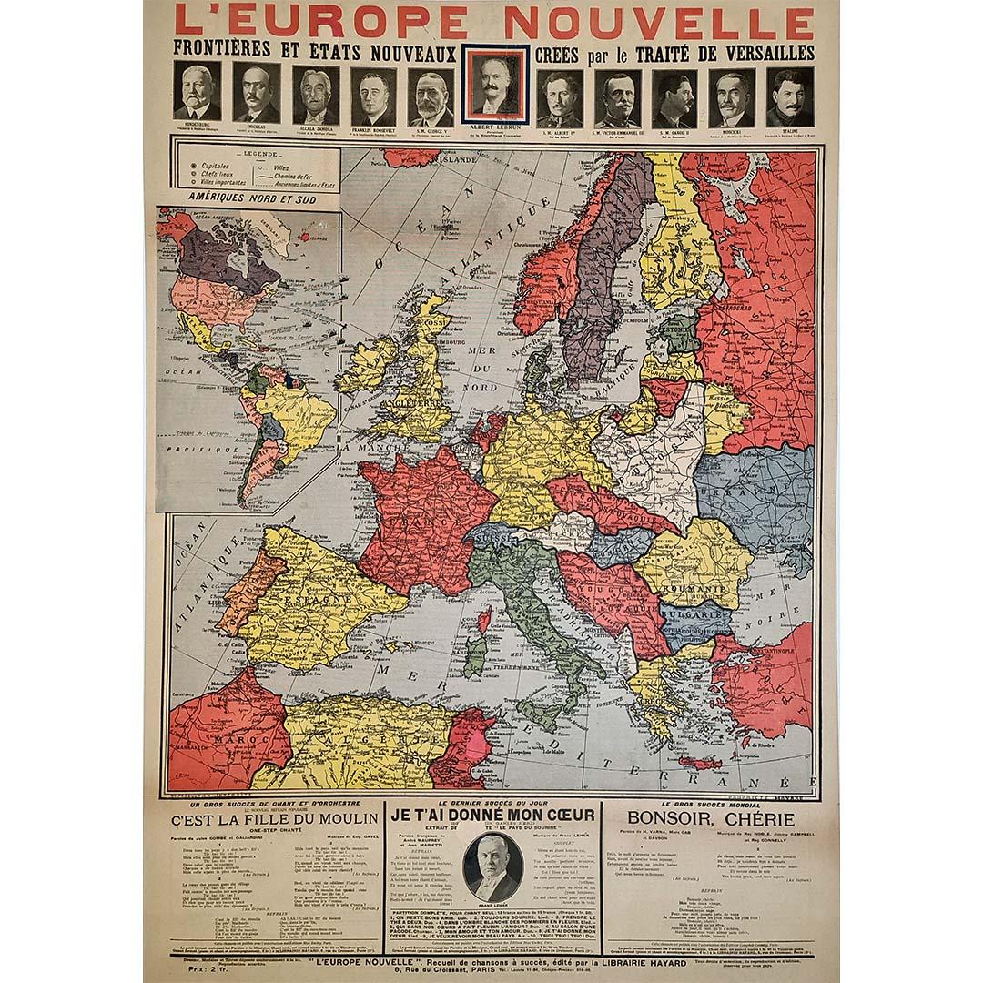
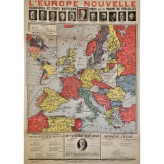
Original poster, titled “L’Europe Nouvelle” - political map of Europe
Located in PARIS, FR
This fascinating original poster, titled “L’Europe Nouvelle”, presents a vivid political map of Europe and the world as reshaped by the Treaty of Versailles, signed in 1919 at the co...
Category
1910s Prints and Multiples
Materials
Linen, Paper, Lithograph
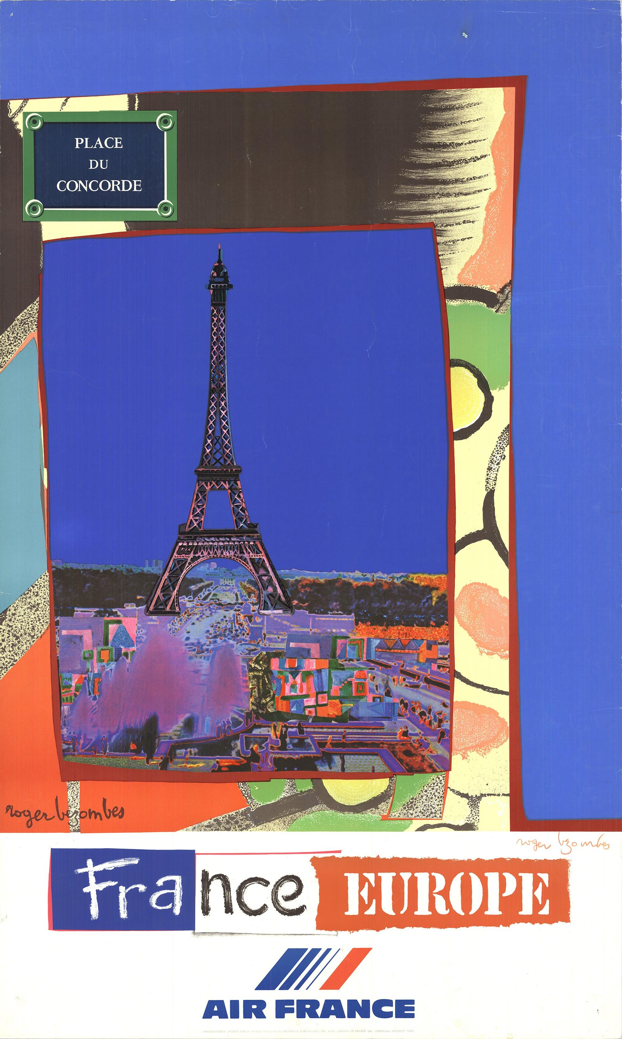
Bezombes France Europe, 1981 - Signed France Tourism Office
By Roger Bezombes
Located in Brooklyn, NY
The original travel poster created by Roger Bezombes for Air France and printed by Mourlot in Paris in 1981 is a collectible piece of art showcasing Bezombes' distinctive style. This...
Category
1980s Contemporary Prints and Multiples
Materials
Lithograph
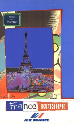
$960 Sale Price
20% Off
Map of Europe, 1844
Located in Houston, TX
Over 150 year old engraved map of Europe by Olney from 1844. Original hand color. Shows Northern Europe, Prussia and Germany.
Original antique map o...
Category
1840s More Prints
Materials
Ink, Watercolor, Handmade Paper

Map of France, 1934
Located in Andrézieux-Bouthéon, FR
Map of France, 1934
Vintage Design
Exceptional, map of France numbered 596 for the reliefs of France, scale 1/1,000,000
That it continues, small crack, visual, only to be noted ...
Category
20th Century French Modern Paintings
Materials
Stone
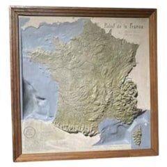
$1,100
Jean Cocteau, Untitled, from We Believe in Europe, 1979 (after)
By Jean Cocteau
Located in Southampton, NY
This exquisite silkscreen after Jean Cocteau (1889–1963), titled Sans titre (Untitled), from the album Nous croyons en lEurope, Etudes pour un projet de timbre (We Believe in Europe,...
Category
1970s Modern Figurative Prints
Materials
Screen
$796 Sale Price
20% Off
Free Shipping
More Ways To Browse
Vintage Europe Map
Petit H
Salomon Van Abbe
Saltimbanque Au Repos
Salvador Dali Cervantes
Salvador Dali El Cid
Salvador Dali Le Baiser
Salvador Dali Mary
Salvador Dali Medusa
Salvador Dali Sa
Salvador Dali Signed Etching El Cid
Salvador Dali The Businessman
Salvador Dali The Mystic Ladder
Santos Chavez
Saul Steinberg Mouton Rothschild Wine Label
Sempe Print
Serigraphs By Tarkay
Shane Turner