Items Similar to Cumberland, English County Antique map, 1847
Want more images or videos?
Request additional images or videos from the seller
1 of 2
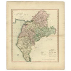
Isaac SlaterCumberland, English County Antique map, 18471847
1847
$195
£145.77
€168.15
CA$273
A$288.47
CHF 155.14
MX$3,453.52
NOK 1,943.73
SEK 1,780.17
DKK 1,255.85
About the Item
Steel-engraved map with original outline colouring by Isaac Slater. A detailed engraved map of the English county with title, scale, and key. Decorated with an uncoloured engraved view of 'Carlisle Cathedral'.
370mm by 240mm (platemark)
The map is loose and unframed.
- Creator:
- Creation Year:1847
- Dimensions:Height: 14.57 in (37 cm)Width: 9.45 in (24 cm)
- Medium:
- Movement Style:
- Period:
- Condition:
- Gallery Location:Melbourne, AU
- Reference Number:Seller: MP96881stDibs: LU124426194722
About the Seller
5.0
Gold Seller
Premium sellers maintaining a 4.3+ rating and 24-hour response times
Established in 2005
1stDibs seller since 2019
635 sales on 1stDibs
Typical response time: 1 hour
- ShippingRetrieving quote...Shipping from: Melbourne, Australia
- Return Policy
More From This Seller
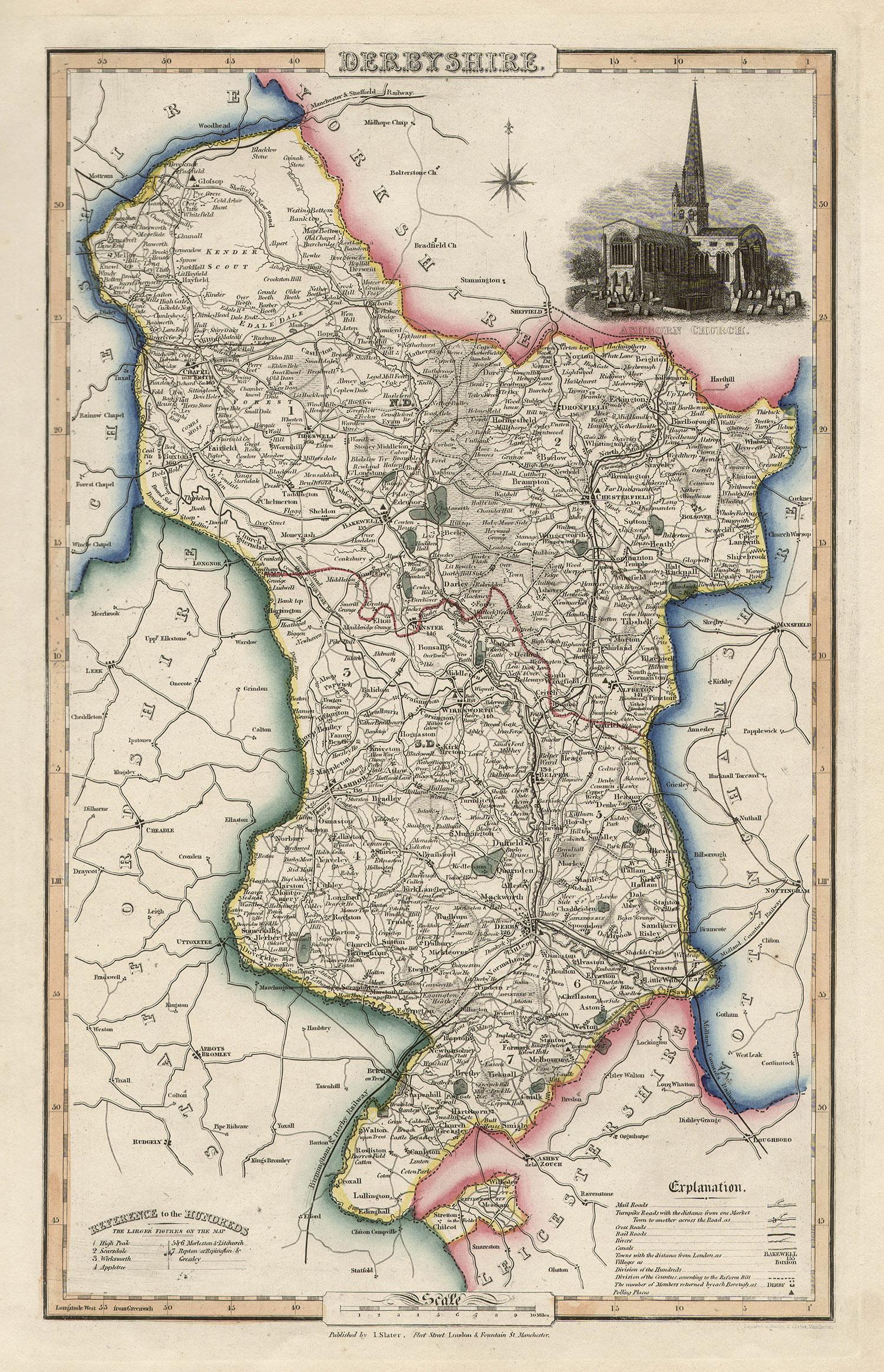
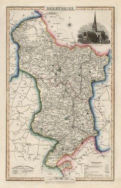
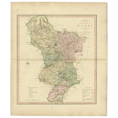
View AllDerbyshire, English County Antique map, 1847
By Isaac Slater
Located in Melbourne, Victoria
Steel-engraved map with original outline colouring by Isaac Slater. A detailed engraved map of the English county with title, scale, and key. Decorated with an uncoloured engraved vi...
Category
19th Century Naturalistic Landscape Prints
Materials
Engraving
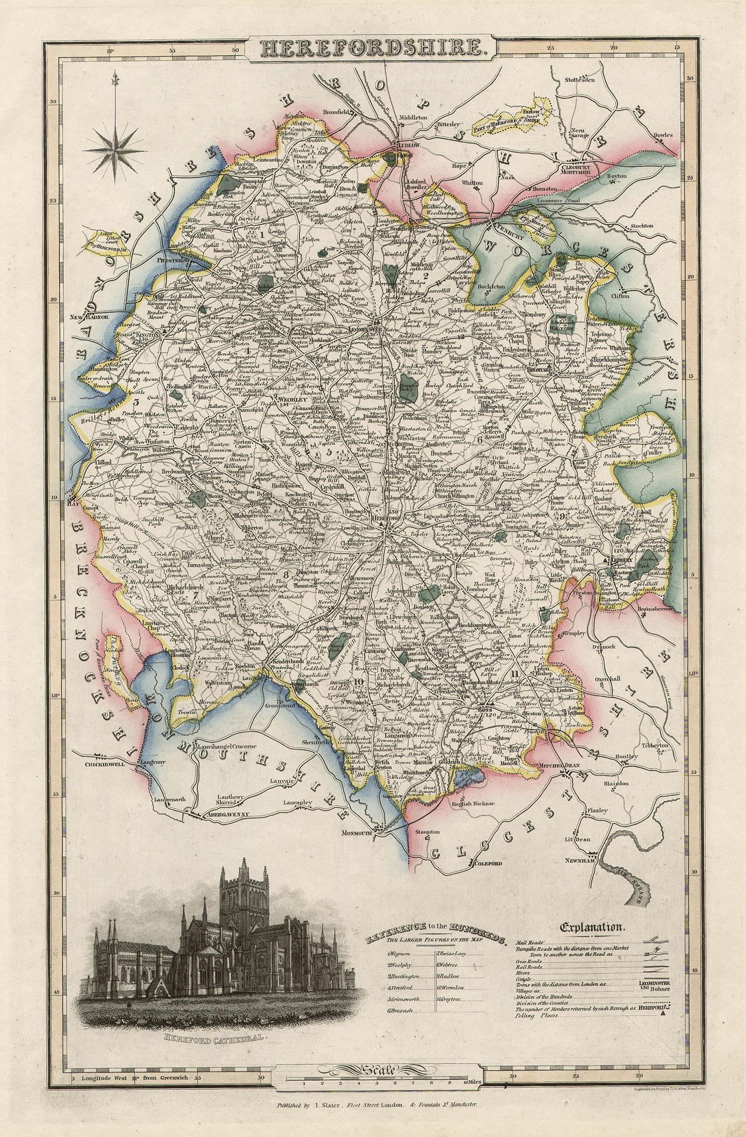
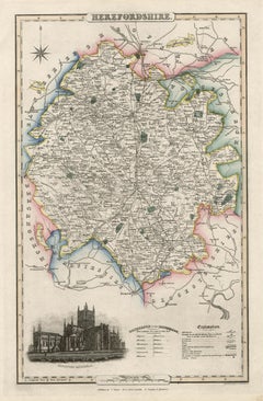
Herefordshire, English County Antique map, 1847
By Isaac Slater
Located in Melbourne, Victoria
Steel-engraved map with original outline colouring by Isaac Slater. A detailed engraved map of the English county with title, scale, and key. Decorated with an uncoloured engraved vi...
Category
19th Century Naturalistic Landscape Prints
Materials
Engraving
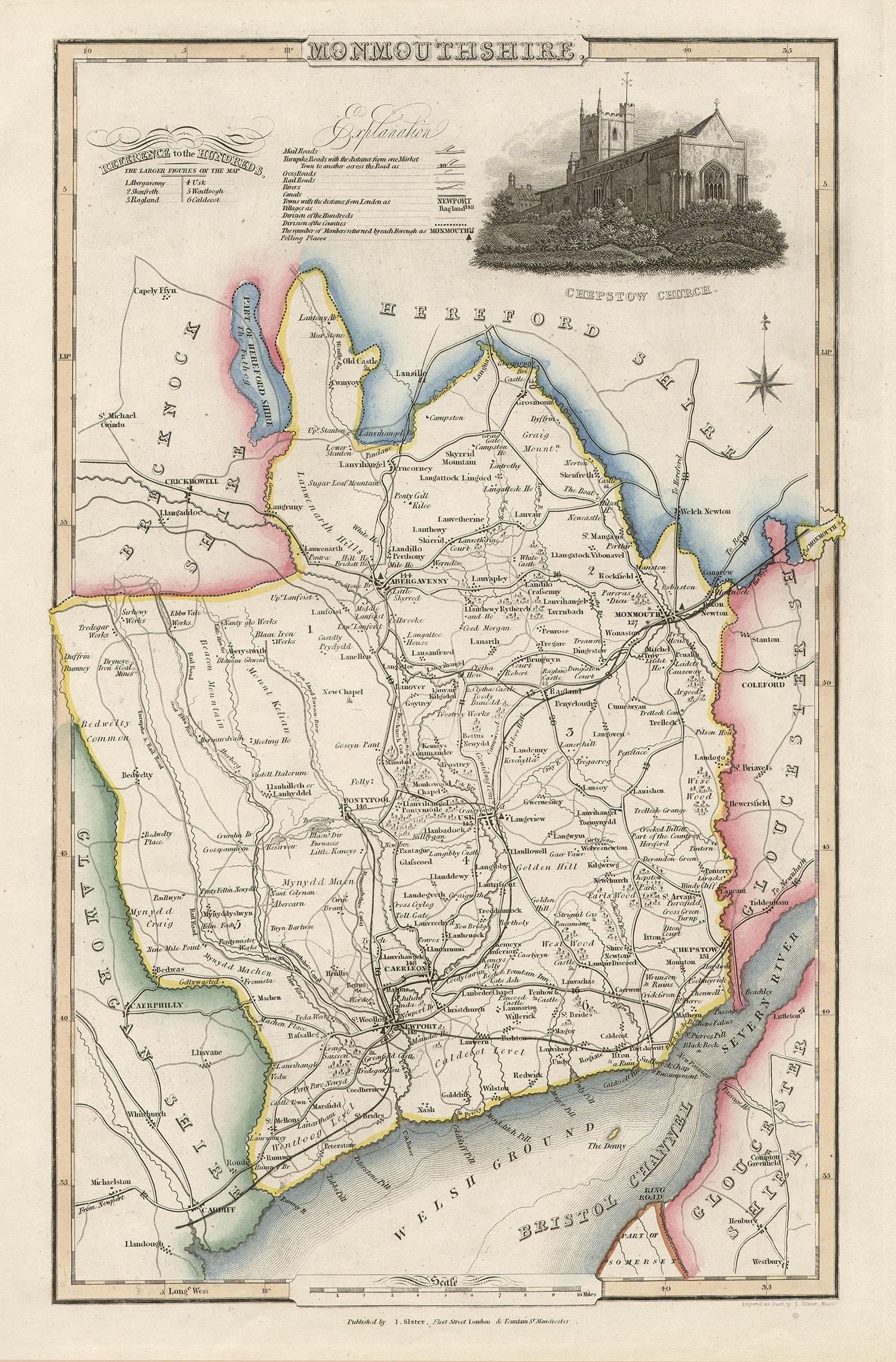
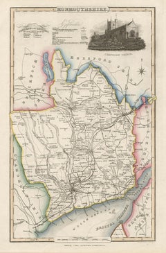
Monmouthshire, English County Antique map, 1847
By Isaac Slater
Located in Melbourne, Victoria
Steel-engraved map with original outline colouring by Isaac Slater. A detailed engraved map of the English county with title, scale, and key. Decorated with an uncoloured engraved vi...
Category
19th Century Naturalistic Landscape Prints
Materials
Engraving
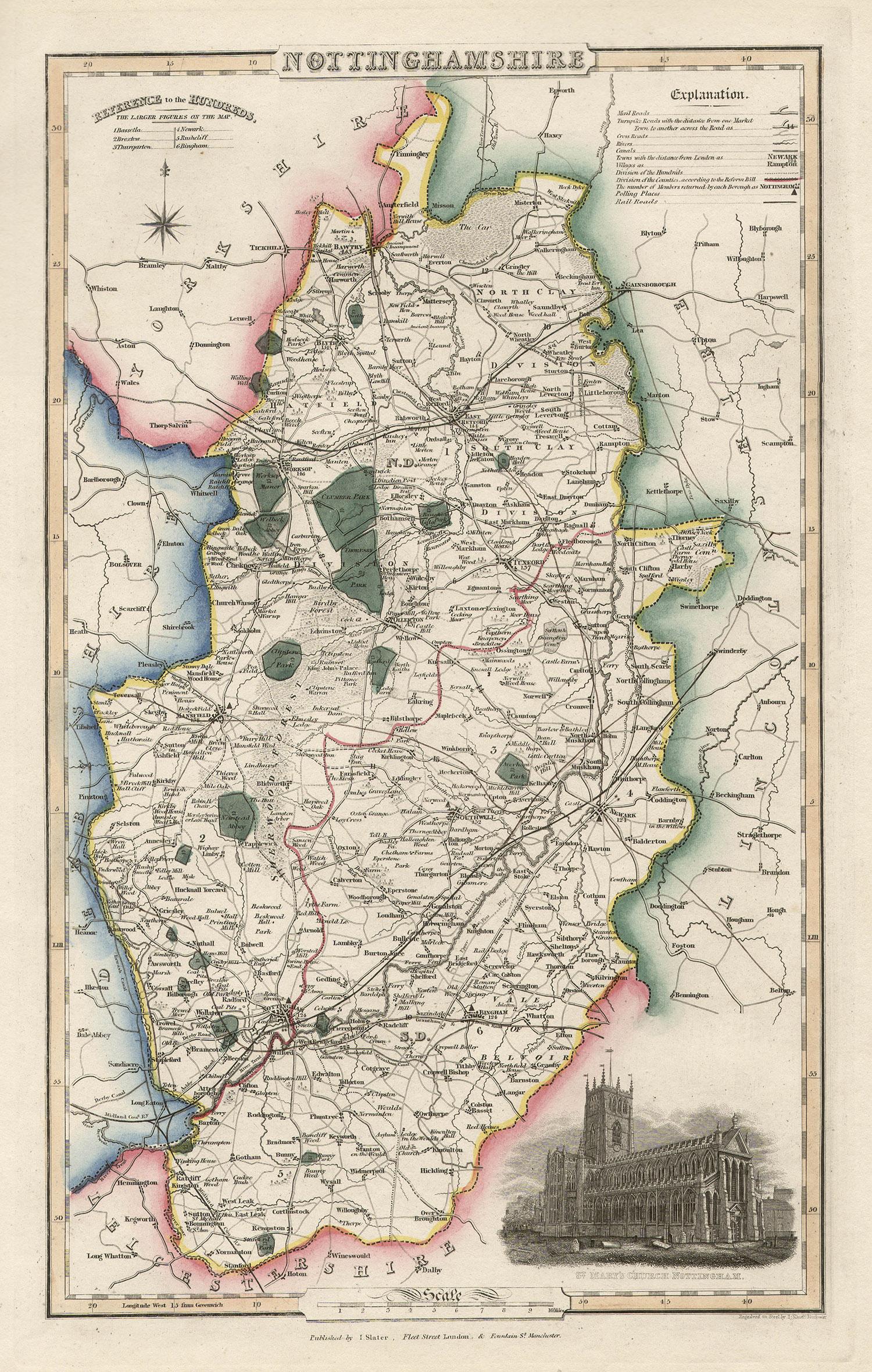
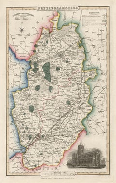
Nottinghamshire, English County Antique map, 1847
By Isaac Slater
Located in Melbourne, Victoria
Steel-engraved map with original outline colouring by Isaac Slater. A detailed engraved map of the English county with title, scale, and key. Decorated with an uncoloured engraved vi...
Category
19th Century Naturalistic Landscape Prints
Materials
Engraving
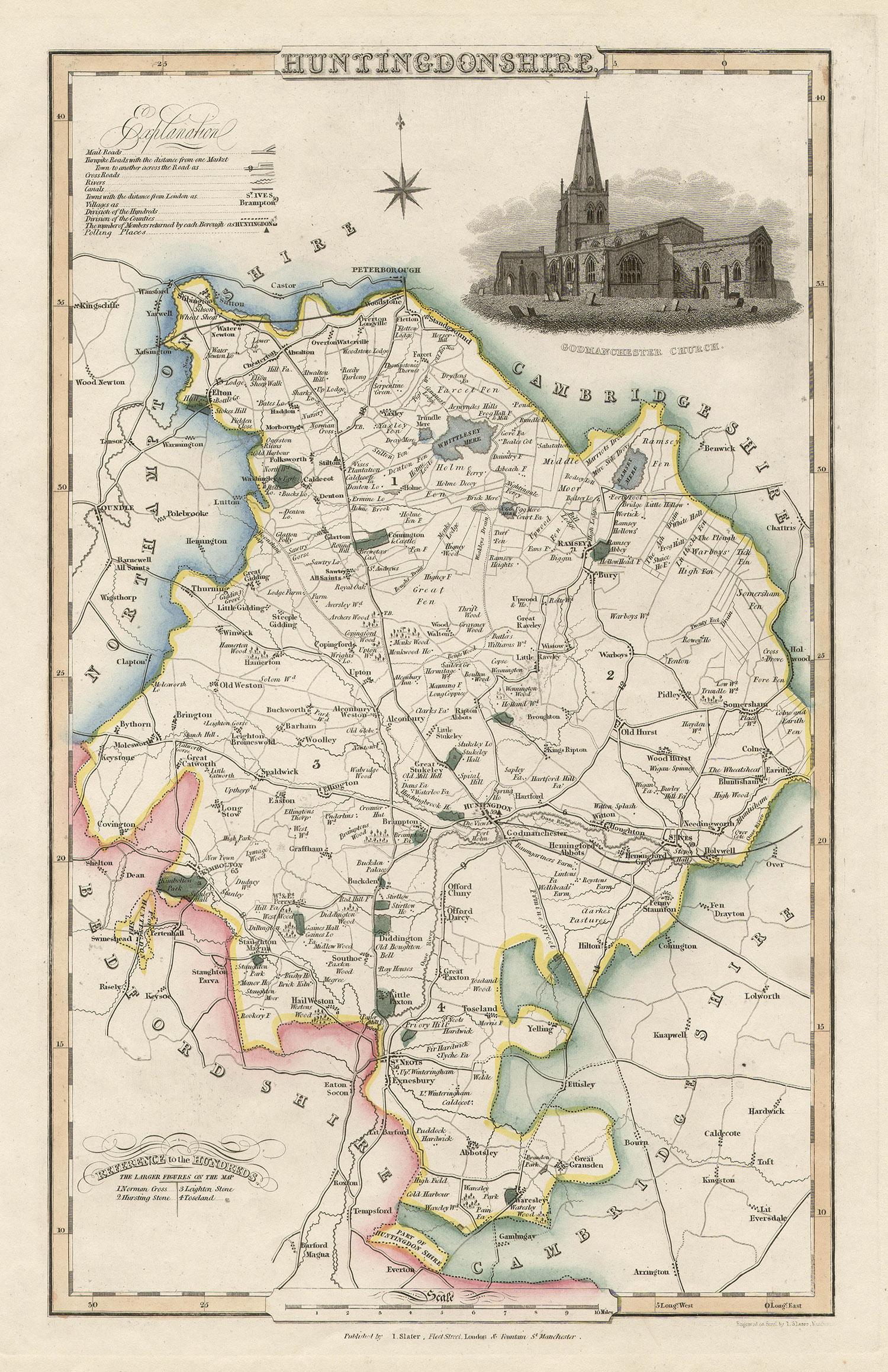
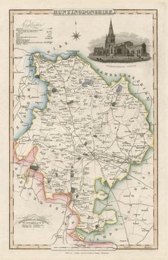
Huntingdonshire, English County Antique map, 1847
By Isaac Slater
Located in Melbourne, Victoria
Steel-engraved map with original outline colouring by Isaac Slater. A detailed engraved map of the English county with title, scale, and key. Decorated with an uncoloured engraved vi...
Category
19th Century Naturalistic Landscape Prints
Materials
Engraving
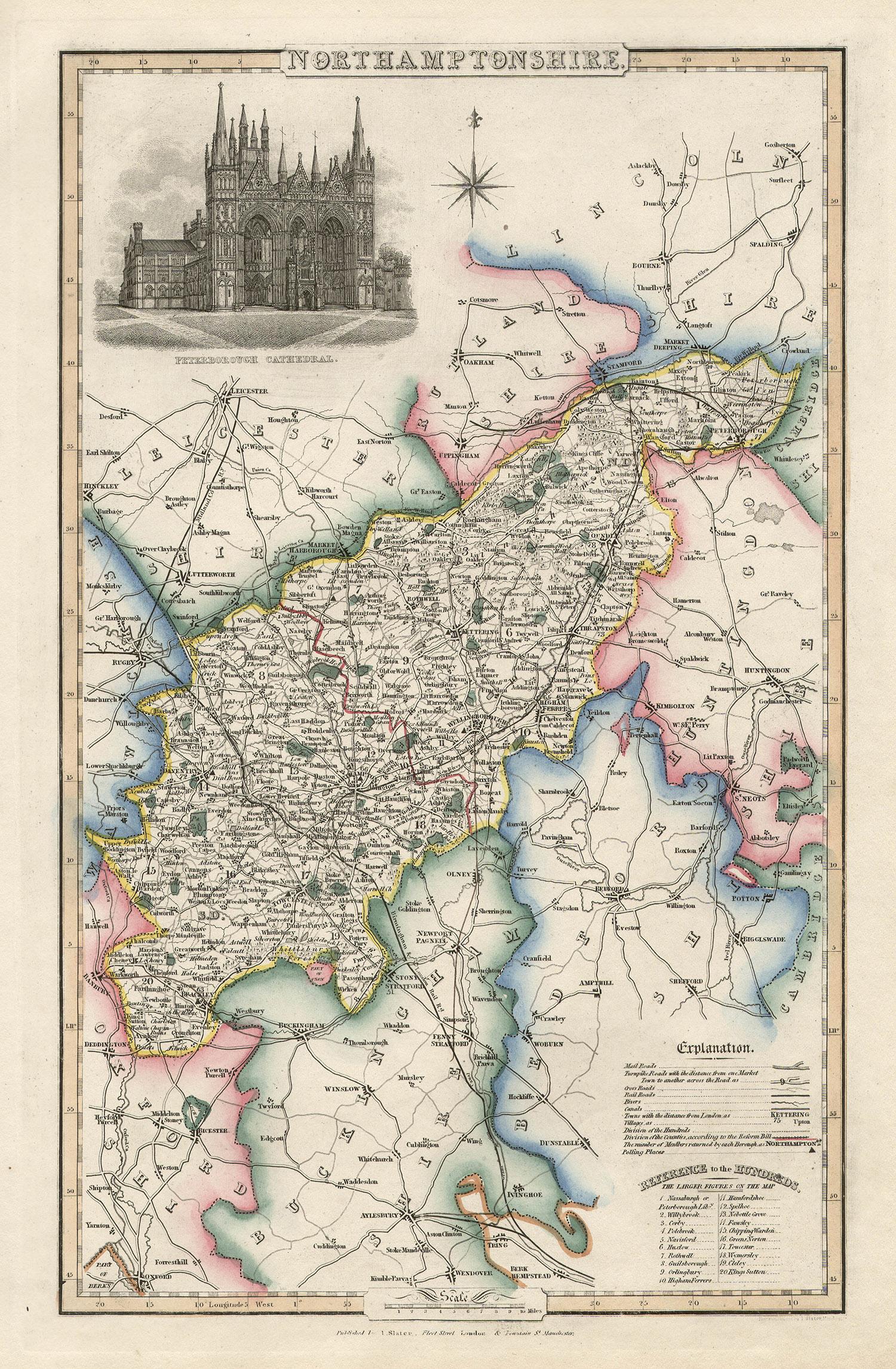
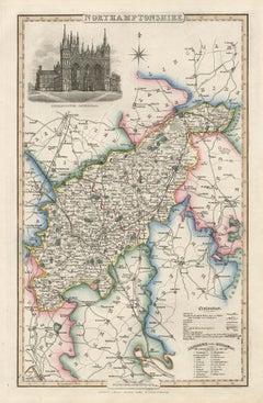
Northamptonshire, English County Antique map, 1847
By Isaac Slater
Located in Melbourne, Victoria
Steel-engraved map with original outline colouring by Isaac Slater. A detailed engraved map of the English county with title, scale, and key. Decorated with an uncoloured engraved view of 'Peterborough...
Category
19th Century Naturalistic Landscape Prints
Materials
Engraving
You May Also Like
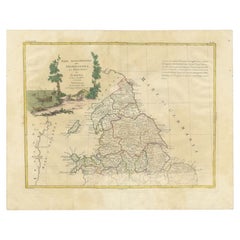
Antique Decorative and Detailed County Map of Cumberland, England, 1804
Located in Langweer, NL
Antique county map of Cumberland first published c.1800. Villages, towns, and cities illustrated include Carlisle, Penrith, Copeland Forest, and Wigt...
Category
Antique Early 1800s Maps
Materials
Paper
$313 Sale Price
20% Off
Antique Map of Northern England and Wales by Zatta, 1784
Located in Langweer, NL
Antique map titled 'Parte Settentrionale dell' Inghilterra e del Principato di Galles'. Engraved map of the northern part of England and Wales, with title cartouche. Shows political and administrative divisions, towns, villages, forests, mountains and rivers. This print originates from 'Atlante Novissimo, illustrato ed accresciuto sulle osservazioni, e scoperte fatte dai piu' celebri e piu' recenti geografi' by A. Zatta. Artists and Engravers: Antonio Zatta (active 1757-1797) was the most prominent Italian map...
Category
Antique 18th Century Maps
Materials
Paper
$205 Sale Price
20% Off
Antique County Map of Derbyshire, England, 1804
Located in Langweer, NL
Antique county map of Derbyshire first published, circa 1800. Villages, towns, and cities illustrated include Chesterfield, Wirksworth, Derby, and ...
Category
Antique Early 1800s Maps
Materials
Paper
$313 Sale Price
20% Off
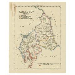
1830 Map of Northern England and Durham, Cumberland, Westmorland, Northumberland
Located in Langweer, NL
Title: Antique 1830 Map of Northern England with Durham, Cumberland, Westmorland, and Northumberland
Description: This 1830 German-language map, titled Britisches Reich – A. Kon...
Category
Antique 1830s Maps
Materials
Paper
Antique Decorative County Map of Lincolnshire, England, 1804
Located in Langweer, NL
Antique county map of Lincolnshire first published circa 1800 Cities illustrated include Grantham, Spalding, Boston, and Market Raisin.
Charles Smith was a cartographer working in...
Category
Antique Early 1800s Maps
Materials
Paper

$313 Sale Price
20% Off
Original Antique English County Map - Monmouthshire. J
C Walker. 1851
Located in St Annes, Lancashire
Great map of Monmouthshire
Original colour
By J & C Walker
Published by Longman, Rees, Orme, Brown & Co. 1851
Unframed.
Category
Antique 1850s English Other Maps
Materials
Paper
