Items Similar to New South Wales, Australia, antique mid 19th century engraved John Tallis map


Want more images or videos?
Request additional images or videos from the seller
1 of 6
UnknownNew South Wales, Australia, antique mid 19th century engraved John Tallis map1854
1854
$495
£379.48
€434.23
CA$699.55
A$760.38
CHF 407.04
MX$9,191.22
NOK 5,129.54
SEK 4,730.77
DKK 3,243.02
About the Item
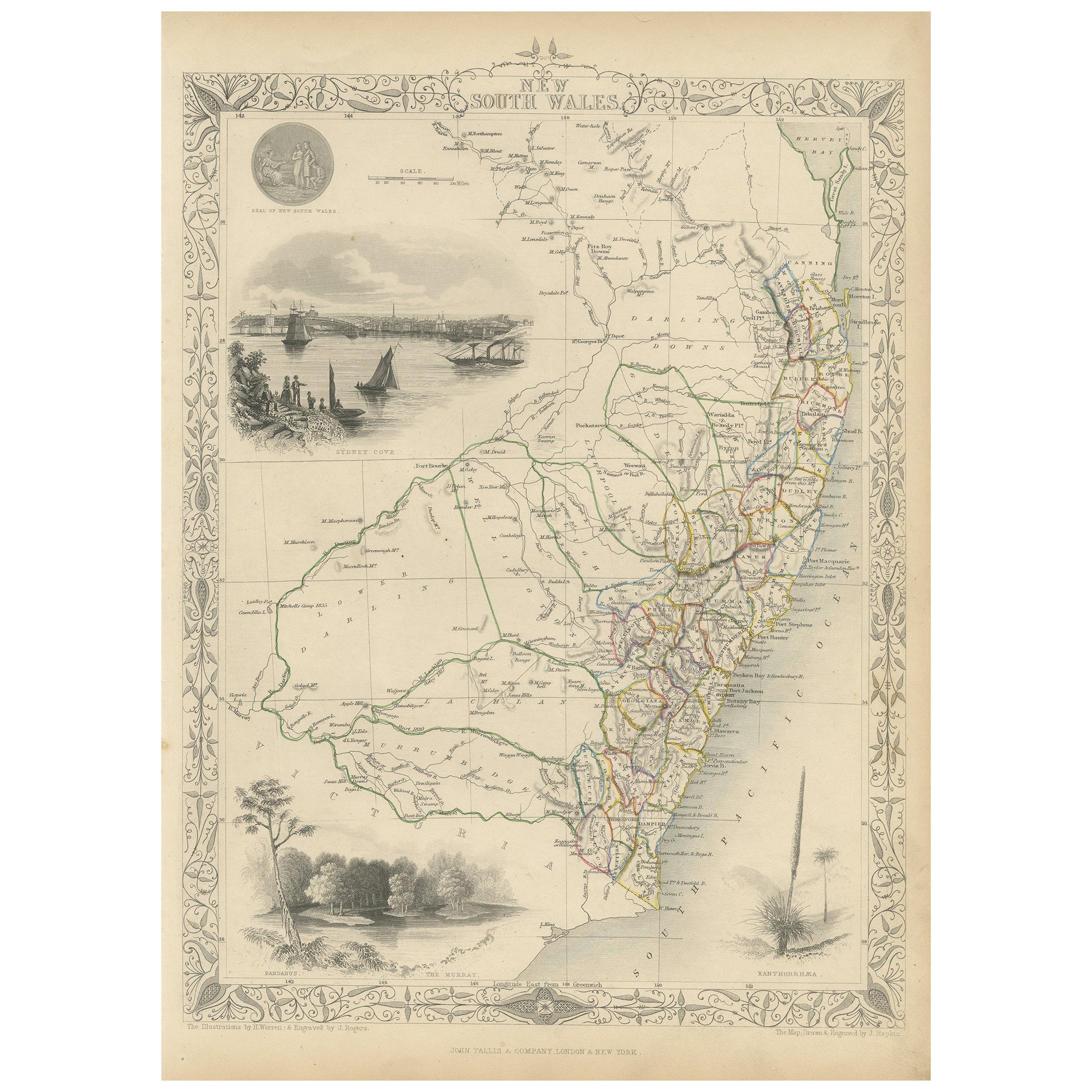
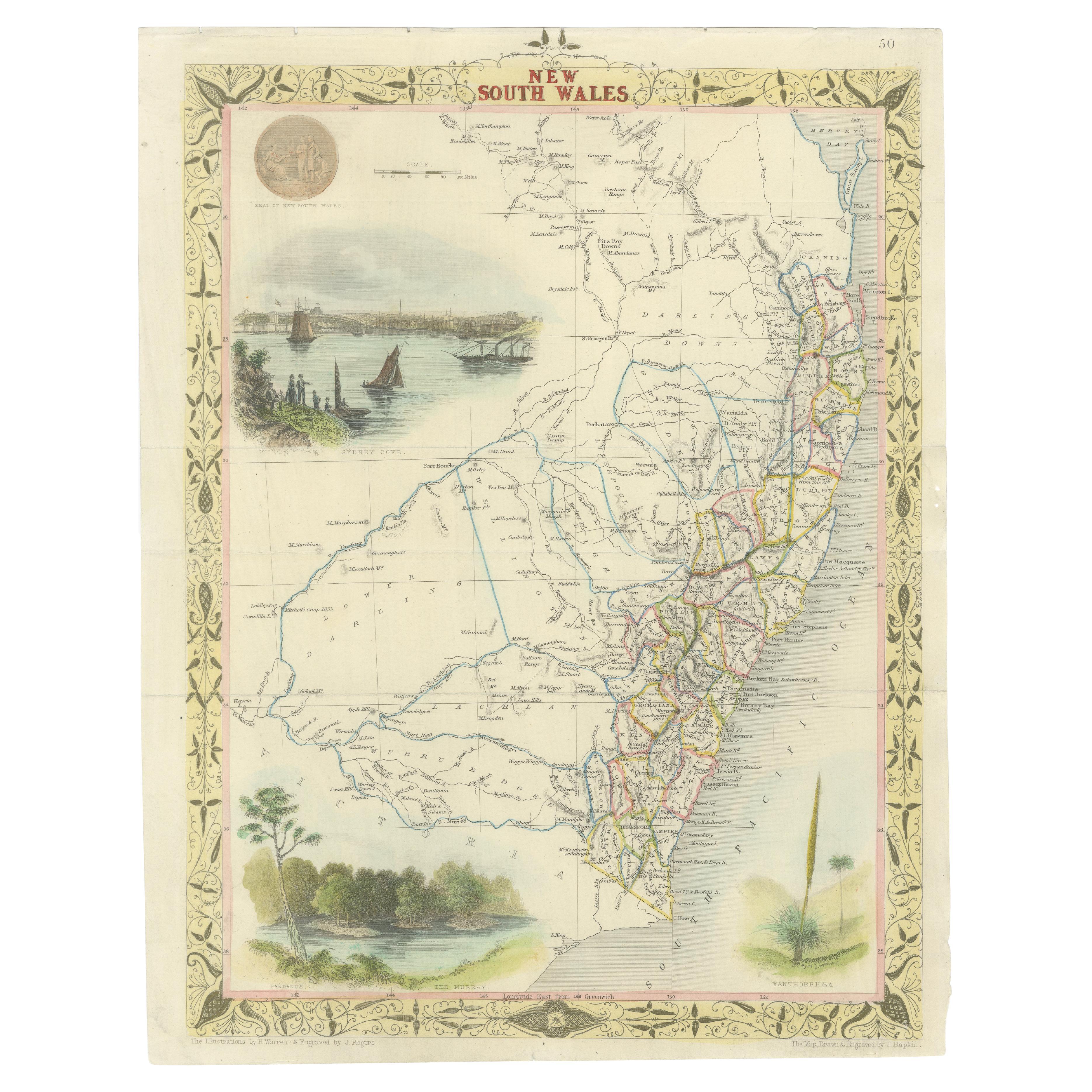
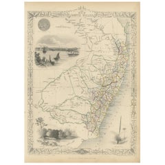
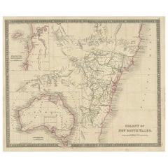
'New South Wales'
With decorative border surrounds and vignettes of 'Sydney Cove'. 'The Murray' and 'Xanthorrhea'.
'Drawn and engraved by J Rapkin'. Published by John Tallis.
375mm by 270mm (sheet)
- Creation Year:1854
- Dimensions:Height: 14.77 in (37.5 cm)Width: 10.63 in (27 cm)
- Medium:
- Movement Style:
- Period:
- Condition:Slight uneven edge to sheet bottom left. Faint soiling top right corner of the sheet.
- Gallery Location:Melbourne, AU
- Reference Number:1stDibs: LU124428841902
About the Seller
5.0
Gold Seller
Premium sellers maintaining a 4.3+ rating and 24-hour response times
Established in 2005
1stDibs seller since 2019
632 sales on 1stDibs
Typical response time: 1 hour
- ShippingRetrieving quote...Shipping from: Melbourne, Australia
- Return Policy
More From This Seller
View AllAustralia, Tallis antique map, 1851
Located in Melbourne, Victoria
'Australia'
With decorative border surrounds and vignettes including a view of Sydney, Kangaroos, Natives of Australia Felix, Australian Parrots and Cockatoos and Natives of the Tri...
Category
19th Century Naturalistic Landscape Prints
Materials
Engraving

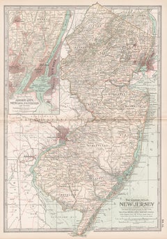
New Jersey. USA Century Atlas state antique vintage map
Located in Melbourne, Victoria
'The Century Atlas. New Jersey'
Original antique map, 1903.
Central fold as issued. Map name and number printed on the reverse corners.
Sheet 40cm by 29.5cm.
Category
Early 20th Century Victorian More Prints
Materials
Lithograph
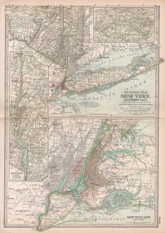
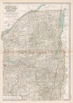
New York. Southern Part. USA. Century Atlas state antique vintage map
Located in Melbourne, Victoria
'The Century Atlas. New York. Southern Part.'
Original antique map, 1903.
Inset maps of 'New York City and Vicinity' and 'The Hudson'.
Central fold as issued. Map name and number p...
Category
Early 20th Century Victorian More Prints
Materials
Lithograph
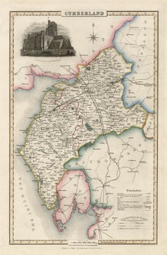
Cumberland, English County Antique map, 1847
By Isaac Slater
Located in Melbourne, Victoria
Steel-engraved map with original outline colouring by Isaac Slater. A detailed engraved map of the English county with title, scale, and key. Decorated with an uncoloured engraved vi...
Category
19th Century Naturalistic Landscape Prints
Materials
Engraving
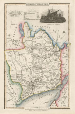
Monmouthshire, English County Antique map, 1847
By Isaac Slater
Located in Melbourne, Victoria
Steel-engraved map with original outline colouring by Isaac Slater. A detailed engraved map of the English county with title, scale, and key. Decorated with an uncoloured engraved vi...
Category
19th Century Naturalistic Landscape Prints
Materials
Engraving
New York. Northern and Eastern Part. USA Century Atlas state antique vintage map
Located in Melbourne, Victoria
'The Century Atlas. New York. Northern and Eastern Part'
Original antique map, 1903.
Central fold as issued. Map name and number printed on the reverse corners.
Sheet 40cm by 29.5c...
Category
Early 20th Century Victorian More Prints
Materials
Lithograph
You May Also Like
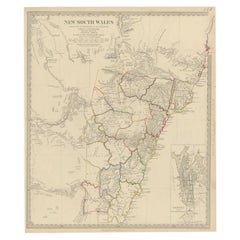
Antique Map of New South Wales by Tallis, circa 1851
Located in Langweer, NL
Antique map titled 'New South Wales'. Decorative and detailed map of New South Wales which was drawn and engraved by J. Rapkin (vignettes by H. Warren ...
Category
Antique Mid-19th Century English Maps
Materials
Paper
Antique Map of New South Wales in Australia, ca. 1850
Located in Langweer, NL
Antique map of Victoria, or Port Phillip (12.7 x 10.0") in Australia. Superb map of Victoria roughly centered on Melbourne. Vignettes of Aborigines, a ...
Category
Antique Mid-19th Century European Maps
Materials
Paper

Antique Map of New South Wales
Australia
by Wyld
1845
Located in Langweer, NL
Antique map titled 'British Settlements in New South Wales'. Original antique map of New South Wales, Australia. This map originates from 'An Atlas of ...
Category
Antique Mid-19th Century Maps
Materials
Paper

$237 Sale Price
20% Off
Antique Map of New South Wales with an Inset of Sydney, Australia, 1833
Located in Langweer, NL
Antique map of Australia titled 'New South Wales'. Old map of New South Wales, Australia. With an inset map of Sydney. Arists and Engravers: Engraved by J. & C. Walker. Published by ...
Category
Antique 19th Century Maps
Materials
Paper
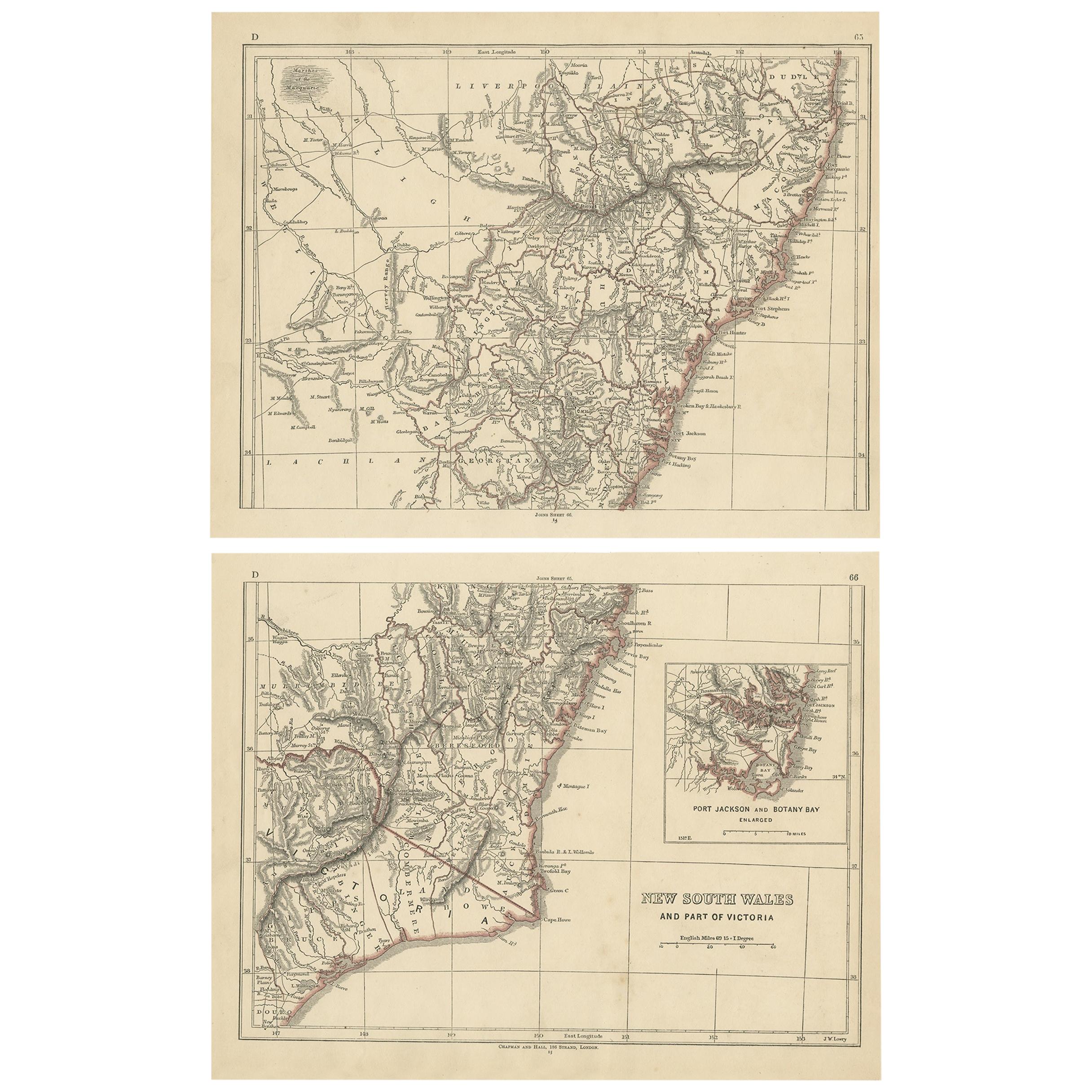
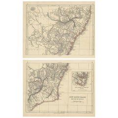
Antique Map of New South Wales by Lowry, 1852
Located in Langweer, NL
Antique map titled 'New South Wales and part of Victoria'. Two individual sheets of New South Wales and part of Victoria. This map originates from 'Low...
Category
Antique Mid-19th Century Maps
Materials
Paper
$142 Sale Price / set
20% Off
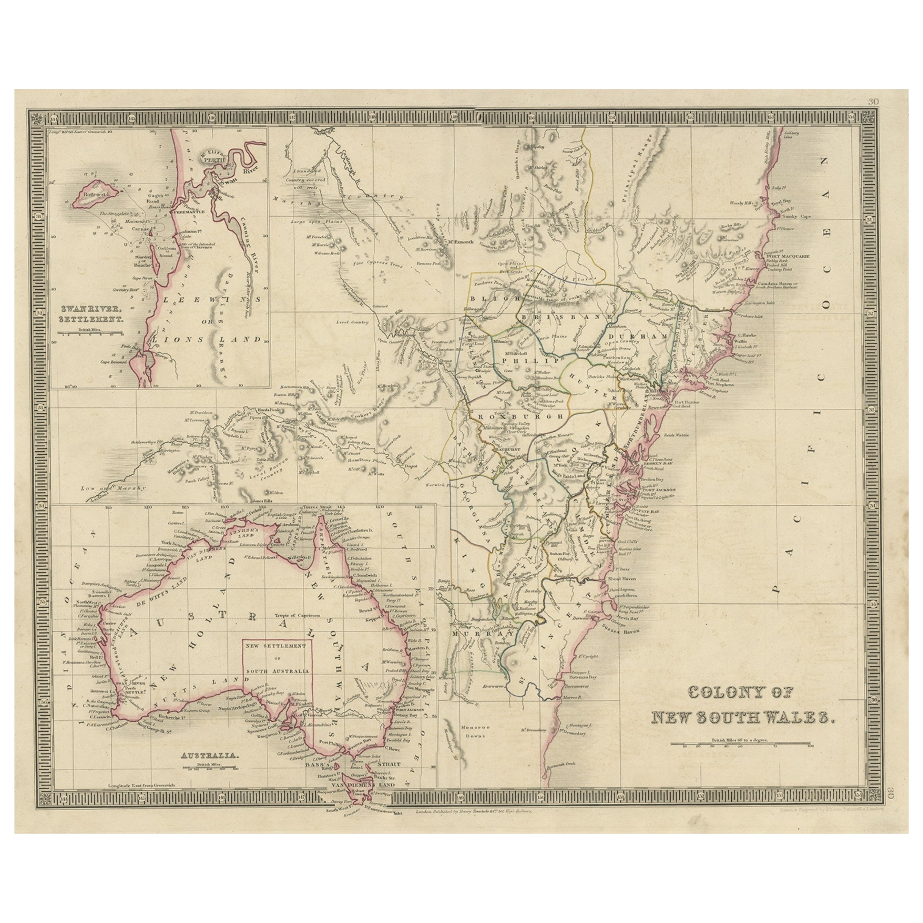
Antique Map of New South Wales with Inset Maps of Australia and Swan River, 1854
Located in Langweer, NL
Antique map titled 'Colony of New South Wales'. Map of New South Wales with inset maps of Australia and Swan River. Artists and Engravers: Drawn and engrave...
Category
Antique 19th Century Maps
Materials
Paper
More Ways To Browse
Antique Maps Australia
Australian Antique Prints
Stanton Gray
Susan George
Tall Metal Abstract Sculpture
Tattoo Nude
Toshio Iezumi
Used Cremation Urns
Vintage Beach Boys
Vintage Electric Chair
Vintage Taxi Cabs
Wild Bunch
Yves Klein Blue
1950 Fashion Illustrations
Antique Poster Food
Arman Resin
Baroque Painting Angel
Botanical Print Rose