Items Similar to Original 1917 Railroad Map of Washington State railway map


Want more images or videos?
Request additional images or videos from the seller
1 of 7
UnknownOriginal 1917 Railroad Map of Washington State railway map1917
1917
$680
$85020% Off
£517.81
£647.2620% Off
€596.24
€745.3020% Off
CA$963.62
CA$1,204.5220% Off
A$1,036.51
A$1,295.6420% Off
CHF 553.94
CHF 692.4320% Off
MX$12,217.51
MX$15,271.8920% Off
NOK 6,983.91
NOK 8,729.8820% Off
SEK 6,384.62
SEK 7,980.7720% Off
DKK 4,454.92
DKK 5,568.6420% Off
About the Item
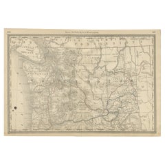
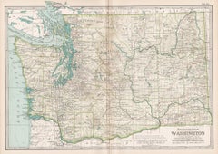
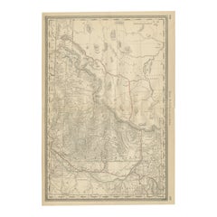
This is an Original Lithograph Vintage Railroad Map of Washington State; it is not a reproduction.
“Railroad Map of Washington, 1917, The Public Service Commission. Archival linen backed and ready to frame.
This image is also part of the historical collection of Washington State University.
The poster has restored fold marks, and there are some age spots located inside the map that can be seen in the enlarged images provided.
This is an Original Lithograph Vintage Poster; it is not a reproduction.
- Creation Year:1917
- Dimensions:Height: 24 in (60.96 cm)Width: 48 in (121.92 cm)Depth: 0.04 in (1.02 mm)
- Medium:
- Movement Style:
- Period:
- Condition:linen backed, some small age spots on the poster, restored fold marks, rare.
- Gallery Location:Spokane, WA
- Reference Number:Seller: 201861stDibs: LU1404210640352
About the Seller
5.0
Platinum Seller
Premium sellers with a 4.7+ rating and 24-hour response times
Established in 1998
1stDibs seller since 2020
276 sales on 1stDibs
Typical response time: 3 hours
- ShippingRetrieving quote...Shipping from: Spokane, WA
- Return Policy
More From This Seller
View AllOriginal 1940 Washington
Oregon Pictorial Map vintage poster
Located in Spokane, WA
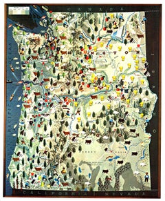
Map of historical landmarks, American Indian territories, rivers, mountains, dams, colleges, federal grazing districts, cities, agriculture, and other activities that were present in...
Category
1940s American Realist Landscape Prints
Materials
Offset
Original
The Evergreen Playground
Easter Washington State map
Located in Spokane, WA
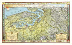
Original The Evergreen Playground Kroll Map Company vintage poster. Archival linen backed in fine condition. A- condition with only 1 small repair on the outer border in the white area. No tears nor stains.
This map was originally drawn during the Great Depression by Ed Poland, Chief Cartographer of many years here at Kroll Map Company. A pictorial bird's eye view of the Puget Sound...
Category
1940s American Realist Landscape Prints
Materials
Lithograph
$760 Sale Price
20% Off
Union Pacific West vintage fun map railroad travel poster
Located in Spokane, WA
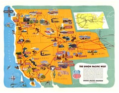
Original “The Union Pacific West fun map, archivally linen backed in very good condition. Ready to frame. This was initially folded, and the fold marks were ...
Category
1960s American Modern Landscape Prints
Materials
Offset
Original
Map of the United States as Californians See It
vintage map poster
Located in Spokane, WA
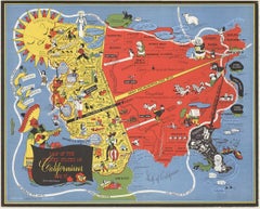
Original vintage poster: "Map of the United States as Californians See It". 1947, artist: Oren Arnold. Size: 16.5" x 20.5", R. H. MOEBUS COMPANY This poster is not linen-backed. This poster is in very good fine condition, ready to frame.
A humorous satirical pictorial map from 1947 with the golden sun on the upper left, gives a detailed depiction of California, its relative size to the rest of the United States, showing Florida as "Death Valley", the rest of the United States as "Unexplored" 'Unimportant anyway, not in California". The image has your Mexican singer; bikini-clad bathers and others set in the image. Shows rivers, lakes, harbors, landmarks, parks, recreational activities, and local people.
This map shows Los Angeles’ city...
Category
1940s American Modern Landscape Prints
Materials
Offset
$1,280 Sale Price
20% Off
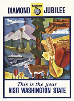
Original Visit Washington State Diamond
75th" Jubilee vintage postger
Located in Spokane, WA
Original, linen backed, Visit Washington State - Diamond Jubilee vintage poster (1889 - 1964), excellent condition. This poster would be produced pri...
Category
1960s American Modern Landscape Prints
Materials
Offset
$300 Sale Price
20% Off
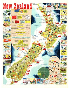
Original New Zealand vintage poster Map and Activities
Located in Spokane, WA
Original vintage 1962 linen-backed map of New Zealand in very fine condition, ready to frame. Grade A- with only small edge tears from linen backing. No paper loss. Excellent colors....
Category
1960s American Realist Landscape Prints
Materials
Lithograph
You May Also Like
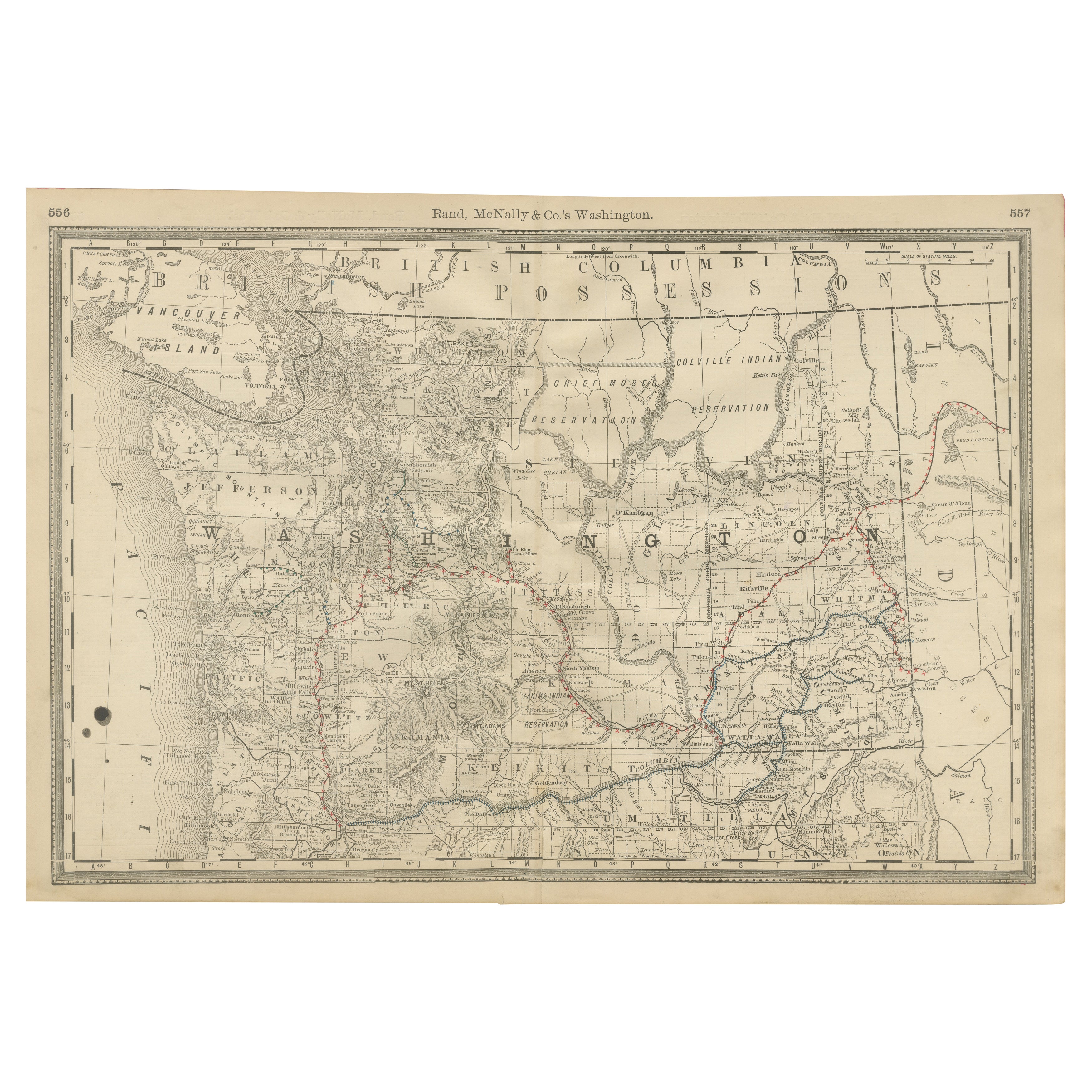
Washington Map 1888 – Antique Railroads, Indian Reservations
Counties
Located in Langweer, NL
Antique Map of Washington – Railroads, Counties & Indian Reservations, 1888
This original engraved map shows the Territory of Washington in 1888, a historically important moment jus...
Category
Antique Late 19th Century American Maps
Materials
Paper
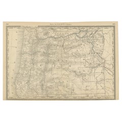
1888 Antique Map of Oregon – Railroads, Counties
Native Indian Reservations
Located in Langweer, NL
Antique Map of Oregon – Railroads, Indian Reservations & Counties, 1888
This antique engraved map presents the state of Oregon in 1888, a time when the Pacific Northwest was rapidly...
Category
Antique Late 19th Century American Maps
Materials
Paper
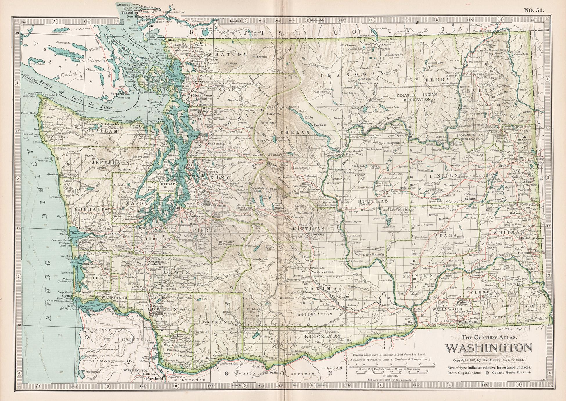
Washington. USA. Century Atlas state antique vintage map
Located in Melbourne, Victoria
'The Century Atlas. Washington'
Original antique map, 1903.
Central fold as issued. Map name and number printed on the reverse corners.
Sheet 29.5cm by 40cm.
Category
Early 20th Century Victorian More Prints
Materials
Lithograph
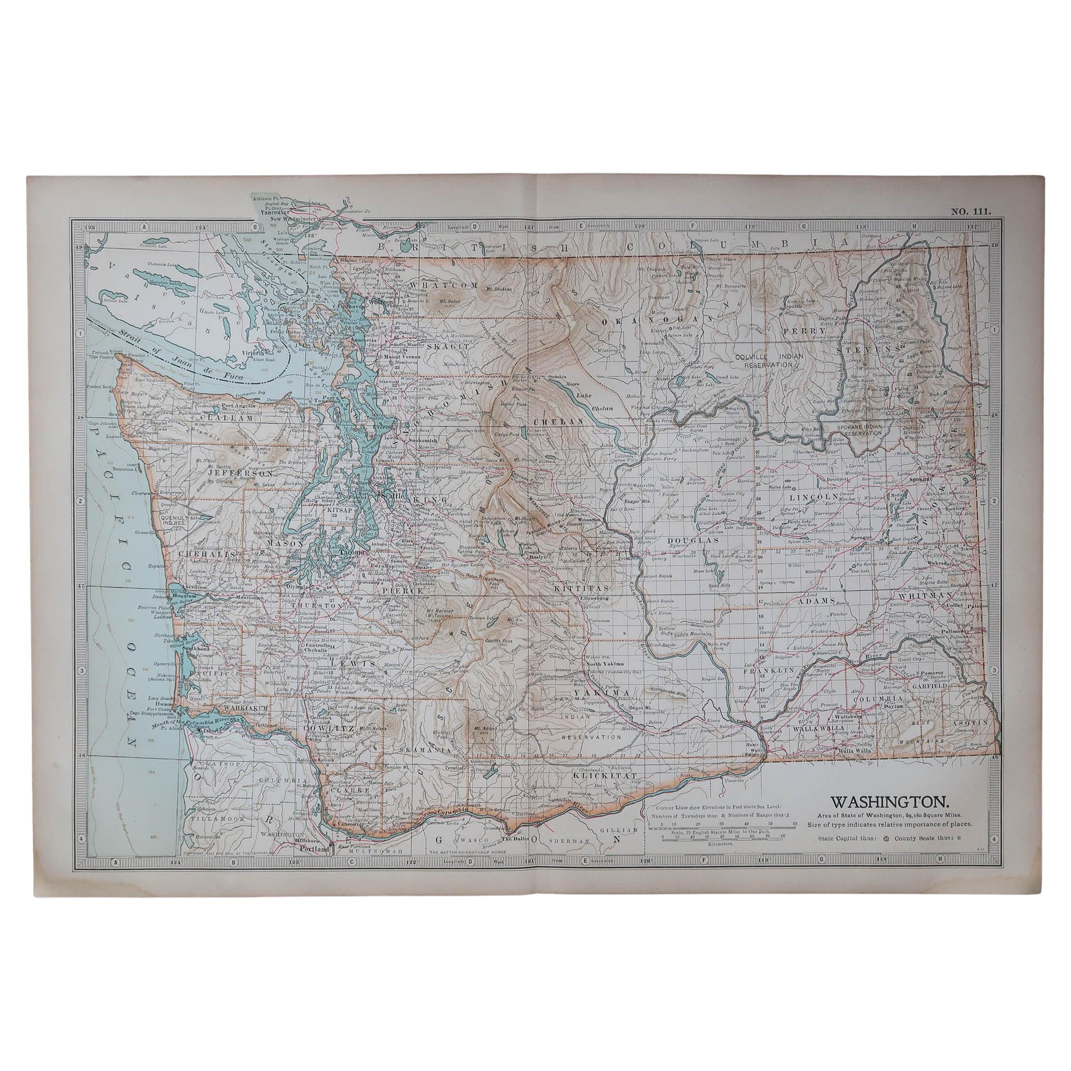
Original Antique Map of the American State of Washington, 1903
Located in St Annes, Lancashire
Antique map of Washington
Published By A & C Black. 1903
Original colour
Good condition
Unframed.
Free shipping
Category
Antique Early 1900s English Maps
Materials
Paper

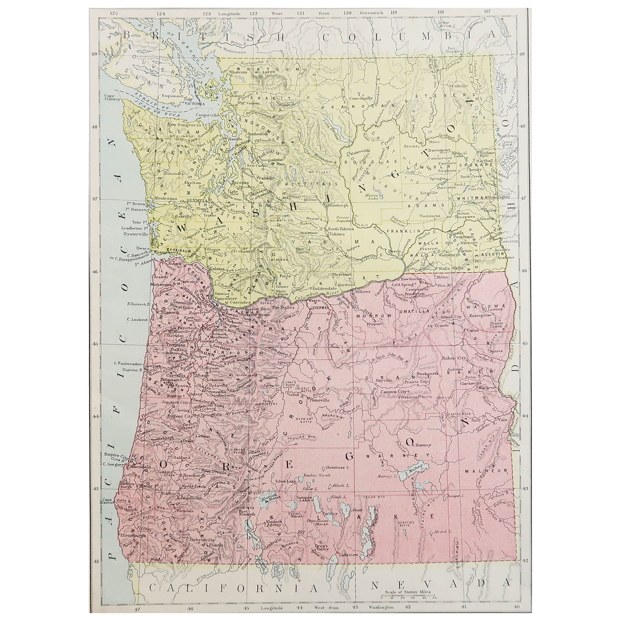
Original Antique Map of the American State of Washington, 1889
Located in St Annes, Lancashire
Great map of Washington
Drawn and Engraved by W. & A.K. Johnston
Published By A & C Black, Edinburgh.
Original colour
Unframed.
Category
Antique 1880s Scottish Victorian Maps
Materials
Paper

1888 Idaho Map – The Gem State’s Railroads, Mining Camps
Counties
Located in Langweer, NL
Antique Map of Idaho – Railroads, Mining Camps & Counties, 1888
This antique engraved map depicts the Territory of Idaho in 1888, engraved and published by Rand, McNally & Co. in Ch...
Category
Antique Late 19th Century American Maps
Materials
Paper
More Ways To Browse
Antique Railroad
Antique Railroad Maps
Railway Map
Buckels Jim
Camel Caravan
Ernest David Roth
Industrial Etchings
John Le Keux
Normandie Poster
Phil Greenwood Limited Edition Etching
Prince Of Wales Signed
Vintage Aviation Memorabilia
Virgil Thrasher
Antique Maps Cambridge
Chamonix Poster
Christo Fabric
Colorado Ski Poster
Desert Plein Air