Items Similar to India (Southern Sheet), English antique map by Alexander Keith Johnston, 1901

Want more images or videos?
Request additional images or videos from the seller
1 of 5
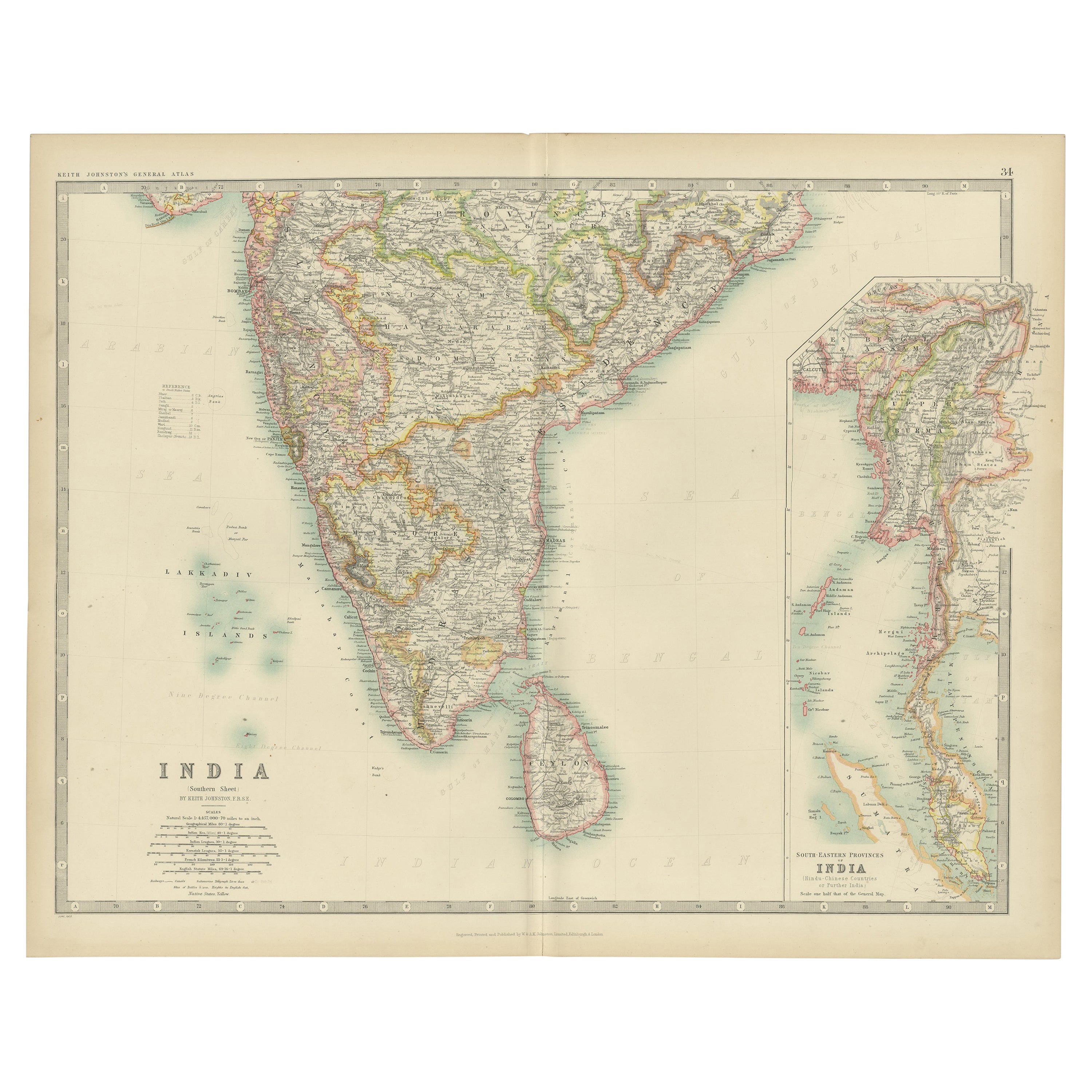
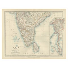
India (Southern Sheet), English antique map by Alexander Keith Johnston, 19011901
1901
$280
£212.49
€244.84
CA$395.60
A$423.87
CHF 227.38
MX$5,020.85
NOK 2,868.26
SEK 2,624.01
DKK 1,828.96
About the Item
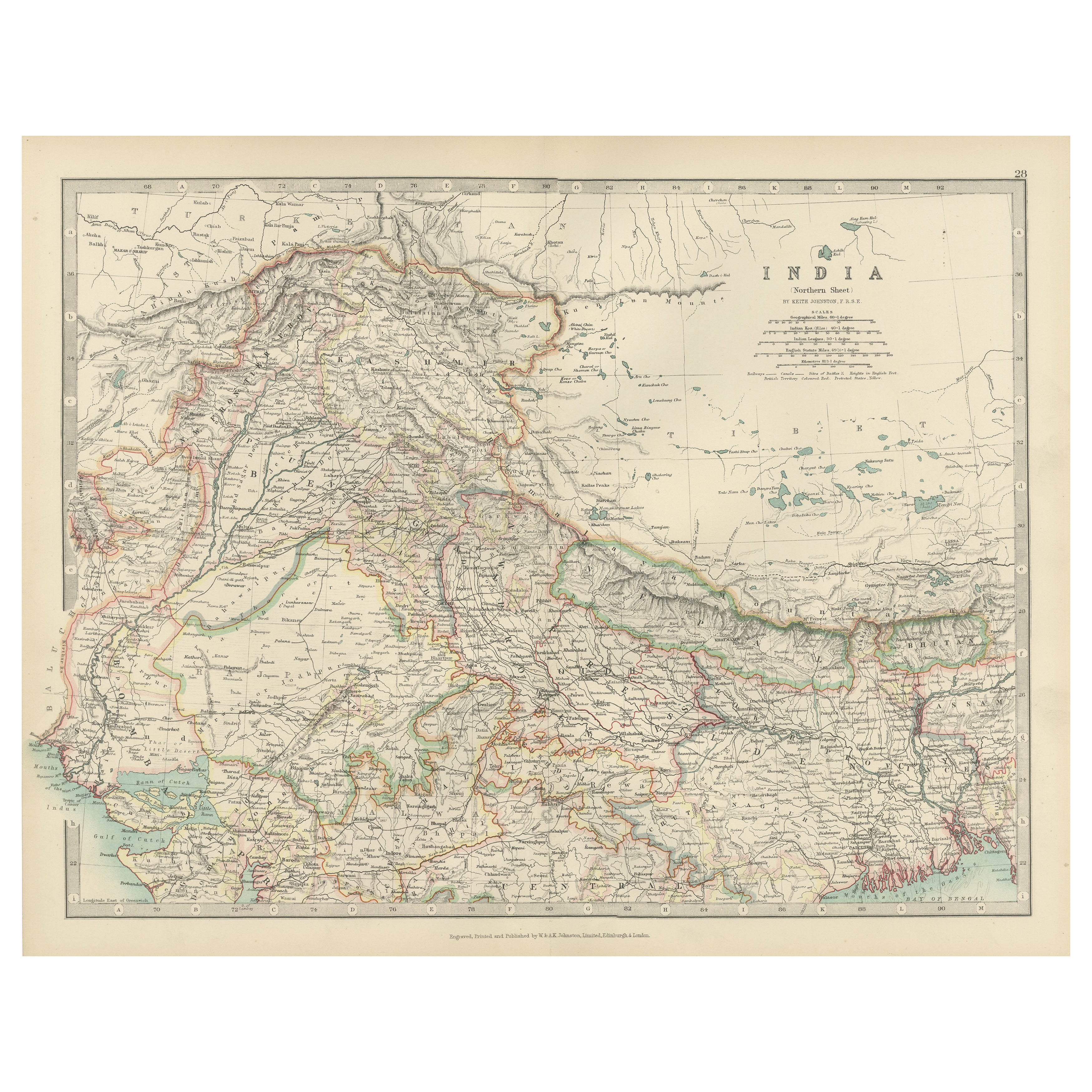
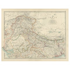
'India (Southern Sheet)', antique lithographic map by Keith Johnston.
Inset maps of 'Bombay Island
Town', 'Madras
Environs', and 'South-Eastern Provinces of India'.
Central vertical fold as issued.
495mm by 625mm (sheet)
Alexander Keith Johnston FRSE FRGS FGS FEGS LLD (1804 – 1871) was a Scottish geographer and cartographer. In 1826, he joined his brother William in a printing and engraving business, forming the well-known cartographical firm of W. and A. K. Johnston.
- Creation Year:1901
- Dimensions:Height: 19.49 in (49.5 cm)Width: 24.61 in (62.5 cm)
- Medium:
- Movement Style:
- After:Alexander Keith Johnston (1804 - 1871, British)
- Period:
- Condition:One faint mark lower left corner of the sheet. One small foxing spot in publication line. Tiny break in paper at the very bottom of the central fold. Central vertical fold as issued.
- Gallery Location:Melbourne, AU
- Reference Number:1stDibs: LU124427851872
About the Seller
5.0
Gold Seller
Premium sellers maintaining a 4.3+ rating and 24-hour response times
Established in 2005
1stDibs seller since 2019
634 sales on 1stDibs
Typical response time: 1 hour
- ShippingRetrieving quote...Shipping from: Melbourne, Australia
- Return Policy
More From This Seller
View AllAfrica. North-West Part. Century Atlas antique vintage map
Located in Melbourne, Victoria
'The Century Atlas. Africa. Southern Part'
Original antique map, 1903.
Central fold as issued. Map name and number printed on the reverse corners.
Sheet 40cm by 29.5cm.
Category
Early 20th Century Victorian More Prints
Materials
Lithograph

Africa. North-East Part. Century Atlas antique vintage map
Located in Melbourne, Victoria
'The Century Atlas. Africa. North-East Part'
Original antique map, 1903.
Inset map of 'Nile Delta and Suez Canal'.
Central fold as issued. Map name and nu...
Category
Early 20th Century Victorian More Prints
Materials
Lithograph

Africa. Southern Part. Century Atlas antique vintage map
Located in Melbourne, Victoria
'The Century Atlas. Africa. Southern Part'
Original antique map, 1903.
Inset maps of 'Cape Town', 'Johannesburg' and 'Ladysmith'.
Central fold as issued. Map name and number printe...
Category
Early 20th Century Victorian More Prints
Materials
Lithograph

China and Japan, English antique map by Alexander Keith Johnston, 1901
Located in Melbourne, Victoria
'China and Japan', antique lithographic map by Keith Johnston.
Central vertical fold as issued.
495mm by 625mm (sheet)
Alexander Keith Johnston FRS...
Category
Early 20th Century Victorian More Prints
Materials
Lithograph

Africa. Central. Century Atlas antique vintage map
Located in Melbourne, Victoria
'The Century Atlas. Africa. Central'
Inset map of 'Madagascar'.
Original antique map, 1903.
Central fold as issued. Map name and number printed on the reverse corners.
Sheet 29.5cm...
Category
Early 20th Century Victorian More Prints
Materials
Lithograph

South America, Eastern Part. Century Atlas antique vintage map
Located in Melbourne, Victoria
'The Century Atlas. South America. Eastern Part'
Original antique map, 1903.
Inset map 'Rio de Janeiro and Vicinity'.
Central fold as issued. Map name and number printed on the rev...
Category
Early 20th Century Victorian More Prints
Materials
Lithograph

You May Also Like
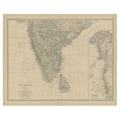
Antique Map of India ( Southern ) by Johnston (1909)
Located in Langweer, NL
Antique map titled 'India'. Original antique map of India Southern sheet. With inset maps of south eastern provinces of India. This map originates from the ‘Royal Atlas of Modern Geo...
Category
Early 20th Century Maps
Materials
Paper

$237 Sale Price
20% Off
Antique Map of Southern India and South Eastern Provinces, 1903
Located in Langweer, NL
Title: Antique Map of Southern India and South Eastern Provinces, 1903, with Intricate Detail
Description:
This antique map, titled "India (Southern Sheet) and the South Eastern Pro...
Category
Early 20th Century Maps
Materials
Paper
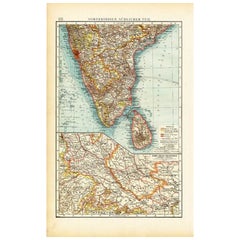
Antique Map of Southern India by Andree, 1904
Located in Langweer, NL
"Antique map titled 'Vorderindien, sudlicher Teil'. Map of India, southern part. This map originates from 'Andrees Allgemeiner Handatlas in 126 Haupt-Und 139 Nebenkarten', Bielefeld;...
Category
20th Century Maps
Materials
Paper
$69 Sale Price
20% Off
Old Map of Southern India and Ceylon
Sri Lanka
, 1882
Located in Langweer, NL
Antique map titled 'India (Southern Sheet)'.
Old map of Southern India and Ceylon (Sri Lanka). With an inset map of the South-Eastern Provinces of India. This map originates from...
Category
Antique 1880s Maps
Materials
Paper
$276 Sale Price
20% Off
Antique Map of Northern India, Featuring Boundaries
Himalayan Detail, 1903
Located in Langweer, NL
Antique Map of Northern India, 1903, Featuring Provincial Boundaries and Himalayan Detail
This antique map, titled "India (Northern Sheet)," was engraved and published in 1903 by W....
Category
Early 20th Century Maps
Materials
Paper
Antique Map of India and Ceylon by Lapie, 1842
Located in Langweer, NL
Antique map titled 'Carte de l'Inde en deca et au dela du Gange'. Map of India and Ceylon (Sri Lanka). This map originates from 'Atlas universel de géographie ancienne et moderne (.....
Category
Antique Mid-19th Century Maps
Materials
Paper

More Ways To Browse
Bombay Antique
Shepard Fairey Interpol
Shepard Fairey Kurt Cobain
Soviet Rowing Poster
Stained Glass Rondels
Studio Ghibli
Toussaint Watches
Triumph Bicycles
Trooping The Colour Vintage Poster
Vintage Airborne Posters
Vintage Bahamas Travel Posters
Vintage Celtics Poster
Vintage Dr Gonzo
Vintage Food And Wine Posters
Vintage Formula Ford Racing
Vintage Horror Movie Posters Uk
Vintage Ibm Poster
Vintage Indian Film Posters