Items Similar to Carte du Bresil, antique 1860s engraved map of Brazil


Want more images or videos?
Request additional images or videos from the seller
1 of 6
Carte du Bresil, antique 1860s engraved map of Brazil1885
1885
$180
£136.63
€156.68
CA$254.07
A$272.72
CHF 145.21
MX$3,230.05
NOK 1,835.05
SEK 1,675.91
DKK 1,170.47
About the Item
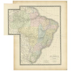
'Carte du Bresil'
Engraving with original outline colouring, circa 1860, by Alexandre Vuillemin, published in Paris.
31cm by 41cm (sheet)
21.5cm by 31.5cm (image)
- Creation Year:1885
- Dimensions:Height: 16.93 in (43 cm)Width: 13 in (33 cm)
- Medium:
- Movement Style:
- After:Alexandre Vuillemin
- Period:
- Condition:Some faults in the margins - a few short breaks in the paper at the edges of the sheet, some creasing and a few marks. Printed area in very good condition.
- Gallery Location:Melbourne, AU
- Reference Number:Seller: VW7841stDibs: LU124427427262
About the Seller
5.0
Gold Seller
Premium sellers maintaining a 4.3+ rating and 24-hour response times
Established in 2005
1stDibs seller since 2019
634 sales on 1stDibs
Typical response time: 1 hour
- ShippingRetrieving quote...Shipping from: Melbourne, Australia
- Return Policy
More From This Seller
View AllSouth America, Eastern Part. Century Atlas antique vintage map
Located in Melbourne, Victoria
'The Century Atlas. South America. Eastern Part'
Original antique map, 1903.
Inset map 'Rio de Janeiro and Vicinity'.
Central fold as issued. Map name and number printed on the rev...
Category
Early 20th Century Victorian More Prints
Materials
Lithograph

South America, North-West Part. Century Atlas antique vintage map
Located in Melbourne, Victoria
'The Century Atlas. South America, North-West Part'
Original antique map, 1903.
Central fold as issued. Map name and number printed on the reverse corners.
Sheet 40cm by 29.5cm.
Category
Early 20th Century Victorian More Prints
Materials
Lithograph

Africa. Central. Century Atlas antique vintage map
Located in Melbourne, Victoria
'The Century Atlas. Africa. Central'
Inset map of 'Madagascar'.
Original antique map, 1903.
Central fold as issued. Map name and number printed on the reverse corners.
Sheet 29.5cm...
Category
Early 20th Century Victorian More Prints
Materials
Lithograph

Central America. Century Atlas antique vintage map
Located in Melbourne, Victoria
'The Century Atlas. Central America.'
Original antique map, 1903.
Inset maps of 'The Country around Lake Nicaragua'.
Central fold as issued. Map name and number printed on the reve...
Category
Early 20th Century Victorian More Prints
Materials
Lithograph

Australia, Tallis antique map, 1851
Located in Melbourne, Victoria
'Australia'
With decorative border surrounds and vignettes including a view of Sydney, Kangaroos, Natives of Australia Felix, Australian Parrots and Cockatoos and Natives of the Tri...
Category
19th Century Naturalistic Landscape Prints
Materials
Engraving

Pyrenees Orientales, France. Antique map of a French department, 1856
By Victor Levasseur
Located in Melbourne, Victoria
'Dept. des Pyrenees Orientales', steel engraving with original outline hand-colouring., 1856, from Levasseur's 'Atlas National Illustre'.
This area is well-known wine producing reg...
Category
19th Century Naturalistic Landscape Prints
Materials
Engraving

You May Also Like
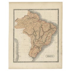
Antique Map of Brazil by Levasseur
1875
Located in Langweer, NL
Antique map titled 'Carte du Brésil'. Large map of Brazil, with small fold out. This map originates from 'Atlas de Géographie Moderne Physique et Politiq...
Category
Antique Late 19th Century French Maps
Materials
Paper
$382 Sale Price
20% Off
Antique Map of Brazil, Including Part of Colombia, Peru and Chili, c.1880
Located in Langweer, NL
Antique map South America titled 'Brazil'. This map depicts Brazil and its surroundings including part of Colombia, Peru and Chili. Source un...
Category
Antique 19th Century Maps
Materials
Paper
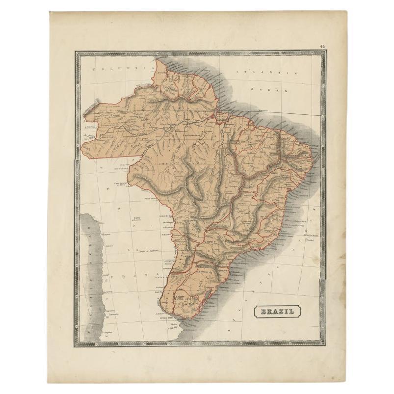
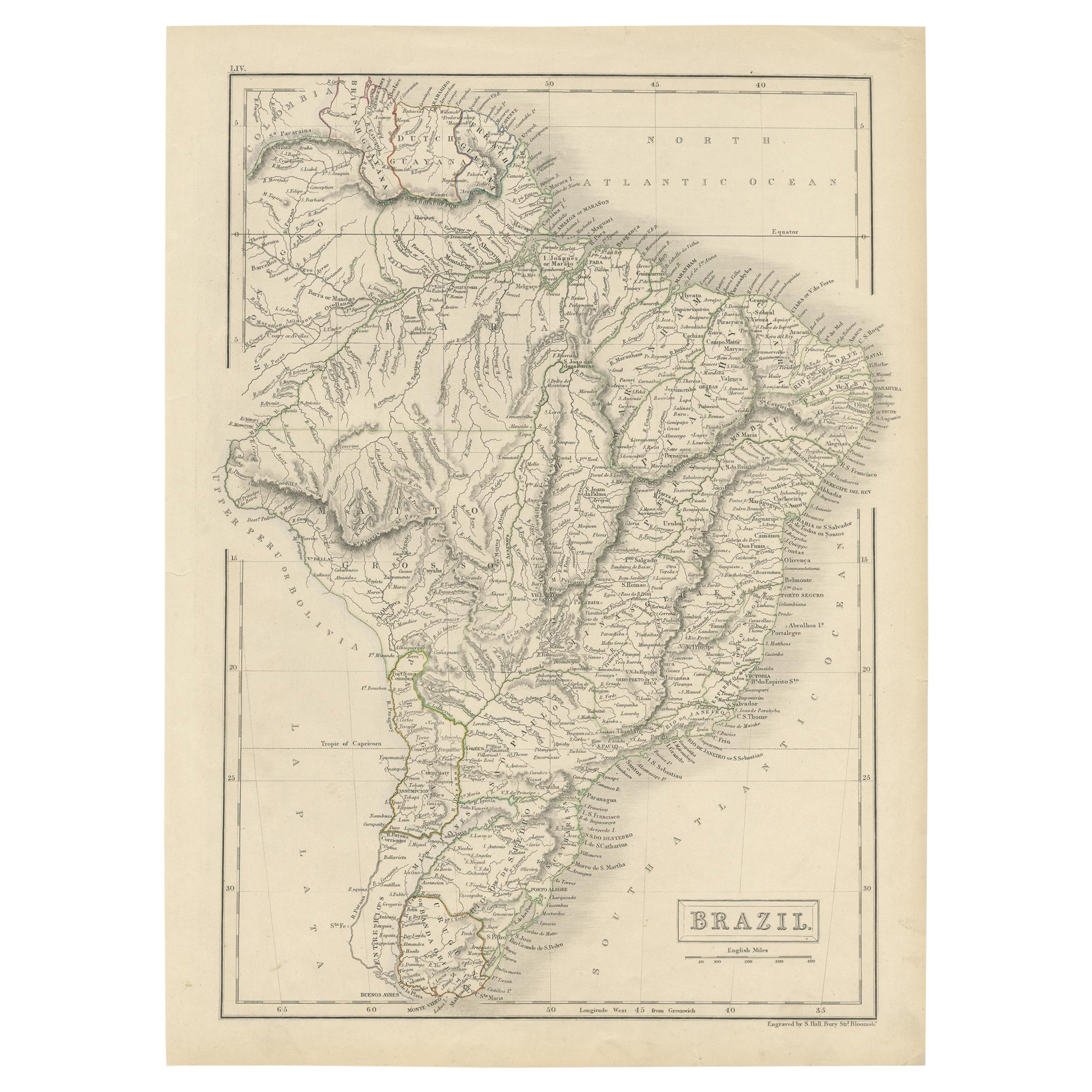
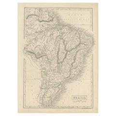
Antique Map of Brazil with Original Outline Hand-Colouring, c.1844
Located in Langweer, NL
Antique map titled 'Brazil'. Beautiful map with outline color of Brazil, engraved by S. Hall.
Artists and Engravers: Sydney Hall (1788-1831) was one of the most recognised and prolific British map...
Category
Antique 19th Century Maps
Materials
Paper
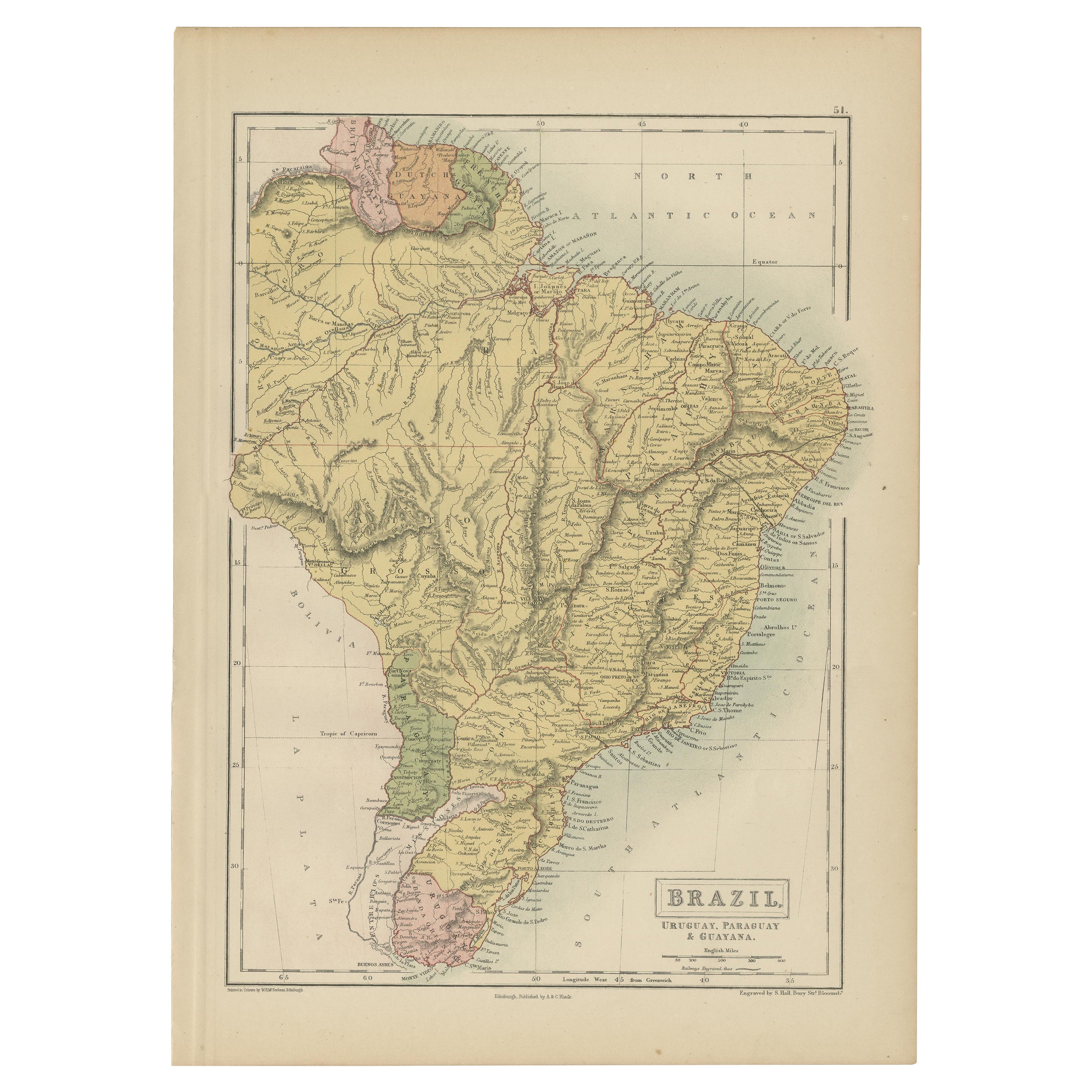
Antique Map of Brazil, Uruguay, Paraguay and Guyana by A
C. Black, 1870
Located in Langweer, NL
Antique map titled 'Brazil'. Original antique map of Brazil, Uruguay, Paraguay and Guyana. This map originates from ‘Black's General Atlas of The...
Category
Antique Late 19th Century English Maps
Materials
Paper
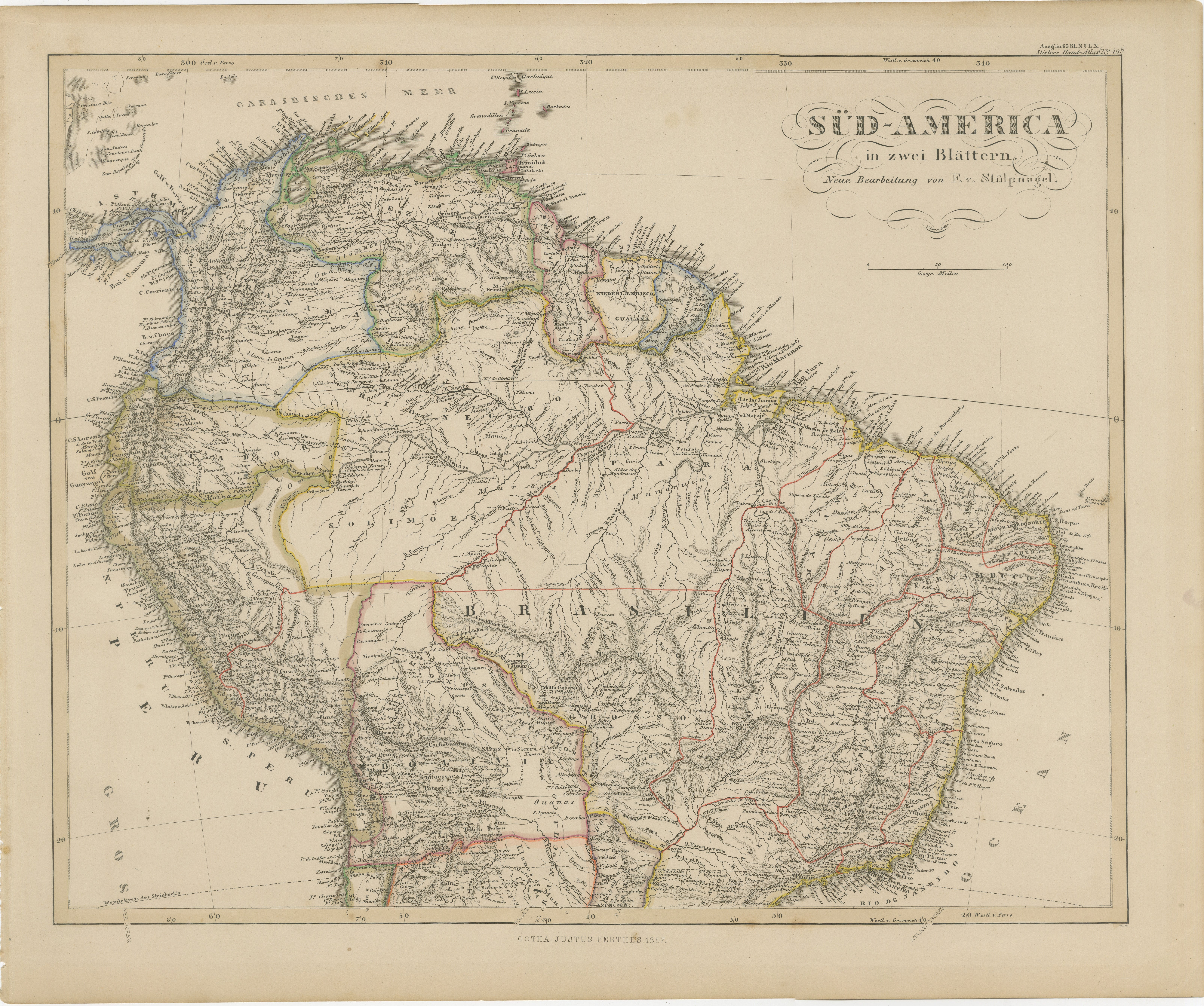
1857 Map of Northern South America – Brazil, Colombia, Peru by Stülpnagel
Located in Langweer, NL
1857 Map of Northern South America – Brazil, Colombia, Peru by Stülpnagel
Antique map titled “Süd-America in zwei Blättern” (South America in Two Sheets), newly edited by V. v. Stül...
Category
Antique Mid-19th Century German Maps
Materials
Paper

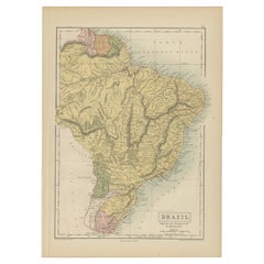
Antique Map of Brazil by Wyld,
1845
Located in Langweer, NL
Antique map titled 'Empire of Brazil'. Original antique map of Brazil. This map originates from 'An Atlas of the World, Comprehending Separate Ma...
Category
Antique Mid-19th Century Maps
Materials
Paper

$239 Sale Price
20% Off
More Ways To Browse
Brazil Antique
Brazilian Antiques
Brazilian Antique Art
Original Gay Art
Pablo Picasso Pencil Signed
Pakistan Vintage Travel Posters
Peter Mac
Porsche Targa Poster
Poster Mali
Poster Soviet Space Exploration
Red Grooms Ruckus Taxi
Robert Longo Rick
Russian Winter Hat
Sailing And Vintage Posters
Salvador Dali Papillon
Salvador Dali Religious
Seuss Serigraph
Sharon Hayes