Items Similar to Manitoba, British Columbia and NW Territories, Canada. Century Atlas antique map
Want more images or videos?
Request additional images or videos from the seller
1 of 6
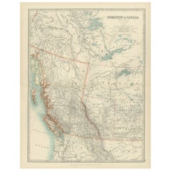
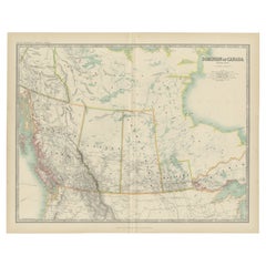
UnknownManitoba, British Columbia and NW Territories, Canada. Century Atlas antique map1903
1903
$85
£64.55
€74.16
CA$119.83
A$127.40
CHF 68.90
MX$1,515.51
NOK 863.02
SEK 788.20
DKK 553.97
About the Item
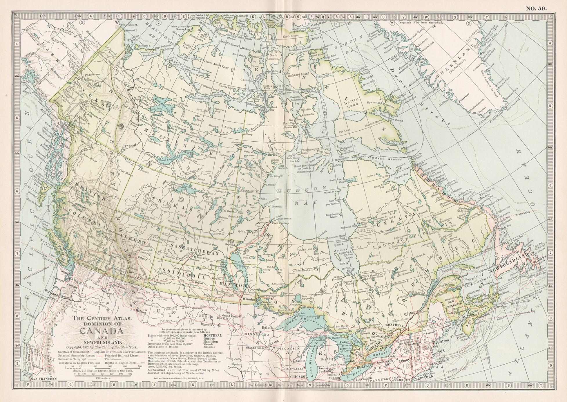
'The Century Atlas. Manitoba, British Columbia and the Northwest Territories, Canada, North America.'
Original antique map, 1903.
Central fold as issued. Map name and number printed on the reverse corners.
Sheet 29.5cm by 40cm.
- Creation Year:1903
- Dimensions:Height: 11.62 in (29.5 cm)Width: 15.95 in (40.5 cm)
- Medium:
- Movement Style:
- Period:
- Condition:
- Gallery Location:Melbourne, AU
- Reference Number:1stDibs: LU1244211224372
About the Seller
5.0
Gold Seller
Premium sellers maintaining a 4.3+ rating and 24-hour response times
Established in 2005
1stDibs seller since 2019
634 sales on 1stDibs
Typical response time: 1 hour
- ShippingRetrieving quote...Shipping from: Melbourne, Australia
- Return Policy
More From This Seller
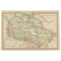
View AllCanada and Newfoundland. Century Atlas antique vintage map
Located in Melbourne, Victoria
'The Century Atlas. Dominion of Canada and Newfoundland.'
Original antique map, 1903.
Central fold as issued. Map name and number printed on the reverse corners.
Sheet 29.5cm by 40...
Category
Early 20th Century Victorian More Prints
Materials
Lithograph

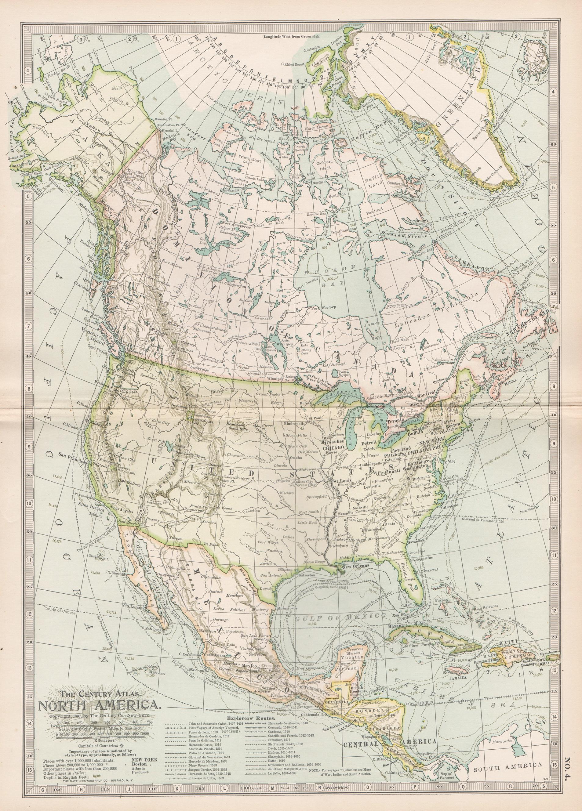
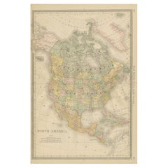
North America. Century Atlas antique vintage map
Located in Melbourne, Victoria
'The Century Atlas. North America'
Original antique map, 1903.
Central fold as issued. Map name and number printed on the reverse corners.
Sheet 40cm by 29.5cm.
Category
Early 20th Century Victorian More Prints
Materials
Lithograph

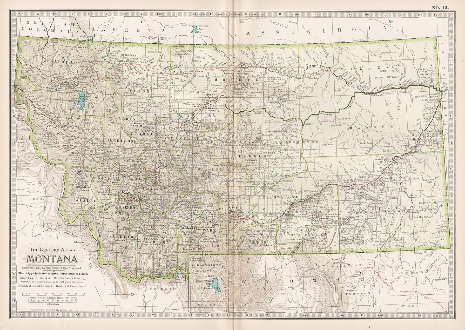
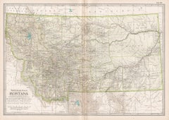
Montana. USA. Century Atlas state antique vintage map
Located in Melbourne, Victoria
'The Century Atlas. Montana'
Original antique map, 1903.
Central fold as issued. Map name and number printed on the reverse corners.
Sheet 29.5cm by 40cm.
Category
Early 20th Century Victorian More Prints
Materials
Lithograph
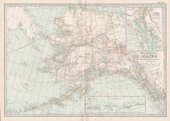
Alaska, North America. Century Atlas antique vintage map
Located in Melbourne, Victoria
'The Century Atlas. Alaska, North America.'
Original antique map, 1903.
Inset maps of 'Sitka, Glacier Bay' and Aleutian Is.'.
Central fold as issued. Map name and number printed on...
Category
Early 20th Century Victorian More Prints
Materials
Lithograph
Alaska, United States of America, Century Atlas state antique vintage map
Located in Melbourne, Victoria
'The Century Atlas. Alaska.' Inset maps of 'Sitka, Glacier Bay' and Aleutian Is.'.
Original antique map, 1903.
Central fold as issued. Map name and number printed on the reverse cor...
Category
Early 20th Century Victorian More Prints
Materials
Lithograph

Quebec. Canada. Century Atlas antique vintage map
Located in Melbourne, Victoria
'The Century Atlas. Quebec'
Original antique map, 1903.
Inset maps 'Sketch Map of Quebec', Quebec and Vicinity; and 'Montreal and Vicinity'.
Central fo...
Category
Early 20th Century Victorian More Prints
Materials
Lithograph

You May Also Like
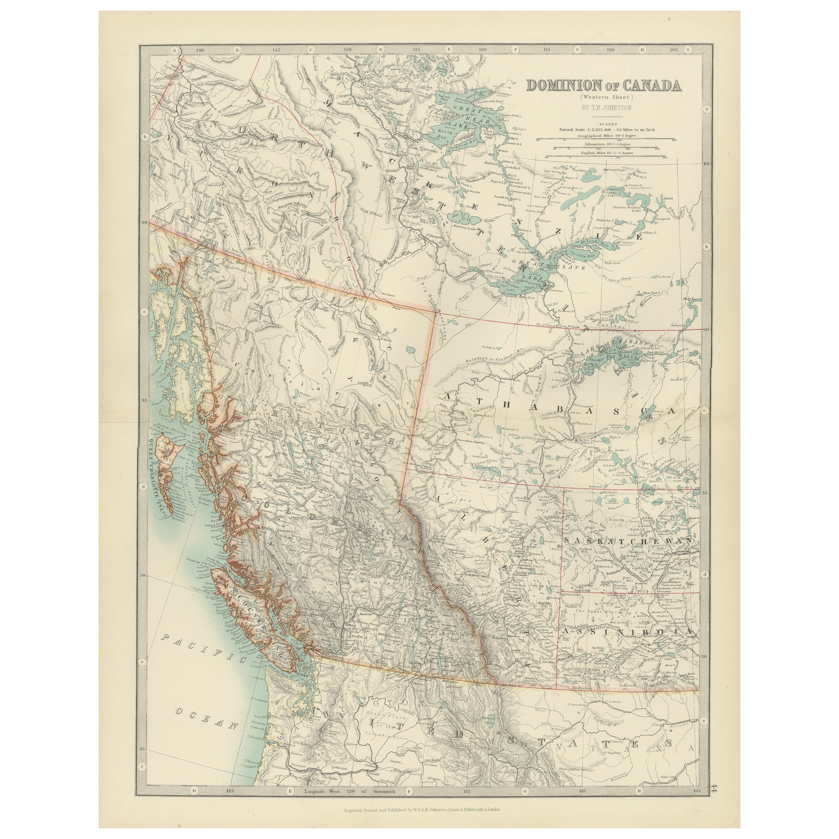
Canada’s West – 1903 Engraved Map by Johnston – Unique and Historic
Located in Langweer, NL
This beautiful and detailed map, titled "Dominion of Canada (Western Sheet)," was created by Keith Johnston and published in 1903.
It presents a fascinating depiction of Canada's w...
Category
Early 20th Century Maps
Materials
Paper
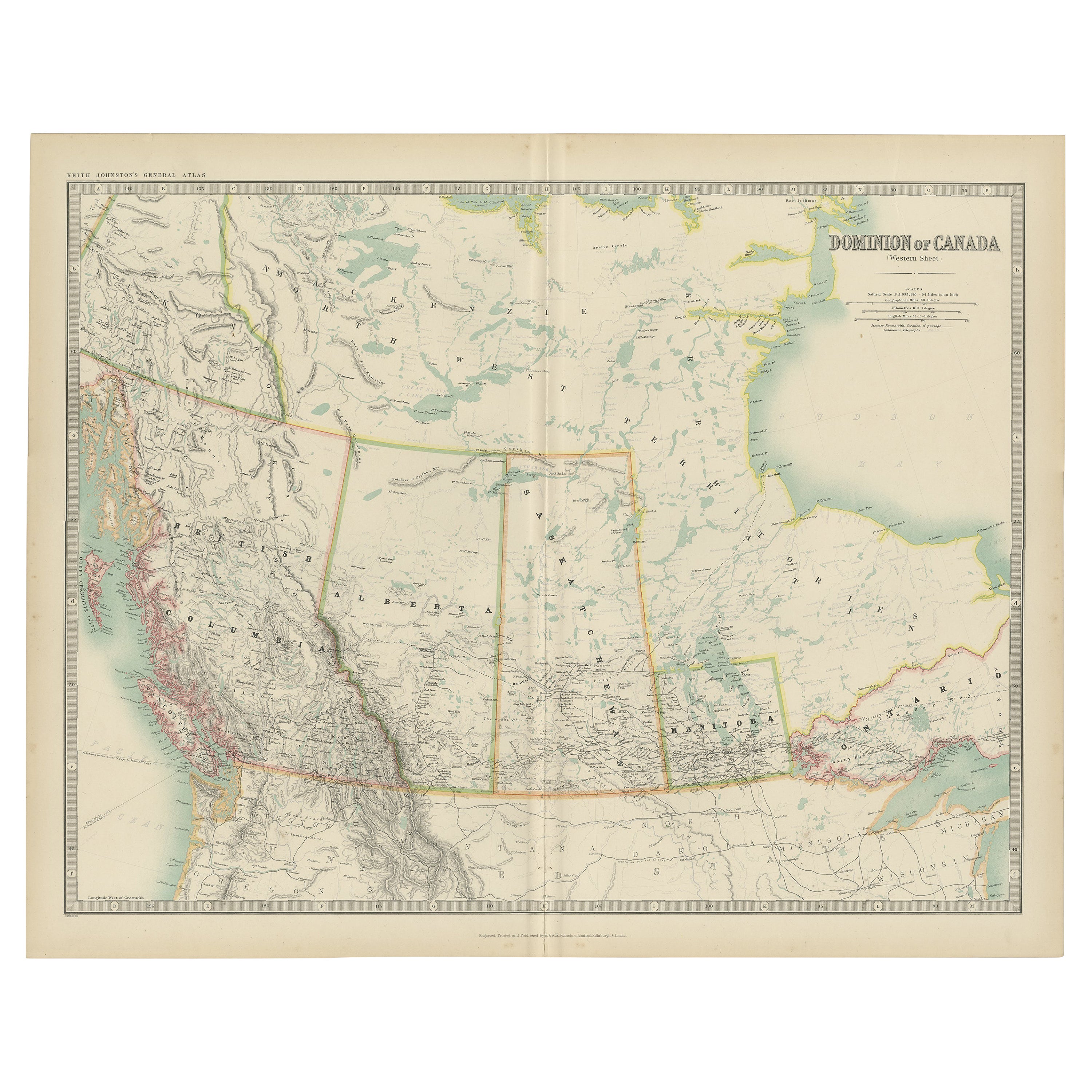
Antique Map of Canada by Johnston
1909
Located in Langweer, NL
Antique map titled 'Dominion of Canada'. Original antique map of Canada. This map originates from the ‘Royal Atlas of Modern Geography’. Publishe...
Category
Early 20th Century Maps
Materials
Paper
$238 Sale Price
20% Off
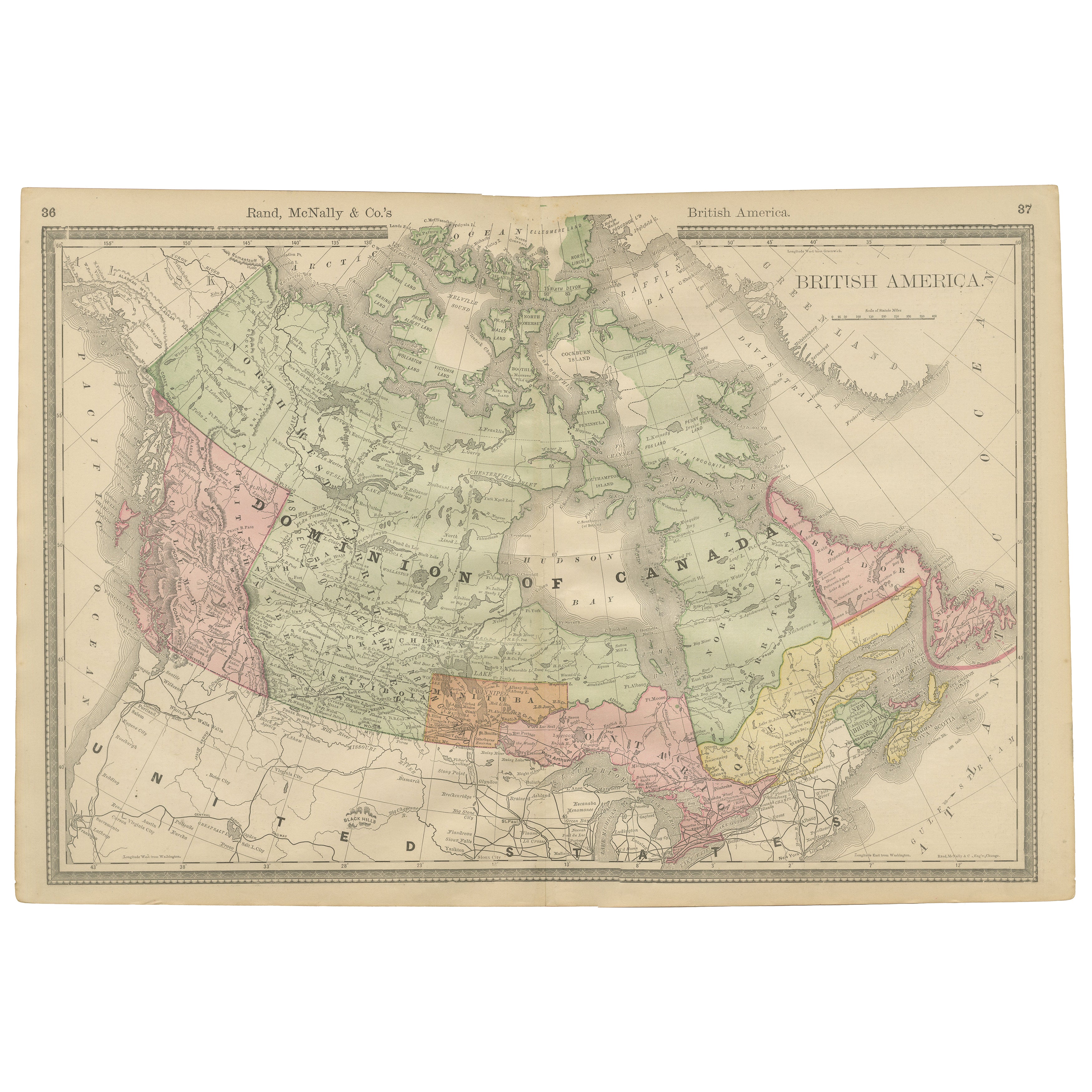
Canada Antique Railroad Map c.1888 – British America, Cities
Regions
Located in Langweer, NL
Antique Map of Canada – Rand McNally’s British America, circa 1888
This antique map titled “Rand, McNally & Co.’s British America” was published around 1888 and depicts the full ext...
Category
Antique Late 19th Century American Maps
Materials
Paper
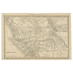
British Columbia 1888 Antique Map – Beautiful BC, Towns
Settlements
Located in Langweer, NL
Antique Map of British Columbia, Canada – Rand McNally, circa 1888
Description:
This antique map of British Columbia was published by Rand, McNally & Co. around 1888. It presents th...
Category
Antique Late 19th Century American Maps
Materials
Paper
1874 Map of Western United States – Detailed Atlas by Keith Johnston
Located in Langweer, NL
1874 Map of Western United States by Keith Johnston – Detailed Atlas
This is an original antique map titled “United States of North America (Western States)” by Alexander Keith John...
Category
Antique 1870s Scottish Maps
Materials
Paper

North America Antique Railroad Map c.1888 – U.S., Canada
Mexico
Located in Langweer, NL
Antique Map of North America – Rand McNally, circa 1888
This antique map of North America, published by Rand, McNally & Co. circa 1888, offers a comprehensive view of the continent ...
Category
Antique Late 19th Century American Maps
Materials
Paper
More Ways To Browse
Canadian Art 20th Century
Antique Manitoba
Christopher Wool The Show Is Over
Cordial Campari
Dali Romeo Juliet
Folon Poster
Invader Map
Jacques Pecnard
Memories Of Surrealism
Motor Racing Art
Osvaldo Peruzzi
Picasso Pan
Wash Art Print 1979
Zhiyong Jing
A La Place Clichy
Alton Kelley
Andy Warhol Tomato Soup
Ark Of The Covenant