Items Similar to Prague, Czechoslovakia. Antique Map City Plan Chromolithograph, circa 1895
Want more images or videos?
Request additional images or videos from the seller
1 of 3
UnknownPrague, Czechoslovakia. Antique Map City Plan Chromolithograph, circa 18951895
1895
$95
£72.11
€82.69
CA$134.09
A$143.94
CHF 76.64
MX$1,704.75
NOK 968.50
SEK 884.51
DKK 617.75
About the Item
'Prag'
Colour lithograph. 1895.
250mm by 305mm (sheet).
Late 19th century German lithograph plan of Prague, Czechoslovakia.
Central vertical fold. Printed street index on the reverse of the map.
- Creation Year:1895
- Dimensions:Height: 9.85 in (25 cm)Width: 12.01 in (30.5 cm)
- Medium:
- Movement Style:
- Period:
- Condition:
- Gallery Location:Melbourne, AU
- Reference Number:1stDibs: LU1244214294362
About the Seller
5.0
Gold Seller
Premium sellers maintaining a 4.3+ rating and 24-hour response times
Established in 2005
1stDibs seller since 2019
634 sales on 1stDibs
Typical response time: 1 hour
- ShippingRetrieving quote...Shipping from: Melbourne, Australia
- Return Policy
More From This Seller
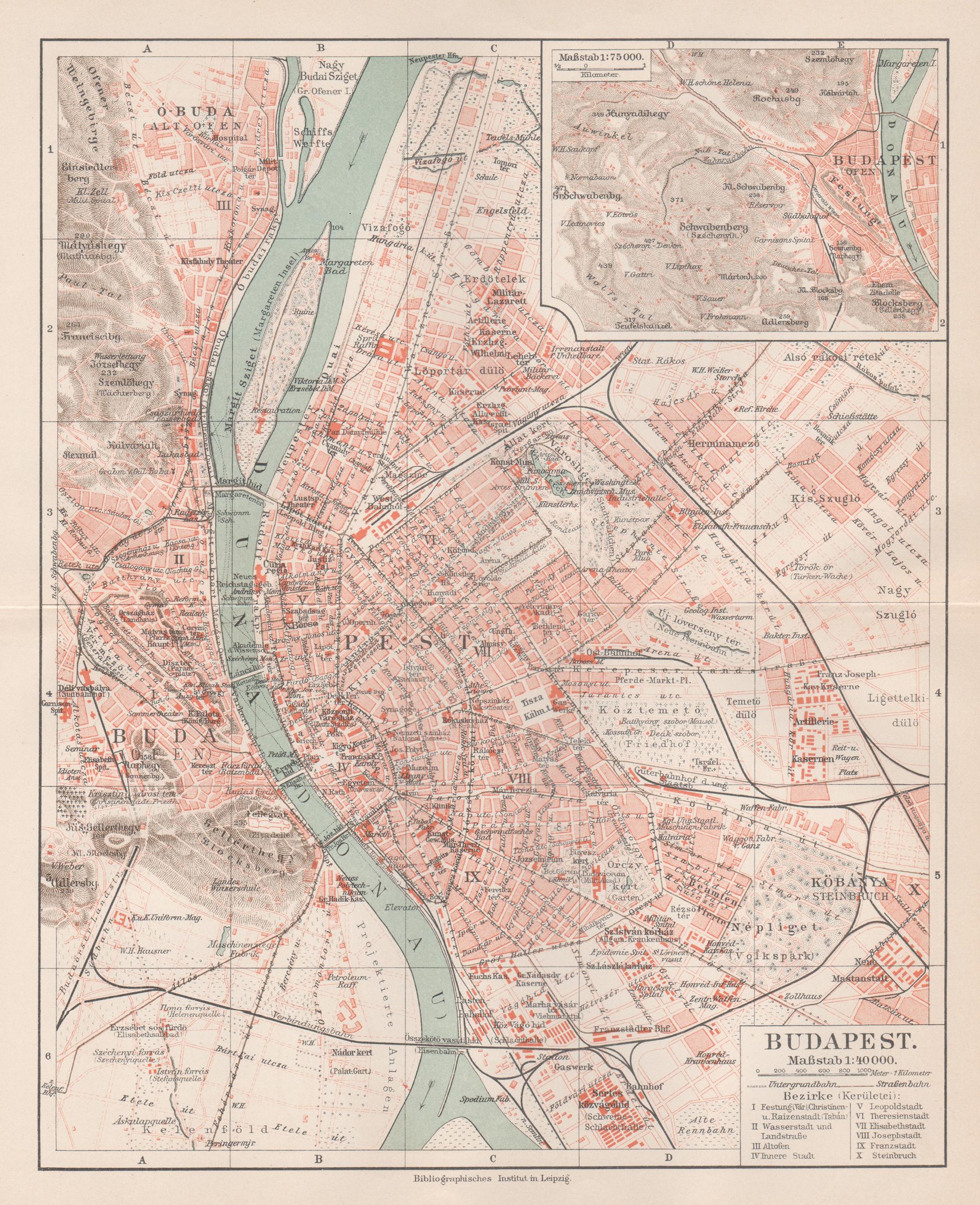
View AllBudapest, Hungary. Antique Map City Plan Chromolithograph, circa 1901.
Located in Melbourne, Victoria
'Budapest'
Colour lithograph. 1901.
305mm by 240mm (sheet).
Late 19th century German lithograph plan of Budapest, Hungary.
Central horizontal fold.
Category
Late 19th Century Victorian More Prints
Materials
Lithograph
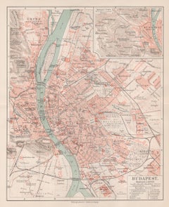
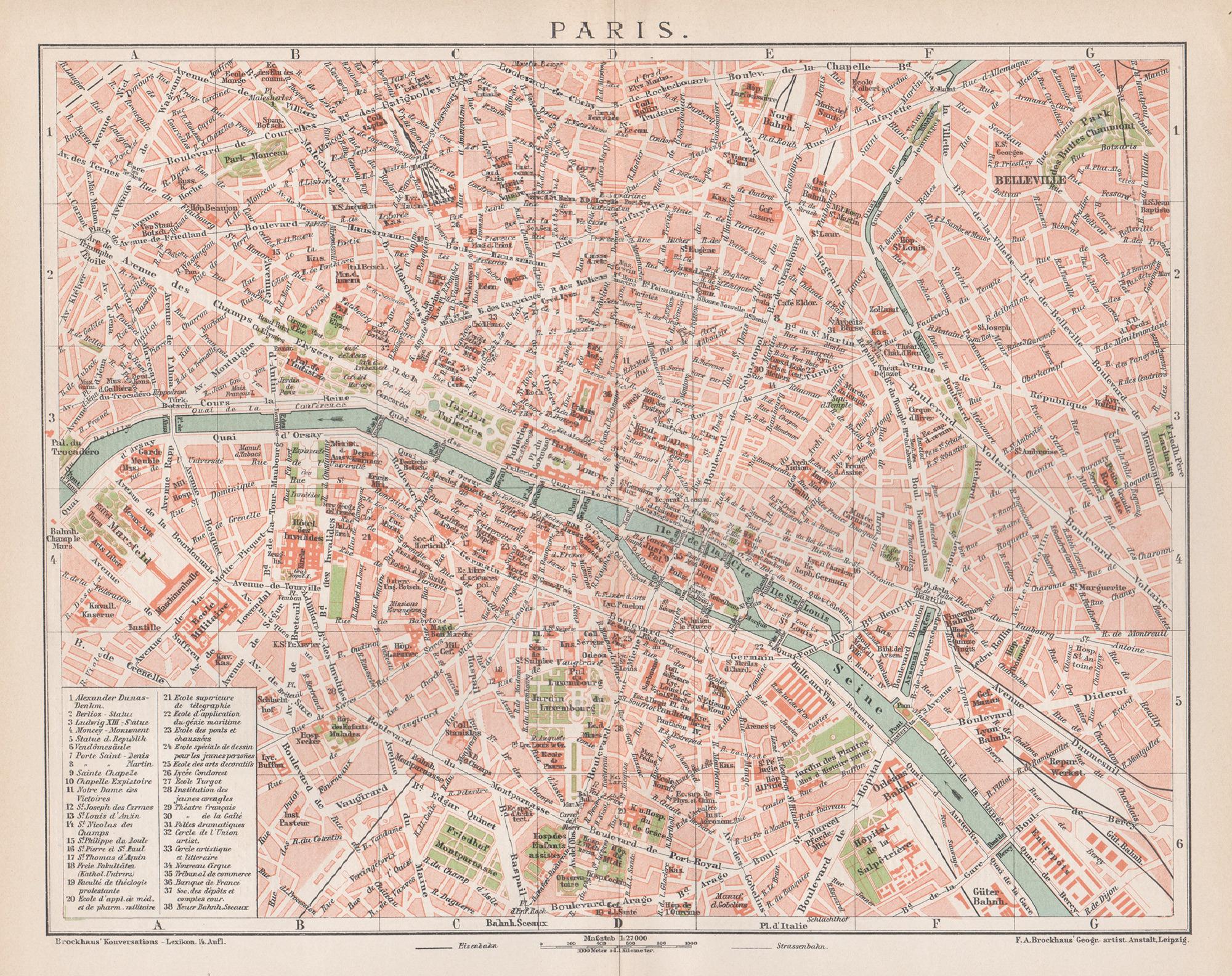
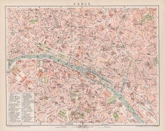
Paris, France. Antique Map City Plan Chromolithograph, circa 1895
Located in Melbourne, Victoria
'Paris'
Colour lithograph. 1895.
250mm by 305mm (sheet).
Late 19th century German lithograph plan of Paris, France.
Central vertical fold. Printed street index on the reverse o...
Category
Late 19th Century Victorian More Prints
Materials
Lithograph
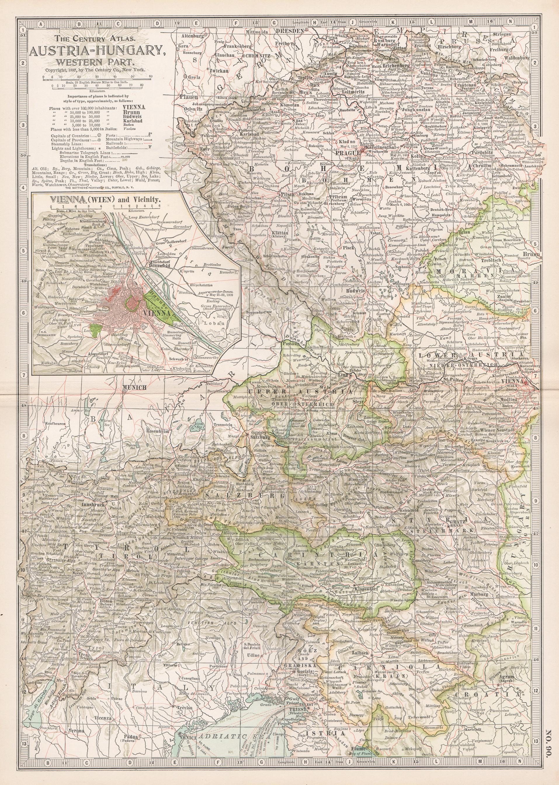
Austria-Hungary, Western Part. Century Atlas antique vintage map
Located in Melbourne, Victoria
'The Century Atlas. Austria-Hungary, Western Part'
Original antique map, 1903.
Central fold as issued. Map name and number printed on the reverse corners.
Sheet 40cm by 29.5cm.
Category
Early 20th Century Victorian More Prints
Materials
Lithograph

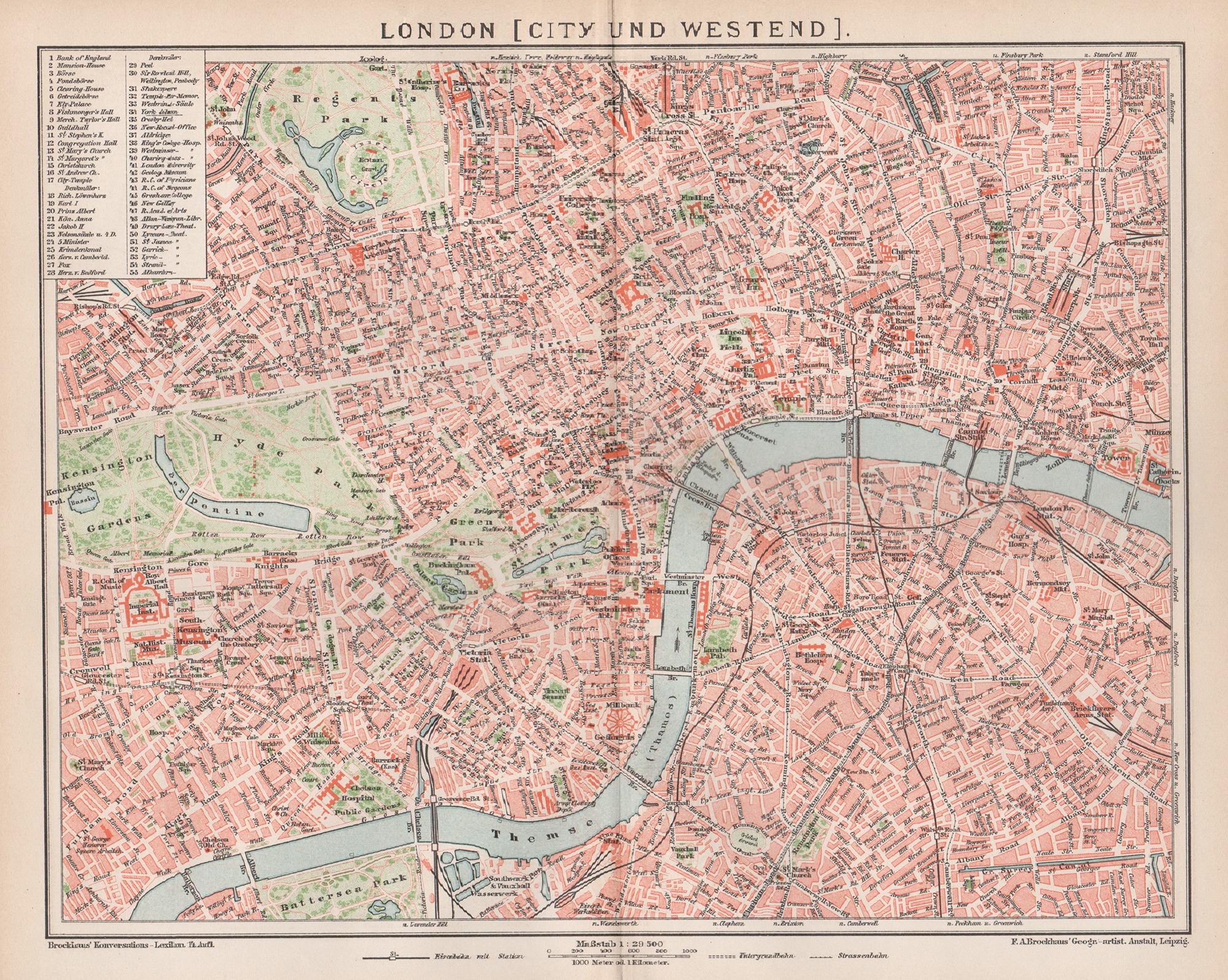
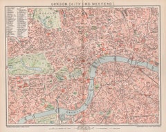
London, City and West End. Antique Map City Plan Chromolithograph, circa 1895
Located in Melbourne, Victoria
'London (City Und Westend)'
Colour lithograph. 1895.
250mm by 305mm (sheet).
Late 19th century German lithograph plan of London, City and West End.
Central vertical fold.
Category
Late 19th Century Victorian More Prints
Materials
Lithograph
German Empire, Northern Part. Century Atlas antique vintage map
Located in Melbourne, Victoria
'The Century Atlas. German Empire, Northern Part.'
Original antique map, 1903.
Central fold as issued. Map name and number printed on the reverse corne...
Category
Early 20th Century Victorian More Prints
Materials
Lithograph

Russia in Europe with Poland and Finland. Century Atlas antique vintage map
Located in Melbourne, Victoria
'The Century Atlas. Russia in Europe with Poland and Finland'
Original antique map, 1903.
Central fold as issued. Map name and number printed on the reverse corners.
Sheet 40cm by ...
Category
Early 20th Century Victorian More Prints
Materials
Lithograph

You May Also Like
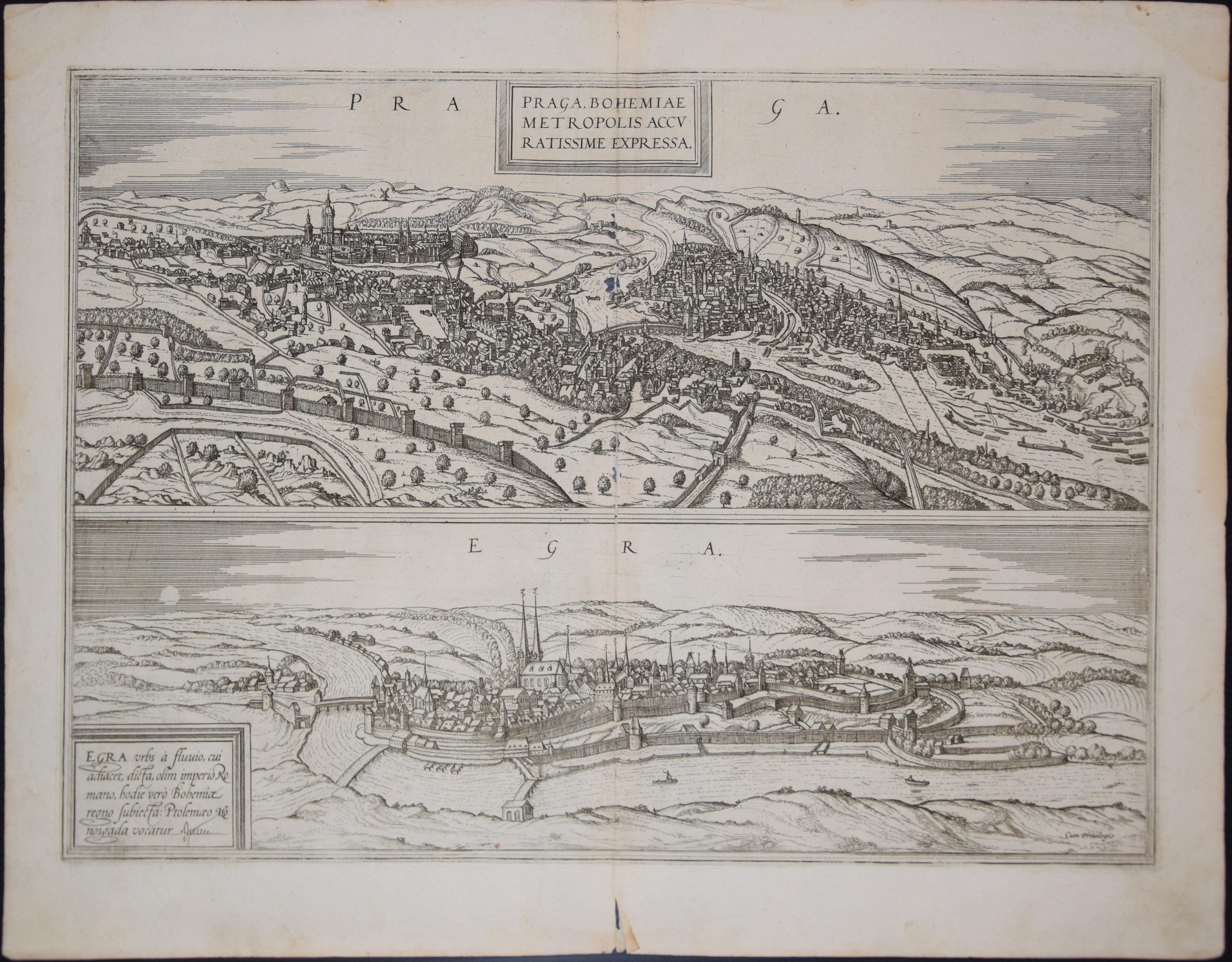
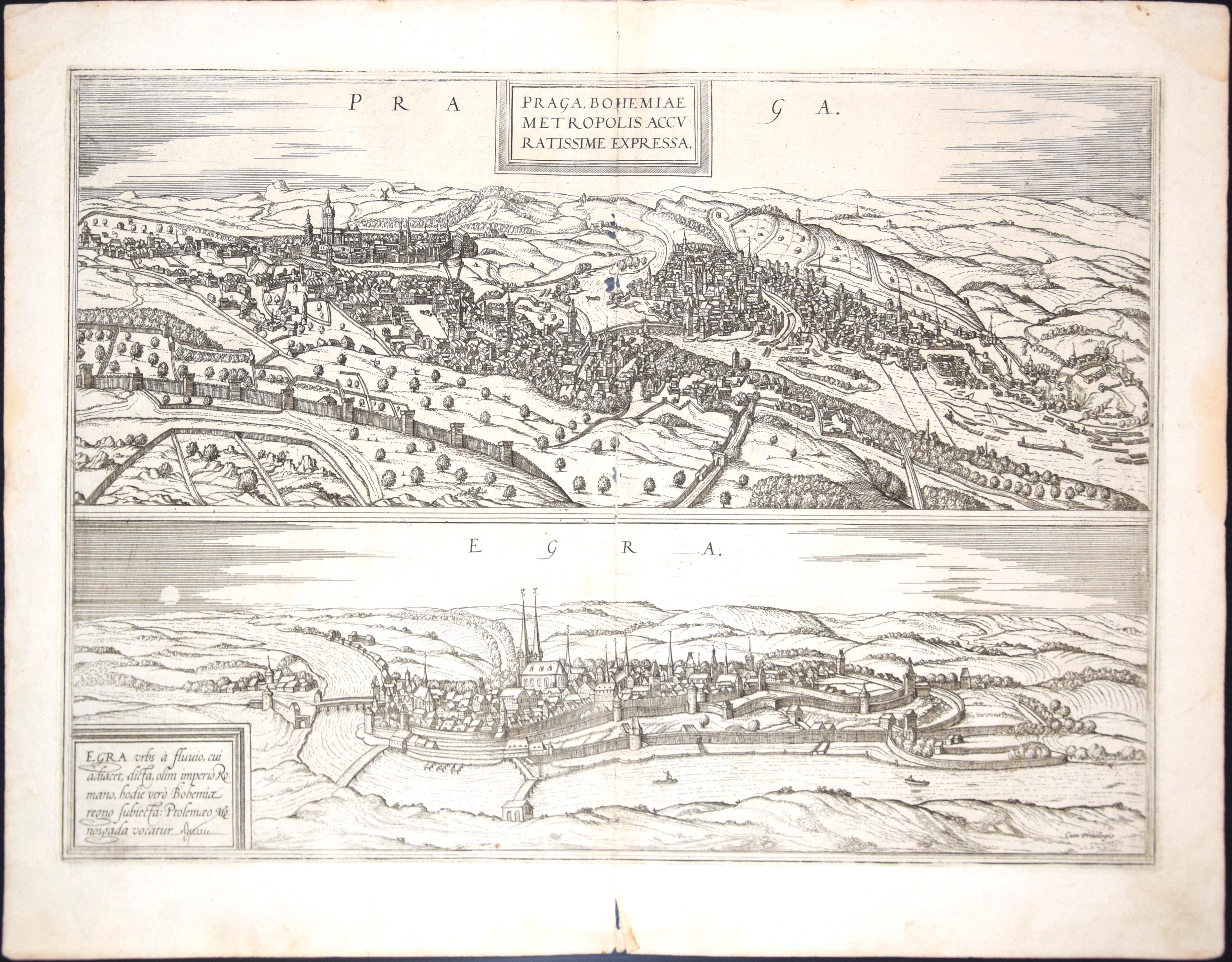
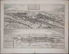
Prague and Egra, Antique Map from "Civitates Orbis Terrarum"
By Franz Hogenberg
Located in Roma, IT
Braun G. & Hogenberg F., Praga, Egra, from the collection Civitates Orbis Terrarum, Cologne, T. Graminaeus, 1572-1617. Image dimensions: 39.5 x 47.5 cm. Dimensions: 41 x 52.5 cm.
Wo...
Category
16th Century Landscape Prints
Materials
Etching
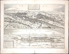
Prague and Egra, Antique Map from "Civitates Orbis Terrarum" - 1572-1617
By Franz Hogenberg
Located in Roma, IT
Braun G. & Hogenberg F., Praga, Egra, from the collection Civitates Orbis Terrarum, Cologne, T. Graminaeus, 1572-1617. Image dimensions: 39.5 x 47.5 cm. Dimensions: 41 x 52.5 cm.
Wo...
Category
16th Century Landscape Prints
Materials
Etching
Original Antique Map of Dresden, Germany by J. Stockdale, 1800
Located in Langweer, NL
Vintage Map of Dresden, Germany by J. Stockdale, 1800
This vintage map titled "A Plan of the City of Dresden" was published by J. Stockdale in Piccadilly, London, in 1800. It provid...
Category
Antique Early 1800s Maps
Materials
Paper
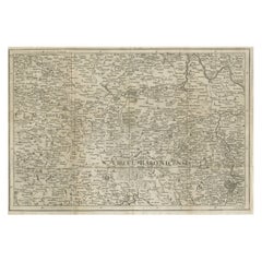
Rare Detailed Antique Map of Prague and Its North West Environs, ca.1760
Located in Langweer, NL
Description: original antique map of the environs of North West Prague. This map originates from the 'Gentlemans Magazine'. Published circa 1760.
Artists and Engravers: Engraved ...
Category
Antique 1760s Maps
Materials
Paper
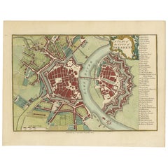
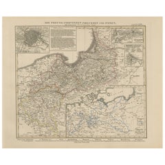
Antique Map of Prussia
Posen – Insets of Berlin, Königsberg
Danzig, 1858
Located in Langweer, NL
Antique Map of Prussia & Posen – With Insets of Berlin, Königsberg & Danzig, 1858
Highly detailed and information-rich map titled "Die Preuss: Provinzen Preussen und Posen", publish...
Category
Antique Mid-19th Century German Maps
Materials
Paper
Antique Map of Central Europe Showing The Railways and The Political Bounderies
Located in Langweer, NL
Explore the Heart of Europe with the 'Central Europe' Map, Featuring Principal Railways and Political Boundaries! This map offers a captivating view of the dynamic landscapes and pol...
Category
Antique 1880s Maps
Materials
Paper

$162 Sale Price
20% Off