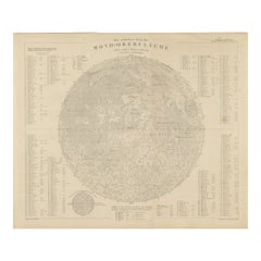
Items Similar to Ubersichtskarte Des Mondes (Overview Map of the Moon), antique astronomy print
Want more images or videos?
Request additional images or videos from the seller
1 of 3
UnknownUbersichtskarte Des Mondes (Overview Map of the Moon), antique astronomy print1895
1895
$65
£49.34
€56.58
CA$91.75
A$98.48
CHF 52.44
MX$1,166.41
NOK 662.66
SEK 605.19
DKK 422.67
About the Item
'Ubersichtskarte Des Mondes'
(Overview Map of the Moon)
German chromolithograph, circa 1895.
245mm by 305mm (sheet).
Central vertical fold as issued.
- Creation Year:1895
- Dimensions:Height: 12.01 in (30.5 cm)Width: 9.26 in (23.5 cm)
- Medium:
- Movement Style:
- Period:
- Condition:Central vertical fold as issued. Text on the reverse with list of moon craters.
- Gallery Location:Melbourne, AU
- Reference Number:1stDibs: LU1244214034762
About the Seller
5.0
Gold Seller
Premium sellers maintaining a 4.3+ rating and 24-hour response times
Established in 2005
1stDibs seller since 2019
634 sales on 1stDibs
Typical response time: 1 hour
- ShippingRetrieving quote...Shipping from: Melbourne, Australia
- Return Policy
More From This Seller
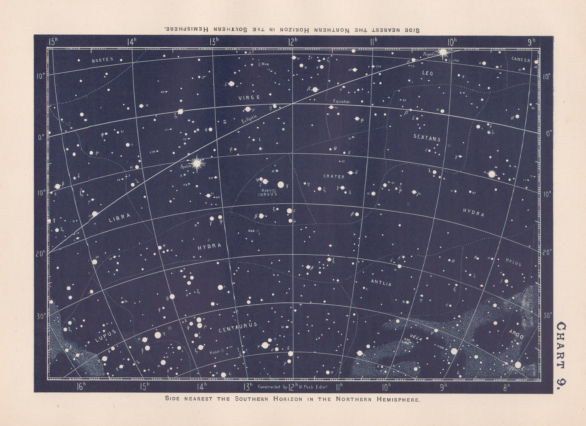
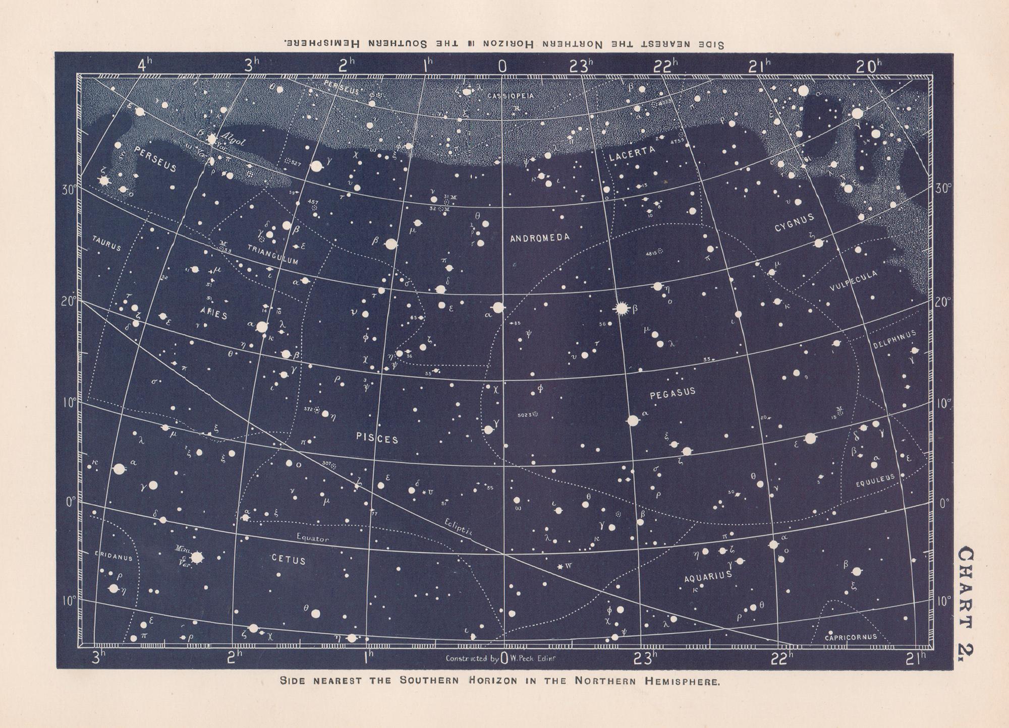
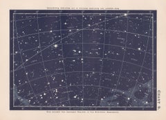
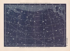
View AllStar Chart. Antique Astronomy celestial print
Located in Melbourne, Victoria
Colour lithograph, 1890. 210mm by 285mm (sheet). From W Peck's 'A Handbook and Atlas of Astronomy', 1890. Sir William Peck FRSE FRAS (1862 – 1925) was a Scottish astronomer and scien...
Category
Late 19th Century Victorian More Prints
Materials
Lithograph
Star Chart. Antique Astronomy celestial print
Located in Melbourne, Victoria
Colour lithograph, 1890. 210mm by 285mm (sheet). From W Peck's 'A Handbook and Atlas of Astronomy', 1890. Sir William Peck FRSE FRAS (1862 – 1925) was a Scottish astronomer and scien...
Category
Late 19th Century Victorian More Prints
Materials
Lithograph
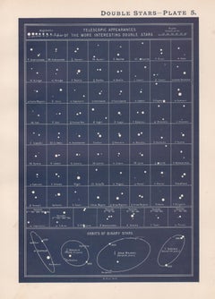
Double Stars. Antique Astronomy science print
Located in Melbourne, Victoria
Colour lithograph, 1890. 285mm by 210mm (sheet). From W Peck's 'A Handbook and Atlas of Astronomy', 1890. Sir William Peck FRSE FRAS (1862 – 1925) was a Scottish astronomer and scien...
Category
Late 19th Century Victorian More Prints
Materials
Lithograph
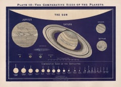
The Comparative Sizes of the Planets. Antique Astronomy diagram
Located in Melbourne, Victoria
Colour lithograph, 1890. 210mm by 285mm (sheet). From W Peck's 'A Handbook and Atlas of Astronomy', 1890. Sir William Peck FRSE FRAS (1862 – 1925) was a Scottish astronomer and scien...
Category
Late 19th Century Victorian More Prints
Materials
Lithograph
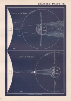
Eclipses. Antique Astronomy science print
Located in Melbourne, Victoria
Colour lithograph, 1890. 285mm by 210mm (sheet). From W Peck's 'A Handbook and Atlas of Astronomy', 1890. Sir William Peck FRSE FRAS (1862 – 1925) was a Scottish astronomer and scien...
Category
Late 19th Century Victorian More Prints
Materials
Lithograph
German Empire, Northern Part. Century Atlas antique vintage map
Located in Melbourne, Victoria
'The Century Atlas. German Empire, Northern Part.'
Original antique map, 1903.
Central fold as issued. Map name and number printed on the reverse corne...
Category
Early 20th Century Victorian More Prints
Materials
Lithograph

You May Also Like
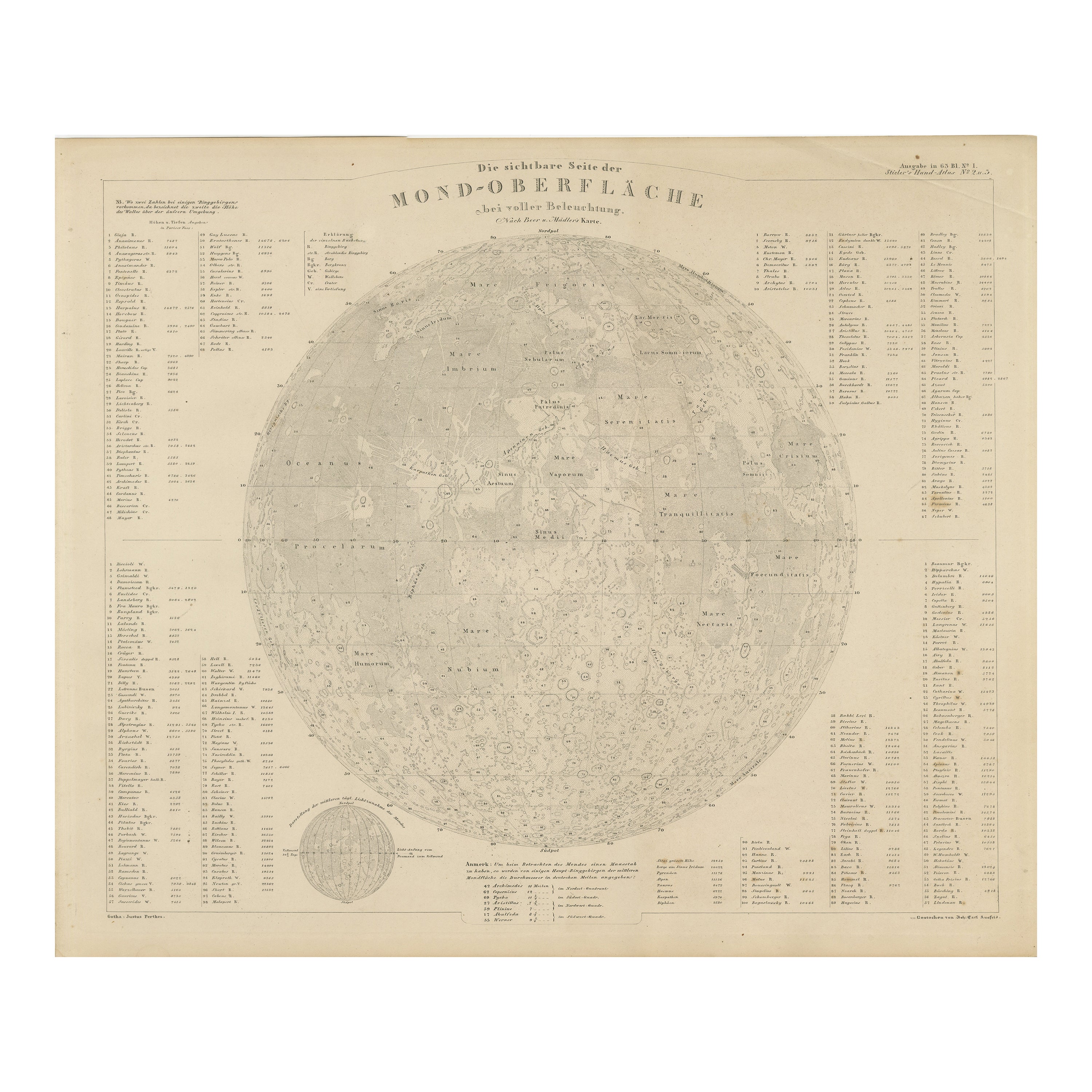
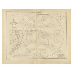
Visible Side of the Moon Map – Detailed Lunar Crater Chart, Published in 1858
Located in Langweer, NL
Visible Side of the Moon Map – Detailed Lunar Crater Chart 1858
This fascinating antique print shows the visible side of the moon with incredible precision and detail. It depicts th...
Category
Antique Mid-19th Century German Maps
Materials
Paper
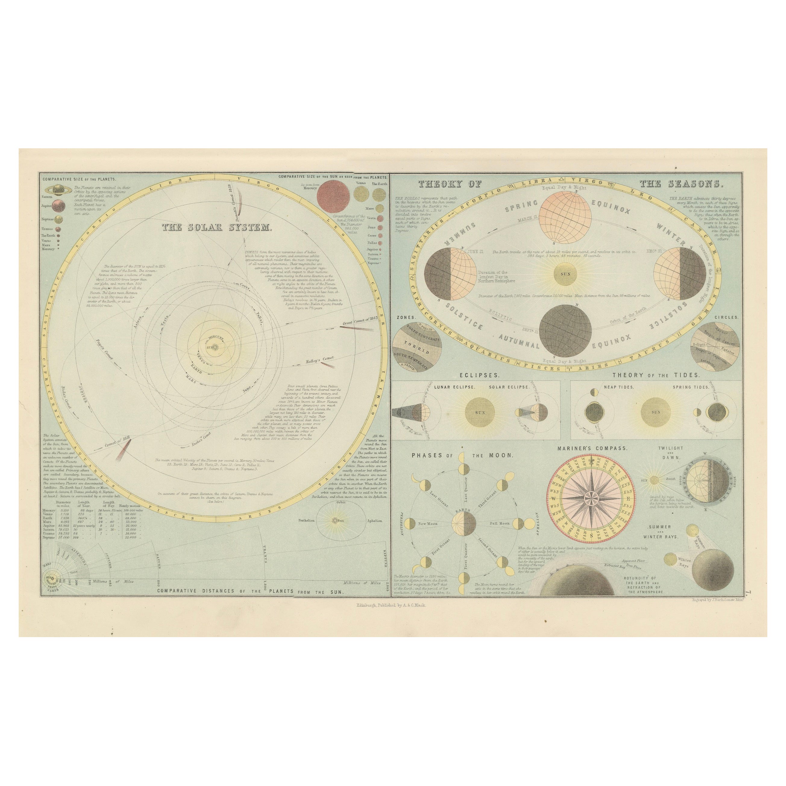
Antique Astronomical Chart of the Solar System and Seasons – Black’s Atlas, 1884
Located in Langweer, NL
Antique Astronomical Chart of the Solar System and Seasons – Black’s Atlas, 1884
This striking scientific chart comes from the New and Revised Edition of Black’s General Atlas of th...
Category
Antique 1880s Scottish Maps
Materials
Paper
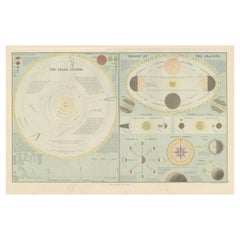
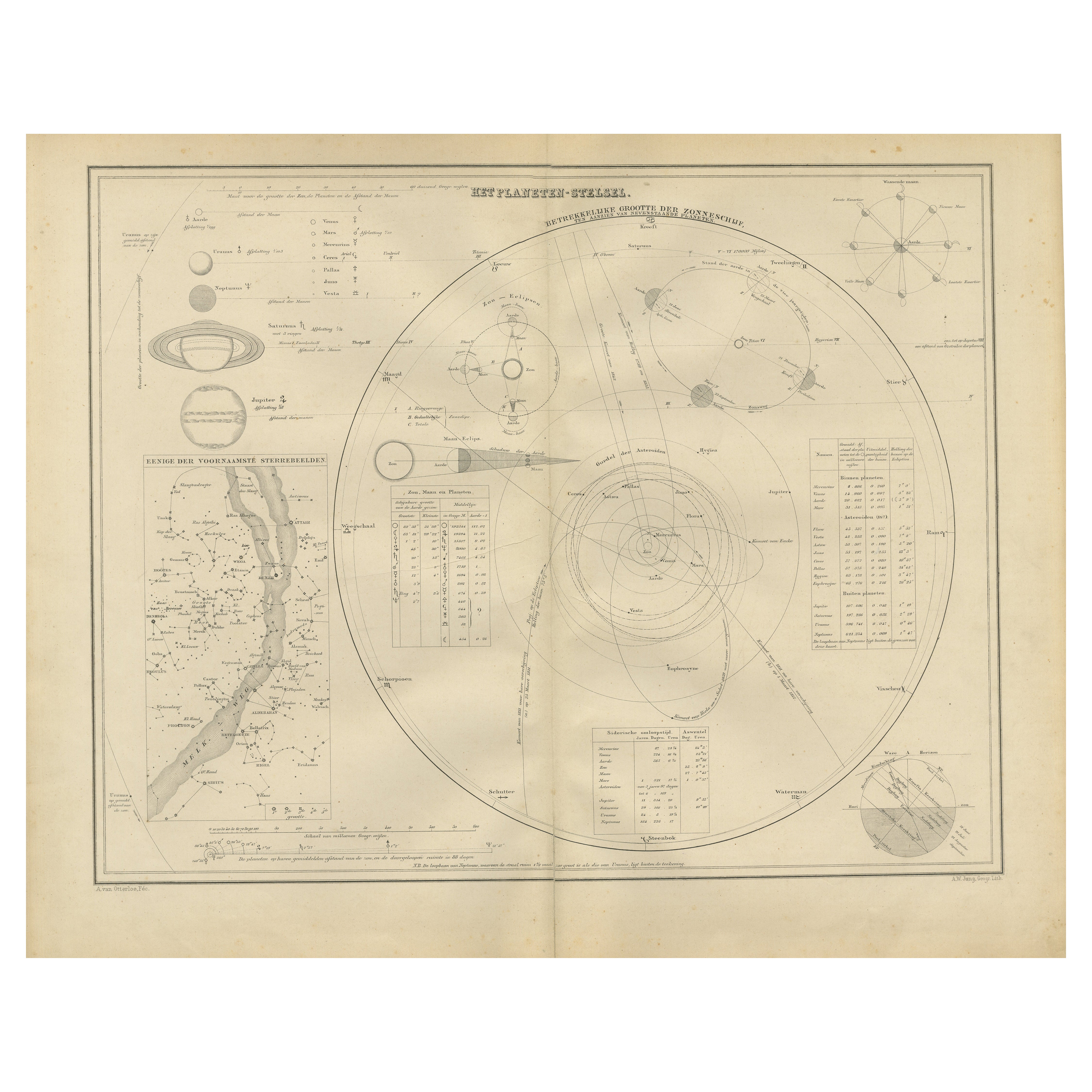
The Solar System – Astronomical Lithograph - The Nieuwe Hand-Atlas, Leiden 1876
Located in Langweer, NL
The Solar System – Astronomical Lithograph from the Nieuwe Hand-Atlas, Leiden 1876
This detailed 19th-century Dutch astronomical lithograph, titled “Het Planeten-Stelsel” (The Plane...
Category
Antique 1870s Dutch Maps
Materials
Paper
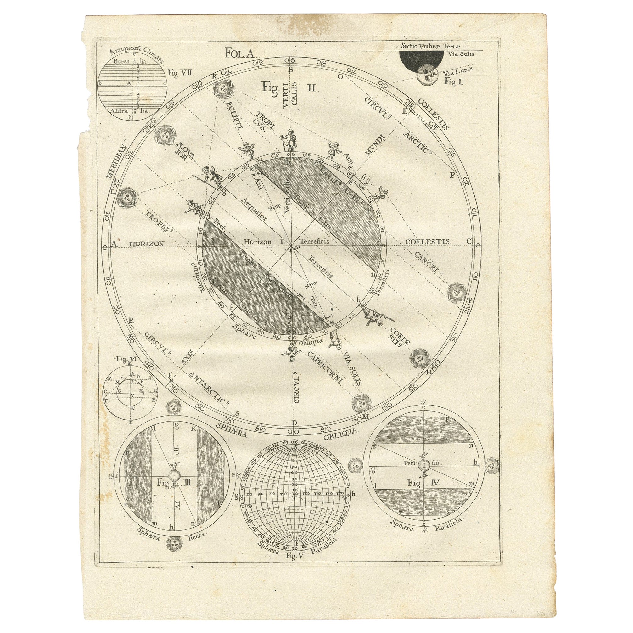
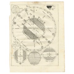
Antique Map Illustrating Solar Eclipses by Scherer, C.1703
Located in Langweer, NL
Antique map of an hemisphere and several figures illustrating the position of the earth, moon and sun. Printed for Scherer's 'Atlas Novus' (1702-1710).
Artists and Engravers: Heinrich Scherer (1628-1704) was a Professor of Hebrew, Mathematics and Ethics at the University of Dillingen until about 1680. Thereafter he obtained important positions as Official Tutor to the Royal Princes...
Category
Antique 18th Century Maps
Materials
Paper
$122 Sale Price
53% Off
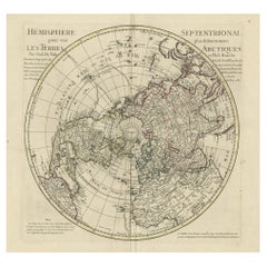
Antique Map of the Northern Hemisphere, 1782
Located in Langweer, NL
Antique map titled 'Hémisphère Septentrional pour voir plus distinctement les Terres Arctiques (..)'.
Map of the Northern Hemisphere, originall...
Category
Antique 1780s Maps
Materials
Paper
1730 Southern Hemisphere Celestial Chart with Zodiac Signs and Decorative Putti
Located in Langweer, NL
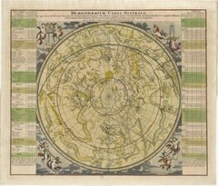
Title: 1730 Southern Hemisphere Celestial Chart with Zodiac Signs and Decorative Putti
Description: This stunning 1730 celestial map, "Hemisphaerium Coeli Australe," showcases the S...
Category
Antique 1730s Prints
Materials
Paper
More Ways To Browse
Richard Bernstein Ruby
Toronto Vintage Posters
Vintage Campbells Soup Sign
Warhol Fruit
Warhol Space Fruit
Wayne Thiebaud Cakes
William Todd Haile
Woody Othello
B B La Femme
Banksy Box Set
Banksy Walled Off Hotel Box Set
Bernard Buffet Le Bouquet
Carl Thiemann
Goyard Print
Kazutoshi Sugiura
Month Flower Prints
Ohno Bakufu
Peter Max Marilyn