Items Similar to Royal Wedding Queen Elizabeth II Prince Philip 1947 London map Daily Telegraph
Want more images or videos?
Request additional images or videos from the seller
1 of 9
UnknownRoyal Wedding Queen Elizabeth II Prince Philip 1947 London map Daily Telegraph1947
1947
$747.82
£550
€642.07
CA$1,035.41
A$1,125.31
CHF 603.06
MX$13,663.26
NOK 7,571.09
SEK 7,021.04
DKK 4,795.47
About the Item
To see more, scroll down to "More from this Seller" and below it click on "See all from this Seller."
N. V. Gray
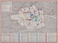
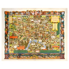
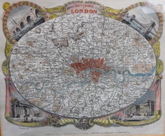
The Royal Wedding: Picture Map of the Route through London (1947)
Lithograph
50 x 76 cm
Produced by H.A.
W.L. Pitkin Ltd for the Daily Telegraph and published by Geographia Ltd., of Hutchinson
Co.
Signed in plate lower right.
Complete with slip showing the genealogy of the two parties.
Princess Elizabeth (later Her Majesty Queen Elizabeth II) and Prince Philip married on Thursday 20th November 1947 at Westminster Abbey in London. This map, commissioned and sold by the Daily Telegraph newspaper, was designed by N. V. Gray. It depicts the route the carriage processions took on the way to the Abbey; Princess Elizabeth and her father King George Vi travelled in the magnificent Irish State Coach. Crests of London's boroughs border this delightfully coloured map.
- Creation Year:1947
- Dimensions:Height: 19.69 in (50 cm)Width: 29.93 in (76 cm)
- Medium:
- Movement Style:
- Period:
- Framing:Framing Options Available
- Condition:Very good, complete with slip.
- Gallery Location:London, GB
- Reference Number:1stDibs: LU795311009752
About the Seller
4.8
Vetted Professional Seller
Every seller passes strict standards for authenticity and reliability
Established in 2014
1stDibs seller since 2017
362 sales on 1stDibs
Typical response time: 13 hours
- ShippingRetrieving quote...Shipping from: London, United Kingdom
- Return Policy
More From This Seller
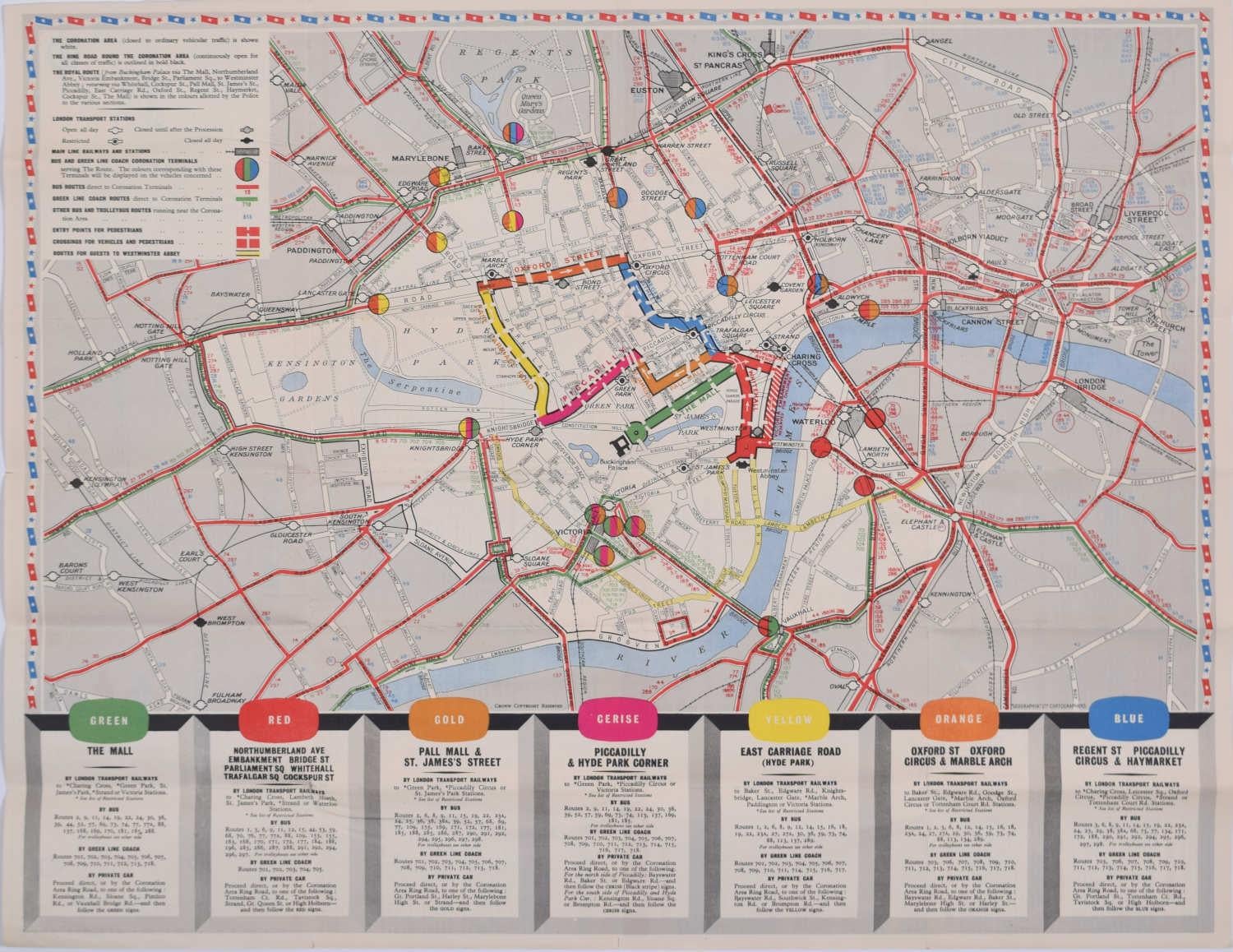
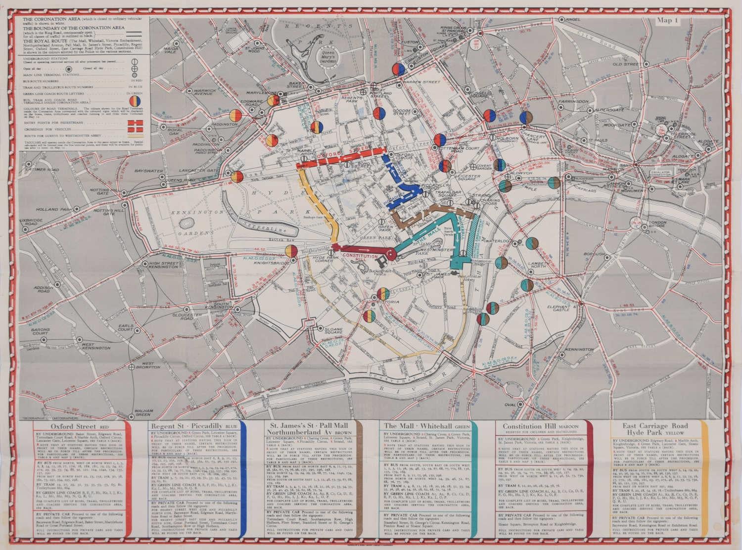
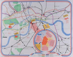
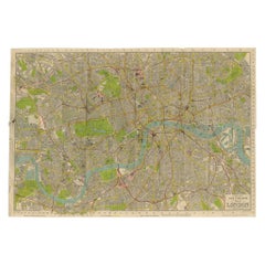
View All1953 Coronation Map for London Transport
Located in London, GB
To see more, scroll down to "More from this Seller" and below it click on "See all from this Seller."
Coronation Arrangements – Map of London (1...
Category
1950s Landscape Prints
Materials
Lithograph
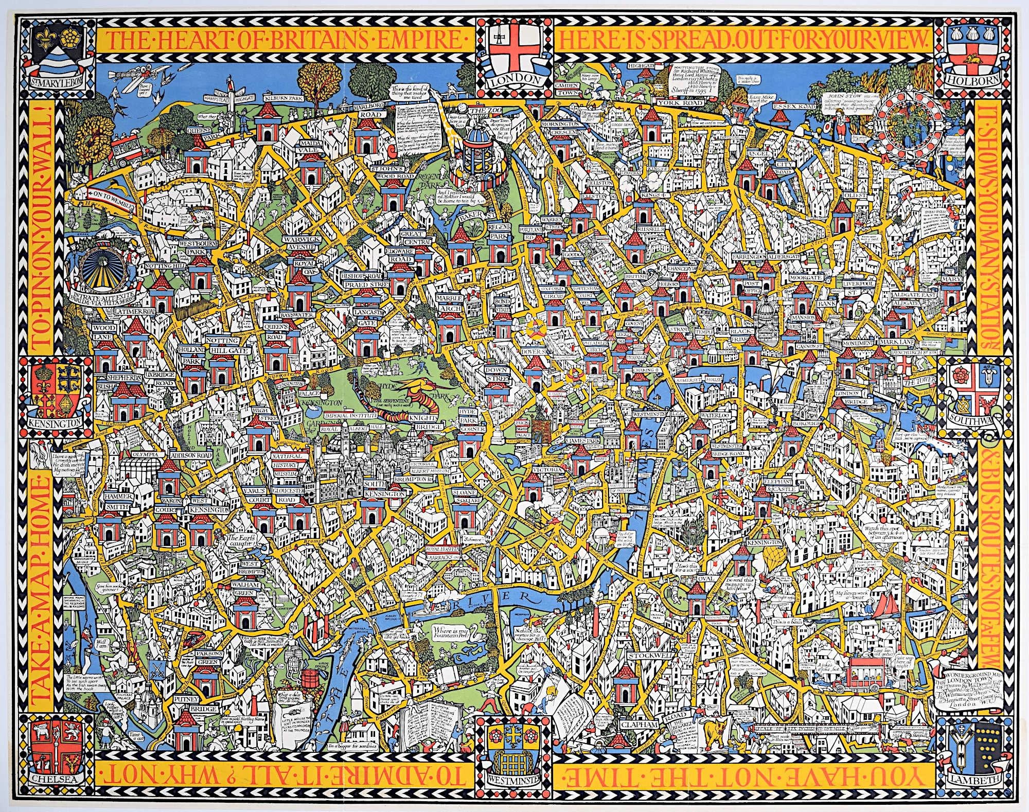
Wonderground Map of London by MacDonald
Max
Gill c. 1924 original poster
By "Leslie MacDonald ""Max"" Gill"
Located in London, GB
To see our other original vintage posters and views of London (including original paintings), scroll down to "More from this Seller" and below it click on "See all from this Seller" ...
Category
1920s Modern Landscape Prints
Materials
Lithograph
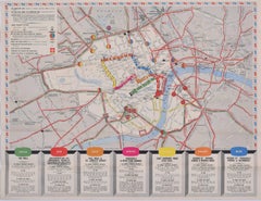
1937 Coronation Map for London Transport
Located in London, GB
To see more, scroll down to "More from this Seller" and below it click on "See all from this Seller."
Coronation Arrangements – Map of London (1...
Category
1950s Landscape Prints
Materials
Lithograph
James Hart Festival of Britain 1951 London Transport map poster UK Mid Century
By James Hart
Located in London, GB
To see our other views of London, scroll down to "More from this Seller" and below it click on "See all from this seller" - or send us a message if you cannot find the view you want....
Category
1950s Realist More Prints
Materials
Lithograph
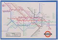
Harry Beck, September 1937 No 1 London Underground Pocket Map
By Harry Beck
Located in London, GB
To see our other original vintage travel posters including more London Transport posters, scroll down to "More from this Seller" and below it click on "See all from this Seller" - or...
Category
1930s Modern More Prints
Materials
Lithograph
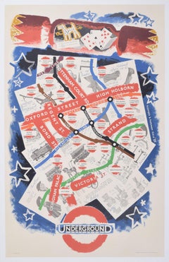
London Underground Map of London Christmas poster by Clifford and Rosemary Ellis
By Clifford
Rosemary Ellis
Located in London, GB
To see our other original vintage travel posters including more pre-war London Transport posters, scroll down to "More from this Seller" and below it click on "See all from this Seller" - or send us a message if you cannot find the poster you want.
Clifford and Rosemary Ellis
London Underground Map
Original vintage poster
103 x 64 cm
Signed in the plate 'Clifford & Rosemary Ellis '35"
Printed by Waterlow & Sons Ltd for London Transport.
This marvellous original vintage poster was designed for London Transport and encourages shoppers to use the Tube to do their Christmas shopping. The map of London's streets of shops, including Oxford Street, Regent Street, and Bond Street, are set on the background of a Christmas shopping list and various items to be purchased. The cross-section of a Christmas cracker...
Category
1930s Modern More Prints
Materials
Lithograph
You May Also Like
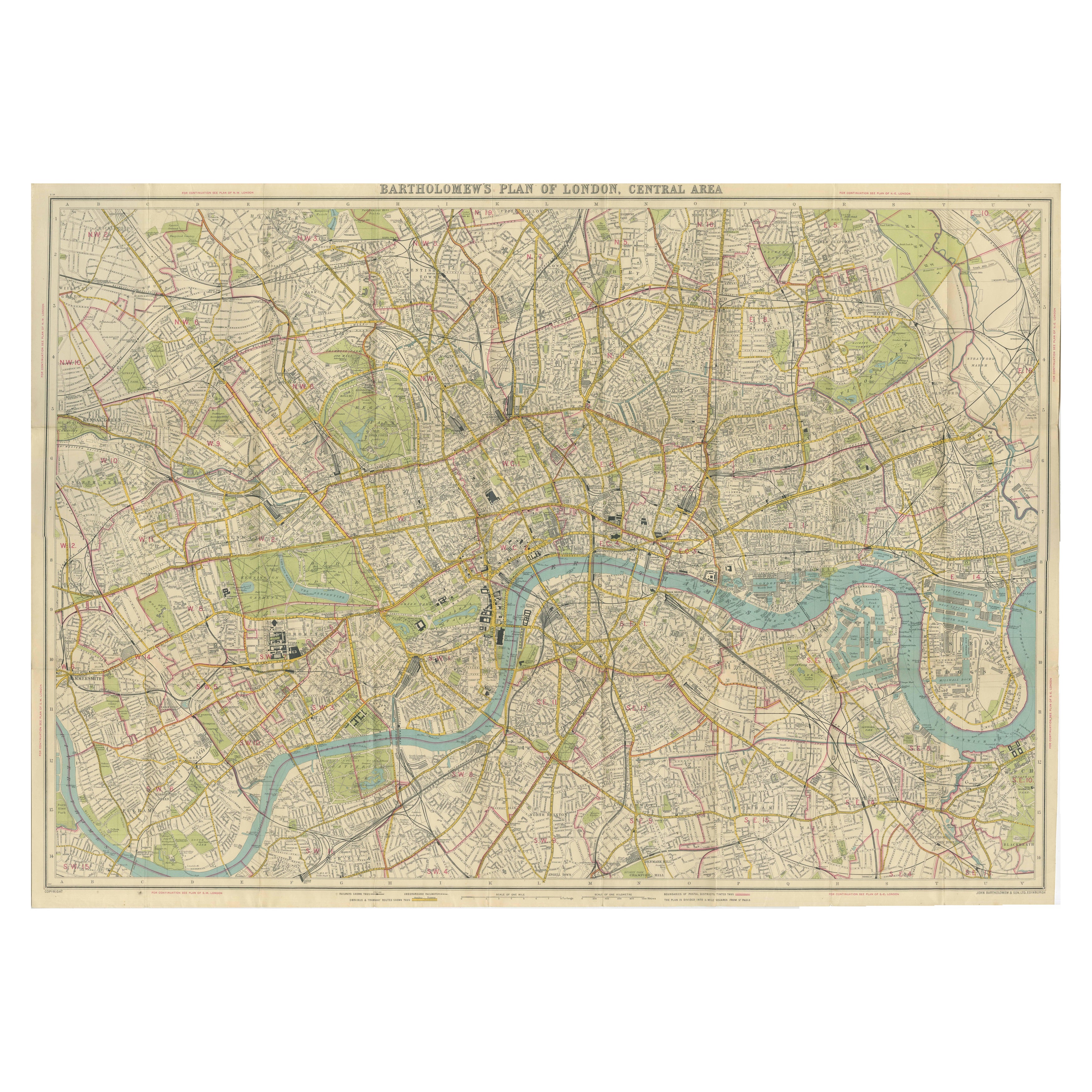
Vintage Map of London – Bartholomew’s Plan of Central London, c.1929
Located in Langweer, NL
London Central Map c.1929 – Bartholomew Antique City Plan
This detailed city plan, titled “Bartholomew’s Plan of London, Central Area,” was published by John Bartholomew & Son, Edin...
Category
Early 20th Century Scottish Maps
Materials
Paper
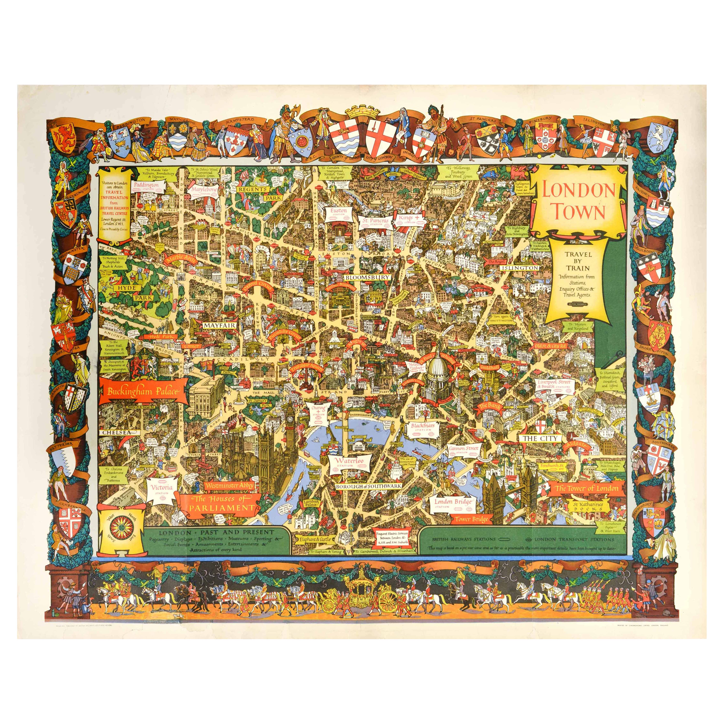
Original Vintage Travel By Train London Town Pictorial Map Poster Kerry Lee
By Kerry Lee
Located in London, GB
Original vintage Travel By Train map poster for London Town by the British artist, illustrator and poster designer Kerry Lee (1902-1988) featuring a detailed...
Category
Vintage 1950s British Posters
Materials
Paper
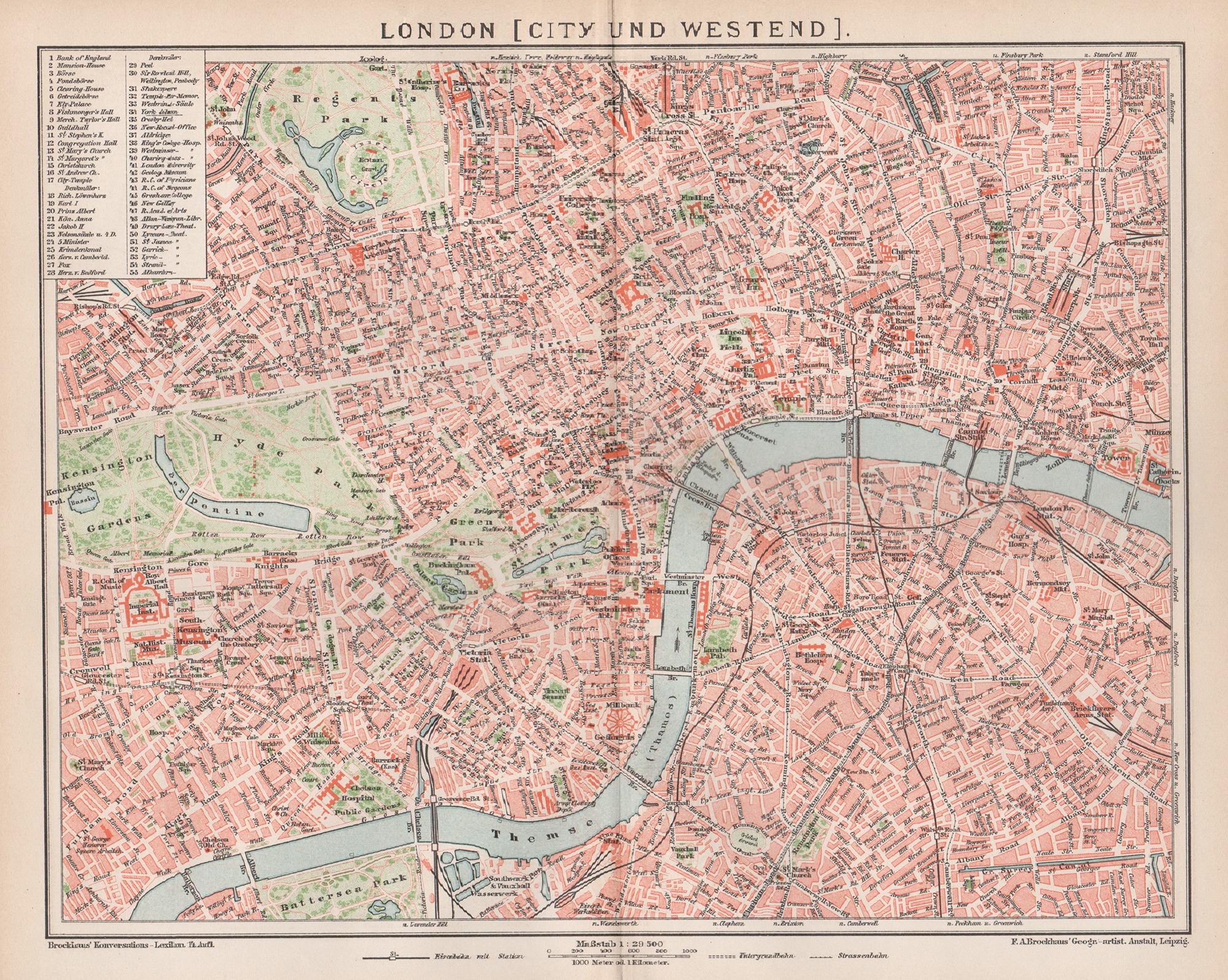
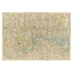
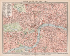
London, City and West End. Antique Map City Plan Chromolithograph, circa 1895
Located in Melbourne, Victoria
'London (City Und Westend)'
Colour lithograph. 1895.
250mm by 305mm (sheet).
Late 19th century German lithograph plan of London, City and West End.
Central vertical fold.
Category
Late 19th Century Victorian More Prints
Materials
Lithograph
Original Vintage Poster London Town Pictorial Map Southern Railway Underground
By Kerry Lee
Located in London, GB
Original vintage Travel By Train map poster for London Town by the British artist, illustrator and poster designer Kerry Lee (1902-1988) featuring a detailed...
Category
Vintage 1930s British Posters
Materials
Paper
Vintage Map of London – Phillips’ Tape Indicator Map of Central London, c.1930
Located in Langweer, NL
Phillips Tape Indicator Map of London c.1930 – Antique City Plan
This large and detailed map of central London is titled “Phillips’ Tape Indicator Map of London.” It was published b...
Category
Early 20th Century Scottish Maps
Materials
Paper
Antique Map of London by Thomas Moule and William Schmollinger
Located in Rochester, NY
Decorative engraved map of London by William Schmollinger for Moule's English County maps. Hand colored. Circa 1830's.
Category
Antique Early 19th Century English Prints
Materials
Paper
More Ways To Browse
Royal Prince
Map Of London
King George Vi
Princess Elizabeth
London Map Art Print
Vintage Mountain Posters
Zuniga Artist
Alex Katz Blue
Alex Katz Dancer
Alvar Sunol Munoz Ramos
Antique Currier Ives Prints
Batik Kate
British Airways Boac
Chicago Poster
Erte Signed Print
Fish Etching
Framed Block Print
Grace Jones Warhol