Objekte ähnlich wie Antique Map of the Peloponnese – Peloponnesus, Morea, by Cluver, ca.1697

Möchten Sie mehr Bilder oder Videos?
Zusätzliche Bilder oder Videos von dem*der Anbieter*in anfordern
1 von 9
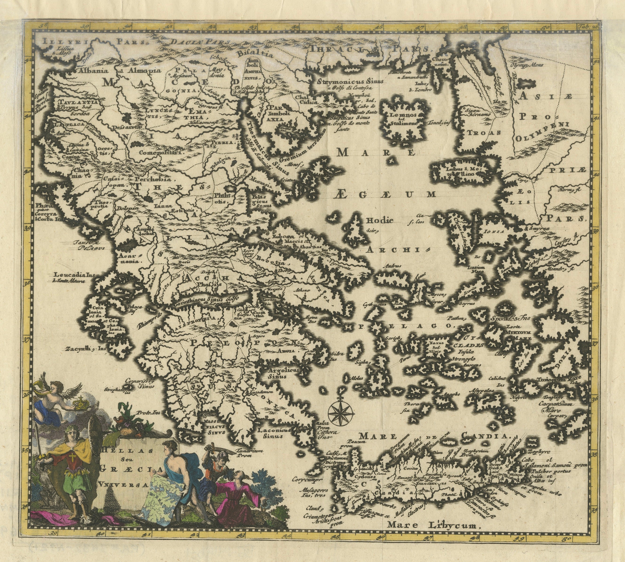
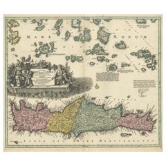
Antique Map of the Peloponnese – Peloponnesus, Morea, by Cluver, ca.1697
470 €Einschließlich MwSt.
Angaben zum Objekt
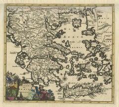
Hellas seu Graecia Universa is a finely detailed late-17th-century map of Greece and the Aegean world, issued by Philipp Cluver around 1697 (possibly 1694). The map was published in Introductio in Universam Geographiam, Cluver’s influential geographical handbook that shaped European understanding of classical and contemporary geography for more than a century.
The map presents a comprehensive view of the Greek mainland, the Peloponnese, Crete (Candia), and the densely articulated island world of the Aegean Sea. Ancient regional names—such as Thessalia, Macedonia, Epirus, Achaia, and Laconia—are prominently shown, reflecting Cluver’s pioneering approach of combining classical sources with modern geographic knowledge. This synthesis made his work particularly valued by scholars of antiquity, historians, and educated collectors throughout Europe.
Cartographically, the engraving is rich and precise, with deeply indented coastlines, clearly engraved mountain ranges, and an intricate hydrographic network. The Aegean archipelago is rendered with exceptional density, giving the map strong visual rhythm and decorative appeal. A compass rose provides orientation, while the allegorical title cartouche—populated by classical figures—reinforces the learned, humanist character of the work and anchors it firmly within the intellectual traditions of the Dutch Golden Age of cartography.
This example is attractively hand colored, adding warmth and depth to the engraved lines without obscuring detail. Issued in numerous editions across major European publishing centers such as Amsterdam, Nuremberg, and London, Cluver’s Introductio became one of the most widely disseminated geographic works of the 17th century, and maps such as this were central to its success.
Today, Hellas seu Graecia Universa is appreciated both as a scholarly map of classical Greece and as a highly decorative wall piece. It appeals equally to collectors of antique maps, classicists, and interior designers seeking an image that conveys learning, history, and visual complexity.
Condition report: Generally good for a 17th-century engraving. Light age toning and minor handling wear, consistent with age. Plate mark visible.
Framing tips: A dark walnut or ebonized frame with a warm ivory or parchment mat emphasizes the engraving and hand color; alternatively, an antique gold frame with a narrow profile enhances the classical character of the cartouche.
Technique: Copper engraving with hand color
Maker: Philipp Cluver, published in Europe, ca. 1697
- Maße:Höhe: 22,5 cm (8,86 in)Breite: 27,3 cm (10,75 in)Tiefe: 0,2 mm (0,01 in)
- Materialien und Methoden:Papier,Graviert
- Herkunftsort:
- Zeitalter:Spätes 17. Jahrhundert
- Herstellungsjahr:circa 1697
- Zustand:Condition report: Generally good for a 17th-century engraving. Light age toning and minor handling wear, consistent with age. Plate mark visible.
- Anbieterstandort:Langweer, NL
- Referenznummer:Anbieter*in: BG-14196-21stDibs: LU3054348065792
Anbieterinformationen
5,0
Anerkannte Anbieter*innen
Diese renommierten Anbieter*innen sind führend in der Branche und repräsentieren die höchste Klasse in Sachen Qualität und Design.
Platin-Anbieter*in
Premium-Anbieter*innen mit einer Bewertung über 4,7 und 24 Stunden Reaktionszeit
Gründungsjahr 2009
1stDibs-Anbieter*in seit 2017
2.811 Verkäufe auf 1stDibs
Typische Antwortzeit: 1 Stunde
- VersandAngebot wird abgerufen …Versand von: Langweer, Niederlande
- Rückgabebedingungen
Einige Inhalte dieser Seite wurden automatisch übersetzt. Daher kann 1stDibs nicht die Richtigkeit der Übersetzungen garantieren. Englisch ist die Standardsprache dieser Website.
Mehr von diesem*dieser Anbieter*in
Alle anzeigenAntique Classical Greece Map – Aegean Sea
Crete, ca.1697
Hellas seu Graecia Universa is a finely detailed late-17th-century map of Greece and the Aegean world, issued by Philipp Cluver around 1697 (possibly 1694). The map was published in ...
Kategorie
Antik, Spätes 17. Jahrhundert, Landkarten
Materialien
Papier
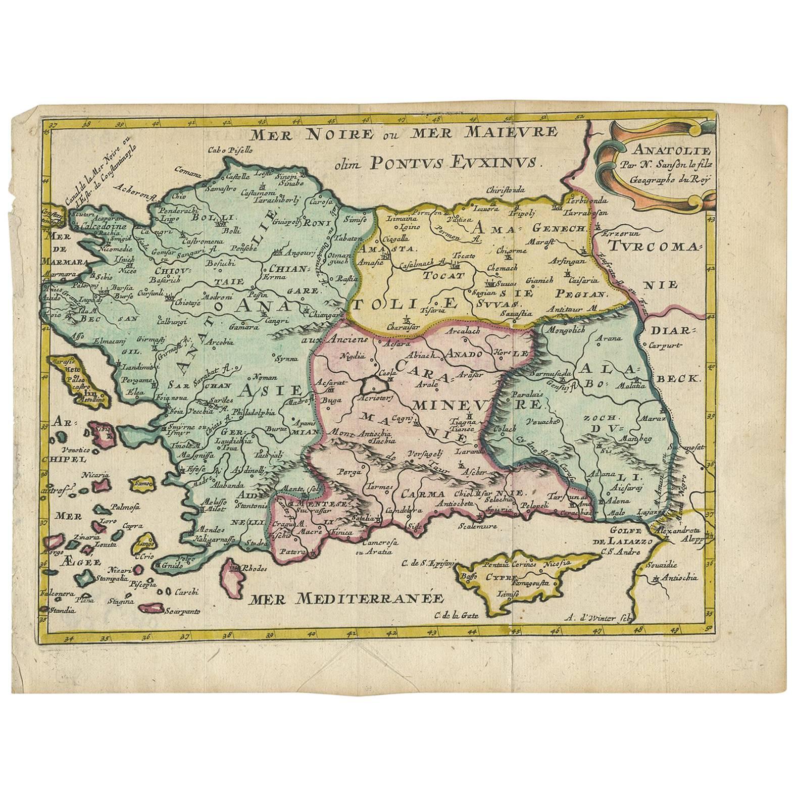
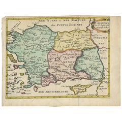
Antike Karte der Türkei mit Zypern und griechischen Inseln von N. Sanson, um 1652
Antike Landkarte der Türkei, Anatolien mit Zypern und den griechischen Inseln. Attraktive verschnörkelte Titelkartusche in der rechten oberen Ecke. Verso leer.
Kategorie
Antik, Mitte 17. Jahrhundert, Landkarten
Materialien
Papier
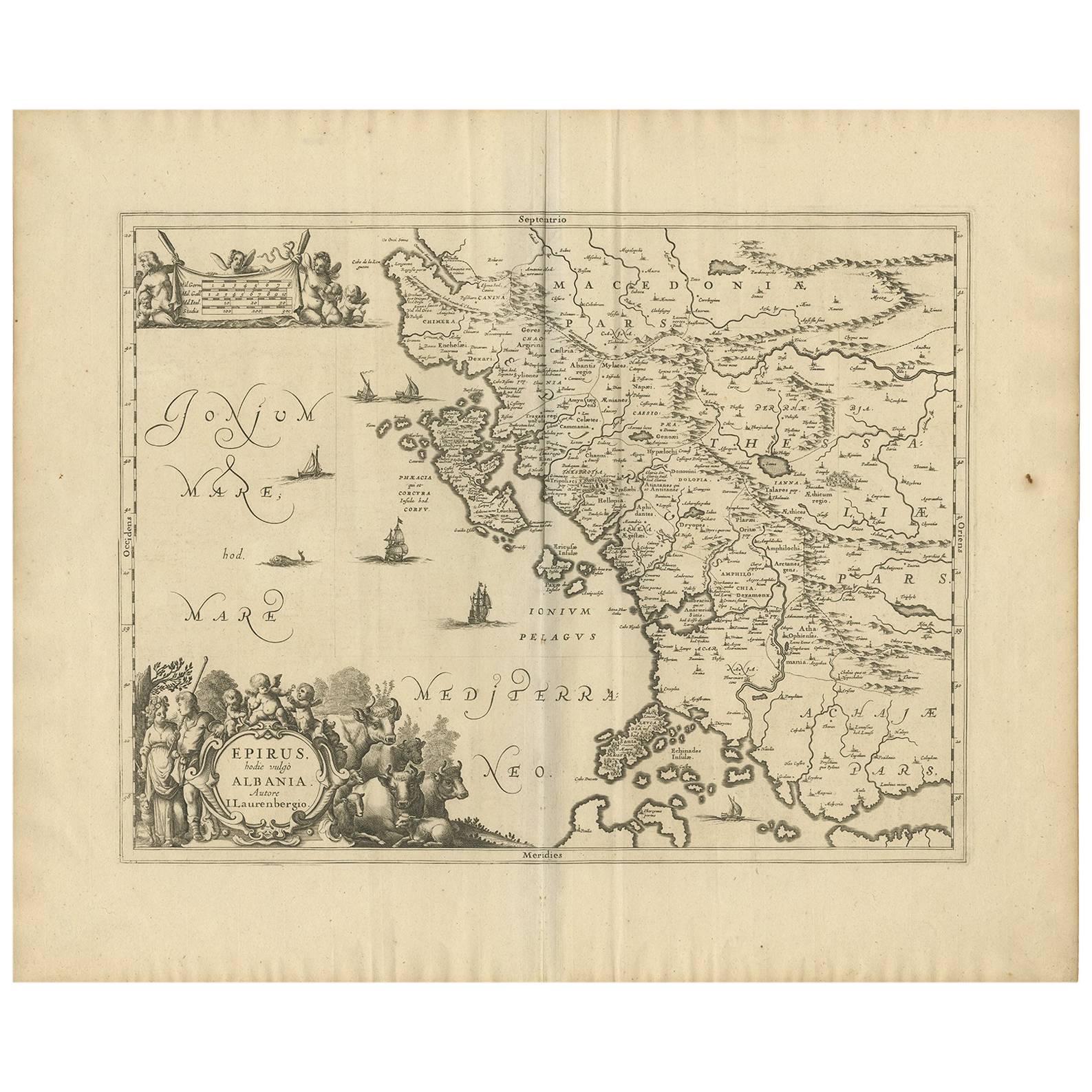
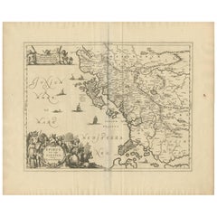
Antike Karte von Epirus „Albania, Griechenland“ von J. Janssonius, um 1650
Diese Karte umfasst die nordwestliche Küste Griechenlands und einen Teil des heutigen Albaniens. Die Karte wurde von Johannes Wilhelm Laurenberg gezeichnet, einem Mathematiker und Hi...
Kategorie
Antik, Mitte 17. Jahrhundert, Landkarten
Materialien
Papier
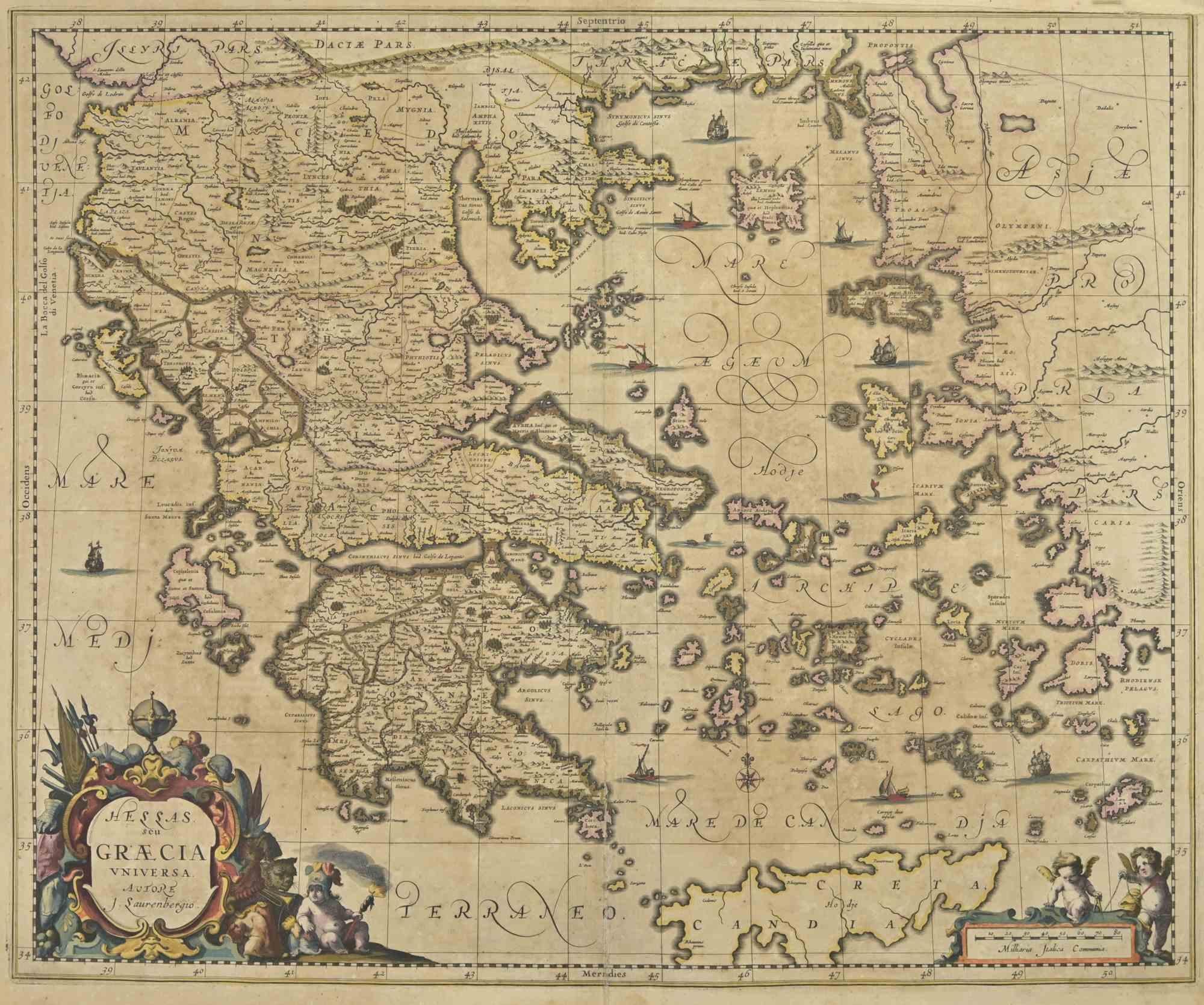
Antike griechische Karte von Allard (ca. 1698)
Antike Karte mit dem Titel 'Hellas seu Graecia Universa' Detaillierte Karte von Griechenland, mit Kreta, den Ägäischen Inseln und einem Teil der Türkei. Mit zwei Kartuschen, Kompassr...
Kategorie
Antik, Spätes 17. Jahrhundert, Landkarten
Materialien
Papier

784 € Verkaufspreis
20 % Rabatt
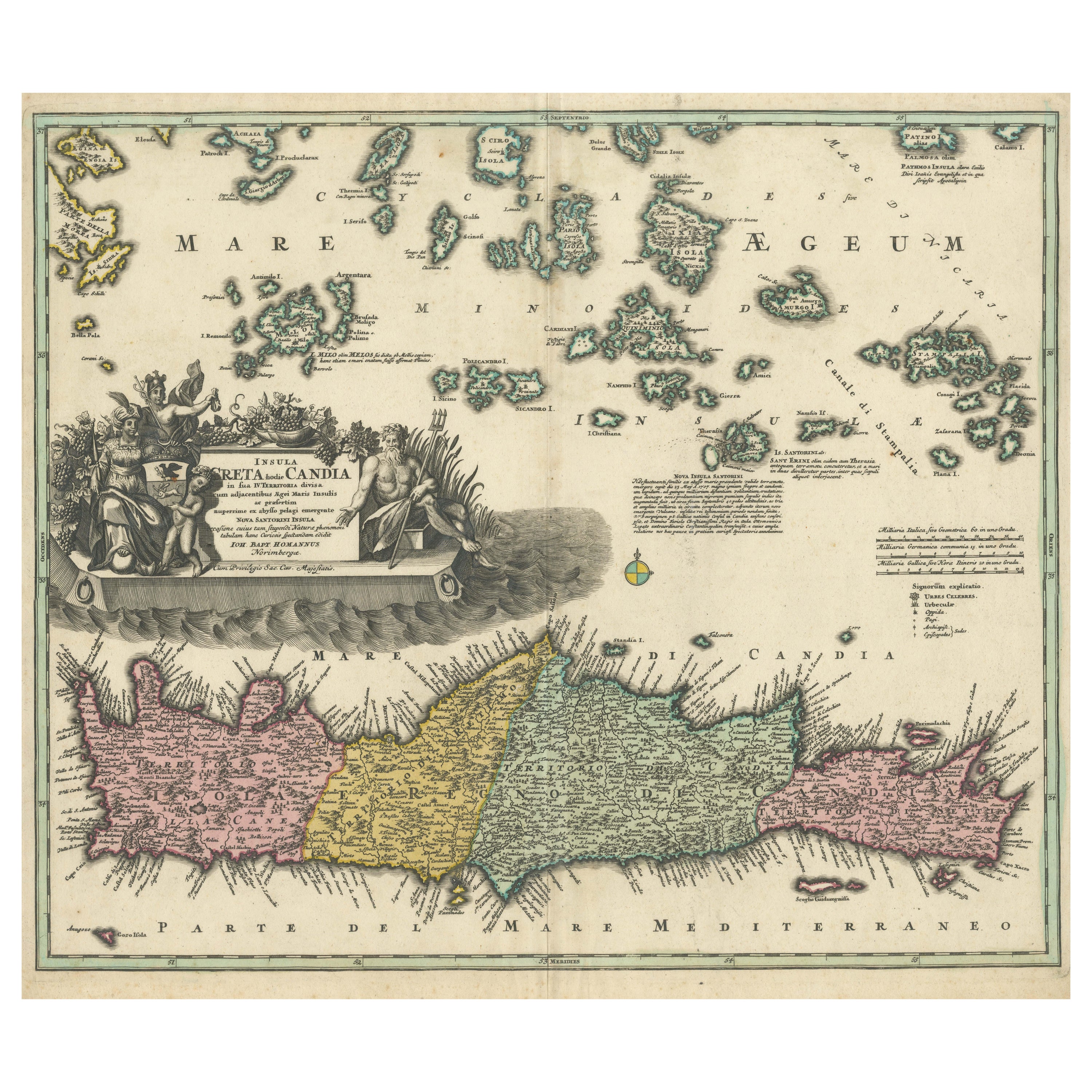
Kreta Karte 1749 - Homann Heirs Kupferstich von Candia mit Ägäischen Inseln
Kreta Karte 1749 - Homann Heirs Kupferstich von Candia mit Ägäischen Inseln
Diese schöne Karte aus dem Jahr 1749 mit dem Titel "Insula Creta hodie Candia" zeigt ein kartografisches ...
Kategorie
Antik, 1740er, Deutsch, Landkarten
Materialien
Papier
Antike Karte Süditalien von Janssonius, um 1650
"Antike Karte mit dem Titel 'Itala nam tellus Graecia Maior erat Ovid. IV. Fastor. Haec Italiae pars nunc primum de prica aerugine est abstersa (...)". Schöne Karte von Süditalien, v...
Kategorie
Antik, 17. Jahrhundert, Landkarten
Materialien
Papier

592 € Verkaufspreis
20 % Rabatt
Das könnte Ihnen auch gefallen
Antike Karte - Karte von Griechenland - Radierung von Johannes Janssonius - 1650s
Von Johannes Janssonius
Antike Karte von Griechenland - Graecia Vniversa ist eine antike Karte aus dem Jahr 1650 von Johannes Janssonius (1588-1664).
Die Karte ist eine handkolorierte Radierung mit Coeval...
Kategorie
1650er, Moderne, Figurative Drucke
Materialien
Radierung

Südgriechisches Griechenland: Eine große handkolorierte Karte des 17. Jahrhunderts von Sanson und Jaillot
Von Nicholas Sanson d
Abbeville
Diese große original handkolorierte Kupferstichkarte von Südgriechenland und der Halbinsel Peloponnes mit dem Titel "La Moree Et Les Isles De Zante, Cefalonie, Ste. Marie, Cerigo & C...
Kategorie
1690er, Landschaftsdrucke
Materialien
Gravur

Karte Griechenlands – Original-Radierung von Antonio Zatta – 18. Jahrhundert
Diese Karte von Griechenland ist eine Radierung von Antonio Zatta, Kartograph, Verleger und Typograph.
Der Erhaltungszustand des Kunstwerks ist bis auf das abgenutzte Papier gut und...
Kategorie
1780er, Figurative Drucke
Materialien
Radierung

Antike Karte – Mazedonien – Radierung von Johannes Janssonius – 1650er Jahre
Von Johannes Janssonius
Makedonien ist eine antike Karte, die 1650 von Johannes Janssonius (1588-1664) erstellt wurde.
Die Karte ist eine handkolorierte Radierung mit Coeval-Aquarellierung.
Guter Zustand ...
Kategorie
1650er, Moderne, Figurative Drucke
Materialien
Radierung

Antike Karte – Mar Di Athiopia – Radierung von Johannes Janssonius – 1650er Jahre
Von Johannes Janssonius
Antike Landkarte - Mar Di Athiopia ist eine antike Landkarte aus dem Jahre 1650 von Johannes Janssonius (1588-1664).
Die Karte ist handkolorierte Radierung, mit Coeval Aquarellang.
...
Kategorie
1650er, Moderne, Figurative Drucke
Materialien
Radierung

Southern Greece: Eine große handkolorierte Karte aus dem 17. Jahrhundert von Sanson und Jaillot
Von Nicolas Sanson
Diese große original handkolorierte Kupferstichkarte von Südgriechenland und der Halbinsel Peloponnes mit dem Titel "La Moree Et Les Isles De Zante, Cefalonie, Ste. Marie, Cerigo & C...
Kategorie
Antik, 1690er, Französisch, Landkarten
Materialien
Papier

1.367 € Verkaufspreis
20 % Rabatt