Objekte ähnlich wie Egypt
Arabia Petraea – Large Nile Map, British Cartography, c.1815


Möchten Sie mehr Bilder oder Videos?
Zusätzliche Bilder oder Videos von dem*der Anbieter*in anfordern
1 von 10
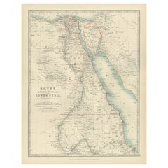
Egypt
Arabia Petraea – Large Nile Map, British Cartography, c.1815
840 €Einschließlich MwSt.
Angaben zum Objekt
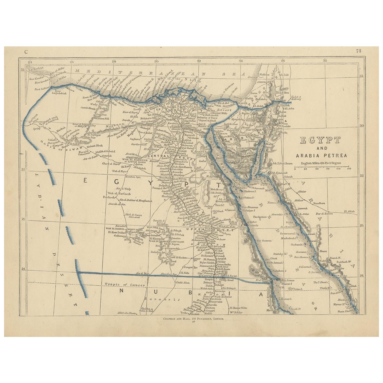
Egypt
Arabia Petraea – Large Nile Map, British Cartography, c.1815
This impressive early 19th-century map depicts Egypt and Arabia Petraea with exceptional detail, extending from the Mediterranean Sea and the Nile Delta southward through Upper Egypt and Nubia, and eastward across the Red Sea to the Arabian Peninsula. Titled “Egypt and Arabia Petraea,” the map reflects the heightened European scholarly and strategic interest in Egypt during the years surrounding the Napoleonic campaigns and the subsequent rise of modern scientific cartography.
The Nile dominates the composition as the central geographic and cultural axis of Egypt. Its full course is meticulously traced, with branches, cataracts, settlements, ancient sites, desert routes, and regional divisions carefully engraved. The surrounding deserts, mountain ranges, and caravan paths are rendered with restraint, emphasizing the river’s singular role in sustaining civilization. To the east, Arabia Petraea and the Red Sea coastline provide essential context for ancient and early modern trade routes linking Africa, the Levant, and the Indian Ocean world.
The map belongs to the British cartographic tradition associated with the Arrowsmith circle and related London publishers, known for their emphasis on empirical accuracy, clarity, and large-scale presentation. The engraving is precise and refined, with dense but highly legible geographical information. Subtle outline color is used sparingly to distinguish coastlines and regional boundaries without disturbing the map’s calm, scholarly aesthetic.
Visually, this is a powerful wall map. Its tall vertical format, generous margins, and restrained monochrome palette give it an architectural presence that works exceptionally well in both classic and contemporary interiors. It functions equally as a collector-grade document of early modern Egypt and as a sophisticated decorative centerpiece.
This map is particularly appealing to collectors of Egyptology, Nile history, and 19th-century British cartography, as well as interior designers seeking a large, authoritative historic map with strong visual impact.
Condition report
Good condition overall. Central vertical fold as issued. Light age toning consistent with period. Minor scattered spots and faint surface marks. Original outline hand color. Plate mark visible. Margins intact.
Framing tips
This map benefits from a wide off-white or light sand-colored mat to emphasize its scale and vertical flow. A medium to dark wood frame or softly ebonized frame enhances the engraving and gives the piece a refined, museum-style presence. Particularly effective as a stand-alone statement map.
Technique: Copper engraving with contemporary outline hand color
Maker: British school (Johnston), c.1815
- Maße:Höhe: 54,5 cm (21,46 in)Breite: 68 cm (26,78 in)Tiefe: 0,2 mm (0,01 in)
- Materialien und Methoden:Papier,Graviert
- Herkunftsort:
- Zeitalter:
- Herstellungsjahr:circa 1815
- Zustand:Good condition overall. Central vertical fold as issued. Light age toning consistent with period. Minor scattered spots and faint surface marks. Original outline hand color. Plate mark visible. Margins intact.
- Anbieterstandort:Langweer, NL
- Referenznummer:Anbieter*in: BG-14128-131stDibs: LU3054348017552
Anbieterinformationen
5,0
Anerkannte Anbieter*innen
Diese renommierten Anbieter*innen sind führend in der Branche und repräsentieren die höchste Klasse in Sachen Qualität und Design.
Platin-Anbieter*in
Premium-Anbieter*innen mit einer Bewertung über 4,7 und 24 Stunden Reaktionszeit
Gründungsjahr 2009
1stDibs-Anbieter*in seit 2017
2.813 Verkäufe auf 1stDibs
Typische Antwortzeit: 1 Stunde
- VersandAngebot wird abgerufen …Versand von: Langweer, Niederlande
- Rückgabebedingungen
Einige Inhalte dieser Seite wurden automatisch übersetzt. Daher kann 1stDibs nicht die Richtigkeit der Übersetzungen garantieren. Englisch ist die Standardsprache dieser Website.
Mehr von diesem*dieser Anbieter*in
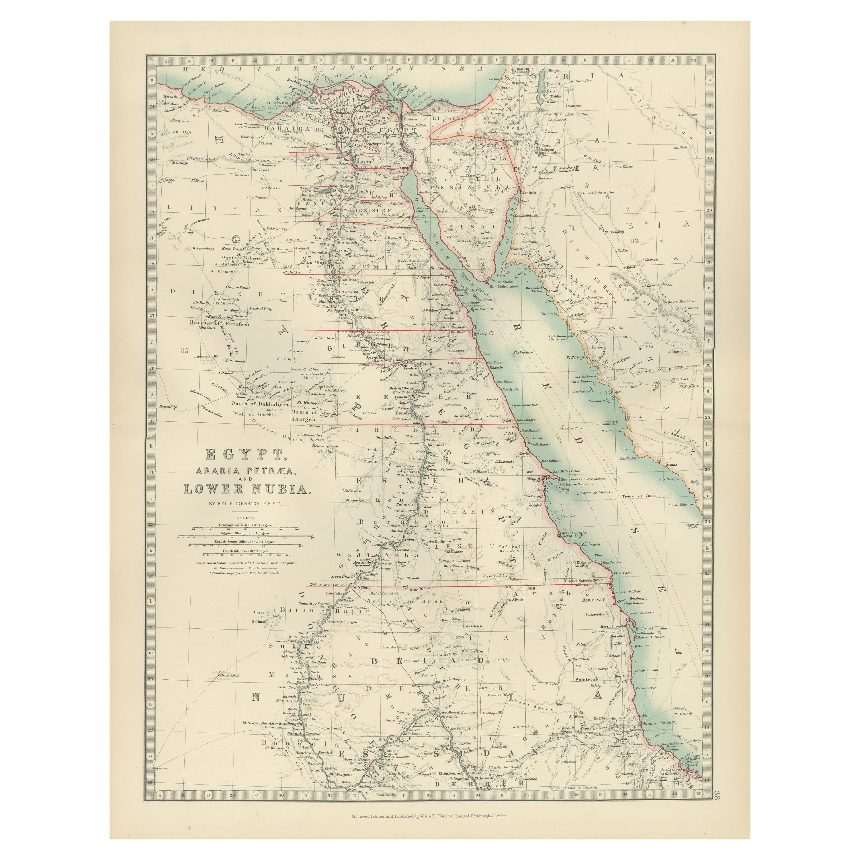
Alle anzeigenAntike Ägyptische Karte von Ägypten, Arabia Petraea und Lower Nubia von Johnston
1909
Antike Karte mit dem Titel 'Ägypten, Arabia Petraea und Niedernubien'. Original antike Karte von Ägypten, Arabia Petraea und Nieder-Nubien. Mit beigefügten Karten von Alexandria, Kai...
Kategorie
Frühes 20. Jahrhundert, Landkarten
Materialien
Papier

188 € Verkaufspreis
24 % Rabatt
Antike antike Karte des antiken Ägyptens mit auch der Darstellung des Nile-Fluss und des Roten Meeres, 1845
Antike Karte Ägypten mit dem Titel 'General Karte von Alt Aegypten von A.H. Brué'. Große Karte von Ägypten, auf der auch der Nil und das Rote Meer eingezeichnet sind. Quelle unbekann...
Kategorie
Antik, 19. Jahrhundert, Landkarten
Materialien
Papier

Antike antike Karte von Ägypten und Arabia Petraea von Lowry,
1852
Antike Karte mit dem Titel 'Ägypten und Arabien Petrea'. Original-Karte von Ägypten und Arabia Petraea. Diese Karte stammt aus "Lowry's Table Atlas constructed and engraved from the ...
Kategorie
Antik, Mittleres 19. Jahrhundert, Landkarten
Materialien
Papier
80 € Verkaufspreis
20 % Rabatt
Antike antike Karte von Ägypten und Ägypten Petraea von A
C. Black, 1870
Antike Karte mit dem Titel 'Ägypten und Arabia Petraea'. Original antike Karte von Ägypten und Arabia Petraea. Diese Karte stammt aus dem "Black's General Atlas of The World". Heraus...
Kategorie
Antik, Spätes 19. Jahrhundert, Landkarten
Materialien
Papier

122 € Verkaufspreis
30 % Rabatt
Ägypten und Niedernubien, 1903 - Historische Karte mit Nil und Rotem Meer
Ägypten und Niedernubien, 1903 - Historische Karte mit Nil und Rotem Meer
Diese wunderschön detaillierte Karte mit dem Titel "Egypt, Arabia Petraea, and Lower Nubia" wurde gestochen...
Kategorie
Frühes 20. Jahrhundert, Landkarten
Materialien
Papier
Ägypten
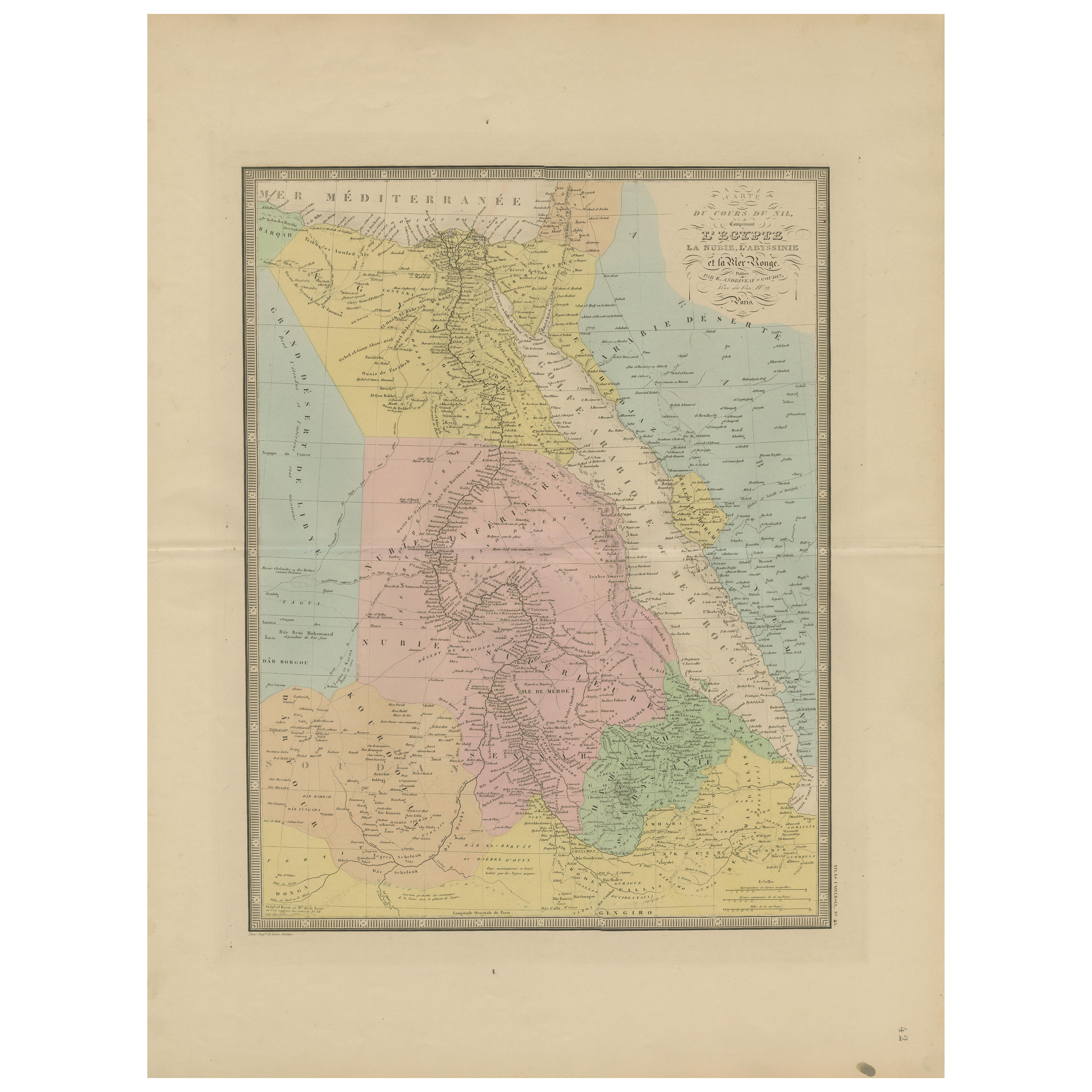
Rotes Meer Antike Karte - Detaillierte 1865 Karte von Nubien und Nil Regionen
Antike Karte von Ägypten, Nubien und der Küste des Roten Meeres - Andriveau-Goujon, Paris 1865
Diese zart kolorierte antike Karte mit dem Titel *Partie du Cours du Nil comprenant l'...
Kategorie
Antik, Mittleres 19. Jahrhundert, Französisch, Landkarten
Materialien
Papier
Das könnte Ihnen auch gefallen
Map des Heiligen Landes „Carte de la Syrie et de l
Egypte“ von Pierre Lapie
Von Pierre M. Lapie
Dies ist eine Karte des antiken Syriens und Ägyptens aus dem frühen 19. Jahrhundert mit dem Titel "Carte de la Syrie et de l'Egypte anciennes/dressée par M. Lapie, Colonel d'Etat Maj...
Kategorie
1830er, Landschaftsdrucke
Materialien
Gravur

536 € Verkaufspreis
20 % Rabatt
Map of the Holy Land „Carte de la Syrie et de l
Egypte“ von Pierre M. Lapie
Von Pierre M. Lapie
Eine Karte des antiken Syriens und Ägyptens aus dem frühen 19. Jahrhundert mit dem Titel "Carte de la Syrie et de l'Egypte anciennes/dressée par M. Lapie, Colonel d'Etat Major, et M....
Kategorie
Antik, Frühes 19. Jahrhundert, Französisch, Landkarten
Materialien
Papier

536 € Verkaufspreis
20 % Rabatt
Große Original Vintage Karte von Ägypten, um 1920
Große Karte von Ägypten
Ungerahmt
Original Farbe
Von John Bartholomew und Co. Geographisches Institut Edinburgh
Veröffentlicht, ca. 1920
Kostenloser Versand.
Kategorie
Vintage, 1920er, Britisch, Landkarten
Materialien
Papier

Afrika. Nord-Ost-Teil. Antike Atlas-Vintage-Karte
Der Jahrhundertatlas. Afrika. Nordöstlicher Teil
Originale antike Karte, 1903.
Inspektionskarte "Nildelta und Suezkanal".
Zentrale Falte wie ausgestellt. Name und Nummer der Karte ...
Kategorie
Frühes 20. Jahrhundert, Viktorianisch, Mehr Drucke
Materialien
Lithografie

Campagne d
Egypte - Radierung von Pierre François Tardieu - 1837
Campagne d'Egypte ist eine Radierung von Pierre François Tardieu aus dem Jahr 1837.
Gute Bedingungen.
Das Kunstwerk ist in einer ausgewogenen Komposition realisiert. Das Kunstwerk ...
Kategorie
1830er, Moderne, Figurative Drucke
Materialien
Lithografie
Karte von Nubia und Abissinia – Original-Radierung von Antonio Zatta – 1784
Diese Karte von Nubien und Abissinien ist eine Radierung von Antonio Zatta aus dem Jahr 1784 in Venedig.
Der Erhaltungszustand des Kunstwerks ist gut, abgesehen von dem abgenutzten ...
Kategorie
1770er, Landschaftsdrucke
Materialien
Radierung
