Objekte ähnlich wie Ireland Antique Map – Royaume d’Irlande, De Vaugondy, Venice 1778


Möchten Sie mehr Bilder oder Videos?
Zusätzliche Bilder oder Videos von dem*der Anbieter*in anfordern
1 von 11
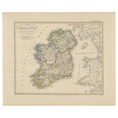
Ireland Antique Map – Royaume d’Irlande, De Vaugondy, Venice 1778
640 €Einschließlich MwSt.
Angaben zum Objekt
Antique Map of Ireland – Royaume d’Irlande, Robert de Vaugondy, Venice 1778
Description:
This finely engraved 18th-century map depicts the Kingdom of Ireland under the title Royaume d’Irlande divisé en ses quatre Provinces et subdivisé en Comtés. The island is shown in impressive detail, with the traditional four provinces—Ulster, Connaught, Leinster, and Munster—clearly delineated and subdivided into counties by contemporary outline coloring. Coastal features, rivers, towns, and road networks are rendered with the clarity and balance typical of late Enlightenment French cartography.
The map was drawn by Robert de Vaugondy, one of the most influential mapmakers of the 18th century and royal geographer to the King of France. This Venetian edition was published in 1778 by Paolo Santini, who issued a number of high-quality Italian editions of leading French cartographic works. Santini’s publications are prized for their crisp engraving, generous format, and restrained coloring, making them particularly attractive for framing.
The decorative maritime cartouche, left uncolored as issued, provides a refined visual counterbalance to the densely engraved map surface. Longitude and latitude scales frame the composition, while inset coastal details along the eastern seaboard emphasize Ireland’s maritime orientation and strategic importance during the Georgian period. The overall aesthetic is elegant rather than ornate, lending the map strong decorative appeal for both classic and contemporary interiors.
This map sits at the intersection of political geography and decorative cartography, reflecting Ireland’s administrative structure in the late 18th century while remaining visually calm and highly legible. It works exceptionally well as a stand-alone wall piece in libraries, studies, hallways, or heritage-inspired interiors, and also pairs beautifully with maps of England or Scotland from the same period.
Condition report:
Good antique condition. Light, even age toning throughout. Original centerfold as issued. Minor handling wear and soft creases consistent with age. Contemporary outline coloring well preserved. No major tears or losses.
Framing tips:
This map benefits from a wide mat to emphasize its scale and clarity. Recommended combinations include a dark walnut or ebonized frame with an ivory or light parchment mat for a traditional library look, or a slim black frame with an off-white mat for a cleaner, architectural presentation. UV glass is advised to preserve the original coloring.
Technique: Copper engraving with contemporary outline coloring
Maker: Robert de Vaugondy, published by Paolo Santini, Venice, 1778
Keywords:
antique map of Ireland, antique Ireland map, Royaume d’Irlande map, Robert de Vaugondy Ireland, Santini Venice map, 18th century Ireland map, hand colored antique map, Georgian era cartography, historic Ireland wall map, European antique map, French cartographic school, Italian engraved map, copper engraved map, decorative antique map, neutral antique wall art, classic library wall decor, historic wall decor, heritage interior art, gentleman’s library wall art, study wall decor, old world interior decor, English country house style, refined wall map, vintage European wall art, timeless wall decor, architectural interior art, framed antique map, collector wall map, understated antique decor, European heritage wall art
- Maße:Höhe: 48,5 cm (19,1 in)Breite: 54,5 cm (21,46 in)Tiefe: 0,2 mm (0,01 in)
- Materialien und Methoden:Papier,Graviert
- Herkunftsort:
- Zeitalter:1770–1779
- Herstellungsjahr:1778
- Zustand:Good antique condition. Light, even age toning throughout. Original centerfold as issued. Minor handling wear and soft creases consistent with age. Contemporary outline coloring well preserved. No major tears or losses.
- Anbieterstandort:Langweer, NL
- Referenznummer:Anbieter*in: BG-141541stDibs: LU3054348066062
Anbieterinformationen
5,0
Anerkannte Anbieter*innen
Diese renommierten Anbieter*innen sind führend in der Branche und repräsentieren die höchste Klasse in Sachen Qualität und Design.
Platin-Anbieter*in
Premium-Anbieter*innen mit einer Bewertung über 4,7 und 24 Stunden Reaktionszeit
Gründungsjahr 2009
1stDibs-Anbieter*in seit 2017
2.811 Verkäufe auf 1stDibs
Typische Antwortzeit: 1 Stunde
- VersandAngebot wird abgerufen …Versand von: Langweer, Niederlande
- Rückgabebedingungen
Einige Inhalte dieser Seite wurden automatisch übersetzt. Daher kann 1stDibs nicht die Richtigkeit der Übersetzungen garantieren. Englisch ist die Standardsprache dieser Website.
Mehr von diesem*dieser Anbieter*in
Alle anzeigenMap of Ireland: frühes 19. Jahrhundert – aus dem Tardieu- Atlas von 1802
Antike Karte Beschreibung
**Titel:** Carte d'Irlande
**Details zur Veröffentlichung:**
- **Atlas-Titel:** Nouvel Atlas Universel de Géographie Ancienne et Moderne
- **Zweck:** Für ...
Kategorie
Antik, Anfang 1800, Landkarten
Materialien
Papier

352 € Verkaufspreis
20 % Rabatt
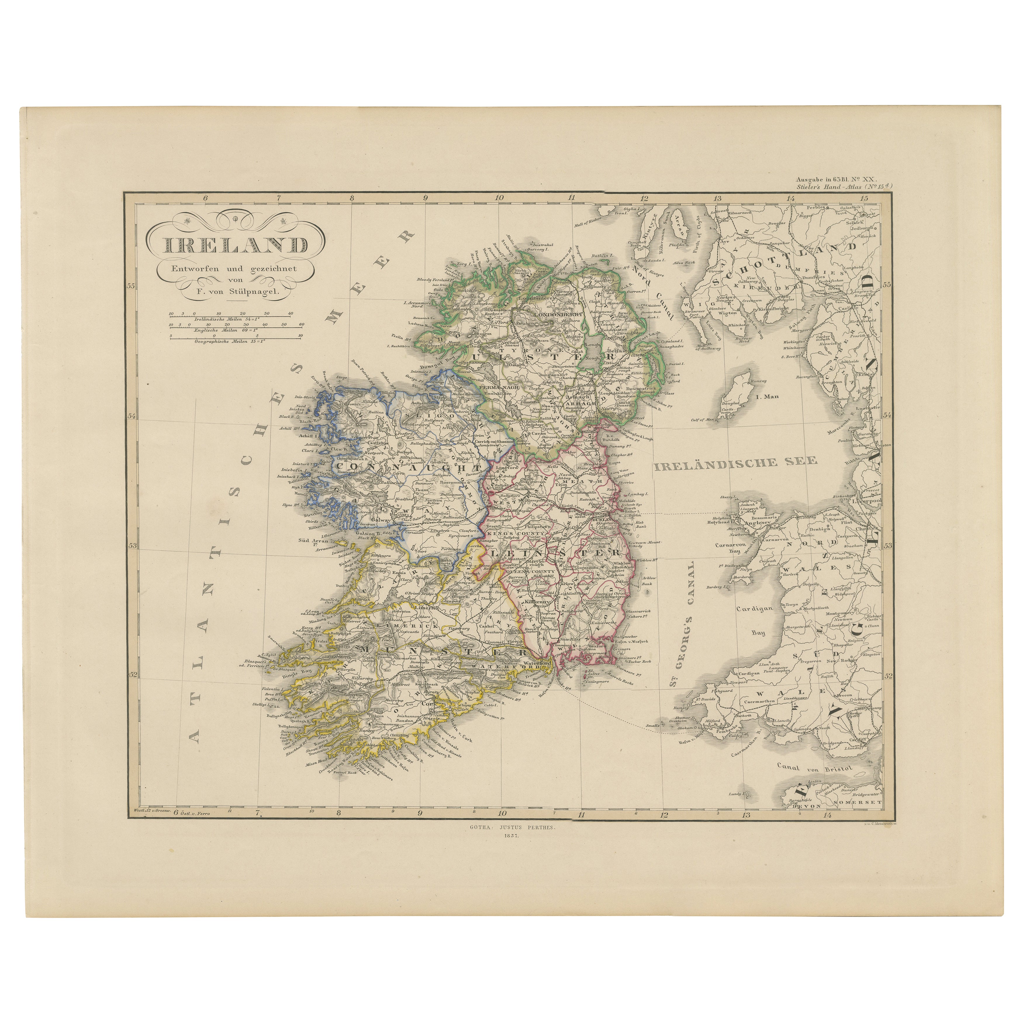
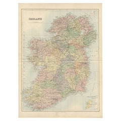
Irland Karte - Provinz- und Grafschaftseinteilung 1851
Irland Karte - Provinz- und Grafschaftseinteilung 1851
Dieser schöne antike Druck zeigt Irland mit dem Titel "Irland", der 1851 von Justus Perthes in Gotha als Teil des renommierten...
Kategorie
Antik, Mittleres 19. Jahrhundert, Deutsch, Landkarten
Materialien
Papier
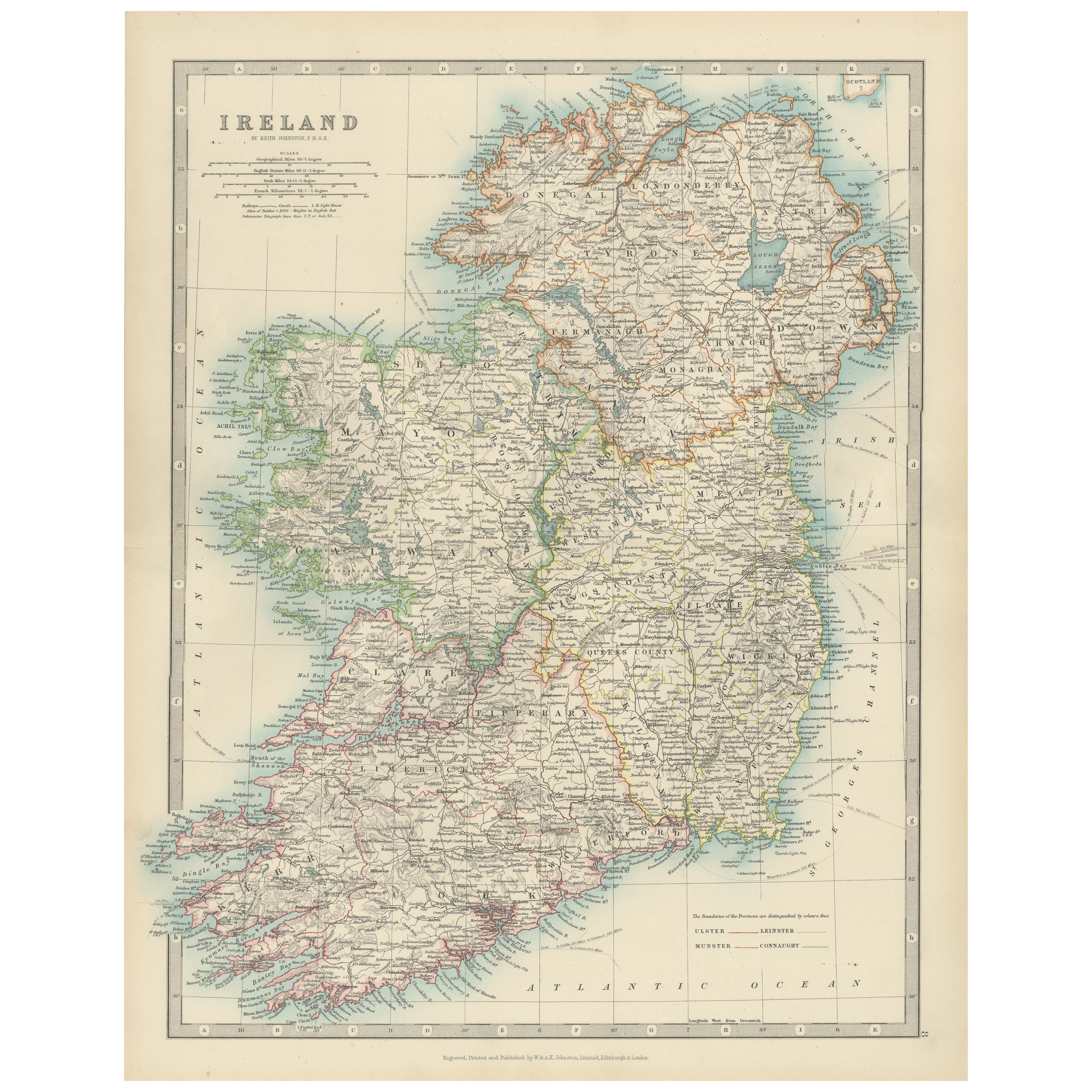
Antike Karte von Irland, 1903, mit komplizierten Grafschaftsgrenzen und Küstendetails
Titel: Antike Karte von Irland, 1903, mit komplizierten Grafschaftsgrenzen und Küstendetails
Beschreibung:
Diese antike Karte von Irland, gestochen und veröffentlicht im Jahr 1903 v...
Kategorie
Frühes 20. Jahrhundert, Landkarten
Materialien
Papier

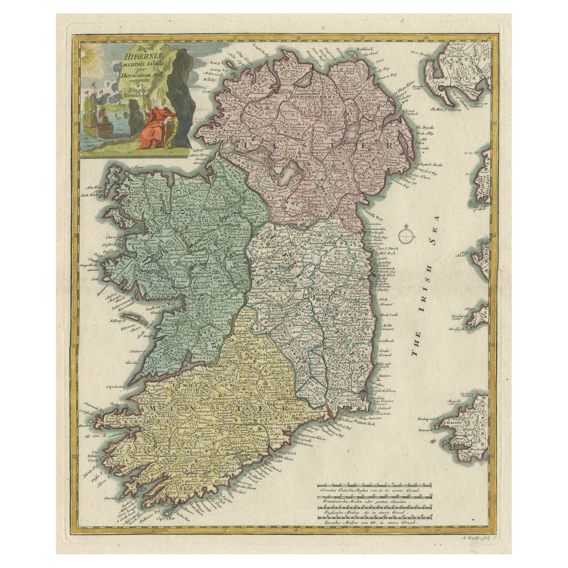
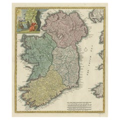
Dekorative handkolorierte antike Karte der vier irischen Provinzen, Irland, um 1718
Titel: Regni Hiberniae Accurata Tabula per Hermanum Moll
Dekorative Karte der vier irischen Provinzen, Irland, 1718, von Christoph Weigel (mit Verweis auf Herman Moll), gestochen v...
Kategorie
Antik, 1710er, Landkarten
Materialien
Papier
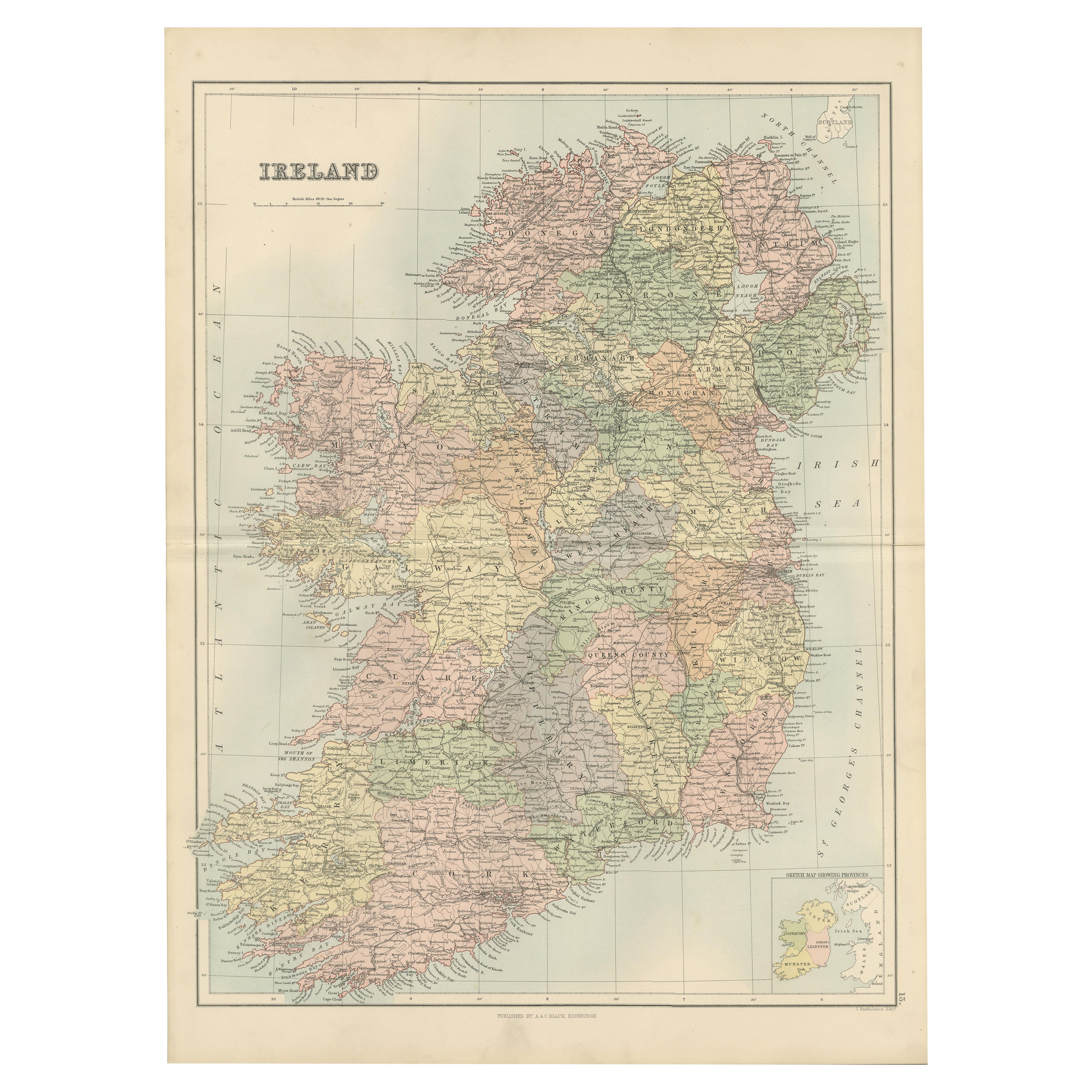
Antike Irlandkarte mit Grafschaftseinteilung - Dekorative Wandkarte, 1884
Antike Karte von Irland mit Grafschaften - Black's Atlas, 1884
Beschreibung:
Diese fein gestochene Karte von Irland wurde in der neuen und überarbeiteten Ausgabe von Black's General...
Kategorie
Antik, 1880er, Schottisch, Landkarten
Materialien
Papier
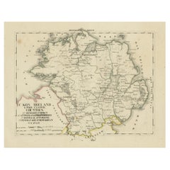
Antike Karte von Ulster, Irland, 1830, mit Armagh, Daunen, Geweih, Donegal, Tyrone
Titel: Antike Karte von Ulster, Irland, 1830 mit Armagh, Down, Antrim, Donegal und Tyrone
Beschreibung: Diese deutschsprachige Karte von 1830 mit dem Titel Britisches Reich - C....
Kategorie
Antik, 1830er, Landkarten
Materialien
Papier
Das könnte Ihnen auch gefallen
Große Original-Antike Original-Karte von Irland. C.1900
Fabelhafte Karte von Irland
Originalfarbe.
Gestochen und gedruckt von der George F. Cram's Company, Indianapolis.
Veröffentlicht, C.1900.
Ungerahmt.
Kostenloser Versand.
Kategorie
Antik, 1890er, amerikanisch, Landkarten
Materialien
Papier

Original Antike Karte von Irland – Kerry. C.1840
Tolle Karte von Kerry
Stahlstich
Gezeichnet unter der Leitung von A. Adlard
Herausgegeben von How and Parsons, C.1840
Ungerahmt.
Kategorie
Antik, 1840er, Englisch, Landkarten
Materialien
Papier

Antike Karte von Irland – Tipperary und Waterford. C.1840
Großartige Karte von Tipperary und Waterford
Stahlstich
Gezeichnet unter der Leitung von A. Adlard
Herausgegeben von How and Parsons, C.1840
Ungerahmt.
Kategorie
Antik, 1840er, Englisch, Landkarten
Materialien
Papier

Südwestirland: Eine handkolorierte Karte aus dem 17. Jahrhundert von Mercator und Hondius
Von Gerard Mercator
Eine handkolorierte Kupferstichkarte aus dem 17. Jahrhundert mit dem Titel "The Second Table of Ireland, Udrone" von Gerard Mercator und Jodocus Hondius, veröffentlicht 1635 in Amste...
Kategorie
Antik, Mitte 17. Jahrhundert, Niederländisch, Landkarten
Materialien
Papier

467 € Verkaufspreis
20 % Rabatt
England, Schottland und Irland: Eine handkolorierte Karte von Großbritannien von Tirion
Von Isaak Tirion
Dies ist eine handkolorierte doppelseitige Kupferstichkarte von Großbritannien mit dem Titel "Nieuwe Kaart van de Eilanden van Groot Britta...
Kategorie
Antik, Mitte des 18. Jahrhunderts, Niederländisch, Landkarten
Materialien
Papier

605 € Verkaufspreis
20 % Rabatt
Südwestirland: Eine handkolorierte Karte aus dem 17. Jahrhundert von Mercator und Hondius
Von Gerard Mercator
Eine handkolorierte Kupferstichkarte aus dem 17. Jahrhundert mit dem Titel "The Second Table of Ireland, Udrone" von Gerard Mercator und Jodocus Hondius, veröffentlicht 1635 in Amste...
Kategorie
1630er, Landschaftsdrucke
Materialien
Gravur

467 € Verkaufspreis
20 % Rabatt