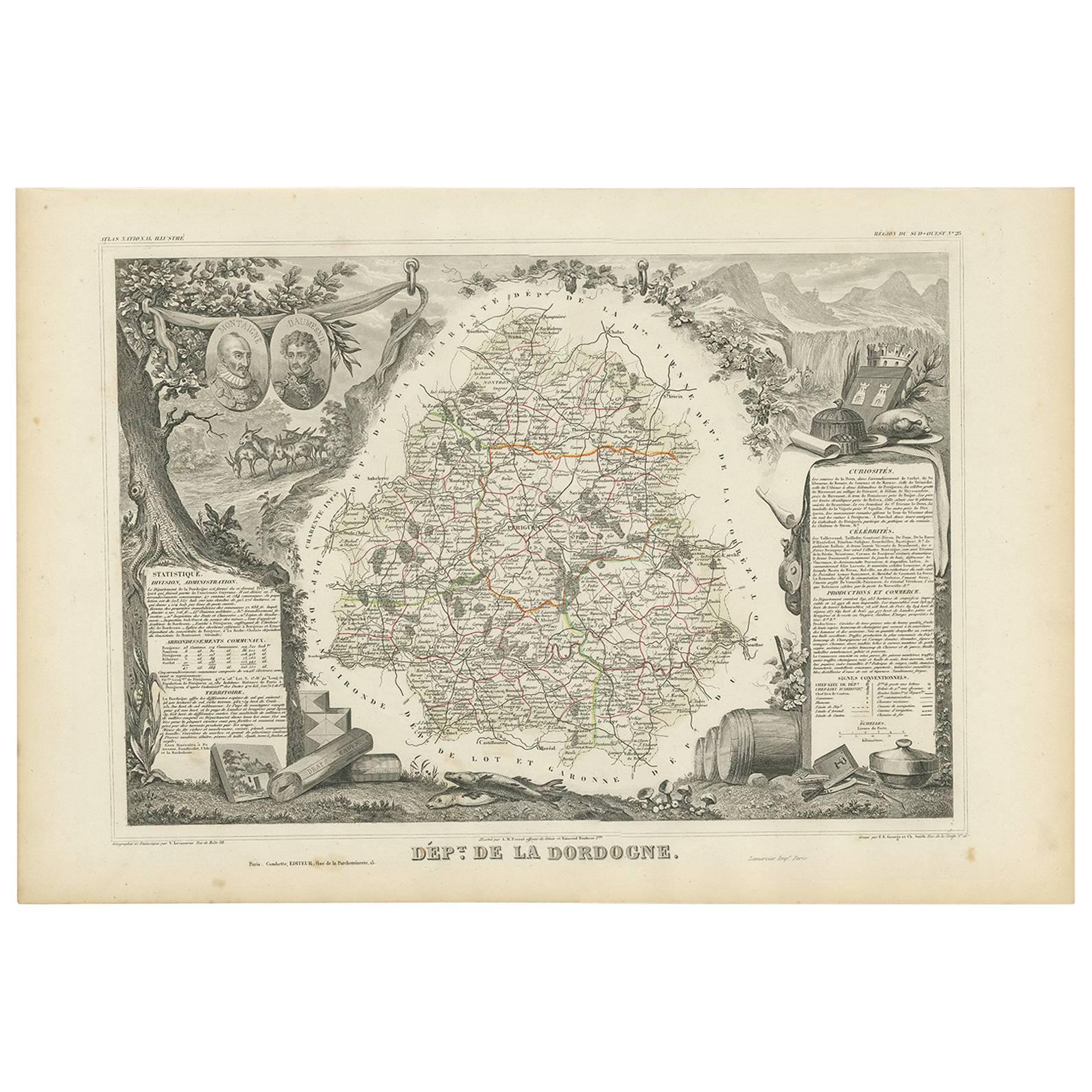
Objekte ähnlich wie Map of Dordogne France with Périgueux and Château de Jumilhac, 19th Century


Möchten Sie mehr Bilder oder Videos?
Zusätzliche Bilder oder Videos von dem*der Anbieter*in anfordern
1 von 10
Map of Dordogne France with Périgueux and Château de Jumilhac, 19th Century
140 €Einschließlich MwSt.
Angaben zum Objekt
Map of Dordogne France with Périgueux and Château de Jumilhac, 19th Century
Description:
This richly detailed 19th-century map of the Dordogne department in southwestern France was drawn by Alexandre Vuillemin and published by Migeon in Paris for the *Nouvel Atlas Illustré*. The map masterfully combines cartographic precision with elegant engravings that highlight the historical and cultural significance of this beloved region of Aquitaine.
The map outlines Dordogne in soft green hand-coloring, with towns, rivers, and roadways finely engraved. The departmental capital, Périgueux, is centrally located and clearly labeled, along with other important towns such as Bergerac, Sarlat, Nontron, and Ribérac. The rolling hills, intersecting river valleys, and dense forests of the Périgord region are suggested through detailed topographical lines.
At the lower left is a charming vignette of Périgueux with its cathedral dome rising above a riverside village scene. To the lower right, the Château de Jumilhac appears perched on a slope, representing the region’s long architectural history and noble estates. The upper left features a portrait of François Fénelon, the theologian and writer born in Périgord in the 17th century. His inclusion reflects the department’s intellectual heritage. The heraldic crest of Dordogne also appears in the upper right.
Dordogne is famous for its culinary and cultural wealth, particularly its foie gras, truffles, walnuts, and wines. Bergerac, located in the southwestern part of the department, is a key wine-producing area within the Bergerac AOC, known for its red, white, and rosé wines. The vineyards here produce wines from Bordeaux varietals such as Merlot, Cabernet Sauvignon, and Sauvignon Blanc, with increasingly refined expressions gaining international recognition. The region is also steeped in prehistoric significance, home to the Lascaux caves and numerous archaeological sites.
This map is a decorative and historical homage to Dordogne’s blend of gastronomy, viticulture, literature, and rural charm. It is a superb piece for collectors with interests in French culture, food, wine, and history.
Condition summary:
Very good condition with light toning and a few small foxing marks, mainly around the margins. The engraving remains crisp and the hand coloring is well preserved.
Framing tips:
Pair this map with a warm walnut or golden oak frame to reflect the earthy tones of Dordogne. A cream or soft green mat will complement the coloring and highlight the detailed vignettes. Use UV-protective glass for long-term display and preservation.
- Maße:Höhe: 32,5 cm (12,8 in)Breite: 26,1 cm (10,28 in)Tiefe: 0,2 mm (0,01 in)
- Materialien und Methoden:Papier,Graviert
- Herkunftsort:
- Zeitalter:
- Herstellungsjahr:circa 1850
- Zustand:Very good condition with light toning and a few small foxing marks, mainly around the margins. The engraving remains crisp and the hand coloring is well preserved.
- Anbieterstandort:Langweer, NL
- Referenznummer:Anbieter*in: BG-13331-231stDibs: LU3054345363672
Anbieterinformationen
5,0
Anerkannte Anbieter*innen
Diese renommierten Anbieter*innen sind führend in der Branche und repräsentieren die höchste Klasse in Sachen Qualität und Design.
Platin-Anbieter*in
Premium-Anbieter*innen mit einer Bewertung über 4,7 und 24 Stunden Reaktionszeit
Gründungsjahr 2009
1stDibs-Anbieter*in seit 2017
2.791 Verkäufe auf 1stDibs
Typische Antwortzeit: <1 Stunde
- VersandAngebot wird abgerufen …Versand von: Langweer, Niederlande
- Rückgabebedingungen
Einige Inhalte dieser Seite wurden automatisch übersetzt. Daher kann 1stDibs nicht die Richtigkeit der Übersetzungen garantieren. Englisch ist die Standardsprache dieser Website.
Mehr von diesem*dieser Anbieter*in
Alle anzeigenMap of Côte-d
Or France with Dijon and Burgundy Wine Region, 19th Century
Map of Côte-d'Or France with Dijon and Burgundy Wine Region, 19th Century
Description:
This beautifully engraved 19th-century map of Côte-d'Or, located in the historic region of Bur...
Kategorie
Antik, Mittleres 19. Jahrhundert, Französisch, Landkarten
Materialien
Papier

Karte von Loire Frankreich mit Saint-Étienne und Montbrison von Vuillemin, 19.
Karte von Loire Frankreich mit Saint-Étienne und Montbrison von Vuillemin, 19.
Diese wunderschön gestochene und handkolorierte Karte des Departements Loire im östlichen Zentralfrank...
Kategorie
Antik, Mittleres 19. Jahrhundert, Französisch, Landkarten
Materialien
Papier

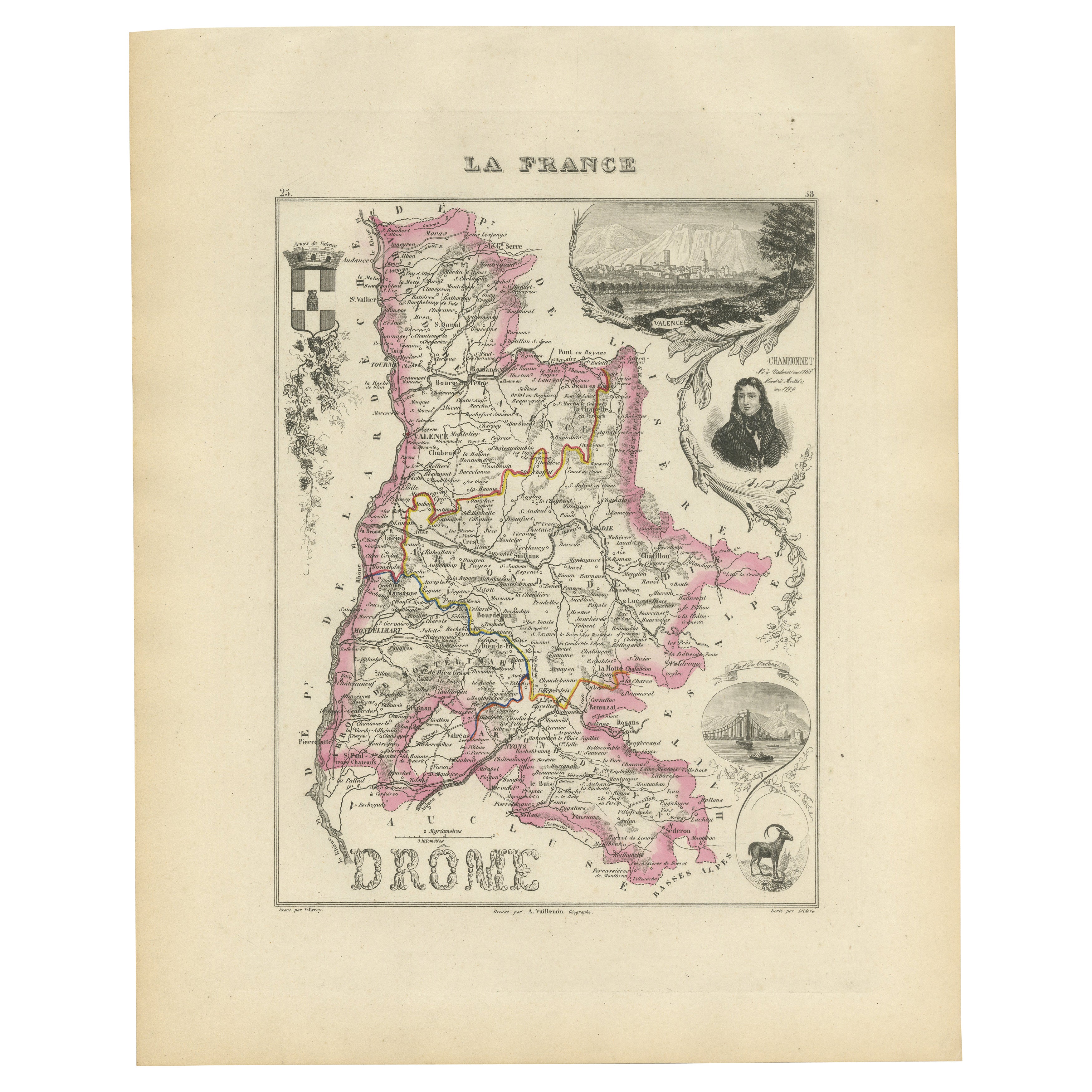
Map of Drôme France with Valence and Rhône Valley Wine Region, 19th Century
Map of Drôme France with Valence and Rhône Valley Wine Region, 19th Century
Description:
This beautifully engraved 19th-century map of the Drôme department in southeastern France wa...
Kategorie
Antik, Mittleres 19. Jahrhundert, Französisch, Landkarten
Materialien
Papier
Map of Côtes-du-Nord France with Saint-Brieuc and Brittany Coastline, c.1850
Map of Côtes-du-Nord France with Saint-Brieuc and Brittany Coastline, 19th c
Description:
This elegant 19th-century map of Côtes-du-Nord, the historic name for what is now known as ...
Kategorie
Antik, Mittleres 19. Jahrhundert, Französisch, Landkarten
Materialien
Papier

Map of Ardèche France with Annonay and Vineyards by Vuillemin, 19th c
Map of Ardèche France with Annonay and Vineyards by Vuillemin, 19th c
This beautifully engraved 19th-century map of Ardèche, a department in southeastern France, comes from Alexandr...
Kategorie
Antik, Mittleres 19. Jahrhundert, Französisch, Landkarten
Materialien
Papier

Antike Karte der Dordogne „Frankreich“ von V. Levasseur, 1854
Antike Karte mit dem Titel 'Dépt. de la Dordogne'. Karte des französischen Departements Dordogne, Frankreich. Dieses Gebiet ist vor allem für die Herstellung von Monbazillac, einem s...
Kategorie
Antik, Mittleres 19. Jahrhundert, Landkarten
Materialien
Papier
Das könnte Ihnen auch gefallen
1771 Bonne Karte von Poitou, Touraine und Anjou, Frankreich, Ric.a015
1771 Bonne-Karte von Poitou,
Touraine und Anjou, Frankreich
Ric.a015
1771 Bonne-Karte von Potiou, Touraine und Anjou mit dem Titel "Carte des Gouvernements D'Anjou et du Sau...
Kategorie
Antik, 17. Jahrhundert, Unbekannt, Landkarten
Materialien
Papier

Große Karte von Frankreich aus dem 19.
Große Karte von Frankreich aus dem 19. Jahrhundert.
Bemerkenswerter Zustand, mit einer angenehmen altersbedingten Patina.
Kürzlich gerahmt.
Frankreich CIRCA 1874.
Kategorie
Antik, Spätes 19. Jahrhundert, Französisch, Landkarten
Materialien
Leinen, Papier

Anlehnung an Loire und Loire, Frankreich. Antike Karte einer französischen Abteilung, 1856
Von Victor Levasseur
dept. de Saone et Loire", Stahlstich mit originaler Handkolorierung der Umrisse, 1856, aus: Atlas National Illustre von Levasseur.
Das französische Departement Saone et Loire ist d...
Kategorie
19. Jahrhundert, Naturalismus, Landschaftsdrucke
Materialien
Gravur

Beinahe Frankreich. Antike Karte einer französischen Abteilung, 1856
Von Victor Levasseur
dept. de L'Aube", Stahlstich mit originaler Handkolorierung der Umrisse, 1856, aus dem "Atlas National Illustre" von Levasseur.
Diese Region Frankreichs ist bekannt für die Herstel...
Kategorie
19. Jahrhundert, Naturalismus, Landschaftsdrucke
Materialien
Gravur

Lozere, Frankreich. Antike Karte einer französischen Abteilung, 1856
Von Victor Levasseur
dept. de La Lozere", Stahlstich mit originaler Handkolorierung der Umrisse, 1856, aus dem "Atlas National Illustre" von Levasseur.
Dieser abgelegene, gebirgige Teil des Languedoc i...
Kategorie
19. Jahrhundert, Naturalismus, Landschaftsdrucke
Materialien
Gravur

L
Isere, Frankreich. Antike Karte der französischen Abteilung, 1856
Von Victor Levasseur
dept. de L'Isere", Stahlstich mit Originalumriss von Hand koloriert, 1856, aus Levasseurs "Atlas National Illustre".
Dieses Gebiet ist bekannt für die Herstellung von Bleu du Verco...
Kategorie
19. Jahrhundert, Naturalismus, Landschaftsdrucke
Materialien
Gravur
