Objekte ähnlich wie Monomotapa Empire Map – East Africa, French Cartography, c.1740

Möchten Sie mehr Bilder oder Videos?
Zusätzliche Bilder oder Videos von dem*der Anbieter*in anfordern
1 von 10
Monomotapa Empire Map – East Africa, French Cartography, c.1740
570 €Einschließlich MwSt.
Angaben zum Objekt
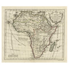
Monomotapa Empire Map – East Africa, French Cartography, c.1740
This important French map depicts the legendary Empire of Monomotapa and the surrounding regions of southeastern Africa, encompassing present-day Mozambique, Zimbabwe, and inland southern Africa. The map is titled “Empire du Monomotapa et États Voisins” and was engraved after the work of Guillaume Delisle and other French authorities. It was published in Paris around 1740 as part of the official French geographical corpus.
The map reflects early European attempts to understand and delineate the political geography of interior southern Africa, a region long associated in European thought with gold wealth, powerful inland kingdoms, and ancient trade networks. Monomotapa, often linked by Europeans to biblical Ophir, appears prominently, alongside neighboring states, river systems, mountain ranges, and coastal trading centers connected to the Indian Ocean world.
The Zambezi river system is carefully traced inland, linking coastal Mozambique to the interior, while named kingdoms, territories, and ethnographic regions are distinguished through subtle hand coloring. Coastal areas show Portuguese trading posts and forts, underscoring the strategic and commercial rivalry between European powers in East Africa. The cartography blends empirical coastal knowledge with speculative interior geography, making the map a compelling document of 18th-century European geographic thought.
Decoratively, the map balances clarity and elegance. A large engraved title cartouche anchors the lower right, while the coastline, rivers, and political boundaries are highlighted with contemporary hand color. Latitude and longitude markings provide a scientific framework, reflecting the influence of Delisle’s reformist cartographic approach, which emphasized accuracy and critical source comparison.
This map is particularly desirable for collectors of African cartography, early colonial history, and maps illustrating the transition from myth-based geography to empirically grounded mapping. It also serves as a powerful contextual counterpart to more focused coastal and harbor charts of Mozambique and the Indian Ocean.
Condition report
Good condition overall. Light age toning consistent with period. Central vertical fold as issued. Minor scattered spots and light surface marks. Original hand coloring. Plate mark visible. Margins intact.
Framing tips
This map benefits from a generous off-white or light sand-colored mat to visually separate the detailed interior geography from the frame. A medium to dark wood frame complements the hand coloring and gives the piece a scholarly, museum-style presence. Particularly effective when displayed as the central piece in an East Africa cartographic grouping.
Technique: Copper engraving with contemporary hand color
Maker: After Guillaume Delisle, France, c.1740
- Maße:Höhe: 24,5 cm (9,65 in)Breite: 32,5 cm (12,8 in)Tiefe: 0,2 mm (0,01 in)
- Materialien und Methoden:Papier,Graviert
- Herkunftsort:
- Zeitalter:1740-1749
- Herstellungsjahr:circa 1740
- Zustand:Good condition overall. Light age toning consistent with period. Central vertical fold as issued. Minor scattered spots and light surface marks. Original hand coloring. Plate mark visible. Margins intact.
- Anbieterstandort:Langweer, NL
- Referenznummer:Anbieter*in: BG-14128-41stDibs: LU3054348016812
Anbieterinformationen
5,0
Anerkannte Anbieter*innen
Diese renommierten Anbieter*innen sind führend in der Branche und repräsentieren die höchste Klasse in Sachen Qualität und Design.
Platin-Anbieter*in
Premium-Anbieter*innen mit einer Bewertung über 4,7 und 24 Stunden Reaktionszeit
Gründungsjahr 2009
1stDibs-Anbieter*in seit 2017
2.836 Verkäufe auf 1stDibs
Typische Antwortzeit: 1 Stunde
- VersandAngebot wird abgerufen …Versand von: Langweer, Niederlande
- Rückgabebedingungen
Einige Inhalte dieser Seite wurden automatisch übersetzt. Daher kann 1stDibs nicht die Richtigkeit der Übersetzungen garantieren. Englisch ist die Standardsprache dieser Website.
Mehr von diesem*dieser Anbieter*in
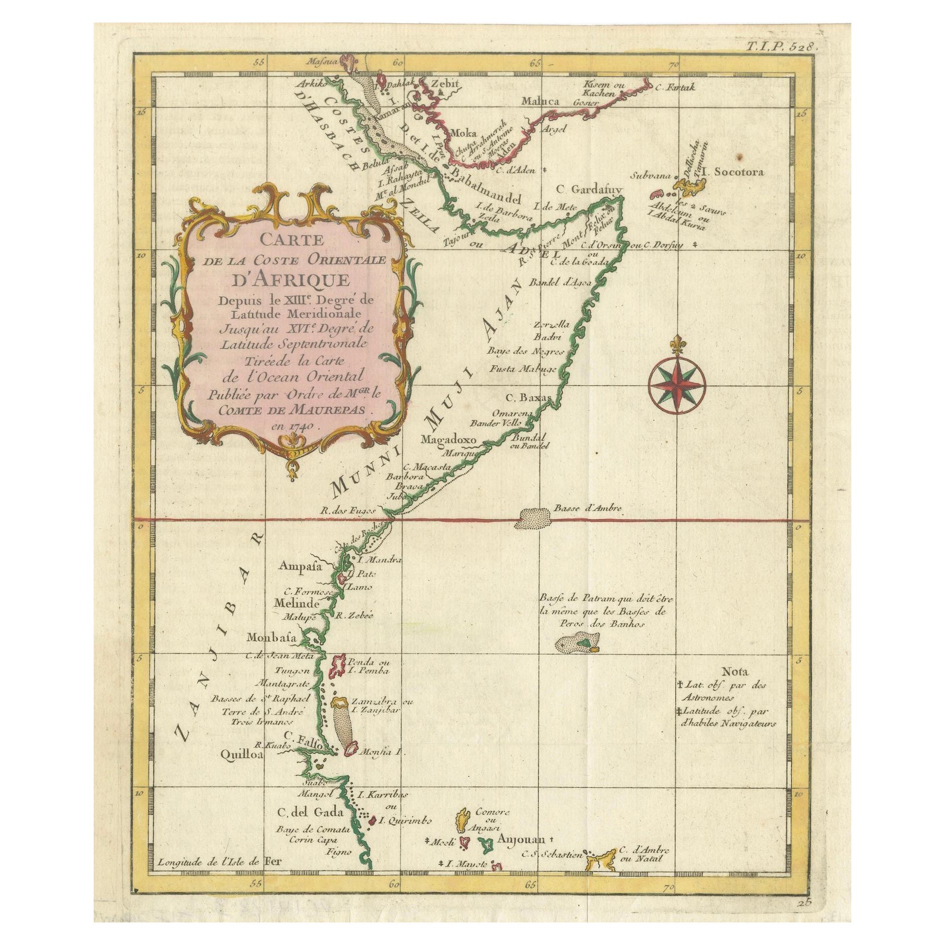
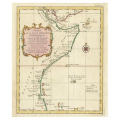
Alle anzeigenEast African Coast – French Map by Bellin, Zanzibar to Arabia, 1740
East African Coast – French Map by Bellin, Zanzibar to Arabia, 1740
This important French map depicts the eastern coast of Africa from Mozambique and Zanzibar northward to the Horn ...
Kategorie
Antik, 1740er, Französisch, Landkarten
Materialien
Papier
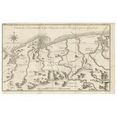
Antike Karte der Umgebung von Cap-Français, Saint-Domingue, ca. 1760
Antike Karte der Umgebung von Cap-Français, Saint-Domingue, ca. 1760
Dieser detaillierte Kupferstich aus dem 18. Jahrhundert mit dem Titel Carte des Environs du Cap Français et des ...
Kategorie
Antik, Frühes 18. Jahrhundert, Französisch, Landkarten
Materialien
Papier
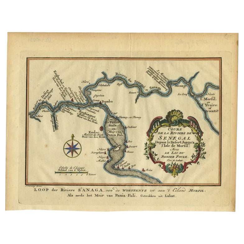
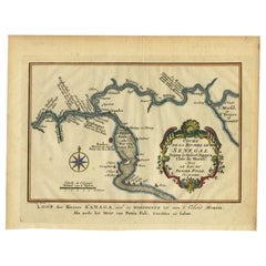
Antike Karte des Verlaufs des Sanaga- Flusses von Van Schley, 1747
Antike Karte mit dem Titel 'Cours de la Riviere de Senegal (..) - Loop der Riviere Sanaga (..)'. Originale antike Karte des Verlaufs des Sanaga-Flusses, der die Grenze zwischen Seneg...
Kategorie
Antik, 18. Jahrhundert, Landkarten
Materialien
Papier
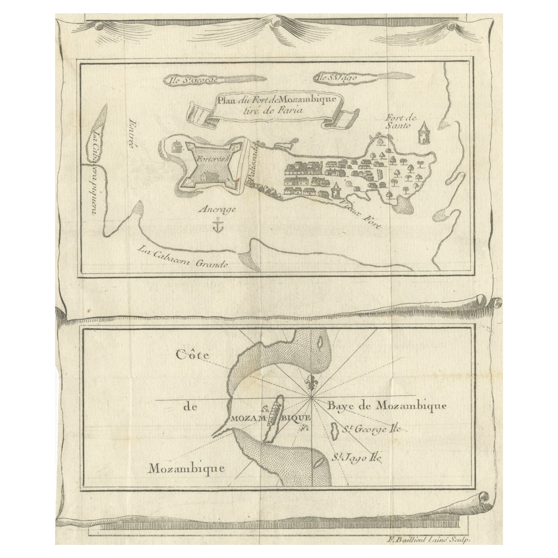
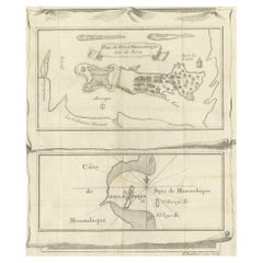
Antike Karte von Fort Mozambik und Mosambik Bay in Afrika, um 1759
Zwei antike Karten auf einem Blatt. Die obere antike Karte trägt den Titel "Plan du Fort de Mozambique tiré de Faria" und zeigt die Insel Mosambik mit ihrem Fort, der Siedlung, dem H...
Kategorie
Antik, 18. Jahrhundert, Landkarten
Materialien
Papier
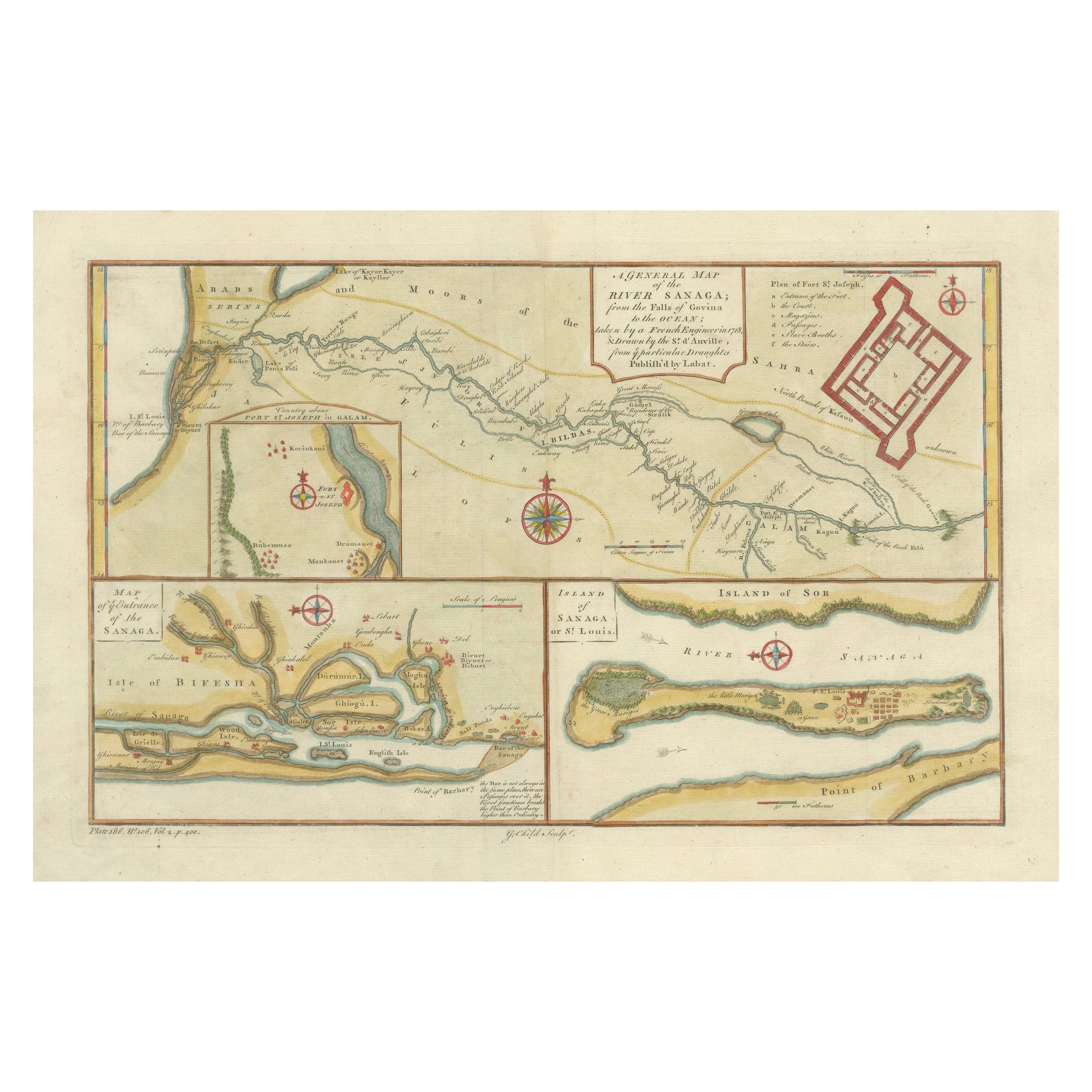
River Sanaga, West Africa – Elegant French Exploration Map, c.1750
Nubia and Abyssinia – Venetian Map of Northeast Africa, Zatta, 1784
This detailed late-18th-century map depicts Nubia and Abyssinia, covering large parts of present-day Sudan, Ethio...
Kategorie
Antik, 1750er, Italienisch, Landkarten
Materialien
Papier
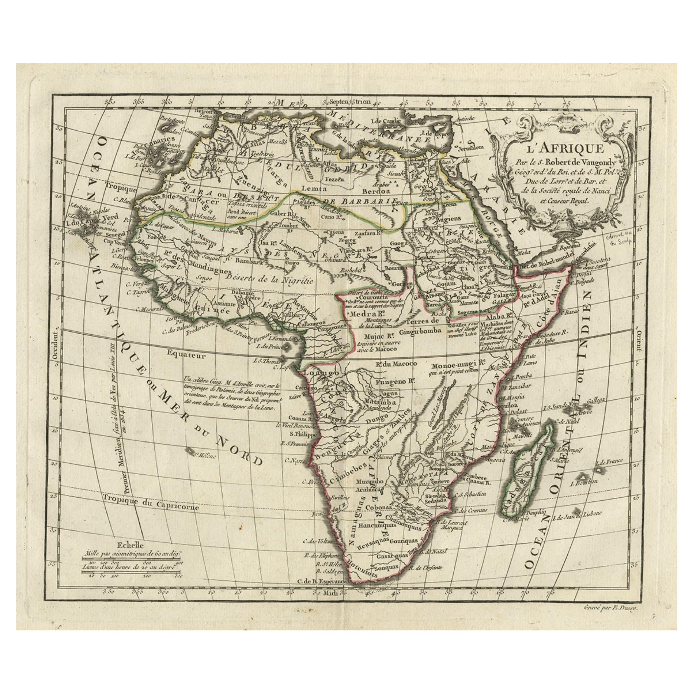
Antike Afrikanische Karte mit französischer Kartusche und Maßstab, um 1780
Antike Karte mit dem Titel 'L'Afrique'. Original antike Karte von Afrika. Mit schöner Titelkartusche und Maßstab. Quelle unbekannt, muss noch ermittelt werden.
Künstler und Graveu...
Kategorie
Antik, 18. Jahrhundert, Landkarten
Materialien
Papier
280 € Verkaufspreis
20 % Rabatt
Das könnte Ihnen auch gefallen
Westafrika mit dem Titel „Guinea Propria“: Eine handkolorierte Homann-Karte aus dem 18. Jahrhundert
Von Johann Baptist Homann
Dies ist eine seltene, reich kolorierte Kupferstichkarte von Afrika mit dem Titel "Guinea Propria, nec non Nigritiae vel Terrae Nigrorum Maxima Pars" von Johann Baptist Homann (1664-...
Kategorie
Antik, Mitte des 18. Jahrhunderts, Deutsch, Landkarten
Materialien
Papier

Handkolorierte Homann-Karte von Westafrika aus dem 18. Jahrhundert mit dem Titel „Guinea Propria“
Von Johann Baptist Homann
Dies ist eine seltene, reich kolorierte Kupferstichkarte von Afrika mit dem Titel "Guinea Propria, nec non Nigritiae vel Terrae Nigrorum Maxima Pars" von Johann Baptist Homann (1664-...
Kategorie
1740er, Sonstige Kunststile, Druckgrafiken und Multiples
Materialien
Gravur

Antike französische Karte von Asien, einschließlich China, Indonesien und Indien, 1783
Sehr schöne Karte von Asien. 1783 Dedie au Roy.
Zusätzliche Informationen:
Land der Herstellung: Europa
Zeitraum: 18. Jahrhundert Qing (1661 - 1912)
Zustand: Gesamtzustand B (Good U...
Kategorie
Antik, 18. Jahrhundert, Europäisch, Landkarten
Materialien
Papier

426 € Verkaufspreis
40 % Rabatt
Afrika: Eine große handkolorierte Karte aus dem 17. Jahrhundert von Sanson und Jaillot
Von Nicholas Sanson d
Abbeville
Diese große original handkolorierte Kupferstichkarte von Afrika mit dem Titel "L'Afrique divisee suivant l'estendue de ses principales parties ou sont distingues les uns des autres, ...
Kategorie
1690er, Landschaftsdrucke
Materialien
Gravur

Afrika: Eine große handkolorierte Karte aus dem 17. Jahrhundert von Sanson und Jaillot
Von Nicolas Sanson
Diese große original handkolorierte Kupferstichkarte von Afrika mit dem Titel "L'Afrique divisee suivant l'estendue de ses principales parties ou sont distingues les uns des autres, ...
Kategorie
Antik, 1690er, Französisch, Landkarten
Materialien
Papier

""Africa Vetus"": Eine handkolorierte Karte von Sanson aus dem 17. Jahrhundert
Von Nicholas Sanson d
Abbeville
Diese originale handkolorierte Kupferstichkarte von Afrika mit dem Titel "Africa Vetus, Nicolai Sanson Christianiss Galliar Regis Geographi" wurde ursprünglich von Nicholas Sanson d'...
Kategorie
1690er, Landschaftsdrucke
Materialien
Gravur
