Objekte ähnlich wie Geological Map of North America by A.K. Johnston – Mountains and Valleys 1852


Möchten Sie mehr Bilder oder Videos?
Zusätzliche Bilder oder Videos von dem*der Anbieter*in anfordern
1 von 12
Geological Map of North America by A.K. Johnston – Mountains and Valleys 1852
260 €pro Objekt|Einschließlich MwSt.
Menge
Angaben zum Objekt
Geological Map of North America by A.K. Johnston – Mountains and Valleys 1852
This finely detailed and beautifully shaded antique map titled "The Mountains, Table Lands, Plains
Valleys of North America" was created by the noted Scottish geographer Alexander Keith Johnston and published in 1852 by William Blackwood
Sons in Edinburgh and London. It was issued as Plate 8 in Johnston’s groundbreaking *Physical Atlas of Natural Phenomena*, one of the earliest and most influential works of thematic cartography in the 19th century.
The map presents the topographic structure of the North American continent, emphasizing physical geography over political borders. Using a delicate yet effective palette of hand-applied color, it distinguishes between mountainous regions, plateaus, plains, and river valleys. Green areas denote lowlands and river basins, while tan and brown areas indicate elevated terrain, such as mountain ranges and high plateaus.
Key geographical features are precisely labeled, including the Rocky Mountains, Appalachian Mountains, Sierra Nevada, Great Basin, Canadian Shield, and Mississippi River Valley. The map covers all of North America, including Canada, the United States, Mexico, Central America, the Caribbean, and Greenland, as well as the Arctic archipelagos. Major tablelands such as those of Mexico and the Colorado Plateau are also clearly outlined, demonstrating the complexity of North America's geological structure.
What sets this map apart is its educational clarity and scientific intent. Johnston’s work was intended to inform and enlighten readers about the structure of the natural world, making this a valuable piece not just for collectors of antique maps but also for educators, environmental historians, and interior designers seeking historically meaningful artwork.
Alexander Keith Johnston (1804–1871) was a pioneering figure in British cartography. As Geographer in Ordinary to Queen Victoria for Scotland, he advanced the visual communication of scientific data through maps. His *Physical Atlas* remains a landmark publication in the history of science and cartography.
Condition and framing tips:
Very good condition with light age toning, original centerfold, and faint foxing at edges. Printed area clean and well-preserved. Frame in dark wood or black with a soft ivory or sage green mat to enhance the earthy palette and highlight the map's elegant detailing. Perfect for libraries, offices, or natural history-themed interiors.
- Maße:Höhe: 34,5 cm (13,59 in)Breite: 27,4 cm (10,79 in)Tiefe: 0,2 mm (0,01 in)
- Materialien und Methoden:
- Herkunftsort:
- Zeitalter:
- Herstellungsjahr:1852
- Zustand:Very good condition. Light overall toning near the margins. The paper remains strong and well-preserved. Folding line as issued.
- Anbieterstandort:Langweer, NL
- Referenznummer:Anbieter*in: BG-13207-81stDibs: LU3054345386722
Anbieterinformationen
5,0
Anerkannte Anbieter*innen
Diese renommierten Anbieter*innen sind führend in der Branche und repräsentieren die höchste Klasse in Sachen Qualität und Design.
Platin-Anbieter*in
Premium-Anbieter*innen mit einer Bewertung über 4,7 und 24 Stunden Reaktionszeit
Gründungsjahr 2009
1stDibs-Anbieter*in seit 2017
2.836 Verkäufe auf 1stDibs
Typische Antwortzeit: 1 Stunde
- VersandAngebot wird abgerufen …Versand von: Langweer, Niederlande
- Rückgabebedingungen
Einige Inhalte dieser Seite wurden automatisch übersetzt. Daher kann 1stDibs nicht die Richtigkeit der Übersetzungen garantieren. Englisch ist die Standardsprache dieser Website.
Mehr von diesem*dieser Anbieter*in
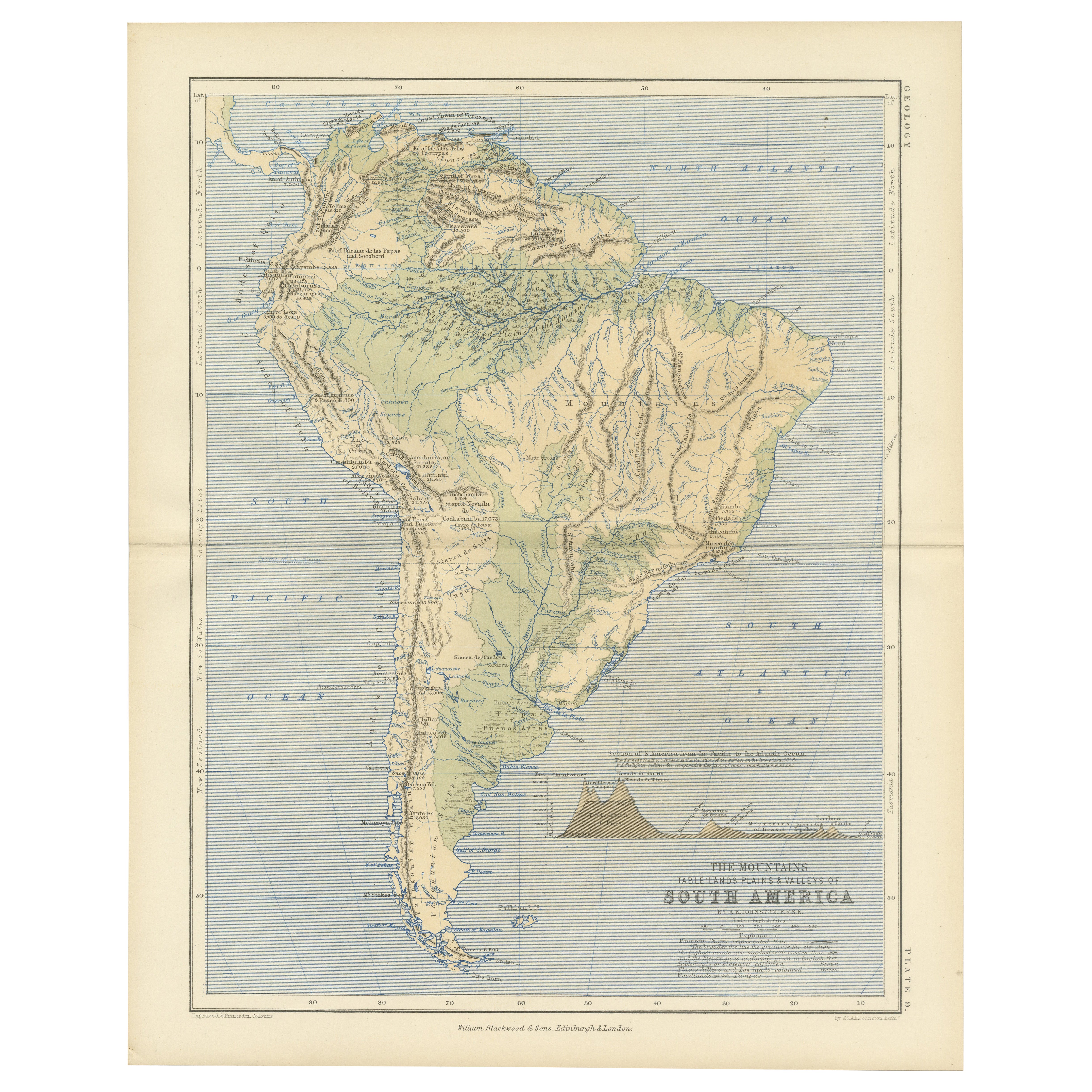
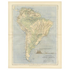
Alle anzeigenGeological Map of South America by A.K. Johnston – Mountains and Valleys 1852
Geological Map of South America by A.K. Johnston – Mountains and Valleys 1852
This antique map titled "The Mountains, Table Lands, Plains & Valleys of South America" was produced by...
Kategorie
Antik, Mittleres 19. Jahrhundert, Schottisch, Drucke
Materialien
Papier
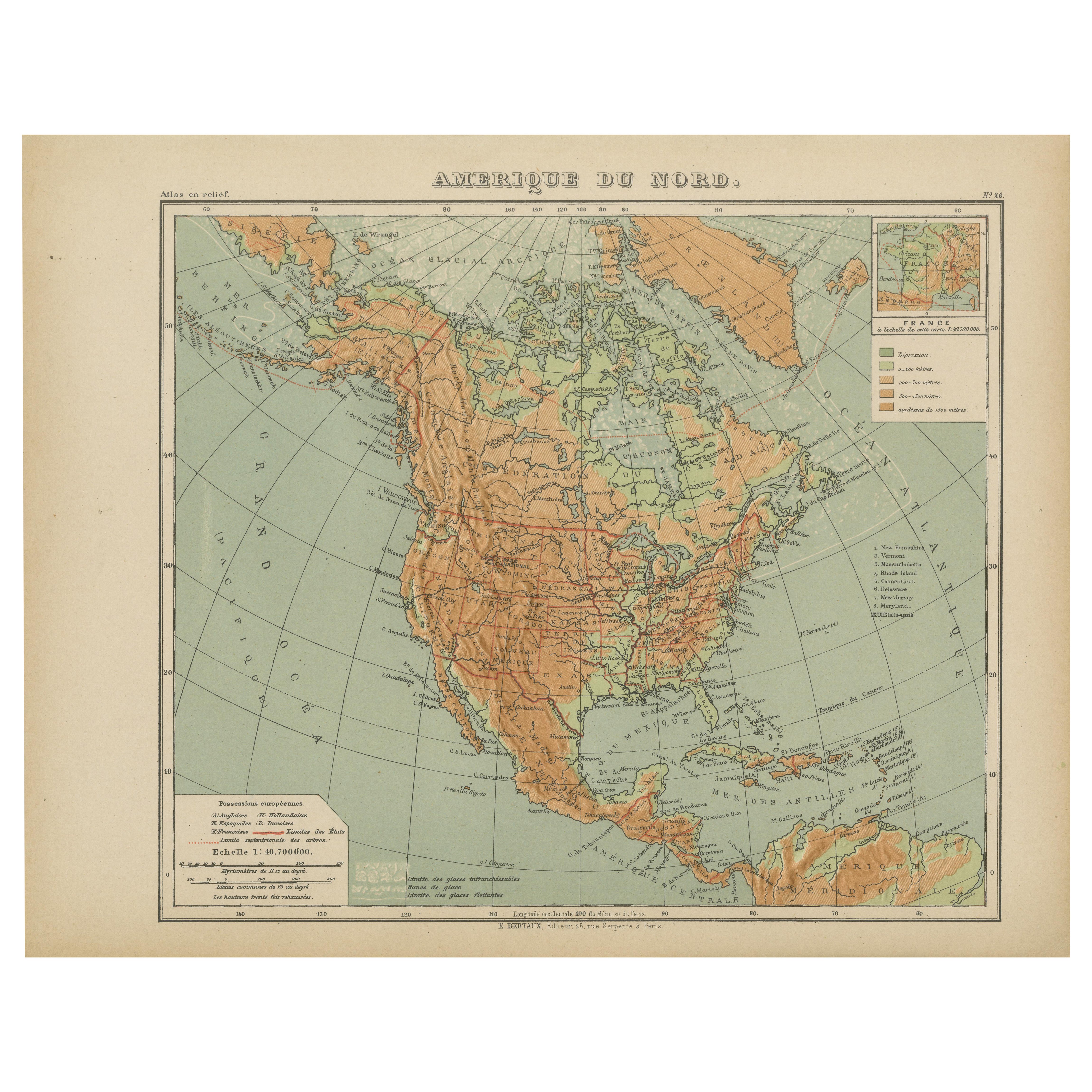
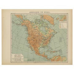
Antike Karte von Nordamerika - Physikalische Reliefkarte von Hachette ca. 1883
Antike Karte von Nordamerika - Physikalische Reliefkarte von Hachette ca. 1883
Beschreibung:
Diese antike Karte mit dem Titel "Amérique du Nord" wurde um 1883 von E. Hachette in Par...
Kategorie
Antik, Spätes 19. Jahrhundert, Französisch, Landkarten
Materialien
Papier
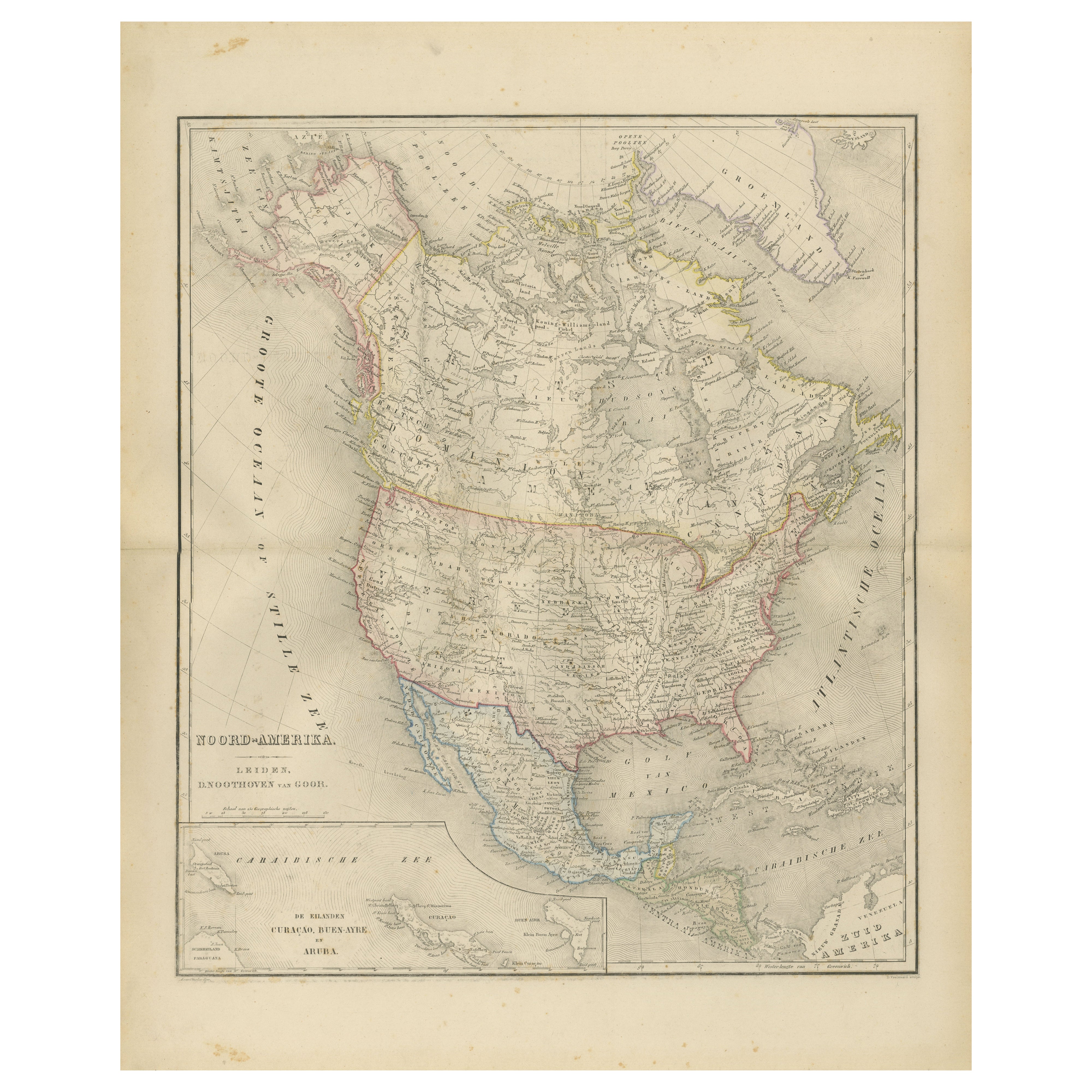
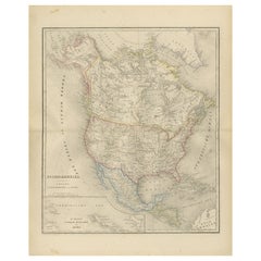
Nordamerika Karte mit USA, Kanada
Mexiko - Nieuwe Hand-Atlas, 1876
Nordamerika Karte mit USA, Kanada & Mexiko - Nieuwe Hand-Atlas, 1876
Diese fein gestochene Karte von "Noord-Amerika" aus dem 19. Jahrhundert, die 1876 von D. Noothoven van Goor aus ...
Kategorie
Antik, 1870er, Niederländisch, Landkarten
Materialien
Papier
Antike Karte Nordamerikas von A
C. Black, 1870
Antike Karte mit dem Titel 'Nordamerika'. Original antike Karte von Nordamerika. Diese Karte stammt aus dem "Black's General Atlas of The World". Herausgegeben von A & C. Black, 1870.
Kategorie
Antik, Spätes 19. Jahrhundert, Landkarten
Materialien
Papier

220 € Verkaufspreis
20 % Rabatt
Antike Karte Nordamerikas von Johnston, 1882
Von Alexander Keith Johnston
Antike Karte mit dem Titel 'Nordamerika'.
Alte Karte von Nordamerika. Diese Karte stammt aus "The Royal Atlas of Modern Geography, Exhibiting, in a Series of Entirely Original and ...
Kategorie
Antik, 19. Jahrhundert, Landkarten
Materialien
Papier

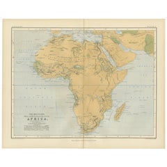
Geological Map of Africa by A.K. Johnston – Mountains and Valleys 1852
Geological Map of Africa by A.K. Johnston – Mountains and Valleys 1852
This antique map titled "The Mountains, Table Lands, Plains & Valleys of Africa" was produced by the distingui...
Kategorie
Antik, Mittleres 19. Jahrhundert, Schottisch, Drucke
Materialien
Papier
Das könnte Ihnen auch gefallen
Nord-Amerika. Antike Atlas-Vintage-Karte
Der Jahrhundertatlas. Nordamerika
Originale antike Karte, 1903.
Zentrale Falte wie ausgestellt. Name und Nummer der Karte sind auf der Rückseite aufgedruckt.
Blatt 40cm x 29,5cm.
Kategorie
Frühes 20. Jahrhundert, Viktorianisch, Mehr Drucke
Materialien
Lithografie

Original Antike Karte von Nordamerika von Dower, um 1835
Schöne Karte von Nordamerika
Gezeichnet und gestochen von J. Dower
Herausgegeben von Orr & Smith. C.1835
Ungerahmt.
Kostenloser Versand
Kategorie
Antik, 1830er, Englisch, Landkarten
Materialien
Papier

Große Original-Vintage-Karte von Nordamerika, circa 1920
Großartige Karte von Nordamerika
Originalfarbe. Guter Zustand
Herausgegeben von Alexander Gross
Ungerahmt.
Kategorie
Vintage, 1920er, Englisch, Edwardian, Landkarten
Materialien
Papier

1864 Karte Nordamerikas, antike handkolorierte Karte, von Adolphe Hippolyte Dufour
Angeboten wird eine Karte von Nordamerika mit dem Titel Amerique du Nord aus dem Jahr 1864. Diese seltene, separat veröffentlichte Wandkarte wurde von Adolphe Hippolyte Dufour herges...
Kategorie
Antik, 1860er, Französisch, Landkarten
Materialien
Papier

Original Antike Karte der Vereinigten Staaten von Amerika von Dower, circa 1835
Schöne Karte der USA
Gezeichnet und gestochen von J. Dower
Herausgegeben von Orr & Smith. C.1835
Ungerahmt.
Kostenloser Versand
Kategorie
Antik, 1830er, Englisch, Landkarten
Materialien
Papier

52 €
Kostenloser Versand
Große Karte Nordamerikas und Territorien von 1848
Gerahmte Karte von S. Augustus und Mitchell, Philadelphia, PA, Nordamerika und Territorien, 1848.
Mit den Vereinigten Staaten, Kanada (britisches Territorium) und den mexikanischen ...
Kategorie
Antik, 1840er, amerikanisch, Amerikanische Klassik, Landkarten
Materialien
Glas, Holz, Papier
