Artículos similares a Geological Map of Africa by A.K. Johnston – Mountains and Valleys 1852


¿Quieres más imágenes o vídeos?
Solicita imágenes o vídeos adicionales al vendedor
1 de 10
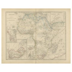
Geological Map of Africa by A.K. Johnston – Mountains and Valleys 1852
260 €por artículo|IVA incluido
Cantidad
Acerca del artículo
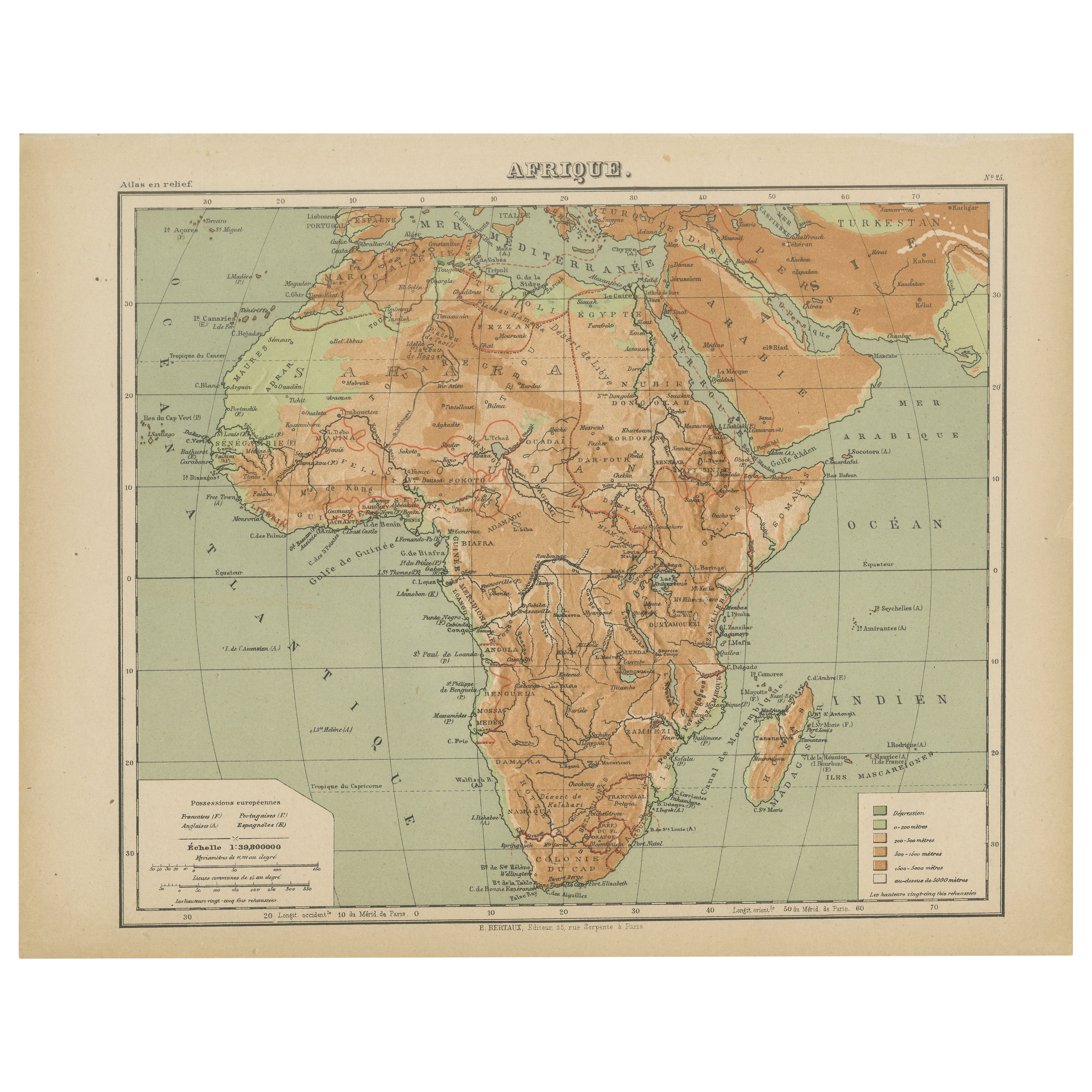
Geological Map of Africa by A.K. Johnston – Mountains and Valleys 1852
This antique map titled "The Mountains, Table Lands, Plains
Valleys of Africa" was produced by the distinguished Scottish cartographer Alexander Keith Johnston and published in 1852 by William Blackwood
Sons, Edinburgh and London. Issued as Plate 7 in Johnston’s seminal work *The Physical Atlas of Natural Phenomena*, it represents one of the earliest and most influential attempts to visualize Africa’s topography through scientific cartography.
This map presents a detailed physical overview of the African continent, using subtle coloration and shading to depict mountain ranges, elevated tablelands, deserts, and low-lying river basins. Unlike political maps of the period, it forgoes country borders in favor of a focus on natural geography. Earth-toned shades indicate elevation—yellow and tan for deserts and plains, green for coastal lowlands, and brown for highlands and mountain systems.
Prominent physical features such as the Atlas Mountains, Ethiopian Highlands, the Mountains of the Moon, Table Mountain, the Sahara Desert, and the Great Rift Valley are clearly labeled. River systems including the Nile, Niger, Congo, and Zambezi are also traced with scientific accuracy. This map offers an insightful view of Africa's geologic and climatic structure before many interior regions had been fully charted by European explorers.
A.K. Johnston (1804–1871), who served as Geographer in Ordinary to Queen Victoria in Scotland, was a pioneer in thematic cartography. His *Physical Atlas* was the first of its kind to translate complex natural data into visual form, combining scientific precision with artistic presentation. This map stands out not only for its geographical value but for its restrained beauty and clarity—qualities that made Johnston’s atlases widely respected by scientists, educators, and collectors alike.
This print is a valuable addition to collections focused on African geography, scientific history, or antique educational material, and it remains aesthetically appealing for decorative use.
Condition and framing tips:
Very good condition with light age toning and faint edge wear. The engraved detail is sharp, and the original hand coloring remains clean and vivid. Frame in black or dark oak with a cream or soft sand-colored mat to highlight the warm earth tones and emphasize the elegant cartographic lines. Suitable for a library, office, or academic space.
- Dimensiones:Altura: 27,4 cm (10,79 in)Anchura: 34,5 cm (13,59 in)Profundidad: 0,2 mm (0,01 in)
- Materiales y técnicas:
- Lugar de origen:
- Época:
- Fecha de fabricación:1852
- Estado:Very good condition. Light overall toning near the margins. The paper remains strong and well-preserved. Folding line as issued.
- Ubicación del vendedor:Langweer, NL
- Número de referencia:Vendedor: BG-13207-71stDibs: LU3054345386642
Sobre el vendedor
5,0
Vendedor reconocido
Estos prestigiosos vendedores son líderes del sector y representan el escalón más alto en cuanto a calidad y diseño de artículos.
Vendedor Platino
Vendedores premium con una calificación de +4,7 y tiempos de respuesta de 24 horas
Establecido en 2009
Vendedor de 1stDibs desde 2017
2809 ventas en 1stDibs
Tiempo de respuesta usual: 1 hora
- EnvíoRecuperando presupuesto…Envío desde: Langweer, Países Bajos
- Política de devolución
Partes de esta página se han traducido automáticamente. 1stDibs no puede garantizar la exactitud de las traducciones. El inglés es el idioma predeterminado de este sitio web.
Más de este vendedor
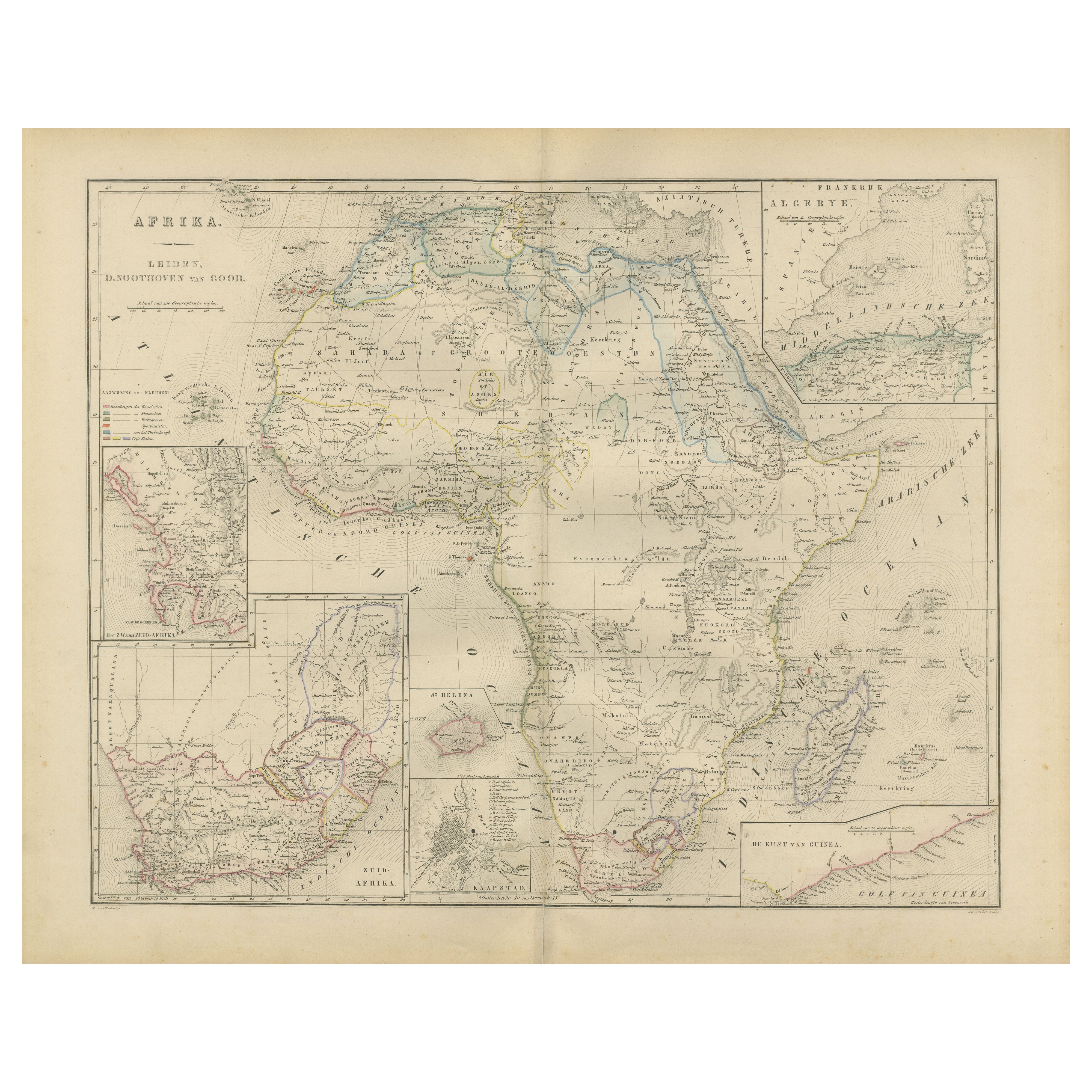
Ver todoMapa de África con Egipto y Sudáfrica - Nieuwe Hand-Atlas, 1876
Mapa de África con Egipto y Sudáfrica - Nieuwe Hand-Atlas, 1876
Este mapa del siglo XIX titulado "Afrika", publicado en 1876 en el Nieuwe Hand-Atlas der Aarde in haren Tegenwoordige...
Categoría
Antiguo, Década de 1870, Holandés, Mapas
Materiales
Papel
Mapa Atlas en relieve de África de Hachette - Antique c.1883 French Map
Mapa antiguo de África - Mapa Atlas en relieve de Hachette, hacia 1880
Descripción:
Se trata de un atractivo mapa antiguo titulado "Afrique", publicado por Hachette en París hacia 1...
Categoría
Antiguo, Fines del siglo XIX, Mapas
Materiales
Papel
Mapa antiguo de África, destacando divisiones coloniales, accidentes geográficos 1903
Título: Mapa antiguo de África, 1903, que destaca las divisiones coloniales y los accidentes geográficos
Descripción: Este mapa antiguo, titulado "África", fue grabado y publicado e...
Categoría
principios del siglo XX, Mapas
Materiales
Papel

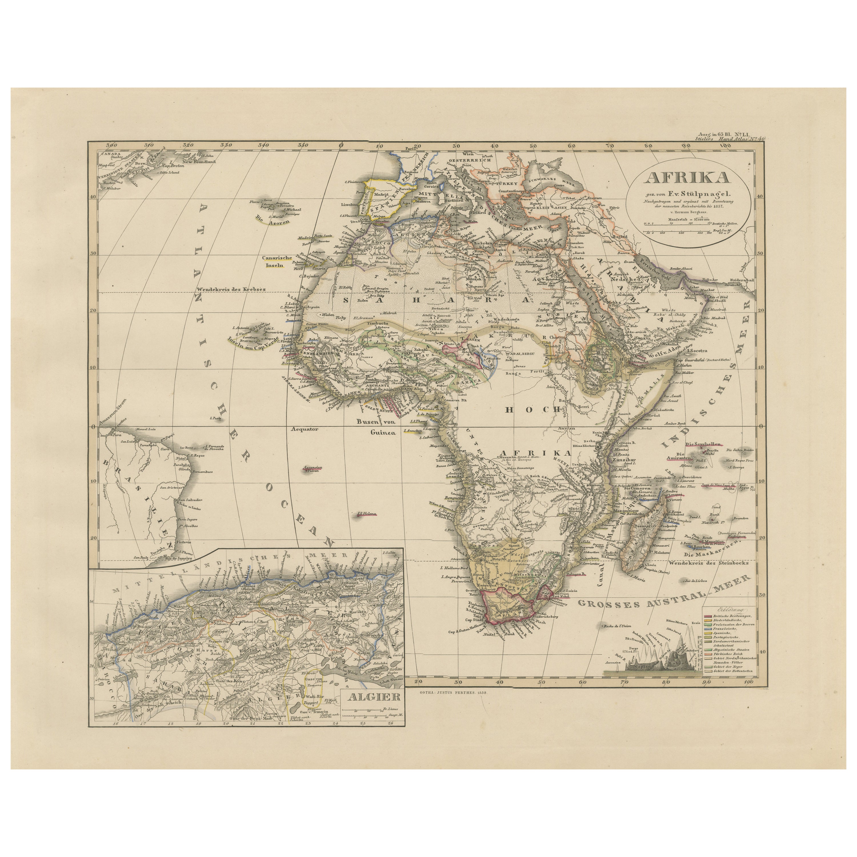
Mapa antiguo a todo color de África con Argelia - Atlas Stieler 1858
Mapa antiguo de África con Argelia - Atlas Stieler 1858
Este mapa antiguo de África, grabado por F. von Stülpnagel y publicado por Justus Perthes en 1858, es una representación fina...
Categoría
Antiguo, Mediados del siglo XIX, Alemán, Mapas
Materiales
Papel
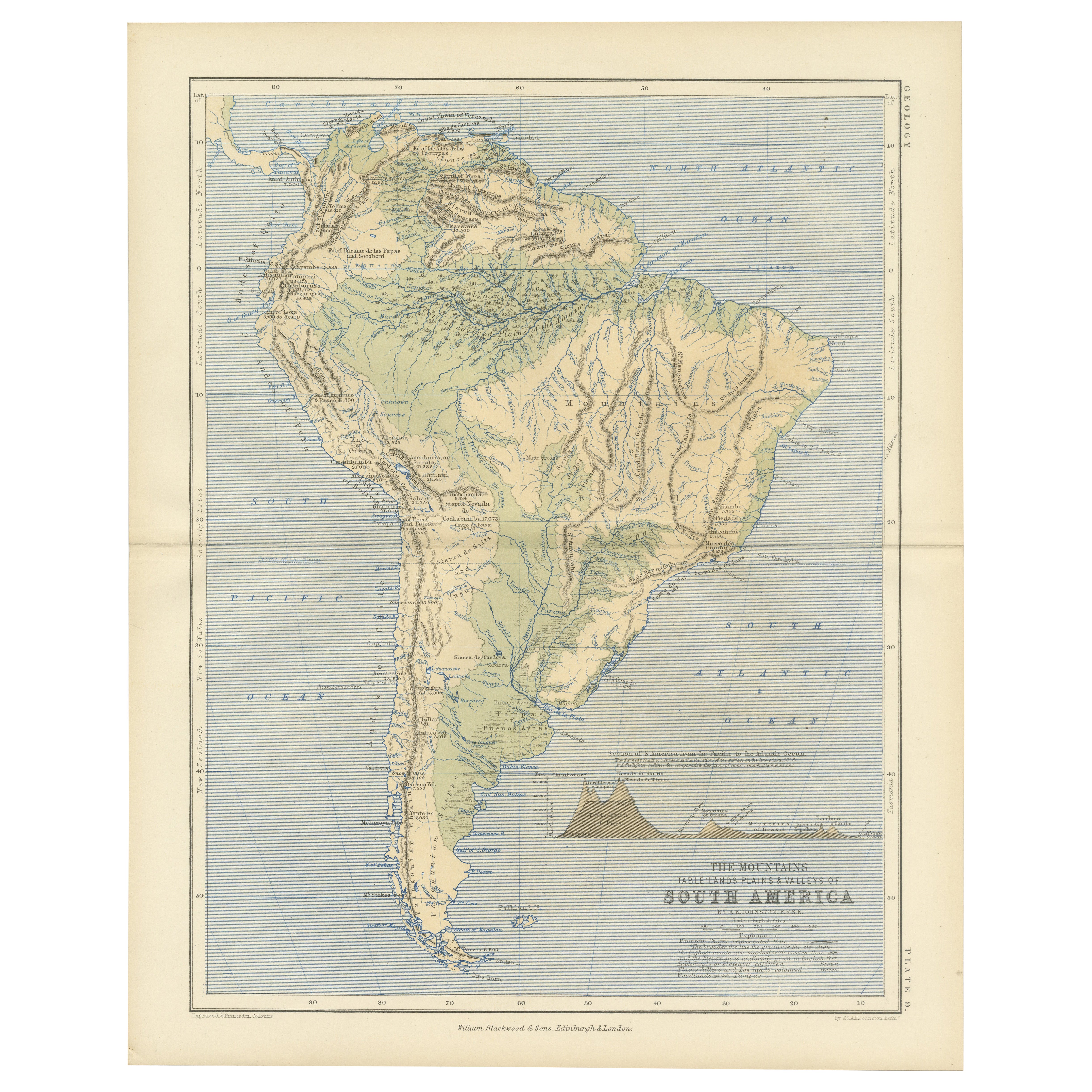
Geological Map of South America by A.K. Johnston – Mountains and Valleys 1852
Geological Map of South America by A.K. Johnston – Mountains and Valleys 1852
This antique map titled "The Mountains, Table Lands, Plains & Valleys of South America" was produced by...
Categoría
Antiguo, Mediados del siglo XIX, Escocés, Impresiones
Materiales
Papel
Mapa antiguo de África por Lapie, 1842
Mapa antiguo titulado "Carte d'Afrique". Mapa de África. Este mapa procede del "Atlas universel de géographie ancienne et moderne (..)" de Pierre M. Lapie y Alexandre E. Lapie. Pierr...
Categoría
Antiguo, Mediados del siglo XIX, Mapas
Materiales
Papel

También te puede gustar
Mapa original antiguo de África por Dower, hacia 1835
Bonito mapa de África
Dibujado y grabado por J.Dower
Publicado por Orr & Smith. C.1835
Sin enmarcar.
Envío gratuito
Categoría
Antiguo, Década de 1830, Inglés, Mapas
Materiales
Papel

Gran Mapa Antiguo Original de África. C.1900
Fabuloso mapa de África
Color original.
Grabado e impreso por la George F. Cram Company, Indianápolis.
Publicado, C.1900.
Sin enmarcar.
Envío gratuito.
Categoría
Antiguo, Década de 1890, Estadounidense, Mapas
Materiales
Papel

África. Parte Noreste. Atlas del Siglo mapa antiguo de época
El Atlas del Siglo. África. Parte Noreste".
Mapa antiguo original, 1903.
Mapa en recuadro del "Delta del Nilo y Canal de Suez".
Pliegue central como se emitió. Nombre y número del ...
Categoría
principios del siglo XX, Victoriano, Más impresiones
Materiales
Litografía

África. Parte Sur. Atlas del Siglo mapa antiguo de época
El Atlas del Siglo. África. Parte Sur".
Mapa antiguo original, 1903.
Mapas en recuadro de "Ciudad del Cabo", "Johannesburgo" y "Ladysmith".
Pliegue central como se emitió. Nombre y...
Categoría
principios del siglo XX, Victoriano, Más impresiones
Materiales
Litografía

África. Central. Atlas del Siglo mapa antiguo vintage
El Atlas del Siglo. África. Central
Mapa en recuadro de "Madagascar".
Mapa antiguo original, 1903.
Pliegue central como se emitió. Nombre y número del mapa impresos en las esquinas...
Categoría
principios del siglo XX, Victoriano, Más impresiones
Materiales
Litografía

Mapa de África - Grabado original de C. Brue - 1820
Mapa de África es un aguafuerte original realizado por C.Brue en 1820.
El grabado procede de la Serie "Atlas Universal" PL. 31.
El estado de conservación de la obra es bueno, salvo...
Categoría
Década de 1820, Moderno, Impresiones figurativas
Materiales
Grabado químico
