Artículos similares a Antique Map of the Peloponnese – Peloponnesus, Morea, by Cluver, ca.1697

¿Quieres más imágenes o vídeos?
Solicita imágenes o vídeos adicionales al vendedor
1 de 9
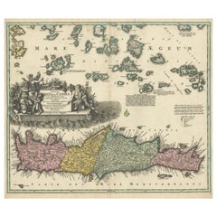
Antique Map of the Peloponnese – Peloponnesus, Morea, by Cluver, ca.1697
470 €IVA incluido
Acerca del artículo
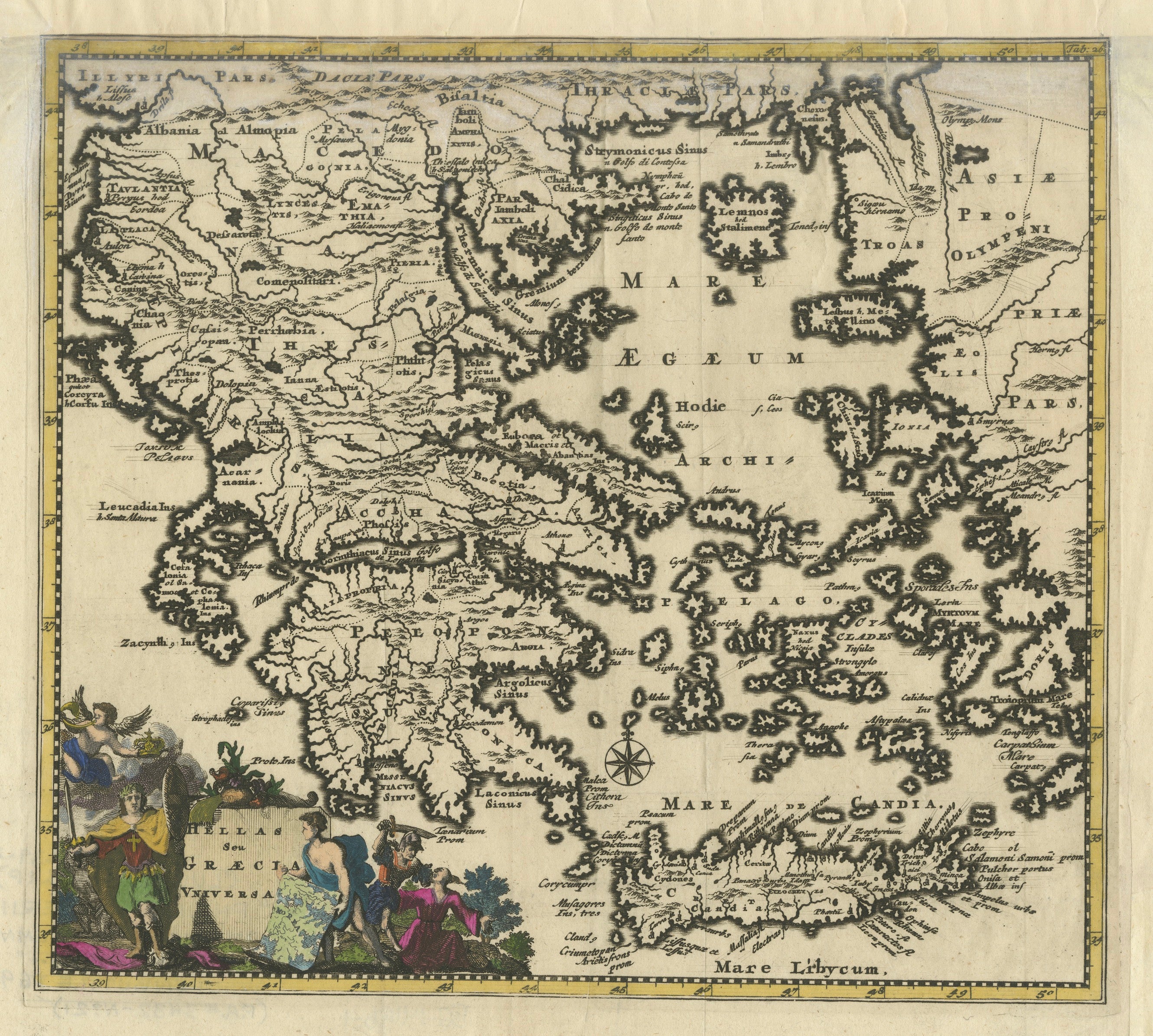
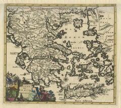
Hellas seu Graecia Universa is a finely detailed late-17th-century map of Greece and the Aegean world, issued by Philipp Cluver around 1697 (possibly 1694). The map was published in Introductio in Universam Geographiam, Cluver’s influential geographical handbook that shaped European understanding of classical and contemporary geography for more than a century.
The map presents a comprehensive view of the Greek mainland, the Peloponnese, Crete (Candia), and the densely articulated island world of the Aegean Sea. Ancient regional names—such as Thessalia, Macedonia, Epirus, Achaia, and Laconia—are prominently shown, reflecting Cluver’s pioneering approach of combining classical sources with modern geographic knowledge. This synthesis made his work particularly valued by scholars of antiquity, historians, and educated collectors throughout Europe.
Cartographically, the engraving is rich and precise, with deeply indented coastlines, clearly engraved mountain ranges, and an intricate hydrographic network. The Aegean archipelago is rendered with exceptional density, giving the map strong visual rhythm and decorative appeal. A compass rose provides orientation, while the allegorical title cartouche—populated by classical figures—reinforces the learned, humanist character of the work and anchors it firmly within the intellectual traditions of the Dutch Golden Age of cartography.
This example is attractively hand colored, adding warmth and depth to the engraved lines without obscuring detail. Issued in numerous editions across major European publishing centers such as Amsterdam, Nuremberg, and London, Cluver’s Introductio became one of the most widely disseminated geographic works of the 17th century, and maps such as this were central to its success.
Today, Hellas seu Graecia Universa is appreciated both as a scholarly map of classical Greece and as a highly decorative wall piece. It appeals equally to collectors of antique maps, classicists, and interior designers seeking an image that conveys learning, history, and visual complexity.
Condition report: Generally good for a 17th-century engraving. Light age toning and minor handling wear, consistent with age. Plate mark visible.
Framing tips: A dark walnut or ebonized frame with a warm ivory or parchment mat emphasizes the engraving and hand color; alternatively, an antique gold frame with a narrow profile enhances the classical character of the cartouche.
Technique: Copper engraving with hand color
Maker: Philipp Cluver, published in Europe, ca. 1697
- Dimensiones:Altura: 22,5 cm (8,86 in)Anchura: 27,3 cm (10,75 in)Profundidad: 0,2 mm (0,01 in)
- Materiales y técnicas:Papel,Grabado
- Lugar de origen:
- Época:finales del siglo XVII
- Fecha de fabricación:circa 1697
- Estado:Condition report: Generally good for a 17th-century engraving. Light age toning and minor handling wear, consistent with age. Plate mark visible.
- Ubicación del vendedor:Langweer, NL
- Número de referencia:Vendedor: BG-14196-21stDibs: LU3054348065792
Sobre el vendedor
5,0
Vendedor reconocido
Estos prestigiosos vendedores son líderes del sector y representan el escalón más alto en cuanto a calidad y diseño de artículos.
Vendedor Platino
Vendedores premium con una calificación de +4,7 y tiempos de respuesta de 24 horas
Establecido en 2009
Vendedor de 1stDibs desde 2017
2811 ventas en 1stDibs
Tiempo de respuesta usual: 1 hora
- EnvíoRecuperando presupuesto…Envío desde: Langweer, Países Bajos
- Política de devolución
Partes de esta página se han traducido automáticamente. 1stDibs no puede garantizar la exactitud de las traducciones. El inglés es el idioma predeterminado de este sitio web.
Más de este vendedor
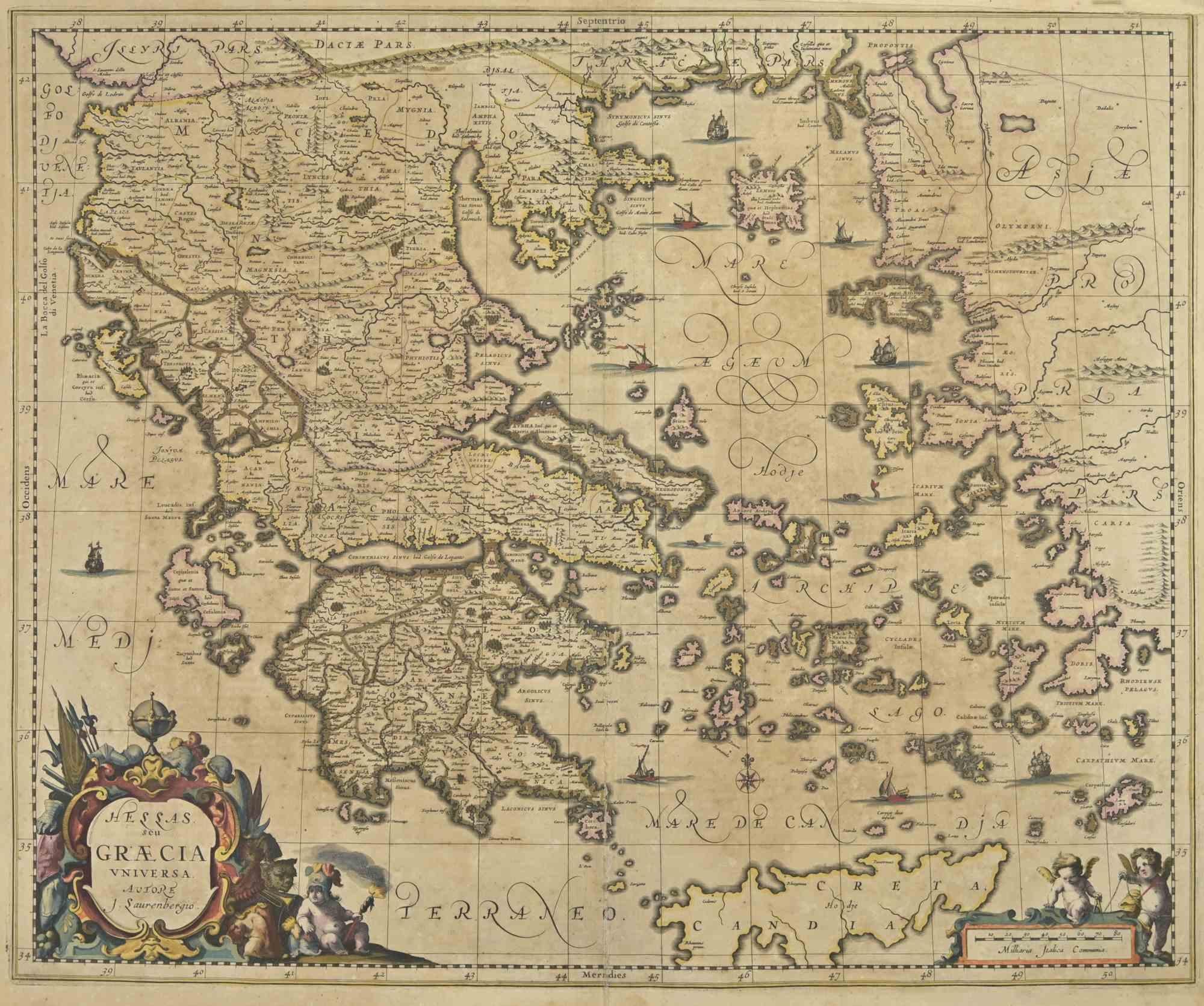
Ver todoAntique Classical Greece Map – Aegean Sea
Crete, ca.1697
Hellas seu Graecia Universa is a finely detailed late-17th-century map of Greece and the Aegean world, issued by Philipp Cluver around 1697 (possibly 1694). The map was published in ...
Categoría
Antiguo, finales del siglo XVII, Mapas
Materiales
Papel
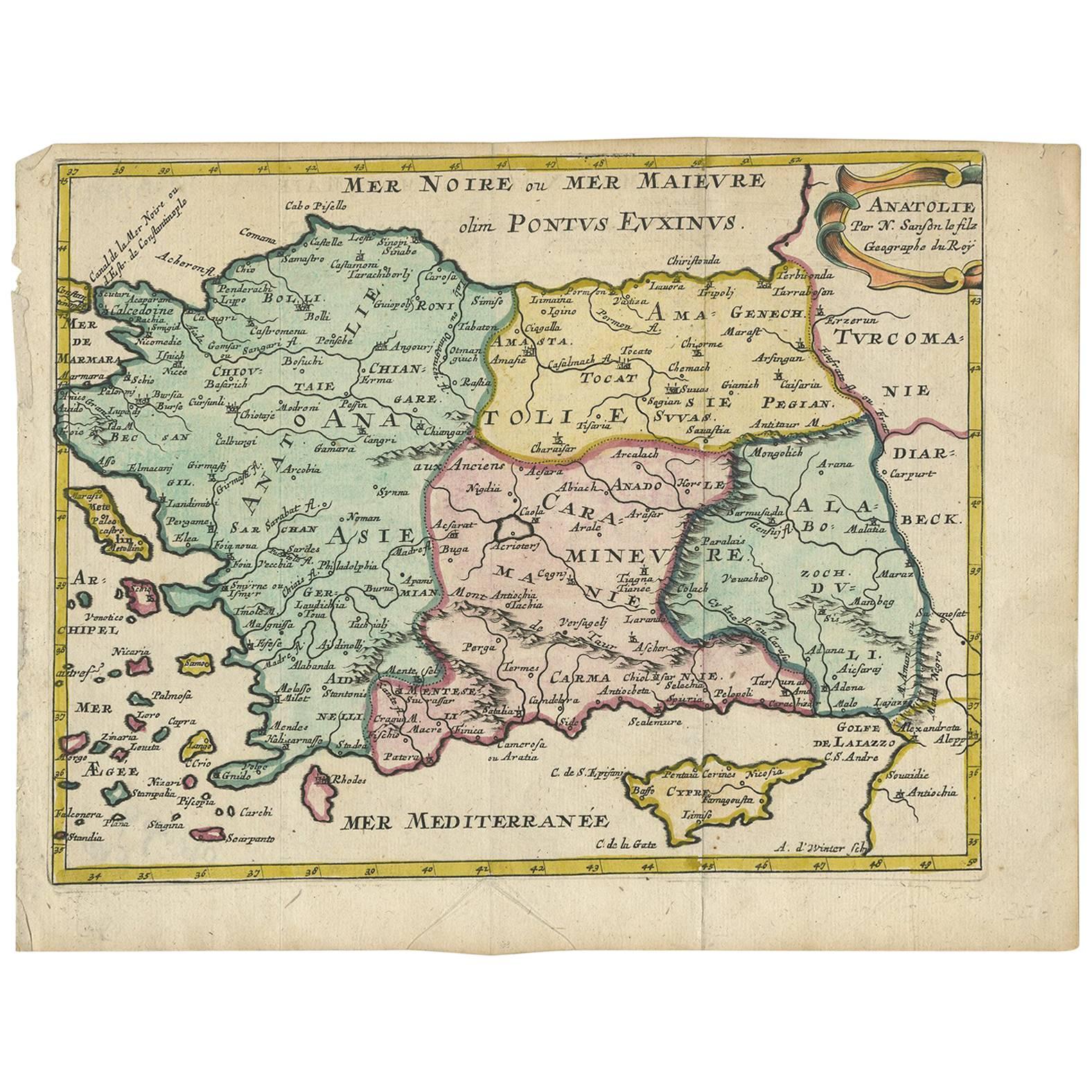
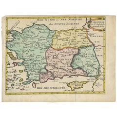
Mapa antiguo de Turquía con Chipre y las islas griegas por N. Sanson, hacia 1652
Mapa antiguo de Turquía, Anatolia con Chipre y las islas griegas. Atractiva cartela con título en volutas en la esquina superior derecha. Verso en blanco.
Categoría
Antiguo, mediados del siglo XVII, Mapas
Materiales
Papel
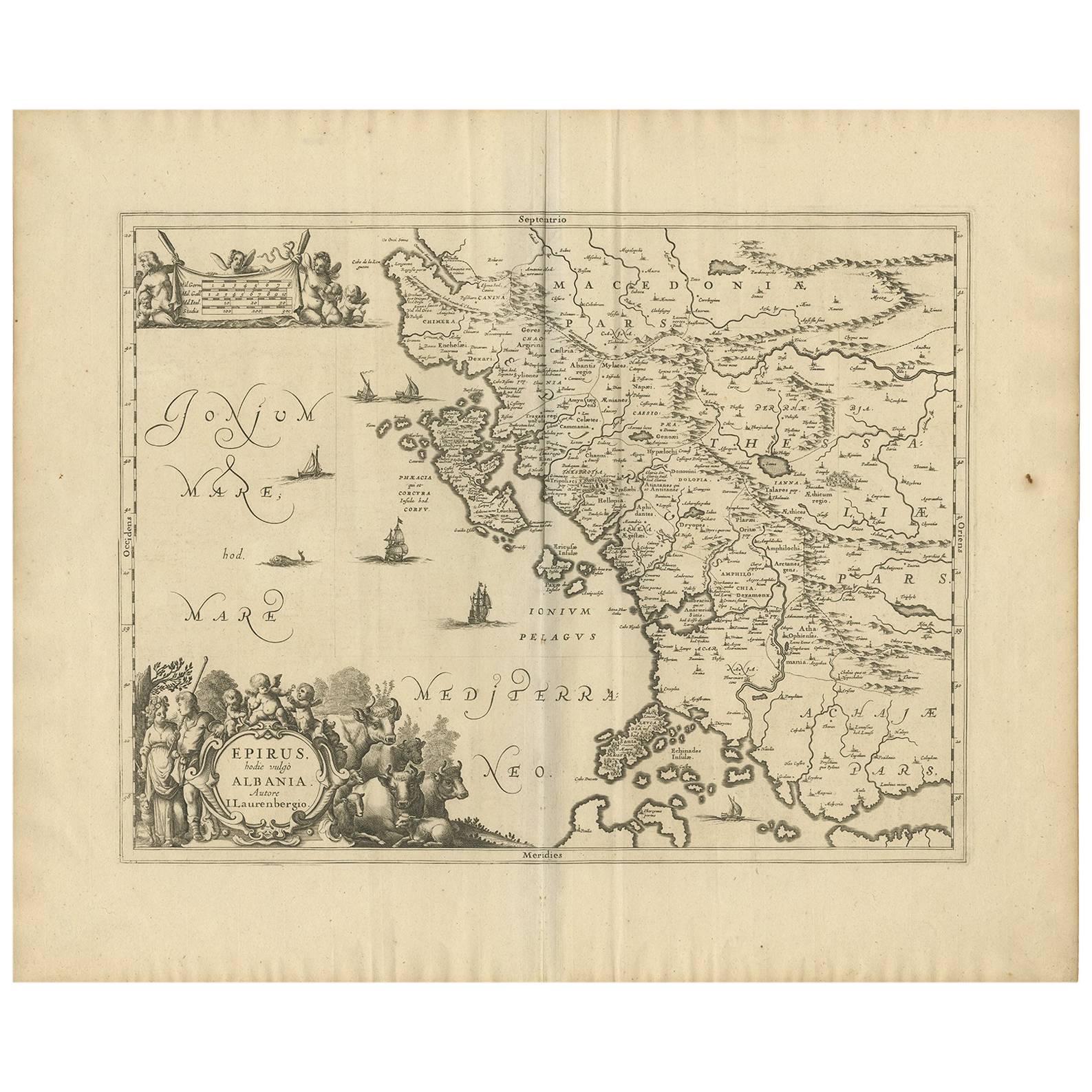
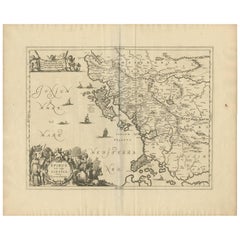
Mapa antiguo de Epiro
Albania, Grecia
por J. Janssonius, hacia 1650
Este mapa abarca la costa noroeste de Grecia y parte de la actual Albania. El mapa fue dibujado por Johannes Wilhelm Laurenberg, matemático e historiador que realizó varios atlas de ...
Categoría
Antiguo, mediados del siglo XVII, Mapas
Materiales
Papel
Mapa antiguo de Grecia por Allard (c.1698)
Mapa antiguo titulado "Hellas seu Graecia Universa" Mapa detallado de Grecia, con Creta, las islas del Egeo y parte de Turquía. Con dos cartelas, rosa de los vientos y escala. Excudi...
Categoría
Antiguo, finales del siglo XVII, Mapas
Materiales
Papel

784 € Precio de venta
Descuento del 20 %
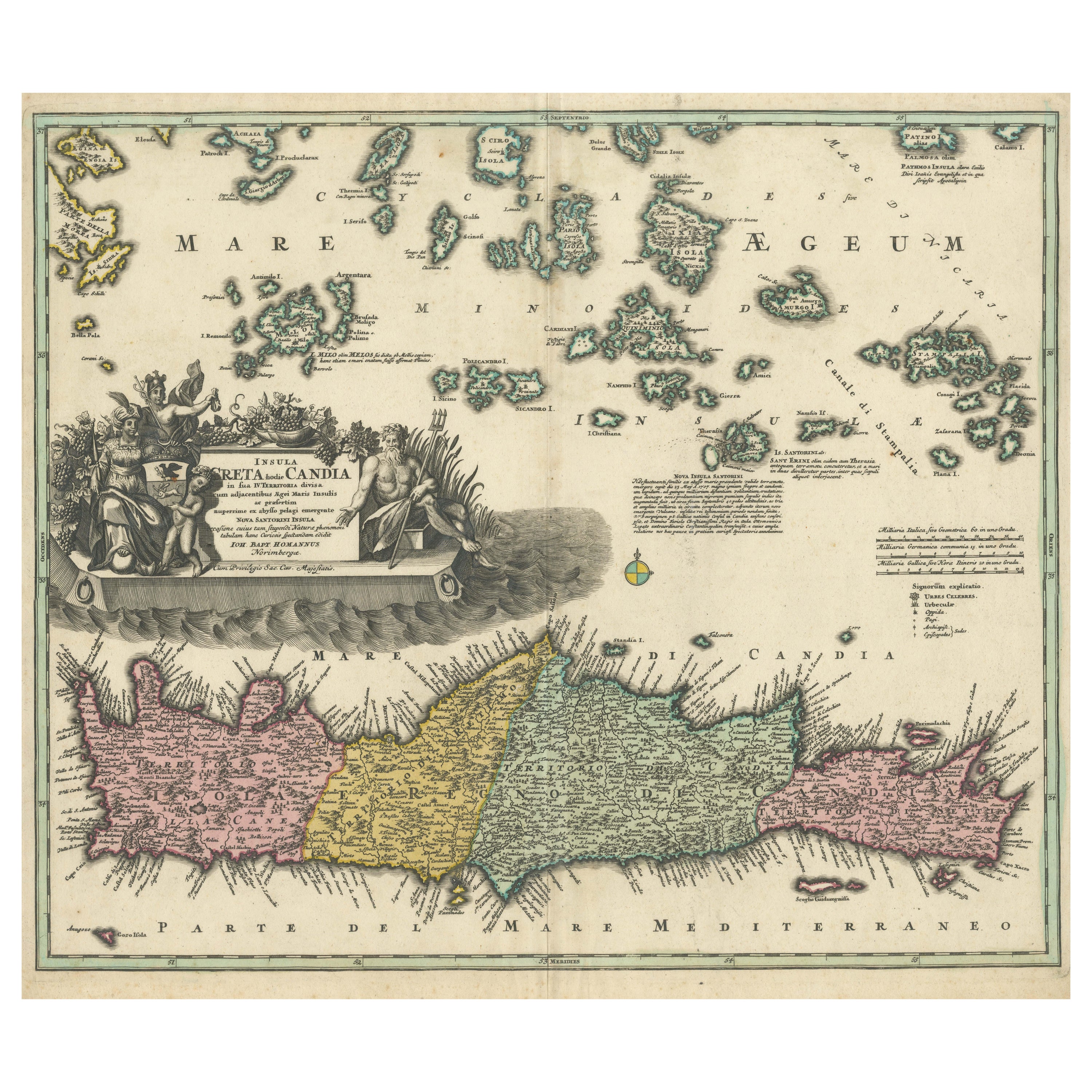
Mapa de Creta 1749 - Grabado de Homann Heirs de Candia con las islas del Egeo
Crete Map 1749 – Homann Heirs Engraving of Candia with Aegean Islands
This fine 1749 map titled 'Insula Creta hodie Candia' presents an 18th-century cartographic portrait of the isl...
Categoría
Antiguo, Década de 1740, Alemán, Mapas
Materiales
Papel
Mapa antiguo del sur de Italia de Janssonius, c.1650
" Mapa antiguo titulado "Itala nam tellus Graecia Maior erat Ovid. IV. Fastor. Haec Italiae pars nunc primum de prica aerugine est abstersa (..)". Precioso mapa del sur de Italia, vi...
Categoría
Antiguo, siglo XVII, Mapas
Materiales
Papel

592 € Precio de venta
Descuento del 20 %
También te puede gustar
Mapa antiguo - Mapa de Grecia - Grabado de Johannes Janssonius - Década de 1650
Por Johannes Janssonius
Mapa antiguo de Grecia - Graecia Vniversa es un mapa antiguo realizado en 1650 por Johannes Janssonius (1588-1664).
El Mapa es un grabado coloreado a mano, con acuarela coetánea.
...
Categoría
Década de 1650, Moderno, Impresiones figurativas
Materiales
Grabado químico

Grecia Meridional: Un gran mapa coloreado a mano del siglo XVII por Sanson y Jaillot
Por Nicholas Sanson d
Abbeville
Este gran mapa original grabado a mano en cobre del sur de Grecia y la península del Peloponeso, titulado "La Moree Et Les Isles De Zante, Cefalonie, Ste. Marie, Cerigo & C. Dresse S...
Categoría
Década de 1690, Impresiones de paisajes
Materiales
Grabado

1367 € Precio de venta
Descuento del 20 %
Mapa de Grecia - Grabado original de Antonio Zatta - Siglo XVIII
Este Mapa de Grecia es un aguafuerte realizado por Antonio Zatta, Cartógrafo, editor y tipógrafo.
El estado de conservación de la obra es bueno, salvo por el papel desgastado y el p...
Categoría
Década de 1780, Impresiones figurativas
Materiales
Grabado químico

Mapa antiguo - Macedonia - Grabado de Johannes Janssonius - Década de 1650
Por Johannes Janssonius
Macedonia es un mapa antiguo realizado en 1650 por Johannes Janssonius (1588-1664).
El Mapa es un grabado coloreado a mano, con acuarela coetánea.
Buen estado de conservación, con ...
Categoría
Década de 1650, Moderno, Impresiones figurativas
Materiales
Grabado químico

Mapa Antiguo - Mar Di Athiopia - Aguafuerte de Johannes Janssonius - Década de 1650
Por Johannes Janssonius
Mapa antiguo - Mar Di Athiopia es un mapa antiguo realizado en 1650 por Johannes Janssonius (1588-1664).
El Mapa es un aguafuerte coloreado a mano, con acuarela coetánea.
Buen esta...
Categoría
Década de 1650, Moderno, Impresiones figurativas
Materiales
Grabado químico

Grecia Meridional: Un gran mapa coloreado a mano del siglo XVII por Sanson y Jaillot
Por Nicolas Sanson
Este gran mapa original grabado a mano en cobre del sur de Grecia y la península del Peloponeso, titulado "La Moree Et Les Isles De Zante, Cefalonie, Ste. Marie, Cerigo & C. Dresse S...
Categoría
Antiguo, Década de 1690, Francés, Mapas
Materiales
Papel

1367 € Precio de venta
Descuento del 20 %