Artículos similares a Mediterranean
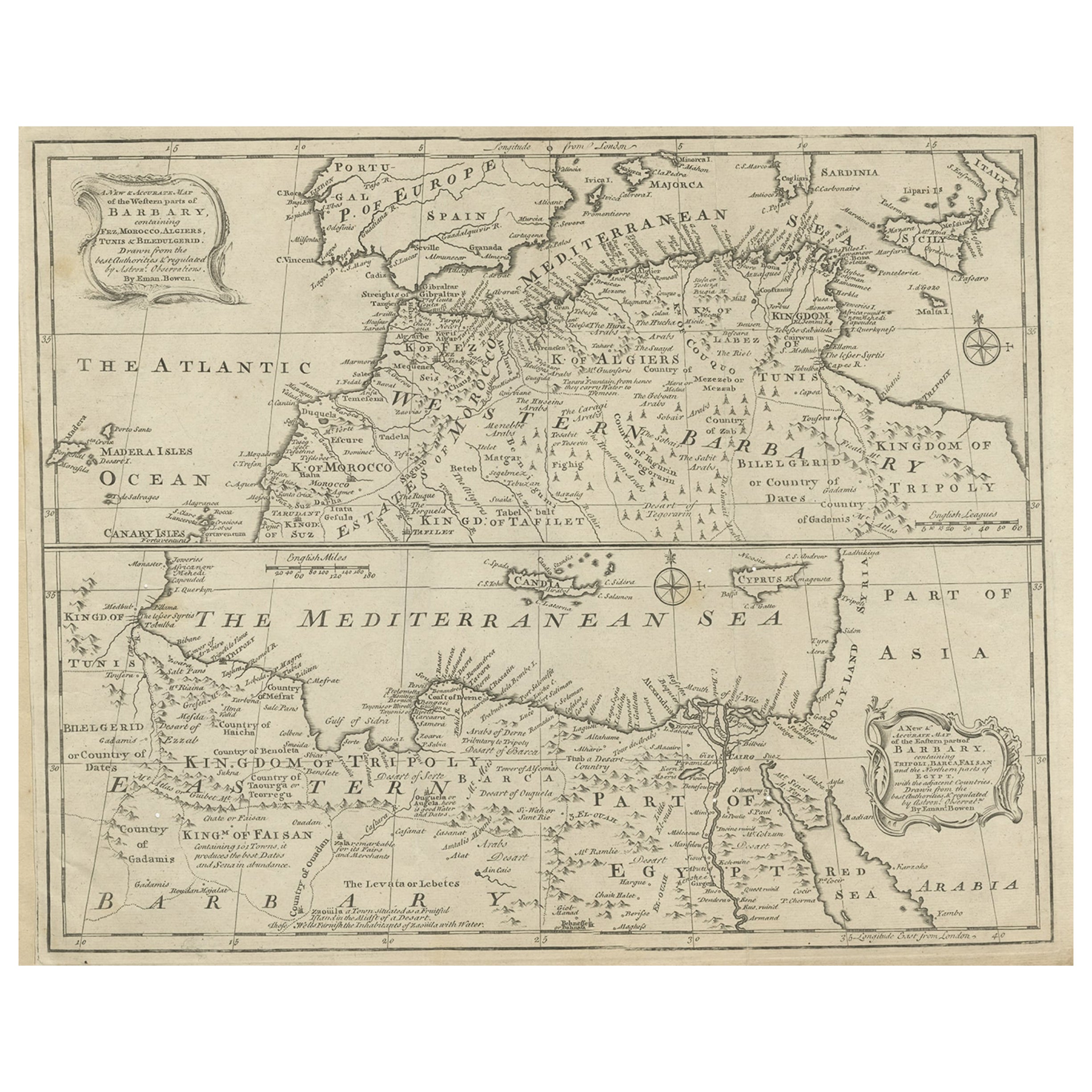
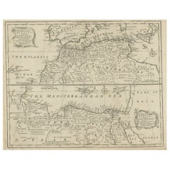
Barbary Coast – Elegant 18th Century Map by Bowen, c.1747

¿Quieres más imágenes o vídeos?
Solicita imágenes o vídeos adicionales al vendedor
1 de 10
Mediterranean
Barbary Coast – Elegant 18th Century Map by Bowen, c.1747
880 €IVA incluido
Acerca del artículo
Mediterranean
Barbary Coast – Elegant 18th Century Map by Bowen, c.1747
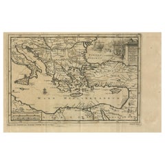
This elegant mid-18th-century engraved map presents the Mediterranean world with a strong focus on the Barbary Coast and North Africa, extending from the Atlantic coast of Morocco across the Mediterranean Sea to Egypt, the Levant, and parts of the Near East. The map encompasses southern Europe, including Spain, Italy, and the islands of the Mediterranean, while highlighting North African regions such as Morocco, Algiers, Tunis, Tripoli, Egypt, and Arabia.
The map was engraved by Emanuel Bowen and published circa 1747, during a period when European interest in the Mediterranean was driven by trade, naval power, diplomacy, and the strategic control of sea routes linking Europe, Africa, and the East. Bowen was one of the most prominent English mapmakers of the 18th century, serving as Royal Geographer to King George II, and his work is valued for its clarity, balance, and decorative refinement.
Coastal outlines, principal cities, kingdoms, and regions are clearly delineated, while inland territories are filled with place names, mountain ranges, and desert annotations that convey both geographic structure and contemporary European perceptions of North Africa and the eastern Mediterranean. The Barbary Coast is prominently labeled, with references to historic kingdoms, trading centers, and ports central to Mediterranean and trans-Saharan commerce. Egypt and the eastern Mediterranean are carefully rendered, including the Nile delta and surrounding regions.
The Mediterranean Sea itself dominates the composition, creating a calm, expansive visual rhythm that gives the map exceptional decorative presence. Decorative cartouches, compass roses, and neatline borders add elegance without overpowering the geography. The engraving style is refined and legible, making the map equally appealing to collectors and interior designers.
This map works beautifully as a statement wall piece, offering a timeless view of the Mediterranean world that complements both classic and contemporary interiors. It also integrates naturally with displays focused on North Africa, the Mediterranean basin, or 18th-century European cartography.
Condition report
Good condition overall. Central vertical fold as issued. Light age toning consistent with period, with a few scattered spots and minor surface marks. Plate mark visible. Margins intact.
Framing tips
A wide off-white or light sand-colored mat enhances the balance of the composition and allows the dense geography to breathe. A medium to dark wood frame or softly ebonized frame gives the piece a refined, hotel-ready appearance suitable for residential or hospitality interiors.
Technique: Copper engraving
Maker: Emanuel Bowen, England, c.1747
- Dimensiones:Altura: 40,5 cm (15,95 in)Anchura: 50,5 cm (19,89 in)Profundidad: 0,2 mm (0,01 in)
- Materiales y técnicas:Papel,Grabado
- Lugar de origen:
- Época:1740-1749
- Fecha de fabricación:circa 1747
- Estado:Good condition overall. Central vertical fold as issued. Light age toning consistent with period, with a few scattered spots and minor surface marks. Plate mark visible. Margins intact.
- Ubicación del vendedor:Langweer, NL
- Número de referencia:Vendedor: BG-14128-81stDibs: LU3054348017132
Sobre el vendedor
5,0
Vendedor reconocido
Estos prestigiosos vendedores son líderes del sector y representan el escalón más alto en cuanto a calidad y diseño de artículos.
Vendedor Platino
Vendedores premium con una calificación de +4,7 y tiempos de respuesta de 24 horas
Establecido en 2009
Vendedor de 1stDibs desde 2017
2848 ventas en 1stDibs
Tiempo de respuesta usual: 1 hora
- EnvíoRecuperando presupuesto…Envío desde: Langweer, Países Bajos
- Política de devolución
Partes de esta página se han traducido automáticamente. 1stDibs no puede garantizar la exactitud de las traducciones. El inglés es el idioma predeterminado de este sitio web.
Más de este vendedor
Ver todoMapa antiguo de Berbería occidental y oriental en África, c.1744
Mapa antiguo titulado "Un mapa nuevo y preciso de las partes occidentales de Berbería" y "Un mapa nuevo y preciso de las partes orientales de Berbería". Mapas decorativos del norte d...
Categoría
Antiguo, siglo XVIII, Británico, Mapas
Materiales
Papel
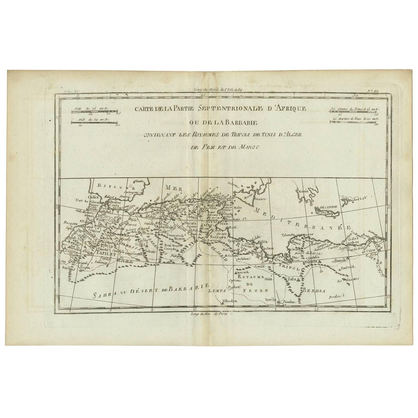
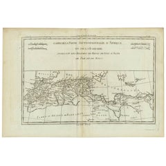
Mapa antiguo del norte de África "Costa Berberisca" por R. Bonne, hacia 1780
Un buen ejemplo del mapa de 1780 de Rigobert Bonne y Guilleme Raynal del noroeste de África o Costa Berberisca. Incluye los países actuales de Marruecos, Argelia, Túnez, Libia y part...
Categoría
Antiguo, finales del siglo XVIII, Francés, Mapas
Materiales
Papel
Mapa antiguo de la costa norte de África y sur de Europa, hacia 1745
Por Covens
Mortier
Mapa antiguo titulado "In Notitiam Ecclesiasticam Africae Tabula Geographica". Mapa muy decorativo coloreado a mano de la costa norte de África, España, Italia y el Mediterráneo con ...
Categoría
Antiguo, mediados del siglo XVIII, Mapas
Materiales
Papel

262 € Precio de venta
Descuento del 67 %
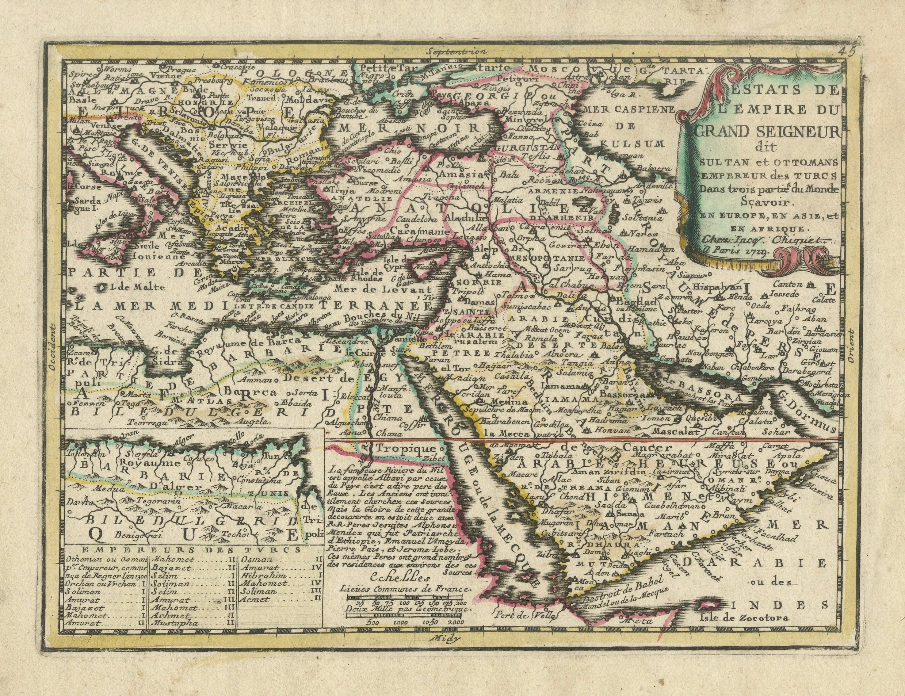
Mapa del Imperio Otomano 1719 - Europa Asia África, Jean Chiquet, París
Título: Mapa del Imperio Otomano 1719 - Europa Asia África, Jean Chiquet, París
Descripción:
Mapa grabado original de principios del siglo XVIII titulado Estats de l'Empire du Grand...
Categoría
Antiguo, principios del siglo XVIII, Francés, Mapas
Materiales
Papel
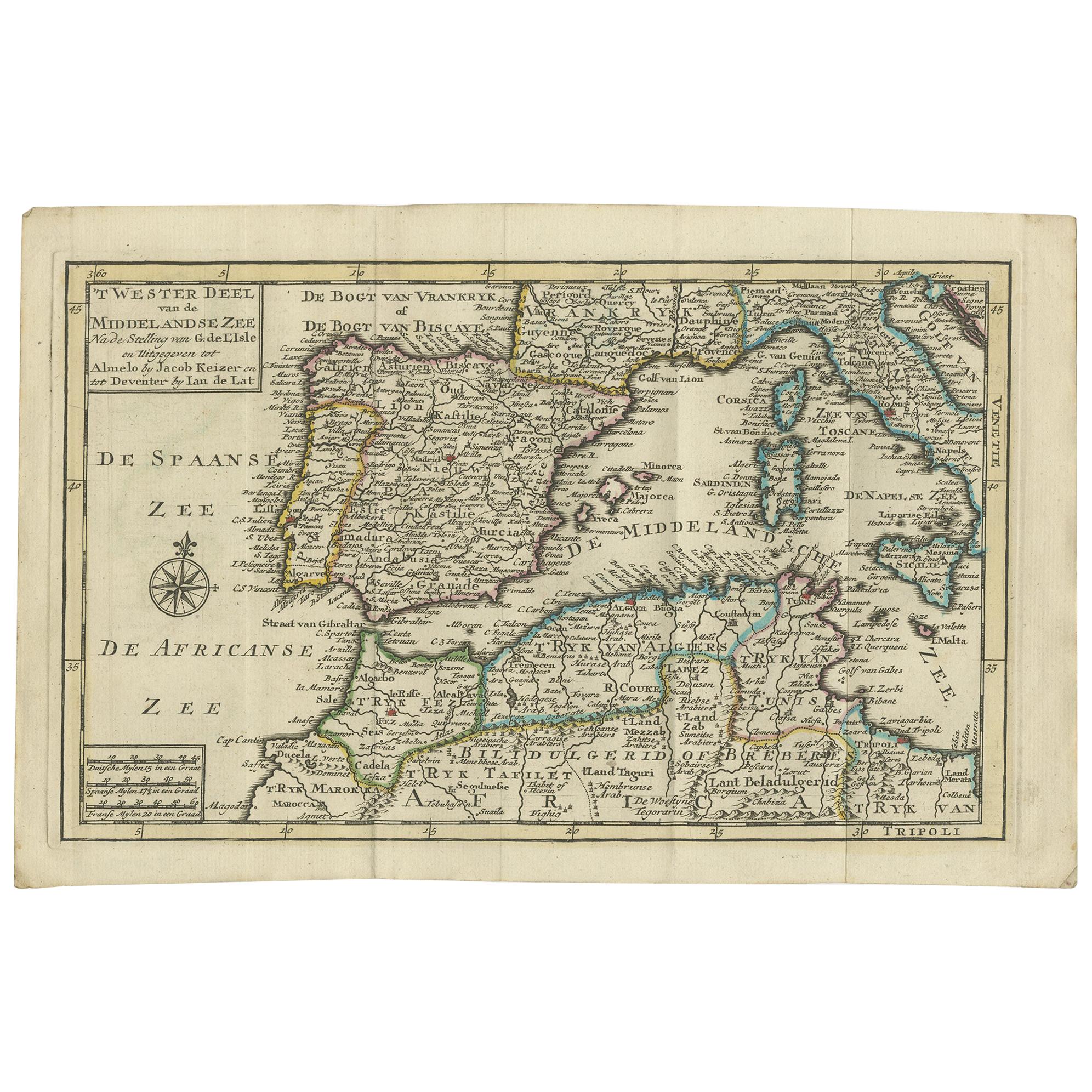
Mapa antiguo del Mar Mediterráneo y sus alrededores por Keizer
de Lat, 1788
Mapa antiguo titulado 't Wester Deel van de Middelandse Zee (..)'. Mapa antiguo original poco común del Mar Mediterráneo y sus alrededores. Este mapa procede del "Nieuwe Natuur- Gesc...
Categoría
Antiguo, finales del siglo XVIII, Mapas
Materiales
Papel

280 € Precio de venta
Descuento del 20 %
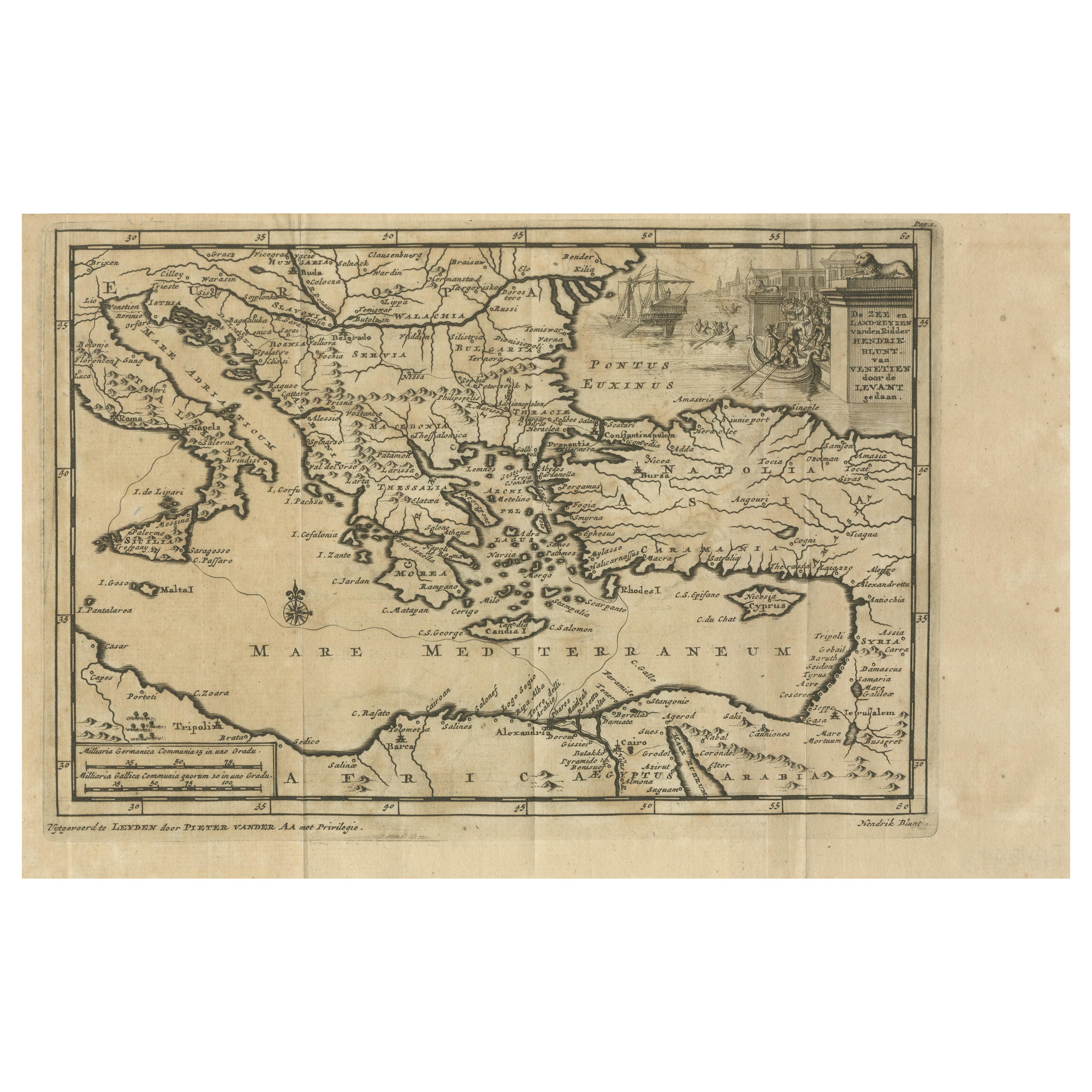
Rutas comerciales venecianas en Levante - Mapa antiguo de Pieter van der Aa, ca.1720
Rutas comerciales venecianas en Levante - Mapa antiguo de Pieter van der Aa, principios del siglo XVIII
Este mapa finamente grabado, publicado por Pieter Van Der Aa en Leiden, ofre...
Categoría
Antiguo, Década de 1720, Mapas
Materiales
Papel
También te puede gustar
Mar Mediterráneo y Adriático: Mapa original del siglo XVIII coloreado a mano por Bowen
Se trata de un mapa original coloreado a mano del siglo XVIII titulado "An Accurate Chart of The Mediterranean and Adriatic Sea's; with the Archipelago & Part of the Black Sea. Exhib...
Categoría
mediados del siglo XVIII, Antiguos maestros, Impresiones de paisajes
Materiales
Grabado

Costa Oeste de África, Guinea y Sierra Leona: Un mapa del siglo XVIII de Bellin
Por Jacques-Nicolas Bellin
Mapa en cobre de Jacques Bellin titulado "Partie de la Coste de Guinee Dupuis la Riviere de Sierra Leona Jusquau Cap das Palmas", que representa la costa de Guinea y Sierra Leona en ...
Categoría
Antiguo, mediados del siglo XVIII, Francés, Mapas
Materiales
Papel

África: Un gran mapa coloreado a mano del siglo XVII por Sanson y Jaillot
Por Nicolas Sanson
Este gran mapa original de África grabado a mano en cobre titulado "L'Afrique divisee suivant l'estendue de ses principales parties ou sont distingues les uns des autres, Les Empires...
Categoría
Antiguo, Década de 1690, Francés, Mapas
Materiales
Papel

Mapa antiguo - Mare Pacificum - Aguafuerte de Johannes Janssonius - Década de 1650
Por Johannes Janssonius
Mare Pacificum es un mapa antiguo realizado en 1650 por Johannes Janssonius (1588-1664).
El Mapa es un aguafuerte coloreado a mano, con acuarela coetánea.
Buen estado de conservaci...
Categoría
Década de 1650, Moderno, Impresiones figurativas
Materiales
Grabado químico

Mapa Antiguo - Mar Di Athiopia - Aguafuerte de Johannes Janssonius - Década de 1650
Por Johannes Janssonius
Mapa antiguo - Mar Di Athiopia es un mapa antiguo realizado en 1650 por Johannes Janssonius (1588-1664).
El Mapa es un aguafuerte coloreado a mano, con acuarela coetánea.
Buen esta...
Categoría
Década de 1650, Moderno, Impresiones figurativas
Materiales
Grabado químico

Mapa de las Indias Orientales: Un mapa original coloreado a mano del siglo XVIII por E. Bowen
Se trata de un mapa original coloreado a mano del siglo XVIII titulado "Un mapa preciso de las Indias Orientales que muestra el curso del comercio europeo tanto en el continente como...
Categoría
mediados del siglo XVIII, Antiguos maestros, Impresiones de paisajes
Materiales
Grabado
