Artículos similares a River Sanaga, West Africa – Elegant French Exploration Map, c.1750


¿Quieres más imágenes o vídeos?
Solicita imágenes o vídeos adicionales al vendedor
1 de 9
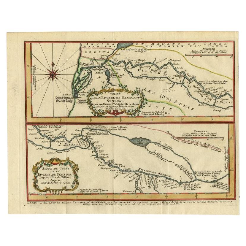
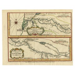
River Sanaga, West Africa – Elegant French Exploration Map, c.1750
630 €IVA incluido
Acerca del artículo
Nubia and Abyssinia – Venetian Map of Northeast Africa, Zatta, 1784
This detailed late-18th-century map depicts Nubia and Abyssinia, covering large parts of present-day Sudan, Ethiopia, Eritrea, and the Horn of Africa. The map is titled “La Nubia ed Abissinia” and was published in Venice in 1784 by Antonio Zatta, one of the most important Italian map publishers of the period. It forms part of Zatta’s monumental Atlante Novissimo, produced with the privilege of the Venetian Senate.
The map presents the Nile basin in exceptional detail, tracing the river from its upper reaches through Nubia toward Egypt, while also mapping the Red Sea coast, inland mountain ranges, deserts, and regional kingdoms. Political and regional boundaries are outlined in contemporary hand color, distinguishing Nubia, Abyssinia, and neighboring territories. Numerous towns, tribal regions, rivers, and topographical features are carefully named, reflecting the synthesis of classical sources, Jesuit reports, and more recent travel accounts available to European geographers in the late Enlightenment period.
Zatta’s cartography represents the Italian continuation of the scientific mapping tradition pioneered by Delisle and d’Anville, emphasizing clarity, proportional accuracy, and critical compilation of sources. While interior Africa remained imperfectly known, this map shows a marked departure from earlier speculative geography, replacing legend with measured structure and comparative reasoning.
The decorative title cartouche, engraved in a restrained architectural style, anchors the upper right and reflects the sober elegance characteristic of Venetian Enlightenment cartography. Latitude and longitude lines, clean engraving, and balanced composition give the map strong visual presence without excess ornamentation.
This map is particularly appealing to collectors of African cartography, Nile exploration history, Ethiopian history, and Enlightenment-era geography. It also serves as an excellent intellectual counterpart to earlier French coastal and regional charts of Africa, illustrating the progression of European geographic knowledge during the 18th century.
Condition report
Good condition overall. Central vertical fold as issued. Light age toning and some mild discoloration, more noticeable along the fold. Minor scattered spots and faint handling marks. Original outline hand color. Plate mark visible. Margins intact.
Framing tips
A wide off-white or light sand-colored mat is recommended to balance the dense interior detail and preserve visual calm. A medium to dark wood frame enhances the engraved line work and complements the restrained hand coloring. Particularly effective as a scholarly centerpiece or paired with Indian Ocean or Nile-related maps.
Technique: Copper engraving with contemporary outline hand color
Maker: Antonio Zatta, Venice, 1784
Keywords: Nubia map, Abyssinia map, Ethiopia antique map, Northeast Africa cartography, Nile map, Blue Nile, White Nile, Red Sea map, Horn of Africa, Ethiopian Highlands, Kingdom of Nubia, Kingdom of Abyssinia, Gondar, Axum, Aksum, Sennar, Dongola, Suakin, Massawa, Zeila, Bab el Mandeb, Red Sea trade routes, Mecca, Mekka, Meca, Arabian Peninsula, African exploration map, 18th century map Africa, Venetian map, Antonio Zatta, Atlante Novissimo, Enlightenment cartography, antique engraved map
- Dimensiones:Altura: 34,7 cm (13,67 in)Anchura: 43,7 cm (17,21 in)Profundidad: 0,2 mm (0,01 in)
- Materiales y técnicas:Papel,Grabado
- Lugar de origen:
- Época:1750-1759
- Fecha de fabricación:circa 1750
- Estado:Good condition overall. Central vertical fold as issued. Light age toning and some mild discoloration, more noticeable along the fold. Minor scattered spots and faint handling marks. Original outline hand color. Plate mark visible. Margins intact.
- Ubicación del vendedor:Langweer, NL
- Número de referencia:Vendedor: BG-14128-61stDibs: LU3054348017042
Sobre el vendedor
5,0
Vendedor reconocido
Estos prestigiosos vendedores son líderes del sector y representan el escalón más alto en cuanto a calidad y diseño de artículos.
Vendedor Platino
Vendedores premium con una calificación de +4,7 y tiempos de respuesta de 24 horas
Establecido en 2009
Vendedor de 1stDibs desde 2017
2813 ventas en 1stDibs
Tiempo de respuesta usual: 1 hora
- EnvíoRecuperando presupuesto…Envío desde: Langweer, Países Bajos
- Política de devolución
Partes de esta página se han traducido automáticamente. 1stDibs no puede garantizar la exactitud de las traducciones. El inglés es el idioma predeterminado de este sitio web.
Más de este vendedor
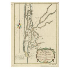
Ver todoMapa antiguo del río Sanaga, Senegal, 1747
Mapa antiguo titulado 'Cours De La Riviere De Sanaga Ou Senegal (..) - Kaart van den Loop der Riviere Sanaga (..)'. Atractivo mapa doble del río Sanaga, Senegal, África. Este mapa pr...
Categoría
Antiguo, siglo XVIII, Mapas
Materiales
Papel
Mapa antiguo del río Gambia por J. Van Schley, hacia 1750
"Carte de la Riviere de Gambra ou Gambie. Depuis son Embouchure Jusqu a Eropina". Grabado original en cobre según el Capt. J. Mapa de la región de Leach de 1732. Con cartela ornament...
Categoría
Antiguo, mediados del siglo XVIII, Mapas
Materiales
Papel

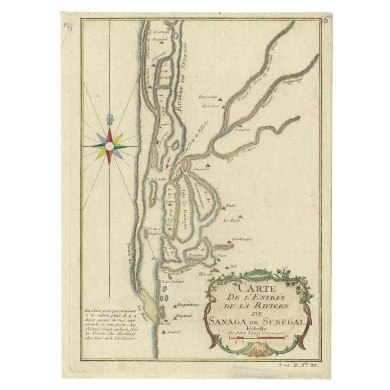
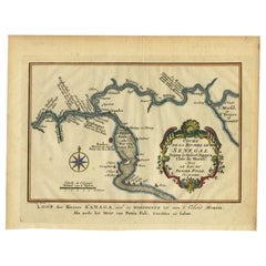
Mapa antiguo del río Senegal por Bellin, 1746
Mapa antiguo titulado "Carte de l'Entrée de la Rivière de Sanaga ou Senegal". Mapa de la desembocadura del río Senegal. Este mapa procede de la "Histoire Generale des Voyages" de Pre...
Categoría
Antiguo, siglo XVIII, Mapas
Materiales
Papel
188 € Precio de venta
Descuento del 20 %
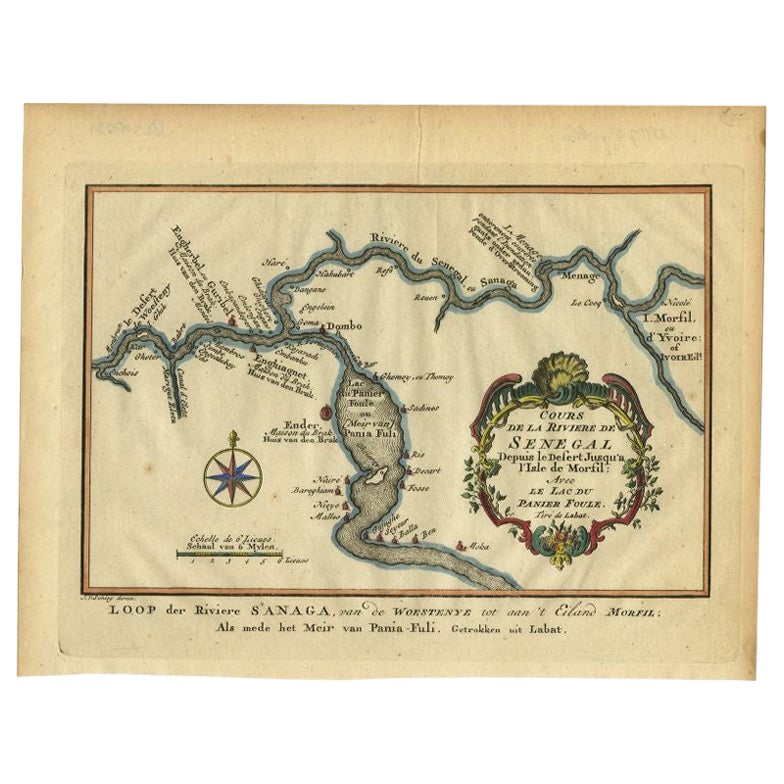
Mapa antiguo del curso del río Sanaga por Van Schley, 1747
Mapa antiguo titulado "Cours de la Riviere de Senegal (..) - Loop der Riviere Sanaga (..)". Mapa antiguo original del curso del río Sanaga que forma la frontera entre Senegal y Mauri...
Categoría
Antiguo, siglo XVIII, Mapas
Materiales
Papel
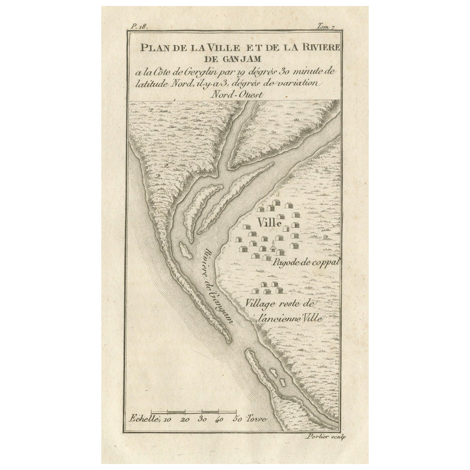
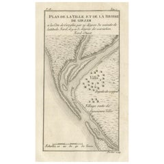
Plano de la ciudad y del río de Ganjam, India - Antique French Map by Portier 1790
Plano de la ciudad y el río de Ganjam, India - Antique French Map by Portier, c.1790
Este grabado francés antiguo muestra un plano detallado de la ciudad y el río de Ganjam, situado...
Categoría
Antiguo, finales del siglo XVIII, Francés, Mapas
Materiales
Papel
Mapa antiguo del río y la bahía de Tunquin, Siam, 1757
Mapa antiguo titulado 'Carte du Cours de la Riviere de Tunquin Depuis Cacho jusqu'à la Mer'. Mapa detallado del río y la bahía de Tunquin, que se extiende hacia el norte hasta Cacho,...
Categoría
Antiguo, siglo XVIII, Francés, Mapas
Materiales
Papel

También te puede gustar
Costa Oeste de África, Guinea y Sierra Leona: Un mapa del siglo XVIII de Bellin
Por Jacques-Nicolas Bellin
Mapa en cobre de Jacques Bellin titulado "Partie de la Coste de Guinee Dupuis la Riviere de Sierra Leona Jusquau Cap das Palmas", que representa la costa de Guinea y Sierra Leona en ...
Categoría
Antiguo, mediados del siglo XVIII, Francés, Mapas
Materiales
Papel

398 € Precio de venta
Descuento del 20 %
África Occidental Titulado "Guinea Propia": Un Mapa Homann Coloreado a Mano del Siglo XVIII
Por Johann Baptist Homann
Se trata de un escaso mapa de África grabado en plancha de cobre, ricamente coloreado a mano, titulado "Guinea Propria, nec non Nigritiae vel Terrae Nigrorum Maxima Pars" de Johann B...
Categoría
Antiguo, mediados del siglo XVIII, Alemán, Mapas
Materiales
Papel

1299 € Precio de venta
Descuento del 20 %
Costa Oeste de África; Guinea y Sierra Leona: Mapa Bellin del siglo XVIII
Se trata de un mapa en plancha de cobre de Jacques Bellin titulado "Partie de la Coste de Guinee Dupuis la Riviere de Sierra Leona Jusquau Cap das Palmas", que representa la costa de...
Categoría
Década de 1740, Antiguos maestros, Impresiones de paisajes
Materiales
Grabado

398 € Precio de venta
Descuento del 20 %
África Occidental: Mapa Homann del siglo XVIII coloreado a mano titulado "Guinea Propia"
Por Johann Baptist Homann
Se trata de un escaso mapa de África grabado en plancha de cobre, ricamente coloreado a mano, titulado "Guinea Propria, nec non Nigritiae vel Terrae Nigrorum Maxima Pars" de Johann B...
Categoría
Década de 1740, Otro estilo de arte, Impresiones y múltiplos
Materiales
Grabado

1299 € Precio de venta
Descuento del 20 %
1640 Joan Bleau Mapa titulado "Diocecese de rheims et le pais de rethel, " Eic.a011
1640 Mapa de Joan Bleau titulado
"Diocecese de rheims et le pais de rethel".
Ric.a011
OAN BLAEU
Diocecese de Reims, et le pais de Rethel.
Grabado coloreado a mano, c.1...
Categoría
Antiguo, siglo XVII, Holandés, Mapas
Materiales
Papel

Mapa Tierra Santa La Terre Sainte Grabado van Loon Publicado N de Fer 1703 Francés
La Terre Sainte, La Tierra Santa, Tiree Des Memoires De M.De.La Rue. Par N. de Fer. Geographe de Sa Majeste Catoliq et de Monseigneur le Dauphin. Avec Privil du Roi 1703
Mapa deta...
Categoría
Antiguo, Principios del 1700, Francés, Luis XIV, Mapas
Materiales
Papel
