Artículos similares a Southern India Map, Deccan
Malabar, Nicolas Sanson, 1683

¿Quieres más imágenes o vídeos?
Solicita imágenes o vídeos adicionales al vendedor
1 de 10
Southern India Map, Deccan
Malabar, Nicolas Sanson, 1683
440 €IVA incluido
Acerca del artículo
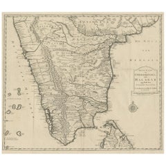
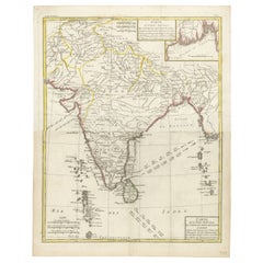
Southern India Map, Deccan
Malabar, Nicolas Sanson, 1683
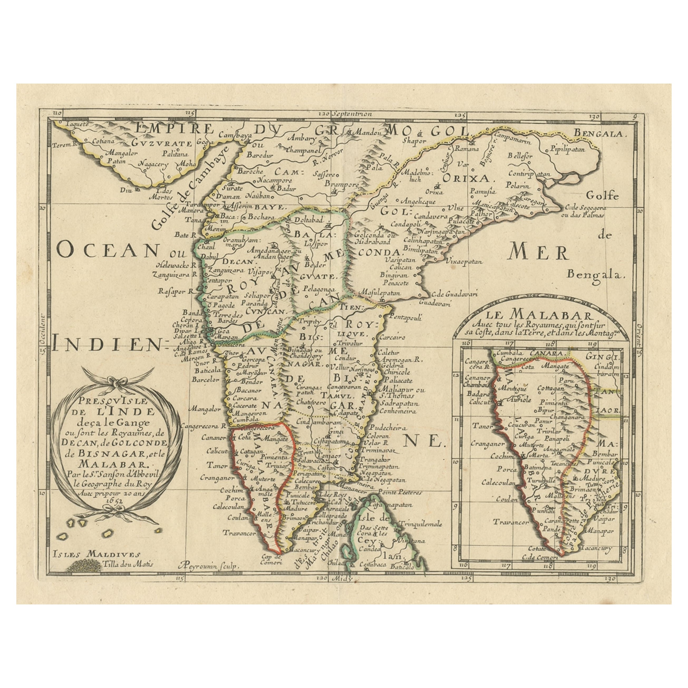
This engraved map depicts the Indian Peninsula, extending from Gujarat and the Bay of Bengal in the north to Cape Comorin and the northern tip of Sri Lanka in the south. Titled Presqu’Isle de l’Inde deça la Gange, it shows the major regions known to European geographers in the mid-17th century, including the Deccan, Golconda, Bisnagar, and the Malabar Coast.
The coastline is rendered with clarity and confidence, reflecting the strength of European coastal knowledge driven by maritime trade. Inland geography is more speculative, with mountain ranges and river systems presented according to contemporary geographic theory rather than direct observation. Despite this, the map successfully conveys the political and commercial structure of southern India as understood by Europeans during the early modern period.
An inset map at the lower right provides a focused view of the Malabar Coast, underscoring its importance within the Indian Ocean trading world. The Maldives are also included, with the northern atoll identified as “Tilla dou Matis,” highlighting European awareness of key maritime landmarks. Place names such as Golconda and Bisnagar reflect European adaptations of local political entities, some of which were already in decline or transformation by the time this map was issued.
The map was originally created by Nicolas Sanson in 1653 and later re-engraved for the first Dutch edition of his small-format atlas, published in Utrecht in 1683. The Dutch plates were engraved by Anthonie de Winter after Sanson’s Paris originals and are faithful copies rather than later reinterpretations. This example corresponds to that 1683 Utrecht issue, prior to later reworkings of the plate around 1700.
Printed on period paper, the map shows signs of age and use consistent with its origin from a bound atlas. It remains visually strong and is well suited for decorative framing, particularly for interiors focused on cartography, travel, or Asian history.
Condition report:
Engraved map on paper. Central vertical folds as issued, with overall age toning and light surface wear. Minor stains and handling marks visible. Margins present with some wear. Condition consistent with age and reflected in price.
Framing tips:
A wide mat is recommended to accommodate the folds and soften their appearance. Dark wood or black frames enhance the engraved detail and give the map strong visual presence. A floated mount can also work well if the folds are embraced as part of the map’s history.
Technique: Engraving
Maker: Nicolas Sanson d’Abbeville, re-engraved by Anthonie de Winter, Utrecht, 1683
- Dimensiones:Altura: 21,6 cm (8,51 in)Anchura: 29,8 cm (11,74 in)Profundidad: 0,2 mm (0,01 in)
- Materiales y técnicas:Papel,Grabado
- Lugar de origen:
- Época:finales del siglo XVII
- Fecha de fabricación:1683
- Estado:Engraved map on paper. Central vertical folds as issued, with overall age toning and light surface wear. Minor stains and handling marks visible. Margins present with some wear. Condition consistent with age and reflected in price.
- Ubicación del vendedor:Langweer, NL
- Número de referencia:Vendedor: PCT-352281stDibs: LU3054348089232
Sobre el vendedor
5,0
Vendedor reconocido
Estos prestigiosos vendedores son líderes del sector y representan el escalón más alto en cuanto a calidad y diseño de artículos.
Vendedor Platino
Vendedores premium con una calificación de +4,7 y tiempos de respuesta de 24 horas
Establecido en 2009
Vendedor de 1stDibs desde 2017
2816 ventas en 1stDibs
Tiempo de respuesta usual: 1 hora
- EnvíoRecuperando presupuesto…Envío desde: Langweer, Países Bajos
- Política de devolución
Partes de esta página se han traducido automáticamente. 1stDibs no puede garantizar la exactitud de las traducciones. El inglés es el idioma predeterminado de este sitio web.
Más de este vendedor
Ver todoMapa Sanson de la India meridional y Malabar de 1705 con un mapa en recuadro
Título: 1705 Sanson Map of Southern India and Malabar with an Inset Map
Descripción: Este mapa antiguo, finamente grabado y bellamente coloreado a mano, publicado en 1705, represe...
Categoría
Antiguo, Principios del 1700, Mapas
Materiales
Papel

616 € Precio de venta
Descuento del 20 %
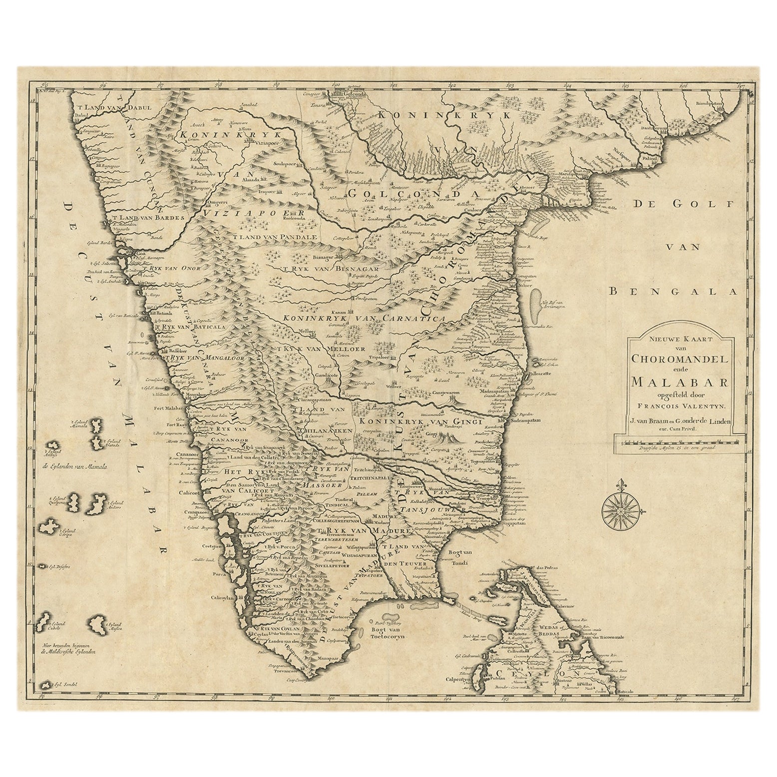
Mapa de Choromandel y Malabar, incluidos Kerala, Tamil Nadu y parte de Sri Lanka, 1726
Mapa antiguo titulado 'Nieuwe kaart van Choromandel ende Malabar.'
Mapa antiguo original del sur de la India que documenta las zonas de influencia de la VOC. Se incluyen Kerala, ...
Categoría
Antiguo, Década de 1720, Holandés, Mapas
Materiales
Papel
490 € Precio de venta
Descuento del 50 %
Envío gratuito
Mapa original antiguo de la India meridional, Sri Lanka septentrional y Malabar, 1652
Mapa antiguo titulado 'Presqu'Isle de l'Inde deca le Gange (..)'.
Mapa antiguo que muestra la parte meridional de la India, incluida la parte septentrional de Sri Lanka. Con mapa...
Categoría
Antiguo, Década de 1650, Mapas
Materiales
Papel

528 € Precio de venta
Descuento del 20 %
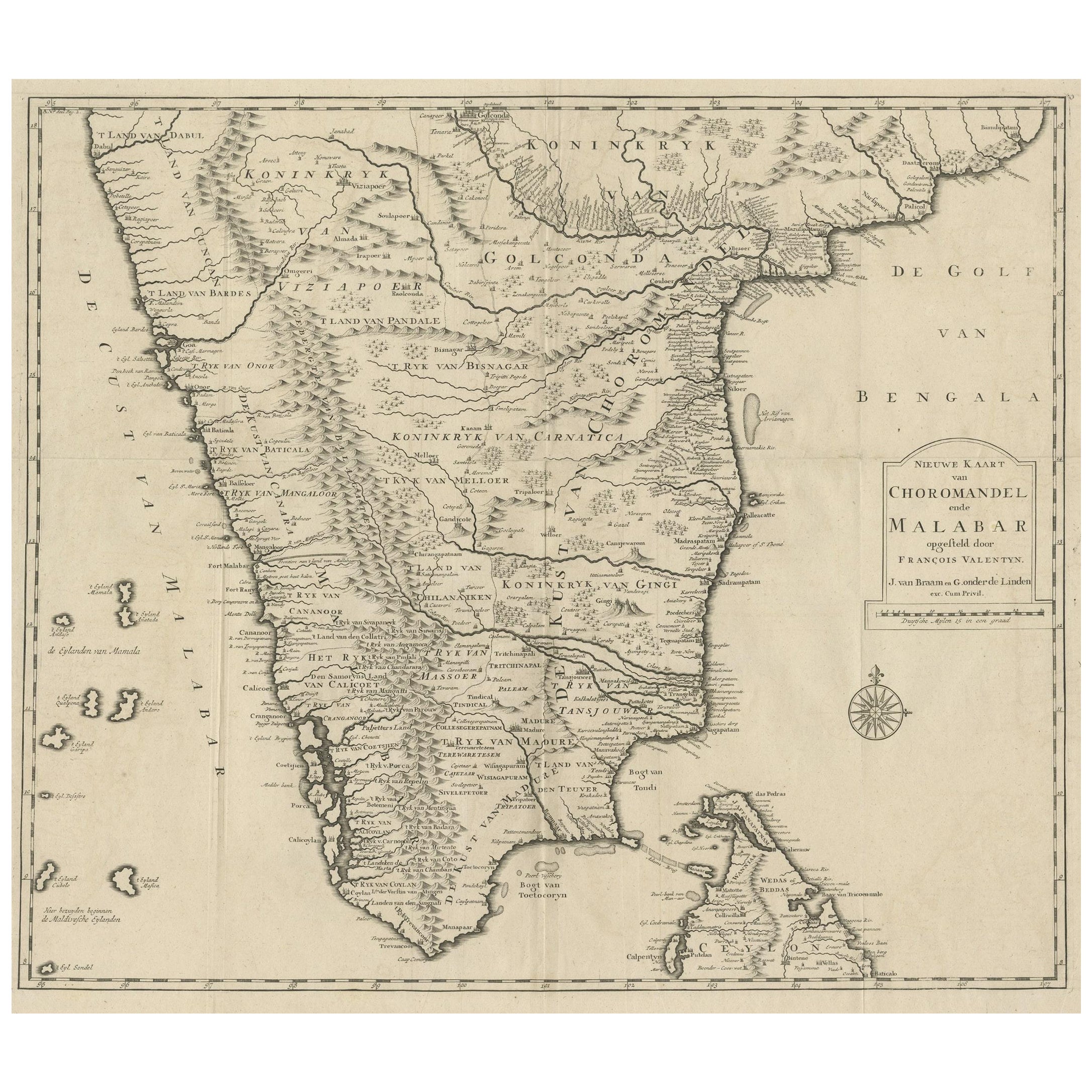
Antiguo mapa original de Chormandel y Malabar, India y Ceilán, actual Sri Lanka, 1726
Mapa antiguo titulado "Nieuwe Kaart van Choromandel ende Malabar".
Mapa antiguo que representa la parte meridional de la India y el extremo septentrional de Ceilán, Sri Lanka. Este...
Categoría
Antiguo, Década de 1720, Mapas
Materiales
Papel
440 € Precio de venta
Descuento del 20 %
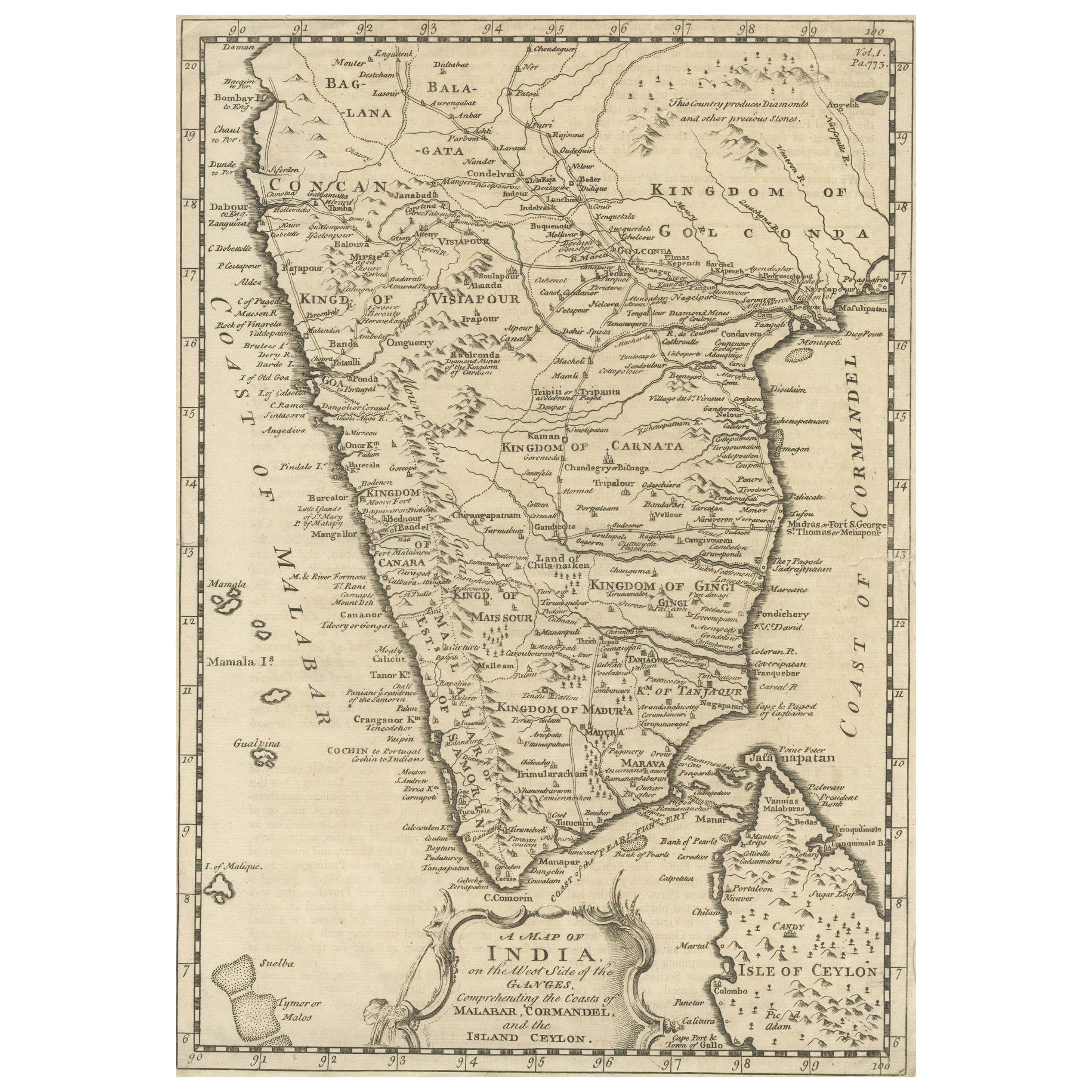
Mapa original antiguo detallado del sur de la India y la mayor parte de Ceilán, 1744
Mapa antiguo titulado "Mapa de la India en el lado occidental del Ganges, que comprende las costas de Malabar, Coromandel y la isla de Ceilán".
Mapa del Sur de la India y de la m...
Categoría
Antiguo, Década de 1740, Mapas
Materiales
Papel
352 € Precio de venta
Descuento del 20 %
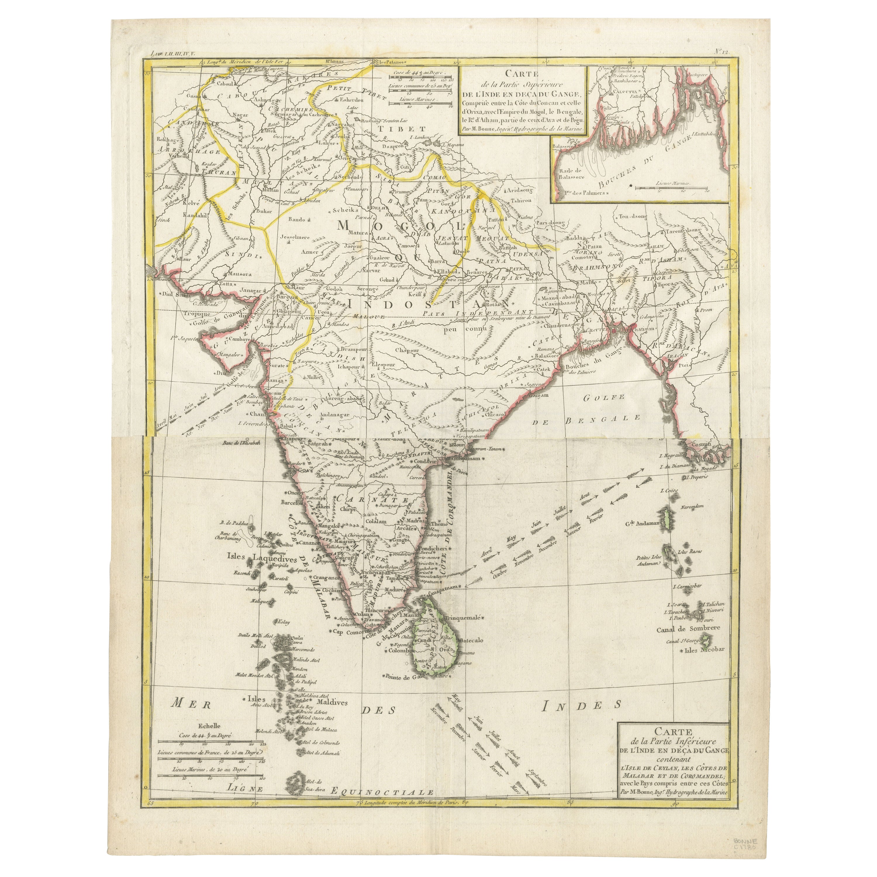
Mapa de la India y Ceilán con Calcuta y el Ganges, por Bonne, 1780
El mapa que se ofrece es un antiguo grabado en cobre de la India y Ceilán (Sri Lanka), creado por Rigobert Bonne (1727-1794), un destacado cartógrafo francés. Aquí tienes un desglose...
Categoría
Antiguo, Década de 1780, Francés, Mapas
Materiales
Papel
También te puede gustar
Mapa original antiguo de la India por Dower, hacia 1835
Bonito mapa de la India
Dibujado y grabado por J.Dower
Publicado por Orr & Smith. C.1835
Sin enmarcar.
Envío gratuito
Categoría
Antiguo, Década de 1830, Inglés, Mapas
Materiales
Papel

Mapa De La India - Litografía Original - Siglo XIX
Mapa de la India es una obra de arte litográfica original realizada por un Grabador anónimo del siglo XIX.
Impreso en la serie de "Francia Pittoresca".
Titulado "Francia Pittores...
Categoría
siglo XIX, Moderno, Impresiones figurativas
Materiales
Litografía

Antique French Map of Asia Including China Indoneseia India, 1783
Muy bonito mapa de Asia. 1783 Dedie au Roy.
Más información:
País de fabricación: Europa
Periodo: Siglo XVIII Qing (1661 - 1912)
Estado: Estado general B (Bien usado): Algunos rastr...
Categoría
Antiguo, siglo XVIII, Europeo, Mapas
Materiales
Papel

421 € Precio de venta
Descuento del 40 %
Tabula Indiae Orientalis - Grabado de Frederick de Wit - 1680ca
Por Frederick de Wit
Este grabado a doble página con coloreado contemporáneo, titulado Tabula Indiae orientalis, fue realizado por el cartógrafo Frederick de Wit para el famoso Atlas publicado en Amsterd...
Categoría
Década de 1680, Moderno, Impresiones figurativas
Materiales
Grabado químico

Mapa de las Indias Orientales: Un mapa original coloreado a mano del siglo XVIII por E. Bowen
Se trata de un mapa original coloreado a mano del siglo XVIII titulado "Un mapa preciso de las Indias Orientales que muestra el curso del comercio europeo tanto en el continente como...
Categoría
mediados del siglo XVIII, Antiguos maestros, Impresiones de paisajes
Materiales
Grabado

883 € Precio de venta
Descuento del 20 %
Persiae, Armeniae, Natoliae et Arabiae Descriptio per Frederick deWit 1666 mapa
Mapa de Persiae, Armeniae, Natoliae et Arabiae Descriptio per F de Wit 1688 grabado de: Atlas Contractus Orbis Terrarum Praecipuas ac Novissimas Complectens Tabulas. Amsterdam, ...
Categoría
Década de 1660, Realista, Impresiones de paisajes
Materiales
Grabado
