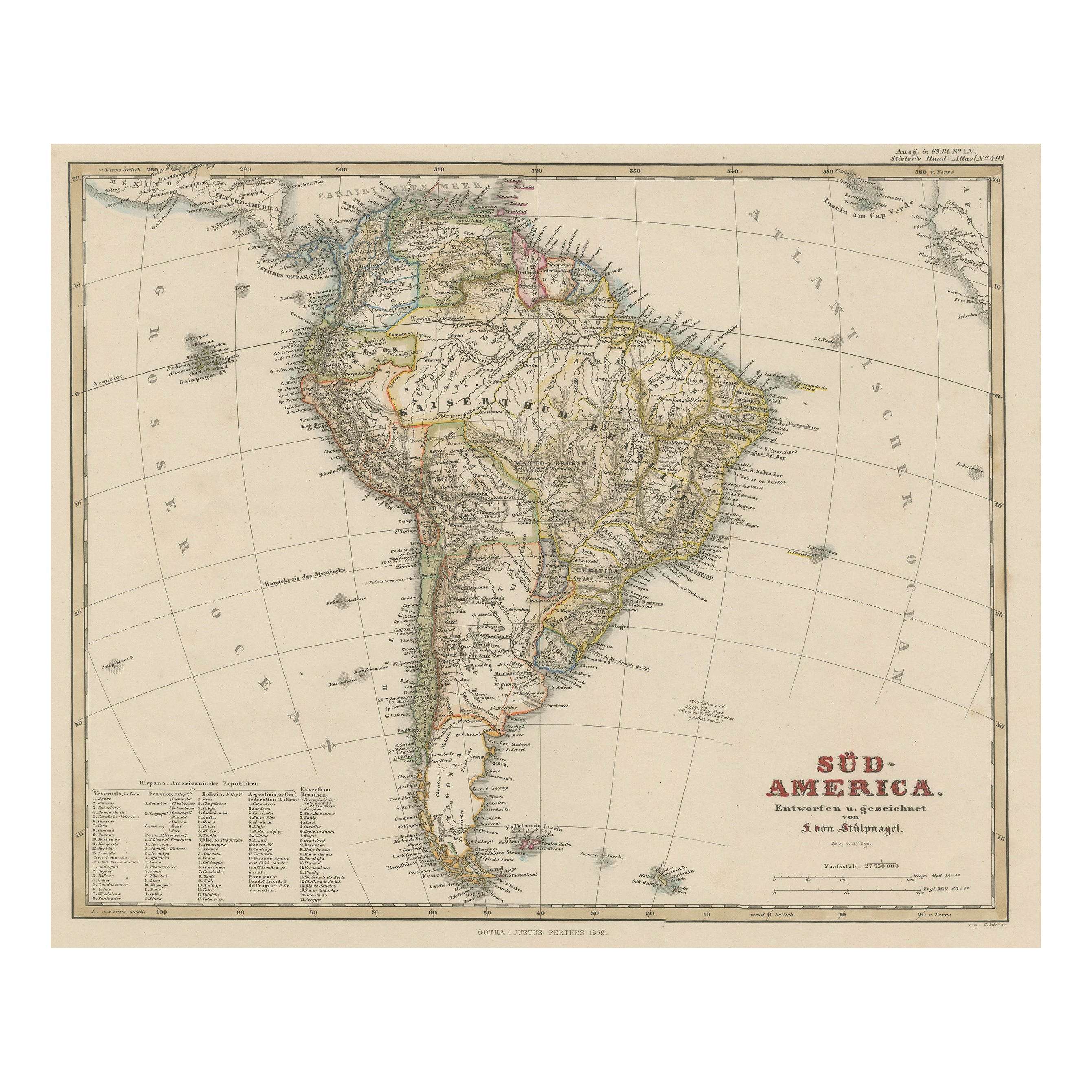
Articles similaires à Geological Map of South America by A.K. Johnston – Mountains and Valleys 1852


Vous voulez plus d
images ou de vidéos ?
Demander au vendeur plus d
images ou de vidéos
1 sur 10
Geological Map of South America by A.K. Johnston – Mountains and Valleys 1852
260 €par article|TVA incluse
Quantité
À propos de cet article
Geological Map of South America by A.K. Johnston – Mountains and Valleys 1852
This antique map titled "The Mountains, Table Lands, Plains
Valleys of South America" was produced by Alexander Keith Johnston and published in 1852 by William Blackwood
Sons in Edinburgh and London. It is Plate 9 from Johnston’s groundbreaking work *The Physical Atlas of Natural Phenomena*, a pioneering 19th-century publication that helped popularize thematic mapping and scientific cartography.
The map provides a physical representation of South America’s terrain, highlighting the dramatic topography of the Andes Mountains along the continent’s Pacific coast and the vast lowlands of the Amazon and La Plata river basins. Using subtle hand coloring, the map distinguishes mountain ranges, highland plateaus, valleys, and plains, rather than political borders. Light tan indicates elevated regions, green is used for valleys and lowland areas, while blue lines trace major rivers and coastlines.
Key natural features are clearly labeled, including the Cordillera of the Andes, the Brazilian Highlands, the Pampas, Patagonia, and Tierra del Fuego. The Amazon River and its tributaries dominate the northern interior, while a small inset diagram at lower right provides a vertical section showing comparative mountain heights across the continent from the Pacific to the Atlantic.
This map is of special interest due to its emphasis on natural geography over colonial divisions, which was a progressive perspective for the time. Johnston’s work sought to explain the physical world through data visualization, making it useful not only to geographers and scientists, but also to educators, students, and policymakers of the mid-19th century.
Alexander Keith Johnston (1804–1871), Geographer in Ordinary to Queen Victoria in Scotland, was renowned for his clarity, scientific rigor, and contribution to thematic mapping. His *Physical Atlas* is widely considered one of the most important scientific atlases ever published.
Condition and framing tips:
Very good condition with only minor age toning and faint foxing near the edges. The printed area remains clean and sharp.
Frame with a warm wood or black frame and use a cream, pale green, or light blue mat to enhance the natural hues and fine linework. Ideal for display in a study, office, or educational setting.
- Dimensions:Hauteur : 34,5 cm (13,59 po)Largeur : 27,4 cm (10,79 po)Profondeur : 0,2 mm (0,01 po)
- Matériaux et techniques:
- Lieu d origine:
- Période:
- Date de fabrication:1852
- État:Very good condition. Light overall toning near the margins. The paper remains strong and well-preserved. Folding line as issued.
- Adresse du vendeur:Langweer, NL
- Numéro de référence:Vendeur : BG-13207-91stDibs : LU3054345387912
À propos du vendeur
5,0
Vendeur reconnu
Ces vendeurs prestigieux sont des leaders du secteur. Ils représentent le summum en matière de qualité et de design.
Vendeur Platine
Vendeurs premium dont la note est supérieure à 4,7 et le délai de réponse de 24 heures maximum
Établi en 2009
Vendeur 1stDibs depuis 2017
2 809 ventes sur 1stDibs
Temps de réponse habituel : 1 heure
- ExpéditionRecherche du devis...Expédition depuis : Langweer, Pays-Bas
- Politique des retours
Certaines parties de cette page ont été traduites automatiquement. 1stDibs ne garantit pas l
exactitude des traductions. L
anglais est la langue par défaut de ce site web.
Plus d articles de ce vendeur
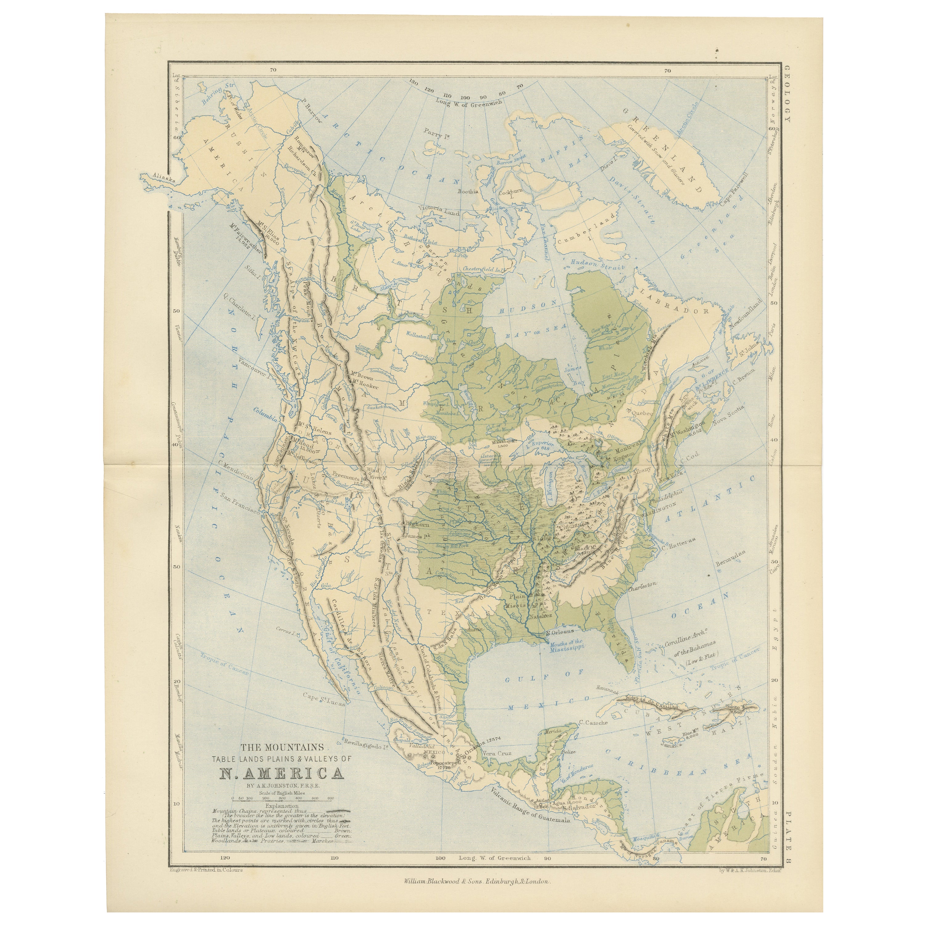
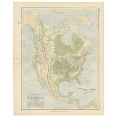
Tout afficherGeological Map of North America by A.K. Johnston – Mountains and Valleys 1852
Geological Map of North America by A.K. Johnston – Mountains and Valleys 1852
This finely detailed and beautifully shaded antique map titled "The Mountains, Table Lands, Plains & Va...
Catégorie
Antiquités, Milieu du XIXe siècle, Écossais, Estampes
Matériaux
Papier
Carte ancienne d
Amérique du Sud "North" par A.K. Johnston, 1865
Carte ancienne intitulée "South America, Northern Sheet". Représentation de la Guyane, de l'Équateur, du Brésil, de la Bolivie, des Amazones et plus encore. Cette carte provient du "...
Catégorie
Antiquités, Milieu du XIXe siècle, Cartes
Matériaux
Papier

Carte ancienne d
Amérique du Sud par W. G. Blackie, 1859
Carte ancienne intitulée "Amérique du Sud". Carte ancienne originale de l'Amérique du Sud. Cette carte provient de l'"Atlas impérial de géographie moderne". Publié par W. G. Blackie,...
Catégorie
Antiquités, Milieu du XIXe siècle, Cartes
Matériaux
Papier

200 € Prix de vente
20 % de remise
Carte ancienne d
Amérique du Sud par Johnston, 1844
Carte antitique intitulée "Amérique du Sud". Belle carte originale et ancienne de l'Amérique du Sud. Cette carte est tirée de "The National Atlas of Historical, Commercial and Politi...
Catégorie
Antiquités, XIXe siècle, Cartes
Matériaux
Papier

156 € Prix de vente
20 % de remise
Carte ancienne d
Amérique du Sud, c.1840
Carte ancienne intitulée 'South America'. Carte originale et ancienne représentant l'Amérique du Sud. Avec un coloriage des contours. Source inconnue, à déterminer. Artistics et Grav...
Catégorie
Antiquités, XIXe siècle, Cartes
Matériaux
Papier

58 € Prix de vente
20 % de remise
Carte ancienne d
Amérique du Sud avec de nombreux détails, vers 1859
Carte originale ancienne intitulée "Süd-America". Belle carte ancienne de l'Amérique du Sud, avec de nombreux détails et légendes.
Cette carte provient du Stielers Handatlas, pub...
Catégorie
Antiquités, Milieu du XIXe siècle, Cartes
Matériaux
Papier
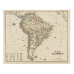
464 € Prix de vente
20 % de remise
Suggestions
Amérique du Sud, partie orientale. Carte vintage Atlas du XXe siècle
L'Atlas du siècle. Amérique du Sud. Partie orientale
Carte originale ancienne, 1903.
Carte en médaillon "Rio de Janeiro et ses environs".
Pli central tel que publié. Le nom et le n...
Catégorie
Début du 20ème siècle, Victorien, Plus d Estampes
Matériaux
Lithographie

Amérique du Sud, partie nord-ouest Carte vintage Atlas du XXe siècle
L'Atlas du siècle. Amérique du Sud, partie nord-ouest
Carte originale ancienne, 1903.
Pli central tel que publié. Le nom et le numéro de la carte sont imprimés sur les coins arrièr...
Catégorie
Début du 20ème siècle, Victorien, Plus d Estampes
Matériaux
Lithographie

Charte von Sud-America (Carte de l
Amérique du Sud) - Gravure à l
eau-forte avec contours dessinés à la main
Carte de l'Amérique du Sud, gravée par Franz Pluth (tchèque, 1800-1871), d'après le livre "Neueste Länder - und Völkerkunde, ein geographisches Lesebuch für alle Stände" de Linder, F...
Catégorie
années 1820, Autres styles artistiques, Plus d Estampes
Matériaux
Papier, Encre d imprimerie, Eau-forte

226 € Prix de vente
20 % de remise
Carte ancienne d
Amérique du Sud dans un cadre Roma
Carte ancienne de l'Amérique du Sud. Présenté dans un nouveau cadre Roma avec un passe-partout de qualité musée. Cadre personnalisé en platine. Il n'y a pas de date d'impression, mai...
Catégorie
Antiquités, Fin du XIXe siècle, Victorien, Estampes
Matériaux
Bois de feuillus, Papier

Carte du Brésil, ancienne carte gravée des années 1860
Carte du Bresil
Gravure avec coloriage original des contours, vers 1860, par Alexandre Vuillemin, publiée à Paris.
31cm par 41cm (feuille)
21,5cm par 31,5cm (image)
Catégorie
Fin du XIXe siècle, Victorien, Plus d Estampes
Matériaux
Lithographie

Carte ancienne originale de l
hémisphère occidental par Dower, vers 1835
Belle carte de l'hémisphère occidental
Dessiné et gravé par J.Dower
Publié par Orr & Smith. C.1835
Non encadré.
Expédition gratuite
Catégorie
Antiquités, années 1830, Anglais, Cartes
Matériaux
Papier
