Articles similaires à Antique Classical Greece Map – Aegean Sea
Crete, ca.1697


Vous voulez plus d
images ou de vidéos ?
Demander au vendeur plus d
images ou de vidéos
1 sur 9
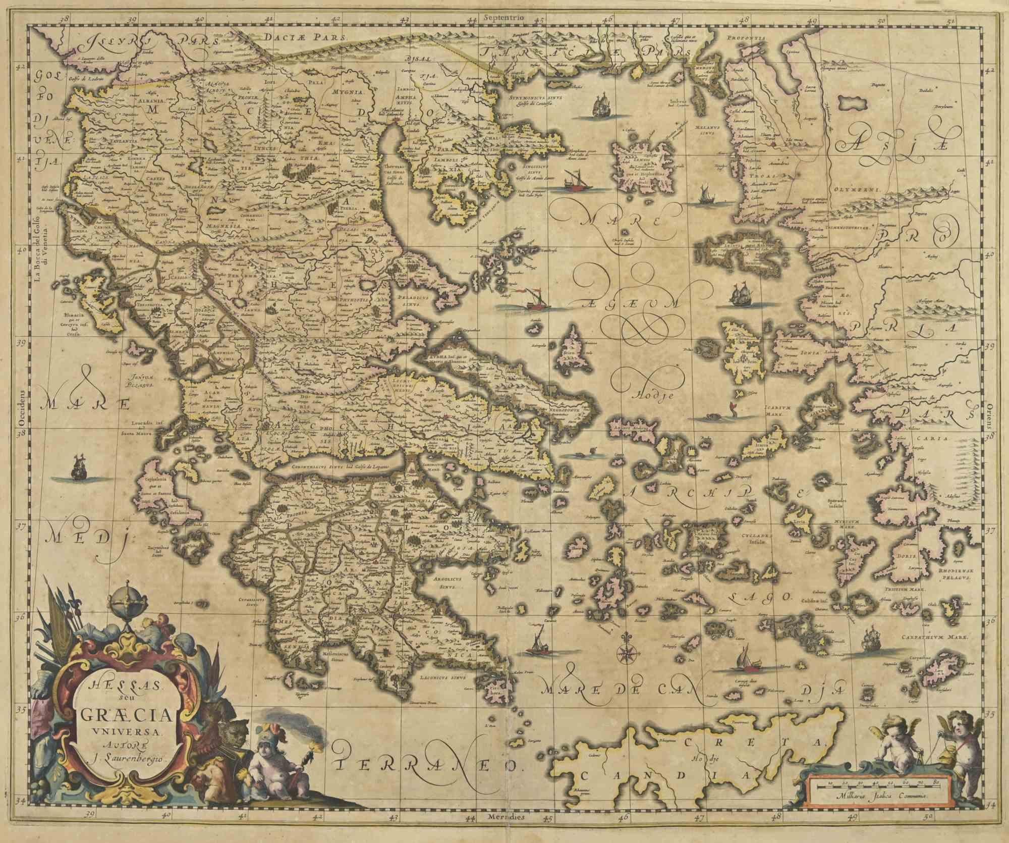
Antique Classical Greece Map – Aegean Sea
Crete, ca.1697
490 €TVA incluse
À propos de cet article
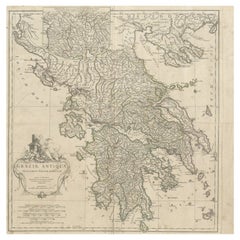
Hellas seu Graecia Universa is a finely detailed late-17th-century map of Greece and the Aegean world, issued by Philipp Cluver around 1697 (possibly 1694). The map was published in Introductio in Universam Geographiam, Cluver’s influential geographical handbook that shaped European understanding of classical and contemporary geography for more than a century.
The map presents a comprehensive view of the Greek mainland, the Peloponnese, Crete (Candia), and the densely articulated island world of the Aegean Sea. Ancient regional names—such as Thessalia, Macedonia, Epirus, Achaia, and Laconia—are prominently shown, reflecting Cluver’s pioneering approach of combining classical sources with modern geographic knowledge. This synthesis made his work particularly valued by scholars of antiquity, historians, and educated collectors throughout Europe.
Cartographically, the engraving is rich and precise, with deeply indented coastlines, clearly engraved mountain ranges, and an intricate hydrographic network. The Aegean archipelago is rendered with exceptional density, giving the map strong visual rhythm and decorative appeal. A compass rose provides orientation, while the allegorical title cartouche—populated by classical figures—reinforces the learned, humanist character of the work and anchors it firmly within the intellectual traditions of the Dutch Golden Age of cartography.
This example is attractively hand colored, adding warmth and depth to the engraved lines without obscuring detail. Issued in numerous editions across major European publishing centers such as Amsterdam, Nuremberg, and London, Cluver’s Introductio became one of the most widely disseminated geographic works of the 17th century, and maps such as this were central to its success.
Today, Hellas seu Graecia Universa is appreciated both as a scholarly map of classical Greece and as a highly decorative wall piece. It appeals equally to collectors of antique maps, classicists, and interior designers seeking an image that conveys learning, history, and visual complexity.
Condition report: Generally good for a 17th-century engraving. Light age toning and minor handling wear, consistent with age. Plate mark visible.
Framing tips: A dark walnut or ebonized frame with a warm ivory or parchment mat emphasizes the engraving and hand color; alternatively, an antique gold frame with a narrow profile enhances the classical character of the cartouche.
Technique: Copper engraving with hand color
Maker: Philipp Cluver, published in Europe, ca. 1697
- Dimensions:Hauteur : 25 cm (9,85 po)Largeur : 29,2 cm (11,5 po)Profondeur : 0,2 mm (0,01 po)
- Matériaux et techniques:Papier,Gravé
- Période:Fin du XVIIe siècle
- Date de fabrication:circa 1697
- État:Condition report: Generally good for a 17th-century engraving. Light age toning and minor handling wear, consistent with age. Plate mark visible. Some support on the reverse in the borders.
- Adresse du vendeur:Langweer, NL
- Numéro de référence:Vendeur : BG-14196-11stDibs : LU3054348065782
À propos du vendeur
5,0
Vendeur reconnu
Ces vendeurs prestigieux sont des leaders du secteur. Ils représentent le summum en matière de qualité et de design.
Vendeur Platine
Vendeurs premium dont la note est supérieure à 4,7 et le délai de réponse de 24 heures maximum
Établi en 2009
Vendeur 1stDibs depuis 2017
2 810 ventes sur 1stDibs
Temps de réponse habituel : <1 heure
- ExpéditionRecherche du devis...Expédition depuis : Langweer, Pays-Bas
- Politique des retours
Certaines parties de cette page ont été traduites automatiquement. 1stDibs ne garantit pas l
exactitude des traductions. L
anglais est la langue par défaut de ce site web.
Plus d articles de ce vendeur
Tout afficherCarte ancienne de la Grèce par Allard (vers 1698)
Carte ancienne intitulée "Hellas seu Graecia Universa" Carte détaillée de la Grèce, avec la Crète, les îles de la mer Égée et une partie de la Turquie. Avec deux cartouches, une rose...
Catégorie
Antiquités, Fin du XVIIe siècle, Cartes
Matériaux
Papier

784 € Prix de vente
20 % de remise
Carte ancienne de Grèce, d
Albanie, de Macédoine et des parties de Turquie et de Cyprus, vers 1745
Carte ancienne intitulée "Accurata Totius Archipelagi Et Graeciae Universae Tabula".
Carte détaillée de la Grèce. Comprend l'Albanie, la Macédoine et certaines parties de la Turqui...
Catégorie
Antiquités, XVIIIe siècle, Cartes
Matériaux
Papier

Carte ancienne de la Grèce par Keizer
de Lat, 1788
Carte ancienne intitulée "t Zuider Deel van Turks Europe genaamt Griekenland (..)". Carte ancienne originale peu commune de la Grèce. Cette carte provient du "Nieuwe Natuur- Geschied...
Catégorie
Antiquités, Fin du XVIIIe siècle, Cartes
Matériaux
Papier

280 € Prix de vente
20 % de remise
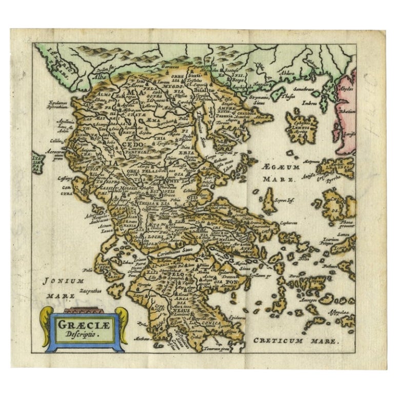
Charmante carte miniature de Grèce du XVIIIe siècle représentant une Grèce, 1685
Carte ancienne intitulée "Graeciae Descriptio" Charmante carte miniature de la Grèce tirée de l'atlas de poche "Introductionis in Universam Geographiam tam Veterem quam novam...". Ac...
Catégorie
Antiquités, 17ème siècle, Cartes
Matériaux
Papier
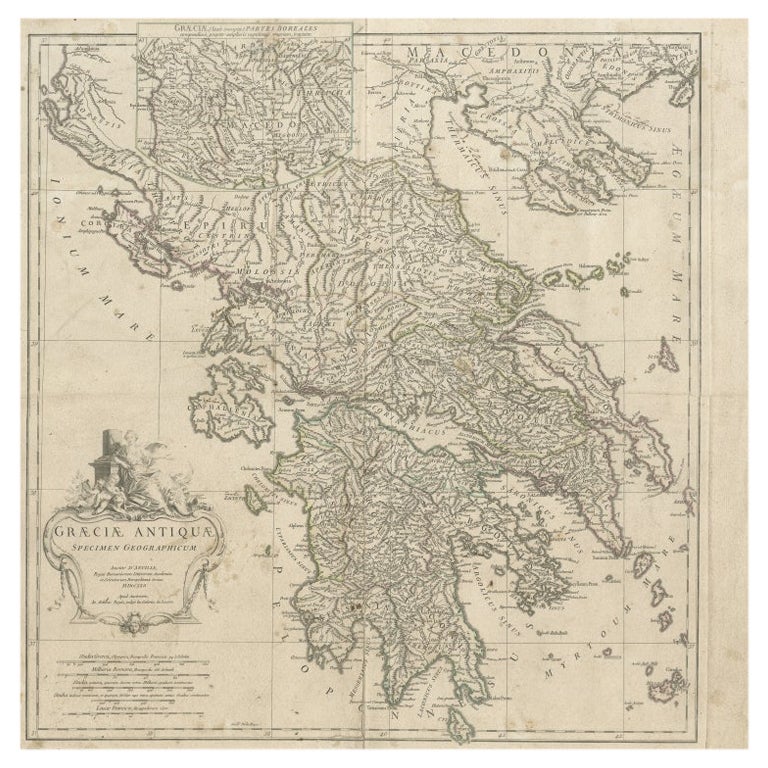
Carte à grande échelle de la Grèce avec carte encastrée de la Macédoine, vers 1786
Carte ancienne intitulée "Graeciae Antiquae". Carte à grande échelle de la Grèce, s'étendant au sud jusqu'à l'île de Cythère. La carte en médaillon montre les détails de la Macédoine...
Catégorie
Antiquités, XVIIIe siècle, Cartes
Matériaux
Papier
Carte ancienne de la Grèce par J. Jansson, datant d
environ 1653
Il s'agit d'une authentique carte ancienne de la Grèce par Jan Jansson. La carte a été publiée à Amsterdam, vers 1653. Cette étonnante carte de la Grèce du XVIIe siècle est basée sur...
Catégorie
Antiquités, Milieu du XVIIe siècle, Cartes
Matériaux
Papier

704 € Prix de vente
20 % de remise
Suggestions
Carte ancienne - Carte de la Grèce - gravure de Johannes Janssonius - années 1650
Par Johannes Janssonius
Carte ancienne de la Grèce - Graecia Vniversa est une carte ancienne réalisée en 1650 par Johannes Janssonius (1588-1664).
La carte est une gravure à l'eau-forte coloriée à la main...
Catégorie
années 1650, Moderne, Estampes - Figuratif
Matériaux
Eau-forte

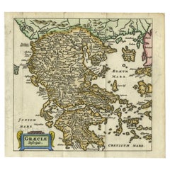
Grèce, "Graeciae Antiquae""" Une carte du 17ème siècle colorée à la main par Sanson
Par Nicolas Sanson
Il s'agit d'une carte originale de la Grèce du XVIIe siècle, gravée sur cuivre et colorée à la main, intitulée "Graeciae Antiquae Tabula Hanc Geographicam" par Nicolas d'Abbeville Sa...
Catégorie
Antiquités, Milieu du XVIIe siècle, Français, Cartes
Matériaux
Papier

1 091 € Prix de vente
20 % de remise
Grèce du Sud : Grande carte du XVIIe siècle colorée à la main par Sanson et Jaillot
Par Nicolas Sanson
Cette grande carte originale gravée sur cuivre et colorée à la main du sud de la Grèce et de la péninsule du Péloponnèse, intitulée "La Moree Et Les Isles De Zante, Cefalonie, Ste. M...
Catégorie
Antiquités, 1690, Français, Cartes
Matériaux
Papier

1 368 € Prix de vente
20 % de remise
Carte de la Grèce - eau-forte sur papier 19ème siècle
Dimensions de l'image : 22.2 x 27,8 cm.
Grecia est une intéressante gravure sur papier colorée à la main, réalisée par un artiste anonyme dans la première moitié du XIXe siècle.
Av...
Catégorie
XIXe siècle, Moderne, Estampes - Figuratif
Matériaux
Eau-forte

Carte ancienne de la Grèce antique, Achaia, Corinthe, 1786
Grande carte de la Grèce antique. Représentation de la région de Thessalie, y compris le mont Olympe
Dessiné par J.D. Barbie Du Bocage
Gravure sur cuivre de P.F.I.P.
Dessin ...
Catégorie
Antiquités, années 1780, Français, Autre, Cartes
Matériaux
Papier

Carte de la Grèce - gravure originale d
Antonio Zatta - 18ème siècle
Cette carte de la Grèce est une gravure réalisée par Antonio Zatta, cartographe, éditeur et typographe.
L'état de conservation de l'œuvre est bon, à l'exception du papier usé et du ...
Catégorie
années 1780, Estampes - Figuratif
Matériaux
Eau-forte
