Articles similaires à Antique French Map of the Holy Land, Twelve Tribes of Israel, c.1750


Vous voulez plus d
images ou de vidéos ?
Demander au vendeur plus d
images ou de vidéos
1 sur 11
Antique French Map of the Holy Land, Twelve Tribes of Israel, c.1750
1 100 €TVA incluse
À propos de cet article
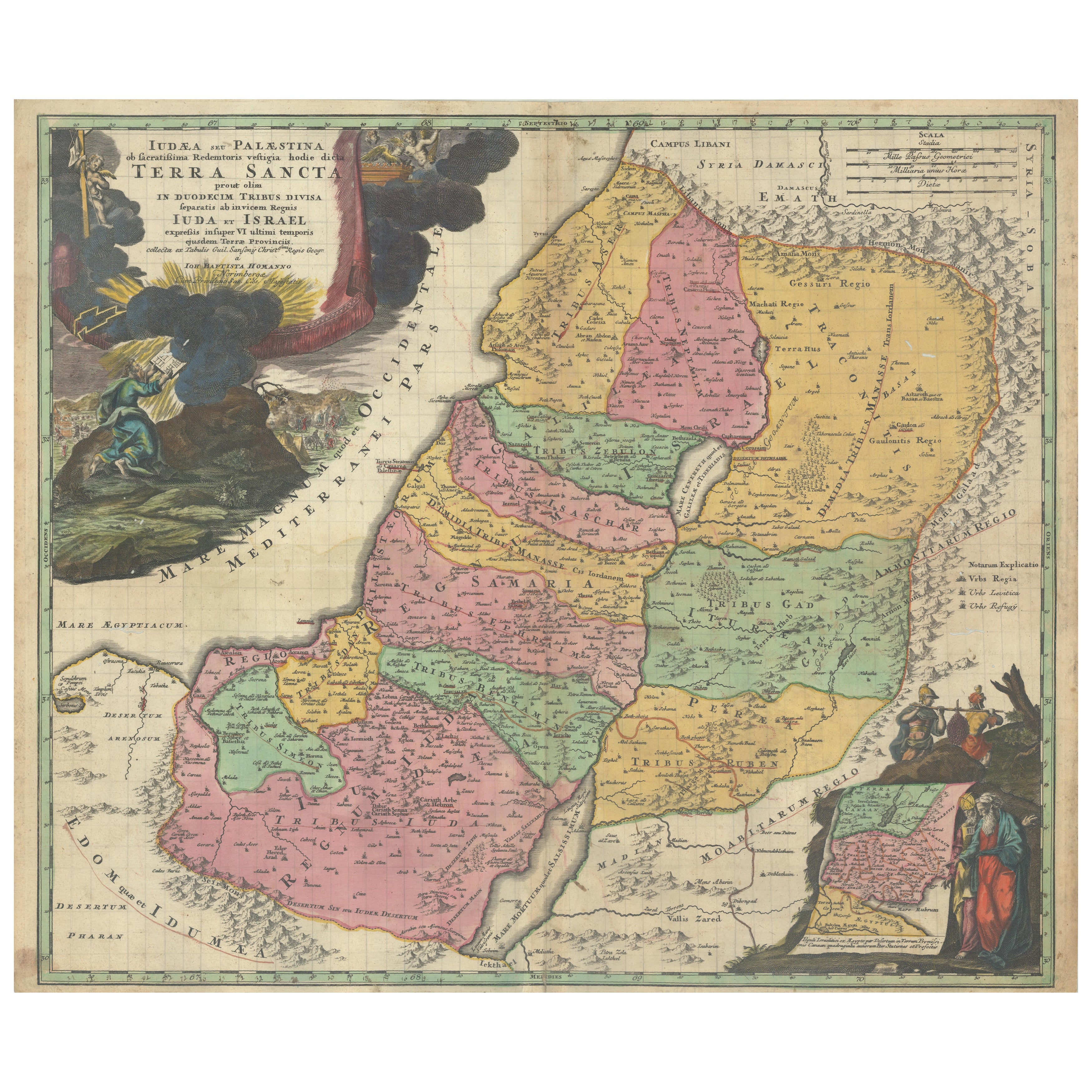
Antique Holy Land Map, Twelve Tribes of Israel – Robert de Vaugondy, c.1750
Description
This finely engraved and hand-colored map depicts Judea, or the Holy Land, divided according to the Twelve Tribes of Israel, each territory carefully delineated with colored boundaries and identified by name. The composition reflects the scholarly French cartographic tradition of the mid-18th century, combining biblical geography with contemporary geographic knowledge in a visually balanced and highly legible format.
The map was produced in Paris around 1750 by Robert de Vaugondy, one of the most respected mapmakers of the Enlightenment period. Vaugondy’s work is known for its precision, clarity, and elegant ornamentation, qualities that made his maps popular with scholars, collectors, and institutions throughout Europe.
An inset map in the upper left shows Canaan, or the Promised Land, extending into Phoenicia and Syria, with the northeastern reaches of Egypt also indicated. Geographic features such as coastlines, rivers, mountain ranges, deserts, and settlements are carefully rendered, while the Mediterranean Sea and surrounding regions are clearly labeled. The decorative cartouche adds refinement without overwhelming the map’s academic character, making it equally suitable for a study, library, or refined interior.
Maps of the Holy Land from this period remain highly sought after for their historical, religious, and decorative significance. This example offers a particularly appealing balance of scholarship and visual presence, with strong original hand coloring enhancing both the tribal divisions and the overall composition.
Condition report
Good antique condition. Original central fold as issued. Light age toning and minor handling marks consistent with 18th-century paper. No losses or major defects. Overall well-preserved with strong clarity of engraving and color.
Framing tips
This map presents beautifully with a muted walnut or dark ebonized frame paired with an off-white or parchment mat. For a more traditional look, an antique gold frame with a narrow profile will subtly echo the cartouche while maintaining a refined, scholarly appearance.
Technique: Engraving with original hand color
Maker: Robert de Vaugondy, Paris, circa 1750
- Dimensions:Hauteur : 51 cm (20,08 po)Largeur : 68 cm (26,78 po)Profondeur : 0,2 mm (0,01 po)
- Matériaux et techniques:Papier,Gravé
- Lieu d origine:
- Période:
- Date de fabrication:circa 1750
- État:Good antique condition. Original central fold as issued. Light age toning and minor handling marks consistent with 18th-century paper. No losses or major defects. Overall well-preserved with strong clarity of engraving and color.
- Adresse du vendeur:Langweer, NL
- Numéro de référence:Vendeur : BG-14152-21stDibs : LU3054348066812
À propos du vendeur
5,0
Vendeur reconnu
Ces vendeurs prestigieux sont des leaders du secteur. Ils représentent le summum en matière de qualité et de design.
Vendeur Platine
Vendeurs premium dont la note est supérieure à 4,7 et le délai de réponse de 24 heures maximum
Établi en 2009
Vendeur 1stDibs depuis 2017
2 809 ventes sur 1stDibs
Temps de réponse habituel : 1 heure
- ExpéditionRecherche du devis...Expédition depuis : Langweer, Pays-Bas
- Politique des retours
Certaines parties de cette page ont été traduites automatiquement. 1stDibs ne garantit pas l
exactitude des traductions. L
anglais est la langue par défaut de ce site web.
Plus d articles de ce vendeur
Tout afficherCarte ancienne de la Terre Sainte montrant 12 tribus d
Israël, vers 1720
Carte ancienne intitulée "Lande Land verdeeld in de Twaalf Stammen Israels (...)".
Carte très détaillée de la Lande divisée en 12 tribus d'Israël. Avec un beau grand cartouche de...
Catégorie
Antiquités, années 1720, Cartes
Matériaux
Papier

384 € Prix de vente
20 % de remise
Livraison gratuite
Carte ancienne de la Terre Sainte par Van Luchtenburg, vers 1720
Carte ancienne intitulée "Heylige Land verdeeld in de Twaalf Stammen Israels (...)" Carte très détaillée de la Terre Sainte divisée en 12 tribus d'Israël. Avec un beau grand cartouch...
Catégorie
Antiquités, XVIIIe siècle, Cartes
Matériaux
Papier

Carte ancienne de la Terre Sainte - douze tribus, six provinces, colorée à la main, 1718
Titre : Terra Sancta in XII olim Tribus nunc VI Provincias Dispertita
Cartographe : Christophe Weigel l'Ancien (1654-1725)
Éditeur : Johann Ernst Adelbulner
Lieu et année de pu...
Catégorie
Antiquités, années 1710, Allemand, Cartes
Matériaux
Papier

Carte coloriée à la main de la Terre sainte divisée entre les douze tribus, c.C.C.
Carte coloriée à la main de la Terre sainte divisée entre les douze tribus, c.C.C.
Cette remarquable carte ancienne, intitulée "Iudaea seu Palaestina ob Sacratissima Redemtoris Vest...
Catégorie
Antiquités, Début du XVIIIe siècle, Européen, Cartes
Matériaux
Papier

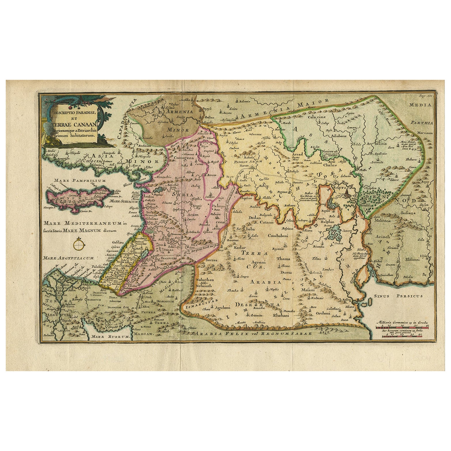
Carte ancienne de la Terre Sainte et du Paradis - Carte de Terrae Canaan, c.1720
Carte ancienne de la Lande et du Paradis par François Halma, c.1720
Belle carte du Moyen-Orient du début du XVIIIe siècle, colorée à la main, s'étendant de la mer Méditerranée au go...
Catégorie
Antiquités, Début du XVIIIe siècle, Néerlandais, Cartes
Matériaux
Papier

Carte ancienne de la Terre Sainte par Keur, 1748
Carte ancienne de la Terre Sainte intitulée 'De Gelegentheyd van t'Paradys ende t'Landt Canaan, Mitsgaders d'eerst bewoonde Landen der Patriarchen'. Comprend cinq vignettes décorativ...
Catégorie
Antiquités, XVIIIe siècle, Cartes
Matériaux
Papier

Suggestions
Carte de la Terre Sainte gravée van Loon publiée N de Fer 1703 français
La Terre Sainte, La Lande, Tiree Des Memoires De M.De.La Rue. Par N. de Fer. Géographe de Sa Majestic Catoliq et de Monseigneur le Dauphin. Avec Privil du Roi 1703
Carte détaillée de la Lande d'après L'Atlas Curieux ou le Monde de Nicolas de Or. L'Est est orienté vers le haut.
FABRICANT Nicolas de Fer...
Catégorie
Antiquités, Début des années 1700, Français, Louis XIV, Cartes
Matériaux
Papier

Carte ancienne de Li Governi di Borgogna - 1777
Li Governi di Borgogna est une gravure originale en noir et blanc sur papier, imprimée par Antonio Zatta à Venise, en 1777.
Titre original : Li Governi di Borgogna della Franca Cont...
Catégorie
années 1770, Moderne, Estampes - Paysage
Matériaux
Eau-forte

La région de Normandie en France : une carte du XVIIe siècle colorée à la main par Sanson et Jaillot
Par Nicolas Sanson
Cette grande carte coloriée à la main intitulée "Le Duché et Gouvernement de Normandie divisée en Haute et Basse Normandie en divers Pays ; et par evêchez, avec le Gouvernement Gener...
Catégorie
Antiquités, 1690, Français, Cartes
Matériaux
Papier

La région de Normandie en France : une carte du XVIIe siècle colorée à la main par Sanson et Jaillot
1 653� € Prix de vente
20 % de remise
La Grèce du Sud : une grande carte du 17e siècle colorée à la main par Sanson et Jaillot
Par Nicholas Sanson d
Abbeville
Cette grande carte originale gravée sur cuivre et colorée à la main du sud de la Grèce et de la péninsule du Péloponnèse, intitulée "La Moree Et Les Isles De Zante, Cefalonie, Ste. M...
Catégorie
1690, Estampes - Paysage
Matériaux
Gravure

1 375 € Prix de vente
20 % de remise
Carte de 1657 Janssonius représentant Vermandois et Cappelle, Ric. A-004
1657 Carte de Janssonius de
Vermandois et Cappelle
Ric.a004
Description : Carte ancienne de France intitulée "Descriptio Veromanduorum - Gouvernement de la Cappelle". Deux car...
Catégorie
Antiquités, 17ème siècle, Inconnu, Cartes
Matériaux
Papier

Portugal : Grande carte du 17ème siècle colorée à la main par Sanson et Jaillot
Par Nicholas Sanson d
Abbeville
Cette grande carte coloriée à la main intitulée "Le Royaume de Portugal et des Algarves Divisee en see Archeveches, Eveches et Territoires Par le Sr Sanson" a été créée à l'origine p...
Catégorie
1690, Estampes - Paysage
Matériaux
Gravure

1 514 € Prix de vente
20 % de remise