Articles similaires à Egypt
Arabia Petraea – Large Nile Map, British Cartography, c.1815


Vous voulez plus d
images ou de vidéos ?
Demander au vendeur plus d
images ou de vidéos
1 sur 10
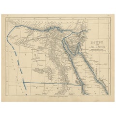
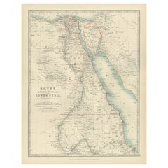
Egypt
Arabia Petraea – Large Nile Map, British Cartography, c.1815
840 €TVA incluse
À propos de cet article
Egypt
Arabia Petraea – Large Nile Map, British Cartography, c.1815
This impressive early 19th-century map depicts Egypt and Arabia Petraea with exceptional detail, extending from the Mediterranean Sea and the Nile Delta southward through Upper Egypt and Nubia, and eastward across the Red Sea to the Arabian Peninsula. Titled “Egypt and Arabia Petraea,” the map reflects the heightened European scholarly and strategic interest in Egypt during the years surrounding the Napoleonic campaigns and the subsequent rise of modern scientific cartography.
The Nile dominates the composition as the central geographic and cultural axis of Egypt. Its full course is meticulously traced, with branches, cataracts, settlements, ancient sites, desert routes, and regional divisions carefully engraved. The surrounding deserts, mountain ranges, and caravan paths are rendered with restraint, emphasizing the river’s singular role in sustaining civilization. To the east, Arabia Petraea and the Red Sea coastline provide essential context for ancient and early modern trade routes linking Africa, the Levant, and the Indian Ocean world.
The map belongs to the British cartographic tradition associated with the Arrowsmith circle and related London publishers, known for their emphasis on empirical accuracy, clarity, and large-scale presentation. The engraving is precise and refined, with dense but highly legible geographical information. Subtle outline color is used sparingly to distinguish coastlines and regional boundaries without disturbing the map’s calm, scholarly aesthetic.
Visually, this is a powerful wall map. Its tall vertical format, generous margins, and restrained monochrome palette give it an architectural presence that works exceptionally well in both classic and contemporary interiors. It functions equally as a collector-grade document of early modern Egypt and as a sophisticated decorative centerpiece.
This map is particularly appealing to collectors of Egyptology, Nile history, and 19th-century British cartography, as well as interior designers seeking a large, authoritative historic map with strong visual impact.
Condition report
Good condition overall. Central vertical fold as issued. Light age toning consistent with period. Minor scattered spots and faint surface marks. Original outline hand color. Plate mark visible. Margins intact.
Framing tips
This map benefits from a wide off-white or light sand-colored mat to emphasize its scale and vertical flow. A medium to dark wood frame or softly ebonized frame enhances the engraving and gives the piece a refined, museum-style presence. Particularly effective as a stand-alone statement map.
Technique: Copper engraving with contemporary outline hand color
Maker: British school (Johnston), c.1815
- Dimensions:Hauteur : 54,5 cm (21,46 po)Largeur : 68 cm (26,78 po)Profondeur : 0,2 mm (0,01 po)
- Matériaux et techniques:Papier,Gravé
- Lieu d origine:
- Période:
- Date de fabrication:circa 1815
- État:Good condition overall. Central vertical fold as issued. Light age toning consistent with period. Minor scattered spots and faint surface marks. Original outline hand color. Plate mark visible. Margins intact.
- Adresse du vendeur:Langweer, NL
- Numéro de référence:Vendeur : BG-14128-131stDibs : LU3054348017552
À propos du vendeur
5,0
Vendeur reconnu
Ces vendeurs prestigieux sont des leaders du secteur. Ils représentent le summum en matière de qualité et de design.
Vendeur Platine
Vendeurs premium dont la note est supérieure à 4,7 et le délai de réponse de 24 heures maximum
Établi en 2009
Vendeur 1stDibs depuis 2017
2 838 ventes sur 1stDibs
Temps de réponse habituel : 1 heure
- ExpéditionRecherche du devis...Expédition depuis : Langweer, Pays-Bas
- Politique des retours
Certaines parties de cette page ont été traduites automatiquement. 1stDibs ne garantit pas l
exactitude des traductions. L
anglais est la langue par défaut de ce site web.
Plus d articles de ce vendeur
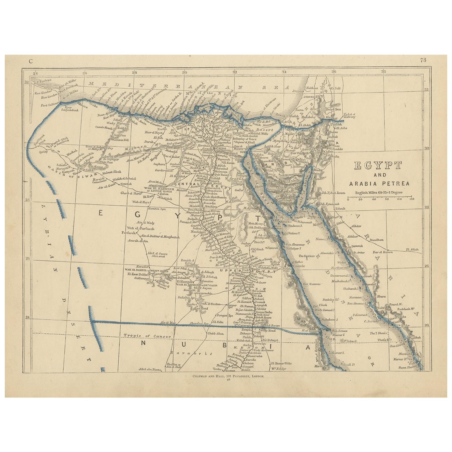
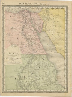
Tout afficherCarte ancienne d
Égypte, d
Arabie Petraea et du bas de la Nubie par Johnston
1909
Carte ancienne intitulée "Égypte, Arabie Petraea et Basse Nubie". Carte ancienne originale de l'Égypte, de l'Arabie Petraea et de la Basse Nubie. Avec des cartes en médaillon d'Alexa...
Catégorie
Début du 20ème siècle, Cartes
Matériaux
Papier

188 € Prix de vente
24 % de remise
Carte ancienne de l
Égypte ancienne représentant également le fleuve Nile et la mer rouge, 1845
Carte ancienne d'Égypte intitulée "General Karte von Alt Aegypten von A.H.". Brué'. Grande carte de l'Égypte illustrant également le Nil et la mer Rouge. Source inconnue, à détermine...
Catégorie
Antiquités, XIXe siècle, Cartes
Matériaux
Papier

Carte ancienne d
Égypte et d
Arabie Petraea par Lowry,
1852
Carte ancienne intitulée "Egypt and Arabia Petrea". Carte originale de l'Égypte et de l'Arabia Petraea. Cette carte provient du "Lowry's Table Atlas constructed and engraved from the...
Catégorie
Antiquités, Milieu du XIXe siècle, Cartes
Matériaux
Papier
80 € Prix de vente
20 % de remise
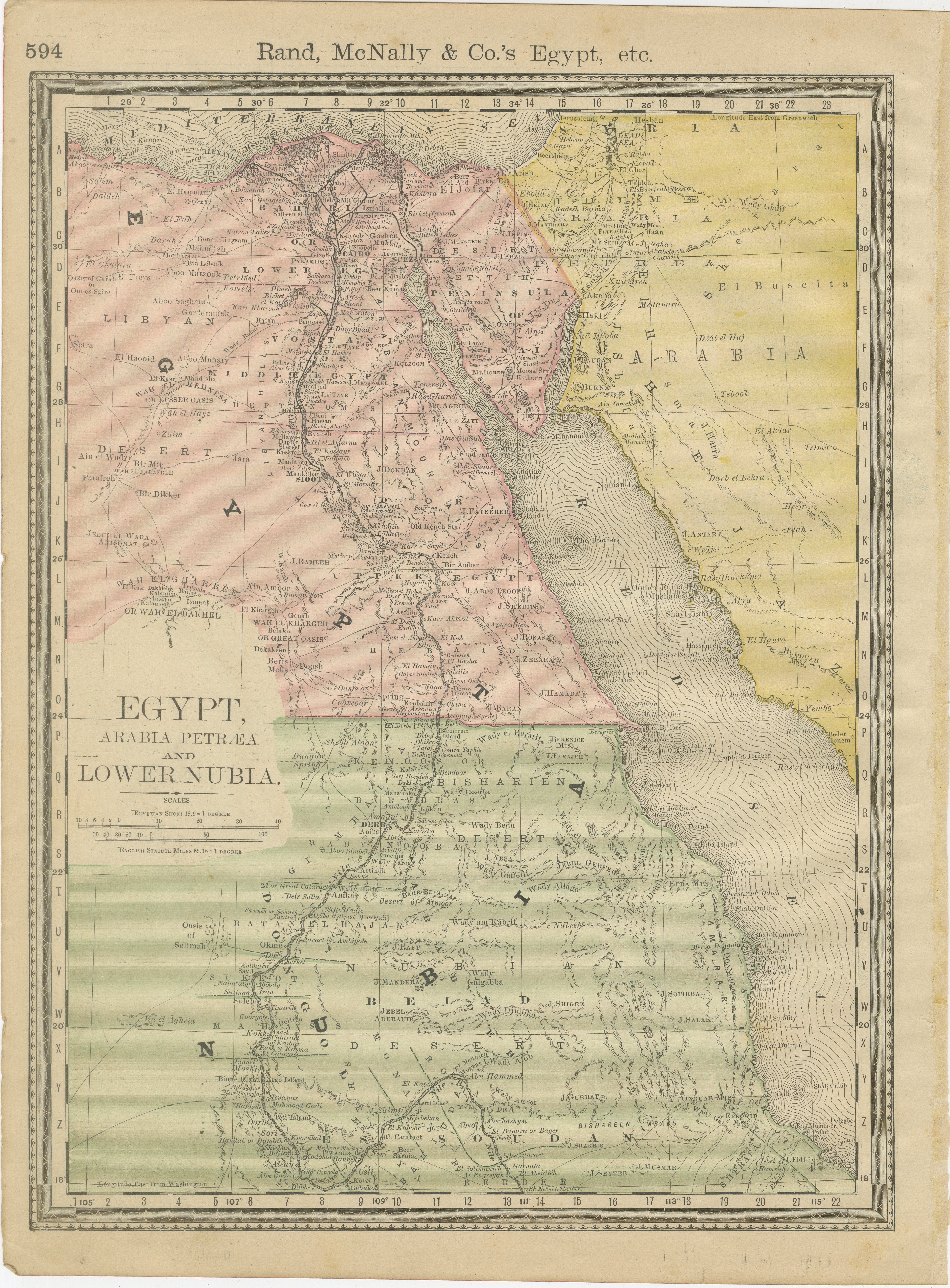
Carte ancienne d
Égypte et d
Arabie Petraea par A
C. Black, 1870
Carte ancienne intitulée "Egypt and Arabia Petraea". Carte ancienne originale de l'Égypte et de l'Arabie Petraea. Cette carte provient du "Black's General Atlas of The World". Publié...
Catégorie
Antiquités, Fin du XIXe siècle, Cartes
Matériaux
Papier

122 € Prix de vente
30 % de remise
Égypte et Basse-Nubie, 1903 - Carte historique mettant en évidence le Nil et la mer Rouge
Égypte et Basse-Nubie, 1903 - Carte historique mettant en évidence le Nil et la mer Rouge
Cette carte magnifiquement détaillée intitulée "Egypt, Arabia Petraea, and Lower Nubia" a é...
Catégorie
Début du 20ème siècle, Cartes
Matériaux
Papier
Égypte et Basse-Nubie - Élégante carte du Nil de l
Atlas ancien, vers 1888
Égypte et Basse-Nubie - Élégante carte du Nil de l'Atlas ancien, vers 1888
Cette élégante carte ancienne de l'atlas présente l'Eleg et la vallée du Nil dans une composition raffinée...
Catégorie
Antiquités, Fin du XIXe siècle, Américain, Cartes
Matériaux
Papier
Suggestions
Carte de la Terre Sainte "Carte de la Syrie et de l
Égypte" de Pierre Lapie
Par Pierre M. Lapie
Il s'agit d'une carte du début du XIXe siècle de la Syrie et de l'Égypte anciennes intitulée "Carte de la Syrie et de l'Égypte anciennes/dressée par M. Lapie, Colonel d'État Major, e...
Catégorie
années 1830, Estampes - Paysage
Matériaux
Gravure

Carte de la Terre Sainte "Carte de la Syrie et de l
Égypte" de Pierre M. Lapie
Par Pierre M. Lapie
Carte du début du XIXe siècle de la Syrie et de l'Égypte anciennes intitulée "Carte de la Syrie et de l'Égypte anciennes/dressée par M. Lapie, Colonel d'État Major, et M. Lapie fils,...
Catégorie
Antiquités, Début du XIXe siècle, Français, Cartes
Matériaux
Papier

Grande carte originale d
Egypte, circa 1920
Grande carte de l'Egypte
Non encadré
Couleur originale
Par John Bartholomew and Co. Institut géographique d'Édimbourg
Publié, vers 1920
Livraison ...
Catégorie
Vintage, années 1920, Britannique, Cartes
Matériaux
Papier

Afrique. Part One. Carte vintage Atlas du XXe siècle
L'Atlas du siècle. Afrique. Partie nord-est
Carte originale ancienne, 1903.
Carte en médaillon du "Delta du Nil et du canal de Suez".
Pli central tel que publié. Le nom et le numér...
Catégorie
Début du 20ème siècle, Victorien, Plus d Estampes
Matériaux
Lithographie

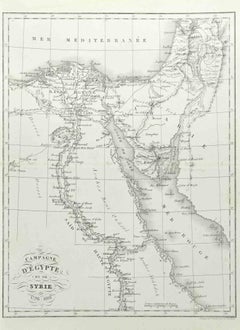
Campagne d
Egypte - Gravure de Pierre François Tardieu - 1837
Campagne d'Egypte est une eau-forte réalisée par Pierre François Tardieu en 1837.
Bonnes conditions.
L'œuvre est réalisée dans une composition équ...
Catégorie
années 1830, Moderne, Estampes - Figuratif
Matériaux
Lithographie
Carte de Nubia et d
Abissinia - gravure originale d
Antonio Zatta - 1784
Cette carte de Nubie et d'Abissinie est une gravure réalisée par Antonio Zatta à Venise en 1784.
L'état de conservation de l'œuvre est bon, à l'exception du papier usé avec quelques...
Catégorie
années 1770, Estampes - Paysage
Matériaux
Eau-forte
