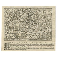
Articles similaires à Jerusalem, Holy City View – Early Renaissance Woodcut, c.1560

Vous voulez plus d
images ou de vidéos ?
Demander au vendeur plus d
images ou de vidéos
1 sur 10
Jerusalem, Holy City View – Early Renaissance Woodcut, c.1560
620 €TVA incluse
À propos de cet article
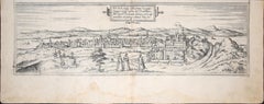
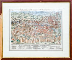
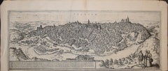
Jerusalem, Holy City View – Early Renaissance Woodcut, c.1560
This rare and evocative Renaissance woodcut depicts the Holy City of Jerusalem as imagined in early modern Europe, shown as a fortified, densely built sacred city surrounded by hills, valleys, and biblical landmarks. The view presents Jerusalem as the spiritual and historical heart of the Holy Land, combining biblical tradition, medieval cartographic conventions, and early Renaissance city imagery.
The city is rendered in a panoramic bird’s-eye perspective, with major sacred sites clearly identified, including the Temple of Solomon, the Holy Sepulchre, Mount Zion, the Valley of Jehoshaphat, and the Garden of Gethsemane. Towers, gates, walls, domes, and churches fill the composition, creating a powerful visual narrative of Jerusalem as both an earthly city and a divine center. The emphasis is symbolic rather than topographically exact, reflecting how Jerusalem was understood and revered in 16th-century Christian Europe.
The French title at the top identifies Jerusalem as the former metropolitan city of the Kingdom of the Jews and notes its later status as a Roman colony, anchoring the image firmly within biblical and classical historical tradition. Below the city view, extensive French text discusses Jericho and biblical geography, accompanied by a decorative botanical woodcut, a characteristic feature of Renaissance cosmographical and biblical publications.
This print originates from a mid-16th-century French cosmographical or biblical work, influenced by Sebastian Münster and related Renaissance scholars. The woodcut technique, Gothic-Renaissance lettering, and dense narrative imagery place the print firmly within the great age of European biblical geography and early historical illustration.
Highly decorative and rich in symbolic detail, this view of Jerusalem is equally appealing to collectors of early Holy Land imagery, Renaissance prints, and biblical cartography, as well as to interior designers seeking a visually striking and intellectually layered historical work on paper.
Condition report
Good condition for a 16th-century woodcut. Central vertical fold as issued. General age toning and some discoloration consistent with period. Light creasing and minor edge wear. Text and image clear and well preserved. No major losses.
Framing tips
This print benefits from a wide off-white or light parchment-colored mat to emphasize the historic paper tone. A dark walnut, ebonized, or softly gilt frame enhances the Renaissance character and architectural detail. Particularly effective as a statement piece in a study, library, or classical interior.
Technique
Woodcut
Maker: Sebastian Münster (1488–1552) was a German cartographer/scholar, even when the book edition (and many surviving sheets) were printed in Basel and sometimes in French., c.1560
Keywords: Jerusalem, Holy Land, Holy City, Renaissance Jerusalem view, antique Jerusalem print, biblical Jerusalem, Holy Sepulchre, Temple of Solomon, Mount Zion, Gethsemane, Valley of Jehoshaphat, Jericho, biblical geography, early Holy Land map, 16th century woodcut, Renaissance woodcut, Sebastian Münster circle, antique religious print, Christian cartography, biblical city view, antique Israel print, Palestine, sacred geography, early modern cosmography
- Dimensions:Hauteur : 30,5 cm (12,01 po)Largeur : 38,7 cm (15,24 po)Profondeur : 0,2 mm (0,01 po)
- Matériaux et techniques:Papier,Gravé
- Lieu d origine:
- Période:
- Date de fabrication:circa 1560
- État:Good condition for a 16th-century woodcut. Central vertical fold as issued. General age toning and some discoloration consistent with period. Light creasing and minor edge wear. Text and image clear and well preserved. No major losses.
- Adresse du vendeur:Langweer, NL
- Numéro de référence:Vendeur : BG-14153-41stDibs : LU3054348018012
À propos du vendeur
5,0
Vendeur reconnu
Ces vendeurs prestigieux sont des leaders du secteur. Ils représentent le summum en matière de qualité et de design.
Vendeur Platine
Vendeurs premium dont la note est supérieure à 4,7 et le délai de réponse de 24 heures maximum
Établi en 2009
Vendeur 1stDibs depuis 2017
2 834 ventes sur 1stDibs
Temps de réponse habituel : 1 heure
- ExpéditionRecherche du devis...Expédition depuis : Langweer, Pays-Bas
- Politique des retours
Certaines parties de cette page ont été traduites automatiquement. 1stDibs ne garantit pas l
exactitude des traductions. L
anglais est la langue par défaut de ce site web.
Plus d articles de ce vendeur
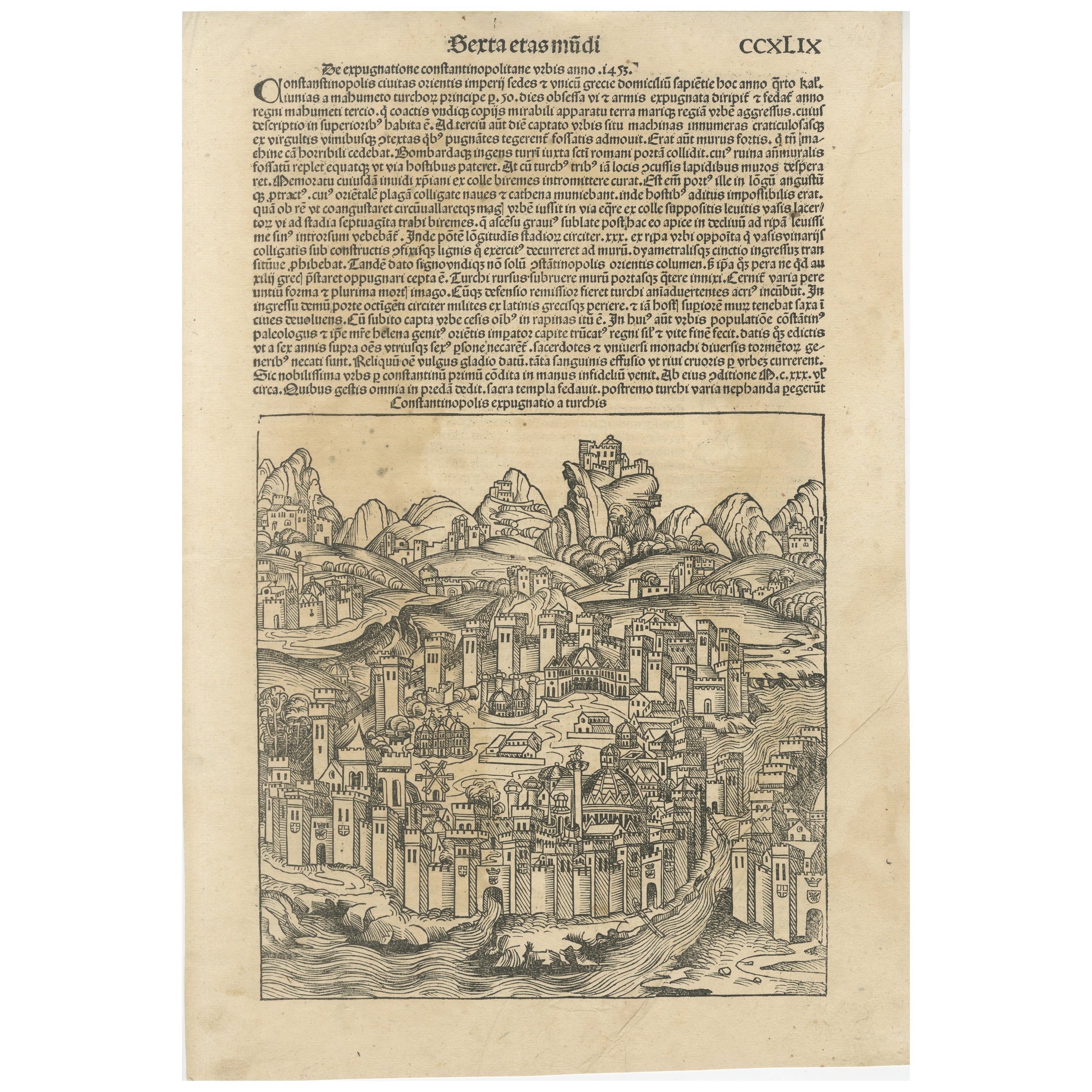
Tout afficherRare gravure sur bois de Constantinople du Chronicle Nuremberg de Hartmann Schedel, 1493
Titre : Constantinopolis Expugnatio a Turchis - Hartmann Schedel, 1493
Cette vue de Constantinople gravée sur bois est tirée de la "Chronique de Nuremberg" (Liber Chronicarum) de Ha...
Catégorie
Antiquités, 15e siècle et avant, Allemand, Estampes
Matériaux
Papier
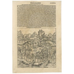
792 € Prix de vente
20 % de remise
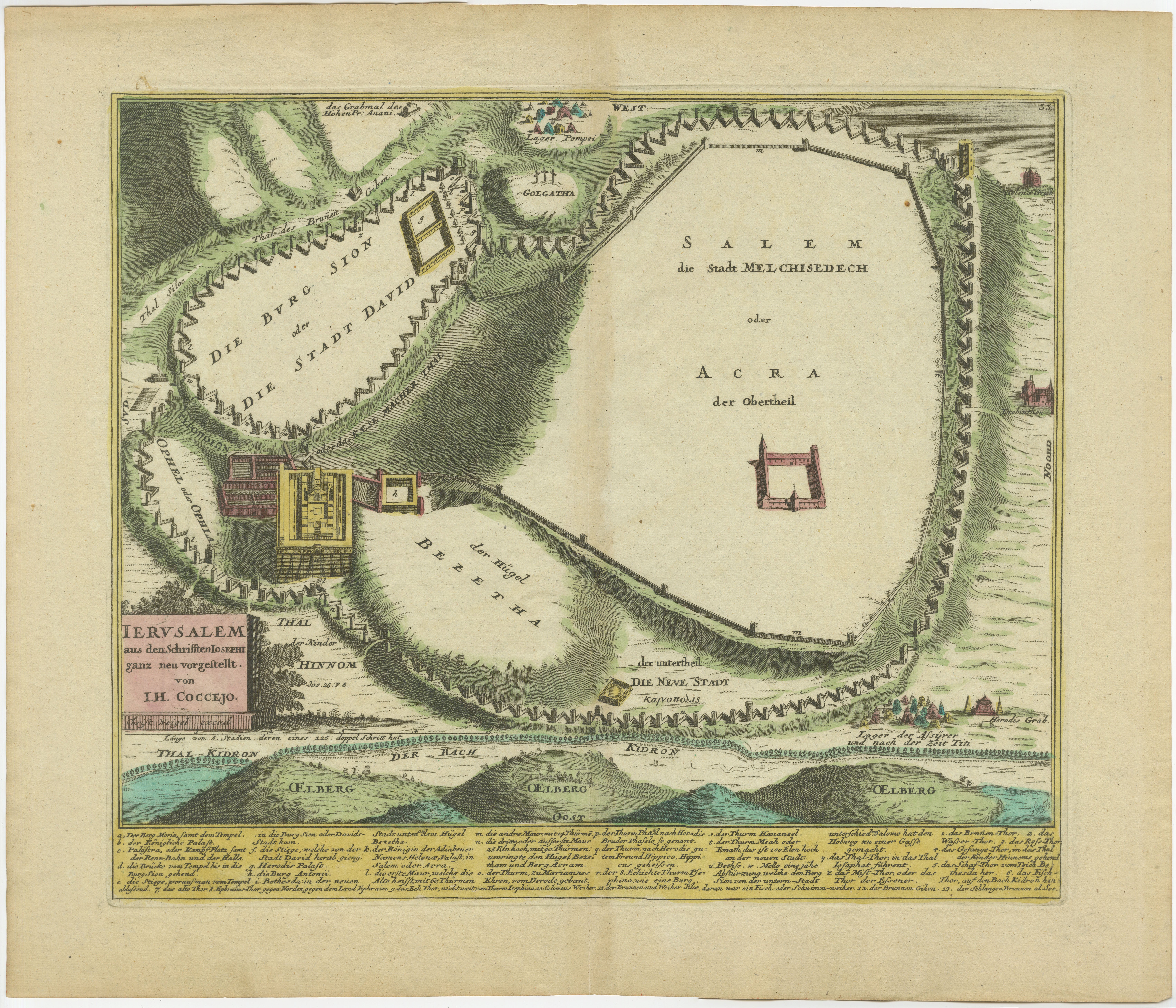
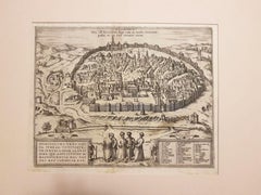
La gravure de Weigel de Jérusalem : une vue biblique de la perspective de Josephus, 1720
1720 Carte Weigel de Jérusalem basée sur les écrits de Josèphe
Cette carte à vol d'oiseau de l'ancienne Jérusalem, réalisée en 1720 par I+I, est d'une grande complexité. Coccejo,...
Catégorie
Antiquités, années 1720, Cartes
Matériaux
Papier

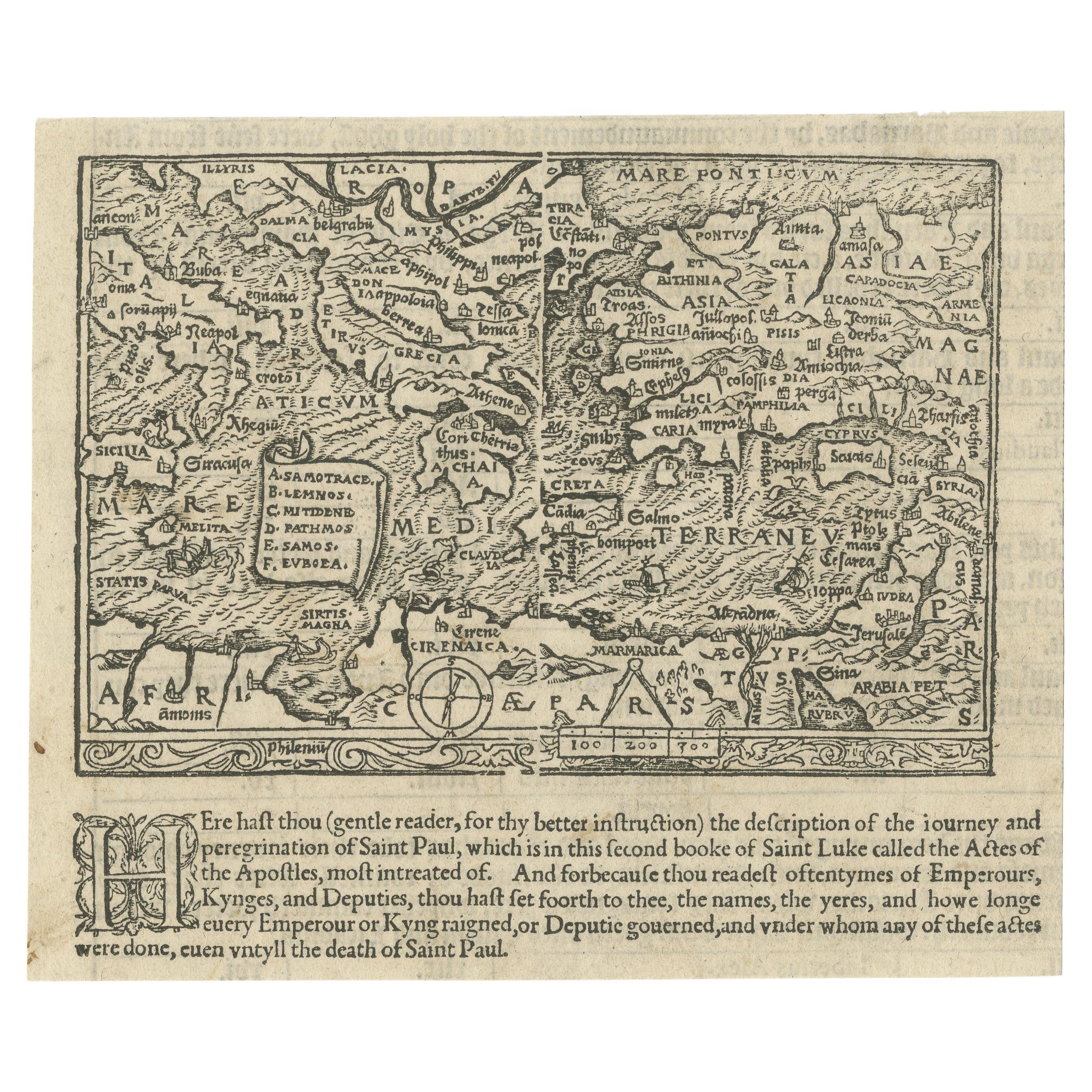
Petite carte ancienne rare et intéressante de la Méditerranée, 1568
Très rare carte ancienne gravée sur bois, sans titre, montrant la région des voyages missionnaires de l'apôtre Paul. Il montre la Méditerranée avec la Grèce, l'Asie mineure (Turquie)...
Catégorie
Antiquités, XVIe siècle, Britannique, Cartes
Matériaux
Papier
2 100 € Prix de vente
25 % de remise
Spectaculaire gravure originale d
un plan de ville de Jérusalem, 1708
Description : Carte ancienne intitulée " Erster Abriss der Stadt Jerusalem wie sie Furnemblich zur Zeit des Hernn Christi beschaffen (...) ".
Spectaculaire plan de ville de Towne...
Catégorie
Antiquités, Début des années 1700, Cartes
Matériaux
Papier

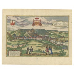
Huy (Huum) Paysage urbain 1574 : gravure historique en cuivre de Braun
Hogenberg
Titre : Huum opp. condrusorum caput (...) Anno partae salutis 1574.
**Type:** Impression (gravure sur cuivre colorée)
**Année:** Vers 1580
**Technique:** Gravure sur cuivre coloré
...
Catégorie
Antiquités, XVIe siècle, Cartes
Matériaux
Papier
512 € Prix de vente
20 % de remise
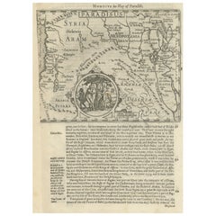
Carte ancienne de la Terre Sainte, avec vignette du Jardin d
Eden
Carte ancienne intitulée 'Hondius his Map of Paradise'. Belle carte de la région délimitée par la Lande. Syrie, Mésopotamie, Chaldée et une partie de l'Arabie. Avec vignette décorati...
Catégorie
Antiquités, Milieu du XVIIe siècle, Cartes
Matériaux
Papier
384 € Prix de vente
20 % de remise
Suggestions
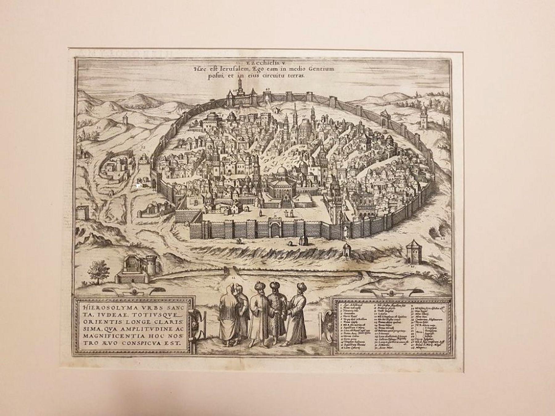
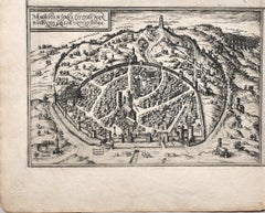
Carte ancienne de Jérusalem de « Civitates Orbis Terrarum » - 1572-1617
Par Franz Hogenberg
Braun G., Hogenberg F., Jérusalem, de la collection Civitates Orbis Terrarum, Cologne, T. Graminaeus, 1572-1617.
Dimensions de l'image : cm 32,8 x 41 ; dimensions : cm 41 x 54 ; dim...
Catégorie
XVIe siècle, Estampes - Paysage
Matériaux
Eau-forte
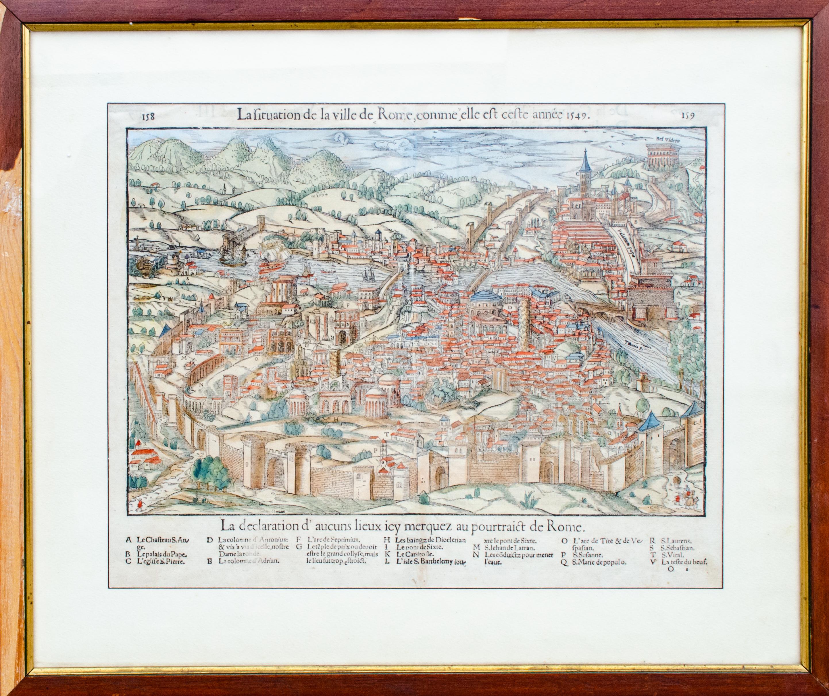
Carte ancienne de The City of Rome par Sebastian Münster, 1549
Par Sebastian Münster
Sebastian Münster (allemand, 1488-1552)
LA SITUATION DE LA VILLE DE ROME
Carte ancienne de Rome, 1549
Probablement imprimé en 1964
Impression sur papier
Editeur : Heinrich Petri pou...
Catégorie
années 1960, Réalisme, Estampes - Figuratif
Matériaux
Gravure sur bois
Carte de Toledo, « Civitates Orbis Terrarum » - par F. Hogenberg - 1575
Par Franz Hogenberg
Braun G., Hogenberg F., "Tolède", de la collection "Civitates Orbis Terrarum", Cologne, T. Graminaeus, 1572-1617. Image Dim : cm 19 x 48 , Dim : cm 22. 5 x 52.5 .
Très belle aquatin...
Catégorie
XVIe siècle, Estampes - Figuratif
Matériaux
Eau-forte, Aquatinte
Carte de Nemavsus - eau-forte de George Braun - fin du 16ème siècle
Cette Carte de Nemavsus est une gravure originale réalisée par George Braun (1541 - 1622)
L'état de conservation de l'œuvre est bon et a vieilli sur les bords de la feuille avec qu...
Catégorie
XVIe siècle, Plus d Estampes
Matériaux
Eau-forte
Carte de Grenade, Civitates Orbis Terrarum - par F. Hogenberg - 1575
Par Franz Hogenberg
"Grenade", de la Collection "Civitates Orbis Terrarum", Cologne, AT&T, 1575.
Très belle aquatinte N/B, représentant une Vue de Grenade, depuis l'Est, qui fut peut-être la plus bel...
Catégorie
XVIe siècle, Estampes - Figuratif
Matériaux
Eau-forte, Aquatinte
Carte ancienne de Buda de « Civitates Orbis Terrarum » - 1572-1617
Par Franz Hogenberg
Braun G., Hogenberg F., Buda, de la collection Civitates Orbis Terrarum, Cologne, T. Graminaeus, 1572-1617.
Très belle aquatinte N/B montrant une vue de Buda, une partie actuelle de...
Catégorie
XVIe siècle, Estampes - Paysage
Matériaux
Eau-forte