Articles similaires à Mediterranean
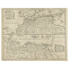
Barbary Coast – Elegant 18th Century Map by Bowen, c.1747

Vous voulez plus d
images ou de vidéos ?
Demander au vendeur plus d
images ou de vidéos
1 sur 10
Mediterranean
Barbary Coast – Elegant 18th Century Map by Bowen, c.1747
880 €TVA incluse
À propos de cet article
Mediterranean
Barbary Coast – Elegant 18th Century Map by Bowen, c.1747
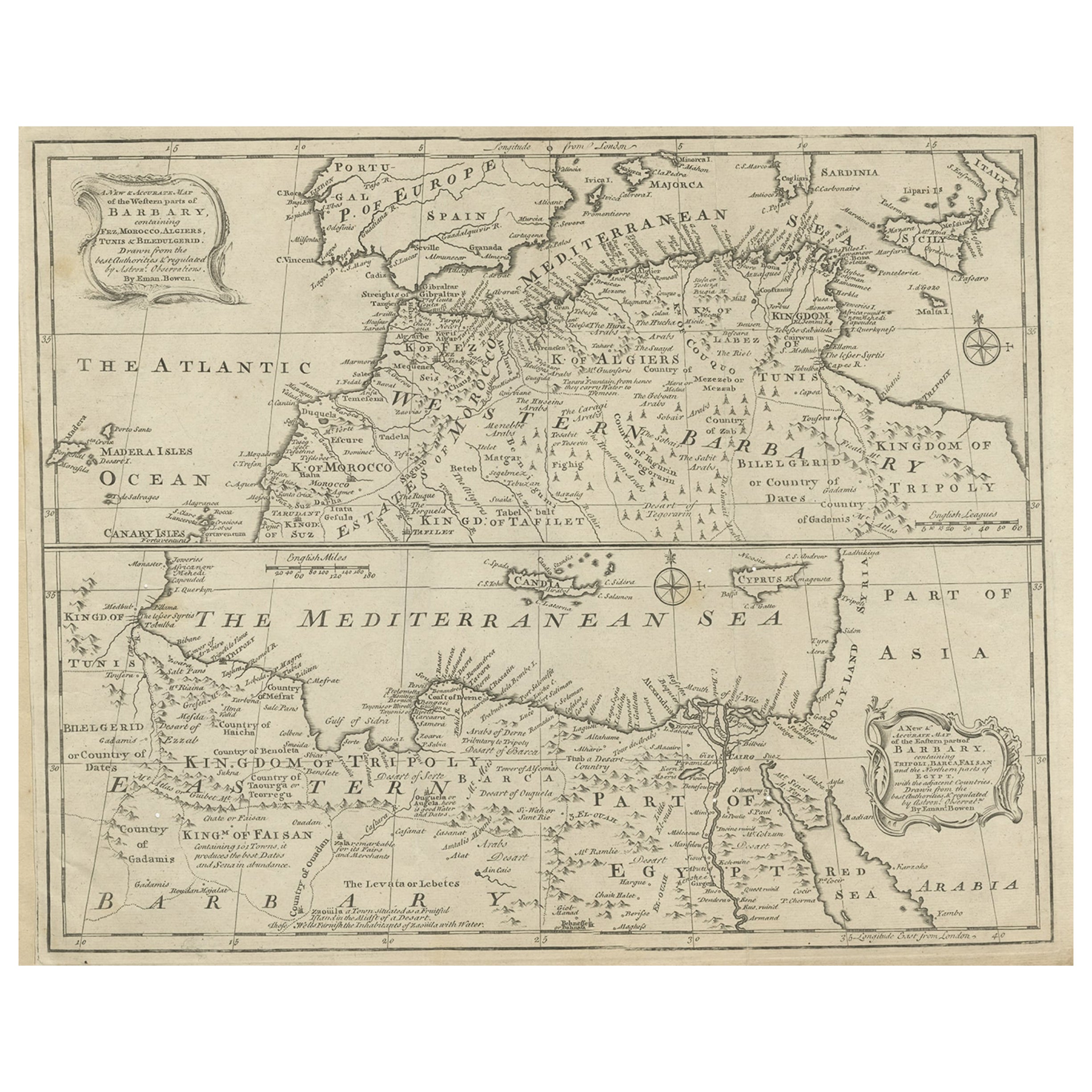
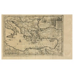
This elegant mid-18th-century engraved map presents the Mediterranean world with a strong focus on the Barbary Coast and North Africa, extending from the Atlantic coast of Morocco across the Mediterranean Sea to Egypt, the Levant, and parts of the Near East. The map encompasses southern Europe, including Spain, Italy, and the islands of the Mediterranean, while highlighting North African regions such as Morocco, Algiers, Tunis, Tripoli, Egypt, and Arabia.
The map was engraved by Emanuel Bowen and published circa 1747, during a period when European interest in the Mediterranean was driven by trade, naval power, diplomacy, and the strategic control of sea routes linking Europe, Africa, and the East. Bowen was one of the most prominent English mapmakers of the 18th century, serving as Royal Geographer to King George II, and his work is valued for its clarity, balance, and decorative refinement.
Coastal outlines, principal cities, kingdoms, and regions are clearly delineated, while inland territories are filled with place names, mountain ranges, and desert annotations that convey both geographic structure and contemporary European perceptions of North Africa and the eastern Mediterranean. The Barbary Coast is prominently labeled, with references to historic kingdoms, trading centers, and ports central to Mediterranean and trans-Saharan commerce. Egypt and the eastern Mediterranean are carefully rendered, including the Nile delta and surrounding regions.
The Mediterranean Sea itself dominates the composition, creating a calm, expansive visual rhythm that gives the map exceptional decorative presence. Decorative cartouches, compass roses, and neatline borders add elegance without overpowering the geography. The engraving style is refined and legible, making the map equally appealing to collectors and interior designers.
This map works beautifully as a statement wall piece, offering a timeless view of the Mediterranean world that complements both classic and contemporary interiors. It also integrates naturally with displays focused on North Africa, the Mediterranean basin, or 18th-century European cartography.
Condition report
Good condition overall. Central vertical fold as issued. Light age toning consistent with period, with a few scattered spots and minor surface marks. Plate mark visible. Margins intact.
Framing tips
A wide off-white or light sand-colored mat enhances the balance of the composition and allows the dense geography to breathe. A medium to dark wood frame or softly ebonized frame gives the piece a refined, hotel-ready appearance suitable for residential or hospitality interiors.
Technique: Copper engraving
Maker: Emanuel Bowen, England, c.1747
- Dimensions:Hauteur : 40,5 cm (15,95 po)Largeur : 50,5 cm (19,89 po)Profondeur : 0,2 mm (0,01 po)
- Matériaux et techniques:Papier,Gravé
- Lieu d origine:
- Période:1740-1749
- Date de fabrication:circa 1747
- État:Good condition overall. Central vertical fold as issued. Light age toning consistent with period, with a few scattered spots and minor surface marks. Plate mark visible. Margins intact.
- Adresse du vendeur:Langweer, NL
- Numéro de référence:Vendeur : BG-14128-81stDibs : LU3054348017132
À propos du vendeur
5,0
Vendeur reconnu
Ces vendeurs prestigieux sont des leaders du secteur. Ils représentent le summum en matière de qualité et de design.
Vendeur Platine
Vendeurs premium dont la note est supérieure à 4,7 et le délai de réponse de 24 heures maximum
Établi en 2009
Vendeur 1stDibs depuis 2017
2 847 ventes sur 1stDibs
Temps de réponse habituel : 1 heure
- ExpéditionRecherche du devis...Expédition depuis : Langweer, Pays-Bas
- Politique des retours
Certaines parties de cette page ont été traduites automatiquement. 1stDibs ne garantit pas l
exactitude des traductions. L
anglais est la langue par défaut de ce site web.
Plus d articles de ce vendeur
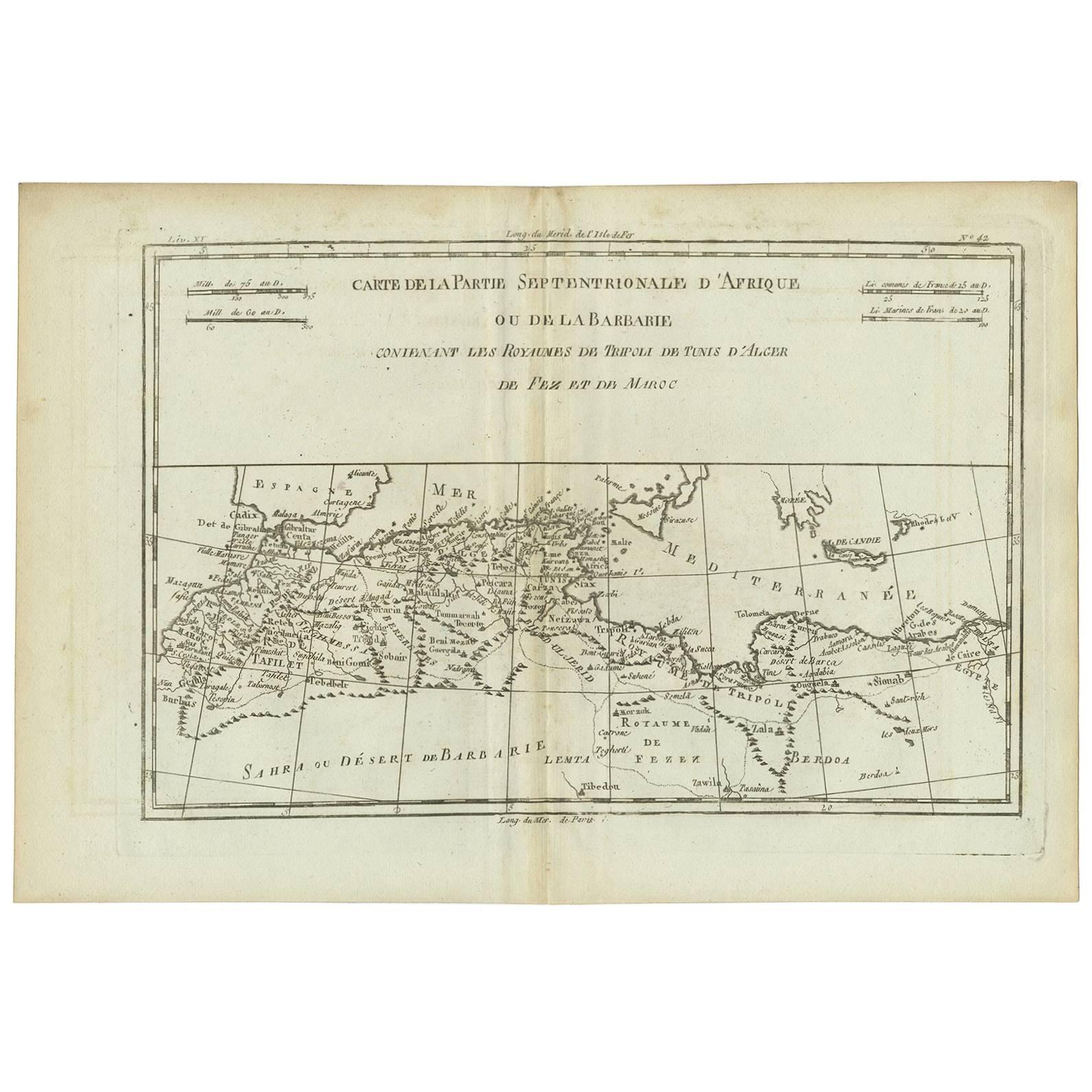
Tout afficherCarte ancienne de la Barbarie occidentale et orientale en Afrique, vers 1744
Carte ancienne intitulée "A New & Accurate Map of the Western Parts of Barbary" et "A New & Accurate Map of the Eastern Parts of Barbary". Cartes décoratives de l'Afrique du Nord et ...
Catégorie
Antiquités, XVIIIe siècle, Britannique, Cartes
Matériaux
Papier
Carte ancienne d
Afrique du Nord « Barbary Coast » (Côte de Barbary) par R. Bonne, vers 1780
Bel exemple de la carte du nord-ouest de l'Afrique ou Côte de Barbarie réalisée en 1780 par Rigobert Bonne et Guilleme Raynal. Comprend les pays actuels que sont le Maroc, l'Algérie,...
Catégorie
Antiquités, Fin du XVIIIe siècle, Français, Cartes
Matériaux
Papier
Carte ancienne de la côte nord de l
Afrique et de l
Europe du Sud, vers 1745
Par Covens
Mortier
Carte ancienne intitulée "In Notitiam Ecclesiasticam Africae Tabula Geographica". Carte coloriée à la main très décorative de la côte nord de l'Afrique, de l'Espagne, de l'Italie et ...
Catégorie
Antiquités, Milieu du XVIIIe siècle, Cartes
Matériaux
Papier

262 € Prix de vente
67 % de remise
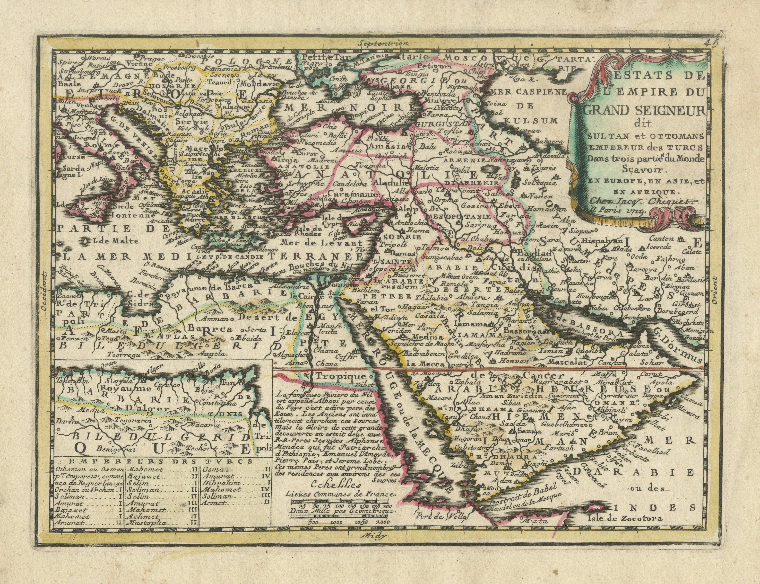
Carte de l
Empire ottoman 1719 - Europe Asie Afrique, Jean Chiquet, Paris
Titre : Carte de l'Empire ottoman 1719 - Europe Asie Afrique, Jean Chiquet, Paris
Description :
Originale carte gravée du début du XVIIIe siècle intitulée Estats de l'Empire du Gran...
Catégorie
Antiquités, Début du XVIIIe siècle, Français, Cartes
Matériaux
Papier
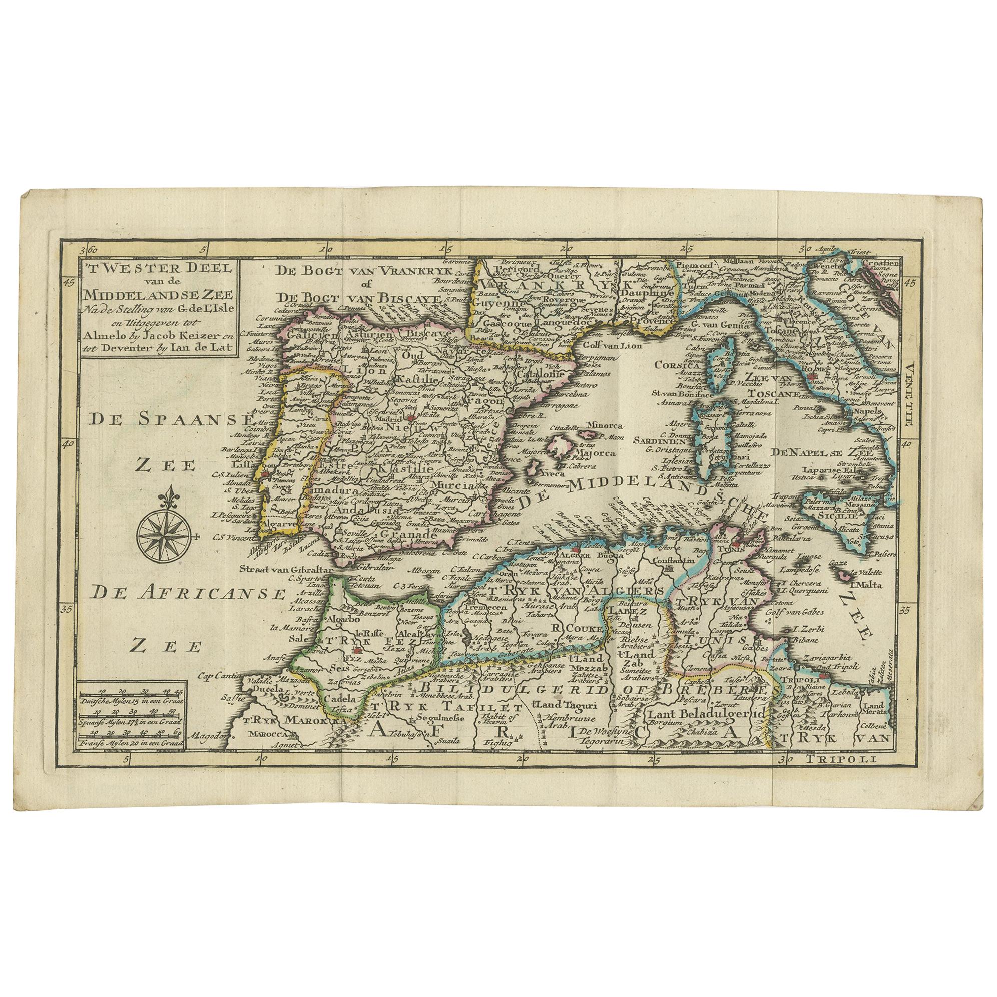
Carte ancienne de la mer méditerranéenne et de son entourage par Keizer
de Lat, 1788
Carte ancienne intitulée 't Wester Deel van de Middelandse Zee (...)'. Carte antique originale peu commune de la mer Méditerranée et de ses environs. Cette carte est tirée du "Nieuwe...
Catégorie
Antiquités, Fin du XVIIIe siècle, Cartes
Matériaux
Papier

280 € Prix de vente
20 % de remise
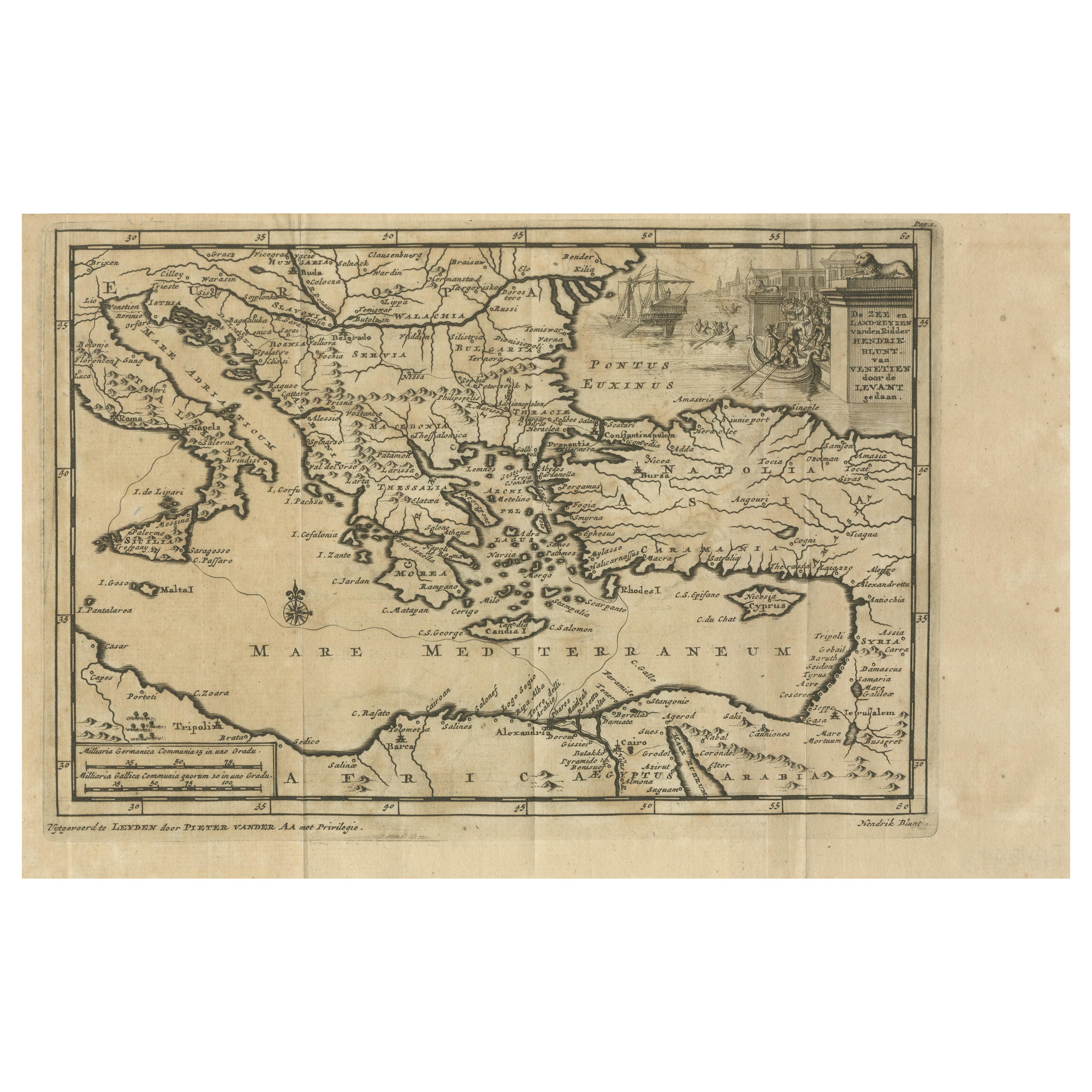
Routes commerciales vénitiennes au Levant - Carte ancienne de Pieter Van Der Aa, ca. 1720
Routes commerciales vénitiennes au Levant - Carte ancienne de Pieter van der Aa, début du XVIIIe siècle
Cette carte finement gravée, publiée par Pieter van der Aa à Leyde, fournit ...
Catégorie
Antiquités, années 1720, Cartes
Matériaux
Papier
Suggestions
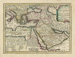
Mers méditerranéennes et Adriatiques : Carte originale du 18e siècle colorée à la main par Bowen
Il s'agit d'une carte originale du XVIIIe siècle, coloriée à la main, intitulée "An Accurate Chart of The Mediterranean and Adriatic Sea's ; with the Archipelago & Part of the Black ...
Catégorie
Milieu du XVIIIe siècle, Maîtres anciens, Estampes - Paysage
Matériaux
Gravure

Coast West Coast of Africa, Guinea
Sierra Leone: An 18th Century Map by Bellin
Par Jacques-Nicolas Bellin
La carte sur cuivre de Jacques Bellin intitulée "Partie de la Coste de Guinee Dupuis la Riviere de Sierra Leona Jusquau Cap das Palmas", représentant la côte de Guinée et de Sierra L...
Catégorie
Antiquités, Milieu du XVIIIe siècle, Français, Cartes
Matériaux
Papier

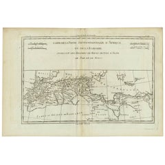
Afrique : une grande carte colorée à la main du 17ème siècle par Sanson et Jaillot
Par Nicolas Sanson
Cette grande carte originale de l'Afrique, gravée sur cuivre et colorée à la main, intitulée "L'Afrique divisée suivant l'estendue de ses principales parties ou sont distinguées les ...
Catégorie
Antiquités, 1690, Français, Cartes
Matériaux
Papier

Carte ancienne - Mare Pacificum - gravure de Johannes Janssonius - années 1650
Par Johannes Janssonius
Mare Pacificum est une carte ancienne réalisée en 1650 par Johannes Janssonius (1588-1664).
La carte est une gravure à l'eau-forte coloriée à la main, avec des aquarelles coeval.
B...
Catégorie
années 1650, Moderne, Estampes - Figuratif
Matériaux
Eau-forte

Carte ancienne - Mar Di Athiopia - gravure de Johannes Janssonius - années 1650
Par Johannes Janssonius
Carte ancienne - Marli est une carte ancienne réalisée en 1650 par Johannes Janssonius (1588-1664).
La carte est une gravure à l'eau-forte coloriée à la main, avec des aquarelles co...
Catégorie
années 1650, Moderne, Estampes - Figuratif
Matériaux
Eau-forte

Carte des Indes orientales : une carte originale du 18e siècle colorée à la main par E. Bowen
Il s'agit d'une carte originale du XVIIIe siècle, coloriée à la main, intitulée "An Accurate Map of the East Indies Exhibiting the Course of the European Trade both on the Continent ...
Catégorie
Milieu du XVIIIe siècle, Maîtres anciens, Estampes - Paysage
Matériaux
Gravure
