Items Similar to Map Of Florence By F.B.Werner
Want more images or videos?
Request additional images or videos from the seller
1 of 6
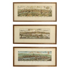
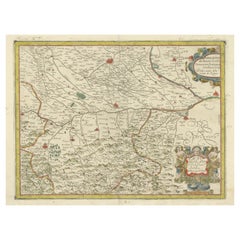
Map Of Florence By F.B.Werner
$250
$50050% Off
£190.46
£380.9250% Off
€217.36
€434.7250% Off
CA$351.31
CA$702.6250% Off
A$382.87
A$765.7350% Off
CHF 202.74
CHF 405.4950% Off
MX$4,598.61
MX$9,197.2350% Off
NOK 2,566.78
NOK 5,133.5650% Off
SEK 2,359.90
SEK 4,719.8050% Off
DKK 1,623.42
DKK 3,246.8550% Off
About the Item
This detailed map of Florence is a fine example of early modern cartography, printed on paper by the German geographer and cartographer F.B. Werner. Measuring 30 × 87.5 cm, the map provides a comprehensive view of the city and its surrounding region, capturing streets, landmarks, rivers, and topographical features with precision. Werner, active in the late 17th and early 18th centuries, was known for his meticulous engraving techniques and ability to combine geographic accuracy with decorative elegance. The elongated format of the map allows for an extended perspective, highlighting both urban and regional aspects of Florence. Printed maps of this type were valued for both practical navigation and scholarly study, as well as for their aesthetic qualities when displayed. This piece would appeal to collectors of antique maps, historians of Florence and Italy, and enthusiasts of fine cartographic art, reflecting both Werner’s skill and the historical representation of one of Italy’s most important cities.
- Dimensions:Height: 11.82 in (30 cm)Width: 34.65 in (88 cm)Depth: 0.79 in (2 cm)
- Materials and Techniques:
- Period:
- Date of Manufacture:18th century
- Condition:
- Seller Location:Porto, PT
- Reference Number:1stDibs: LU10523246812002
About the Seller
New to 1stDibs
Joined in the past six months.
4.0
Vetted Professional Seller
Every seller passes strict standards for authenticity and reliability
Established in 2000
1stDibs seller since 2025
Typical response time: 3 hours
- ShippingRetrieving quote...Shipping from: Porto, Portugal
- Return Policy
More From This Seller
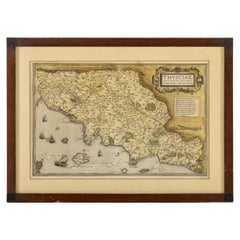
View AllThusciae
Located in Porto, PT
This finely printed map depicts the historical region of Tuscia, located in central Italy, known today largely as the area encompassing parts of modern Tuscany, Umbria, and Lazio. Ex...
Category
Antique 19th Century Antiquities
Materials
Paper
Map Of The Island Of Cuba - Guillaume Thomas Raynal (1711-1796)
Located in Porto, PT
This historical map of the Island of Cuba was produced in the late 18th century and is taken from an edition of “Atlas de toutes les parties connues du globe terrestre” by the French...
Category
Antique 18th Century Prints
Materials
Glass, Paper

Chinese Ark - Year 1862 - With Certificate
Located in Porto, PT
This elegant piece originates from the Ching Dynasty, circa 1862, and is a remarkable example of traditional Chinese craftsmanship. Crafted from fine black lacquered wood, the surfac...
Category
Antique 19th Century Furniture
Materials
Wood
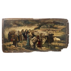
European School - Burial Of Lazarus
Located in Porto, PT
This dramatic “Burial of Lazarus”, executed in oil on wood during the 17th century, is a compelling example of Baroque religious painting. The work captures the poignant moment of La...
Category
Antique 17th Century Paintings
Materials
Paper
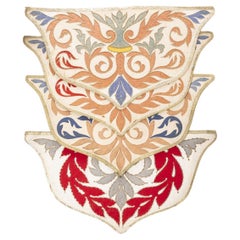
19Th Century - Four Liturgical Cloths
Located in Porto, PT
This lot presents a set of four Portuguese altar cloths, dating from the 19th century, which beautifully illustrate the artistry and devotion embodied in ecclesiastical textiles of t...
Category
Antique 19th Century Decorative Art
Materials
Wood
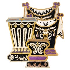
19Th Century - Four Altar Cloths
Located in Porto, PT
This lot comprises four Portuguese altar cloths, dating from the 19th to early 20th century, exemplifying the exquisite artistry of ecclesiastical textiles from this transitional per...
Category
Antique 19th Century Decorative Art
Materials
Wood
You May Also Like
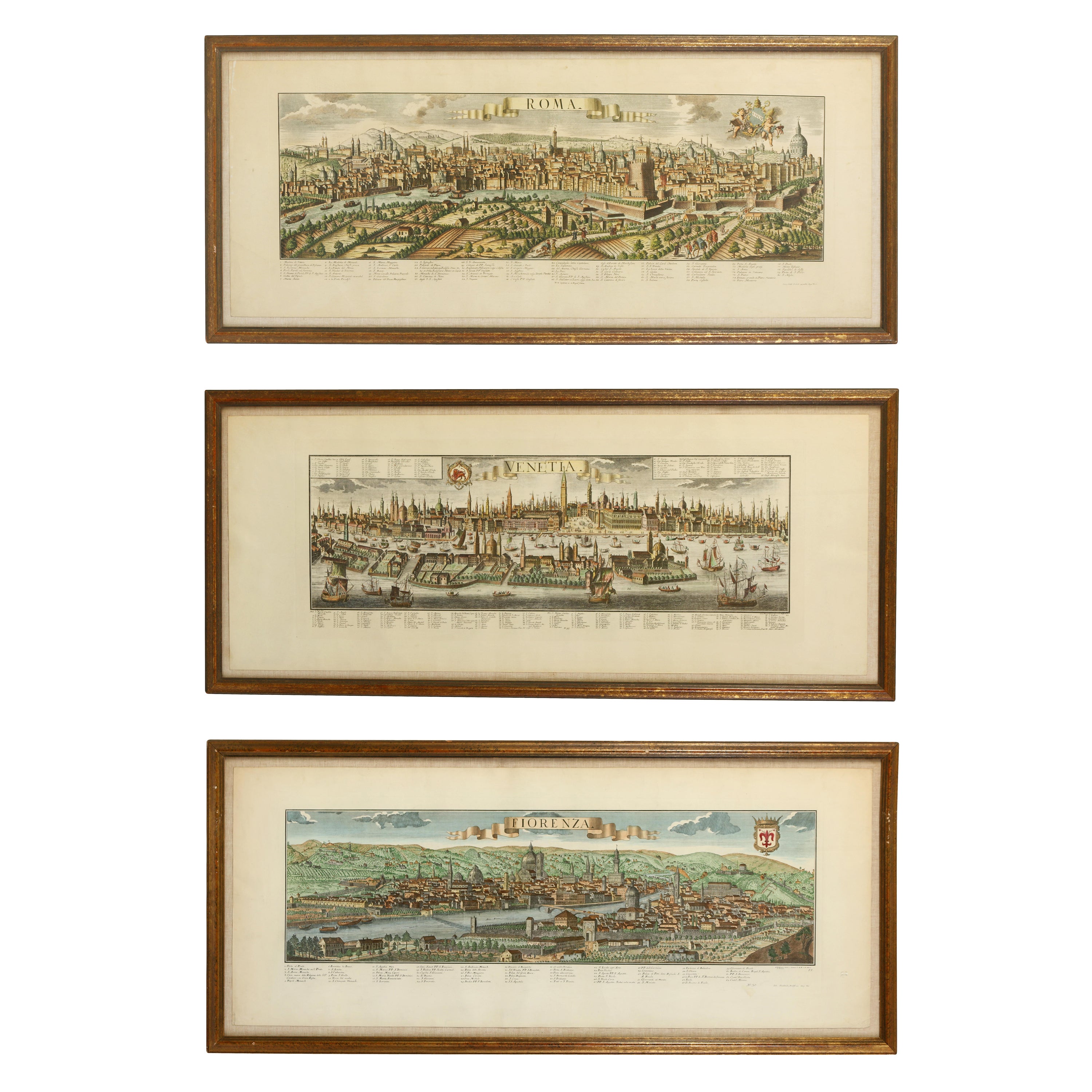
A Series of Historical Maps of Italian Cities
Located in New York, NY
A Pair of vintage maps can add so much interest to a space and this group of Italian maps is particularly interesting. Each is a charming reinterpretation of historical city maps (R...
Category
20th Century Italian Prints
Materials
Paper
$1,260 / item
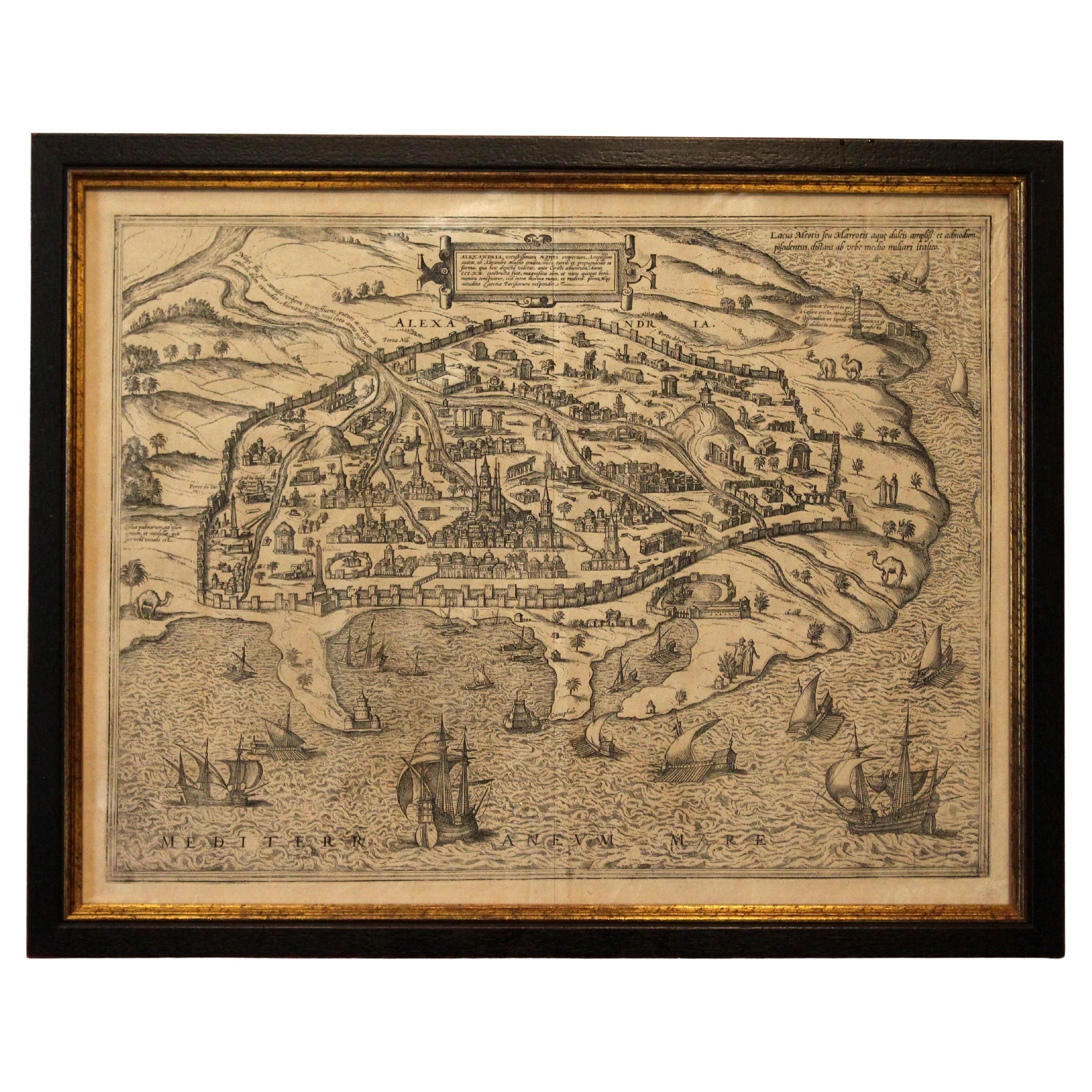
1597 German Map of Alexandria by Georg Braun and Frans Hogenberg
By Georg Braun and Frans Hogenberg
Located in Chapel Hill, NC
1597 Map of Alexandria by Georg Braun and Frans Hogenberg, Germany. From "Civitas Orbis Terrarum", part 2, published in Cologne by Bertram Buchholz. Printed in 2 parts. Title: "Alexa...
Category
Antique 16th Century German Renaissance Maps
Materials
Paper

$480 Sale Price
20% Off
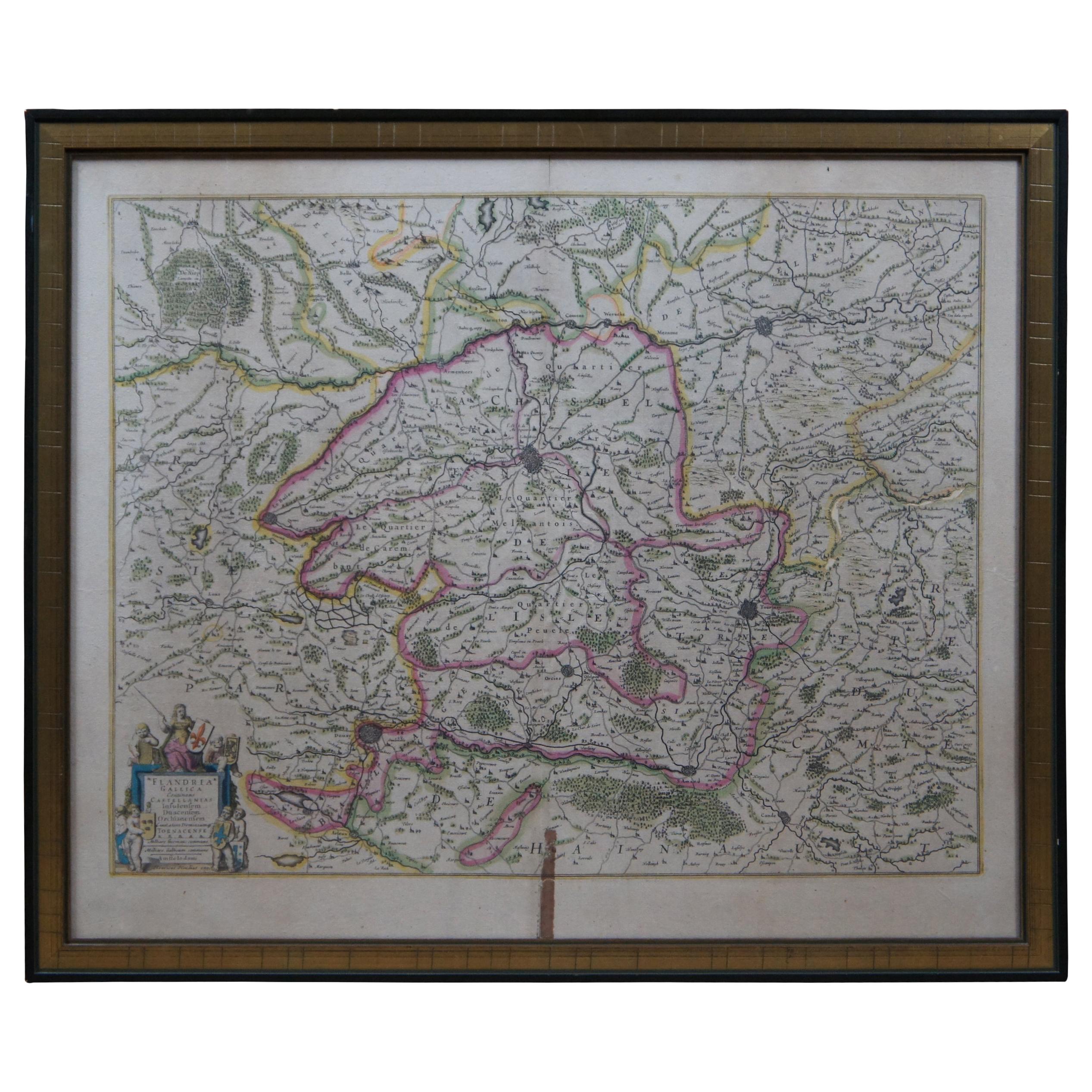
Antique Colored Belgium Map Flandria Gallica Flanders Henricus Hondius
Located in Dayton, OH
Antique hand colored map of Flanders, Belgium, engraved by Henricus Hondius.
Sans frame - 21.25” x 18”.
Category
Antique 19th Century Renaissance Maps
Materials
Paper

$245 Sale Price
30% Off
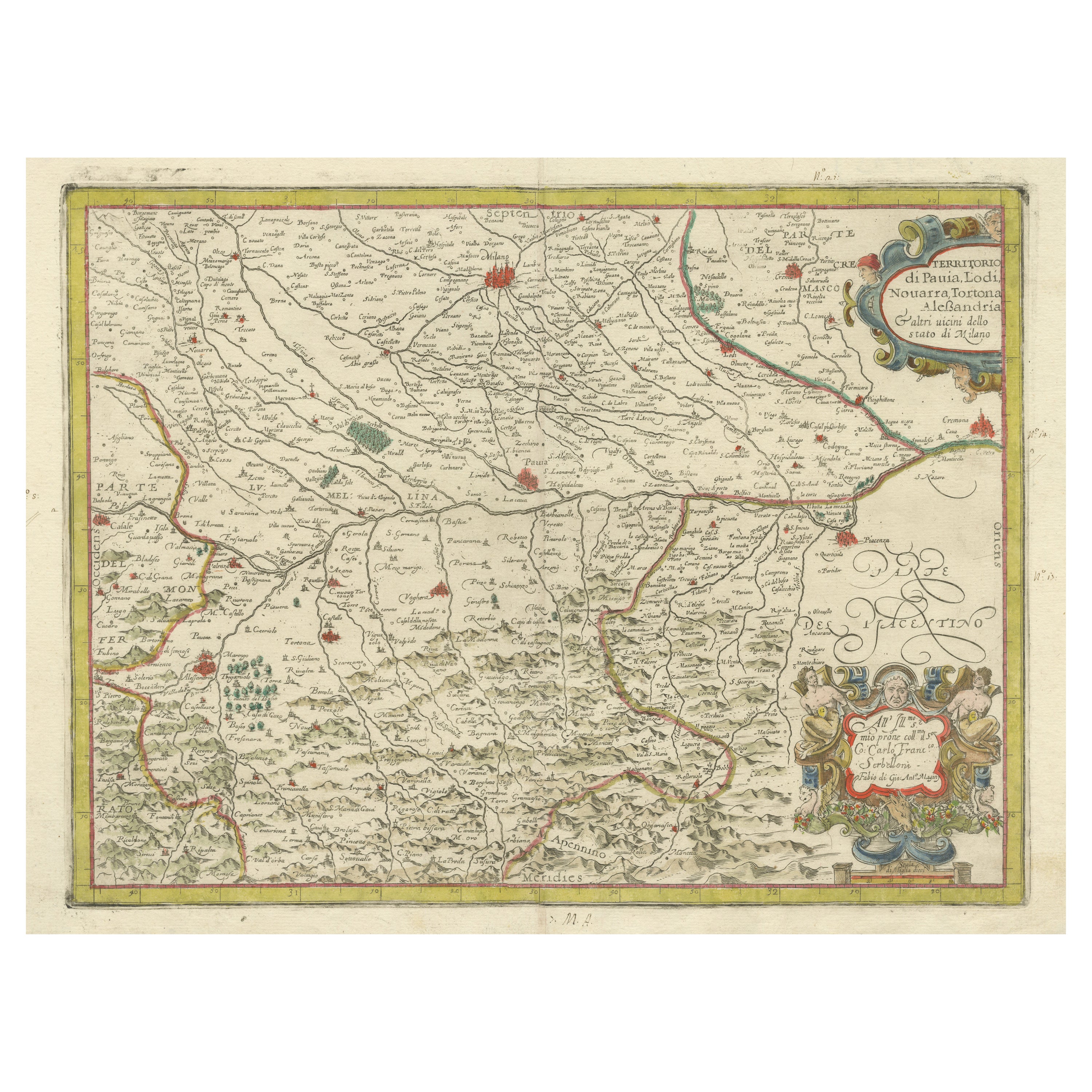
Antique Map of the Region of Pavia, Lodi, Novara, Tortona
Alessandria, Italy
Located in Langweer, NL
Antique map titled 'Territorio di Pavia, Lodi, Novarra, Tortona, Alessandria e altri vicini dello Stato di Milano'. Original old map of the region of Pavia, Lodi, Novara, Tortona and...
Category
Antique Early 17th Century Maps
Materials
Paper
$947 Sale Price
20% Off
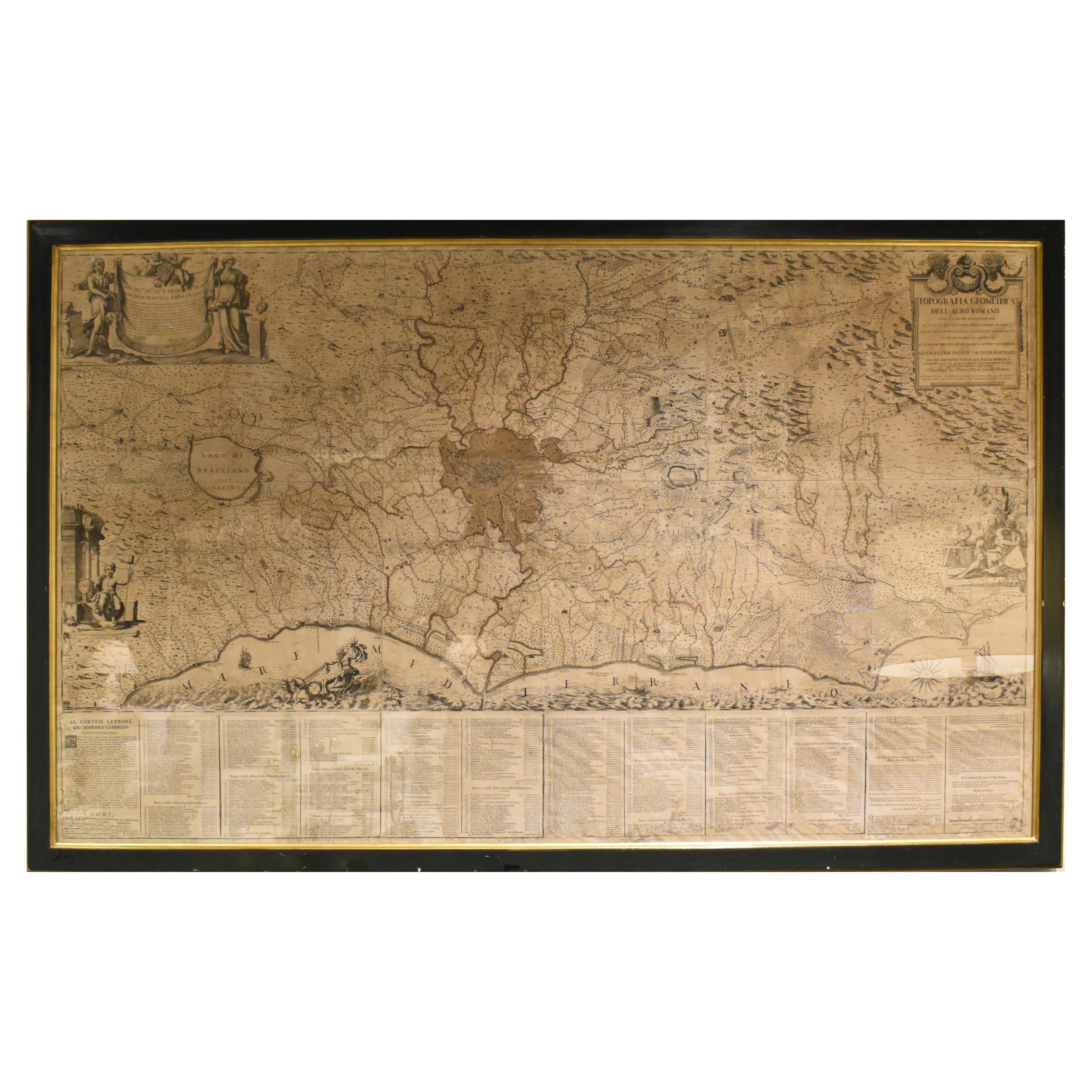
18th Century Map of Rome
Surrounding Vicinity
Located in New Orleans, LA
Intriguing framed map of Rome and the surrounding vicinity featuring detailed cartography, ornamental illustrations, and text index at the bottom. A great, historical conversation pi...
Category
Antique 18th Century Italian Antiquities
Materials
Paper
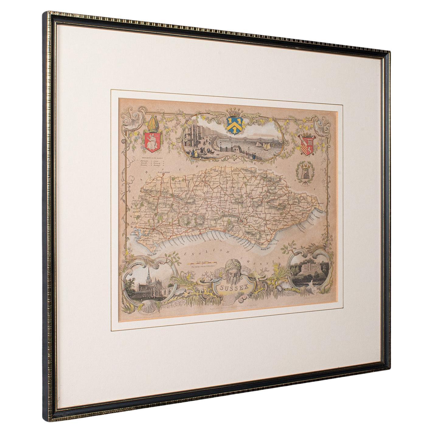
Antique County Map, Sussex, English, Framed Lithography, Cartography, Victorian
Located in Hele, Devon, GB
This is an antique lithography map of Sussex. An English, framed atlas engraving of cartographic interest, dating to the mid 19th century and later.
Superb lithography of Sussex an...
Category
Antique Mid-19th Century British Victorian Maps
Materials
Paper
