Items Similar to Chart of Japan by James Imray and Son


Want more images or videos?
Request additional images or videos from the seller
1 of 13
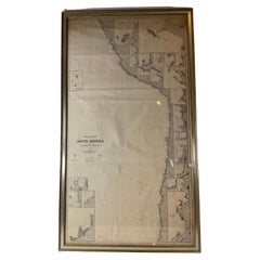
Chart of Japan by James Imray and Son
$1,895
£1,432.10
€1,645.02
CA$2,665.46
A$2,822.02
CHF 1,527.20
MX$33,728.38
NOK 19,036.35
SEK 17,408.06
DKK 12,286.20
About the Item
Chart of southern Japan compiled by James F. Imray and published in 1870. The chart captures the coast and islands. Includes Nagasaki, Kii Channel, Gulf of Yedo, Hiogo, Simoda Harbour, Wadasima, Tago Bay, Arah Bay, Heda Bay, Eno Bay, etc.
Overall Dimensions: Weight is 23 pounds. 46"H x 84"W.
About the Seller
5.0
Vetted Professional Seller
Every seller passes strict standards for authenticity and reliability
Established in 1967
1stDibs seller since 2015
440 sales on 1stDibs
Typical response time: 1 hour
- ShippingRetrieving quote...Shipping from: Norwell, MA
- Return Policy
More From This Seller
View AllAntique Maritime Chart of East Coast Virginia to Nova Scotia
Located in Norwell, MA
1920 nautical chart of the East Coast of the United States from Virginia to Maine, New Brunswick, and Nova Scotia. The chart shows Cape Cod, Long Island, the Connecticut coast, Jersey Shore, Maine, New Hampshire, etc. Very detailed, showing ports, lighthouses, shoals, depths, etc. The chart is by famous cartographer George W. Eldridge, compiled from surveys of the United States government, British Admiralty, George Eldridge, and others. First authorized by George Eldridge, published in 1916 by Wilfred O. White with a merchant's stamp of Charles Hutchinson...
Category
Vintage 1920s North American Maps
Materials
Paper

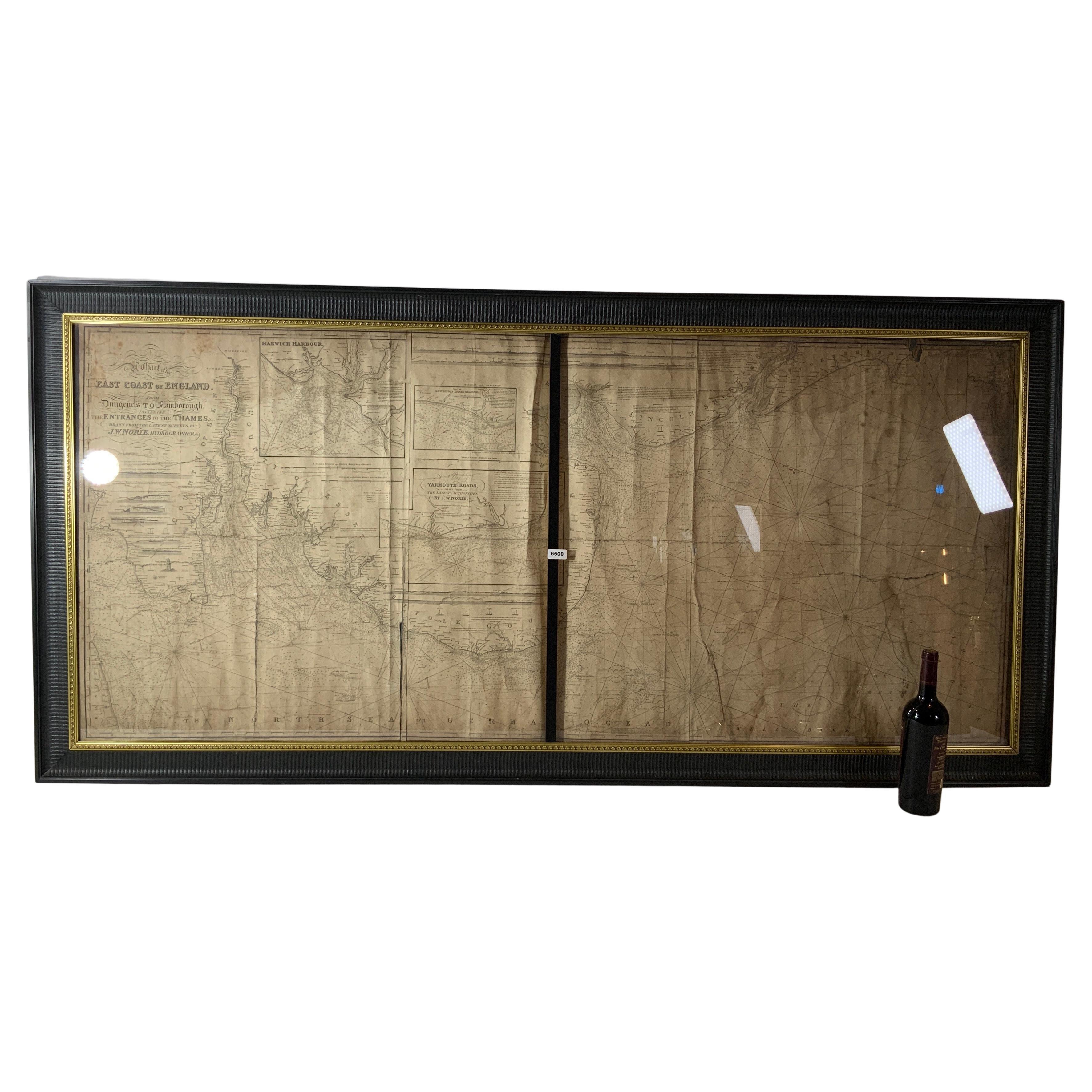
Chart of the East Coast of England
Located in Norwell, MA
Chart of the East Coast of England, from Dungeness to Flamborough, including the entrances to the Thames River. Drawn by hydrographer J.W. Norie in 1841. Includes Kent, Essex and Suf...
Category
Antique 1840s English Nautical Objects
Materials
Paper

Chart of West Coast of South America by James Imray and Son
Located in Norwell, MA
Chart of West Coast of South America compiled by James F. Imray and published in 1880. The chart captures the west coast from Valparaiso to Truxillo. Includes ...
Category
Antique 1880s English Nautical Objects
Materials
Paper
Long Island Chart from 1828
Located in Norwell, MA
Rare original chart of Long Island Sound by E + G Blunt of New York, 179 Water St. "Surveyed in the years 1828, 29 & 30" Exceedingly rare and early chart, titled Long Island Sound fr...
Category
Antique 1830s Nautical Objects
Materials
Paper

Chart of Boston
s North Shore
Located in Norwell, MA
Rarely found restrike of an 1804 chart by Nathanael Bowditch of the Harbors of Salem, Marblehead, Beverly, and Manchester.
Showing the Islands of Great Misery, Satan, Cuney, Winter,...
Category
Vintage 1980s North American Maps
Materials
Paper

1873 Martha
s Vineyard and Nantucket Chart
Located in Norwell, MA
Original chart of Nantucket and Martha's Vineyard by George Eldridge, Cartographer, 125 State Street, Boston. Dated 1873. Mounted to canvas. Also showing the coast of Cape Cod includ...
Category
Antique 1870s North American Maps
Materials
Paper

You May Also Like
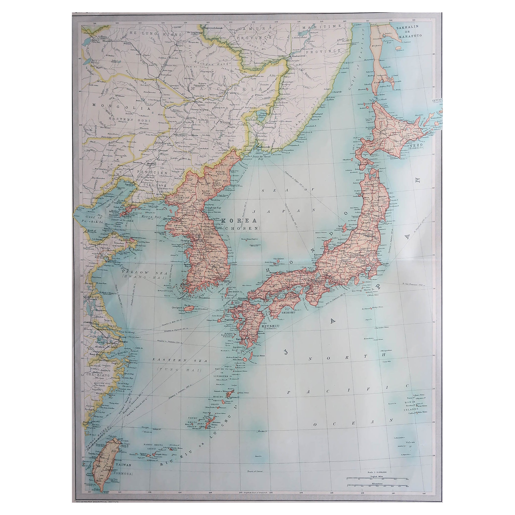
Large Original Vintage Map of Japan, circa 1920
Located in St Annes, Lancashire
Great map of Japan
Unframed
Original color
By John Bartholomew and Co. Edinburgh Geographical Institute
Published, circa 1920
Free shipping.
Category
Vintage 1920s British Maps
Materials
Paper

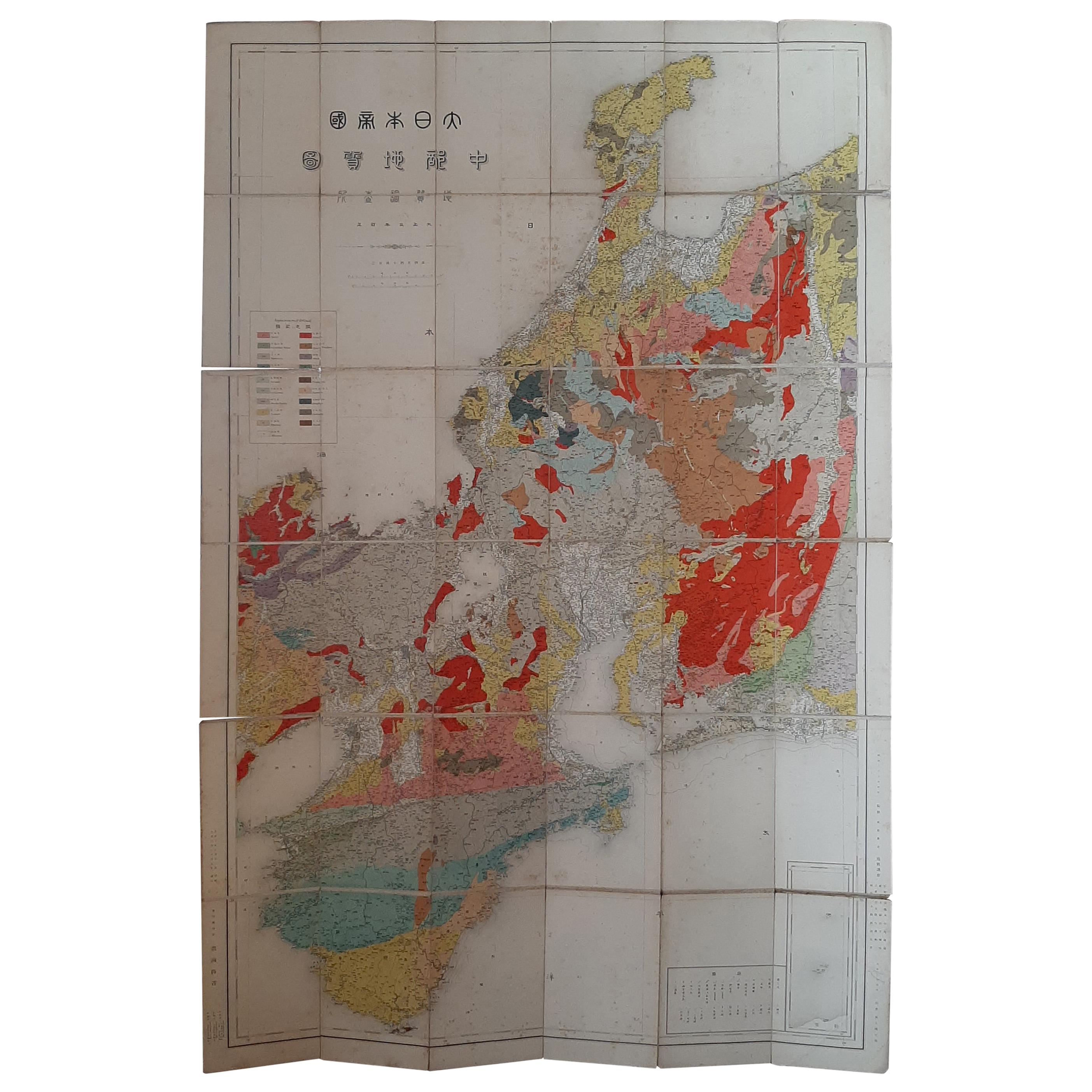
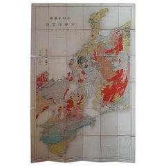
Antique Map of the Region of Wakayama, Nara and Osaka
Japan
, ca.1880
Located in Langweer, NL
Geological folding map of the area with Wakayama, Nara, Osaka, Mie, and Shiga in Japan, circa 1880:
This map is a geological folding map, which means it was designed to be portable ...
Category
Antique Late 19th Century Maps
Materials
Linen, Paper
$910 Sale Price
20% Off
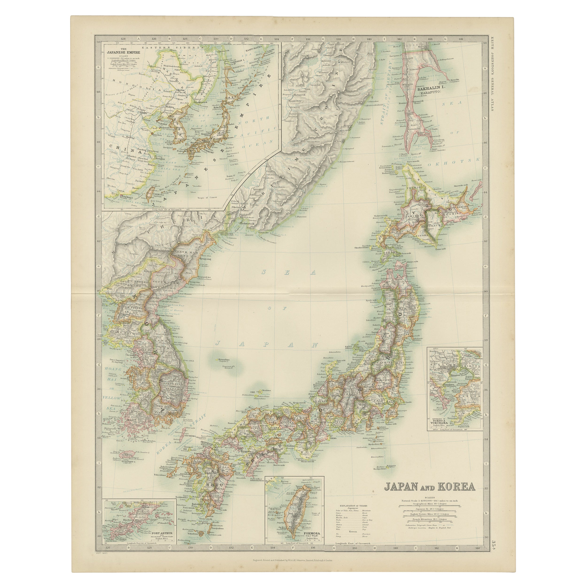
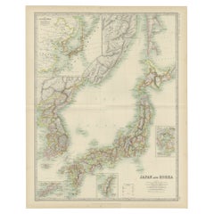
Antique Map of Japan and Korea by Johnston
1909
Located in Langweer, NL
Antique map titled 'Japan and Korea'. Original antique map of Japan and Korea. With inset maps of the Japanese Empire, Port Arthur, Formosa ,Tokyo and Yoko...
Category
Early 20th Century Maps
Materials
Paper
$335 Sale Price
20% Off
Large Original Vintage Map of Japan, circa 1920
Located in St Annes, Lancashire
Great map of Japan
Original color. Good condition
Published by Alexander Gross
Unframed.
Category
Vintage 1920s English Maps
Materials
Paper

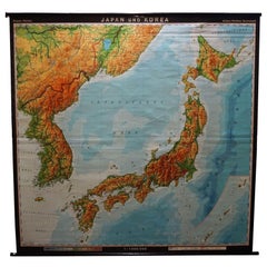
Vintage Rollable Map Asia Japan Korea Wall Chart Poster Countrycore Decoration
Located in Berghuelen, DE
A decorative country core pull-down map depicting Japan and Korea. Published by Haack-Paincke Justus Perthes. Colorful print on paper reinforced with canvas.
Measurements:
Width 199....
Category
Late 20th Century German Country Prints
Materials
Canvas, Wood, Paper
$273 Sale Price
35% Off
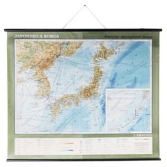
Late 20th Century Educational Geographic Map - Japan - Korea
Located in Hook, Hampshire
Late 20th Century Educational Geographic Map – Japan – Korea
Late 20th Century Educational Geographic Map – Japan – Korea. Good quality roll up school educat...
Category
Late 20th Century Czech Posters
Materials
Cotton
More Ways To Browse
Folk Art Japan
Used Nautical Charts
Antique Nautical Charts
Woolwork Of A Royal Navy Ship
Nautical Flag Art
Folk Art In Bottle
Ship Diorama
Antique Sailors Valentine
Folk Art Sailing
Sailors Valentine Art
Skylight Binnacle
L Fiume
Shell Diorama
Ship Shadow Box
Antique Nautical Flag
Burgee Flag
Nautical Figurehead
Barbados Shell