1 of 5
Tole Heraldic Shield
$875List Price
About the Item
- Dimensions:Height: 35 in (88.9 cm)Width: 42 in (106.68 cm)
- Materials and Techniques:Iron,Tin
- Period:
- Date of Manufacture:1930s
- Condition:Wear consistent with age and use.
- Seller Location:Montecito, CA
- Reference Number:1stDibs: LU92151038454
Authenticity Guarantee
In the unlikely event there’s an issue with an item’s authenticity, contact us within 1 year for a full refund. DetailsMoney-Back Guarantee
If your item is not as described, is damaged in transit, or does not arrive, contact us within 7 days for a full refund. Details24-Hour Cancellation
You have a 24-hour grace period in which to reconsider your purchase, with no questions asked.Vetted Professional Sellers
Our world-class sellers must adhere to strict standards for service and quality, maintaining the integrity of our listings.Price-Match Guarantee
If you find that a seller listed the same item for a lower price elsewhere, we’ll match it.Trusted Global Delivery
Our best-in-class carrier network provides specialized shipping options worldwide, including custom delivery.You May Also Like
19th Century Feench Barometer Antique Scientific Instrument Weather Misure
Located in Milan, IT
Wooden barometer with cedar wood trim at the edges, signed Caux Opticien Rue Rivoli près du Louvre Paris, mid-19th century; dial with the meteorological indications on paper printed ...
Category
Antique 1850s French Scientific Instruments
Materials
Wood
$2,390
H 37.01 in W 10.36 in D 2.37 in
17th Century John Speed Map of Denbighshire, c.1610
By John Speed
Located in Royal Tunbridge Wells, Kent
Antique early 17th century British very rare and original John Speed, hand coloured map of Denbighshire, dated 1610, by John Sunbury and George Humble. John...
Category
Antique 17th Century British Maps
Materials
Wood, Paper

German Bronze Historicism Charger Depicting Entry of Henry IV into Paris in 1594
By Ilsenburg Foundry
Located in Ottawa, Ontario
A Fine German Bronze Historicism Charger Depicting Entry Of Henry IV Into Paris March 22, 1594
Second half 19 century.
A finely cast "Historicism" charger commemorating "The Entry Of Henry IV Into Paris, 22 March in 1594.
The image is loosely based on a painting by Francois Gerard...
Category
Antique Mid-19th Century German Renaissance Decorative Art
Materials
Bronze
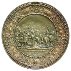
$695
H 1 in Dm 12.75 in
17th Century Nicolas Visscher Map of Southeastern Europe
Located in Hamilton, Ontario
A beautiful, highly detailed map of southeastern Europe by Nicolas Visscher. Includes regions of Northern Italy (showing the cities Bologna, Padua, and Venice), Bohemia, Austria (sho...
Category
Antique 17th Century Dutch Maps
Materials
Paper

$1,350 Sale Price
38% Off
H 26.5 in W 40.75 in D 1 in
Large Original Antique Map of The Pacific Ocean, Fullarton, C.1870
Located in St Annes, Lancashire
Great map of The Pacific Ocean
From the celebrated Royal Illustrated Atlas
Lithograph by Swanston. Original color.
Published by Fullarton,...
Category
Antique 1870s Scottish Maps
Materials
Paper

$60
Free Shipping
H 18.5 in W 22.5 in D 0.07 in
Large Original Antique Map of Arkansas by Rand McNally, circa 1900
By Rand McNally
Co.
Located in St Annes, Lancashire
Fabulous monochrome map with red outline color
Original color
By Rand, McNally & Co.
Published, circa 1900
Unframed
Minor edge tears.
Category
Antique Early 1900s American Edwardian Maps
Materials
Paper

$90
Free Shipping
H 20.5 in W 27.5 in D 0.07 in
Original Antique Map of South Dakota by Rand McNally, circa 1900
By Rand McNally
Co.
Located in St Annes, Lancashire
Fabulous monochrome map with red outline color
Original color
By Rand, McNally & Co.
Published, circa 1900
Unframed
Minor edge tears.
Category
Antique Early 1900s American Edwardian Maps
Materials
Paper

$90
Free Shipping
H 14 in W 20.5 in D 0.07 in
Large Original Antique City Plan of Philadelphia, USA, circa 1900
By Rand McNally
Co.
Located in St Annes, Lancashire
Fabulous colorful map of Philadelphia
Original color
By Rand, McNally & Co.
Published, circa 1900.
Unframed
Free shipping.
Category
Antique Early 1900s American Maps
Materials
Paper

$90
Free Shipping
H 20.5 in W 27.5 in D 0.07 in
Large Scale Antique Scroll Map of Lincolnshire, England, Dated 1778
Located in St Annes, Lancashire
Wonderful scroll map of Lincolnshire
By Captain Armstrong, 1778
Copper plate engraving on paper laid on canvas
Original ebonized wood frame with lovely t...
Category
Antique 1770s English Georgian Maps
Materials
Wood, Paper

$950
Free Shipping
H 84 in W 60 in D 1.5 in
Set of 6 Original Vintage Maps of American States, circa 1900
Located in St Annes, Lancashire
Wonderful set of 6 vintage maps.
Random American states including Maine, Utah, New Hampshire, Nevada, Vermont and New Mexico.
Monochrome with red color outline.
Published by Rand,...
Category
Antique Early 1900s American Edwardian Decorative Art
Materials
Paper
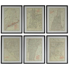
$950 / set
H 23.75 in W 17.75 in D 0.75 in