Want more images or videos?
Request additional images or videos from the seller
1 of 11
The Kentucky Rifle by Captain G. W. Dillin
Price:$129
About the Item
- Creator:John G. W. Dillin (Author)
- Dimensions:Height: 11.25 in (28.58 cm)Width: 8.25 in (20.96 cm)Depth: 1 in (2.54 cm)
- Materials and Techniques:
- Place of Origin:
- Period:
- Date of Manufacture:1946
- Condition:Wear consistent with age and use. slip case is missing a cover label and shows wear/book has some toning.
- Seller Location:valatie, NY
- Reference Number:Seller: NP-659-1st1stDibs: LU260519446013
NPT Books
NPT Books, a division of N. P. Trent Antiques, was established in 1982 and serves clients in the US and around the world. We offer a large selection of used and out of print books mainly concentrating on art, architecture, decoration and antiques with a large focus on 1st editions, signed and rare limited editions. Member of The Art and Antique Dealers League of America since 1996.

About the Seller
5.0
Platinum Seller
Premium sellers with a 4.7+ rating and 24-hour response times
Established in 1980
1stDibs seller since 2017
1,377 sales on 1stDibs
Typical response time: 2 hours
Authenticity Guarantee
In the unlikely event there’s an issue with an item’s authenticity, contact us within 1 year for a full refund. DetailsMoney-Back Guarantee
If your item is not as described, is damaged in transit, or does not arrive, contact us within 7 days for a full refund. Details24-Hour Cancellation
You have a 24-hour grace period in which to reconsider your purchase, with no questions asked.Vetted Professional Sellers
Our world-class sellers must adhere to strict standards for service and quality, maintaining the integrity of our listings.Price-Match Guarantee
If you find that a seller listed the same item for a lower price elsewhere, we’ll match it.Trusted Global Delivery
Our best-in-class carrier network provides specialized shipping options worldwide, including custom delivery.You May Also Like
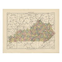
Antique Map of Kentucky
Located in Langweer, NL
Antique map titled 'Kentucky'. Original antique map of Kentucky, United States. This print originates from 'Encyclopaedia Britannica', Ninth E...
Category
Antique Late 19th Century Maps
Materials
Paper
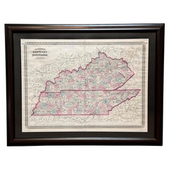
1870 "Johnson
s Kentucky and Tennessee" Published by A. J. Johnson
Located in Colorado Springs, CO
Presented is an original 1870 "Johnson's Kentucky and Tennessee" map. First published in 1865, this map was issued as pages 60 and 61 in the 1870 edition of “Johnson's New Illustrate...
Category
Antique 1870s American Victorian Maps
Materials
Paper
Original Antique Map of the American State of Kentucky, 1903
Located in St Annes, Lancashire
Antique map of Kentucky
Published By A & C Black. 1903
Original colour
Good condition
Unframed.
Free shipping
Category
Antique Early 1900s English Maps
Materials
Paper
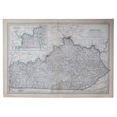
$49
Free Shipping
H 11.5 in W 16.25 in D 0.07 in
Antique Map of Kentucky
Tennessee – The Bluegrass
Volunteer States, 1888
Located in Langweer, NL
Antique Map of Kentucky & Tennessee – The Bluegrass & Volunteer States, 1888
This antique engraved map of Kentucky and Tennessee, published in 1888 by Rand, McNally & Co. in Chicago for their Improved Indexed Business Atlas and Shippers Guide, provides a highly detailed view of two historically important Southern states in the late 19th century. It shows counties, towns, and an extensive network of railroads, capturing a period when rail transportation was rapidly transforming the economy and society of the post-Civil War South.
The Kentucky section, titled “New County and Railroad Map of Kentucky,” highlights the state’s counties, with Louisville, Lexington, Covington, and Frankfort (the state capital) standing out as major centers. Known as “The Bluegrass State,” Kentucky was already famous for its fertile farmland, thoroughbred horse breeding, and bourbon whiskey industry. The map shows dense railroad coverage, including the Louisville & Nashville Railroad, which connected Kentucky to major markets in the Midwest and South.
The Tennessee portion, titled “County and Railroad Map of Tennessee,” provides similar detail. Counties such as Shelby, Davidson, Knox, and Hamilton are clearly marked, along with the major cities of Memphis, Nashville (the state capital), Knoxville, and Chattanooga. Known as “The Volunteer State,” Tennessee played a critical role in American history, from its frontier heritage to its importance during the Civil War. By 1888, Tennessee’s economy was diversifying, with Memphis as a cotton trading hub, Nashville as a growing cultural and commercial center, and Chattanooga as a key industrial city connected to the railroads.
The map’s railroad...
Category
Antique Late 19th Century American Maps
Materials
Paper
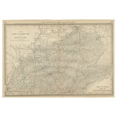
$548
H 20.67 in W 14.18 in D 0.01 in
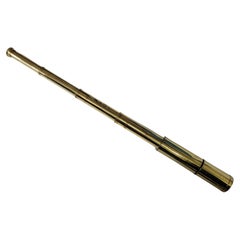
Solid Brass Ship Rifle Telescope
Located in Norwell, MA
Brass telescope appropriate for use on land or sea. This has been meticulously polished and lacquered. We just restored a great collection of these. This fine instruement has a four ...
Category
Vintage 1920s European Nautical Objects
Materials
Brass
Mounted Taxidermy Hare with Rifle
Located in Eindhoven, NL
Mounted taxidermy hare with rifle. The hare is beautifully finished with backpack, hunter's hat and ammunition belt. A real eyecatcher.
Category
21st Century and Contemporary Taxidermy
Materials
Patent Leather

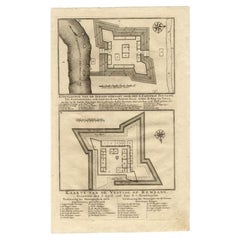
Antique Map of the Fortress of Captain E. Bintang by Valentijn, 1726
Located in Langweer, NL
Antique print titled 'Kaarte van de Schans gemaakt door den E. Capitein Bintang. Kaarte van de Vesting op Rembang.' A plan of the fort constructed by the Captain E. Bintang, in the B...
Category
Antique 18th Century Maps
Materials
Paper
Antique Chart of the Voyage of Captain Cook by Benard, 1780
Located in Langweer, NL
Antique map titled 'Carte des Découvertes faites dans la Mer Pacifique sur la Vaisse au de Roi, La Resolution, Commandé par le Capitaine Cook en 1774'. Chart detailing the 1774 voyag...
Category
Antique 18th Century Maps
Materials
Paper
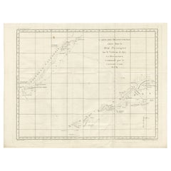
$266 Sale Price
20% Off
H 16.34 in W 21.26 in D 0 in
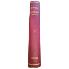
History of Muhlenberg County Kentucky by O.A. Rothert 1913
Located in Dallas, TX
Presenting an extremely rare first edition and signed hardback copy of the History of Muhlenberg County by Otto A. Rothert from 1913.
This rare book is in super condition for its ...
Category
Early 20th Century American Country Books
Materials
Paper
Mounted Taxidermy Hunting Fox with Rifle
Located in Eindhoven, NL
Mounted taxidermy hunting fox with rifle. The fox is beautifully finished with backpack, hunter's hat and ammunition belt. A real eyecatcher.
Category
21st Century and Contemporary European Taxidermy
Materials
Leather

More From This Seller
View All"Road Scrapings: Coaches and Coaching" by Captain M. E. Haworth, 1882
Located in valatie, NY
Road Scrapings: Coaches and Coaching. London: Tinsley Brothers, 1882. First edition Morocco and cloth bound hardcover. Captain Haworth writes about the world of coaching by telling anecdotes when coaching was at its peak. He describes fights among competitors and how one coaching company hired prize-fighters to keep the peace. He also explains how trains are safer for the public with the lack of competitive fist fighting...
Category
Antique Late 19th Century English Books
Materials
Paper, Leather

Winterthur by Jay E. Cantor, Signed and Inscribed by the Author
Located in valatie, NY
Winterthur by Jay E. Cantor, Signed and Inscribed by the Author. Published by Harry N. Abrams, New York, NY, 1986. 2nd Ed hardcover with dust jacket. Traces the history of the Delawa...
Category
Vintage 1980s American Books
Materials
Paper

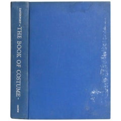
The Book of Costumes by Millia Davenport
By Millia Davenport
Located in valatie, NY
The Book of Costumes by Millia Davenport. New York: Crown Publishers, 1956. First edition fourth printing hardcover with no dust jacket, volume 1 of 2. 958 pp. A large chronological ...
Category
20th Century American Books
Materials
Paper
The Vatican Collections: The Papacy and Art by The Metropolitan Museum of Art
Located in valatie, NY
The Vatican Collections: The Papacy and Art by The Metropolitan Museum of Art. Published by The Metropolitan Museum of Art/Harry N. Abrams, 1988. 1st Ed softcover. Nearly three hundr...
Category
Vintage 1980s American Books
Materials
Paper

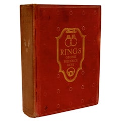
Rings for the Finger Signed by the Author to the Publisher Frank Doubleday
Located in valatie, NY
Rings For The Finger : From The Earliest Known Times To The Present, With Full Descriptions Of The Origin, Early Making, Materials, The Archaeology, History, For Affection, For Love,...
Category
Vintage 1910s American Books
Materials
Paper
The Shanghai Museum by The Curators of the Shanghai Museum, 1st Ed
Located in valatie, NY
The Shanghai Museum by The Curators of the Shanghai Museum. Published by Scala Publishers Ltd, 2007. 1st Ed softcover. The Shanghai Museum is the finest museum of modern China - in terms of wealth of collection, display and architecture. Originally built in 1952 on the site of the old race course, it re-opened in 1993 in a startling new building in Renmin Square in the heart of central Shanghai. Designed in the shape of an ancient bronze ding...
Category
21st Century and Contemporary English Books
Materials
Paper

Still Thinking About These?
All Recently ViewedMore Ways To Browse
Antique Collection Of Italian Grand Tour Plaster Intaglios
Antique Collection Of Italian Grand Tour Plaster Intaglios
Scott Williams
Walt Peregoy
Scott Williams
Walt Peregoy
Ruth Reeves
Photogravure 1895
Aran Lounge Chair
Arben Italy
Arbol Lamps
Arbor Used
Archibald Knox Chair
Ares Bust
Arhaus Console
Arhaus Mirror
Aristokrat Chairs
Armani Casa Torino