1 of 4
Pierre Deux
s Paris Country: A Style and Source Book of the Ile-De-France
$30List Price
About the Item
- Dimensions:Height: 10 in (25.4 cm)Width: 10 in (25.4 cm)Depth: 1 in (2.54 cm)
- Style:French Provincial (In the Style Of)
- Materials and Techniques:
- Place of Origin:
- Period:1990-1999
- Date of Manufacture:1991
- Condition:Wear consistent with age and use.
- Seller Location:Oakland Park, FL
- Reference Number:Seller: KL-0060201stDibs: LU946320325172
Authenticity Guarantee
In the unlikely event there’s an issue with an item’s authenticity, contact us within 1 year for a full refund. DetailsMoney-Back Guarantee
If your item is not as described, is damaged in transit, or does not arrive, contact us within 7 days for a full refund. Details24-Hour Cancellation
You have a 24-hour grace period in which to reconsider your purchase, with no questions asked.Vetted Professional Sellers
Our world-class sellers must adhere to strict standards for service and quality, maintaining the integrity of our listings.Price-Match Guarantee
If you find that a seller listed the same item for a lower price elsewhere, we’ll match it.Trusted Global Delivery
Our best-in-class carrier network provides specialized shipping options worldwide, including custom delivery.You May Also Like
Île-de-France Map, including Paris - Hand-Colored Engraving by F. De Wit c. 1688
Located in Langweer, NL
Title: Hand-Colored 17th-Century Map of Île-de-France by Frederik De Wit c. 1688
Description: This striking map, "Le Gouvernement de l’Isle de France," showcases the Île-de-France r...
Category
Antique 1680s Maps
Materials
Paper
$704
H 20.83 in W 24.41 in D 0.01 in
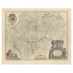
Antique Map of the Region of
Île de France
by Janssonius, 1657
By Johannes Janssonius
Located in Langweer, NL
Antique map of France titled 'Ager Parisiensis vulgo l'Isle de France'. Old map of Paris and adjacent regions. This map originates from 'Atlas Novus, ...
Category
Antique 17th Century Maps
Materials
Paper
The French Country House Book by Christiane de Nicolay-Mazery
Bernard Touillon
By Christiane de Nicolay-Mazery
Located in New York, NY
The French Country House
By: Christiane de Nicolay-Mazery and Bernard Touillon
Epitomizing what the French call l’art de vivre (the art of good living), The French Country House is ...
Category
21st Century and Contemporary Books
Materials
Paper

$30
H 12 in W 9 in D 3 in
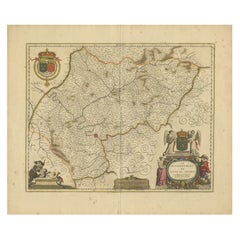
Antique Map of the Region of
Île de France
by Janssonius, circa 1650
By Johannes Janssonius
Located in Langweer, NL
Antique map of France titled 'Le Gouvernement de L'Isle de France'. Paris is represented by a miniature plan of the city, making it distinct from the other towns of the region which ...
Category
Antique Mid-17th Century Maps
Materials
Paper
$537
H 19.3 in W 22.64 in D 0.02 in
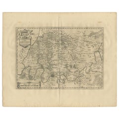
Antique Map of the Region of Île-de-France by Hondius, circa 1630
Located in Langweer, NL
Antique map titled Gouvernement de l'Isle de France'. Old map of the region of Île-de-France, France. It is located in the north-central part of the country and often called the régi...
Category
Antique Mid-17th Century Maps
Materials
Paper

$657
H 19.49 in W 23.04 in D 0.02 in
Antique Map of Île de Ré and Île d
Oléron by Janssonius, 1657
By Johannes Janssonius
Located in Langweer, NL
Antique map 'Insulae Divimartini et Vliarus vulgo l'isle de Re et Oleron'. Decorative map of Île de Ré and Île d'Oléron. This map originates from 'Atlas Novu...
Category
Antique Mid-17th Century Maps
Materials
Paper

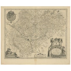
Mapping the Heart of France: Willem Blaeu
s 17th Century Île-de-France, ca.1650
Located in Langweer, NL
This original antique map titled "Le Gouvernement de l'Isle de France" represents the Île-de-France region, which historically was one of the provinces of France and contained the ci...
Category
Antique 1650s Maps
Materials
Paper
$363 Sale Price
20% Off
Free Shipping
H 20.08 in W 24.02 in D 0 in
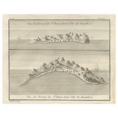
Views of St. Denis and St. Paul, Île de Bourbon – Antique French Engraving, 1790
Located in Langweer, NL
Views of St. Denis and St. Paul, Île de Bourbon – Antique French Engraving by Portier, c.1790
This antique French engraving by Portier, produced around 1790, presents two coastal vi...
Category
Antique Late 18th Century French Maps
Materials
Paper
$406
H 5.83 in W 7.88 in D 0.01 in
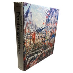
The Great Book of French Impressionism by Diane Kelder
Located in Moreno Valley, CA
The art of the French impressionists great large heavy art table book by Diane Kelder. A survey of works by French artists of the Impressionist movement focuses on Pissarro, Sisley, Manet, Morisot, Monet, Renoir, Cassatt, Degas, and Toulouse-Lautrec. Absolutely gorgeous extra large coffee table book - “The Great Book of French Impressionism...
Category
Vintage 1980s French French Provincial Books
Materials
Paper
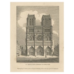
Antique Print of the Notre-Dame de Paris Cathedral in Paris, France, 1835
Located in Langweer, NL
Antique print titled 'Front of the Cathedral of Notre Dame'. Old print of the Notre-Dame de Paris Cathedral, France. This print originates from 'One Hundred and Fifty Wood Cuts selec...
Category
Antique 19th Century Prints
Materials
Paper
$179
H 13.39 in W 9.65 in D 0 in
Still Thinking About These?
All Recently ViewedMore Ways To Browse
Pierre Deux Furniture
Pierre Deux French Country
Pierre Deux Book
Large Antique Books
Sothebys Auction Catalog
Used Office Furniture Edinburgh
Vintage Map Book
Antiques Catalogue
Dj Furniture
Frank Lloyd Wright On Sale
Omar Khayyam
Vintage Coffee Table Book
Winston Leathers
Charles Dickens Christmas
Cooking Book
David Hicks Living With Design
Ernest Hemingway Furniture
Miniature Book