Want more images or videos?
Request additional images or videos from the seller
1 of 5
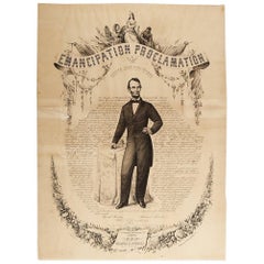
1865 Emancipation Proclamation with Abraham Lincoln Portrait, Antique Engraving
$5,000List Price
About the Item
- Dimensions:Height: 23.75 in (60.33 cm)Width: 17.75 in (45.09 cm)Depth: 0.07 in (1.78 mm)
- Materials and Techniques:
- Place of Origin:
- Period:
- Date of Manufacture:1865
- Condition:Wear consistent with age and use. Good condition. Engraving with strong impression. Four chips in margins, professionally repaired. Toning along top margin. Unframed.
- Seller Location:Colorado Springs, CO
- Reference Number:Seller: PR3441stDibs: LU909719555662
About the Seller
4.9
Gold Seller
Premium sellers maintaining a 4.3+ rating and 24-hour response times
Established in 2010
1stDibs seller since 2011
473 sales on 1stDibs
Typical response time: 4 hours
Authenticity Guarantee
In the unlikely event there’s an issue with an item’s authenticity, contact us within 1 year for a full refund. DetailsMoney-Back Guarantee
If your item is not as described, is damaged in transit, or does not arrive, contact us within 7 days for a full refund. Details24-Hour Cancellation
You have a 24-hour grace period in which to reconsider your purchase, with no questions asked.Vetted Professional Sellers
Our world-class sellers must adhere to strict standards for service and quality, maintaining the integrity of our listings.Price-Match Guarantee
If you find that a seller listed the same item for a lower price elsewhere, we’ll match it.Trusted Global Delivery
Our best-in-class carrier network provides specialized shipping options worldwide, including custom delivery.You May Also Like
Sweden
Norway – Antique Map of Scandinavia with Stockholm Inset, 1865
Located in Langweer, NL
Sweden & Norway – Antique Map of Scandinavia with Stockholm Inset, 1865
This finely detailed antique map titled Sweden & Norway (Scandinavia) offers a comprehensive 19th-century vie...
Category
Antique Mid-19th Century English Maps
Materials
Paper

$328
H 24.41 in W 19.1 in D 0.02 in
Antique Print of a Waterfall in Lincoln Province, C.1785
Located in Langweer, NL
Antique print titled 'Nouvelles Eaux de Belton au Lord Tyrconnel province de Lincoln'. Copper engraving showing a waterfall. This print originates from 'Jardins Anglo-Chinois à la Mo...
Category
Antique 18th Century Prints
Materials
Paper
$267 Sale Price
20% Off
H 10.63 in W 16.15 in D 0 in
Antique Map of South Australia by A.K. Johnston, 1865
Located in Langweer, NL
Antique map titled 'South Australia, New South Wales, Victoria & Queensland'. This map originates from the ‘Royal Atlas of Modern Geography’ by Alexander Keith Johnston. Published by...
Category
Antique Mid-19th Century Maps
Materials
Paper

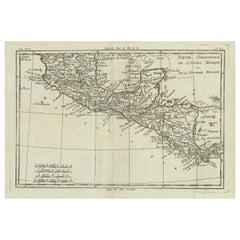
Antique French Engraving of Mexico with Lots of Details, c.1780
Located in Langweer, NL
Antique map titled 'Partie Meridionale, de L'Ancien Mexique ou de la Nouvelle Espagne.'
Detailed map of Mexico, the Yucatan and Central America, prepared under the direction of Rigobert Bonne. Shows towns, rivers, mountains, lakes, etc. Detailed map of the region. Source unknown, to be determined.
Artists and Engravers: Rigobert Bonne (1727-1795 ) was one of the most important cartographers of the late 18th century. In 1773 he succeeded Jacques Bellin as Royal Cartographer to France in the office of the Hydrographer at the Depôt de la Marine. Working in his official capacity Bonne compiled some of the most detailed and accurate maps of the period. Bonne's work represents an important step in the evolution of the cartographic ideology away from the decorative work of the 17th and early 18th century towards a more detail oriented and practical aesthetic. With regard to the rendering of terrain Bonne maps...
Category
Antique 18th Century Maps
Materials
Paper
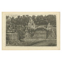
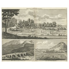
Rare Antique Engraving with Three Unique Views of Iran, 1711
Located in Langweer, NL
Antique print titled 'Karavane by het dorp Coraming - Brug over de rivier Kiesilosan - Het Dorp 't Sargabrand'. Old print with three views, two of which unidentified villages in Iran, and a bridge over the Kiesilosan river. This print originates from 'Cornelis de Bruins...
Category
Antique 18th Century Prints
Materials
Paper
$324 Sale Price
20% Off
H 12.8 in W 13.98 in D 0 in
Antique Map of South America ‘North’ by A.K. Johnston, 1865
Located in Langweer, NL
Antique map titled 'South America, Northern Sheet'. Depicting Guiana, Ecuador, Brazil, Bolivia the Amazones and more. This map originates from the ‘Royal Atlas of Modern Geography’ b...
Category
Antique Mid-19th Century Maps
Materials
Paper

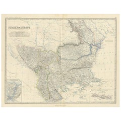
Antique Map of Turkey in Europe by A.K. Johnston, 1865
Located in Langweer, NL
Antique map titled 'Turkey in Europe'. With an inset map of Crete, the Bosporus and Constantinople. This map originates from the ‘Royal Atlas of Modern Geography’ by Alexander Keith ...
Category
Antique Mid-19th Century American Maps
Materials
Paper
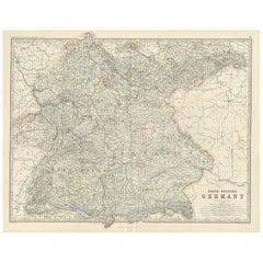
Antique Map of South-Western Germany by A.K. Johnston, 1865
Located in Langweer, NL
Antique map titled 'South-Western Germany'. This map originates from the ‘Royal Atlas of Modern Geography’ by Alexander Keith Johnston. Published by William Blackwood and Sons, Edinb...
Category
Antique Mid-19th Century Maps
Materials
Paper
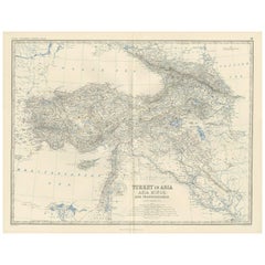
Antique Map of Turkey in Asia by A.K. Johnston, 1865
Located in Langweer, NL
Antique map titled 'Turkey in Asia (Asia Minor) and Transcaucasia'. This map originates from the ‘Royal Atlas of Modern Geography’ by Alexander Keith Johnston. Published by William B...
Category
Antique Mid-19th Century Maps
Materials
Paper
Antique English Map – Southern England
Wales, Johnston’s Royal Atlas, 1865
Located in Langweer, NL
Antique Map of England & Wales (Southern Sheet) – Johnston’s Royal Atlas, 1865
This finely engraved antique map, titled *England and Wales (Southern Sheet)*, was published in 1865 i...
Category
Antique Mid-19th Century Scottish Maps
Materials
Paper

$328
H 19.1 in W 24.41 in D 0.02 in
More From This Seller
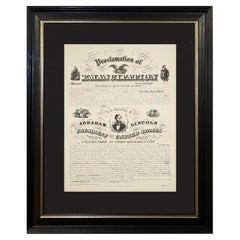
View All1865 Emancipation Proclamation, Antique Lithograph by P.S. Duval and Son
Located in Colorado Springs, CO
Presented is a lithographic broadside of the text of the Emancipation Proclamation issued on January 1, 1863. This broadside was published in...
Category
Antique 1860s American Historical Memorabilia
Materials
Paper
1864 Engraving of Lincoln
s "Proclamation of Emancipation" by Charles Shober
Located in Colorado Springs, CO
This 1864 engraving features the Emancipation Proclamation in elaborate calligraphic text, with five patriotic vignettes and a small portrait of Lincoln. This is the second issue of ...
Category
Antique 1860s American American Classical Prints
Materials
Paper
"Lady Washington
s Reception, " Engraved by A. H. Ritchie, Antique Print, 1865
Located in Colorado Springs, CO
This 1865, hand-colored engraving by A. H. Ritchie is entitled Lady Washington's Reception and is based on Daniel F. Huntington's original painting "Th...
Category
Antique 1860s American Prints
Materials
Paper

“A Football Match, Scotland v. England” Antique Engraving, Proof Edition of 100
By Overend and Smythe
Located in Colorado Springs, CO
This is the 1889 William H. Overend (1851-1898) and Lionel Smythe (1839-1918) first edition, photogravure of the Calcutta Cup – a Rugby match between Scotland and England, that has been played over 100 times, the first match...
Category
Antique 19th Century English Prints
Materials
Paper

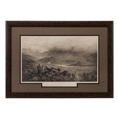
"Rough Shooting" First Edition Antique Engraving by Douglas Adams, circa 1893
By Douglas Adams
Located in Colorado Springs, CO
This is a first edition print of Rough Shooting, signed by the artist, Douglas Adams. The print was published by Thomas McLean and depicts a highlands s...
Category
Antique 1890s British Prints
Materials
Paper
1876 "Gettysburg, The Repulse of Longstreet
s Assault." Engraving
Located in Colorado Springs, CO
Presented here is an 1876 engraving of John B. Bachelder and James Walker’s Gettysburg. The Repulse of Longstreet’s Assault. The engraved scene depicts the decisive battle on the final day of the Battle of Gettysburg. Researched by the photographer and topographer John B. Bachelder and painted by James Walker, the original painting was created in 1870. This detailed engraving was done by H. B. Hall Jr. and published by James Drummond Ball.
Otherwise called Pickett’s Charge, the battle occurred on July 3, 1863. Pickett’s corp commander, Lieutenant General James Longstreet was placed in charge of the attack despite his hesitations. Longstreet’s central role led to the title of the work, Repulse of Longstreet’s Assault. In an attempt to gain control of an important supply route, nine Confederate brigades charged across three-quarters of a mile of open ground against cannon fire to take Cemetery Ridge from the defending Union Army. Despite their overwhelming numbers, the Confederate forces were repelled with considerable casualties marking not only a decisive victory for the Union, but also the beginning of the slow defeat of Lee’s Army. The furthest the charging forces advanced before being repulsed would forever be known as the “High Water Mark of the Confederacy.” The Confederate army never recovered from the losses at Gettysburg and it effectively ended Lee’s campaign into Pennsylvania.
The engraving gives the perspective from the Union rear, one that encompasses most of the battlefield, from Big Round Top on the left to the northern reaches of Cemetery Ridge on the right. The Confederate lines at Seminary Ridge are in the far distance, partially obscured by bursting shells. The image centers on the main Confederate assault, in the vicinity of what today are known as "The Copse" and "The Bloody Angle." The composition has elemen...
Category
Antique 1870s American Prints
Materials
Paper

Still Thinking About These?
All Recently ViewedMore Ways To Browse
Historical Signatures
Used Artillery Shell
Oak Leaf Motif
Vintage German Glass Ornaments
Cash Registers Used
German Christmas Tree
Ancient Coins
War Shell
World War Ii Furniture
Alexander Hamilton
Antique Feather Tree
Charlie Brown Vintage
Wooden Sleds
German Santa Claus
Mid Century Christmas Ornament
Antique Artillery Shells
German Christmas Santa
Royal Flag