Items Similar to 1562 Map of Toscana Nuova Tavola by Girolamo Ruscelli

Want more images or videos?
Request additional images or videos from the seller
1 of 5
1562 Map of Toscana Nuova Tavola by Girolamo Ruscelli
$360
$45020% Off
£274.60
£343.2520% Off
€312.86
€391.0720% Off
CA$505.98
CA$632.4820% Off
A$552.01
A$690.0220% Off
CHF 292.29
CHF 365.3620% Off
MX$6,614.70
MX$8,268.3820% Off
NOK 3,722.45
NOK 4,653.0720% Off
SEK 3,403.91
SEK 4,254.8820% Off
DKK 2,336.05
DKK 2,920.0720% Off
About the Item
A 1562 map of Toscana Nuova Tavola by Girolamo Ruscelli. Tuscany is the heart of Italy
birthplace of the Italian language. Early hand-coloring. Copper plate engraving. Interestingly the map is one of two engraved on the same plate, then separated for inclusion in the book (note crease). We know this as the plate mark runs off the top of the table. Printed in Venice. Latin description verso can be seen through the paper. Sheet size: 9 1/8" x 11 7/8".
Framed: 11.75" x 14.75".
Whitehall Antiques is a family business that has been a major source for the selective buyer for over 90 years. We are one the finest antiques shop in the South and Mid-Atlantic, proclaimed the “Best Antiques Shop in the Mid-Atlantic” by Mid-Atlantic Antiques Magazine. With over 7,500 square feet of show room space in an impressive Italianate Villa setting, Whitehall is a must visit spot for antiques collectors, dealers and decorators alike!
We specialize in period 18th and 19th century English and Country French furniture, fine art, silver, porcelain, lighting, and all appropriate decorative accessories. You will also find pieces of American origin, from Continental Europe, Asia, and the Middle East and ranging in date and style from Baroque to Mid-Century Modern. In short, we are a treasure trove of unique items with an unprecedented selection for your home or collection!
- Dimensions:Height: 14.75 in (37.47 cm)Width: 11.75 in (29.85 cm)Depth: 0.75 in (1.91 cm)
- Style:Renaissance (Of the Period)
- Materials and Techniques:
- Place of Origin:
- Period:
- Date of Manufacture:1562
- Condition:Wear consistent with age and use.
- Seller Location:Chapel Hill, NC
- Reference Number:Seller: WP-2522z1stDibs: LU6458241498432
About the Seller
4.9
Platinum Seller
Premium sellers with a 4.7+ rating and 24-hour response times
Established in 1930
1stDibs seller since 2022
379 sales on 1stDibs
Typical response time: 1 hour
- ShippingRetrieving quote...Shipping from: Chapel Hill, NC
- Return Policy
More From This Seller
View All1597 German Map of Alexandria by Georg Braun and Frans Hogenberg
By Georg Braun and Frans Hogenberg
Located in Chapel Hill, NC
1597 Map of Alexandria by Georg Braun and Frans Hogenberg, Germany. From "Civitas Orbis Terrarum", part 2, published in Cologne by Bertram Buchholz. Printed in 2 parts. Title: "Alexa...
Category
Antique 16th Century German Renaissance Maps
Materials
Paper

$480 Sale Price
20% Off
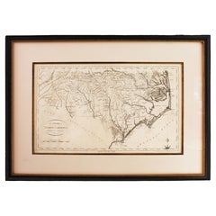
1796 Map of North Carolina by John Reid
Located in Chapel Hill, NC
1796 Map of North Carolina by John Reid. A rare & important early map of the state based on the 1795 Lewis/Carey map for his "An American Atlas". Engraved by Benjamin Tanner. Old pur...
Category
Antique Late 18th Century American Prints
Materials
Paper
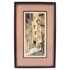
Mid-20th Century "Via degli Amieri, Firenze Antica" Print by Cioni
Located in Chapel Hill, NC
Mid-20th century "Via degli Amieri, Firenze Antica" print by Cioni. Signed in print with inscribed titles in margin. Numerous examples of his works are found in galleries & online sa...
Category
Mid-20th Century Italian Prints
Materials
Paper
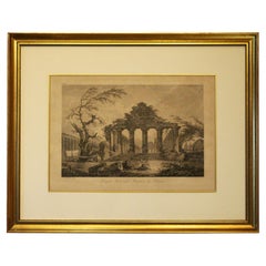
Late 18th Century French Print "Temple Herastyle Périptère de Pestum"
Located in Chapel Hill, NC
Late 18th century print "Temple Herastyle Périptère de Pestum", French. No 381, G.G., Gravé à L'eau-forte par Weisbret. Terminé par J. Miamet graveur du Roi. From "Voyage Pittoresque...
Category
Antique Late 18th Century French Neoclassical Prints
Materials
Paper
$396 Sale Price
20% Off
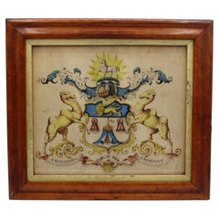
18th-19th Century Watercolor Coat of Arms of Company of Merchant Taylors
Located in Chapel Hill, NC
18th to 19th century framed watercolor Coat of Arms of the Company of Merchant Taylors of the City of York. A guild of freemen since 1273, Charles II granted them a royal charter Apr...
Category
Antique 19th Century English Baroque Paintings
Materials
Maple, Paint
$236 Sale Price
47% Off
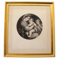
1865 German Lithograph by Eduard Mandel of Raphael
s Madonna Della Seggiola
Located in Chapel Hill, NC
1865 lithograph by Eduard Mandel of Raphael's Madonna della Seggiola. Beside the seated Madonna & Child is the young John the Baptist. Johann Au...
Category
Antique 1860s German Victorian Prints
Materials
Paper
You May Also Like
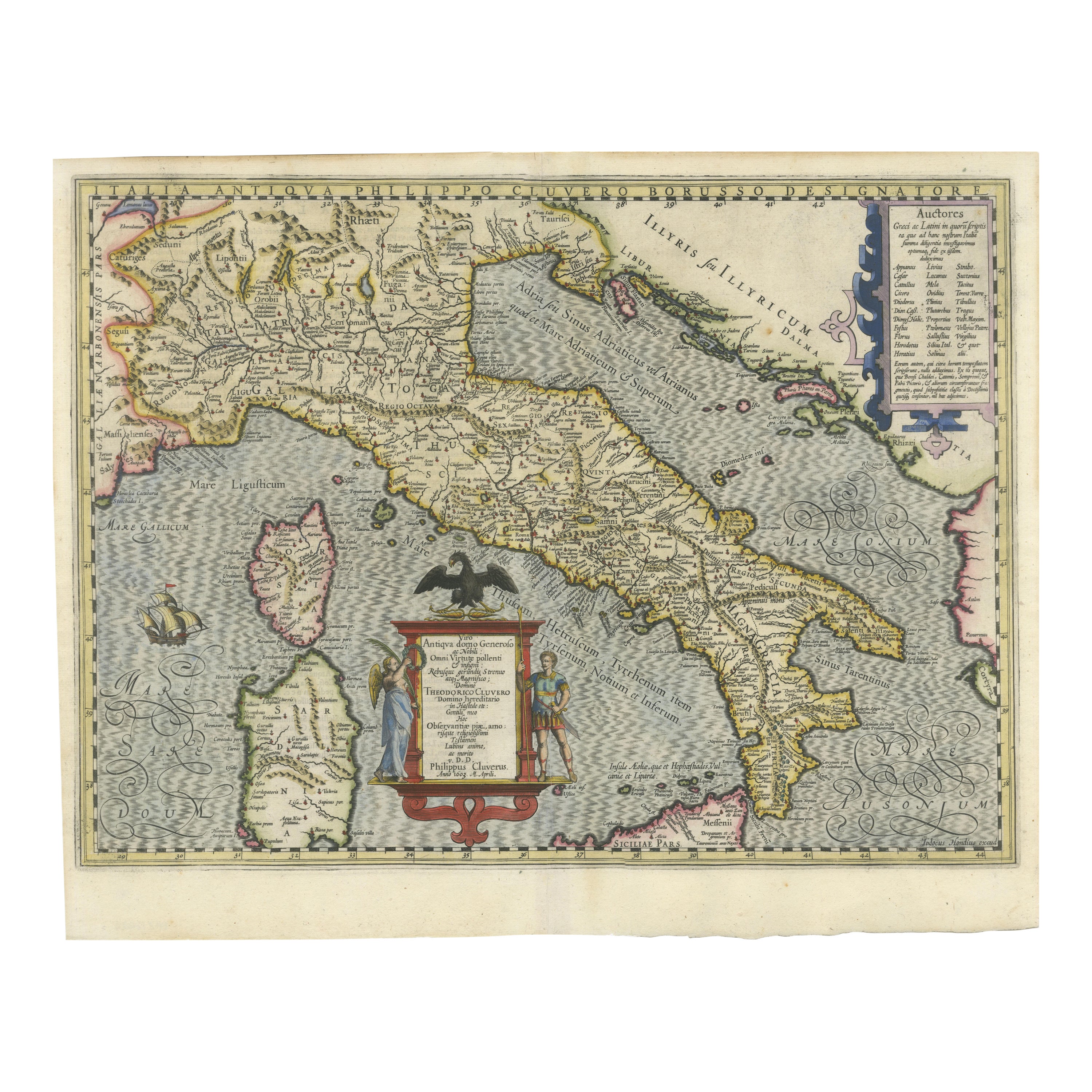
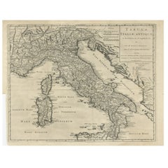
Italia Antiqua Philippo Cluvero – 1603 Hondius Map of Ancient Italy, Handcolored
Located in Langweer, NL
Italia Antiqua Philippo Cluvero – 1603 Hondius Map of Ancient Italy with Hand Color
This stunning early 17th-century map, *Italia Antiqua Philippo Cluvero Borusso Designatore*, wa...
Category
Antique Early 1600s Maps
Materials
Paper
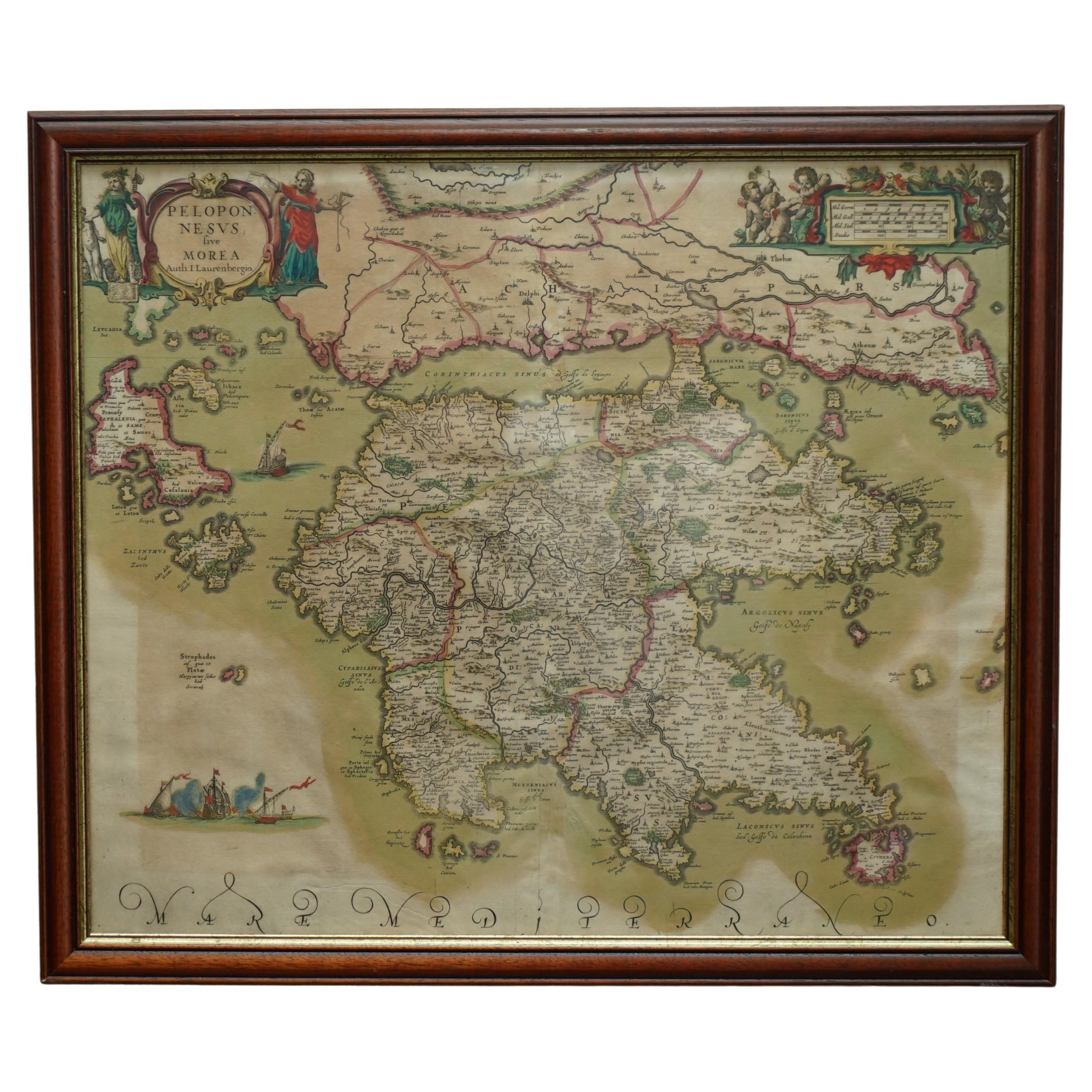
Greece 1660 Jan Jansson Watercolour Map Peloponesus Sive Morea I Laurenbergio
Located in West Sussex, Pulborough
We are delighted to offer for sale this Jan Jansson Date: 1660 (published) Amsterdam map of Greece.
This is an authentic antique map of Peloponnese or...
Category
Antique 1660s Danish Dutch Colonial Maps
Materials
Copper

Antique Map of Italy, Showing Corsica, Sardinia, Croatia, Malta and More, C.1740
Located in Langweer, NL
Antique map titled 'Nieuwe Kaart van Italie na de Nieuwste waarnemingen van de l'Isle en andere.'
Attractive detailed map showing Italy as well as Corsica, Sardinia, Minorca, Croat...
Category
Antique 18th Century Maps
Materials
Paper

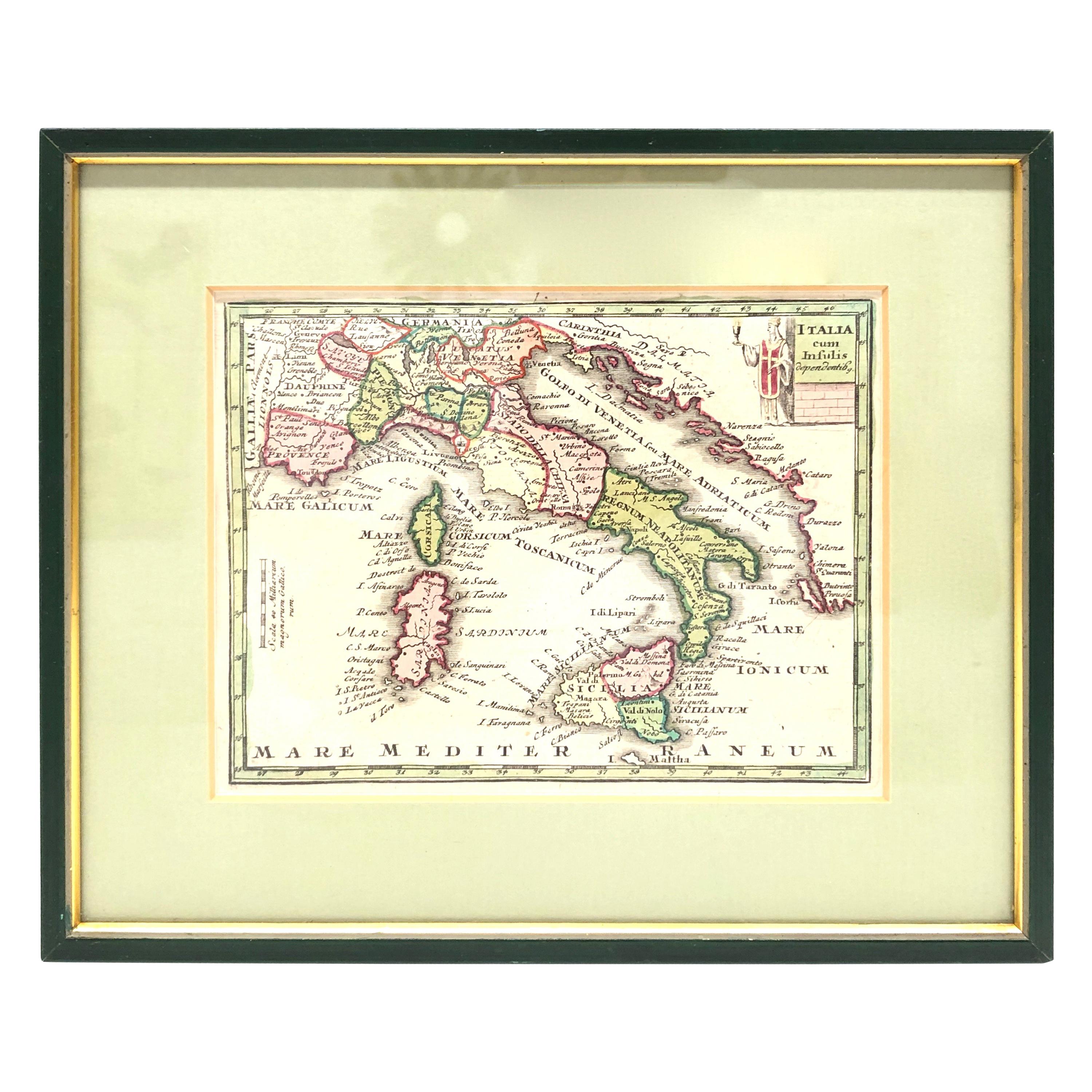
1970s Framed Antique Map of Italy 1746 Original
Located in Nuernberg, DE
An extraordinary original antique map, framed in the 1970s by Brehm Nuremberg, Germany, showing Italy. Map is dated 1746 and approx. 7 ¼" wide and 5 ¾" high in viewable size. Framed ...
Category
Vintage 1970s Decorative Art
Materials
Glass, Wood
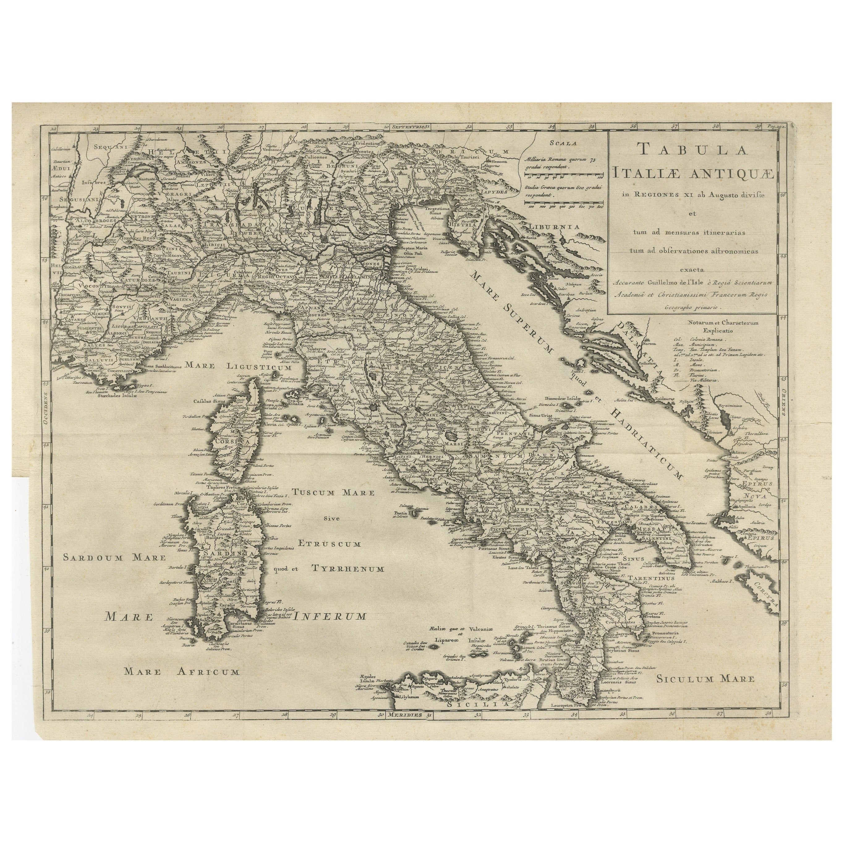
Antique Engraved Map of Italy in Roman Times, ca.1730
Located in Langweer, NL
Plain engr. map of Italy according to the division of Emperor Augustus by G. Delisle.
Title: "Tabula Italiae Antiquae In Regiones XI Ab Augusto Divisae Et Tum Ad Mensuras Itinerari...
Category
Antique 1730s Maps
Materials
Paper
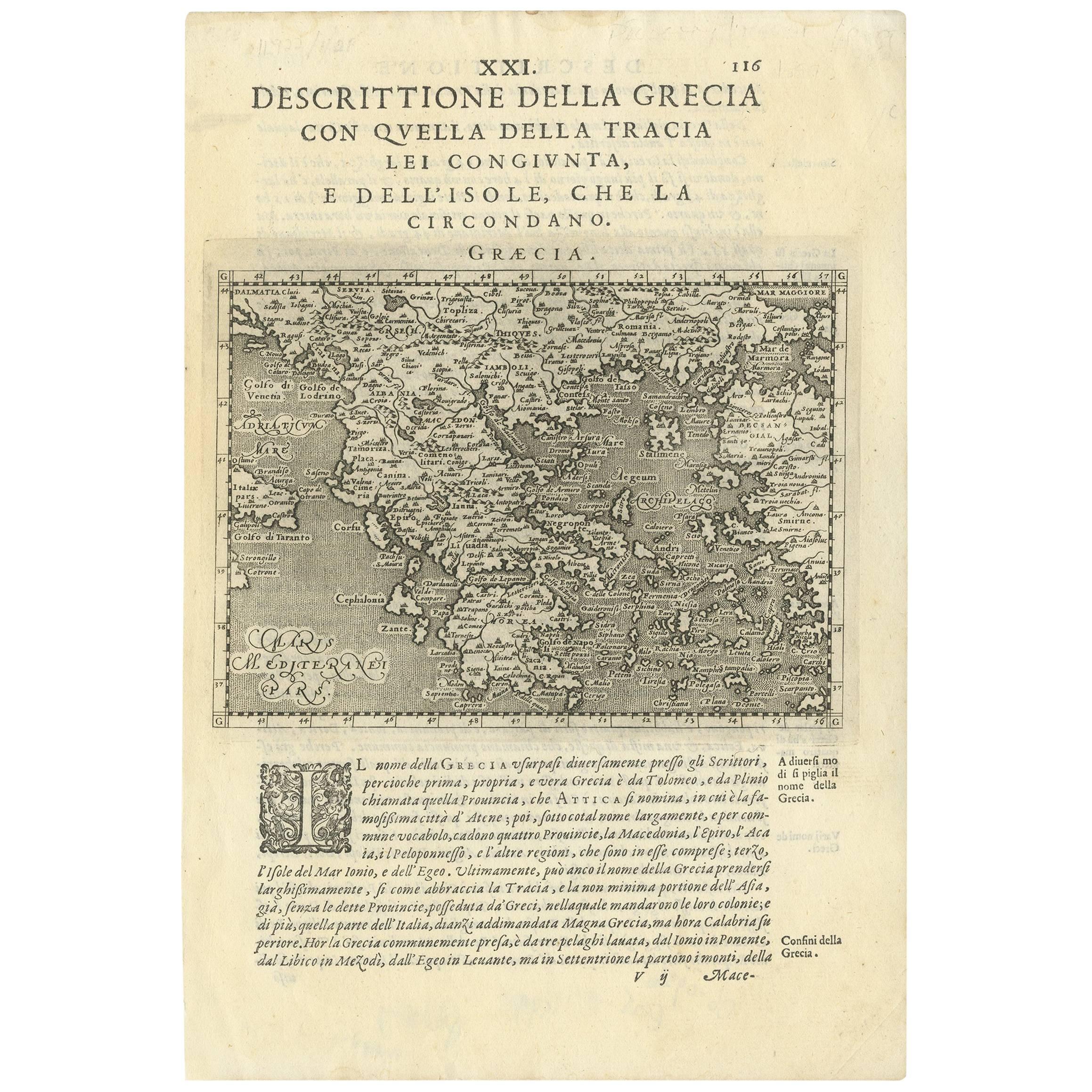
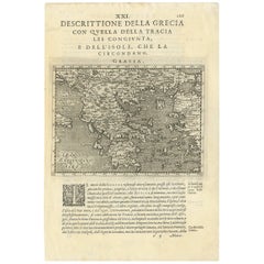
Rare Original 16th Century Antique Map of Greece, 1598
Located in Langweer, NL
Beautiful and rare antique map of Greece with Albania, Mecedonia, Romania, Dalmatia and the peninsula of Salento to the Golf of Taranto. Also clearly shown the islands of the Aegaian...
Category
Antique 16th Century Italian Maps
Materials
Paper
More Ways To Browse
Venice Table
18th Century Engravings
Antique Carved Wood Chair
Black Scandinavian Modern Dining Chairs
Dutch Mid Century Modern Table
Gold Modern Coffee Table
Iconic Modern Furniture
Midcentury Modern Gray Glass Vase
Round Glass Coffee Tables
Vintage Cave
18th Century Wood Side Tables
Antique Hand Carved Dining Room Sets
Mid Century Modern Pitcher
Vintage Italian Leather Dining Chair
Vintage Movie Posters
Blue Green Wool And Silk Rug
Brown Sheepskin Chair
Vintage Brass Bar Carts