Items Similar to 1692 Jacq. Peeters Map: East Indies, Indonesia, Japan, Philippines and Singapore


Want more images or videos?
Request additional images or videos from the seller
1 of 6
1692 Jacq. Peeters Map: East Indies, Indonesia, Japan, Philippines and Singapore
$633.58
$791.9720% Off
£469.52
£586.9020% Off
€528
€66020% Off
CA$865.91
CA$1,082.3920% Off
A$942.62
A$1,178.2720% Off
CHF 500.34
CHF 625.4320% Off
MX$11,341.74
MX$14,177.1720% Off
NOK 6,340.02
NOK 7,925.0320% Off
SEK 5,809.25
SEK 7,261.5620% Off
DKK 4,021.93
DKK 5,027.4220% Off
About the Item
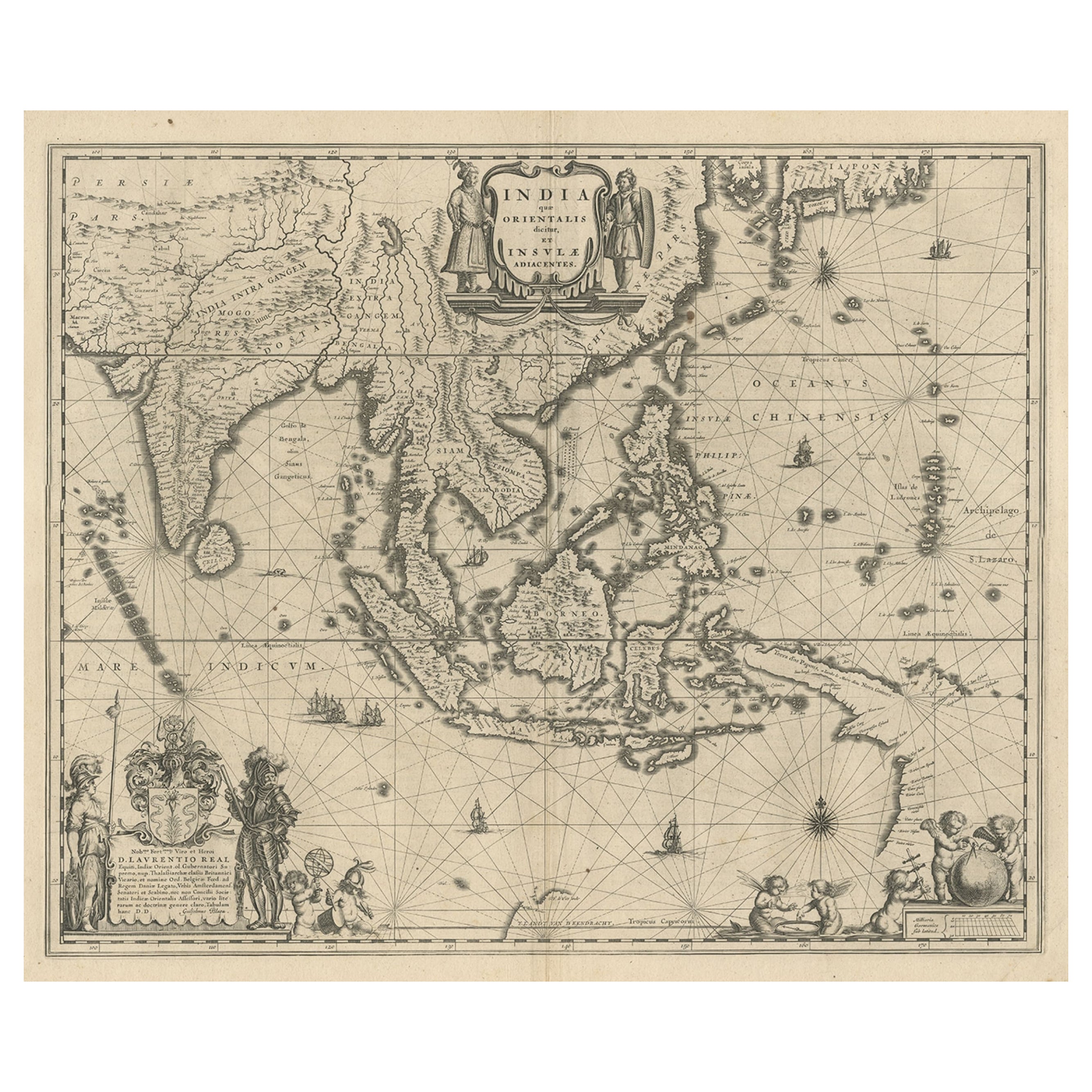
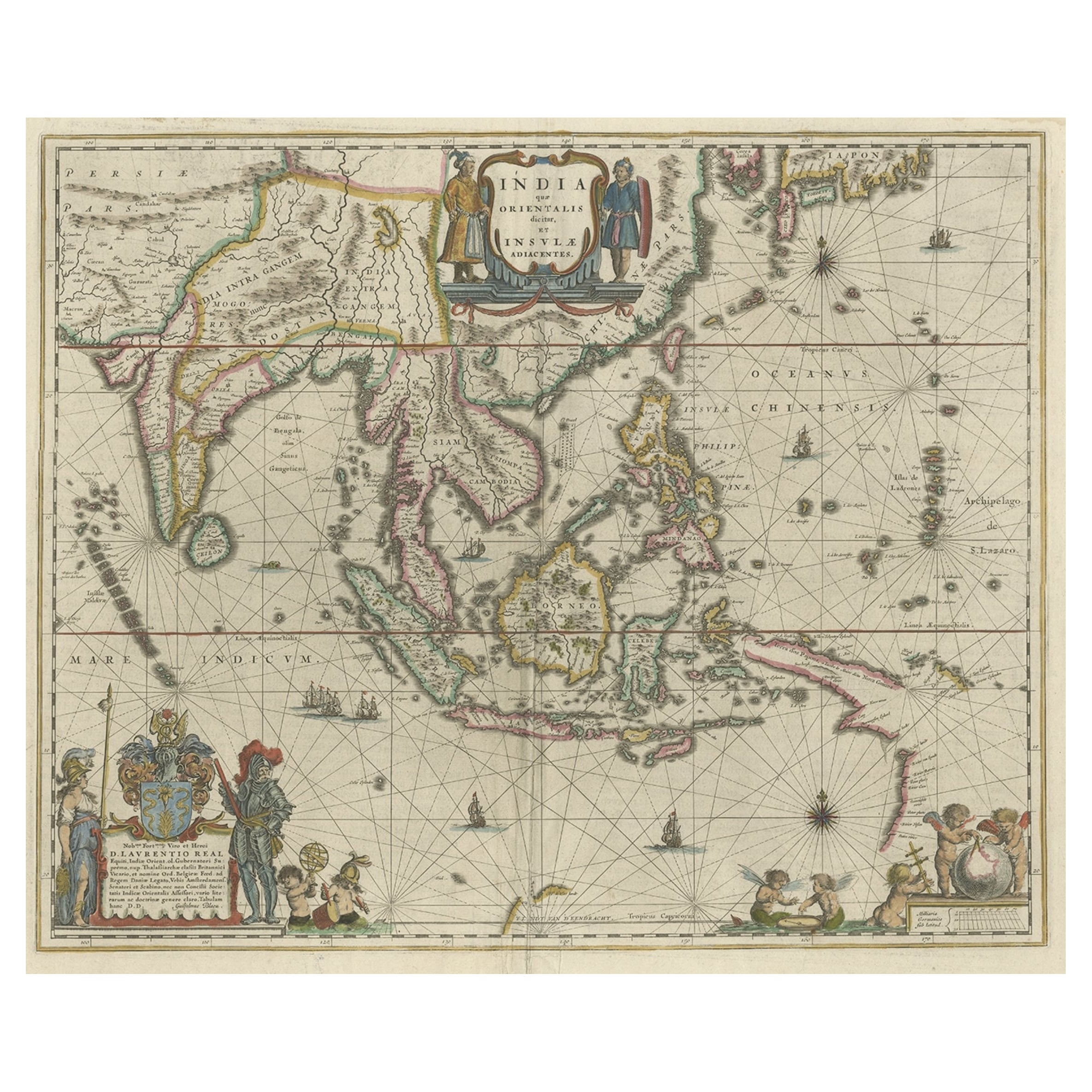
1692 Jacques Peeters Map: East Indies, Indonesia
Japan with Unique Inset
This hand-colored map from 1692, created by Jacques Peeters, captures the islands of Indonesia, the Philippines, and features a unique inset of Japan.
It closely resembles Nicolas de Fer's map and is primarily based on Sanson's influential maps. The map meticulously details cities, smaller settlements, rivers, mountain chains, and forests, offering a comprehensive view of the region's geography.
The inset map of Japan stands out due to its distinctive shape and influences, reflecting different cartographic sources. Notable features include the marked equator and detailed latitude and longitude indications on the borders.
The map measures 6.5 inches in width by 5.5 inches in height and is in excellent condition, with a dark impression, slight toning, and a minor centerfold crease.
Keywords:
- East Indies map
- Indonesia historical map
- Philippines map 17th century
- Japan inset map
- Jacques Peeters
- Nicolas de Fer
- Sanson maps
- 1692 antique map
- Spice Islands
- Sumatra, Borneo, Celebes
- Historical cartography
These keywords will help attract collectors and enthusiasts interested in early maps of Southeast Asia, including the Spice Islands, Japan, and surrounding regions.
- Dimensions:Height: 5.5 in (13.97 cm)Width: 6.5 in (16.51 cm)Depth: 0.02 in (0.51 mm)
- Materials and Techniques:Paper,Engraved
- Period:1690-1699
- Date of Manufacture:1692
- Condition:The map is in excellent condition, with a dark impression, slight toning, and a minor centerfold crease.
- Seller Location:Langweer, NL
- Reference Number:Seller: BG-138561stDibs: LU3054341277002
About the Seller
5.0
Recognized Seller
These prestigious sellers are industry leaders and represent the highest echelon for item quality and design.
Platinum Seller
Premium sellers with a 4.7+ rating and 24-hour response times
Established in 2009
1stDibs seller since 2017
2,819 sales on 1stDibs
Typical response time: 1 hour
- ShippingRetrieving quote...Shipping from: Langweer, Netherlands
- Return Policy
More From This Seller
View AllMap of Southeast Asia, Extending from India to Tibet
Japan to New Guinea, 1640
Located in Langweer, NL
Antique map titled 'India quae Orientalis dicitur et Insulae adiacentes'.
Map of Southeast Asia, extending from India to Tibet to Japan to New Guinea. This map is one of the firs...
Category
Antique 1640s Maps
Materials
Paper
$2,543 Sale Price
20% Off
Original Antique Map of the Philippines, Malaysia, Indonesia, Singapore, c.1690
Located in Langweer, NL
Antique map titled 'Isole dell' Indie, diuise in Filippine, Molucche e della Sonda'.
Old map of the Philippines, Malaysia, Indonesia, Singapore, Northern Australia and contiguous i...
Category
Antique 1690s Italian Maps
Materials
Paper

$2,159 Sale Price
20% Off
Free Shipping
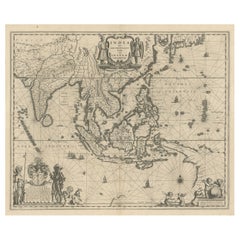
Old Antique Map of the East Indies and Southeast Asia, ca.1644
Located in Langweer, NL
Antique map titled 'India quae Orientalis dicitur, et Insulae adiacentes'.
Old map of the East Indies and Southeast Asia showing the area between India in the West and parts of Japan, the Marianas and New Guinea/Australia in the East. This map is dedicated to D. Christophorus Thisius by Henricus...
Category
Antique 1640s Dutch Maps
Materials
Paper

$2,384 Sale Price
25% Off
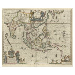
Original Antique Map of the East Indies (Indonesia) by Janssonius, c.1644
By Johannes Janssonius
Located in Langweer, NL
Antique map titled 'India quae Orientalis dicitur, et Insulae adiacentes'. Old map of the East Indies and Southeast Asia showing the area between India in the West and parts of Japan...
Category
Antique 17th Century Maps
Materials
Paper

$2,399 Sale Price
20% Off
Original Blaeu Map of Southeast Asia from India to Tibet and Japan to New Guinea
Located in Langweer, NL
Antique map titled 'India quae Orientalis dicitur et Insulae Adiacentes'.
Beautiful map of Southeast Asia, extending from India to Tibet to Japan to New Guinea. It was the first po...
Category
Antique 1640s Maps
Materials
Paper
$3,359 Sale Price
20% Off
Antique Map of Southeast Asia from Persia to the Timor Island, 1712
Located in Langweer, NL
Antique map titled 'A New Map of the East Indies'.
Old map covering all of Southeast Asia from Persia to the Timor Island, inclusive of the modern day nations of India, Ceylon, T...
Category
Antique 1710s Maps
Materials
Paper

$758 Sale Price
20% Off
You May Also Like
Antique French Map of Asia Including China Indoneseia India, 1783
Located in Amsterdam, Noord Holland
Very nice map of Asia. 1783 Dedie au Roy.
Additional information:
Country of Manufacturing: Europe
Period: 18th century Qing (1661 - 1912)
Condition: Overall Condition B (Good Used)...
Category
Antique 18th Century European Maps
Materials
Paper

$486 Sale Price
40% Off
Antique 1803 Italian Map of Asia Including China Indoneseia India
Located in Amsterdam, Noord Holland
Antique 1803 Italian Map of Asia Including China Indoneseia India
Very nice map of Asia. 1803.
Additional information:
Type: Map
Country of Manufacturing: Europe
Period: 19th centu...
Category
Antique 19th Century European Maps
Materials
Paper

$438 Sale Price
39% Off
1627 Hendrik Hondius Map Entitled "Vltoniae Orientalis Pars, " Ric.a009
Located in Norton, MA
1627 Hendrik Hondius map entitled
"Vltoniae orientalis pars,"
Ric.a009
Title:
Vltoniae orientalis : pars
Title (alt.) :
Ultoniae orientalis pars
Creator:
Mercator, Gerh...
Category
Antique 17th Century Dutch Maps
Materials
Paper

1633 Map "La Souverainete De Sedan Et De Raucourt, Et La Prevoste Ric0011
Located in Norton, MA
1653 map entitled
"La Souverainete de Sedan et de Raucourt, et la Prevoste de Doncheri,"
Ric0011
Description:
Lovely map centered on Sedan and Doncheri and the Meuze River fr...
Category
Antique 17th Century Dutch Maps
Materials
Paper

Map of the East Indies: An Original 18th Century Hand-colored Map by E. Bowen
Located in Alamo, CA
This is an original 18th century hand-colored map entitled "An Accurate Map of the East Indies Exhibiting the Course of the European Trade both on the Continent and Islands" by Emanu...
Category
Mid-18th Century Old Masters Landscape Prints
Materials
Engraving

$1,020 Sale Price
20% Off
Africa: A Large 17th Century Hand-Colored Map by Sanson and Jaillot
By Nicolas Sanson
Located in Alamo, CA
This large original hand-colored copperplate engraved map of Africa entitled "L'Afrique divisee suivant l'estendue de ses principales parties ou sont distingues les uns des autres, L...
Category
Antique 1690s French Maps
Materials
Paper

$1,740 Sale Price
20% Off
More Ways To Browse
Philippines Antique
Singapore Furniture
Singapore Antique
Goblets
Mid Century Modern Yellow Chair
Paulin Pierre
Used Pianos Pianos
18th Century Engravings
Antique Carved Wood Chair
Black Scandinavian Modern Dining Chairs
Dutch Mid Century Modern Table
Gold Modern Coffee Table
Iconic Modern Furniture
Japanese Metal
Midcentury Modern Gray Glass Vase
Round Glass Coffee Tables
Vintage Cave
18th Century Wood Side Tables