Items Similar to 1806 John Cary Map of Hindoostan – Detailed British Cartography of India
Want more images or videos?
Request additional images or videos from the seller
1 of 7
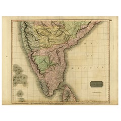
1806 John Cary Map of Hindoostan – Detailed British Cartography of India
$518.83
$648.5420% Off
£384.32
£480.4020% Off
€432
€54020% Off
CA$709.89
CA$887.3620% Off
A$772.42
A$965.5220% Off
CHF 408.98
CHF 511.2320% Off
MX$9,292.69
MX$11,615.8620% Off
NOK 5,193.19
NOK 6,491.4920% Off
SEK 4,751.41
SEK 5,939.2620% Off
DKK 3,292.19
DKK 4,115.2420% Off
About the Item
Title: 1806 John Cary Map of Hindoostan – Detailed British Cartography of India
This highly detailed map, titled "A New Map of Hindoostan from the Latest Authorities," was engraved and sold by renowned London cartographer John Cary. Published on December 1, 1806, this map reflects Cary's reputation for accuracy and attention to detail during a time when British interest in the Indian subcontinent was paramount.
The map covers the Indian subcontinent, which includes present-day India, Pakistan, Bangladesh, Nepal, Bhutan, and Sri Lanka. Key geographical features such as the Himalayan range, the extensive river systems of the Ganges and Indus, and coastal boundaries along the Arabian Sea and Bay of Bengal are clearly marked. The map also includes an inset of the Isle of Ceylon (modern-day Sri Lanka), reflecting the colonial territories under British influence at the time.
Significant cities such as Calcutta (Kolkata), Madras (Chennai), Bombay (Mumbai), and Delhi are prominently featured. Historical provinces and regions like Bengal, Punjab, Deccan, and Malabar are distinguished with finely colored borders, showcasing the political divisions of the time.
Collectors of antique maps will find this work highly valuable due to Cary's precision and its historical significance in reflecting early 19th-century British knowledge of the region. This map represents a time when cartographic efforts were crucial for navigation, trade, and governance in the expanding British Empire.
If you're looking for an authentic, detailed historical representation of British India from a master cartographer like John Cary, this 1806 map is an excellent acquisition for any collection.
The condition of this map is well-preserved for its age, especially considering it was published in 1806. The paper is strong and seems to show minimal toning, a common occurrence with antique maps due to aging and exposure to elements. There is some light foxing or spotting, which is typical for maps of this period. The engraving lines remain sharp and clear, with the hand-colored boundaries still visible, though they might have slightly faded over time.
The margins are intact, with no significant tears or repairs, although there is some very light creasing, particularly along fold line (as Issued) and borders. If there are any imperfections, they do not detract from the overall visual appeal or legibility of the map.
Overall, this map seems to be in good collectible condition, suitable for display or as part of a serious collection of historical cartography.
- Dimensions:Height: 21.26 in (54 cm)Width: 24.41 in (62 cm)Depth: 0 in (0.02 mm)
- Materials and Techniques:Paper,Engraved
- Period:
- Date of Manufacture:1806
- Condition:Condition: good, given age. General age-related (light brownish) toning and/or occasional minor defects from handling. Please study scan carefully.
- Seller Location:Langweer, NL
- Reference Number:Seller: BG-13777-31stDibs: LU3054341784962
About the Seller
5.0
Recognized Seller
These prestigious sellers are industry leaders and represent the highest echelon for item quality and design.
Platinum Seller
Premium sellers with a 4.7+ rating and 24-hour response times
Established in 2009
1stDibs seller since 2017
2,816 sales on 1stDibs
Typical response time: 1 hour
- ShippingRetrieving quote...Shipping from: Langweer, Netherlands
- Return Policy
More From This Seller
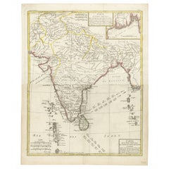
View All1808 C. Smith Map of Hindoostan – British India with Intricate Details
Located in Langweer, NL
Title: 1808 C. Smith Map of Hindoostan – British India with Intricate Details
This map, titled "Hindoostan," was published by C. Smith, a prominent London map seller, on January 6, ...
Category
Antique Early 1800s Maps
Materials
Paper
$374 Sale Price
20% Off
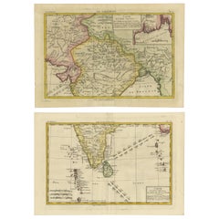
1816 Large Southern Hindostan Map by J. Thomson – New General Atlas
Located in Langweer, NL
Title: 1816 Southern Hindostan Map by J. Thomson – New General Atlas
This map, titled "Southern Hindostan," was published in 1816 as part of J. Thomson’s *New General Atlas*. The ma...
Category
Antique 1810s Maps
Materials
Paper
$509 Sale Price
20% Off
Antique Map of Southern India and Ceylon by Thomson, 1816
Located in Langweer, NL
"Antique map titled 'Southern Hindostan'. A map of Southern India and the North of Ceylon. From Thomson's 'New General Atlas', 1816. Artists and Engravers: Engraved by Neele.
Arti...
Category
Antique 19th Century Maps
Materials
Paper
$168 Sale Price
20% Off
Antique Map of Hindustan, or India
Located in Langweer, NL
Antique map titled 'Hindoostan, or India'. Original antique map of India (Hindustan) and Sri Lanka (Ceylon). Engraved by Russell. Published by Nuttall, Fisher & Co, 1814.
Category
Antique Early 19th Century Maps
Materials
Paper

$278 Sale Price
20% Off
18th Century Cartographic Depiction of Upper India and Ceylon, 1835
Located in Langweer, NL
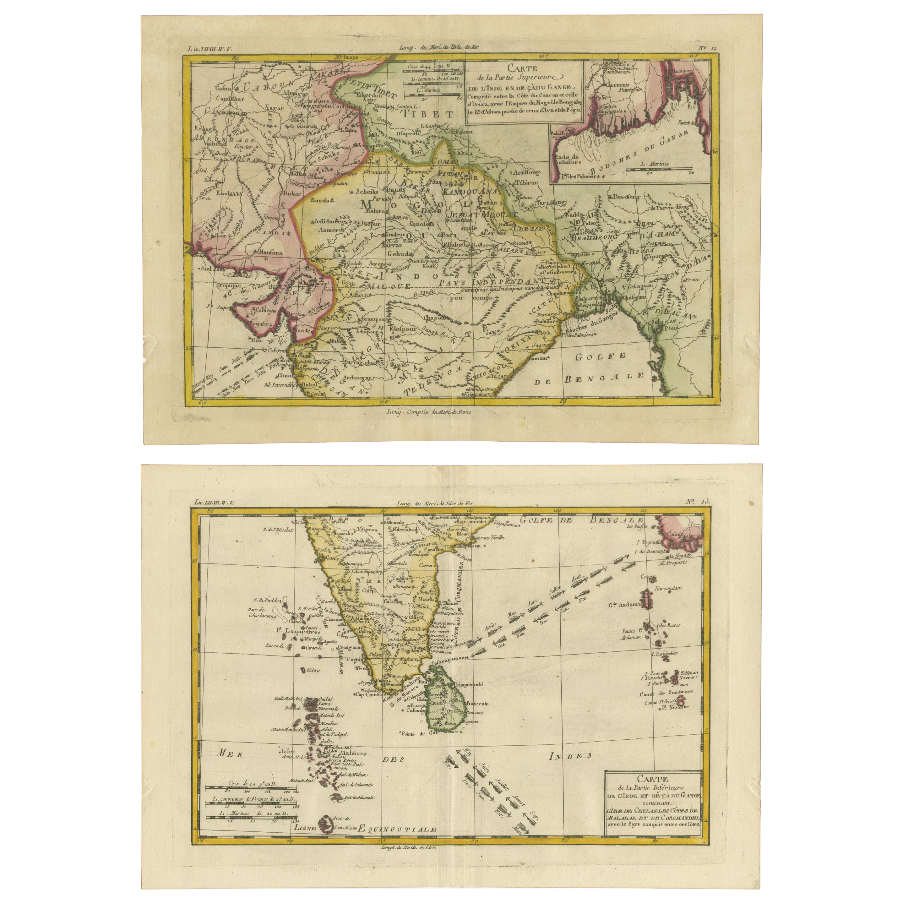
An exquisite set of two maps, 'Carte de la Partie Superieure De L'Inde en de Cadu Gange,' masterfully crafted by the renowned 18th-century French cartographer, Charles Marie Rigobert...
Category
Antique 1830s French Maps
Materials
Paper
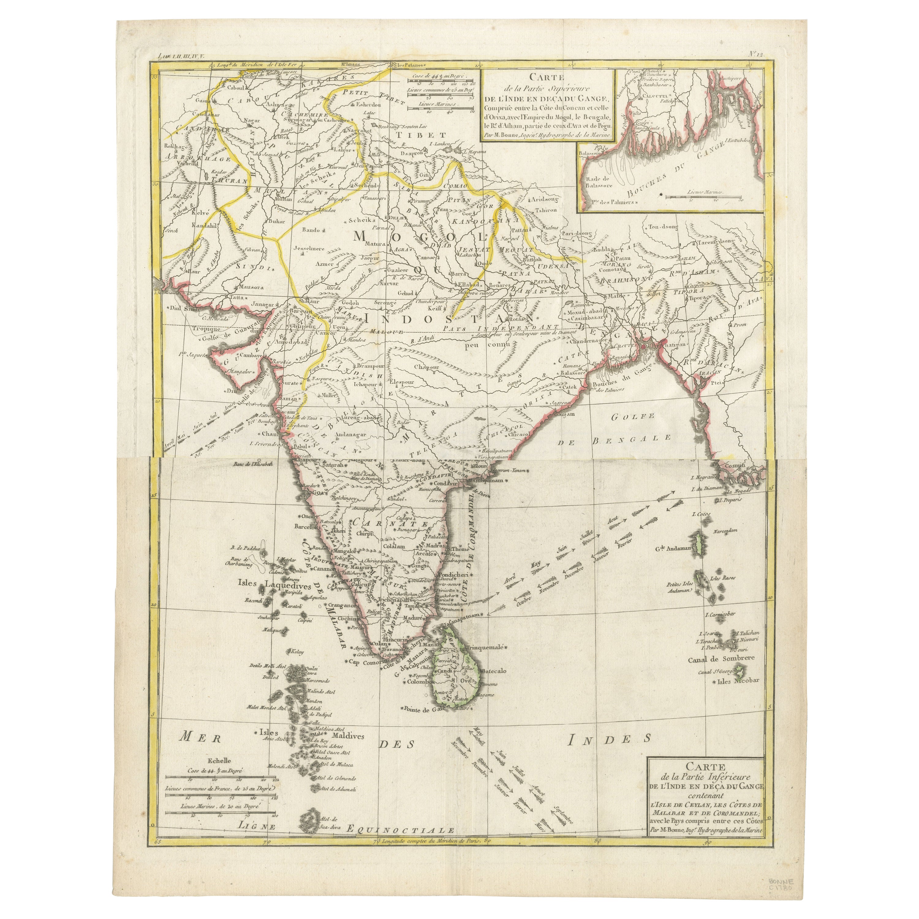
Map of India and Ceylon with Inset of Calcutta and the Ganges, by Bonne, 1780
Located in Langweer, NL
The map on offer is an antique copperplate engraving of India and Ceylon (Sri Lanka), created by Rigobert Bonne (1727-1794), a prominent French cartographer. Here is a breakdown of t...
Category
Antique 1780s French Maps
Materials
Paper
You May Also Like
Original Antique Map of India by Dower, circa 1835
Located in St Annes, Lancashire
Nice map of India
Drawn and engraved by J.Dower
Published by Orr & Smith. C.1835
Unframed.
Free shipping
Category
Antique 1830s English Maps
Materials
Paper

Antique 1803 Italian Map of Asia Including China Indoneseia India
Located in Amsterdam, Noord Holland
Antique 1803 Italian Map of Asia Including China Indoneseia India
Very nice map of Asia. 1803.
Additional information:
Type: Map
Country of Manufacturing: Europe
Period: 19th centu...
Category
Antique 19th Century European Maps
Materials
Paper

$438 Sale Price
39% Off
Antique French Map of Asia Including China Indoneseia India, 1783
Located in Amsterdam, Noord Holland
Very nice map of Asia. 1783 Dedie au Roy.
Additional information:
Country of Manufacturing: Europe
Period: 18th century Qing (1661 - 1912)
Condition: Overall Condition B (Good Used)...
Category
Antique 18th Century European Maps
Materials
Paper

$486 Sale Price
40% Off
Map Of India - Original Lithograph - 19th Century
Located in Roma, IT
Map of India is an original lithograph artwork realized by an Anonymous engraver of the 19th Century.
Printed in the series of "France Pittoresque".
Titled "France Pittoresque".
...
Category
19th Century Modern Figurative Prints
Materials
Lithograph

India (Southern Sheet), English antique map by Alexander Keith Johnston, 1901
Located in Melbourne, Victoria
'India (Southern Sheet)', antique lithographic map by Keith Johnston.
Inset maps of 'Bombay Island & Town', 'Madras & Environs', and 'South-Eastern Provinces of India'.
Central vertical fold as issued.
495mm by 625mm (sheet)
Alexander Keith...
Category
Early 20th Century Victorian More Prints
Materials
Lithograph

Large Original Vintage Map of India, circa 1920
Located in St Annes, Lancashire
Great map of India
Original color.
Good condition / repair to some minor damage just above Sri Lanka. Shown in the last image.
Published by Alexander Gross
Unframed.
Category
Vintage 1920s English Maps
Materials
Paper

More Ways To Browse
British Empire
British India
Antique Punjab
Black Scandinavian Modern Dining Chairs
Gold Modern Coffee Table
Round Glass Coffee Tables
18th Century Wood Side Tables
Antique Hand Carved Dining Room Sets
Mid Century Modern Pitcher
Vintage Italian Leather Dining Chair
Vintage Movie Posters
Blue Green Wool And Silk Rug
Brown Sheepskin Chair
Vintage Brass Bar Carts
Antique Botanical Prints
Green Persian Rug
17th Century Blue And White
50 X 50 Coffee Table