Items Similar to 1830 DATED EXTRA LARGE 194CM X 159CM INLAND NAViGATION MAP CANALS AND RAILROADS

Want more images or videos?
Request additional images or videos from the seller
1 of 21
1830 DATED EXTRA LARGE 194CM X 159CM INLAND NAViGATION MAP CANALS AND RAILROADS
$5,364.31
£3,850
€4,523.37
CA$7,338.88
A$7,759.09
CHF 4,169.52
MX$93,187.85
NOK 52,209.80
SEK 47,775.82
DKK 33,779.62
About the Item
Royal House Antiques
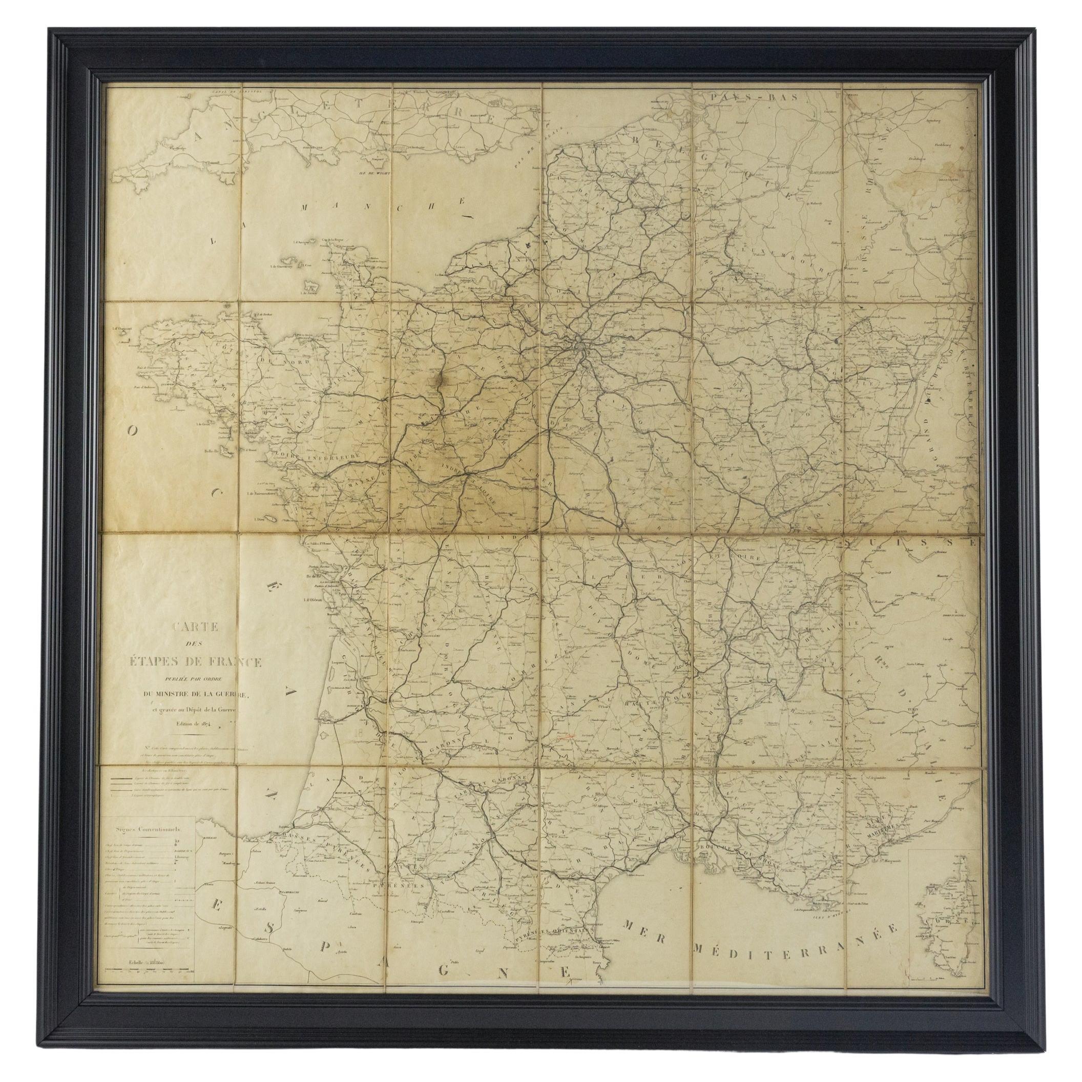
Royal House Antiques is delighted to offer for sale this Stunning Inland Navigation map of Railroads and Canals by Nichols, Priestley
Walker dated January 1st 1830
This piece comes with some documentation outlining exactly what it is, my plan was to have it framed but I haven't got round to it, it comes in six easy to manage sections
Dimensions top to bottom
Height:- 194cm
Width:- 159cm
Depth:- 2cm
Please note all measurements are taken at the widest point, if you would like any additional or specific measurements please ask
Any questions please feel free to ask before you bid
Condition
Please view the very detailed pictures as they form part of the description around condition
Please note vintage period and original items such as leather seating will always have natural patina in the form of cracking creasing and wear, we recommend regular waxing to ensure no moisture is lost, also hand dyed leather is not recommended to sit in direct sunlight for prolonged periods of time as it will dry out and fade.
- Dimensions:Height: 76.38 in (194 cm)Width: 62.6 in (159 cm)Depth: 0.79 in (2 cm)
- Style:Early Victorian (Of the Period)
- Materials and Techniques:Maple,Hand-Crafted
- Place of Origin:
- Period:
- Date of Manufacture:1830
- Condition:Wear consistent with age and use. Minor fading.
- Seller Location:West Sussex, GB
- Reference Number:1stDibs: LU2823348427012
About the Seller
4.7
Platinum Seller
Premium sellers with a 4.7+ rating and 24-hour response times
Established in 2012
1stDibs seller since 2017
2,115 sales on 1stDibs
Typical response time: 1 hour
- ShippingRetrieving quote...Shipping from: West Sussex, United Kingdom
- Return Policy
More From This Seller
View AllGold Leaf Foil Pictorial Plan Map of the West Country of England Antique Style
Located in West Sussex, Pulborough
We are delighted to offer for sale this lovely Antique style pictorial plan map of the West Country of England etched in gold leaf foil
This is a very interesting and decorative p...
Category
20th Century English Adam Style Maps
Materials
Gold Leaf

Fine Antique 1856 Hand Watercolour Map of Dept Des Hautes Alpes by Levasseur
s
Located in West Sussex, Pulborough
We are delighted to offer for sale this stunning 1856 hand watercolour map of the Austrian Alps titled Dept Des Hautes Alpes taken from the Atlas National...
Category
Antique 1850s French Early Victorian Maps
Materials
Paper

Fine French Antique 1856 Hand Watercolour Map of Dept Des Hautes Pyrenees
Located in West Sussex, Pulborough
We are delighted to offer for sale this stunning 1856 hand watercolour map of the Austrian Alps titled Dept Des Hautes Pyrenees taken from the Atlas Nat...
Category
Antique 1850s French Early Victorian Maps
Materials
Paper

London 1744 Published Watercolour Antique Map of East Africa by Eman Bowen
Located in West Sussex, Pulborough
We are delighted to offer for sale this New and Accurate Map of Nubia & Abissinia, together with all the Kingdoms Tributary Thereto, and bordering upon them published in 1744 by Emanuel Bowen
This is a decorative antique engraved map of East Africa...
Category
Antique 1740s English George III Maps
Materials
Paper

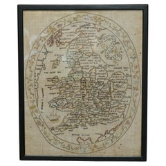
Antique Elizabeth Mason Signed 1789 George II Needlework Sampler Map of England
Located in West Sussex, Pulborough
We are delighted to offer for sale this rather stunning, 1789 dated needlework sampler signed by Elizabeth Mason and dated 1789
I have three other versions of these samplers for ...
Category
Antique 1780s English George II Tapestries
Materials
Cotton
Vintage World Map Mirror Based on the Original by Johnson 1882 Military Campaign
Located in West Sussex, Pulborough
We are delighted to offer for sale this lovely Antique style pictorial plan map of the globe based on the original by Johnson in 1882
This is a very interesting and decorative pie...
Category
20th Century English Campaign Maps
Materials
Mirror

You May Also Like
Large 19th Century Map of France
Located in Pease pottage, West Sussex
Large 19th Century Map of France.
Remarkable condition, with a pleasing age worn patina.
Recently framed.
France Circa 1874.
Category
Antique Late 19th Century French Maps
Materials
Linen, Paper

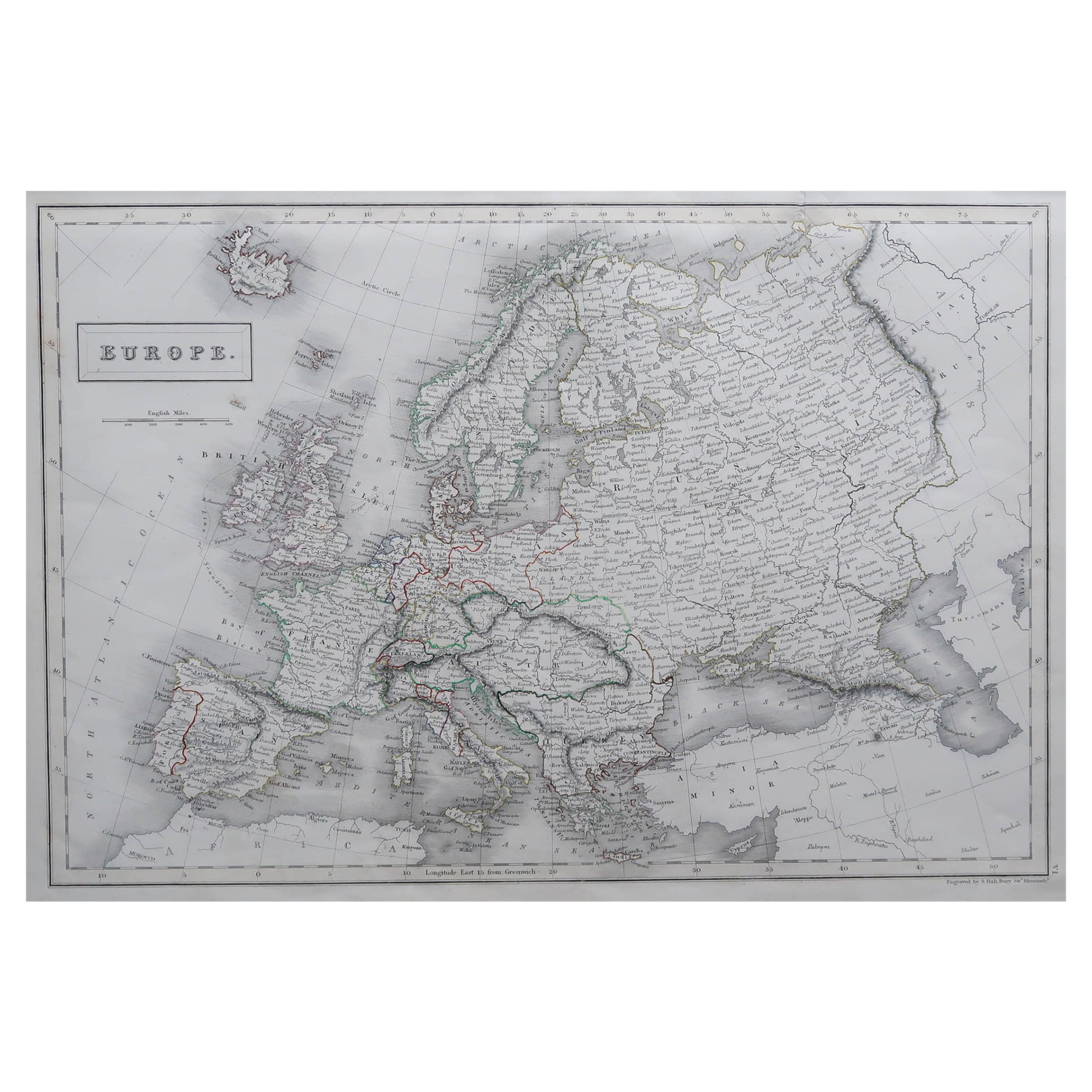
Large Original Antique Map of Europe by Sidney Hall, 1847
Located in St Annes, Lancashire
Great map of Europe
Drawn and engraved by Sidney Hall
Steel engraving
Original colour outline
Published by A & C Black. 1847
Unframed
Free shipping.
Category
Antique 1840s Scottish Maps
Materials
Paper

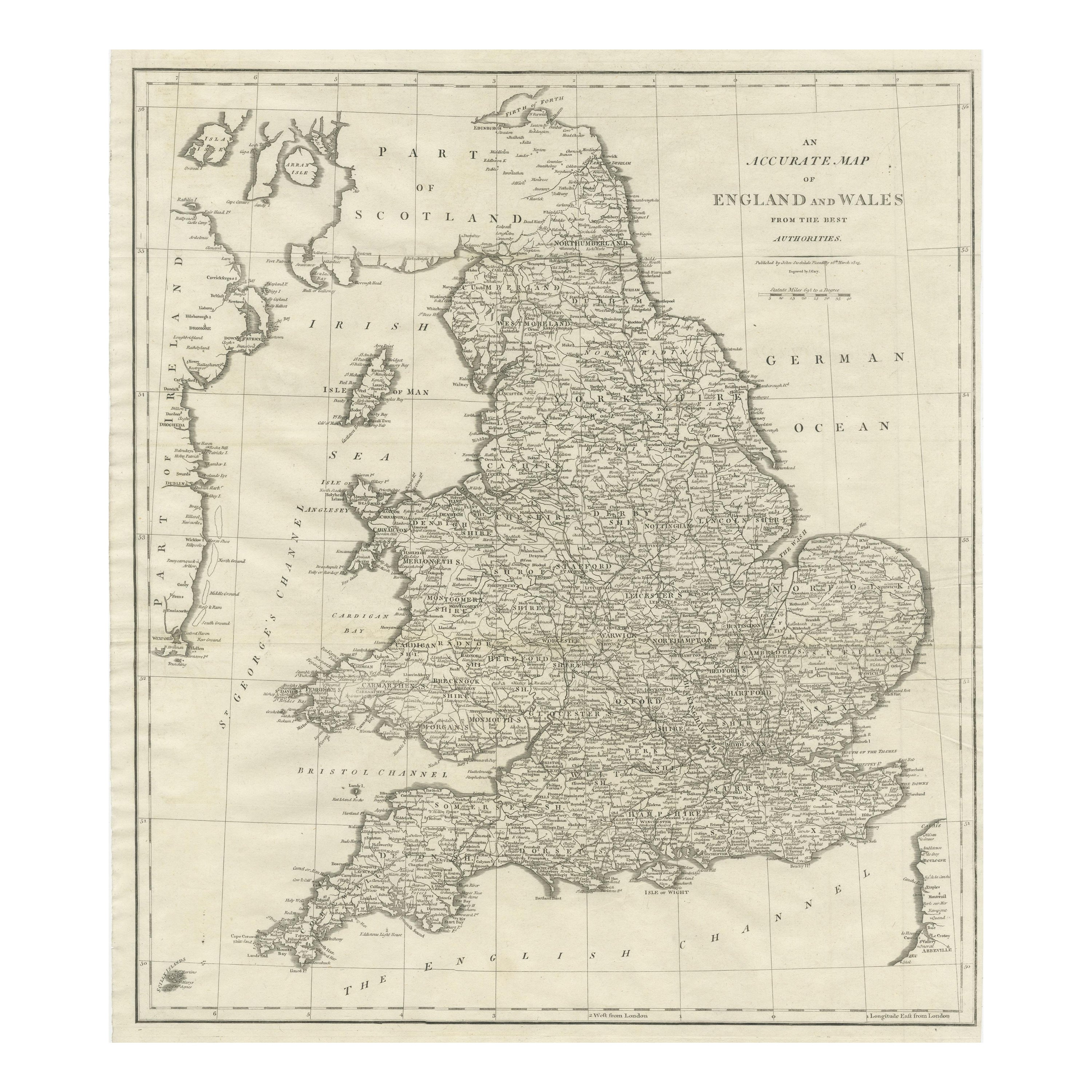
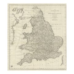
Large Antique Map of England and Wales
Located in Langweer, NL
Antique map titled 'An Accurate Map of England and Wales'. Original old map of England and Wales. Engraved by John Cary. Originates from 'New British Atlas' by John Stockdale, publis...
Category
Antique Early 19th Century Maps
Materials
Paper
$319 Sale Price
20% Off
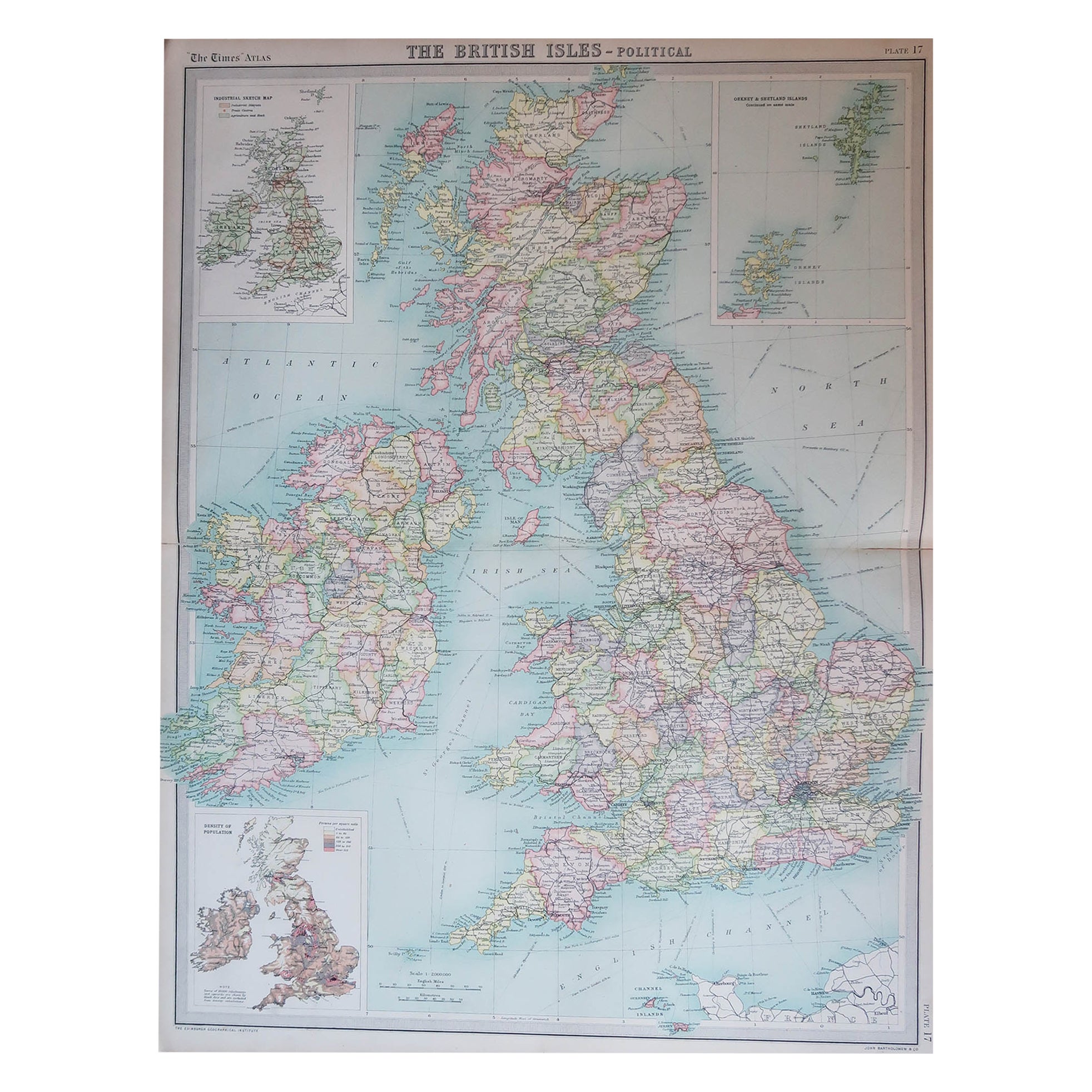
Large Original Vintage Map of the United Kingdom, circa 1920
Located in St Annes, Lancashire
Great map of The United Kingdom
Unframed
Original color
By John Bartholomew and Co. Edinburgh Geographical Institute
Published, circa 1920
Free shipping.
Category
Vintage 1920s British Maps
Materials
Paper

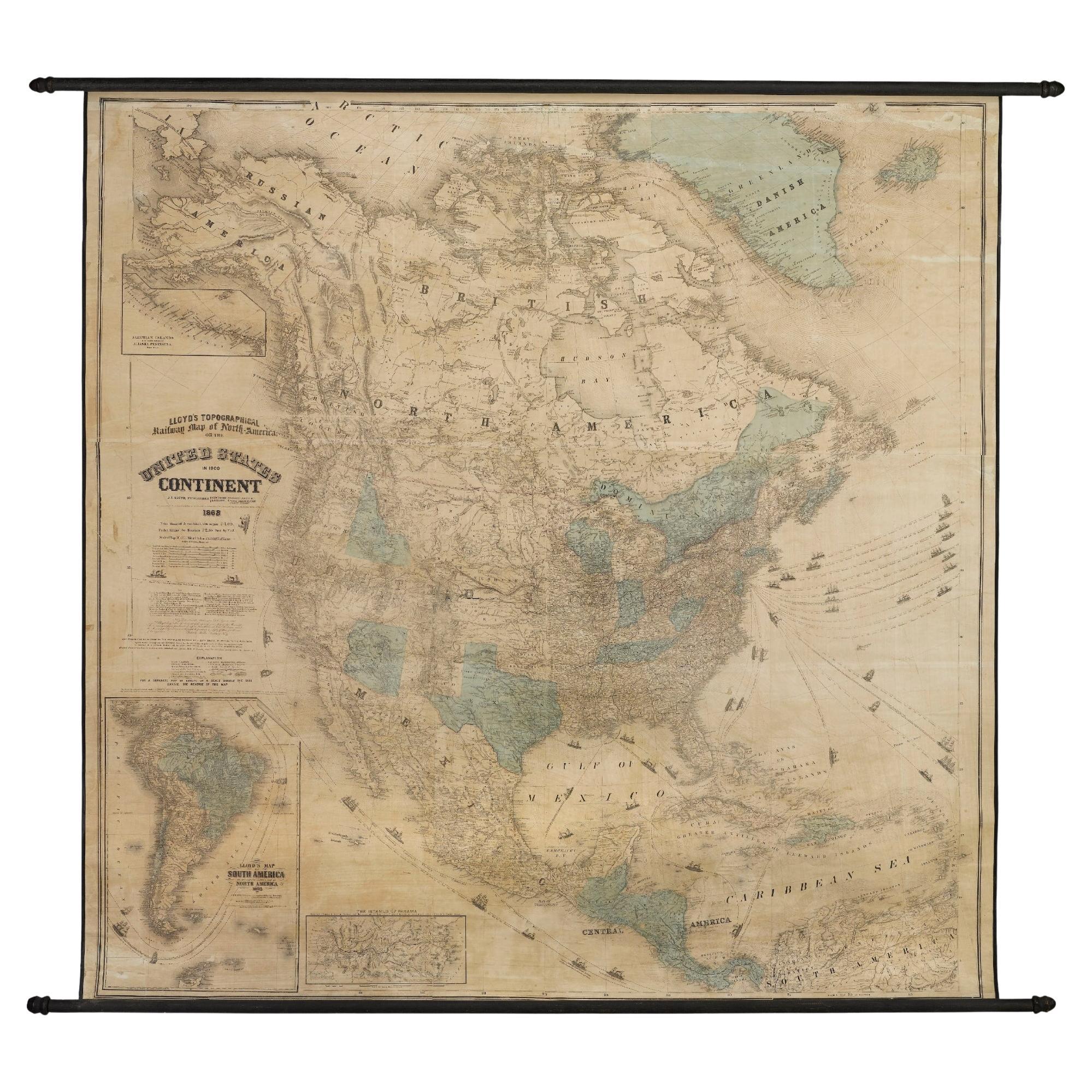
1868 "Lloyd
s Topographical Railway Map of North America..." Hanging Wall Map
Located in Colorado Springs, CO
Presented is “Lloyd's Topographical Railway Map of North-America, or the United States Continent in 1900.” This map was published by J. T. Lloyd, in New York, in 1868. A large, hangi...
Category
Antique 1860s American Late Victorian Maps
Materials
Linen, Paper

Antique Map of England
Wales by Wyld
1845
Located in Langweer, NL
Antique map titled 'England & Wales'. Original antique map of England & Wales. This map originates from 'An Atlas of the World, Comprehending Se...
Category
Antique Mid-19th Century Maps
Materials
Paper

$136 Sale Price
24% Off