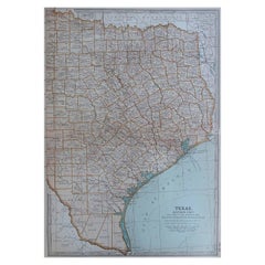
Items Similar to 1850-1960 Cram
s Superior Latest Federal Census Texas Map
Want more images or videos?
Request additional images or videos from the seller
1 of 10
1850-1960 Cram
s Superior Latest Federal Census Texas Map
$1,400
£1,057.78
€1,212.79
CA$1,953.86
A$2,125.95
CHF 1,125.66
MX$25,576.62
NOK 14,293.42
SEK 13,077.48
DKK 9,061.23
About the Item
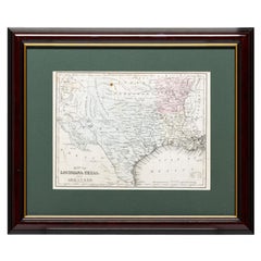
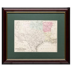
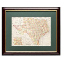
The 1850-1960 Cram's Superior Latest Federal Census Texas Map, crafted from pine wood, steel, and canvas, is a valuable historical cartographic piece. Published by The George F. Cram Company, Inc. with the map number CST-40 and marked with Edition No. 1512, this map likely offers a comprehensive view of the demographic and geographical changes in Texas over a century. It serves as an important resource for studying the state's census data and territorial developments during this significant period. Please note, this item is located in one of our NYC locations.
- Creator:G. F. Cram Company (Manufacturer)
- Dimensions:Height: 56 in (142.24 cm)Width: 53.25 in (135.26 cm)Depth: 0.875 in (2.23 cm)
- Materials and Techniques:
- Place of Origin:
- Period:1910-1919
- Date of Manufacture:1910-1919
- Condition:Wear consistent with age and use.
- Seller Location:New York, NY
- Reference Number:Seller: Q2833291stDibs: LU973640843852
About the Seller
5.0
Vetted Professional Seller
Every seller passes strict standards for authenticity and reliability
Established in 2002
1stDibs seller since 2013
1,363 sales on 1stDibs
Typical response time: <1 hour
- ShippingRetrieving quote...Shipping from: New York City, NY
- Return Policy
More From This Seller
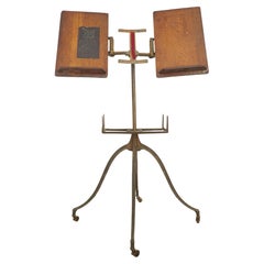
View AllAntique Victorian Cast Iron
Oak Dictionary Stand
Located in New York, NY
Antique 1890s dictionary stand with a cast iron base featuring four curved legs ending in small casters. The top features two adjustable oak book rests, designed to hold large books ...
Category
Antique Late 19th Century American Victorian Musical Instruments
Materials
Iron
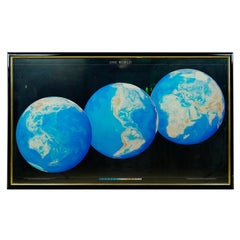
1990 Triple Perspective Planet Earth Map Framed Poster
Located in New York, NY
This decorative poster features a map of the Earth with a unique triple perspective view. It is enclosed in a black plastic frame, and the glass covering the poster is still intact. ...
Category
1990s American Posters
Materials
Glass, Plastic, Paper
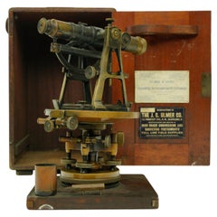
Antique J.C Ulmer Co. Survey Transit
Compass In Original Mahogany Box
Located in New York, NY
Brass and steel survey transit and compass in the original mahogany box. Made by J.C Ulmer Co. Good condition with appropriate wear from age. One availa...
Category
Early 20th Century American Industrial Scientific Instruments
Materials
Brass, Steel
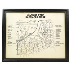
Framed Belmont Park Racetrack Barn Area Guide Map
Located in New York, NY
This piece was acquired from the Belmont Park racetrack in Elmont, New York. It displays an itemized map of the barn area at Belmont Park. It is made of acrylic with a black wood fra...
Category
20th Century American Maps
Materials
Acrylic, Wood
European Brass
Glass Vitrine Display Cabinet No Shelves or Brackets
Located in New York, NY
The vitrine features a clear glass door and sides, a mirrored back, and a simple metal ring handle. The bottom of the vitrine has a dark wooden base with a decorative gilt metal appl...
Category
Early 20th Century European Vitrines
Materials
Brass, Steel

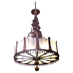
1920 Heavy Large Art Deco Bronze Chandelier Etched Glass from Port Arthur Texas
Located in New York, NY
Large Art Deco bronze chandelier with etched glass from a 1929 school auditorium in Port Arthur, Texas. Cleaned and rewired. Small quantity available at time of posting. Please inqui...
Category
Early 20th Century American Art Deco Chandeliers and Pendants
Materials
Bronze
You May Also Like
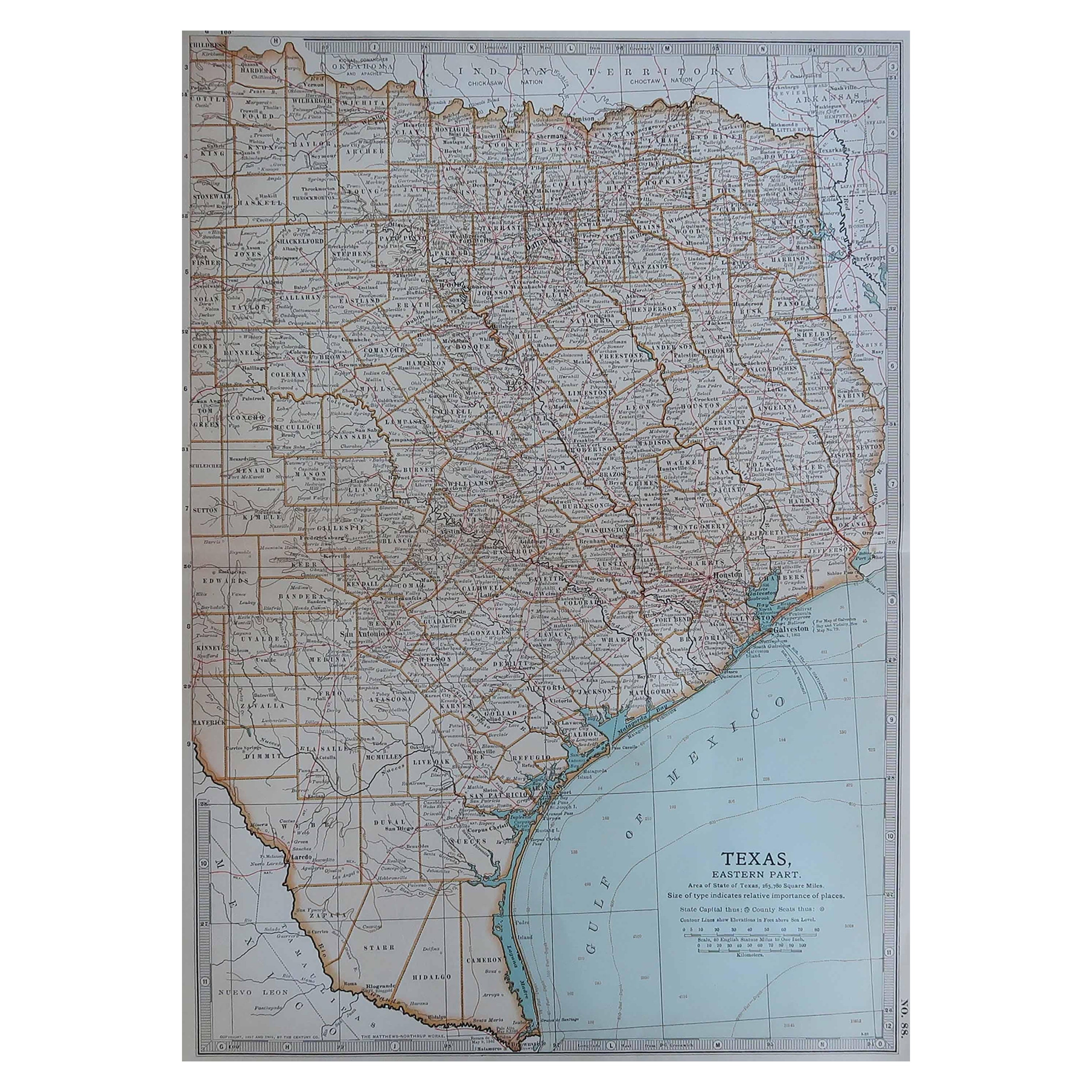
Original Antique Map of the American State of Texas ( Eastern Part ), 1903
Located in St Annes, Lancashire
Antique map of Texas ( Eastern part )
Published By A & C Black. 1903
Original colour
Good condition
Unframed.
Free shipping
Category
Antique Early 1900s English Maps
Materials
Paper
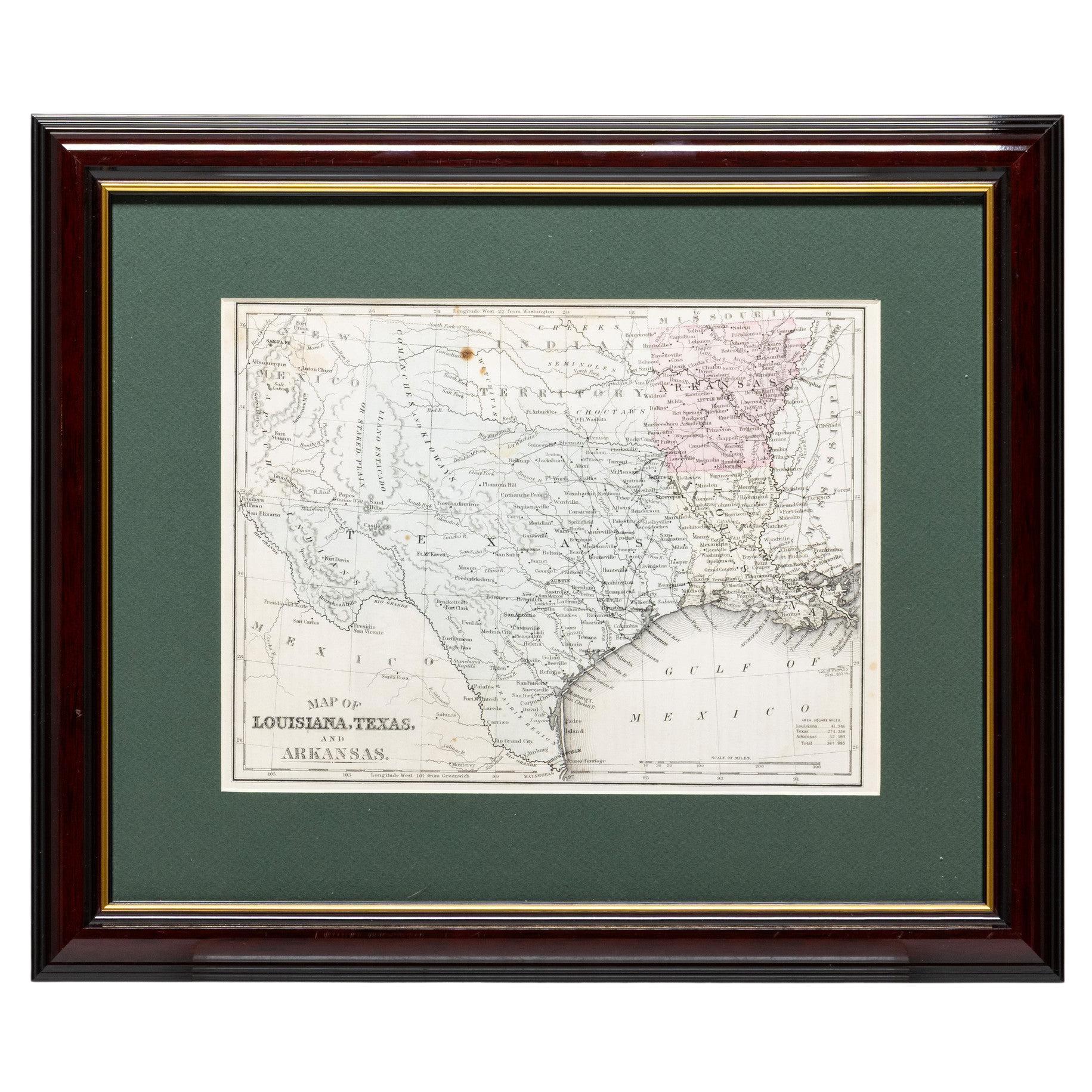
Framed Map of Texas Circa 1880
Located in Coeur d
Alene, ID
Framed circa 1880 map of Texas with Louisiana and Arkansas. Well detailed. Great for display in any home. Encased in cherry and gold frame with dark green mating. Size: 11" x 9", fra...
Category
Antique Late 19th Century American Maps
Materials
Paper
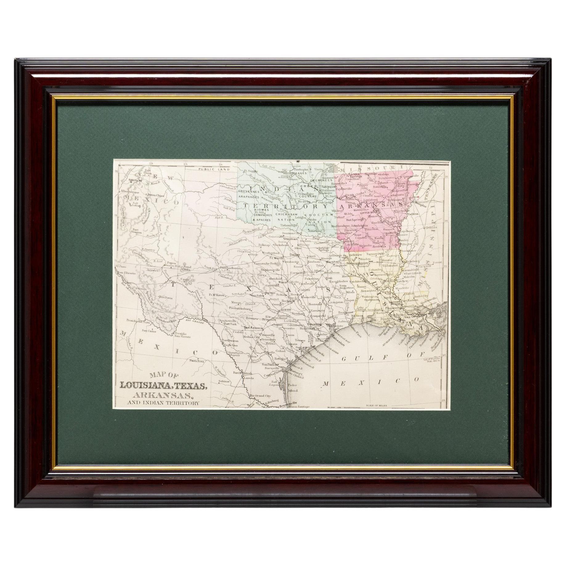
Framed Map of Texas Circa 1886
Located in Coeur d
Alene, ID
Framed circa 1886 map of Texas including Louisiana, Texas and Arkansas, with Indian territory. Well detailed. Great for display in any home. Encased in cherry and gold frame with dar...
Category
Antique Late 19th Century American Maps
Materials
Paper
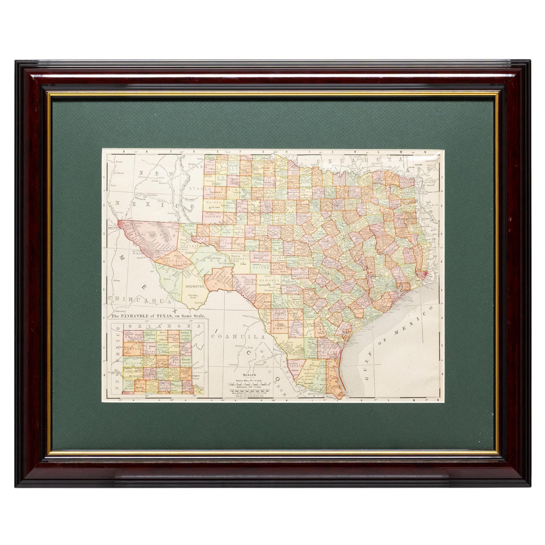
Framed Map of Texas Circa 1908
Located in Coeur d
Alene, ID
Framed circa 1908 map of Texas. Each county separated and colored with panhandle of Texas on same scale in left corner. Well detailed. Would display nicely in any home. Encased in ch...
Category
Early 20th Century American Maps
Materials
Paper
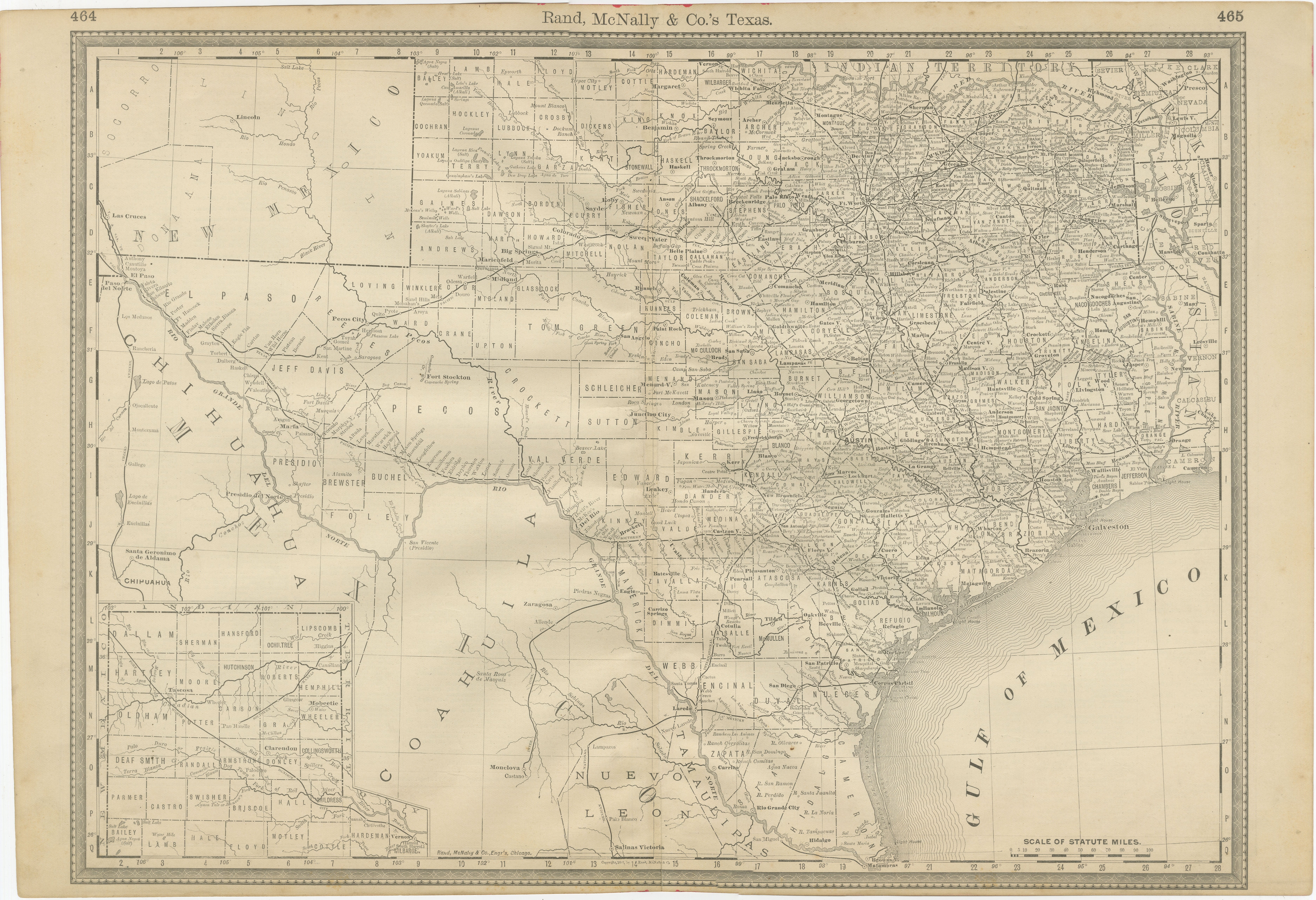
Texas Antique Map 1888 – Railroads, Counties
Frontier Settlements
Located in Langweer, NL
Texas Railroad Map 1888 – Rand McNally Antique Lithograph
This antique 1888 map of Texas, published by Rand, McNally & Co., provides a detailed overview of the state during a critic...
Category
Antique Late 19th Century American Maps
Materials
Paper

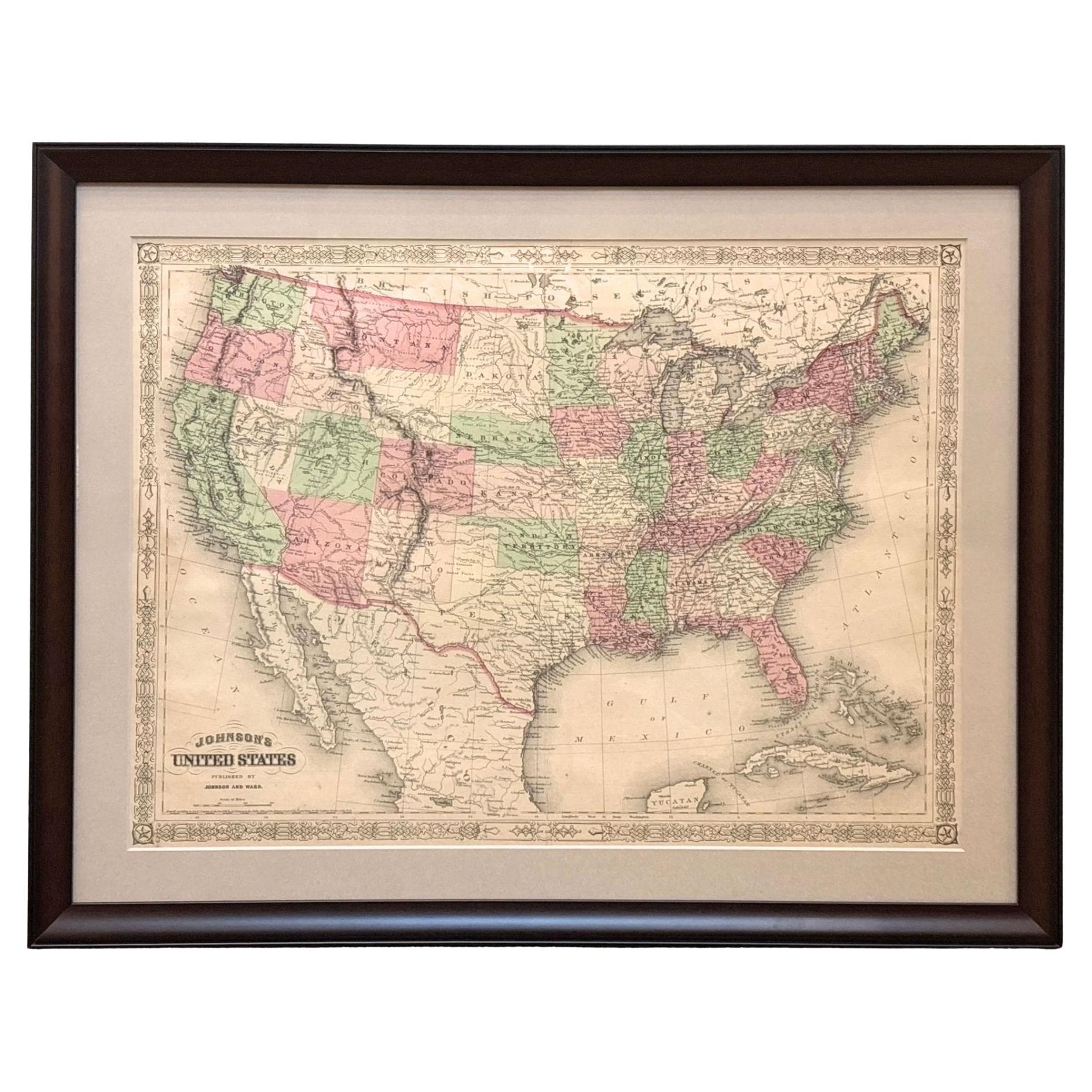
1866 "Johnson
s United States" Map, Published by Johnson and Ward
Located in Colorado Springs, CO
Presented is a detailed map of the United States by A. J. Johnson. Spanning the whole of the continental United States, as well as adjacent parts of Canada and Mexico, the map reflec...
Category
Antique 1860s American Victorian Maps
Materials
Paper

More Ways To Browse
1960s Glass Top Coffee Table
Black Glass Coffee Tables
Mid Century Wrought Iron Chairs
Earth Toned Rug
Black Marble Table Vintage
Goblets
Mid Century Modern Yellow Chair
Paulin Pierre
Used Pianos Pianos
18th Century Engravings
Antique Carved Wood Chair
Black Scandinavian Modern Dining Chairs
Dutch Mid Century Modern Table
Gold Modern Coffee Table
Iconic Modern Furniture
Japanese Metal
Midcentury Modern Gray Glass Vase
Round Glass Coffee Tables