Items Similar to 1859 Denmark and Schleswig-Holstein Map: A Historical View from Blackie
s Atlas


Want more images or videos?
Request additional images or videos from the seller
1 of 10
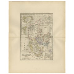
1859 Denmark and Schleswig-Holstein Map: A Historical View from Blackie
s Atlas
$209.41
£156.41
€175
CA$288.50
A$314.42
CHF 166.50
MX$3,776.50
NOK 2,107.90
SEK 1,938.01
DKK 1,333.20
About the Item
The "Antique Map of Denmark with Schleswig
Holstein" from 'The Imperial Atlas of Modern Geography', published by W. G. Blackie in 1859, is a valuable historical document that provides a detailed view of Denmark along with the regions of Schleswig and Holstein as they were understood in the mid-19th century.
Key Features of the Map:
1. Geographical Coverage: The map encompasses the Kingdom of Denmark and the duchies of Schleswig and Holstein. It illustrates the distinct landscapes of these regions, from the Jutland Peninsula to the numerous Danish islands, and the flat plains of Holstein.
2. Political Boundaries: This period was significant for Denmark and the Schleswig-Holstein region due to the national and political tensions. The map likely delineates the boundaries as they were recognized at the time, offering insight into the complex territorial disputes of the era.
3. Urban and Rural Landscapes: Major cities like Copenhagen, Aarhus, and Kiel, as well as smaller towns and rural villages, are marked. This aspect offers a view of the urban distribution and key population centers in Denmark and the Schleswig-Holstein area.
4. Transportation and Trade Routes: The map may detail the transportation infrastructure, including roads and maritime routes, which were vital for trade and communication in these regions.
5. Natural Features: Significant natural features such as the Danish straits, the North Sea and Baltic Sea coastlines, and important rivers and lakes are likely to be highlighted, showcasing the geographic diversity of the area.
6. Artistic Elements: In line with the cartographic style of the Victorian era, the map probably includes ornate borders, an elegant title script, and possibly other artistic embellishments, adding to its aesthetic value.
7. Educational and Historical Significance: As a historical document, this map serves as an invaluable educational tool, offering a snapshot of the geographical understanding and the political landscape of Denmark and the Schleswig-Holstein region in the mid-19th century.
This antique map is not only a collector’s item for enthusiasts of historical cartography but also an important resource for those interested in the historical geography of Scandinavia and Northern Europe, providing a window into the regional dynamics of the time.
- Dimensions:Height: 14.57 in (37 cm)Width: 10.63 in (27 cm)Depth: 0.02 in (0.5 mm)
- Materials and Techniques:
- Period:
- Date of Manufacture:1859
- Condition:Wear consistent with age and use. General age-related toning. some foxing, Please study image carefully.
- Seller Location:Langweer, NL
- Reference Number:Seller: BG-12685-1-131stDibs: LU3054325239302
About the Seller
5.0
Recognized Seller
These prestigious sellers are industry leaders and represent the highest echelon for item quality and design.
Platinum Seller
Premium sellers with a 4.7+ rating and 24-hour response times
Established in 2009
1stDibs seller since 2017
2,786 sales on 1stDibs
Typical response time: <1 hour
- ShippingRetrieving quote...Shipping from: Langweer, Netherlands
- Return Policy
More From This Seller
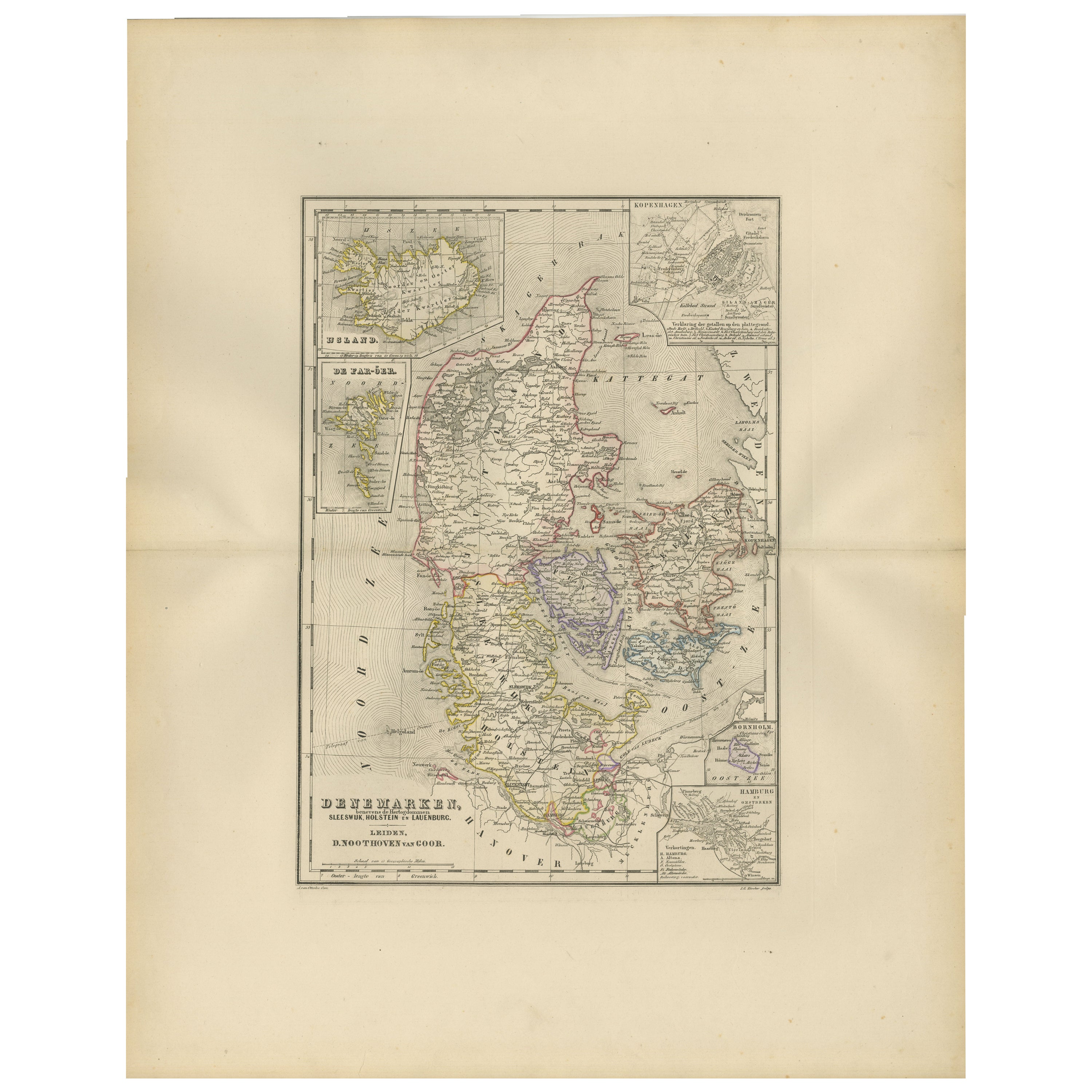
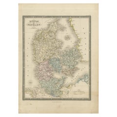
View AllMap of Denmark, Schleswig, Holstein and Lauenburg – Leiden 1876
Located in Langweer, NL
Title: Map of Denmark, Schleswig, Holstein and Lauenburg – Leiden 1876
Description:
This 19th-century Dutch map, titled “Denemarken, Sleeswijk, Holstein en Lauenburg,” was published...
Category
Antique 1870s Dutch Maps
Materials
Paper
Antique Map of the Kingdom of Denmark by Wyld
1845
Located in Langweer, NL
Antique map titled 'Kingdom of Denmark'. Original antique map of the Kingdom of Denmark. This map originates from 'An Atlas of the World, Comprehending Separate Maps of its Various C...
Category
Antique Mid-19th Century Maps
Materials
Paper
$155 Sale Price
35% Off
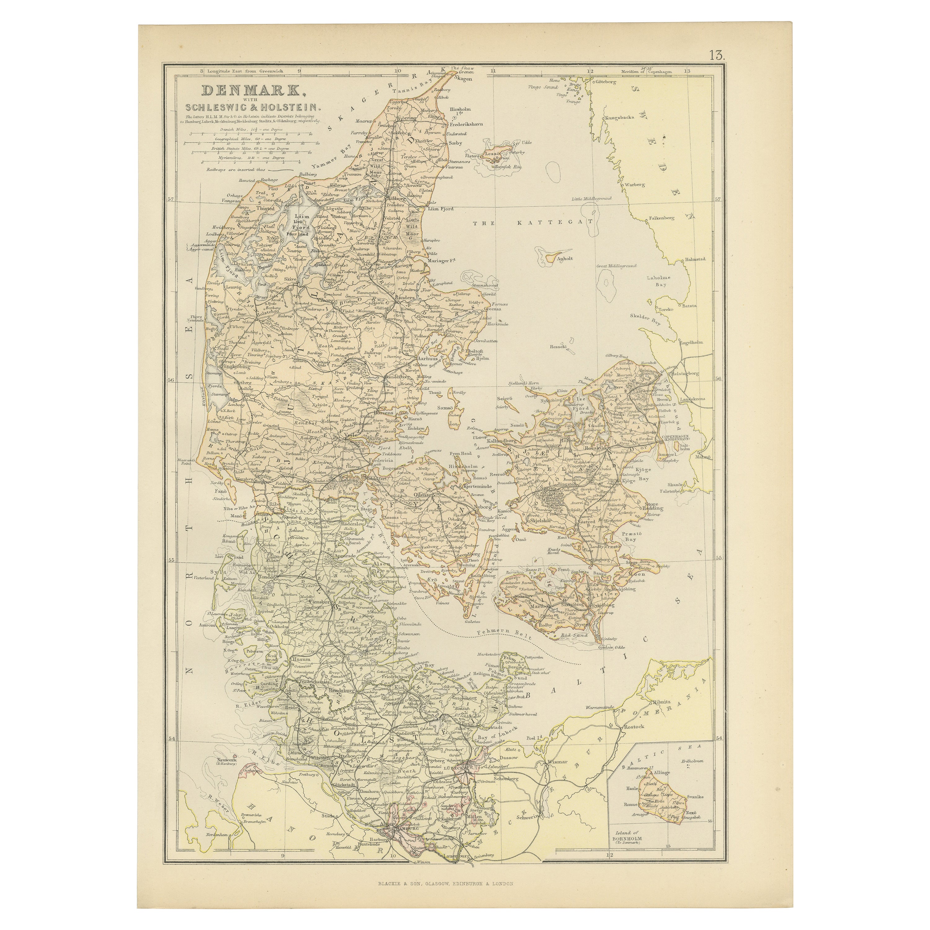
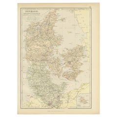
1882 Map of Denmark, Schleswig, and Holstein Highlighting Geographical Details
Located in Langweer, NL
This 1882 map of Denmark, Schleswig, and Holstein, published by Blackie and Son as part of the 'Comprehensive Atlas and Geography of the World,' provides a detailed representation of...
Category
Antique 1880s Maps
Materials
Paper
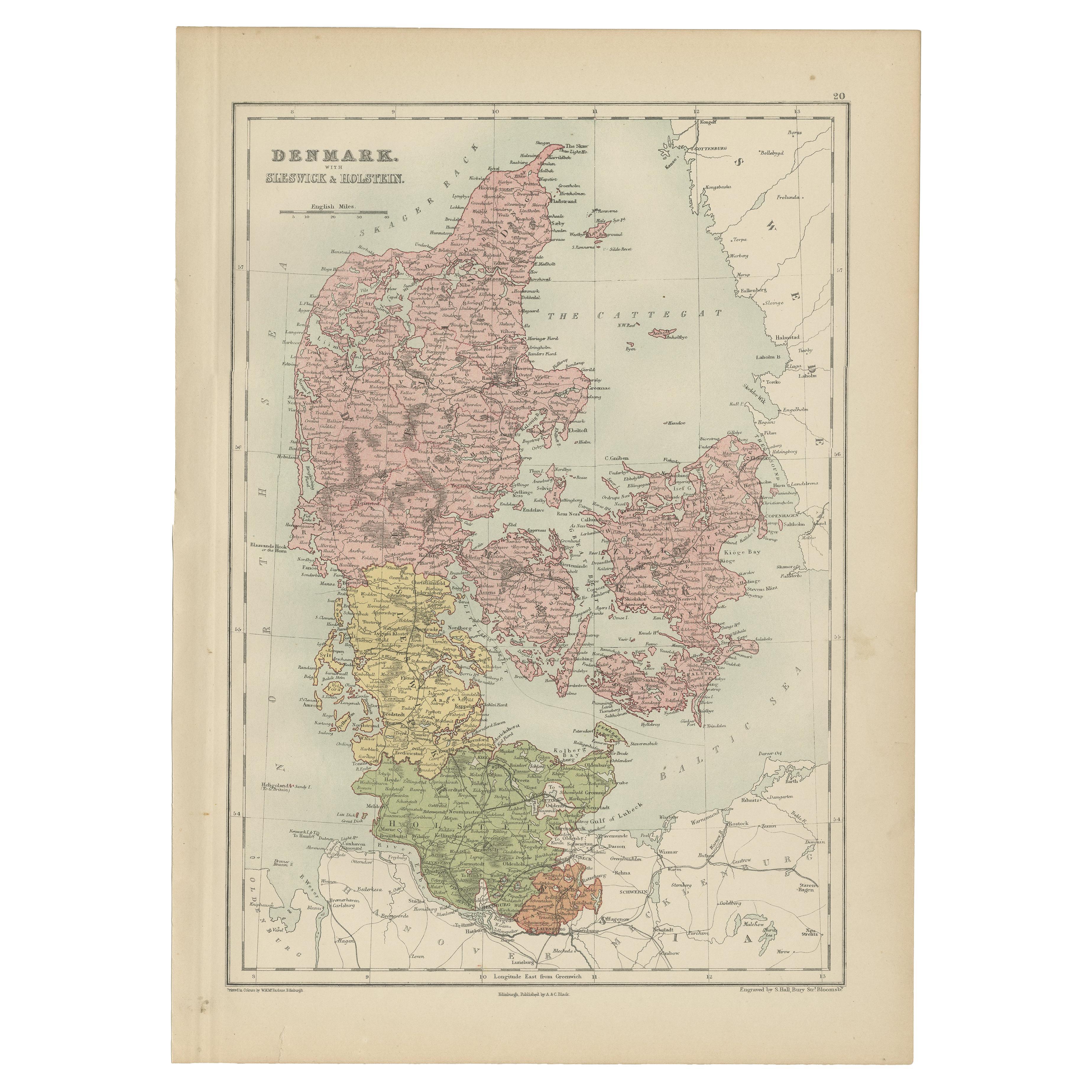
Antique Map of Denmark with Schleswig
Holstein by A
C. Black, 1870
Located in Langweer, NL
Antique map titled 'Denmark with Schleswig & Holstein'. Original antique map of Denmark with Schleswig & Holstein. This map originates from ‘Black's General Atlas of The World’. Publ...
Category
Antique Late 19th Century Maps
Materials
Paper

$125 Sale Price
40% Off
Denmark
Schleswig-Holstein Map with Copenhagen
Iceland Insets – 1865 Atlas
Located in Langweer, NL
Denmark & Schleswig-Holstein Map with Copenhagen & Iceland Insets – 1865 Atlas
This detailed antique map titled Denmark and the Duchies Schleswig, Holstein & Lauenburg; Hanover, Bru...
Category
Antique Mid-19th Century Maps
Materials
Paper

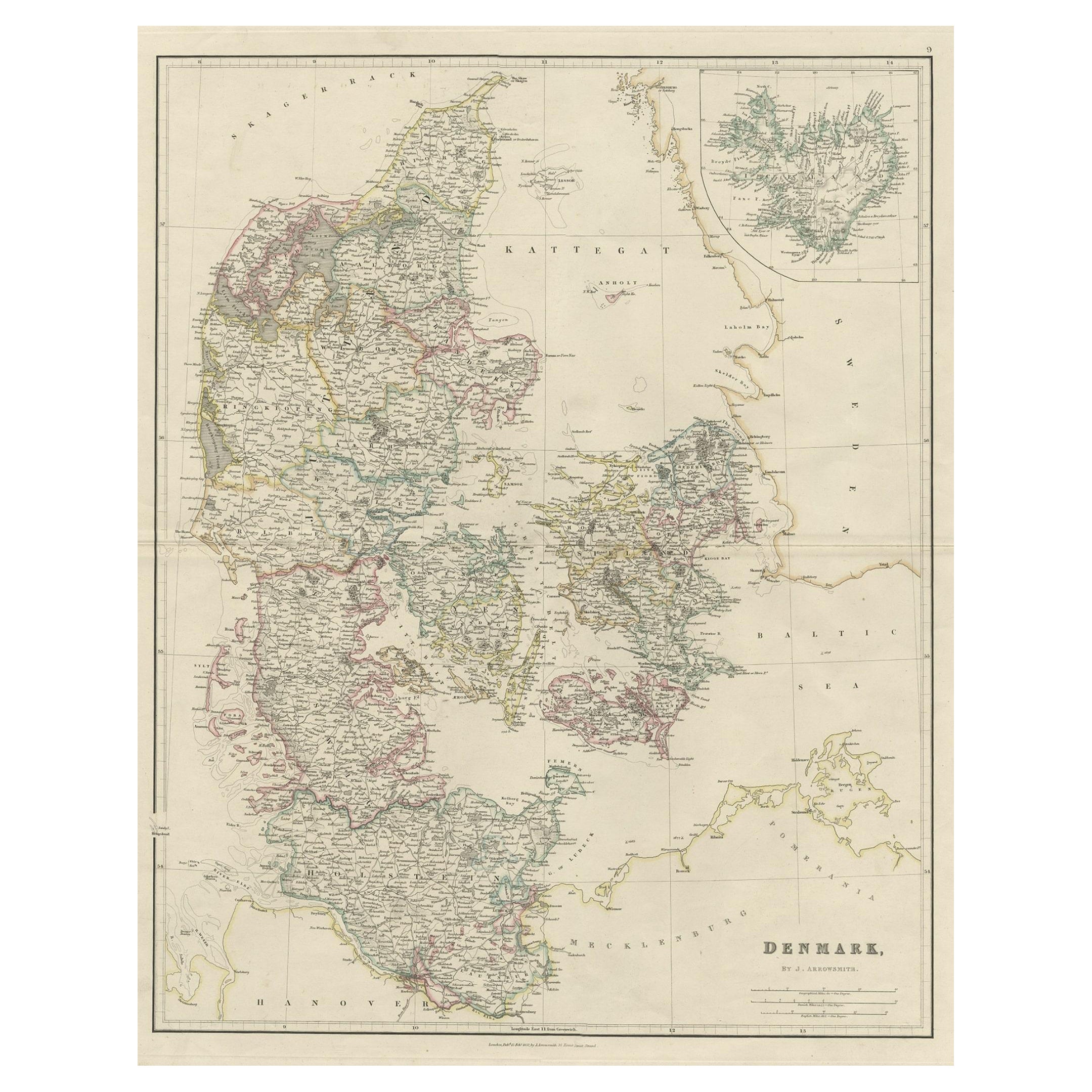
Antique Map of Denmark with an Inset Map of Iceland, 1832
Located in Langweer, NL
Antique map titled 'Denmark'. Large map of Denmark with an inset map of Iceland.
Artists and Engravers: Published by J. Arrowsmith in London, 1832.
Condition: Good, general age...
Category
Antique 19th Century Maps
Materials
Paper

You May Also Like
Denmark. Century Atlas antique vintage map
Located in Melbourne, Victoria
'The Century Atlas. Denmark'
Original antique map, 1903.
Inset maps of 'Faroe Islands', 'Iceland' and 'Copenhagen'.
Central fold as issued. Map name and number printed on the reve...
Category
Early 20th Century Victorian More Prints
Materials
Lithograph

Original Antique English County Map, Nottinghamshire, J
C Walker, 1851
Located in St Annes, Lancashire
Great map of Nottinghamshire
Original colour
By J & C Walker
Published by Longman, Rees, Orme, Brown & Co. 1851
Unframed.
Category
Antique 1850s English Other Maps
Materials
Paper

1849 Map of "Europaische Russland",
Meyer Map of European Russia
, Ric. R017
Located in Norton, MA
1849 Map of
"Europaische Russland"
( Meyer Map of European Russia)
Ric.r017
A lovely map of European Russia dating to 1849 by Joseph Meyer. It covers the European portions of...
Category
Antique 19th Century Unknown Maps
Materials
Paper

1853 Map of "Russia in Europe Including Poland" Ric.r016
Located in Norton, MA
Description
Russia in Europe incl. Poland by J Wyld c.1853
Hand coloured steel engraving
Dimension: Paper: 25 cm W x 33 cm H ; Sight: 22 cm W x 28 cm H
Condition: Good ...
Category
Antique 19th Century Unknown Maps
Materials
Paper

Original Antique English County Map, Herefordshire, J
C Walker, 1851
Located in St Annes, Lancashire
Great map of Herefordshire
Original colour
By J & C Walker
Published by Longman, Rees, Orme, Brown & Co. 1851
Unframed.
Category
Antique 1850s English Other Maps
Materials
Paper

1839 Map of Karte Des "Russischen Reiches in Europa Und Asien" Ric.R0013
Located in Norton, MA
1839 map of Karte Des
"Russischen Reiches in Europa and Asien"
Ric.r013
Map of the European and Asian parts of Russian Empire. Karte der Russischen Reiches in Europa und Asien...
Category
Antique 19th Century Unknown Maps
Materials
Paper

More Ways To Browse
Historical Documents
Schleswig Holstein
Antique Maps Persia
Migeon Migeon
Antique Maps Of Canada
Map Of Arabia
Caribbean Map
California Map
Map Of Egypt
Antique Ecuador
Antique Map New York
Nautical Maps
18th Century Maps America
Antique Map Of Egypt
Map Of Austria
New Zealand Map
Antique Linen Map
19th Century World Map