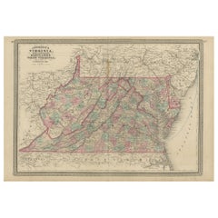
Items Similar to 1864 Johnson
s Map of Virginia, Delaware, and Maryland with Fort Monroe Inset

Want more images or videos?
Request additional images or videos from the seller
1 of 6
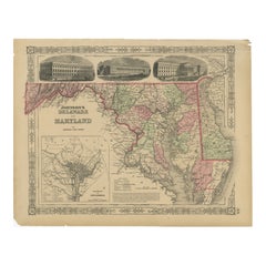
1864 Johnson
s Map of Virginia, Delaware, and Maryland with Fort Monroe Inset
$284.77
$355.9720% Off
£212.60
£265.7520% Off
€240
€30020% Off
CA$395.64
CA$494.5520% Off
A$425.56
A$531.9520% Off
CHF 227.43
CHF 284.2920% Off
MX$5,016.18
MX$6,270.2320% Off
NOK 2,867.41
NOK 3,584.2620% Off
SEK 2,621.35
SEK 3,276.6920% Off
DKK 1,829.07
DKK 2,286.3420% Off
About the Item
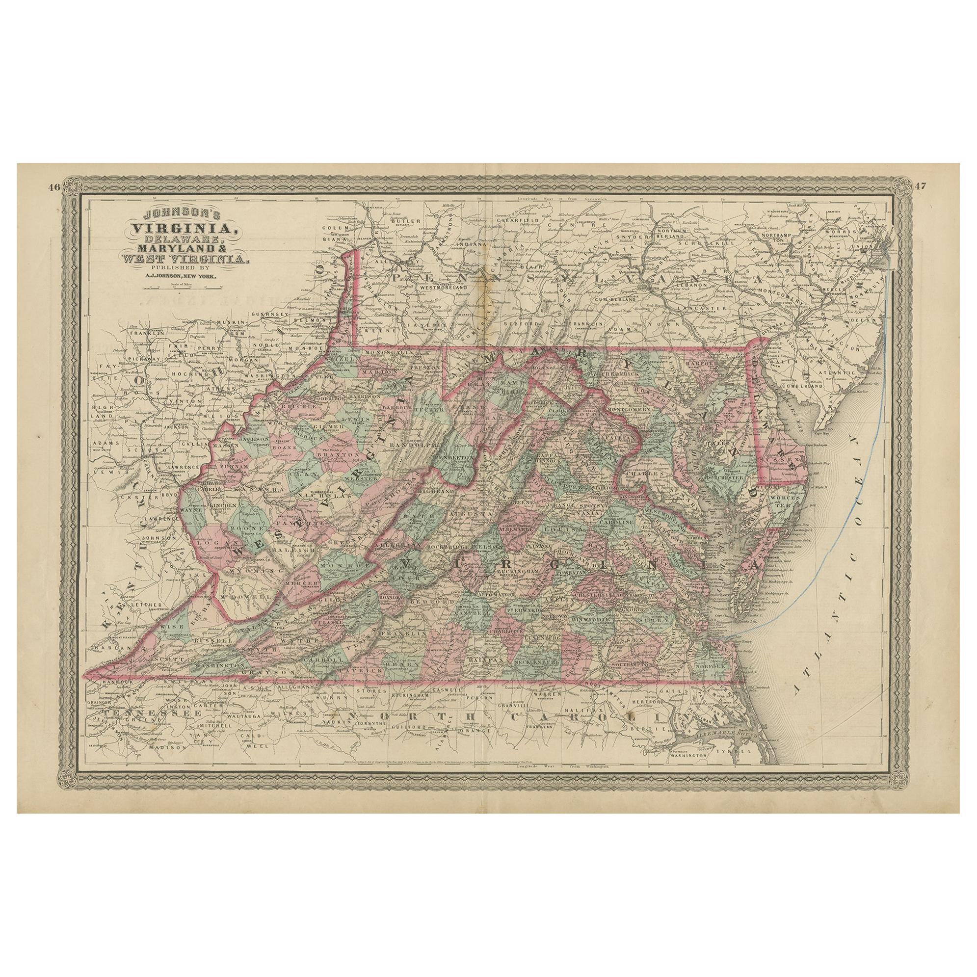
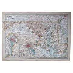
Title: 1864 Johnson's Map of Virginia, Delaware, and Maryland with Fort Monroe Inset
Description: This 1864 map titled "Johnson's Virginia, Delaware, and Maryland," published by Johnson and Ward, offers a detailed view of three key states in the mid-Atlantic region of the United States during the Civil War era. The map provides an intricate depiction of counties, cities, railroads, rivers, and topographical features, with each state highlighted in distinct hand-colored shades to help differentiate the boundaries.
An interesting feature of this map is the inset illustration of Fort Monroe, Virginia, showing a view of this significant Union stronghold at the entrance of Hampton Roads. Fort Monroe played a key role in the Civil War, particularly as a point of refuge for escaped enslaved people and as a strategic base for Union forces.
Condition:
The map is in good condition, with some typical age-related yellowing along the margins. The hand-coloring remains vivid, providing clear distinction between the counties and states. The central fold, likely from its atlas origin, is visible but does not interfere with the overall legibility of the map. The decorative border is well-preserved, and the inset of Fort Monroe adds historical context and visual interest, making it a valuable piece for collectors interested in Civil War history and 19th-century cartography.
- Dimensions:Height: 18 in (45.7 cm)Width: 26.38 in (67 cm)Depth: 0.01 in (0.2 mm)
- Materials and Techniques:
- Period:
- Date of Manufacture:1864
- Condition:Condition: Good condition, with light yellowing along the edges, consistent with its age. The central fold, from its original inclusion in an atlas, is evident but well-maintained. The colors are bright.
- Seller Location:Langweer, NL
- Reference Number:Seller: BG-13952-101stDibs: LU3054342436612
About the Seller
5.0
Recognized Seller
These prestigious sellers are industry leaders and represent the highest echelon for item quality and design.
Platinum Seller
Premium sellers with a 4.7+ rating and 24-hour response times
Established in 2009
1stDibs seller since 2017
2,836 sales on 1stDibs
Typical response time: 1 hour
- ShippingRetrieving quote...Shipping from: Langweer, Netherlands
- Return Policy
More From This Seller
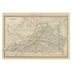
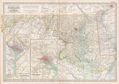
View AllAntique Map of Virginia, Delaware, Maryland
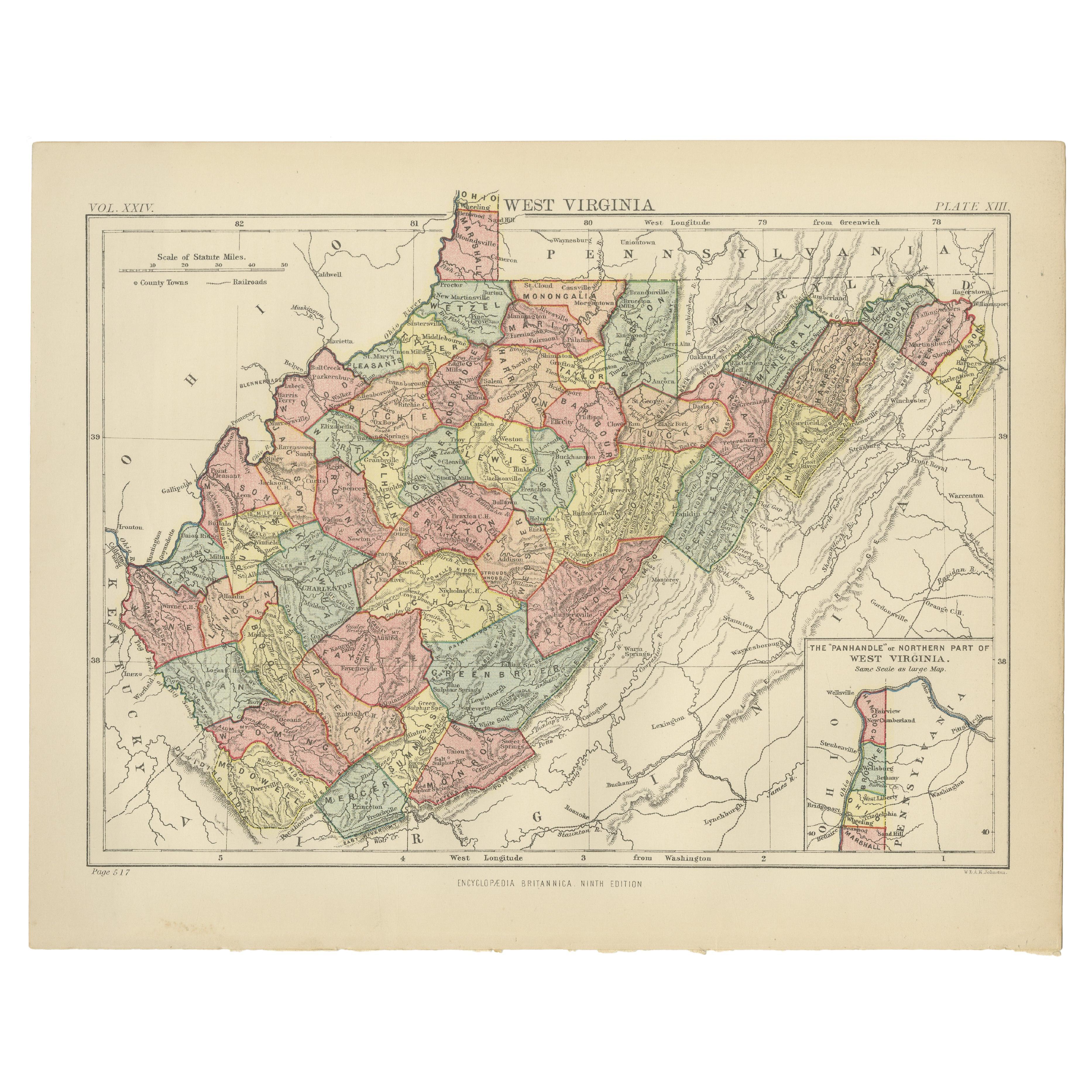
West Virginia by Johnson, 1872
Located in Langweer, NL
Antique map titled 'Johnson's Viriginia (..). Original map of Virginia, Delaware, Maryland and West Virginia. This map originates from 'Johnson's New I...
Category
Antique Late 19th Century European Maps
Materials
Paper
$237 Sale Price
20% Off
Antique Virginia Map c.1888 – Railroads, Towns
The Old Dominion
Located in Langweer, NL
Antique Map of Virginia – Rand McNally, circa 1888
This antique map of Virginia was published by Rand, McNally & Co. around 1888. Drawn from one of their influential late 19th-centu...
Category
Antique Late 19th Century American Maps
Materials
Paper
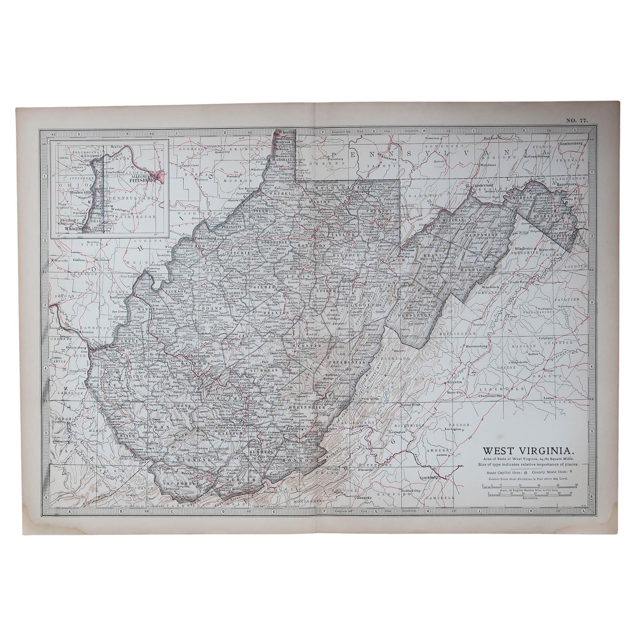
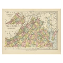
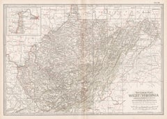
Antique Map of Virginia, with Inset Map of the Northern Part, 1888
Located in Langweer, NL
Antique map titled 'West Virginia'. Original antique map of Virginia, United States. With inset map of the 'Panhandle' or northern part of West...
Category
Antique Late 19th Century British Maps
Materials
Paper

$275 Sale Price
20% Off
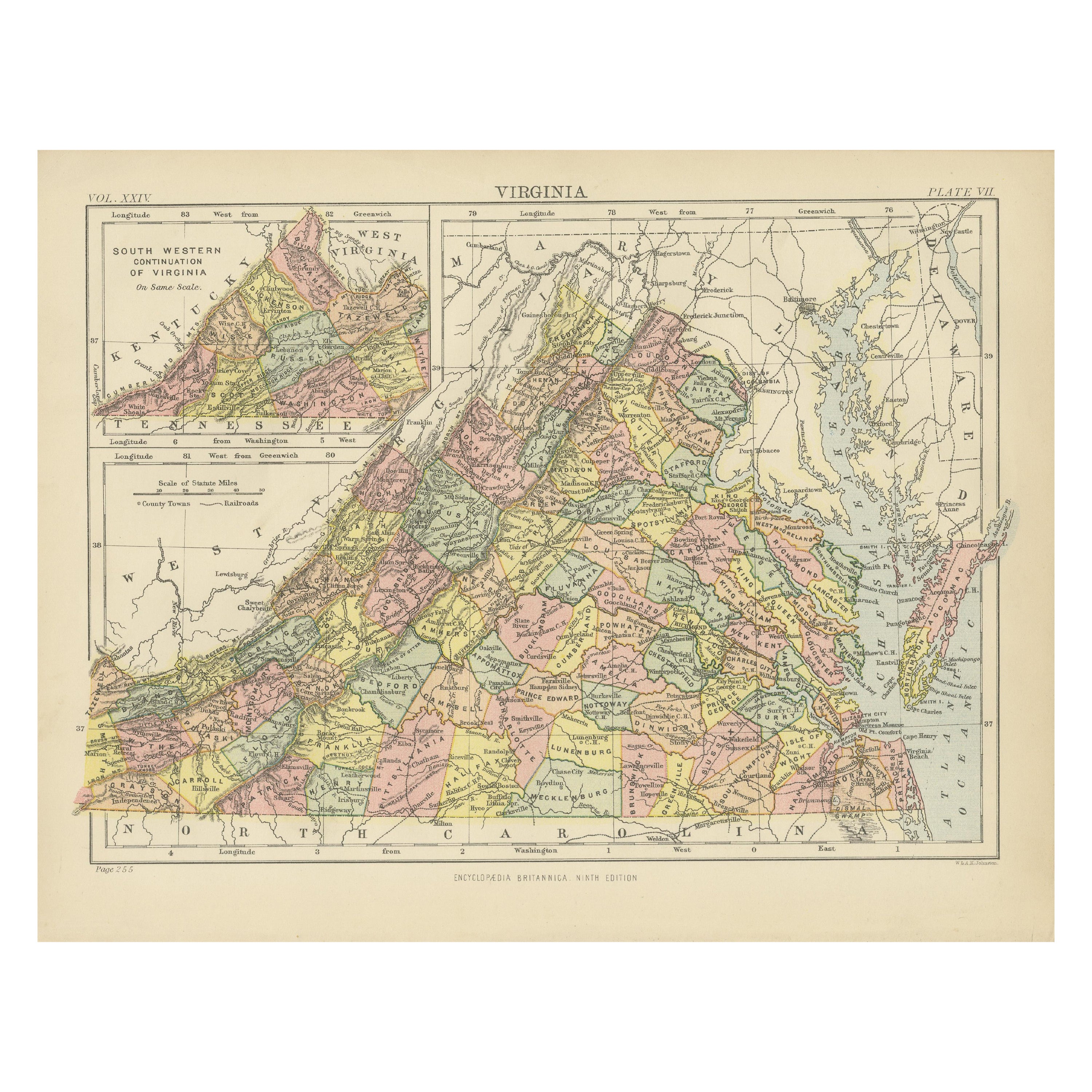
Antique Map of Virginia, with Inset Map of the South Western Continuation
Located in Langweer, NL
Antique map titled 'Virginia'. Original antique map of Virginia, United States. With inset map of the south western continuation of Virginia. T...
Category
Antique Late 19th Century Maps
Materials
Paper
$275 Sale Price
20% Off
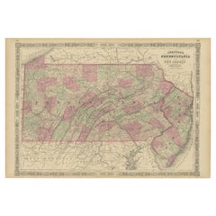
Historic 1864 Civil War Map of Pennsylvania and New Jersey with Coastal Focus
Located in Langweer, NL
Title: Historic 1864 Civil War Map of Pennsylvania and New Jersey with Coastal Focus
Description: This meticulously crafted antique map, titled "Johnson's Pennsylvania and New Jerse...
Category
Antique 1860s Maps
Materials
Paper
Delaware and Maryland Map – Johnson, Hand-Colored with Insets, 1864
Located in Langweer, NL
Johnson’s Delaware and Maryland Map, USA c.1864 – Hand-Colored with Insets
This is a finely engraved and hand-colored map titled Johnson’s Delaware and Maryland, published by Johnso...
Category
Antique Mid-19th Century American Maps
Materials
Paper
You May Also Like
Original Antique Map of the American State of Virginia, 1903
Located in St Annes, Lancashire
Antique map of West Virginia
Published By A & C Black. 1903
Original colour
Good condition
Unframed.
Free shipping
Category
Antique Early 1900s English Maps
Materials
Paper

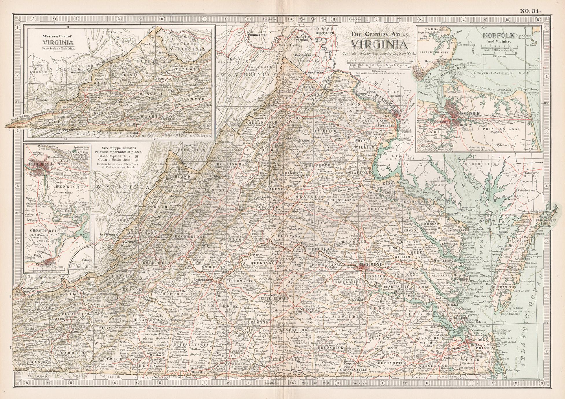
Virginia. USA. Century Atlas state antique vintage map
Located in Melbourne, Victoria
'The Century Atlas. Virginia'
Original antique map, 1903.
Central fold as issued. Map name and number printed on the reverse corners.
Sheet 29.5cm by 40cm.
Category
Early 20th Century Victorian More Prints
Materials
Lithograph
Original Antique Map of the American State of Virginia, 1903
Located in St Annes, Lancashire
Antique map of Virginia
Published By A & C Black. 1903
Original colour
Good condition
Unframed.
Free shipping
Category
Antique Early 1900s English Maps
Materials
Paper
Original Antique Map of the American State of Maryland
Delaware, 1903
Located in St Annes, Lancashire
Antique map of Maryland And Delaware
Published By A & C Black. 1903
Original colour
Good condition
Unframed.
Free shipping
Category
Antique Early 1900s English Maps
Materials
Paper
Maryland and Delaware. USA. Century Atlas state antique vintage map
Located in Melbourne, Victoria
'The Century Atlas. Maryland and Delaware.'
Original antique map, 1903.
Central fold as issued. Map name and number printed on the reverse corners.
Sheet 29.5cm by 40cm.
Category
Early 20th Century Victorian More Prints
Materials
Lithograph
West Virginia. USA. Century Atlas state antique vintage map
Located in Melbourne, Victoria
'The Century Atlas. West Virginia'
Original antique map, 1903.
Central fold as issued. Map name and number printed on the reverse corners.
Sheet 29.5cm by 40cm.
Category
Early 20th Century Victorian More Prints
Materials
Lithograph
More Ways To Browse
Antique Delaware
Black Scandinavian Modern Dining Chairs
Gold Modern Coffee Table
Round Glass Coffee Tables
18th Century Wood Side Tables
Antique Hand Carved Dining Room Sets
Mid Century Modern Pitcher
Vintage Italian Leather Dining Chair
Vintage Movie Posters
Blue Green Wool And Silk Rug
Brown Sheepskin Chair
Vintage Brass Bar Carts
Antique Botanical Prints
Green Persian Rug
17th Century Blue And White
50 X 50 Coffee Table
Antique Wood Panel Painted
Milo Baughman 1970