Items Similar to 1870 "Johnson
s Europe" Map Published by A. J. Johnson


Want more images or videos?
Request additional images or videos from the seller
1 of 10
1870 "Johnson
s Europe" Map Published by A. J. Johnson
$1,250
£953.41
€1,085.71
CA$1,756.63
A$1,915.85
CHF 1,014.89
MX$22,968.36
NOK 12,925.19
SEK 11,819.12
DKK 8,111.30
About the Item
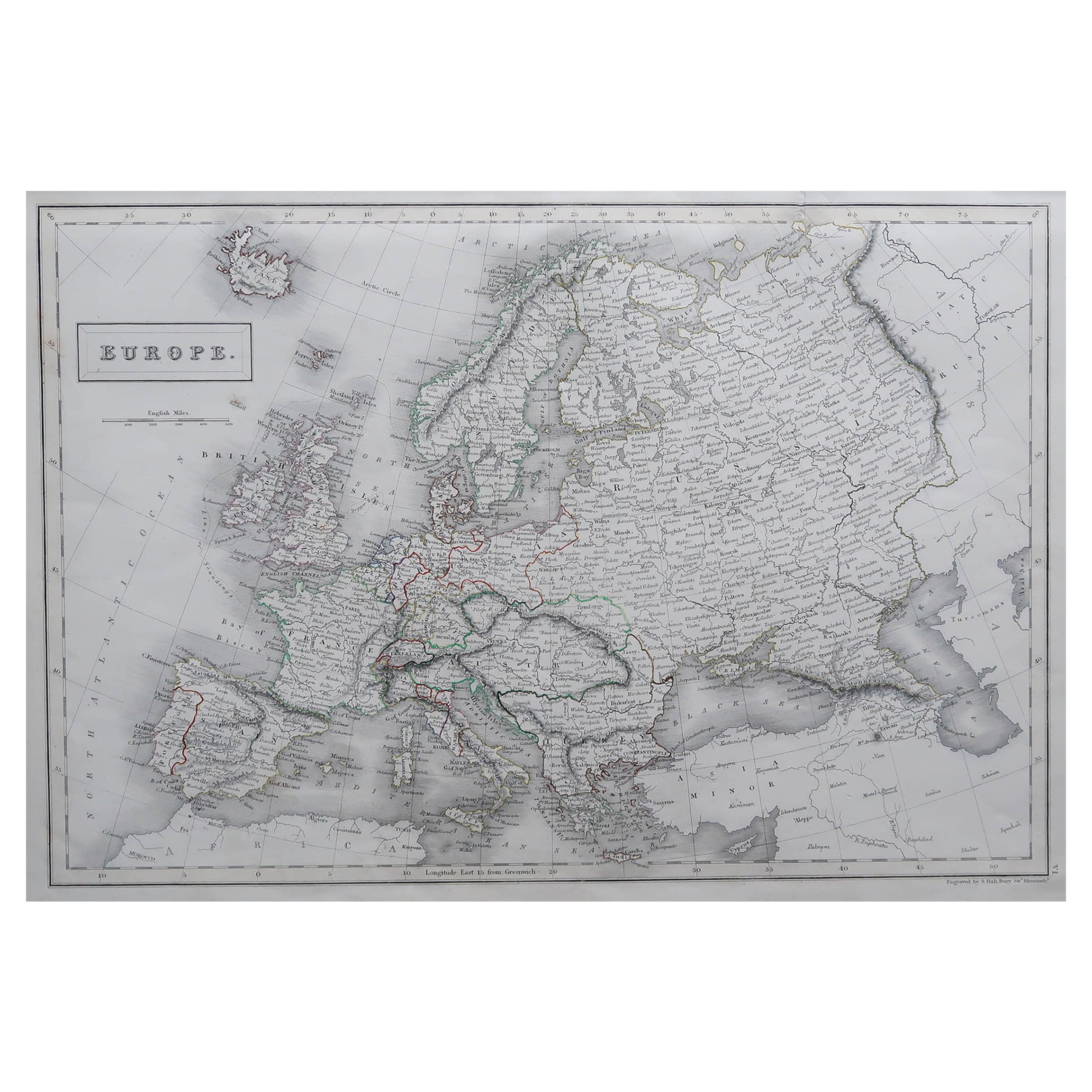
Presented is an original 1870 "Johnson’s Europe" map. First published in 1864, this map was issued as pages 87 and 88 in the 1870 edition of “Johnson's New Illustrated (Steel Plate) Family Atlas.” The map is engraved with attractive hand coloring and a decorative border. The countries of Europe are colored by country, and sometimes further colored by districts or rule. Included are the countries of Iceland, Ireland, England, Wales, Norway, Sweden, Russia, Prussia, Holland, Belgium, Bavaria, Austria, Switzerland, France, Italy, Spain, Portugal, Corsica, Sardinia, Turkey, Greece, and Crete. Russia is very large, divided by provinces, and includes within its borders Finland, Lapland, Baltic Provinces, Poland, West Russia, Little Russia, South Russia, Caucasian Provinces, Astrachan, and Kasan. Depicted but not colored are the border countries and continents of Greenland, Asia, Turkey in Asia, and Africa. The map is beautifully detailed, with cities, towns, railroads, and common roads identified, and mountains, rivers, and lakes depicted.
The publishing company of A.J. Johnson was a successor of Johnson and Ward, a successor to Johnson and Browning, themselves a successor to the famous publishing company, J. H. Colton and Company. A combination of both new plates and older, updated ones, all of the maps in this famous 1870 atlas were compiled, drawn, and engraved under the supervision of A. J. Johnson.
This 1870 publication of “Johnson's New Illustrated (Steel Plate) Family Atlas” is also notable for its inclusion of a treatise on physical geography by Professor A. Guyot, marking the first year his essay appeared and his name featured on the cover. The atlas was recognized with a First Prize Medal at the Universal Exposition of 1867 in Paris.
“Johnson's New Illustrated Family Atlas” was a comprehensive world atlas featuring 60 full-color maps. Designed to be both educational and a decorative addition to a home library, it reflected the 19th-century fascination with detailed and ornate cartographic publications. In addition to maps, the atlas included geographical, statistical, and historical information, as well as a dictionary of religious denominations, a testament to its extensive scope and utility. The treatise on physical geography by A. Guyot further demonstrates that period’s growing interest in scientific inquiry, making the atlas a valuable resource not just for navigation and geography, but also for understanding the natural world.
CONDITION:
Near fine condition. Hand Colored. Page 87 and 88 from “Johnson's New Illustrated (Steel Plate) Family Atlas.” Decorative border. Colored by country or province. Publication line: "Entered according to Act of Congress in the Year 1864, by A.J. Johnson, in the Clerks Office of the District Court of the United States for the Southern District of New York". Toning to paper, full margins, light staining at top.
Artfully framed in a custom-built wooden frame with UV glass and acid-free mats.
Framed Dimensions: 25 3/4"H x 31 3/4"W x 1 1/8"D.
Accompanied by our company's letter of authenticity.
- Dimensions:Height: 25.75 in (65.41 cm)Width: 31.75 in (80.65 cm)Depth: 1.13 in (2.88 cm)
- Style:Victorian (Of the Period)
- Materials and Techniques:Paper,Engraved
- Place of Origin:
- Period:
- Date of Manufacture:1870
- Condition:Additions or alterations made to the original: Framed to archival and conservation standards by Artem Art Services in Colorado Springs CO in November of 2025. Wear consistent with age and use. Minor fading.
- Seller Location:Colorado Springs, CO
- Reference Number:Seller: M4321stDibs: LU909747859962
About the Seller
4.9
Gold Seller
Premium sellers maintaining a 4.3+ rating and 24-hour response times
Established in 2010
1stDibs seller since 2011
471 sales on 1stDibs
Typical response time: <1 hour
- ShippingRetrieving quote...Shipping from: Colorado Springs, CO
- Return Policy
More From This Seller
View All1866 "Johnson
s United States" Map, Published by Johnson and Ward
Located in Colorado Springs, CO
Presented is a detailed map of the United States by A. J. Johnson. Spanning the whole of the continental United States, as well as adjacent parts of Canada and Mexico, the map reflec...
Category
Antique 1860s American Victorian Maps
Materials
Paper

1870 "Johnson
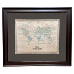
s World" by Prof. A. Guyot, Published by A. J. Johnson
Located in Colorado Springs, CO
Presented is an original "Johnson's World, Showing the Distribution of the Characteristic Forest Trees, Principal Useful Plants and Minerals" by Prof. A. Guyot. This map was issued a...
Category
Antique 1870s American Victorian Maps
Materials
Paper
1856 "Map of the United States" by Ensign, Bridgeman, and Fanning
Located in Colorado Springs, CO
Presented is a scarce American wall map of the United States and Mexico issued by Ensign, Bridgman, and Fanning in 1856. As the title suggests, the map covers all of the United State...
Category
Antique 1850s American Victorian Maps
Materials
Paper

1864 Map of North America, Antique Hand-Colored Map, by Adolphe Hippolyte Dufour
Located in Colorado Springs, CO
Offered is a map of North America entitled Amerique du Nord from 1864. This rare, separately published wall map was produced by Adolphe Hippolyte Dufour. This map includes vibrant an...
Category
Antique 1860s French Maps
Materials
Paper

1859 "Map of the United States of America..." by J. H. Colton
By J.H. Colton
Located in Colorado Springs, CO
Presented is an 1859 “Map of the United States of America, the British Provinces, Mexico, the West Indies and Central America with Part of...
Category
Antique 1850s American Maps
Materials
Paper

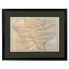
1894 "Texas" Map
Located in Colorado Springs, CO
Presented is a very detailed map of Texas, from 1894. The map is very comprehensive, colored by counties, and outlined in red. The map shows the topography, rivers, springs and water...
Category
Antique 1890s American Victorian Maps
Materials
Paper
$950
You May Also Like
Antique Map of Europe by Johnson,
1872
Located in Langweer, NL
Antique map titled 'Johnson's Europe'. Original map of Europe. This map originates from 'Johnson's New Illustrated Family Atlas of the World' by A.J. Johnson. Published 1872.
Category
Antique Late 19th Century Maps
Materials
Paper

$335 Sale Price
20% Off
Antique Map of the European Continent, 1882
Located in Langweer, NL
Antique map titled 'Europe'. Old map of the European continent. This map originates from 'The Royal Atlas of Modern Geography, Exhibiting, in a Series of ...
Category
Antique 19th Century Maps
Materials
Paper

Large Original Antique Map of Europe by Sidney Hall, 1847
Located in St Annes, Lancashire
Great map of Europe
Drawn and engraved by Sidney Hall
Steel engraving
Original colour outline
Published by A & C Black. 1847
Unframed
Free shipping.
Category
Antique 1840s Scottish Maps
Materials
Paper

Antique Map of the Europe Continent, 1880
Located in Langweer, NL
Antique map titled 'Europe'. Old map of the European continent. This map originates from 'Géographie Universelle Atlas-Migeon' by J. Migeon.
Artists an...
Category
Antique 19th Century Maps
Materials
Paper

Antique Map of Europe by W. G. Blackie, 1859
Located in Langweer, NL
Antique map titled 'Europe'. Original antique map of Europe. This map originates from ‘The Imperial Atlas of Modern Geography’. Published by W. G. Blackie, 1859.
Category
Antique Mid-19th Century Maps
Materials
Paper

$239 Sale Price
20% Off
Antique Map of Europe from an Old Dutch School-Atlas, 1852
Located in Langweer, NL
Antique map titled 'Europa'. Map of Europe. This map originates from 'School-Atlas van alle deelen der Aarde' by Otto Petri.
Artists and Engravers: Published by A. Baedeker (Otto...
Category
Antique 19th Century Maps
Materials
Paper
