Items Similar to 1882 Antique Map of Mexico Highlighting Geographical and Political Boundaries

Want more images or videos?
Request additional images or videos from the seller
1 of 6
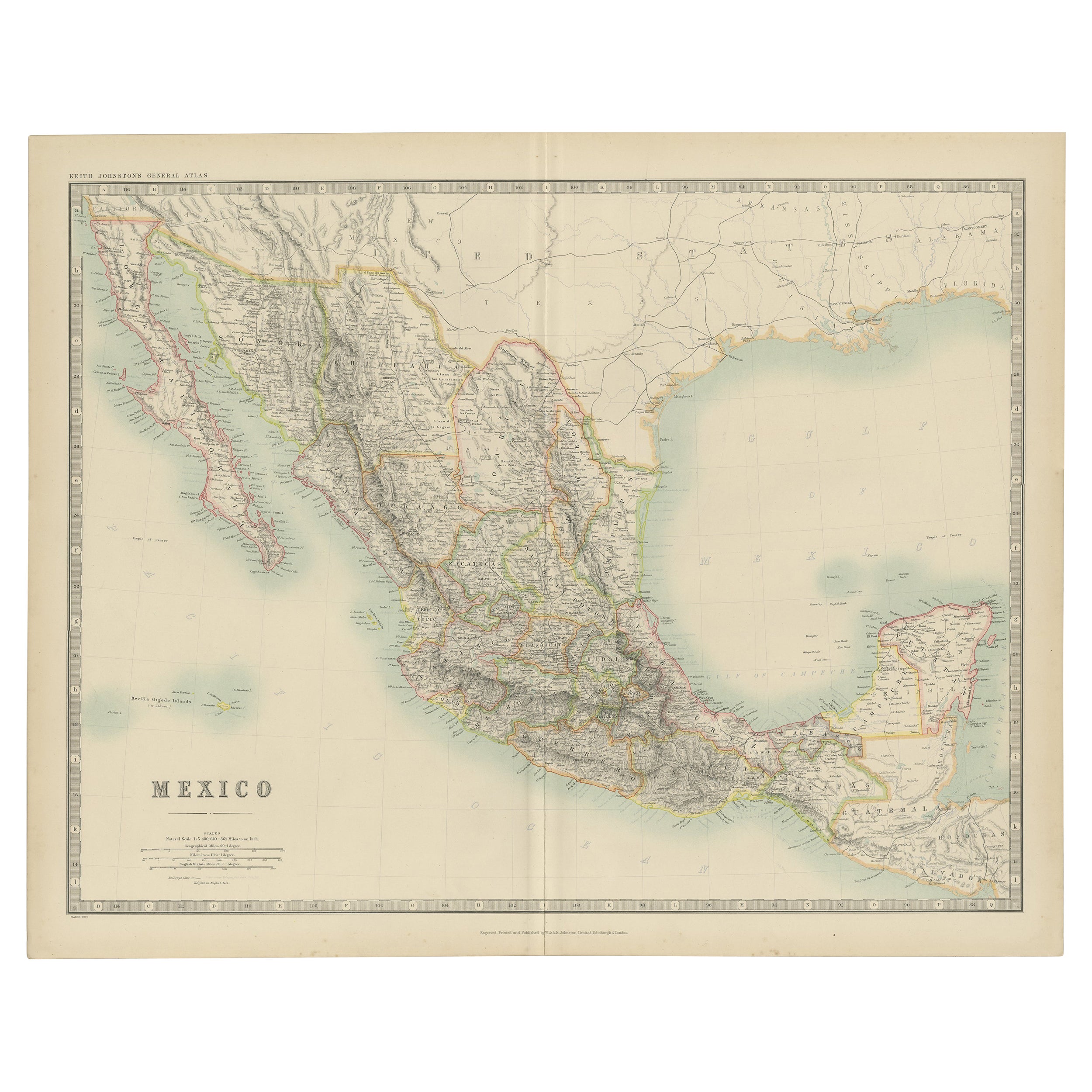
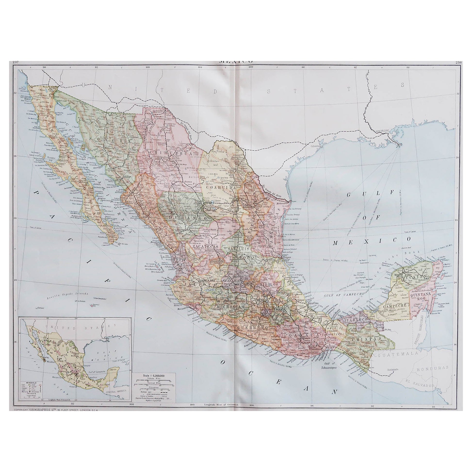
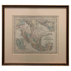
1882 Antique Map of Mexico Highlighting Geographical and Political Boundaries
$299.46
£223.93
€250
CA$412.58
A$449.98
CHF 238.37
MX$5,394.58
NOK 3,035.74
SEK 2,775.96
DKK 1,905.10
About the Item
This 1882 map of Mexico, published by Blackie and Son as part of the 'Comprehensive Atlas and Geography of the World,' provides a highly detailed representation of the country's geography and political divisions during the late 19th century. The map showcases Mexico's states and territories, each outlined with subtle color shading to distinguish them clearly. It includes major cities, towns, and settlements, offering a snapshot of the country's urban and rural landscape at the time.
Topographical details are meticulously engraved, highlighting mountain ranges such as the Sierra Madre, expansive plains, and significant rivers like the Rio Grande. The map also captures the coastal features along the Pacific Ocean, the Gulf of Mexico, and the Yucatan Peninsula, emphasizing Mexico's strategic maritime geography. The detailed depiction of Baja California and the neighboring regions, including portions of the southern United States, reflects the broader geographical context of the region.
The craftsmanship of the engraving and the soft pastel coloring make this map a valuable historical artifact and an attractive piece for display. Its precision and artistry are a testament to the high-quality cartography produced by Blackie and Son.
Condition report: The map is in good condition with minimal edge wear. Slight toning and occasional spotting are present, consistent with its age. The engraving remains sharp, and the colors are well-preserved.
Framing tips: Choose a classic wooden frame in walnut or mahogany to enhance the map's vintage appeal. Use a double mat with a cream or off-white inner mat and a soft green or beige outer mat to complement the map’s tones. Opt for UV-protective glass to safeguard against light damage and preserve the map’s condition.
- Dimensions:Height: 14.97 in (38 cm)Width: 22.45 in (57 cm)Depth: 0 in (0.02 mm)
- Materials and Techniques:
- Period:
- Date of Manufacture:1882
- Condition:Condition report: The map is in good condition with minimal edge wear. Slight toning and occasional spotting are present, consistent with its age. The engraving remains sharp, and the colors are well-preserved. Fold line in middle, as issued.
- Seller Location:Langweer, NL
- Reference Number:Seller: BG-13601-2-661stDibs: LU3054343552752
About the Seller
5.0
Recognized Seller
These prestigious sellers are industry leaders and represent the highest echelon for item quality and design.
Platinum Seller
Premium sellers with a 4.7+ rating and 24-hour response times
Established in 2009
1stDibs seller since 2017
2,788 sales on 1stDibs
Typical response time: <1 hour
- ShippingRetrieving quote...Shipping from: Langweer, Netherlands
- Return Policy
More From This Seller
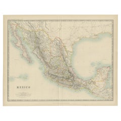
View AllAntique Map of Mexico by Johnston,
1909
Located in Langweer, NL
Antique map titled 'Mexico'. Original antique map of Mexico. This map originates from the ‘Royal Atlas of Modern Geography’. Published by W. & A....
Category
Early 20th Century Maps
Materials
Paper
$239 Sale Price
20% Off
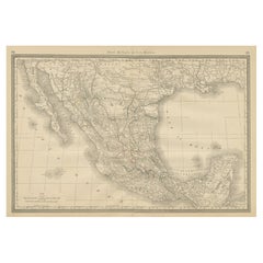
Antique Map of Mexico and Central America by Johnson
1872
Located in Langweer, NL
Antique map titled 'Johnson's Mexico (..)'. Two maps one one sheet showing Mexico and Central America, with inset maps of Tehuantepec and Panama. This map originates from 'Johnson's ...
Category
Antique Late 19th Century Maps
Materials
Paper

$287 Sale Price
20% Off
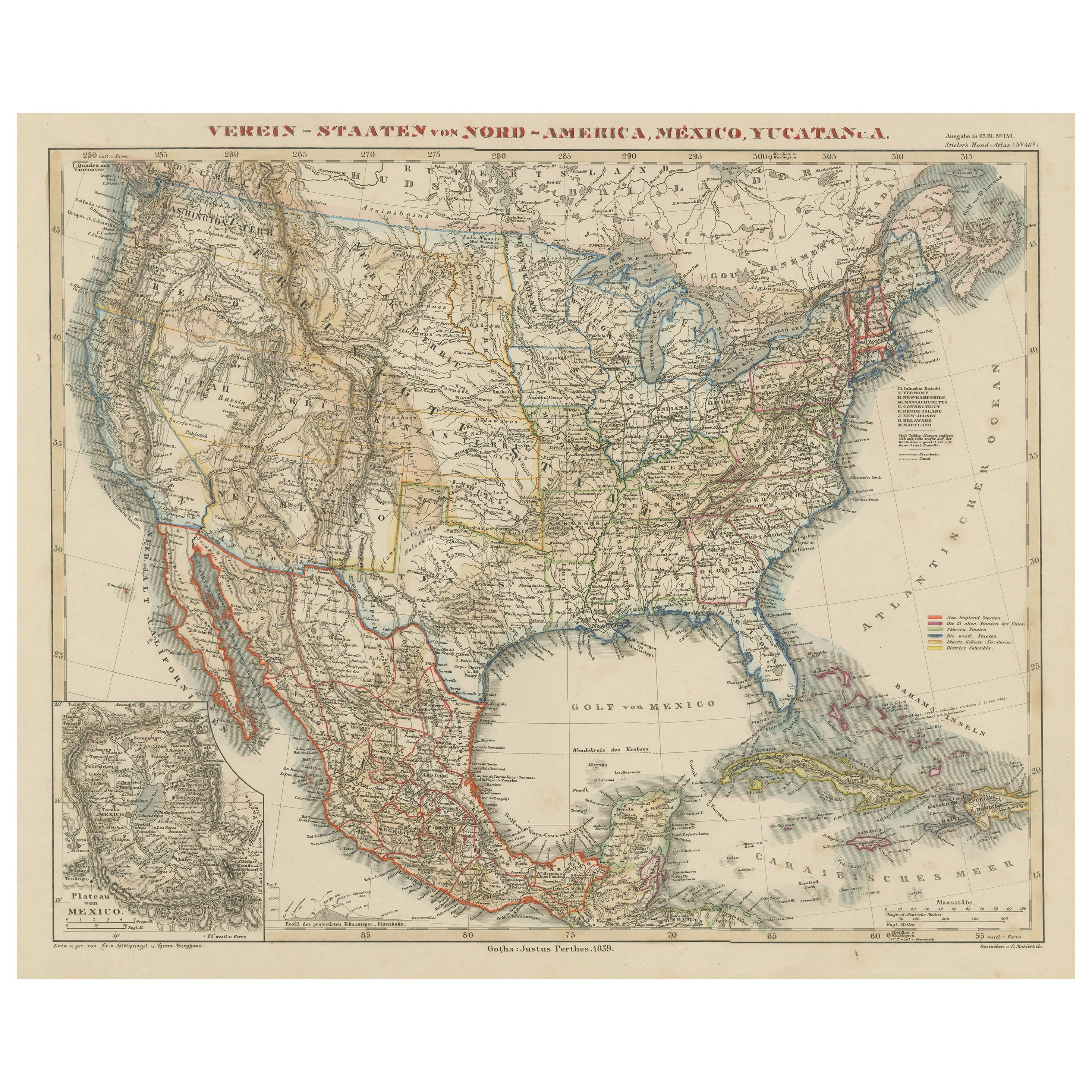
Antique Map of the United States with inset map of the region of Mexico City
Located in Langweer, NL
Antique map titled 'Verein-Staaten von Nord-America, Mexico, Yucatan u.a.'. Very detailed map of the United States of America showing the Caribbean. With an inset map of the surround...
Category
Antique Mid-19th Century Maps
Materials
Paper

$824 Sale Price
20% Off
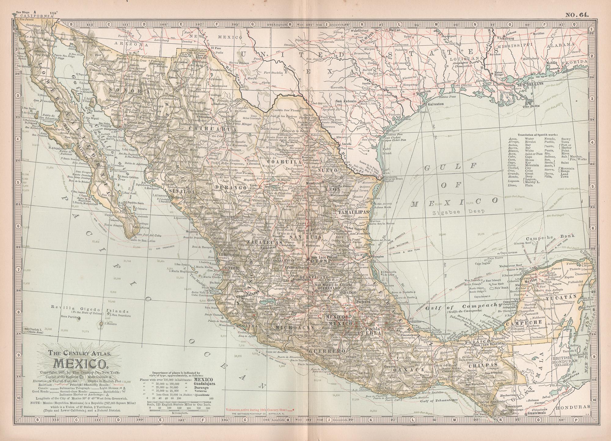
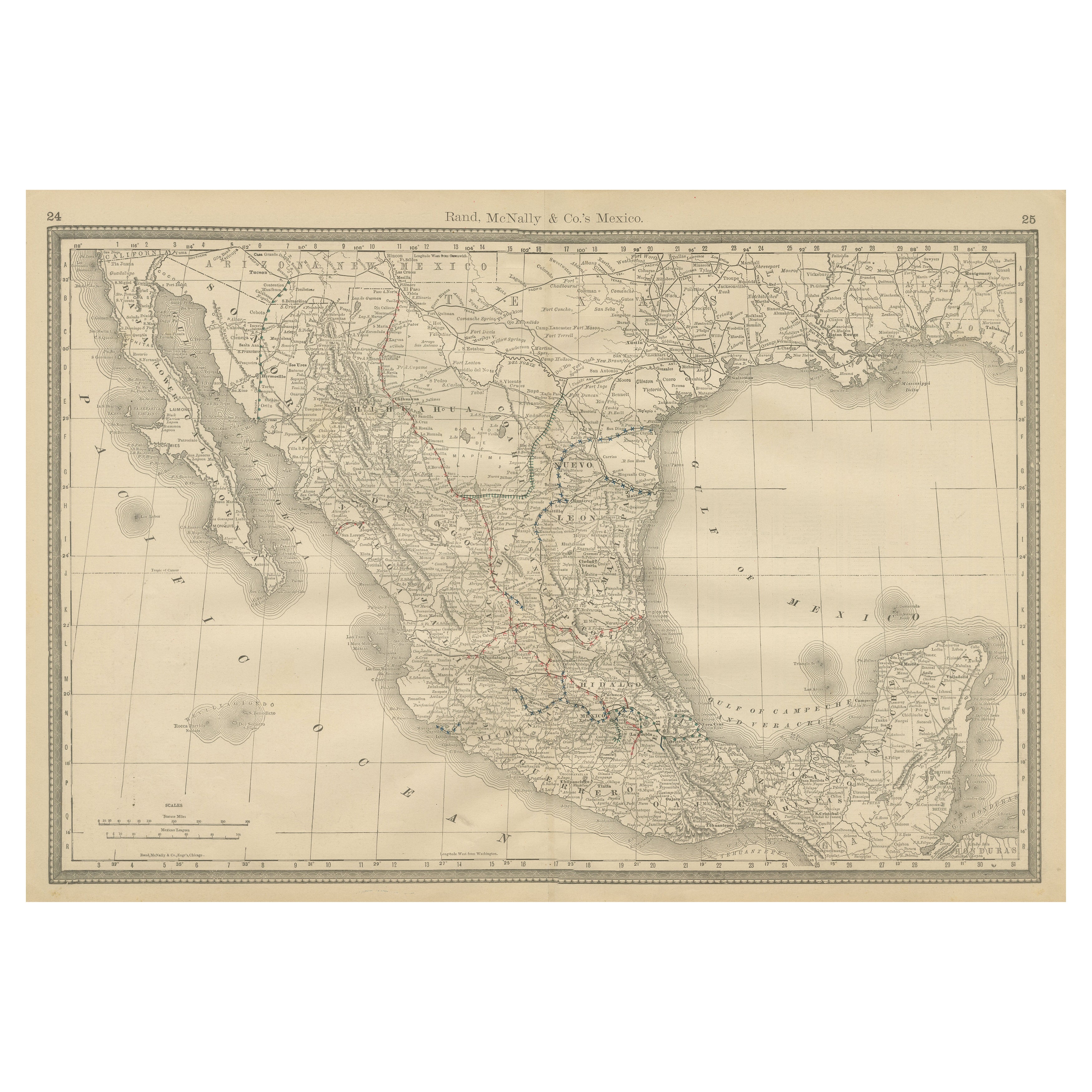
Mexico Antique Railroad Map c.1888 – Cities, States
Land of the Aztecs
Located in Langweer, NL
Antique Map of Mexico – Rand McNally, circa 1888
This antique map titled *“Rand, McNally & Co.’s Mexico”* was published around 1888 and depicts Mexico in the late 19th century, a pe...
Category
Antique Late 19th Century American Maps
Materials
Paper
Johnson’s Mexico Map with Tehuantepec Inset, USA c.1864 – Hand-Colored
Located in Langweer, NL
Johnson’s Mexico Map with Tehuantepec Inset, USA c.1864 – Hand-Colored
This is a finely engraved and hand-colored map titled Johnson’s Mexico, published by Johnson and Ward in New Y...
Category
Antique Mid-19th Century American Maps
Materials
Paper
Antique Map of Mexico, Central America and West Indies by A
C. Black, 1870
Located in Langweer, NL
Antique map titled 'Mexico, Central America and West Indies'. Original antique map of Mexico, Central America and West Indies with inset map of Panama railway. This map originates fr...
Category
Antique Late 19th Century Maps
Materials
Paper

$167 Sale Price
20% Off
You May Also Like
Mexico. Century Atlas antique vintage map
Located in Melbourne, Victoria
'The Century Atlas. Mexico.'
Original antique map, 1903.
Central fold as issued. Map name and number printed on the reverse corners.
Sheet 29.5cm by 40cm.
Category
Early 20th Century Victorian More Prints
Materials
Lithograph

Large Original Vintage Map of Mexico, circa 1920
Located in St Annes, Lancashire
Great map of Mexico
Original color.
Good condition
Published by Alexander Gross
Unframed.
Category
Vintage 1920s English Edwardian Maps
Materials
Paper

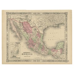
1847 Antique Map of Mexico, Texas and California by Samuel Augustus Mitchell
By Samuel Augustus Mitchell 1
Located in Colorado Springs, CO
Presented is the second edition of Samuel Augustus Mitchell's Map of Mexico, Including Yucatan & Upper California, an important map showing the progress of the Mexican-American War. ...
Category
Antique 1840s American Maps
Materials
Paper

Central America. Century Atlas antique vintage map
Located in Melbourne, Victoria
'The Century Atlas. Central America.'
Original antique map, 1903.
Inset maps of 'The Country around Lake Nicaragua'.
Central fold as issued. Map name and number printed on the reve...
Category
Early 20th Century Victorian More Prints
Materials
Lithograph

Large 1856 Mexico
Guatemala Framed Map by Charles Desilver
Located in Stamford, CT
Large 1856 Mexico & Guatemala Framed map. Published by Charles Desilver, Philadelphia, Pennsylvania.
As found high end custom framing with black giltwood frame, custom matting and UV...
Category
Antique 1850s American American Classical Maps
Materials
Glass, Wood, Paper
1834 Mexico
Guatemala Framed Map by H.S. Tanner
Located in Stamford, CT
1834 Mexico & Guatemala map of published by H.S. Tanner, Philadelphia, Pennsylvania. Engraved by J. Knight.
As found high end custom framing with carved wood frame, custom matting a...
Category
Antique 1830s American American Classical Maps
Materials
Glass, Wood, Paper

More Ways To Browse
Green Persian Rug
50 X 50 Coffee Table
Spanish Baroque Furniture
Couch Console
Vintage Burn
Sterling Silver Flatware Service For 12
Antique Dining Tables With Leaves
Decorative Wall Panels
Frank Lloyd Wright For Cassina
Natural Curved
Spanish Wool Rug
Leather Pouf And Ottomans
Low Side Tables
Set Of Four Italian Dining Chairs
Silk Runner Carpet
18th Century Blue And White Porcelain
3x5 Rugs
Italian Lacquer Dining Room Sets