Items Similar to 1885 Shinsen Tokyo Zenzu: Rare Meiji-Era Map of Tokyo by Sakai Kinzaburo
Want more images or videos?
Request additional images or videos from the seller
1 of 7
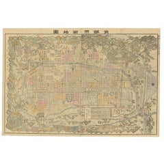
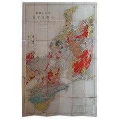
1885 Shinsen Tokyo Zenzu: Rare Meiji-Era Map of Tokyo by Sakai Kinzaburo
$1,727.94
£1,280.51
€1,440
CA$2,361.59
A$2,570.78
CHF 1,364.57
MX$30,932.01
NOK 17,290.97
SEK 15,843.41
DKK 10,968.91
About the Item
Title: Detailed Edo Period Map of Tokyo (Edo), Featuring Neighborhoods and Landmarks
This beautifully detailed patina rich map, titled "Shinsen Tokyo Zenzu" (Newly Selected Complete Map of Tokyo), was created by Sakai Kinzaburo and published in 1885 during the late Meiji period. The map provides a comprehensive view of Tokyo’s urban layout, showcasing the city’s neighborhoods, waterways, and landmarks as it transitioned from Edo to a modern metropolis.
The map is adorned with woodblock-style illustrations of Tokyo’s iconic sites along its borders, including shrines, temples, and famous views. It also includes a detailed legend, address charts by ward, and population data, making it both a functional document and a visual masterpiece. The orientation of the map, with north to the right, is typical of Japanese cartography from this period, offering a unique perspective of the city.
This map serves as a remarkable historical document, reflecting the rapid modernization of Tokyo during the late 19th century. Its artistic and practical details capture a pivotal moment in Japan’s history, blending traditional and modern elements. Collectors and history enthusiasts will appreciate its cultural and cartographic significance.
The map's clear delineation of districts, roads, and waterways illustrates the complexity and organization of Edo, one of the world's largest cities at the time. The inclusion of a compass rose and inset charts suggests the map was not only decorative but also functional, possibly intended for administrative or navigational purposes. The vivid use of color enhances the visual appeal, with blue waterways contrasting beautifully against the ochre-toned land areas.
This map serves as both a historical document and a work of art, reflecting Edo’s bustling urban culture before its transformation into modern Tokyo. The surrounding vignettes offer glimpses into the city's architectural and cultural highlights, making this piece a fascinating window into Japan’s past.
Condition: Fair. The map shows age-appropriate wear with toning and mild foxing. There is evidence of previous folds but flattened when it was mounted on board for support. The colors remain vivid and this patina rich map is overall in fair condition for its age.
Tips for Matting and Framing: To preserve the map’s intricate details, use a wide archival mat in off-white or cream. A black or dark wood frame with minimal decoration will keep the focus on the map itself. Consider UV-protective glass to shield the delicate pigments from light exposure. For added interest, display it alongside a small plaque or text explaining its historical significance.
- Dimensions:Height: 19.69 in (50 cm)Width: 27.56 in (70 cm)Depth: 0.12 in (3 mm)
- Materials and Techniques:
- Period:
- Date of Manufacture:1885
- Condition:Repaired: flattened and mounted on board. Condition: Fair. Age-appropriate wear with toning and mild foxing. There is evidence of previous folds but flattened when it was mounted on board for support. The colors remain vivid and this decorative patina rich map is overall in fair condition.
- Seller Location:Langweer, NL
- Reference Number:Seller: BGCP-0151stDibs: LU3054343469262
About the Seller
5.0
Recognized Seller
These prestigious sellers are industry leaders and represent the highest echelon for item quality and design.
Platinum Seller
Premium sellers with a 4.7+ rating and 24-hour response times
Established in 2009
1stDibs seller since 2017
2,816 sales on 1stDibs
Typical response time: 1 hour
- ShippingRetrieving quote...Shipping from: Langweer, Netherlands
- Return Policy
More From This Seller
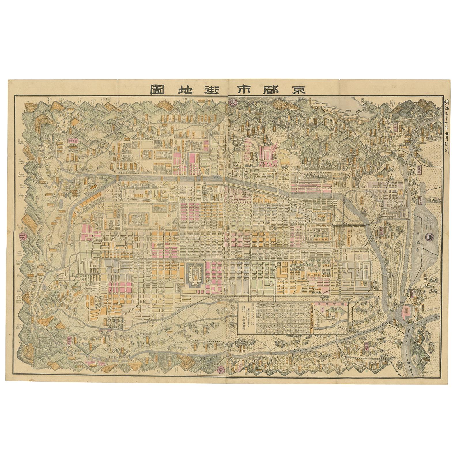
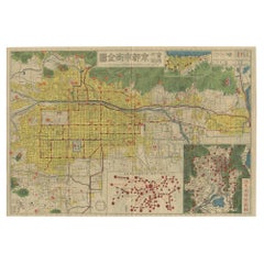
View AllHistorical Large Map of Kyoto, Japan (1905) - Published by Kobayashi
Located in Langweer, NL
Old map of Kyoto, Japan. Published by Kobayashi, 1905.
This is an old map of Kyoto, Japan, published by Kobayashi in 1905. The map showcases a detailed layout of Kyoto during the ea...
Category
Early 20th Century Maps
Materials
Paper
$1,679 Sale Price
20% Off
Free Shipping
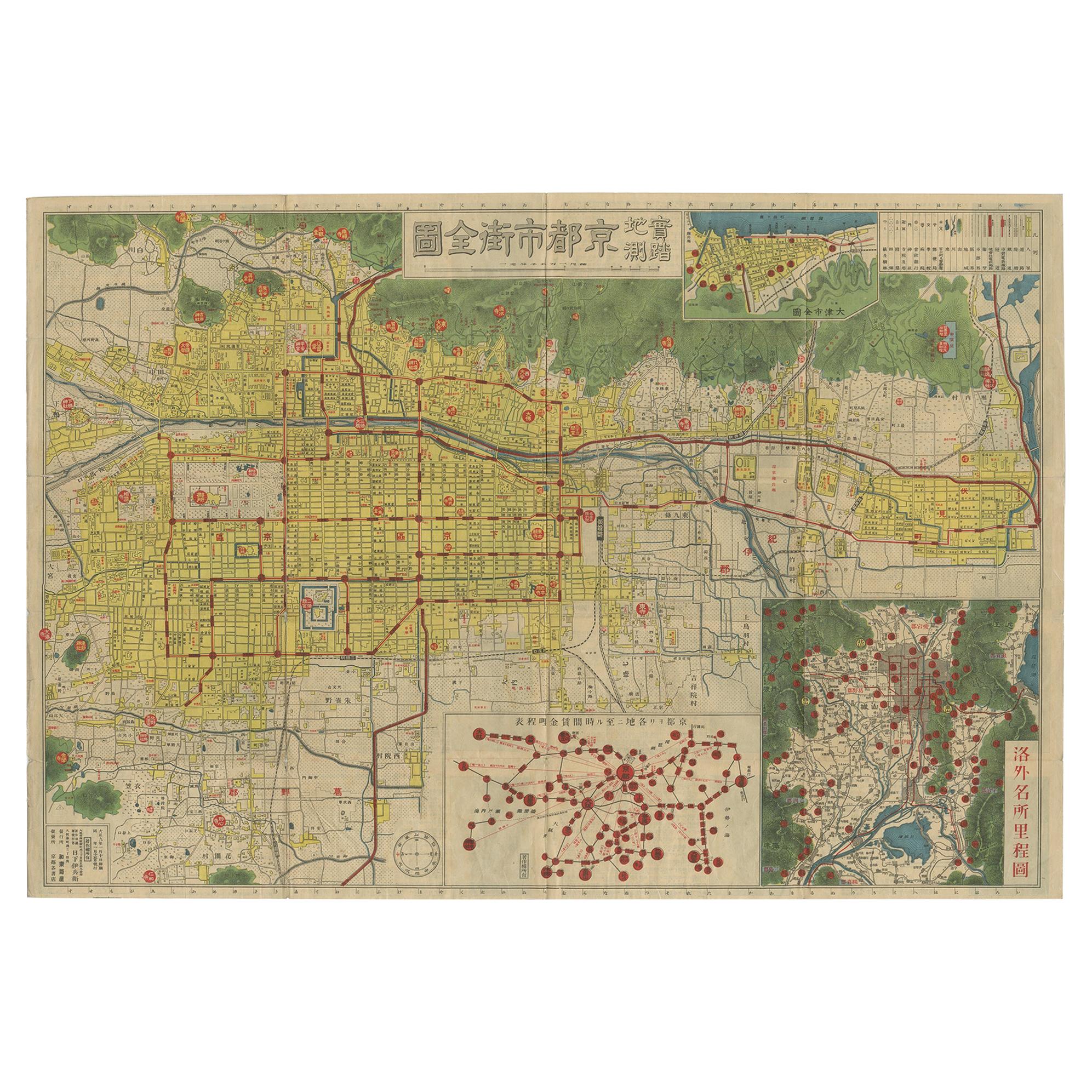
Antique Folding Map of Kyoto, Japan, 1920
Located in Langweer, NL
Antique folding map of Kyoto, Japan. On the verso of this map photos of buildings, other structures and informative text can be found.
Category
20th Century Maps
Materials
Paper
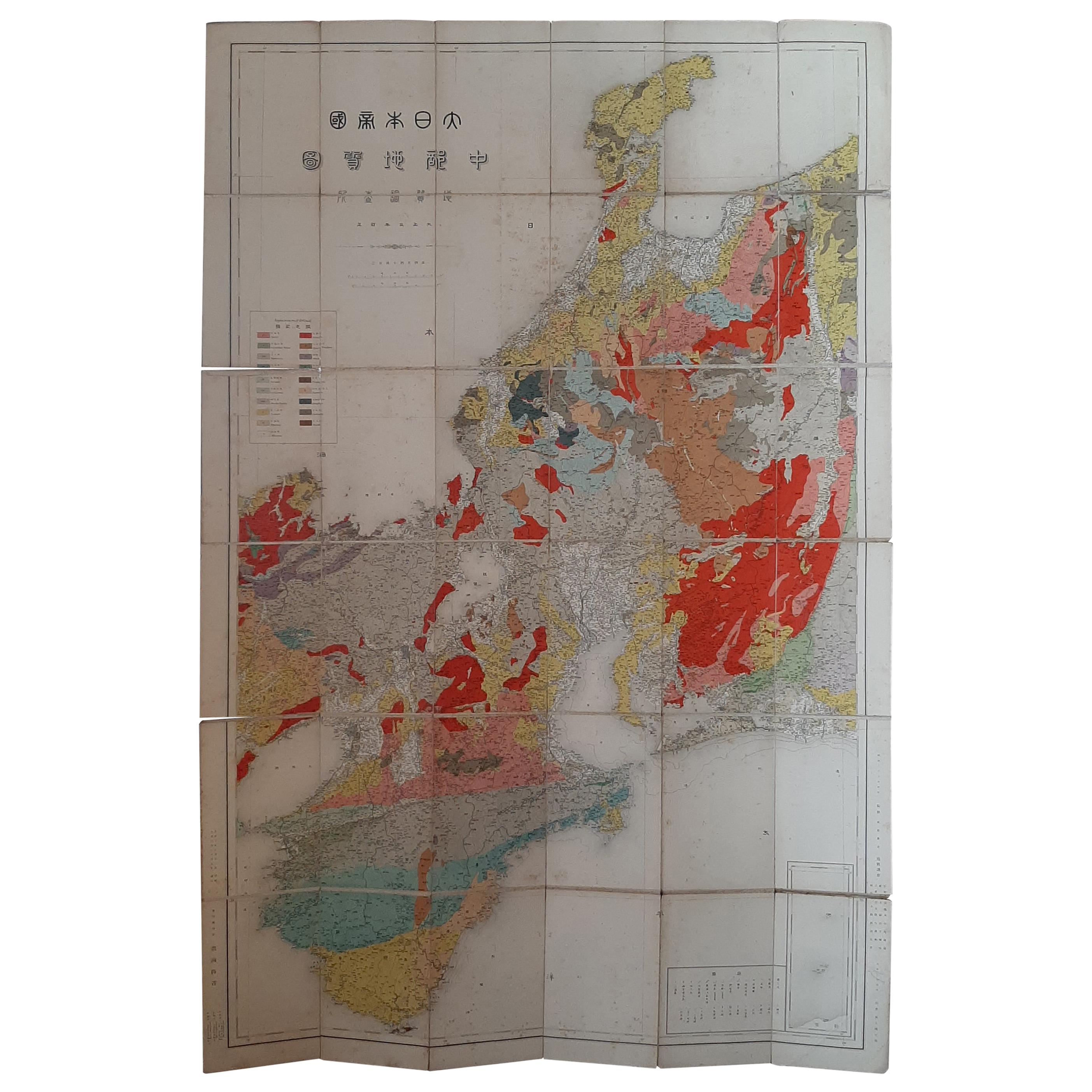
Antique Map of the Region of Wakayama, Nara and Osaka
Japan
, ca.1880
Located in Langweer, NL
Geological folding map of the area with Wakayama, Nara, Osaka, Mie, and Shiga in Japan, circa 1880:
This map is a geological folding map, which means it was designed to be portable ...
Category
Antique Late 19th Century Maps
Materials
Linen, Paper
$911 Sale Price
20% Off
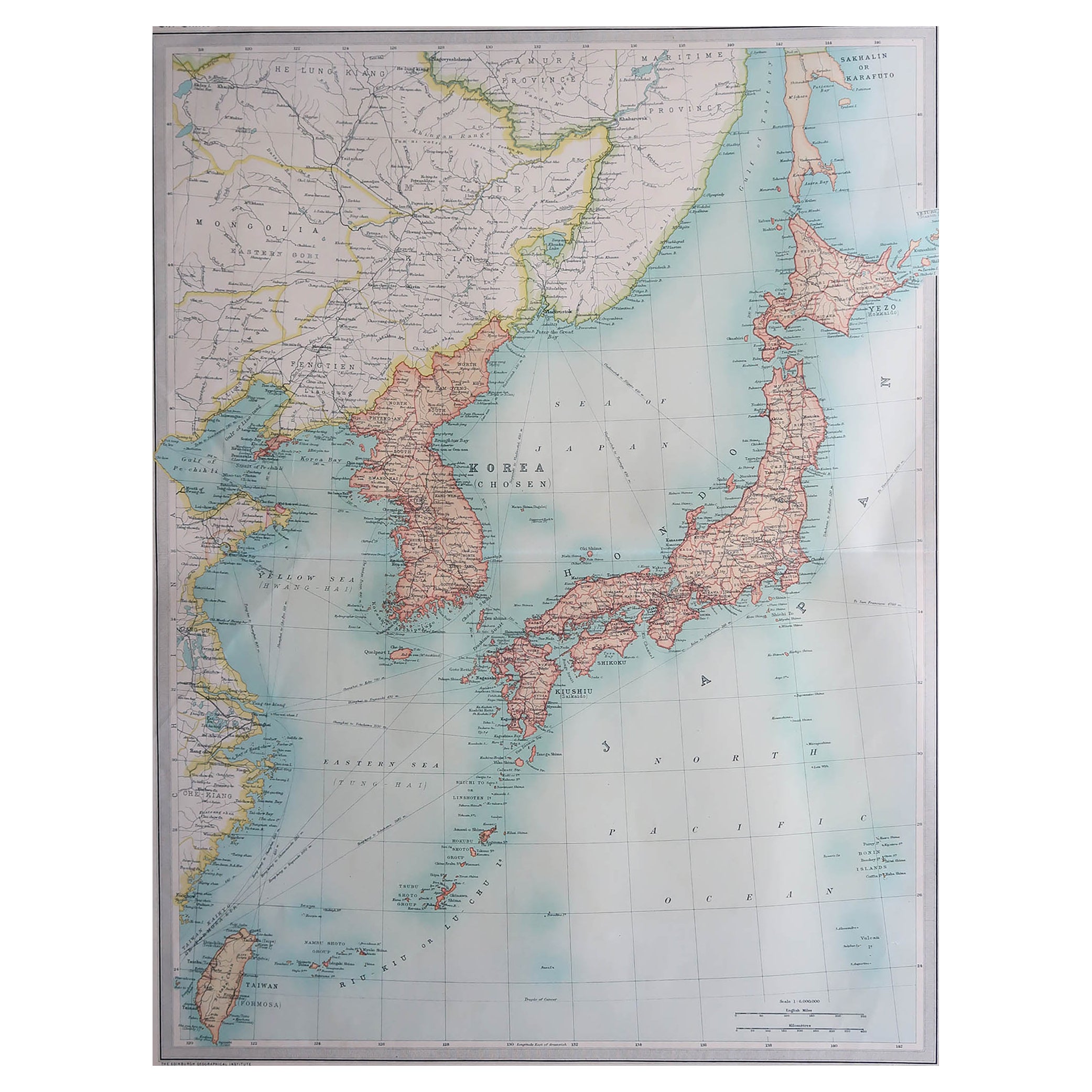
Antique Map of the Region of Tokyo and Nagasaki in Japan, 1922
Located in Langweer, NL
Antique map of Japan titled 'Japan - Environs of Tokio & Nagasaki'. Old map of Japan, includes inset maps of Tokyo, Nagasaki and surroundings. This map or...
Category
20th Century English Maps
Materials
Paper

$120 Sale Price
44% Off
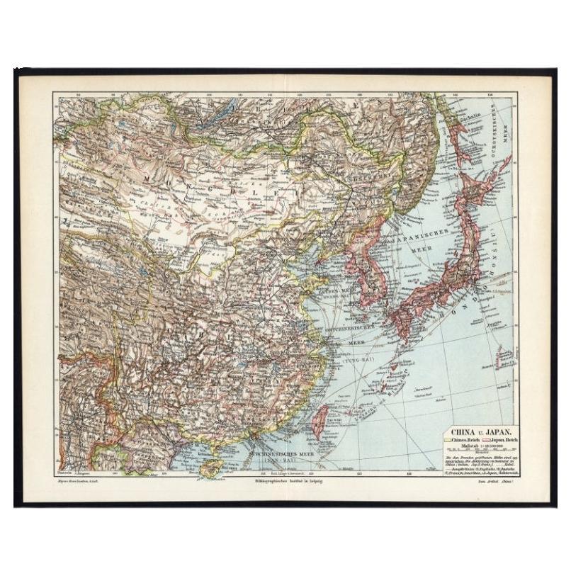
German Antique Map of China And Japan by Meyer, 1902
Located in Langweer, NL
Antique map titled 'China und Japan.' (Map of China and Japan). This attractive original old antique print / plate / map originates from the 6th edition of a famous German encycloped...
Category
20th Century Maps
Materials
Paper
$76 Sale Price
20% Off
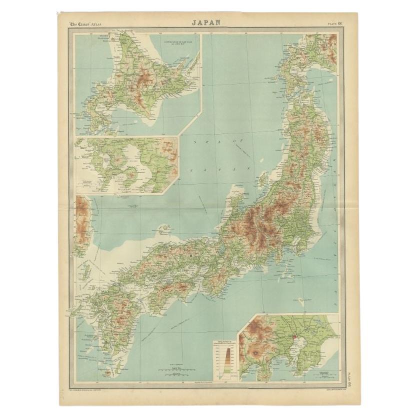
Antique Map of China and Japan by Meyer, 1895
Located in Langweer, NL
Antique map titled 'China und Japan'. Map of China, Mongolia, Taiwan and Japan. With an inset map of Jiaozhou Wan near Qingdao, and another of the region around Hongkong, including Kanton and Macau, with small plans of Hong Kong and Kanton. This map originates from a 1885-1907 edition of a famous German encyclopedia titled 'Meyers grosses Konversations-Lexikon', published in Leipzig and Vienna. Meyers Konversations-Lexikon was a major German encyclopedia that existed in various editions from 1839 until 1984, when it merged with the Brockhaus encyclopedia. Several of the plates were also used in Dutch Encyclopedia's like Winkler Prins...
Category
Antique 19th Century Maps
Materials
Paper
$81 Sale Price
20% Off
You May Also Like
Large Original Vintage Map of Japan, circa 1920
Located in St Annes, Lancashire
Great map of Japan
Unframed
Original color
By John Bartholomew and Co. Edinburgh Geographical Institute
Published, circa 1920
Free shipping.
Category
Vintage 1920s British Maps
Materials
Paper

Large Original Vintage Map of Japan, circa 1920
Located in St Annes, Lancashire
Great map of Japan
Original color. Good condition
Published by Alexander Gross
Unframed.
Category
Vintage 1920s English Maps
Materials
Paper

China and Japan, English antique map by Alexander Keith Johnston, 1901
Located in Melbourne, Victoria
'China and Japan', antique lithographic map by Keith Johnston.
Central vertical fold as issued.
495mm by 625mm (sheet)
Alexander Keith Johnston FRS...
Category
Early 20th Century Victorian More Prints
Materials
Lithograph

Super Rare Antique French Map of Chine and the Chinese Empire, 1780
Located in Amsterdam, Noord Holland
Super Rare Antique French Map of Chine and the Chinese Empire, 1780
Very nice map of Asia. 1780 Made by Bonne.
Additional information:
Type: Map
...
Category
Antique 18th Century European Maps
Materials
Paper

$438 Sale Price
49% Off
Large Original Vintage Map of China, circa 1920
Located in St Annes, Lancashire
Great map of China.
Original color. Good condition.
Published by Alexander Gross
Unframed.
Category
Vintage 1920s English Edwardian Maps
Materials
Paper

Framed Early 19th Century Drawn and Engraved Map of China
By John Knighton Thomson
Located in San Francisco, CA
Hand drawn and tinted engraved map of China dated 1815
Created for Thomson's New General Atlas
Edinburgh
Beautifully framed with a linen covered mat.
Category
Antique Early 19th Century European Prints
Materials
Paper
More Ways To Browse
Historical Documents
Green Persian Rug
50 X 50 Coffee Table
Spanish Baroque Furniture
Couch Console
Vintage Burn
Sterling Silver Flatware Service For 12
Antique Dining Tables With Leaves
Decorative Wall Panels
Frank Lloyd Wright For Cassina
Natural Curved
Spanish Wool Rug
Leather Pouf And Ottomans
Low Side Tables
Set Of Four Italian Dining Chairs
Silk Runner Carpet
18th Century Blue And White Porcelain
3x5 Rugs