Items Similar to 18th-Century Map of Holstein and Surrounding Duchies by Homann Heirs


Want more images or videos?
Request additional images or videos from the seller
1 of 11
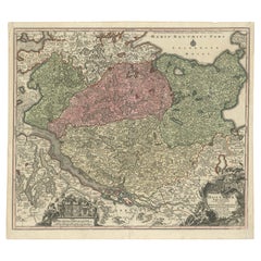
18th-Century Map of Holstein and Surrounding Duchies by Homann Heirs
$682.09
£509.45
€570
CA$939.70
A$1,024.11
CHF 542.31
MX$12,300.59
NOK 6,865.74
SEK 6,312.38
DKK 4,342.41
About the Item
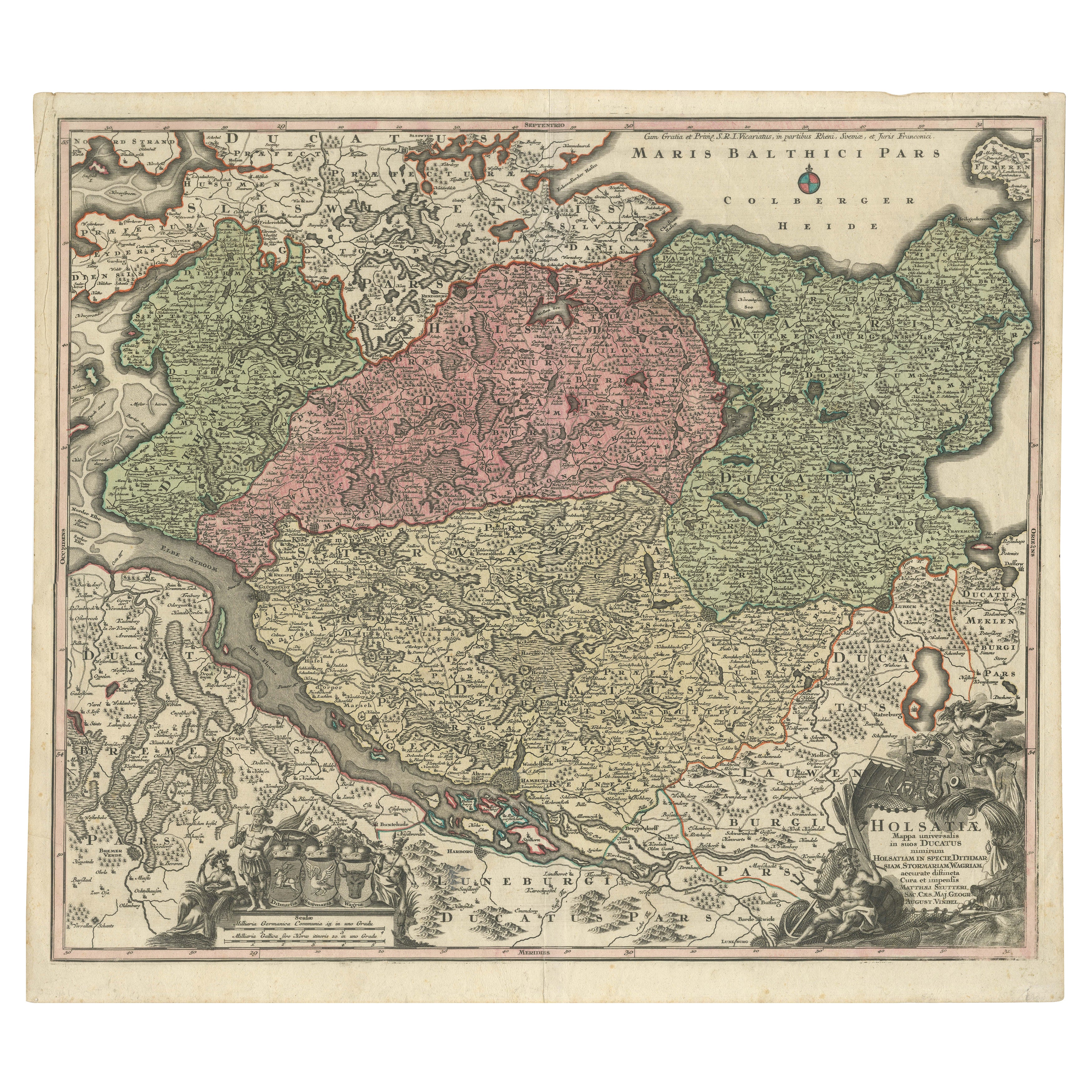
18th-Century Map of Holstein and Surrounding Duchies by Homann Heirs
Description: This finely detailed 18th-century map by the Homann Heirs (Homannische Erben) illustrates the Duchy of Holstein along with the surrounding regions of Schleswig, Lauenburg, and Mecklenburg in northern Germany.
The map captures the intricate political divisions of the time, with hand-colored borders distinguishing different territories under Danish and German control. Holstein, a significant historical region contested between Denmark and the Holy Roman Empire, played a crucial role in North European geopolitics, particularly in the lead-up to the Schleswig Wars.
The map features coastal details along the Baltic Sea (Maris Baltici Pars), major rivers, and important cities such as Kiel, Lübeck, Hamburg, and Altona. The elaborate cartouche, adorned with allegorical figures and military motifs, emphasizes the region’s historical and strategic importance.
Condition: The map is in good condition, with a strong impression and vivid hand-coloring. A visible centerfold, as expected from atlas maps, shows minor toning. Some light creases and marginal imperfections are present but do not detract from the map’s overall aesthetic and historical value.
framing tips: Use an archival mat with a neutral color to enhance the map’s fine engraving. A dark wood or antique-style frame pairs well with the map’s period character. UV-resistant glass is recommended to protect against light exposure, and museum-grade mounting ensures long-term preservation. Double matting with an inner gold accent can further highlight the elegance of this historical cartographic work.
- Dimensions:Height: 19.89 in (50.5 cm)Width: 23.86 in (60.6 cm)Depth: 0.01 in (0.2 mm)
- Materials and Techniques:Paper,Engraved
- Period:1750-1759
- Date of Manufacture:circa 1750
- Condition:Condition: The map is in good condition, with a strong impression and vivid hand-coloring. A visible centerfold, as expected from atlas maps, shows minor toning. Some light creases and marginal imperfections.
- Seller Location:Langweer, NL
- Reference Number:Seller: BG-13672-31stDibs: LU3054343868472
About the Seller
5.0
Recognized Seller
These prestigious sellers are industry leaders and represent the highest echelon for item quality and design.
Platinum Seller
Premium sellers with a 4.7+ rating and 24-hour response times
Established in 2009
1stDibs seller since 2017
2,786 sales on 1stDibs
Typical response time: <1 hour
- ShippingRetrieving quote...Shipping from: Langweer, Netherlands
- Return Policy
More From This Seller
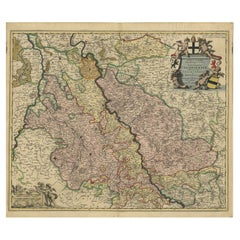
View AllHistorical Map of Holstein - Copperplate Engraving by Matthias Seutter, ca. 1730
Located in Langweer, NL
Historical Map of Holstein - Copperplate Engraving by Matthias Seutter, ca. 1730
This impressive historical map, titled Holsatiae. Mappa universalis in suos ducatus nimirum Holsat...
Category
Antique 1730s Maps
Materials
Paper
Antique Map of Northern Germany by M. Seutter, circa 1730
By Matthew Seutter
Located in Langweer, NL
Antique map titled 'Saxoniae Inferioris Circulus'. Old map of the northern part of Germany by M. Seutter. Covering the area of Lower Saxony, Mecklenburg-Vorpommern and Schleswig-Hols...
Category
Antique Mid-18th Century Maps
Materials
Paper

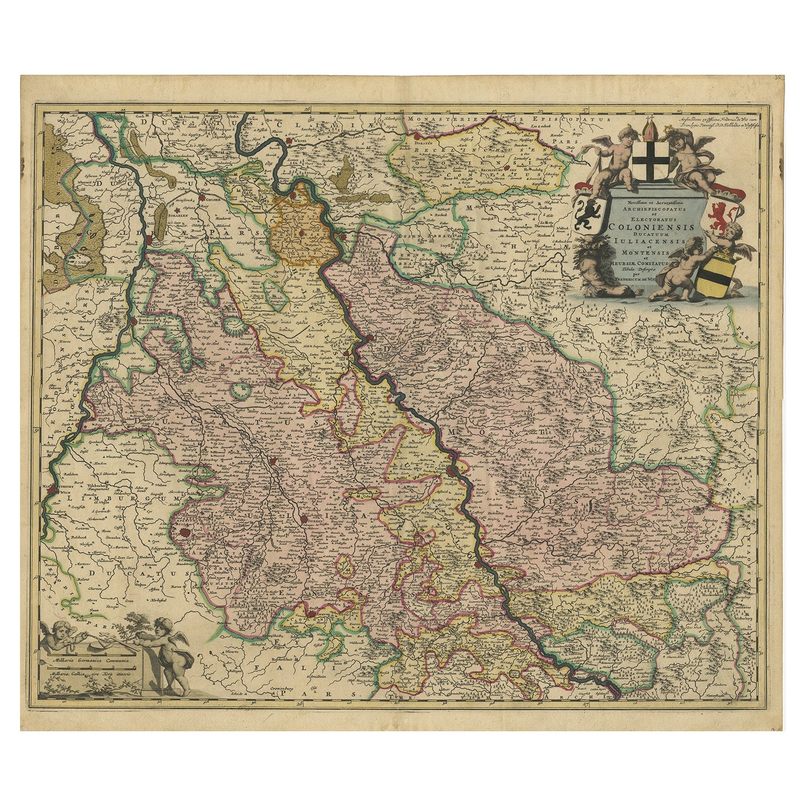
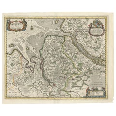
Rhine Splendor: Antique Map of the Lower Rhine Region, circa 1680
Located in Langweer, NL
The antique map titled 'Novissima et Accuratissima Archiepiscopatus et Electoratus Coloniensis Ducatuum Iuliancensis et Montensis et Meursiae Comitatus' is a handsome and detailed ma...
Category
Antique 1680s Maps
Materials
Paper
$919 Sale Price
20% Off
Free Shipping
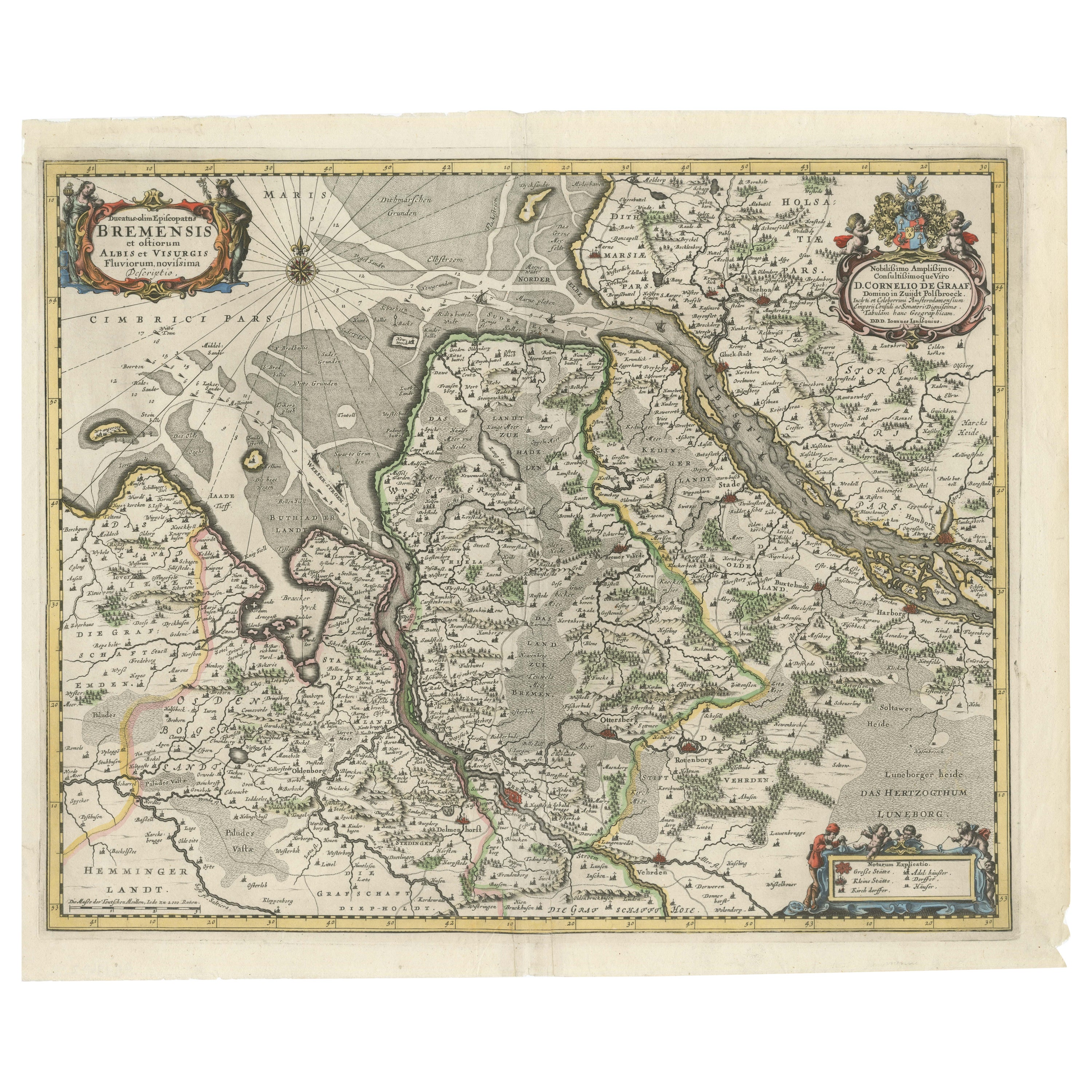
Johannes Janssonius
17th-Century Map of the Duchy of Bremen in Germany
Located in Langweer, NL
The map titled "Ducatus olim Episcopatus Bremensis et ostiorum Albis et Visurgis Fluviorum novissima Descriptio" by Johannes Janssonius provides a rich historical and geographical il...
Category
Antique 1650s Maps
Materials
Paper
$737 Sale Price
20% Off
Decorative Antique Map of Austria – Frederick de Wit, Amsterdam c.1690
Located in Langweer, NL
Antique Map of Austria – “Circuli Austriaci pars Septentrionalis” by F. de Wit, c.1670
This finely engraved map, titled “Circuli Austriaci pars Septent...
Category
Antique Late 17th Century Dutch Maps
Materials
Paper

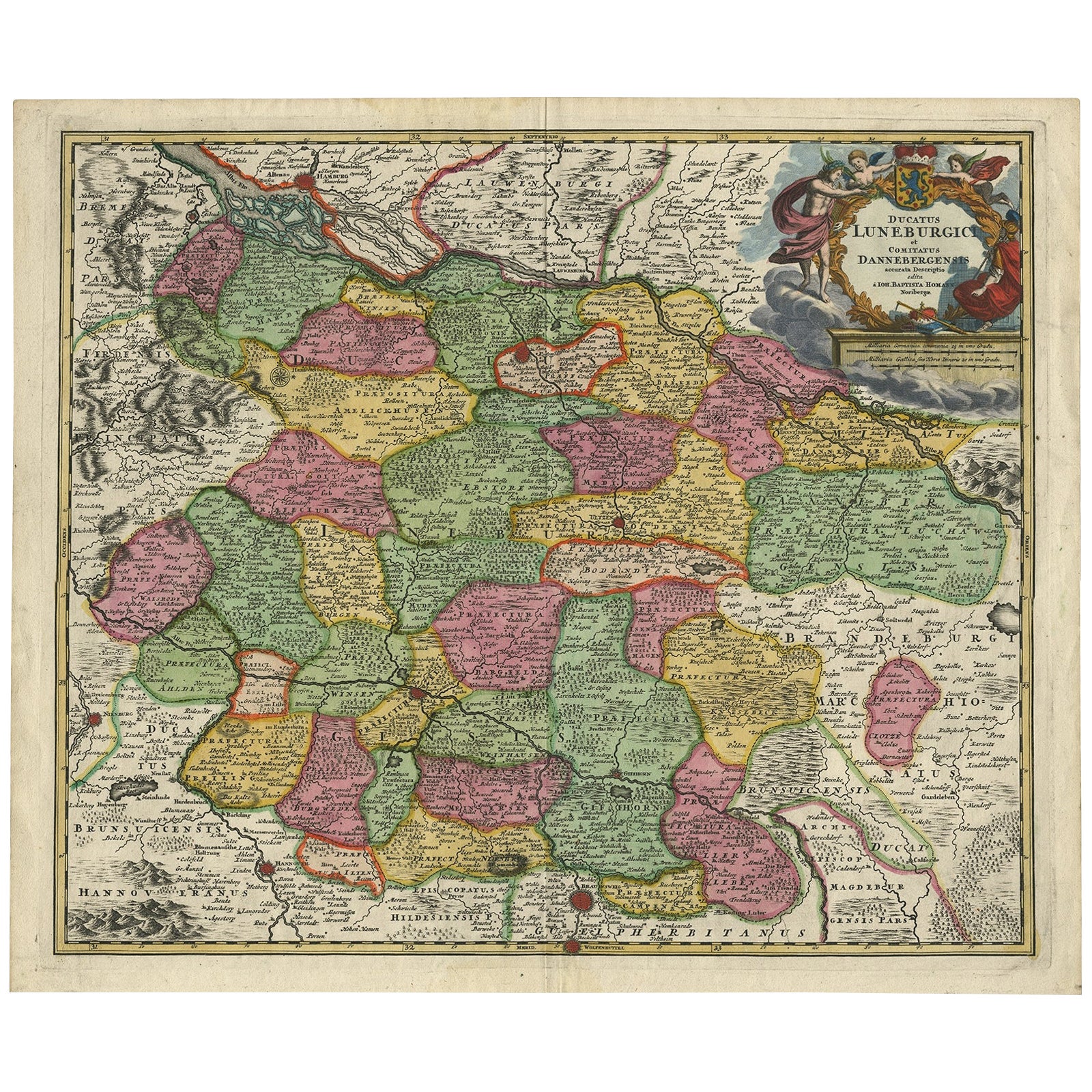
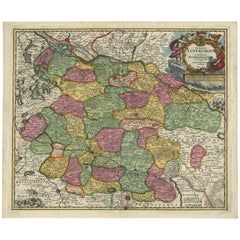
Regional Map of Germany, inc Hamburg, Luneberg, Hannover, Braunsweig etc, c.1720
Located in Langweer, NL
Antique map titled 'Ducatus Luneburgici et Comitatus Dannebergensis accurata Descriptio.'
This detailed regional map includes Hamburg, Luneberg, and as far south as Hannover, Bra...
Category
Antique 1720s Maps
Materials
Paper
You May Also Like
17th Century Nicolas Visscher Map of Southeastern Europe
Located in Hamilton, Ontario
A beautiful, highly detailed map of southeastern Europe by Nicolas Visscher. Includes regions of Northern Italy (showing the cities Bologna, Padua, and Venice), Bohemia, Austria (sho...
Category
Antique 17th Century Dutch Maps
Materials
Paper

$1,350 Sale Price
38% Off
1752 Vaugoundy Map of Flanders : Belgium, France, and the Netherlands, Ric.a002
Located in Norton, MA
Large Vaugoundy Map of Flanders:
Belgium, France, and the Netherlands
Colored -1752
Ric.a002
Description: This is a 1752 Didier Robert de Vaugondy map of Flanders. The map de...
Category
Antique 17th Century Unknown Maps
Materials
Paper

Antique Colored Belgium Map Flandria Gallica Flanders Henricus Hondius
Located in Dayton, OH
Antique hand colored map of Flanders, Belgium, engraved by Henricus Hondius.
Sans frame - 21.25” x 18”.
Category
Antique 19th Century Renaissance Maps
Materials
Paper

$245 Sale Price
30% Off
1643 Willem&Joan Blaeu Map NW Flanders "Flandriae Teutonicae Pars Prientalior
Located in Norton, MA
1643 Willem and Joan Blaeu map of northwest Flanders, entitled
"Flandriae Teutonicae Pars Prientalior,"
Ric0012
" Authentic" - Map of the northwest Fl...
Category
Antique 17th Century Dutch Maps
Materials
Paper

1657 Janssonius Map of Vermandois and Cappelle, Ric. A-004
Located in Norton, MA
1657 Janssonius map of
Vermandois and Cappelle
Ric.a004
Description: Antique map of France titled 'Descriptio Veromanduorum - Gouvernement de la Cappelle'. Two detailed maps o...
Category
Antique 17th Century Unknown Maps
Materials
Paper

West Germany: Original Hand Colored 17th Century Map by Johannes Janssonius
By Johannes Janssonius
Located in Alamo, CA
An original hand colored copperplate engraved map entitled in Latin "Archiepiscopatus Maghdeburgensis et Anhaltinus Ducatus cum terris adjacentibus", published in Amsterdam in 1640 i...
Category
Mid-17th Century Old Masters More Prints
Materials
Engraving

More Ways To Browse
Danish Control
Sterling Silver Flatware Service For 12
Antique Dining Tables With Leaves
Decorative Wall Panels
Frank Lloyd Wright For Cassina
Natural Curved
Spanish Wool Rug
Leather Pouf And Ottomans
Low Side Tables
Set Of Four Italian Dining Chairs
Silk Runner Carpet
18th Century Blue And White Porcelain
3x5 Rugs
Italian Lacquer Dining Room Sets
Round Brass Table
Round Table Base
Antique Imari Porcelain
Belgian Antiques