Items Similar to 1902 Cartographic View of Salamanca: The Golden Province of Spain


Want more images or videos?
Request additional images or videos from the seller
1 of 6
1902 Cartographic View of Salamanca: The Golden Province of Spain
$264.48
$406.8935% Off
£197.99
£304.6035% Off
€221
€34035% Off
CA$364.09
CA$560.1435% Off
A$398.02
A$612.3435% Off
CHF 210.57
CHF 323.9535% Off
MX$4,762.94
MX$7,327.6135% Off
NOK 2,679.20
NOK 4,121.8535% Off
SEK 2,452.54
SEK 3,773.1435% Off
DKK 1,683.75
DKK 2,590.3835% Off
About the Item
This map showcases the province of Salamanca in the year 1902. Salamanca is located in the autonomous community of Castile and León in western Spain. It is bordered by the provinces of Zamora, Valladolid, Ávila, and Cáceres, and is situated close to the Portuguese border.
Salamanca is renowned for its rich cultural heritage, including the University of Salamanca, which is one of the oldest universities in Europe and contributes to the province's reputation as a center of learning and education. The province features a varied landscape with mountains, such as the Sierra de Francia, and the Duero and Tormes rivers providing natural beauty and resources.
The historical city of Salamanca, the province's capital, is known for its golden sandstone architecture, which has earned it the nickname "La Dorada" (The Golden City). It's a UNESCO World Heritage site, replete with historic buildings, including two cathedrals, the Casa de las Conchas, and the Plaza Mayor, which is one of the most beautiful squares in Spain.
The map details the geography of the province with its road networks, railway lines, and natural features like rivers and mountain ranges, as they existed in the early 20th century.
- Dimensions:Height: 14.77 in (37.5 cm)Width: 20.08 in (51 cm)Depth: 0 in (0.02 mm)
- Materials and Techniques:
- Period:1900-1909
- Date of Manufacture:1902
- Condition:Good condition. Central vertical folding lines as issued. Aged paper with typically warm, yellowish-brown hue, especially around the edges. Check the images carefully.
- Seller Location:Langweer, NL
- Reference Number:Seller: BG-13642-351stDibs: LU3054338032512
About the Seller
5.0
Recognized Seller
These prestigious sellers are industry leaders and represent the highest echelon for item quality and design.
Platinum Seller
Premium sellers with a 4.7+ rating and 24-hour response times
Established in 2009
1stDibs seller since 2017
2,792 sales on 1stDibs
Typical response time: <1 hour
- ShippingRetrieving quote...Shipping from: Langweer, Netherlands
- Return Policy
More From This Seller
View AllNavarra in Cartographic Detail: A 1902 Map of the Crossroads of Northern Spain
Located in Langweer, NL
The original antique map for sale shows the Spanish province of Navarra as it was in 1902. Here's a brief description and a potential title for the map:
Description:
- The map detai...
Category
Antique Early 1900s Maps
Materials
Paper

$325 Sale Price
20% Off
Free Shipping
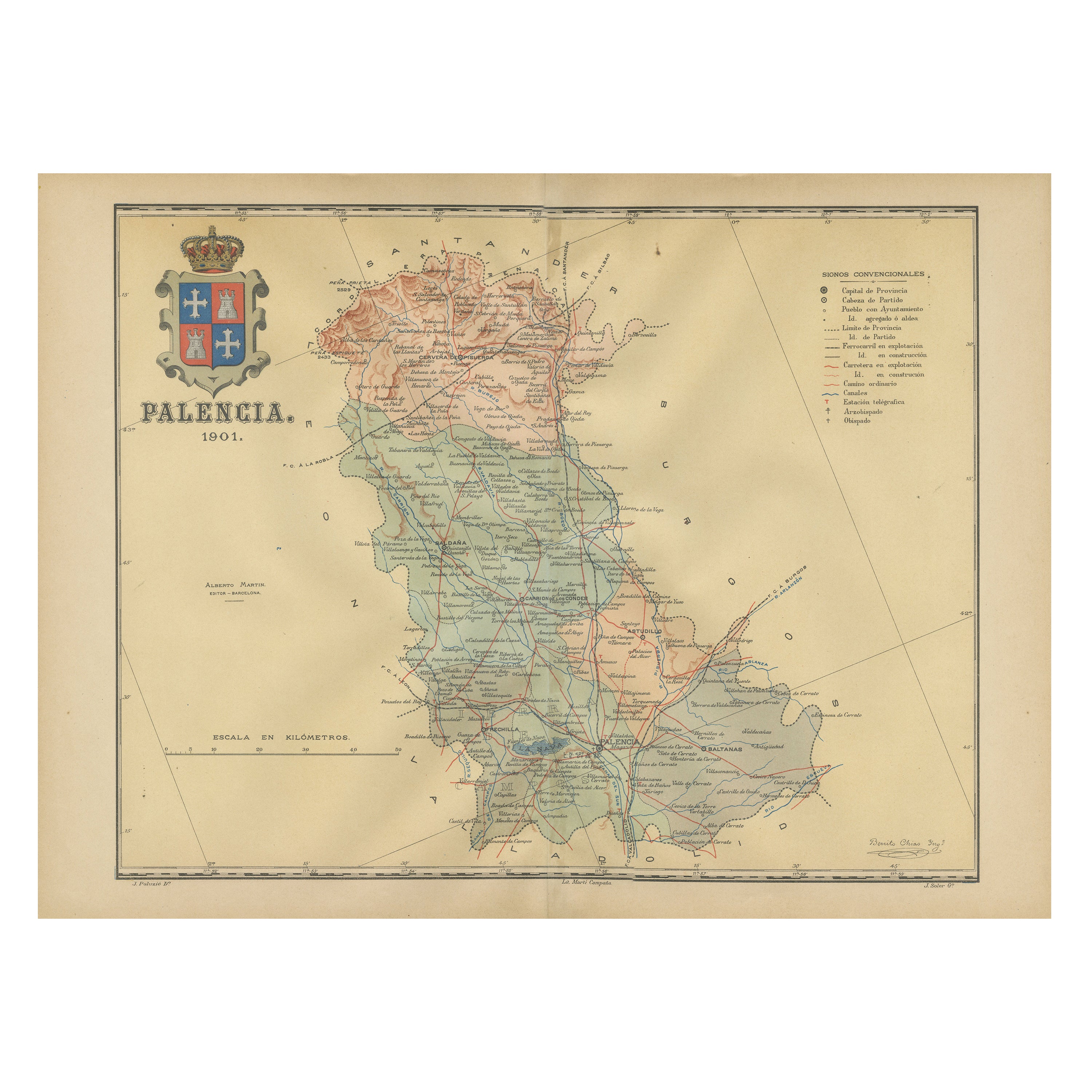
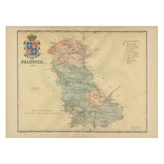
Original Antique Map of Palencia Province, in Northern Spain, 1901
Located in Langweer, NL
This historical map is of Palencia, a province in the northern part of Spain.
Palencia is situated within the autonomous community of Castilla y León. It is bordered by the provinc...
Category
Antique Early 1900s Maps
Materials
Paper
$373 Sale Price
20% Off
Free Shipping
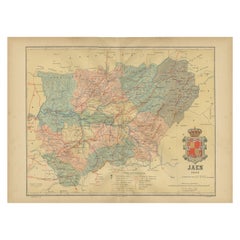
Jaén 1902: A Cartographic Depiction of Andalusia
s Olive Heartland
Located in Langweer, NL
This original antique map displays the province of Jaén, located in the autonomous community of Andalusia in southern Spain, as of the year 1902. It contains various geographic and i...
Category
Antique Early 1900s Maps
Materials
Paper
$277 Sale Price
20% Off
Free Shipping
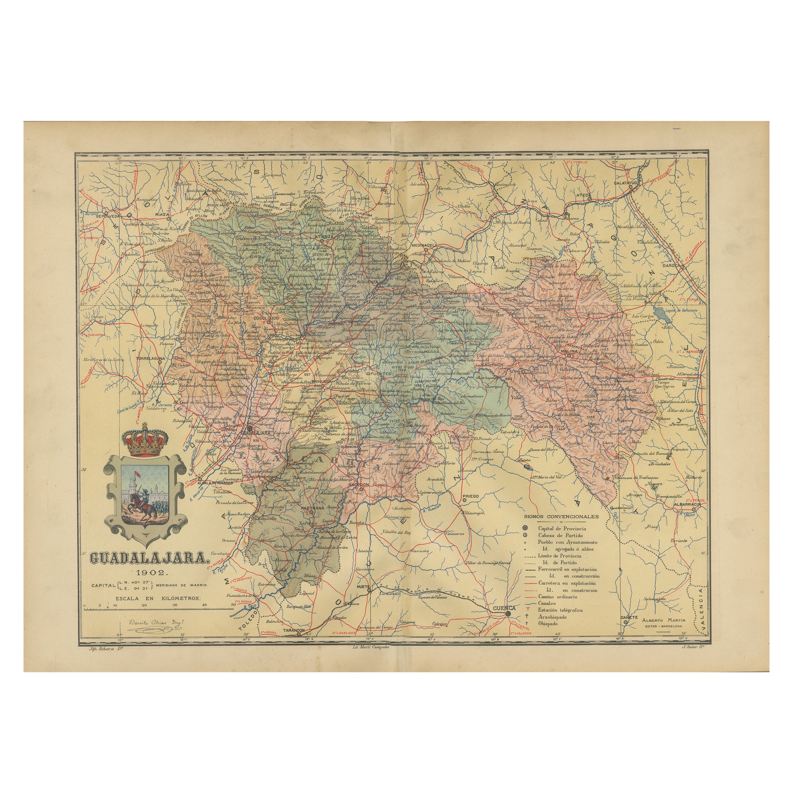
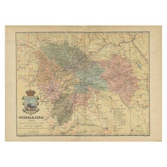
Guadalajara 1902: A Cartographic Image of Castilla-La Mancha
s Northern Province
Located in Langweer, NL
The map illustrates the province of Guadalajara, part of the autonomous community of Castilla-La Mancha in Spain, as of 1902. The map includes various geographic and infrastructural ...
Category
Antique Early 1900s Maps
Materials
Paper
$277 Sale Price
20% Off
Free Shipping
Topographical and Infrastructure Map of the Province of Valencia, 1901
Located in Langweer, NL
A historical map of the province of Valencia, dated 1901. The map includes intricate details such as topographical features, with mountain ranges and river systems prominently marked...
Category
Antique Early 1900s Spanish Maps
Materials
Paper

$497 Sale Price
20% Off
Free Shipping
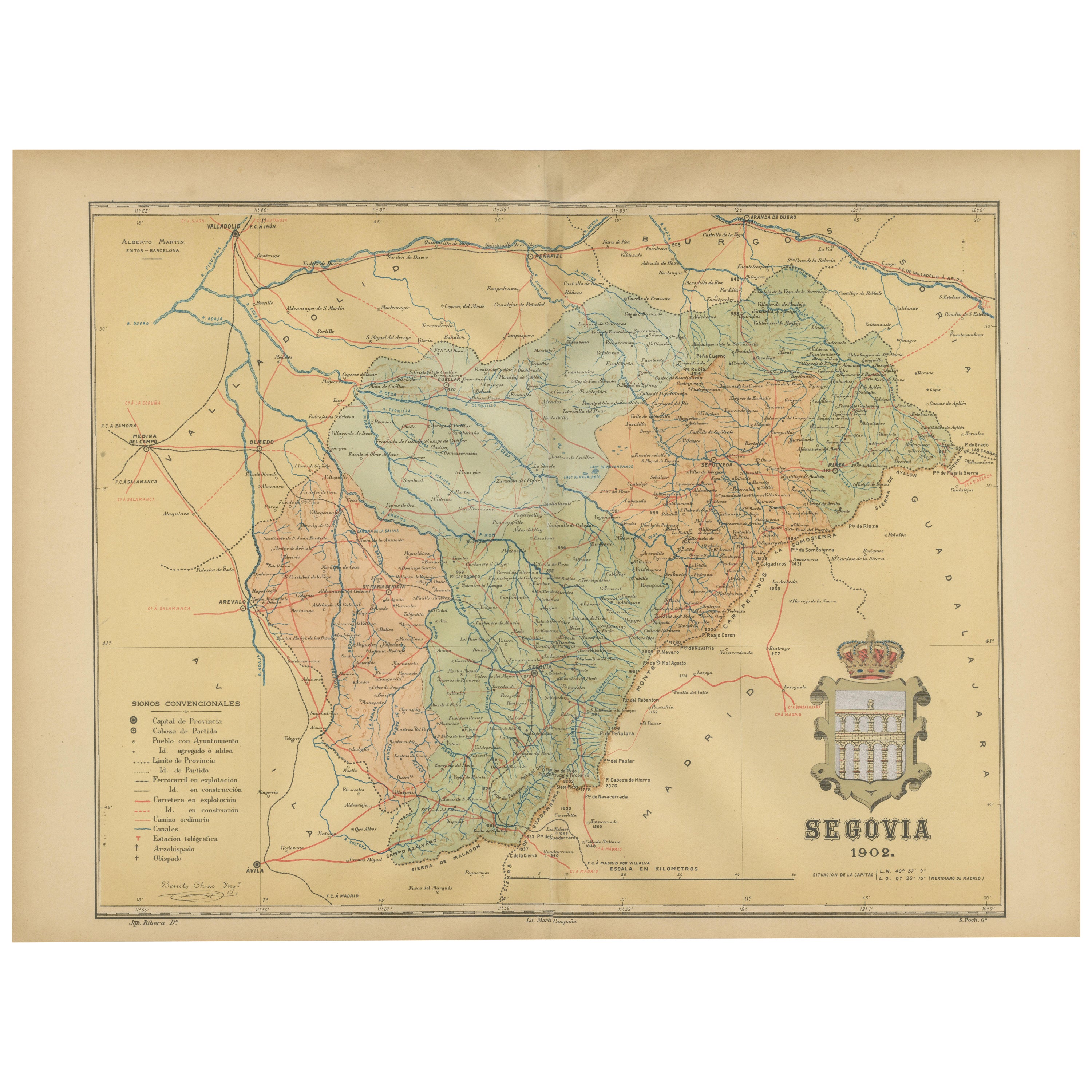
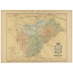
Topographical and Administrative Cartography of Segovia in Spain, 1902
Located in Langweer, NL
An original old map of the province of Segovia from the year 1902. Segovia is a historic area located in the central part of Spain, northwest of Madrid. Known for its rich history, a...
Category
Antique Early 1900s Maps
Materials
Paper
$277 Sale Price
20% Off
Free Shipping
You May Also Like
Large Original Vintage Map of Spain, circa 1920
Located in St Annes, Lancashire
Great map of Spain
Original color.
Good condition
Published by Alexander Gross
Unframed.
Category
Vintage 1920s English Maps
Materials
Paper

Map of Spain and Portugal - Original Etching - Late 19th Century
Located in Roma, IT
This Map of Spain and Portugal is an etching realized by an anonymous artist.
The state of preservation of the artwork is good with some small diffused stains.
Sheet dimension: 28...
Category
Late 19th Century Modern Figurative Prints
Materials
Etching

1751 Map of Spain Castilla Robert De Vaugondy 1st Edition, Ric.a001
Located in Norton, MA
Large Spain Castilla Robert De Vaugondy
1751 1st Edition
-Colored- Ric.a001
Coming from a family of cartographers, a descendant of the famous Nicolas Sanson and ordinary geographer of the king, Gilles Robert de Vaugondy makes himself known by his maps of the French provinces.
He published an Essay on the History of Geography (1755) from which he excluded the physical geography "too systematic". After a Small Atlas (1748), he draws a universal Atlas (1758), a portable Atlas (1762).
His Atlas of the revolutions of the globe remains unpublished. His warnings and prefaces, his book reviews reveal a Cartesian mind and solid knowledge.
Very early, he associates with his works his son Didier who publishes, since 1742, the methodical tables of Nicolas Sanson, two Globes, one terrestrial, the other celestial (1752).
He is credited with a map of Poland...
Category
Antique 18th Century Unknown Maps
Materials
Paper

17th Century Lithograph Framed Map of Spain
Located in Atlanta, GA
In giltwood frame, dated 1652.
Category
Antique 18th Century and Earlier Spanish Baroque Prints
Materials
Ink, Paper

Austria-Hungary, Western Part. Century Atlas antique vintage map
Located in Melbourne, Victoria
'The Century Atlas. Austria-Hungary, Western Part'
Original antique map, 1903.
Central fold as issued. Map name and number printed on the reverse corners.
Sheet 40cm by 29.5cm.
Category
Early 20th Century Victorian More Prints
Materials
Lithograph

Ancient National Atlas of France with Marengo
Located in Alessandria, Piemonte
Ancient National Atlas of France with the department of Marengo: a rare French etching dated 1806.
ST/178.
Category
Antique Early 19th Century French Other Prints
Materials
Paper

More Ways To Browse
Antique Sultanabad Carpets
Used Beige Sofa
Antique Plate Germany
Hand Tufted Rugs
Rare China
Side Table Made In Denmark
Thonet Antique
Victorian Hall Tables
Vintage Computer
England Antique Plates
19th Century Round Dining Table
Antique Counters
Antique Thrones
Carved Chinese Tables
Italian Ceramic 1960s
Mid Century Modern Danish Teak Dining Tables
Rosenthal Century
Long Rug Runners